Fountain Peak
April 5, 2020
1745m
Lillooet, BC
Fountain Peak is a small, but rugged summit that locates right next to the small town of Lillooet on the long chain of Fountain Ridge. The officially-named Fountain Peak isn’t the highest point and in fact, it doesn’t even boast more than 100 m clean prominence and there are at least three taller highpoints further south on Fountain Ridge. I did some thorough research on bivouac.com about the naming history and I think the map isn’t mislabelled. This peak, although not the highest, is the most pointy on Fountain Ridge and boasts a very impressive NE Face, rising almost one vertical mile above Fountain Valley to the north. The website bivouac.com gives the three taller summits south of Fountain Peak separate unofficial names, with the tallest “Fons Peak” about 10 km to the south. All three are rounded and wooded so I figured the pointy summit of Fountain Peak might actually offer the best views.
Alex and I made the spontaneous decision at literally the very last minute. The only spot in SW BC without rain or snow in the forecast was Lillooet so we cancelled the original objective and made some last minute plans. Alex had tried the traverse of Fountain Ridge a few years ago but only managed to get “Fons Peak” as he encountered dead-falls of hell, and generally more rugged terrain than expected. There was no beta whatsoever about Fountain Peak, so our tools were solely the satellite images, topographic maps and my photos taken from the nearby Mt. McLean. We figured the only probable way was to attack the peak directly from the road, up the steep west slopes. To practice this social distancing thing we drove separately. I left home at around 4:30 am and made to Lillooet 3.5 hours later. I made my own breakfast at the “trail-head” by cooking some instant noodles and beef and Alex showed up half an hour or so later.

Fountain Peak via West Slopes. GPX DL
There was no trail whatsoever and it also appeared that the start of our route was in someone’s private property. We could also clearly see a few houses on the lower slopes so after some discussion we changed our plan slightly and opted for starting a few hundred meters to the south. Of course there was still private property issue but at least we were reasonably far away from the houses, and instead of using their private roads we simply entered the brushes and went straight up the slopes. For the lower slopes we kept traversing diagonally to the left (north) in order to join our pre-planned route and the terrain was nothing but Rockies type of scree and dirt. The terrain was pretty monotonous for at least 500 vertical meters. Generally speaking there was more scree but less bush than anticipated. At around 1000-1150 m we encountered a band of steep zone with lots of loose rubble and some snow-covered slippery dirt. Beyond that we were on a ridge feature trending south-east, and were starting to encounter more continuous snow. The snow was icy but also deeper than expected. I started to wonder if we made a good call for not bringing snowshoes.

The deep Fraser Canyon from where we parked

We started by walking on some dirt roads but soon bailed into the woods

After a few hundred meters of gain we looked back at Lillooet

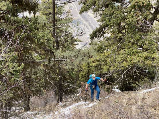
Alex grunting up the typical terrain on the first 500 m gain

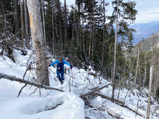
This is around that steep zone near 1100 m elevation
Typical, typical…
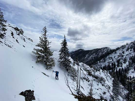
Gaining the ridge now. Me charging up. Photo by Alex R.

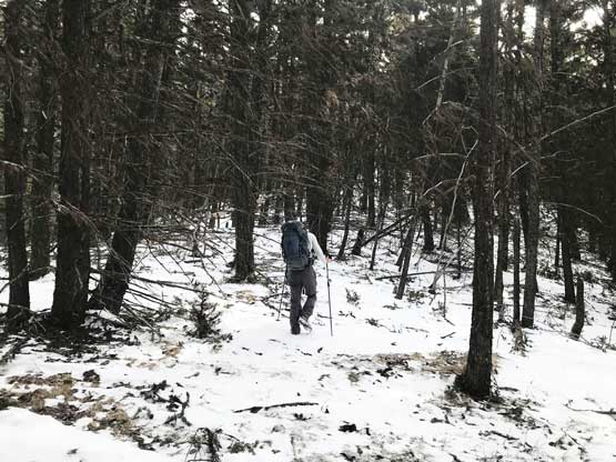
Alex following up the stretch of easy forest
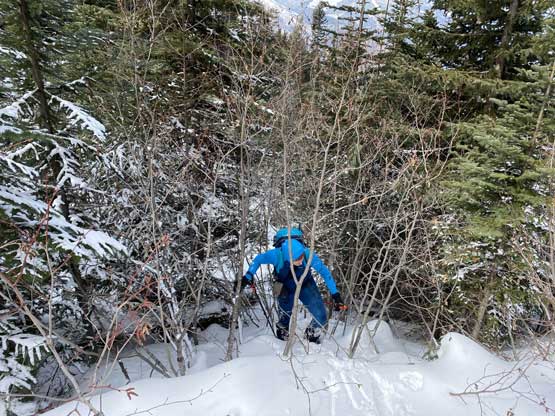
We ascended easily up this ridge for a couple hundred more meters and once it became steep we strapped the crampons on and opted for traversing into the gully to the north of the ridge. This was when hell began. The snow was waist deep on the north side of this ridge and was not very supportive, especially around dead-falls, and to make it more fun we had to hop over probably a hundred dead-falls, on nothing but 40-degree traversing slopes. It took us a good while to clear this shit and we also lost more elevation than I thought. Once into the gully I thought about to ascend onto the south-facing side (the north side of the gully) but there appeared to have more brushes on that side. The snow was actually fairly supportive in the gully with only knee deep post-holing so I changed my mind and started charging straight up. We did encounter weak, waist deep spots near dead-falls but at least we were able to maintain a steady pace. About 200 m or so up the middle of the gully I finally bailed left onto the sunny side and the condition improved drastically. We were now kicking-step on firm snow, for another 200 m or so up the south-west face of Fountain Peak.

Me heading into the gully. The hell began here. Photo by Alex R.

Me picking a route through the dead falls hell. Photo by Alex R.
Alex balancing on a sketchy log. Crampons were mandatory…

It sure was hell. We discovered a ton of waist deep holes
How about wallowing and bushwhacking at the same time…

More wallowing ahead..

Alex following up. We made progress slowly but steadily

Alex hopping over a giant dead-fall, aided by the thickening snowpack

Finally ascending firm snow on the upper SW slopes of Fountain Peak
The route we took became steep near the treeline and we also topped on the south ridge of Fountain Peak higher than the col. This automatically bypassed the troublesome cliffs immediately above Fountain/Weather Slides col. I had brought a rope and a harness in case the scrambling was tricky but it seemed like such was an overkill. We took an energy break and easily ascended the last 50 m to the summit. There was one or two 3rd class moves. The rocks were very loose but the exposure was mild. There seemed to have a poorly built cairn on the summit but we couldn’t find a register. This peak offers unobstructed view down three valleys.
Alex traversing a steep slope below the upper south ridge
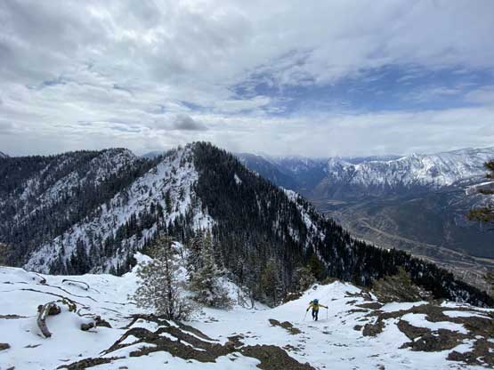
Onto easy terrain now. Bumps on Fountain Ridge behind

Another photo of Alex cramponing up this easy section
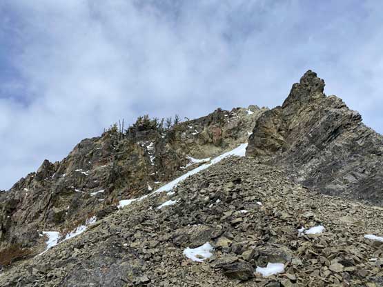
Crampons off. Time to scramble.

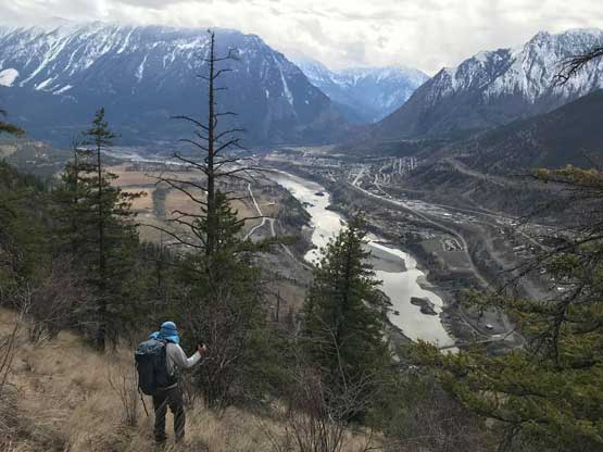
Fraser River north of Lillooet
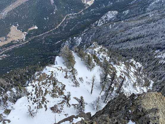
The east face of Fountain Peak is a shear drop…

A wider view of Fountain Valley to the north-east

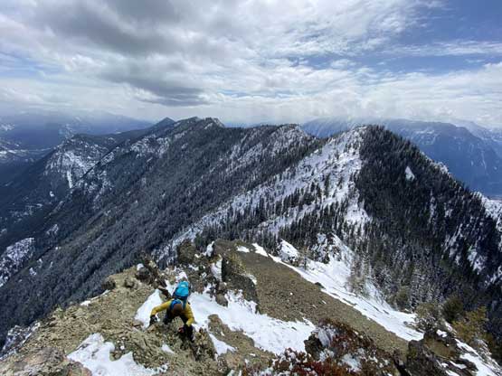
Alex scrambling the only narrow spot
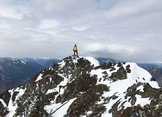
Me already on the summit now. Photo by Alex R.

Northern view from the summit.

Lillooet and the Fraser Canyon
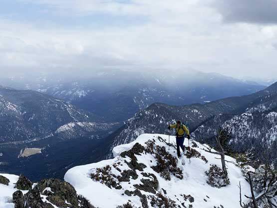
Alex traversing towards the summit
“Camelshoof Mountain”
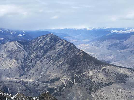
Mt. McLean on Mission Ridge

A closer look at Lillooet. Note where Duffey Road comes from
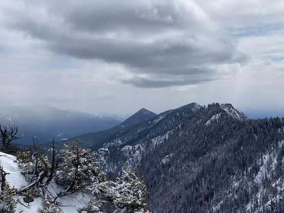
A closer look at the bumps north of Fountain Peak.
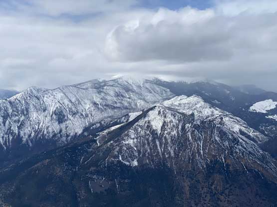
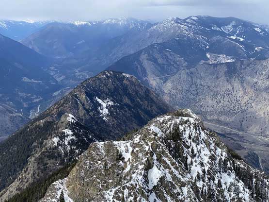
Taller bumps to the south on Fountain Ridge

This is the bump immediately south of Fountain Peak.

Me on the summit of Fountain Peak
We didn’t bother to linger too long on the summit. We thought about to traverse to “Weather Slides Peak” but the terrain looked like waist deep wallowing over dead-falls for pretty much the whole way, so nope. We talked about the alternate descent options and opted for staying further down on the sunny side of the gully. This side had more brushes but much less dead-falls and wallowing, and because of the down-hill orientation we didn’t find the bush annoying. We stayed on this side of the gully for pretty much as long as we could and then re-ascended a short but steep slope to get back on track. The rest of the descent was tedious but not too bad because of the soft nature of the ground. The last 400 m or so down to the road was such a blast as we were able to ski on scree or dirt.

Alex making his way down that 3rd class step
Alex down-climbing

Me heading down. Photo by Alex R.

Me continuing down the south-west face. Photo by Alex R.

The typical terrain on the north slopes (sunny side) of the gully…

Rejoining our ascent route

The typical descent. Tedious to say the least.

At least the view of Lillooet kept improving.
Me, Lillooet and the Fraser River. Photo by Alex R.
Our round trip was about 7 hours but we certainly could have done it faster had we known the route better, but it sure felt like a privilege to explore a route (and a peak) that we were able to find absolutely zero beta even after some thorough research on the internet. The drive home was long, but not as bad as I thought because there was no traffic. I made back home at around 7 pm.
