Gott Peak
July 9, 2021
2511m
Blowdown Creek / Duffey Lake Road, BC
Gott Peak is the only officially-named one among the handful easy summits in the close vicinity of Blowdown Pass. This area is accessed by driving up Blowdown Creek FSR off the main Duffey Lake Road and for those with an aggressive 4WD vehicle that one doesn’t care about pin-stripping, the road is driveable all the way to the pass in alpine zone. In November 2019 I paid my first visit to this area and scrambled “Cottonwood Peak” and “Gotcha Peak”. I made some mental notes that Gott Peak and “Notgot Peak” are some easy summits to come back for, albeit in separate trips. I reserved Gott Peak for a day when I’d be lacking energy and motivation but the weather’s too good to just stay home killing time. This happened to be the case in this past Friday.
I had a 4-day fly-in-hike-out trip planned starting on Saturday and because of the fly-in access I figured the first two days would not be too demanding. The forecast for Friday was also sunny so I pushed myself to must get out on that day as well to take full advantage of the weather. My initial plan was something like Mt. Archibald out towards Chilliwack because that direction is easier for me to drive to (as I live in White Rock), but then at 5 pm I noticed two messages on Instagram. Senay’s based in Squamish and wanted to get out and meanwhile, Christine (a new friend), based in Lower Mainland also wanted to get out. I scratched my head to come up with a suitable objective in the Sea to Sky Corridor but then I picked up Gott Peak from my memory data base, and they both agreed. I did not think I could handle this long drive given that I must wake up at 3 AM the following day to drive to Pemberton again, but Christine offered to drive us there and that solved the problem.
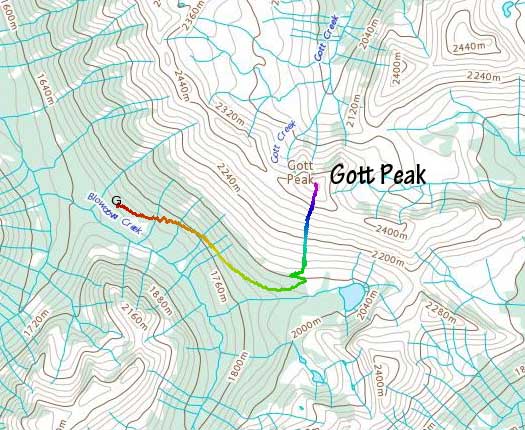
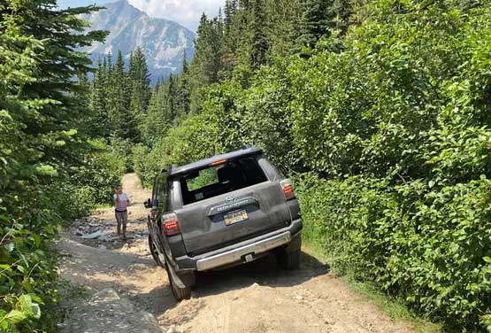
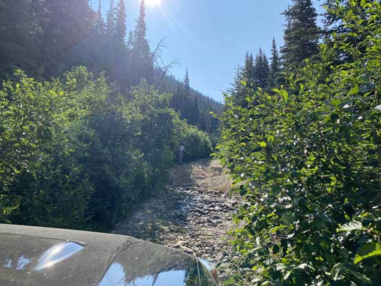
I had not started packing nor shopped food for the Wahoo Tower trip at all so I must get back home in a reasonable hour and to guarantee that Christine and I decided to leave Lower Mainland at 5 AM, and Squamish by 6 AM. By coincidence both Christine and Senay drive 4Runner and I have a Taco so here’s also a Toyota off-roading team. Two hours later we had turned onto Blowdown FSR. The main FSR was not too bad to drive on and we even got a wolf sighting. I thought we would start at the spot where everyone else opted to park, but once there Christine decided to push further. I wasn’t sure about that given that she only had stock tires on the 4Runner but the objective for me on this day was to hike as less as possible to conserve energy, so agreed. The road towards the pass was actually not too bad but the pin-stripping was insane. There were a few rough sections that Senay offered to get out and help but none proved to be problematic. For Gott Peak we did not have to drive all the way to the pass and instead, after a short switchback on the road we parked at a convenient turn-around spot.
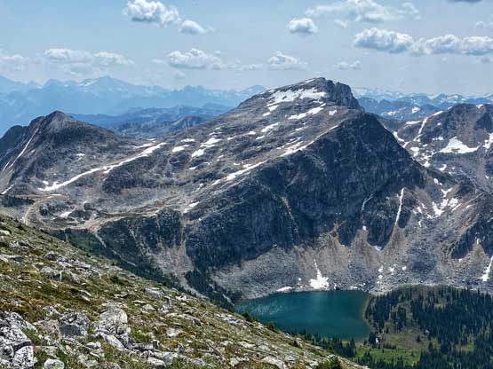
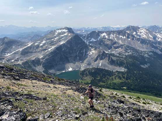
From this spot all we needed was to grunt 500 m straight up to the summit and that’s exactly what I needed. There’s a short band of bushwhack to start with and we opted for a spot about 100 m further up the road. The bushwhack turned out to be nothing and in no time we were on some open alpine meadows. The view towards the summit was very foreshortened as we did need to gain fair amount of elevation.

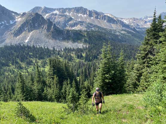
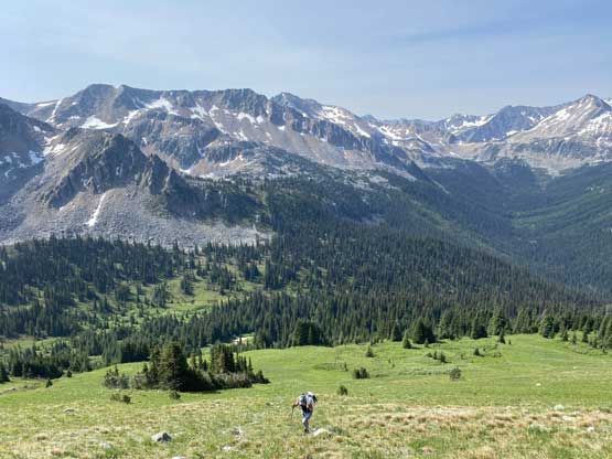

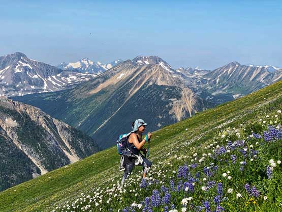

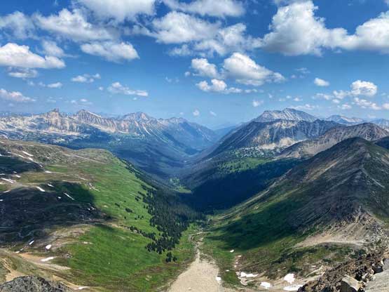
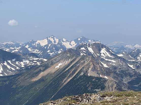
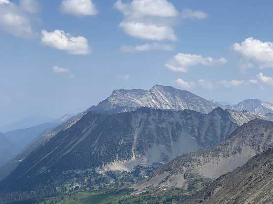
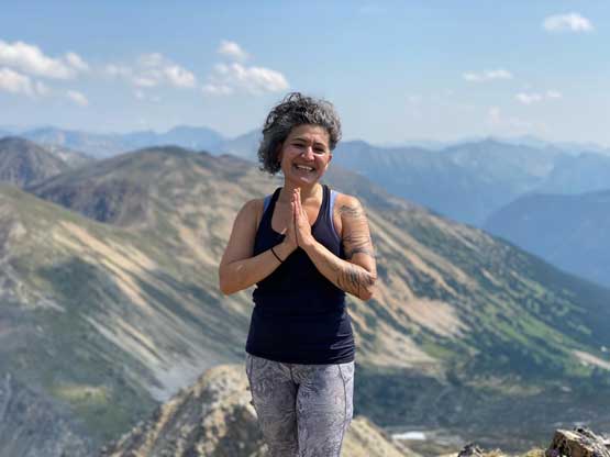
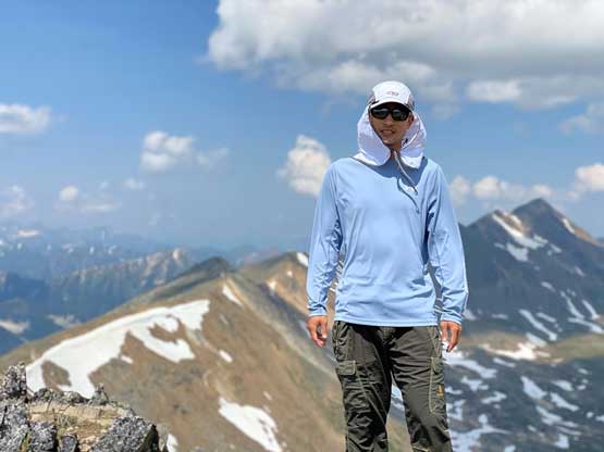
There’s very little change in scenery as we grunted up this never-ending slope, but the view looking back at the small lake under “Gotcha Peak” kept improving. The mosquitoes was rather horrendous and that kept us moving at a quick pace. About halfway up Christine dropped her camera and after about 15 minutes of frustrating search we decided to worry about that on the descent. About 3/4 of the way up the terrain finally changed to talus and scree and a short while later we popped onto the summit ridge with the summit only two minutes away. Prior to this trip I did most, if not all of my Duffey area peaks in winter conditions so it’s great to see what this area looks like without snow.


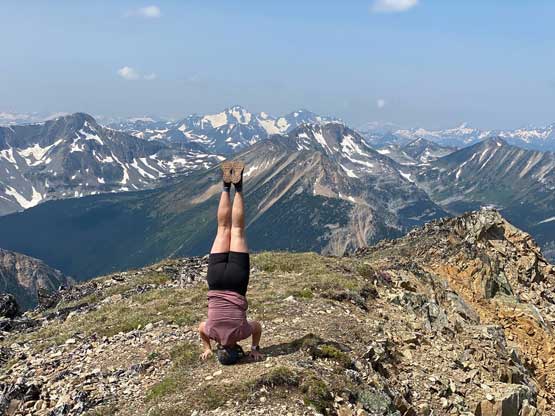
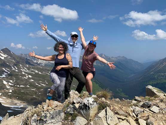
After over an hour on the summit we finally decided to descend. Senay and Christine wanted to make a loop but I said I still had a shit ton of things to do at home so we just went down the easiest possible way, which was to just retrace our own ascent route. Senay even managed to find Christine’s dropped camera. It’s damaged but still functioning. The descent took us no time and the real fun/challenge was the 4-wheel-driving out of the sketchy road, and the subsequent long ass drive back home. I had to thank Christine for the hard work as otherwise, I did not think I could (or should) pull this trip off. I eventually got back to White Rock after 7 pm, rushed up for dinner, shopping and packing and eventually turned in past midnight, just enough of a nap before the Wahoo Tower expedition.