Grainger Peak
June 3, 2020
2183m
Chehalis Area / Harrison West, BC
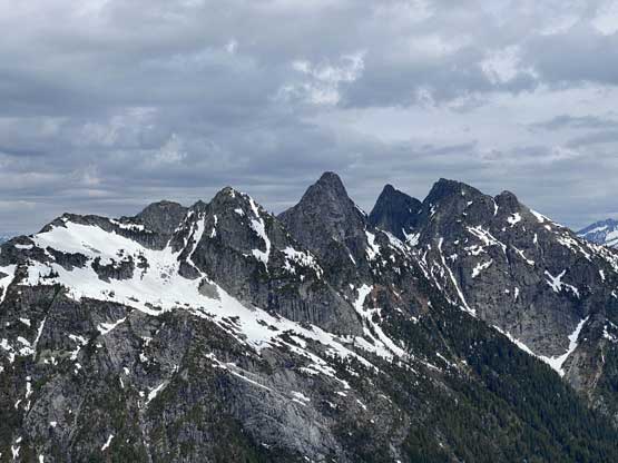
The remote massif of Grainger Peak is the highest summit in the main Chehalis group, buried deeply on the west side of Harrison Lake on the triple divide among Trio, Eagle and Winslow Creeks. To access this area one needs to drive 50 km up West Harrison FSR, which is frequently travelled by loggers, hydraulic workers, 4×4 enthusiasts and weekend campers, but not often visited by hikers and climbers. An ascent of Grainger Peak is a rare feat especially in this modern era after the deactivation of the uppermost Chehalis FSR in the Eagle Creek drainage. The south side approach might still exist but there had been no information for probably over decade, at least not without some thorough digging on the internet. The traditional south side approach is used to climb the south ridge which goes at 6 pitches up to mid 5th class according to Drew Brayshaw on bivouac.com, or the J-Cracks on the south face (5.9). None of these sounds appealing anyway as to reach the summit of Grainger Peak one does not need to climb technical rock.
Thank to some logging and hydro projects the roads in Trio Creek drainage has somehow maintained a decent shape in the latest decade meaning a north side approach had opened the door. The problem was that the road is often gated at the bottom meaning an extra 7 km distance with at least 500 m elevation gain must be dispatched by biking or walking, which is pretty discouraging. There were a few reports on ClubTread, particularly by Adam (Marduk), indicating that with a bit of hassle one might can find a way to access the upper Trio Creek by driving but such never sounded too promising. The north side approach gives access to the NE Ridge (4th class) or the North Face Glacier (snow to 40 degrees). It’s pretty obvious that the North Glacier is the easiest route but it’s a snow-and glacier-ascent so the timing aspect is trickier than a rock route. The approach from Trio Creek road would involve about 2 hours of sustained BW4+ bushwhacking so that’s another factor that deters climbers from coming this way.
To sum it up there’s no easy way to tag this summit and all options involve some degree of suffering and/or technical mountaineering. My friends Al and Katie had put in quite a bit of effort in the last couple weeks including one failed attempt via NE Ridge. They passed me some important beta such as the Trio Creek gate and the NE Ridge being way harder than what Adam (Marduk) made it sound like in his trip report. This further confirmed my decision to go via North Glacier but then we had to explore it out as the route information was very limited. Al and Katie had put in a few days’ worth of thorough digging and a plan was finally formed. As usual the trigger wasn’t pulled until the last minute. Al and Katie drove out in the afternoon while I drove there separately a few hours later as I was stuck at work until 7 pm. The drive up West Harrison FSR was not as smooth as I thought but still averaged 40 km/h. The gate at Trio Creek was indeed open but signs there indicated that they don’t quite want to see recreational uses so I’m not sure how long it’ll stay open. I had no problem driving to the end of the work zone and then continued driving into the bushy, deactivated road. We had decided to park farther on the deactivated portion of this road so that the workers wouldn’t see us in daylight time. This meant we had to drive over a few deep ditches. The first ditch scraped the bottom of my Taco a bit and the second ditch forced me to switch to 4Low. Al and Katie had already made there and started a fire and we exchanged some last minute plan, put up the tents and set the alarm at 5 am in the morning.
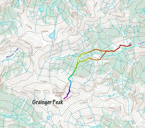
Grainger Peak north face glacier via Trio Creek. GPX DL
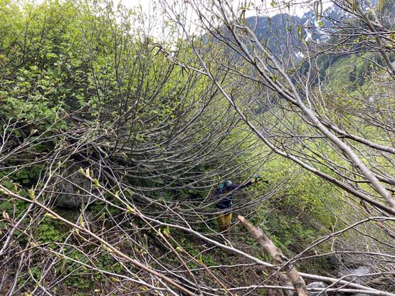
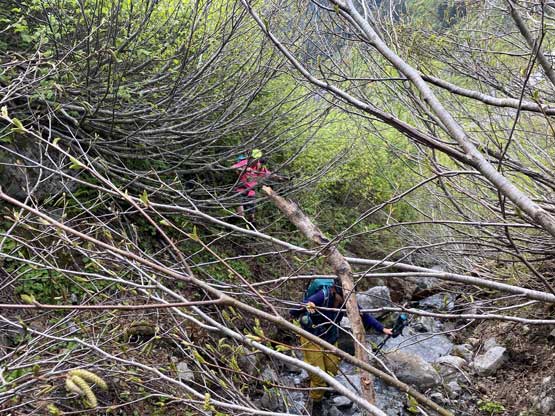
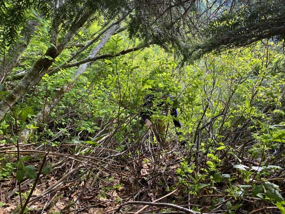
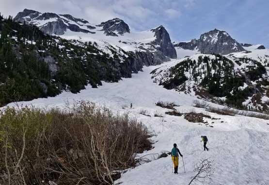
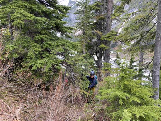
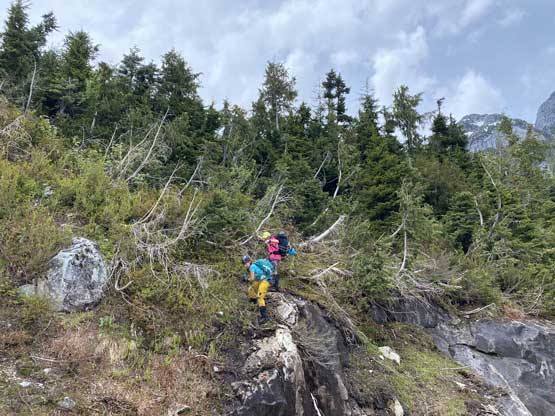
The next morning we woke up under some high clouds just as forecasted and started the going at 5:30 am, also as planned. I followed Al and Katie’s lead to the end of the road and then we made one last decision to stay on the north side of the creek to access a farther gully behind an obvious waterfall. We had some concern that the river crossing might be difficult lower down (based on their last week’s failed attempt) so I voted to bushwhack 300 vertical meters higher to cross the creek. The trade-off would be more bush as the north side looked nothing but slide alders the entire way but again, the only information we had was Google satellite images so we just hoped it wouldn’t be too bad. The start of the bushwhack was indeed not too bad as we could stay within close proximity to a band of old growth forest. We kept a diagonal traversing mode and crossed a dry creek bed. Up to this point I would rate the bushwhack a sustained “BW3” but pretty soon we would battle the real thrash. For the next 500 m horizontal distance we had to fight the side-hill slide alders for pretty much every single step thrown in some devil’s clubs and a few vertical pull-up steps. I lead the way bulldozing while giving no damn shit about my shins, pants or arms fighting as hard as I could as if I was wallowing in waist deep isothermal snow. For a while I couldn’t even see where the ground was with both feet mangled on alders. The fight improved a bit and then once entering the old growth forest beside that waterfall the going became steep, but the bushwhack eased off a lot. We also began to encounter snow, which also helped. The creek crossing was pretty trivial at this elevation but we did have to take the shoes off and wade it. Then a bit more alders and one boulder field later we were at the base of the route, almost exactly 2 hours since the bushwhack started. I would rate the bushwhack a non-stopping “BW4” with a few short stretches “BW5”, not for the faint of heart.

Car camping at the head of Trio Creek.

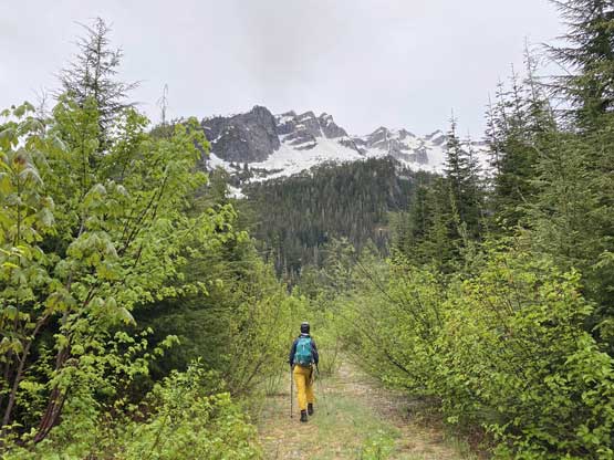
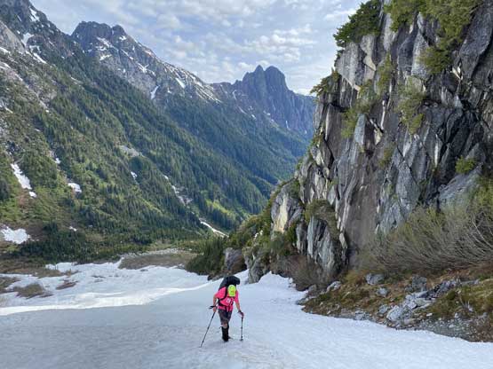
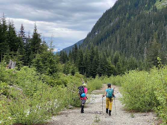
Moody start of the day walking up Trio Creek FSR under overcast sky
Katie leading us towards the road’s end.
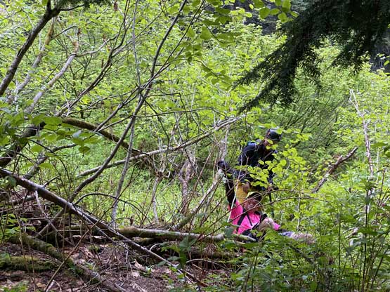
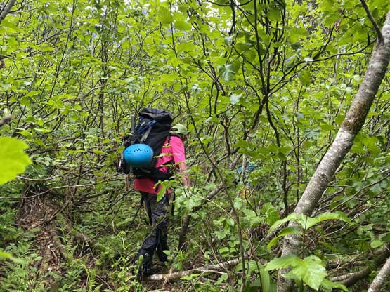
The bushwhack began. Al’s still smiling…

Easy peasy so far…

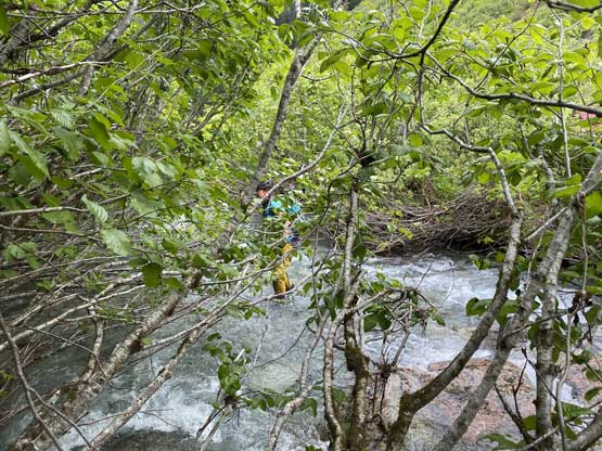
Getting more and more interesting now. Katie’s only 2 m from me.
Crossing one of the few creeks. This is Katie getting into it…
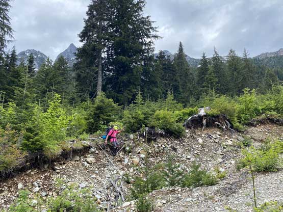
As typical as you might expect in this valley…

A brief break before the worst to come. I didn’t take photos in the worst zone.
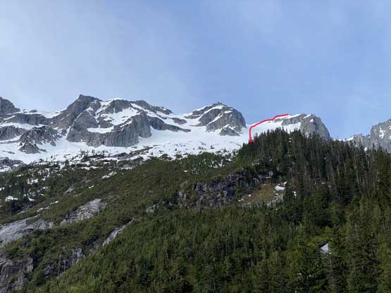
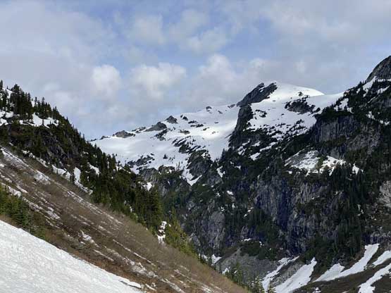
A brief clearing showed the upper North Glacier route of Grainger Peak
Katie just after thrashing up a vertical pull-up step.

Al crossing Trio Creek.
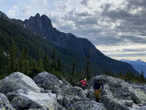
Al balancing over a boulder field with Trio Creek Spires behind
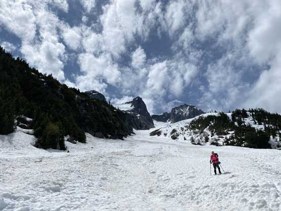
The transition from bush to snow was almost too promising to believe as we were suddenly cruising up the lower gully in perhaps 600 vertical meters per hour pace. The snow was not soft and not icy which meant we had no post-holing but also didn’t need crampons. It was such a cruise sail. The ramp to get onto the upper route was much mellower than we thought that even an ice axe wasn’t needed. We had brought two axes each, steel crampons, a rope and a picket to prepare for the worst, but it seemed like we would end up not needing anything but the ice axe. Al took over the lead charging up a steep and narrow spot to short-cut the route onto the north face glacier. We took a long break at the last rock island, ditching some gears while donning other gears. We opted to wear the harness and strap the crampons on as the glacier did appear a bit steep at least for one roll midway. Katie then led us climbing the left side of the glacier avoiding the crevasses and then I took over kicking-step up the foreshortened slope to the high col. The last snow ramp getting onto the summit was trivial and overall speaking this route was pretty damn easy with the steepest spot 40 degrees with minimal exposure, and no crevasse navigation at least at this time of a year.
Me and Katie transitioning onto snow. Photo by Alan B.
“Medic Peak” at the head of Trio Creek valley.

Katie and Al enjoying the cruise sail now.

It’s almost like a highway up this broad gully
Ascending beside the cliff faces

Al cruising with Doctor Peaks and Trio Spires behind

Al taking over the lead here plodding up

Turning left onto a broad ramp onto the upper mountain.
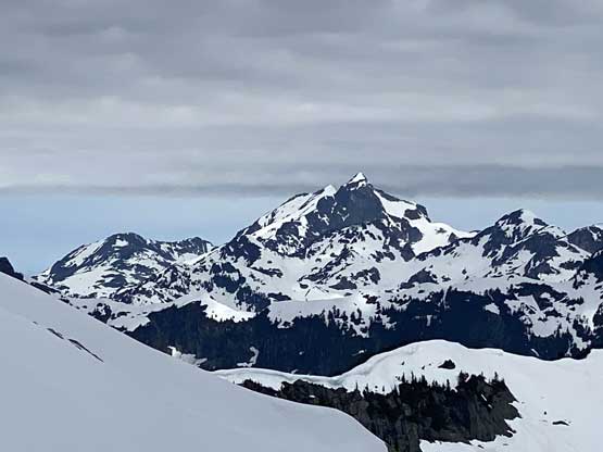
A big peak showed up and it’s Robertson Peak
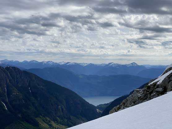
Our first view of Harrison Lake where we drove up from

Al leading this zone of mixed of rock and snow

This constraint was probably slightly over 40 degrees.
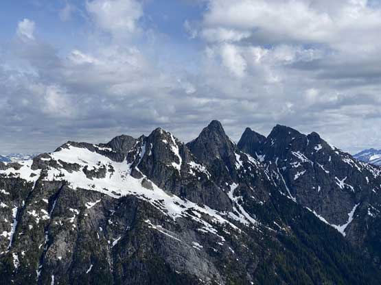
A closer look at Doctor Peaks on the north side of Trio Creek

Another photo of “Medic Peak”
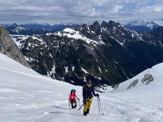
Katie and Al climbing onto the upper mountain

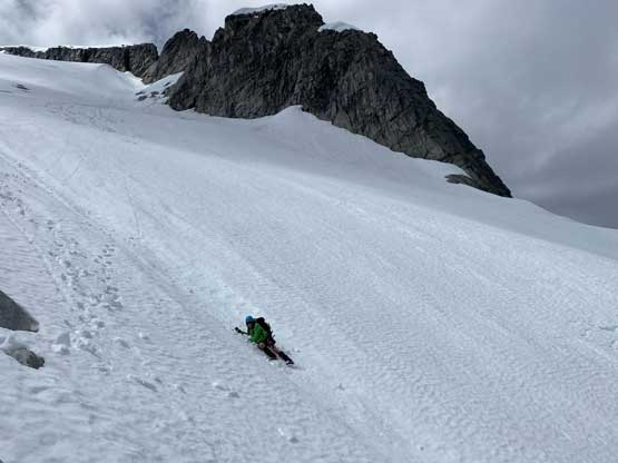
Me ascending the steep roll in the middle of North Glacier. Photo by Alan B.

Katie leading the way. Photo by Alan B.

Al cruising up the upper glacier.

Ascending to the high col now past Al and Katie’s previous attempt
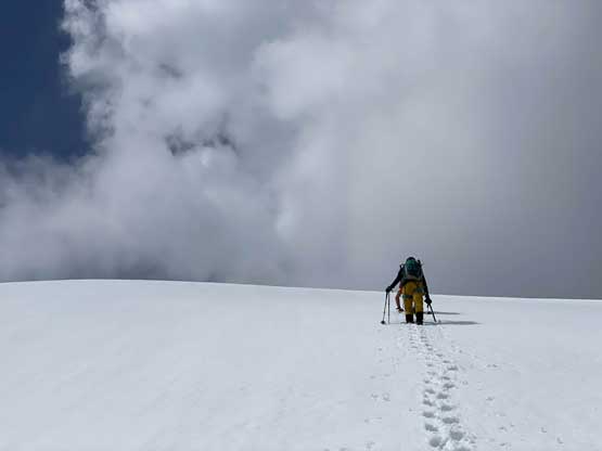
Boot-packing up the final snow roll

Me on the last push. Photo by Alan B.
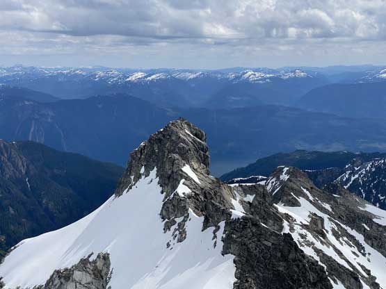
A closer look at the pinnacle on NE Ridge that Al and Katie stopped last time

Partial Summit Panorama from Grainger Peak. Click to view large size.
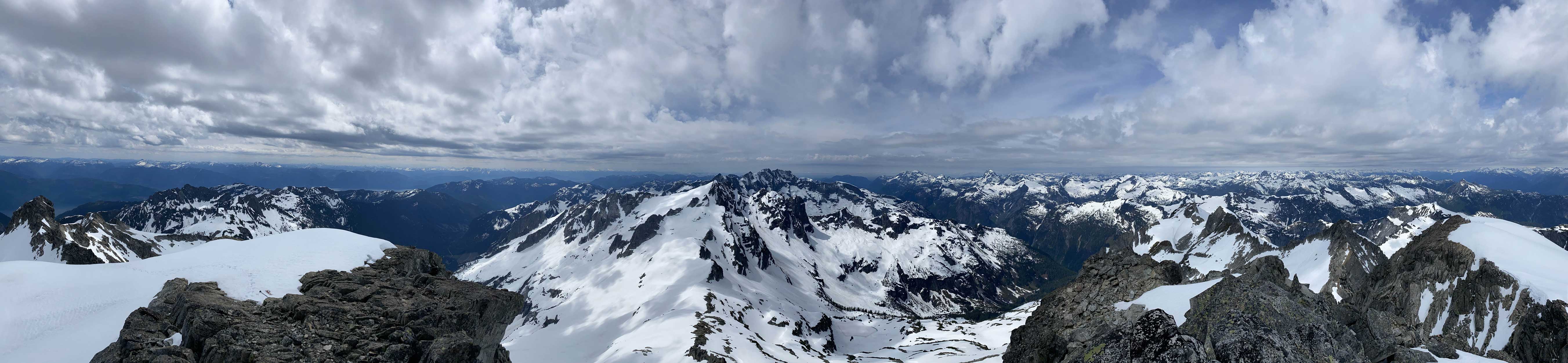
Partial Summit Panorama from Grainger Peak. Click to view large size.
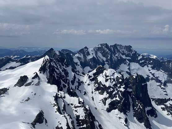
The north face of Mt. Clarke massif with Nursery Peak in front on left

Mt. Robie Reid on the horizon
Winslow Peak to the west in an uber remote zone
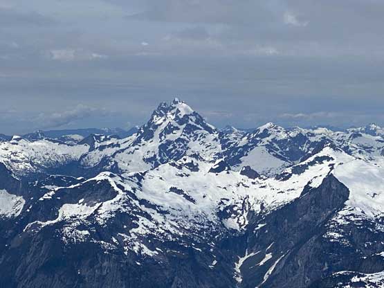
Mt. Judge Howay with its standard route in sight.

In the foreground is Mt. Orrock and behind is Fraser Valley
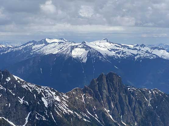
Traverse Peak and Mt. Breakenridge behind Trio Creek Spires

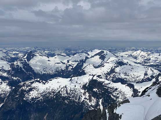
This is looking over Doctor Peaks towards Cairn Needle area

“Coon Peak” in the foreground

Me on the summit of Grainger Peak

Al and Katie, the “team cariboo” on the summit

In the foreground is the west face of “Trio Peak”
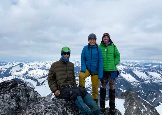
Our group shot on the summit of Grainger Peak
We lingered for about half an hour until the wind and coldness forced us to descend. We thought about checking out the pinnacle on the NE Ridge (where Al and Katie stopped last week), but the laziness took over so we continued plunging down the glacier. We soon started glissading the glacier and in no time we were back to the rock island. Grabbing the ditched gears we continued plunging and glissading all the way down to the Trio Creek valley. I thought about tagging Medic Peak as well since we had enough time to do that, but again laziness kicked in. It turned out to be a good call skipping Medic Peak as rain started literally 10 minutes after we were back to the truck… We decided to bushwhack the south side of Trio Creek on the return for a change of taste. The worst of the bushwhack on this side of the drainage was some tight timbers mixed with some route-finding through minor cliffs, as well as a creek with dense alders that we basically just walked inside the creek, but the worst was all on down-hill direction as opposed to side-hilling. With gravity on our wide we made some pretty quick work down the worst of the bullshit (BW4 and very sustained). A few small boulder fields helped to refresh our brains. Once down to the bottom we stayed higher utilizing snow and boulder fields for as much as possible which eventually got us to pretty close to the road’s end. We waded the creek (knee deep) with some alder thrashing around the creek, and some elevation regain with a bit more alder thrashing to get back to the road. I can’t say if our return route would be a better option for the approach as pulling and thrashing up those dense timbers would be no less pain than those side-hill alders, so pick your poison and embrace the green.

Time to head down… Photo by Alan B.

Katie glissading the middle section of North Glacier
Al went a bit too fast here near our gear cache
Another look at Doctor Peaks

Plunging down the constraint couloir below the glacier

We glissaded the ramp now back into the lower gully

It was a fast ride down the lower gully..

Trio Creek Spires look pretty inspiring
The end of the goodness
Let the bushwhack begin… A lot of side-hilling to start with

This is Trio Creek Valley that we had to exit

Linking up a few boulder fields proved to be crucial

The bushwhack wasn’t too bad yet

It soon became dense and steep and bluffy…

Can’t see Katie until she’s 2 m from me…

Al thrashing down in the middle of a creek to avoid the worst of alders
A bit more avalanche path then we were back onto open terrain

Enjoying the cruise sail for now…

Linking up a few dry creek beds
Katie wading the (slightly higher) Trio Creek on the return
Al bushwhacking on the north side of Trio Creek
Finally back to the road
One more kilometer of road plod

Back down to Harrison West FSR now. Thankfully the gate’s open
We got back to the vehicles with round trip time of 8 hours 40 minutes which was a tad faster than anticipated. As mentioned earlier the rain started pretty soon and fell pretty hard, but we still lingered for almost two extra hours celebrating the success. Eventually it was too cold to stay outside so it’s time to go home. The gate at the bottom of Trio Creek FSR was thankfully open. I had some worry about the gate on a late Friday PM as last week when Al and Katie drove down the gate was closed with some easily-removable wires (but not locked). The rest of the drive back home was uneventful but tiring. Overall this was a very sweet introduction to the main Chehalis Group for me tagging the grand daddy right off the bat. Thanks Al and Katie for the invite.
Make sure to watch Al’s Youtube Video report of our trip.
