Mount Crickmer
March 11, 2018
1359m
Mission / Fraser Valley, BC
There’s a giant wooded plateau in between Alouette Lake and Stave Lake but much of this area is overlooked. Mt. Crickmer is the highest point on this plateau and the summit just pokes above treeline offering 360-degree unobstructed views. The hike to the summit of Mt. Crickmer isn’t among the most popular of Fraser Valley but thank to the inclusion in 103 Hikes in SW British Columbia, this peak does see visitors for once in a while. Apart from that die-hard peak-baggers love this peak because of the 1000+ meters of prominence, despite its lowly, wooded status. This is a peak that’s better done with a ton of snow because of the potential bushwhacking in summer. Most of the route follows logging roads but sections are badly overgrown and the final 300 m to the summit has no trail.
The idea of making an ascent of Mt. Crickmer in winter had been tossed around for at least a couple years but this is nowhere on my priority list. The ascent is simple enough that I do not need the most ideal conditions but the supposed good views means I should save it for an absolute clear day. This past Sunday was the right day for one reason that the weather was crystal clear, and another reason that I wasn’t super motivated to push hard. I hadn’t been following the conditions reports for a while and I was too lazy to search around. I knew Mt. Crickmer would be perfectly doable so why not. I also asked around in a couple groups and Lily Q. signed up for the game.
There’s a maze of logging roads heading up the peak and the simplest way to stay on route is to have a GPX track. I couldn’t find a downloadable track but I did draw a route line based on my interpretation from bivouac.com and other sources. These days I seldom study the access/approach roads intersections but rather letting the technology do the job. The start of our approach road is past the 6KM mark along Florence Lake Road. This main road is the same access road as Mt. Robie Reid’s so I’m fairly familiar with. The morning wasn’t super smooth though as apparently a crew was doing some filming on the nearby Devils Lake that costed some delays but nothing major.
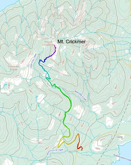
Mt. Crickmer hiking route. GPX DL
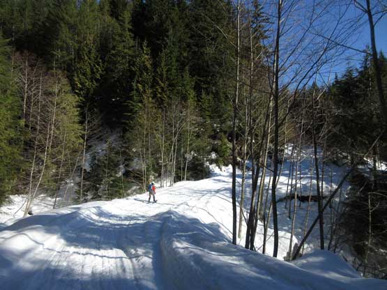
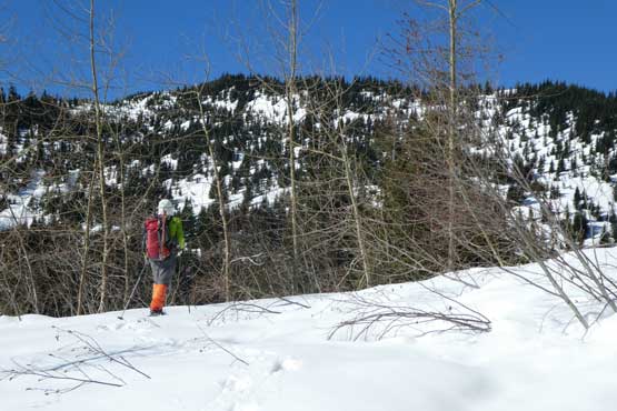
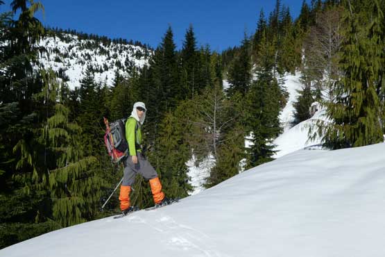
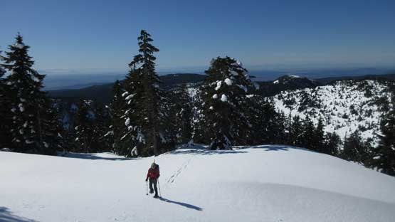
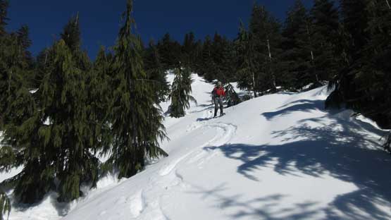
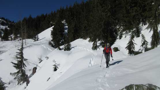
Normally one could drive for at least 3-4 km up the “Kearsley Creek FSR” but we had to park at the bottom gate due to snow and ice. This has been the Pacific NW’s second consecutive cold winter and even at 200 m elevation there’s continuous snow. There had been heavy snowmobile traffics and they sure did their job to pack down the roads. We didn’t have to use snowshoes until a couple kilometers up and then we picked up a set of foot tracks. The track branches off the main road at the first critical intersection (right fork) so we knew we weren’t alone on this day. At the second critical intersection we took the right fork again and the road suddenly become narrow and overgrown.
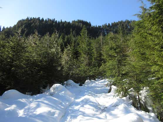
As much as the first few kilometer goes.
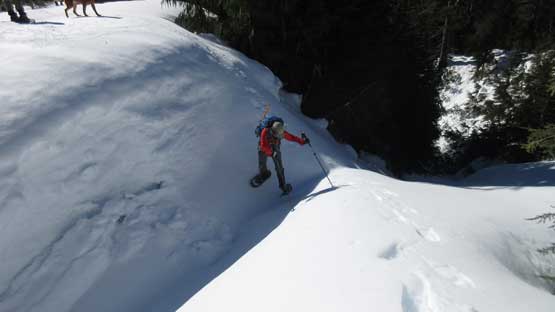
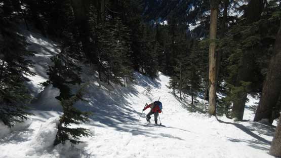
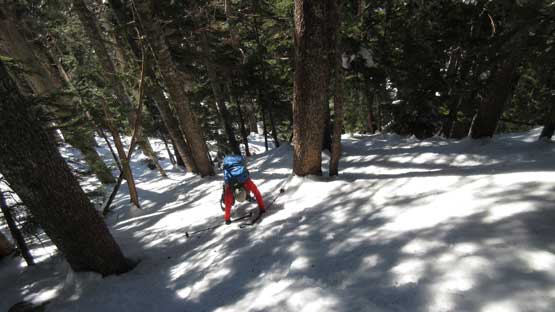
Bushwhacking wasn’t an issue thank to the heavy snowpack. We soon came across a large washout that required a brief detour around on the climber’s left side and then we crossed Kearsley Creek on a narrow bridge over an impressive gorge. Without the bridge this part could have been very problematic. Once on the north side of Kearsley Creek we picked up the road again and followed it upwards and onward into the broad basin beneath Schiedel Ridge. A couple switchbacks later we caught up with the group ahead and then passed them. One traversing bench had a few large ditches that required some creative maneuvering with snowshoes that added some fun into this otherwise, mundane plod. Higher up we short-cutted the last switchback for the simple reason of why not…
Already crossed over to the north side of Kearsley Creek
Hiking into the sunshine.
As you can see the old road is overgrown at places. Photo by Lily Q.
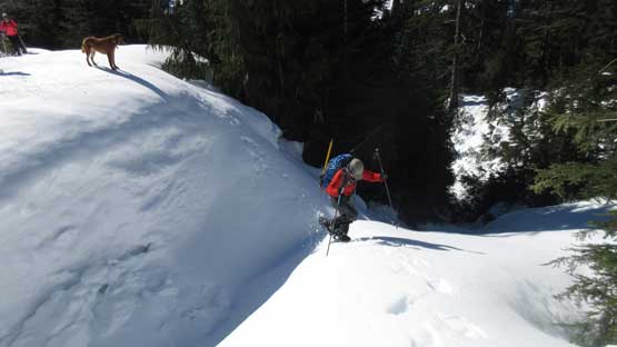
Me down-climbing into the first ditch.
Lily crossing the first ditch.
Same as above.
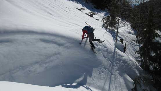
Ahead is a steeper stretch with some side-hilling. Photo by Lily Q.
Lily down-climbing into the second ditch.
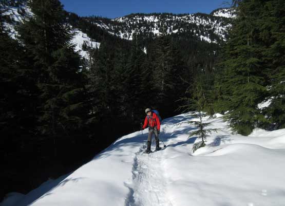
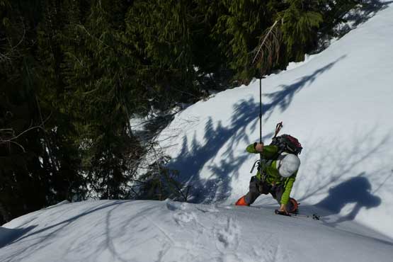
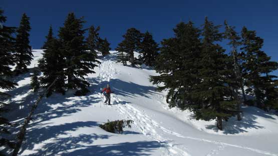
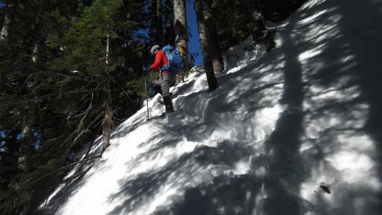
I wasn’t sure where exactly to leave the uppermost spur but the broad scale direction is obvious. We simply picked the spot with the most widely spaced contour lines but even so there are a few very steep forested slopes that surprised me. The slope angle was around 35 degrees which is about the steepest our Lightning Ascents could handle. The snow was soft enough that allowed a bit of cut with the ‘shoes so it wasn’t a huge deal overall.
Grunting up the steep forest.
The grade is pushing our Lightning Ascents towards their limit.
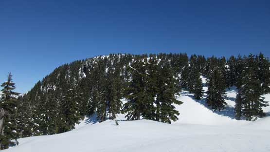
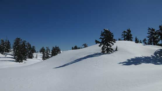
The steepness came to a sudden ease and then we were on the upper plateau. The summit appeared to be still far away but actually not. What’s left was just a scenic traverse. We took our time enjoying the views and the next thing we were on the summit. The summit is broad as a soccer field but has no trees. About 20 minutes later the other group showed up. Good for them to push through that steep section even with marginal gears.

The grade mellows out suddenly as we arriving at the upper plateau
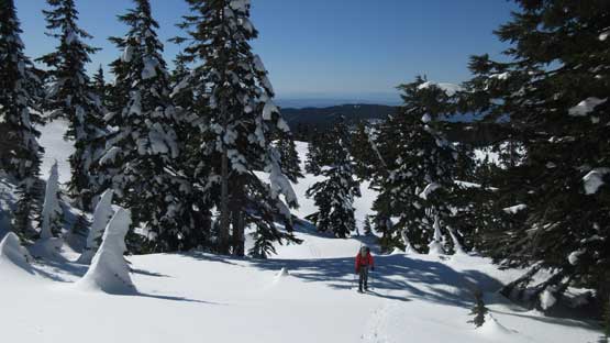
Traversing the upper plateau.
First unobstructed view towards the Golden Ears Group
The summit is still fair a bit of work away.
Winter wonderland!
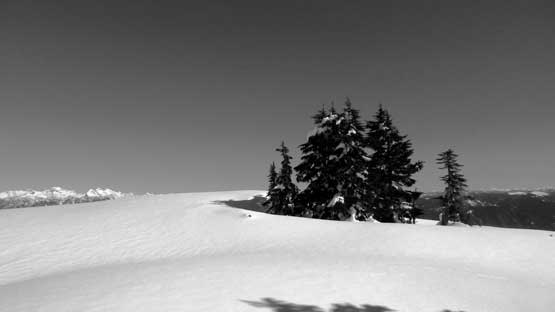
I really liked this group of trees for some reasons.
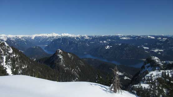
Near the top we came to this viewpoint with show of Stave Lake
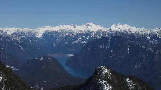
The north end of Stave Lake with the Clarke Group behind

Just another shot of Stave Lake
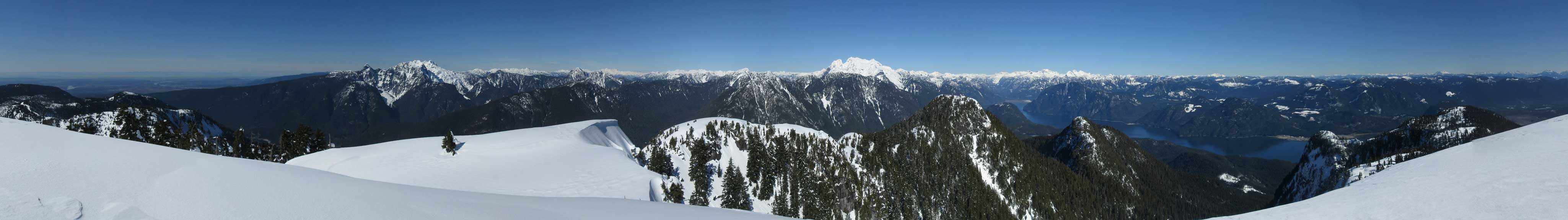
Partial Summit Panorama from Mt. Crickmer. Click to view large size.
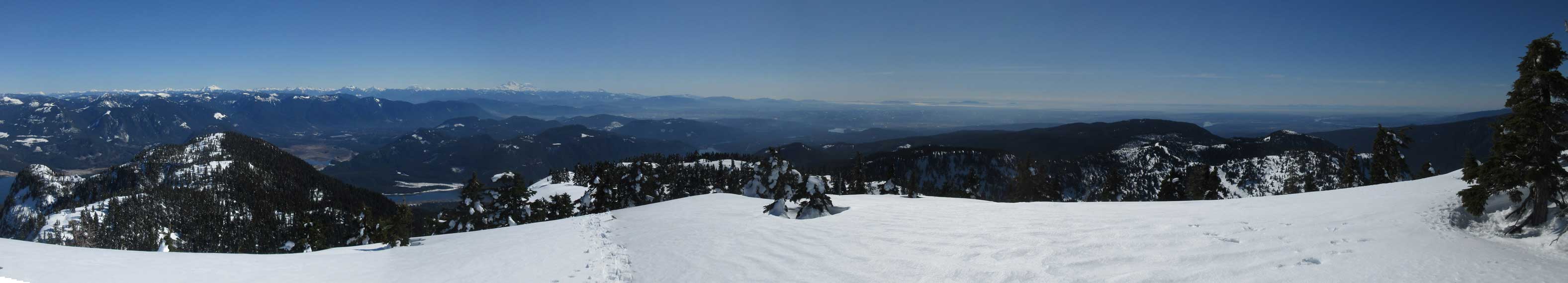
Partial Summit Panorama from Mt. Crickmer. Click to view large size.
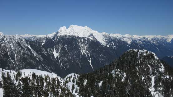
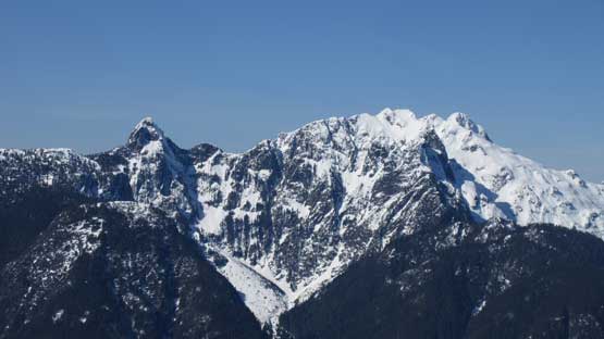
The bulky Mt. Robie Reid dominates the northern skyline
A closer look at Mt. Robie Reid
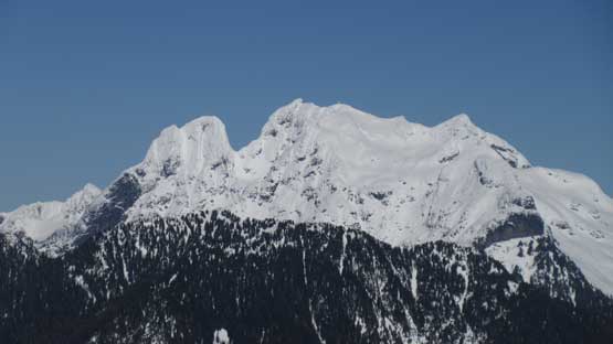
Golden Ears Group
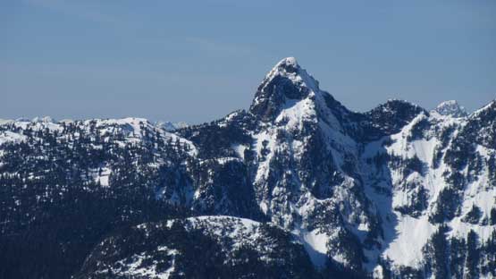
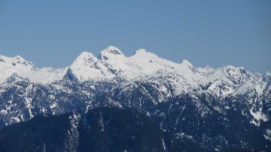
This is a closer look at Blanshard Needle
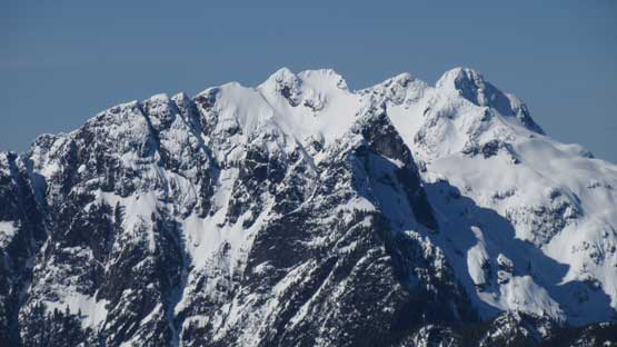
Edge Peak and Golden Ears
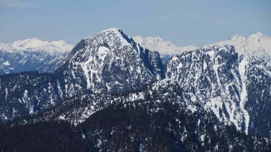
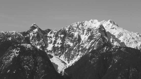
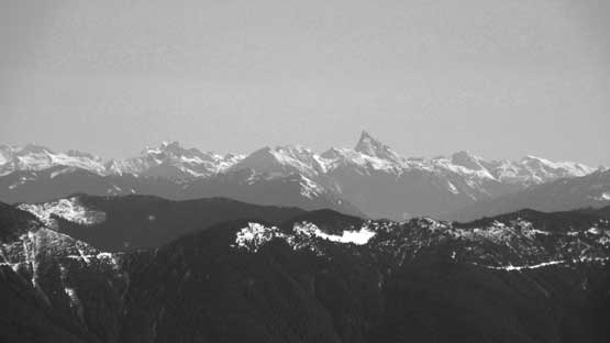
Raven Peak
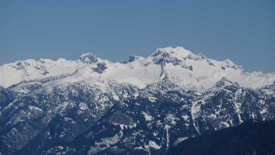
The biggest peak out there is Mt. Clarke
Bardeen and Stonerabbit Group
Slesse Mountain et al. by Chilliwack Valley
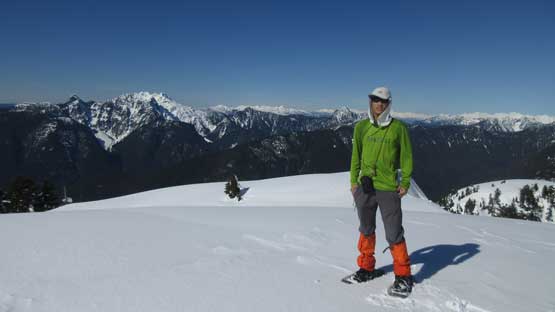
Me on the summit of Mt. Crickmer

Beasty shows up

Bit of a party time on the summit

Lily and myself on the summit of Mt. Crickmer
I thought we might have to remove the snowshoes and down-climb that steep stretch but the condition was actually better on descent. The other group helped packing down the path and the snow had further softened. Apart from some careful footwork the descent was easy going. The rest of the plod down Kearsley Creek FSR was a mind-numbing slog. Boring as hell.. We took no rest – one push all the way back to the truck.
Time to head down
Can’t get enough of this winter wonderland
Carefully descending the steep forest
Taking a short-cut lower down
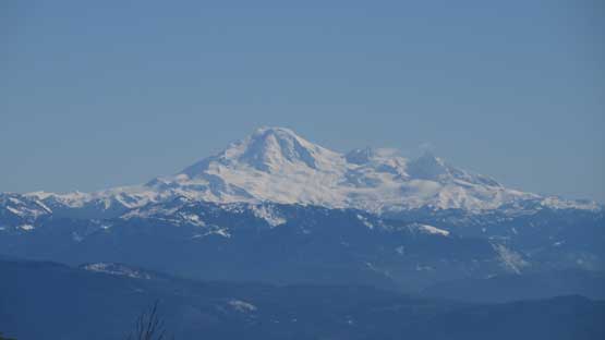
Unobstructed view of Mt. Baker. The light is better right now.
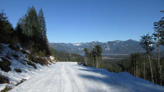
Descending the upper logging road
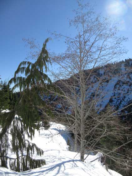
This tree is cool.
Into the mind-numbing plod…
The last few km seemed to drag on forever…
Our round trip time was 7.5 hours which was pretty much just as expected. There’s no rushing the whole day and we also enjoyed about an hour’s summit stay. With those views (and the spring-like temperatures) it’s really difficult to leave the summit behind. The drive back home was short which is another bonus.
