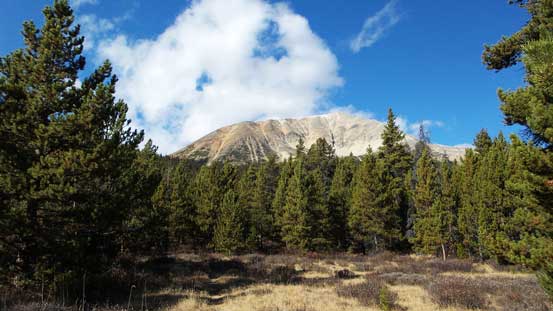
Marble Mountain
October 18-19, 2014
2962m
Jasper – South Boundary Trail, AB
Ben and I were game for a 2-day trip in this past weekend but we had to be careful picking objectives. After a series of aggressive and successful trips in this incredible fall we naturally started by throwing out some ‘grand’ ideas… But we had to resist the temptation to go ‘big’ given the unsettled weather pattern. Well, the weather wasn’t going to be horrible but certainly not the greatest. Judging by our previous experience we should stick to front range, technically-easy peaks that’s not super high in elevation. We had many choices and as usual we’d wait till the last minute to make a decision – this time we picked 2 remote peaks by South Boundary Trail, inspired by Eric’s recent first-ascent of Mount Aztec in the same area. Of course having only 2 days we couldn’t go as far as what Eric did.
Marble Mountain and Flat Ridge are among the few officially named peaks in this area. We couldn’t find any route information but judging by the satellite images and topographic map they shouldn’t impose much of a problem even with fresh snow and/or less-than-ideal weather. Though closer to the road than Mt. Aztec, to ascend both objectives we’d still travel about 60 km distance, so that’d still definitely give a ‘remote’ feeling. (With the majority of that approach on a well-defined trail though). The terrain between Marble Mountain and Flat Ridge appeared to be high alpine meadows so that’d serve as a perfect bivy site. That seemed to be a perfect plan for a 2-day trip!
Due to the poorly scheduled evening midterm exam I couldn’t leave Edmonton until 9 pm on Friday, and the drive to trail-head by Nigel Creek would take at least 4.5 hours. Usually for a long approach on trail we’ll knock off a portion by the first evening but there’s no way we could do that on this trip. The following morning was also quite demotivating as we woke up in rain seeing all the nearby peaks soaked in clouds. As a result we went back to sleep and didn’t start the trip until almost 9 am. Alright, that was quite a few hours behind schedule and as a result, we were forced to ‘rush’ throughout this trip… That’s okay as the lengthy trailed approach would be perfect for going ‘fast’.

Marble Mountain and Flat Ridge scramble route. GPX DL
This was my first time hiking the Nigel Pass trail. Apparently it’d undergone some changes over the past 2 years and the first 2 km or so was following the old Banff-Jasper road on the left (west) side of the creek. This road brought us to an outfitter’s corral before dropping down to the creek. Two newly placed bridges assisted us crossing Nigel Creek and on the opposite bank we picked up the trail. Immediately after that we passed the first campground (Camp Parker). The hiking was mundane until the last bit towards Nigel Pass. We were treated with some temporary views but the strong and cold wind forced us to immediately drop down the other side towards Brazeau River.

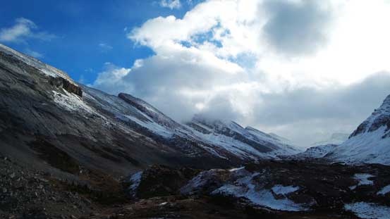
The trip started with not-so-great weather

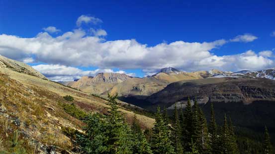
Weather temporarily cleared up when we arrived at Nigel Pass
Looking towards Cataract Pass from Nigel Pass.

One of the many unnamed peaks nearby.
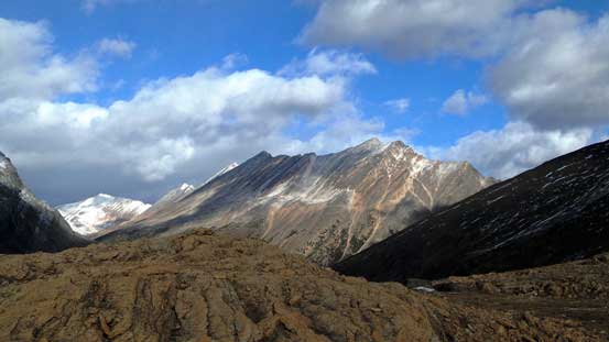
Another unnamed peak. This is looking further towards the front range
We somehow missed a branch on the not-so-clearly defined path near the pass, ended up too high and lost the trail. There’s some steep terrain immediately in front preventing a direct cross of Brazeau River’s tributary but yes, we could clearly see the official trail on the opposite side. After searching around we decided to just scramble down a loose gully and then back up ascending a boulder field to ‘short-cut’ it. That worked because we are scramblers but for hikers, the official trail is way over to the right side of Nigel Pass (as we discovered on the return). Once picking up the trail we followed it steeply down towards the main Brazeau River, and from now on the next few hours would be a tedious slog along the South Boundary Trail. It’s as boring as one could expect and I’m very glad to have my iPod along. On the positive side this trail was very well maintained as for 2014 – all the creek/river crossings were reinforced by newly-built bridges. It took us about 5 hours from the parking lot hiking on a furious pace to reach our ascending drainage just below Marble Mountain. And after a short break we’d start the bushwhack.

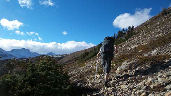
On the descent from Nigel Pass down towards Brazeau River
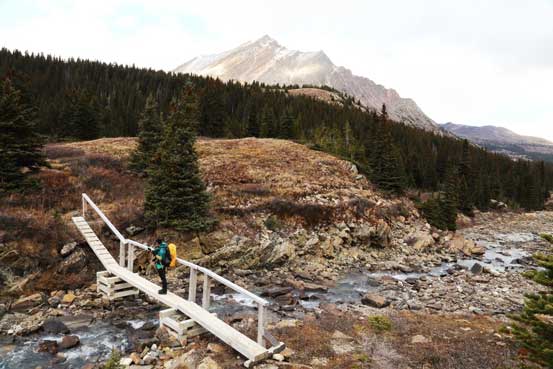
All of the creek crossings were reinforced by new bridges. Photo by Ben
As you can see the weather was moving in-and-out on this day.
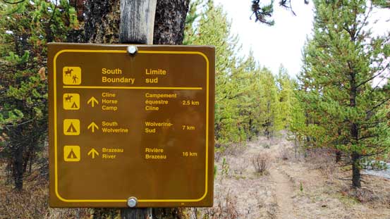
A sign indicating we were on South Boundary Trail
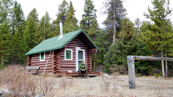
We met a solo camper at Four Point Camp

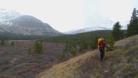
Looking back. Not to our surprise the main range was still soaked.

Me hiking through the typical forecast. Photo by Ben

Arriving at another clearing

Could see our objective on left now
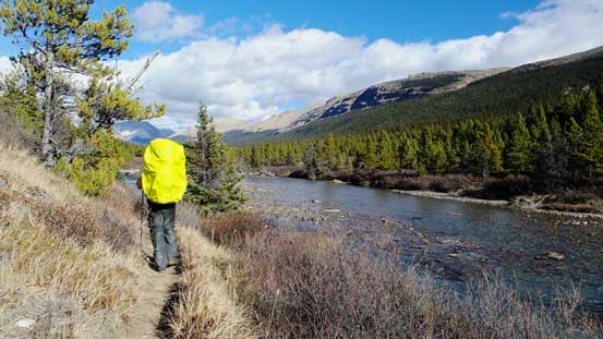
The trail gets pretty close to the (much bigger) Brazeau River
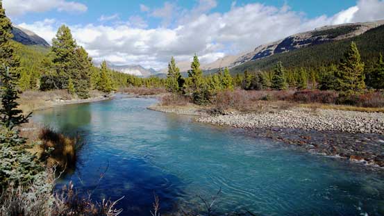
I really like the colour in Brazeau River
Here’s where we left the trail. Marble Mountain directly above us.
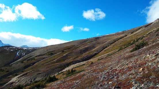
We initially stayed relatively close to the creek but the thick bush forced us to ascend more towards climber’s right. We didn’t pay enough attention to where we headed exactly so before we realized we were already way up high on Marble Mountain’s slope, high above the ascending drainage and pretty close to treeline. This wasn’t our intention but turned out to be a very good route choice. Once exiting the trees we’d contour a long ways around Marble Mountain’s SE and then S slopes before ditching our backpacks for a summit bid. There were some ugly terrain to negotiate on this long side-hill traverse including some krumholtz and steep and loose scree, but still better than the dense bush by the creek (as we discovered on return). The down-side of our route was the lack of water source. We did not fill up our water bottles before leaving the creek, but oh well, there was some snow higher on the mountain so we’d be fine.

Light bushwhacking straight up the forested slope.

Almost at treeline. Now we were too far climber’s right
Looking back we got some great scenery

We had to traverse a long section of side-hill terrain. Photo by Ben

And overcoming krumholtz…
Still far from our ascending ridge
We’d side-hill all the way to the far skyline ridge
Looking back we could see the impressive Mt. Willis.

Here’s where we ditched backpacks.

Great view of Afternoon Peak and Mt. Willis
There was still more than 400 m height gain from where we ditched gears to the summit. It didn’t appear to be that long but having GPS units we knew the view was foreshortened. The weather was held pretty nicely so far for the front range and we were hoping for some really nice views from the top. There was one boulder field requiring some caution due to the fresh snow but other than that it was no more than easy scrambling. Oh by the way, there’s some confusion regarding where the true summit of Marble Mountain locates. The summit we ascended, also the one on bivouac.com is different than the official summit which is marked on the far north end of the long ridge (about 1.2 km further). From our observation as well as the contour lines on topo map the two ends on Marble Mountain’s long ridge have pretty much the same height. The direct traverse didn’t look straightforward but if you just ‘have to’ bag the official highpoint then I believe it’s an easy ascent from its east slope directly from South Boundary Trail, or via the north slopes from Brazeau Lake. I’d treat either of the two as ‘legitimate’, depends on where you start the ascend.
Me with the gentle ascending slope. Photo by Ben

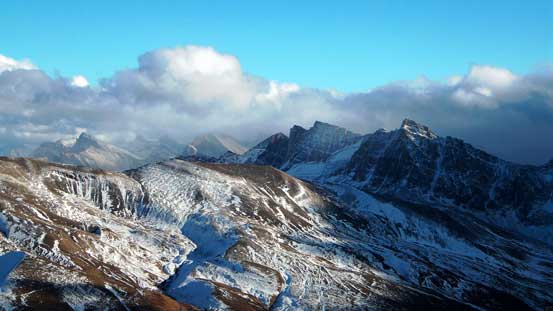
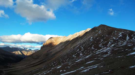
Flat Ridge, our next objective is the bump on left. The higher peak on right is unnamed, or “Marble NW4” by bivouac.com
Ben ascending the typical terrain. Behind in the background is a vast alpine meadow
Sunlight shone on part of Marble Mountain

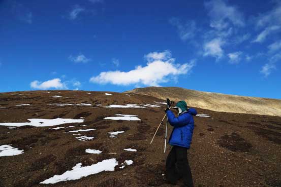
Me scrambling up. Photo by Ben
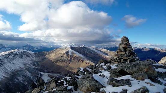
A huge cairn on the summit. Someone must have spent a good amount of time building it…
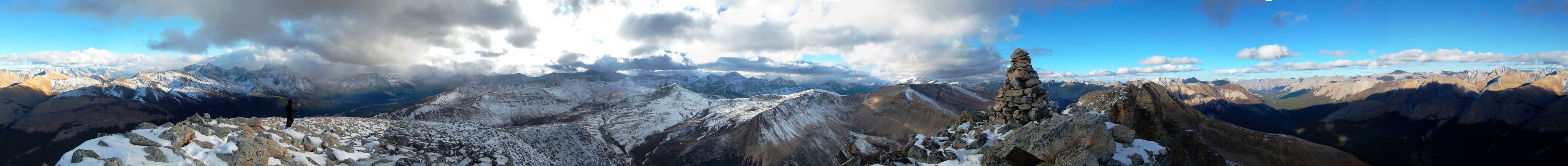
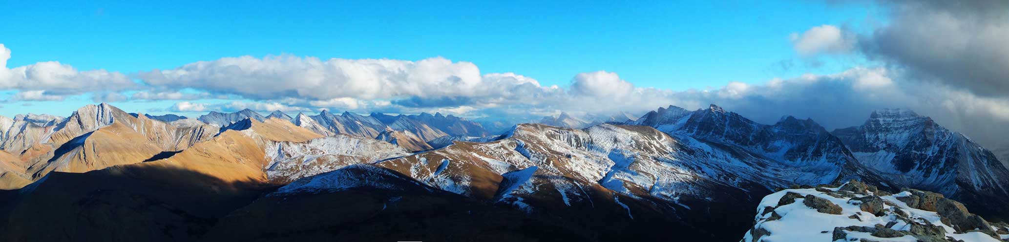
Summit Panorama. Click to view large size.

Further into the front range we could identify Mt. Aztec.

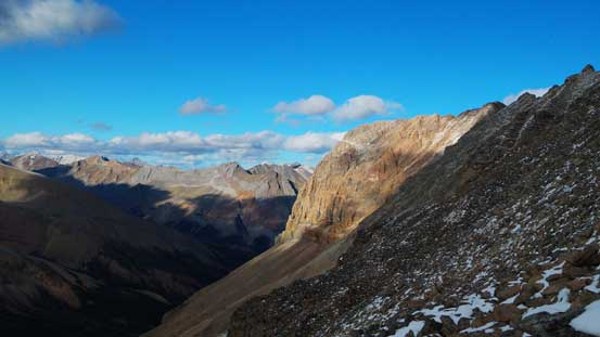
Looking way down Brazeau River towards the distant Tarpeian Rock
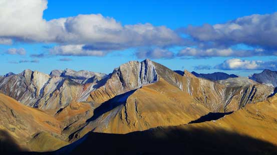
Afternoon Peak is wrongly labelled on the map. It’s the high peak right of center.

A sea of front-range peaks looking into the White Goat Wilderness
Mt. McDonald
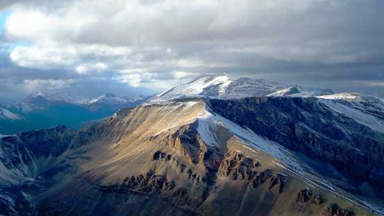
Poboktan Mountain poking behind “Marble NW4”

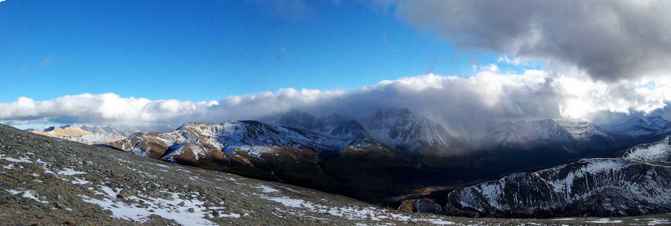
Waterfall Peaks looking north. Weather appeared worse towards Jasper
The back side of Sunwapta Peak surely looks more impressive!
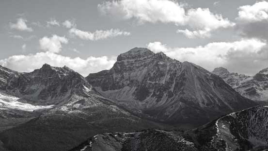
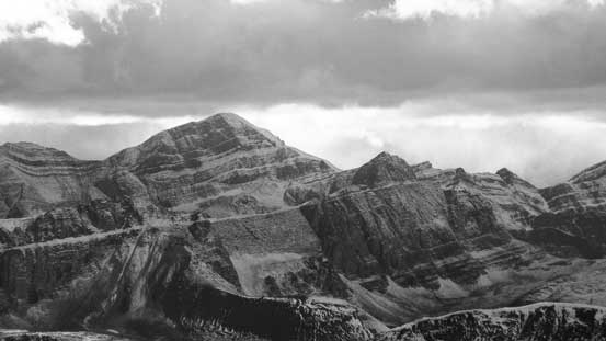
Obstruction Mountain in black-and-white. It’s the highest peak in its vicinity

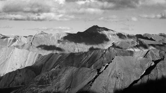
This peak doesn’t have an official peak. It’s named “Copia Peak” on bivouac.com

Mt. Olympus in the front country
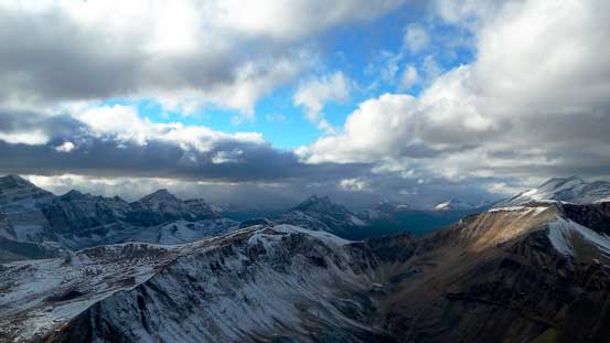
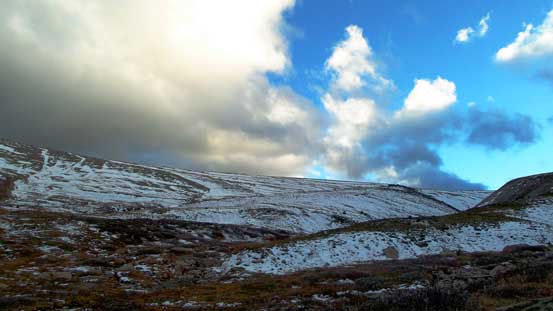
Some cool clouds formation. This picture also shows the typical weather in this day.
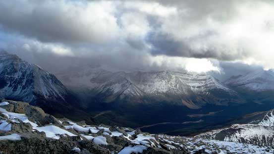
Looking towards the main range. Weather was still bad there.
Another panorama of the front range peaks. Click to view large size.

Me on the summit of Marble Mountain

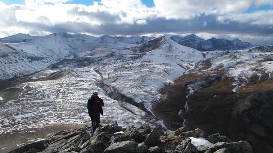
Panorama from the summit. Our bivy will be by the stream, left of center in this picture.
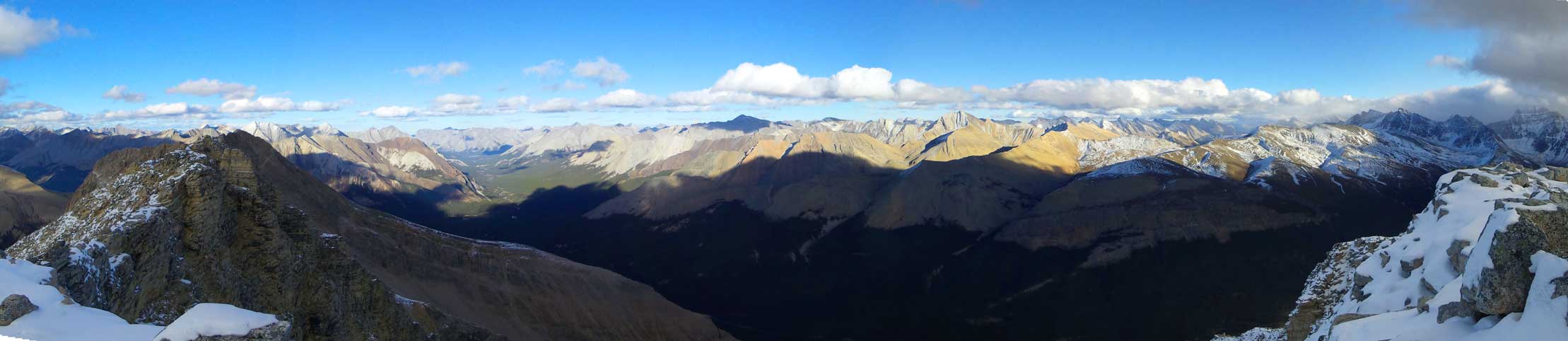
One last panorama from the summit before descending.
The descent was uneventful and soon we were back to where we ditched backpacks. We quickly moved our way down the SW slopes and dropped into the broad valley between Marble and Flat, hoping the creeks weren’t dry. Good news arrived soon as the creeks weren’t dry. It took us 9 hours from parking lot to get here, covering almost 30 km as well as bagging a peak. That was pretty fast and we even had about 1 hour before head-lamp time to enjoy this 5-star bivy site. I’m sure not many people have visited here…
Clouds, blue sky and rarely-ascended peaks. That was the theme of this trip!

Leaving the summit behind

Back to where we ditched backpacks
The last sunbeam shone on Marble Mountain
We didn’t need to search around. Anywhere by that meadow was a prime bivy spot
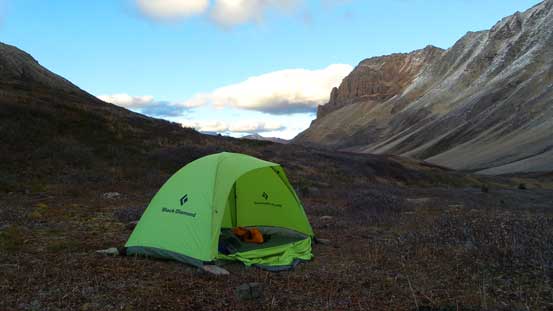
Our camp
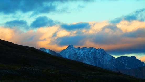
Evening colours by Mt. Aztec
The night was not very cold nor windy, and in the morning we woke up under good weather. And our trip continued with an ascent of Flat Ridge before heading back home.

Hi Steve, do you need a permit for bivy?