Crawford Peak
May 8, 2018
2051m
Squamish / Mamquam Main FSR, BC
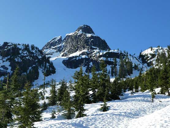
“Crawford Peak” is the unofficial name of the highest among the summits immediately south and south-west of Mamquam Mountain. Other than the new BCMC cabin built at Watersprite Lake this general area is well known for the incredible views it offers, and of course Crawford Peak isn’t an exception. However, unlike the other peaks directly above Watersprite Lake, Crawford Peak requires a bit of a long plod to get to as it’s a little bit farther away. The traditional access is still from Watersprite Lake across some steep south-facing slopes but I had other plans. I’ve put hours and hours into studying the maps and the route I would like to try is a direct assault via Paranoid Creek valley, starting from the Watersprite Lake’s summer trail. The requirement for this route to work is abundant amount of snow to cover the brushes and creeks, and the Tuesday of this second week of May seemed like the right time.
Vlad and Lily were keen to get out and it didn’t take me long to convince them to try my experimental route, and if things went smoothly we would also tag the rarely-ascended Paranoid Peak in that valley making a double-header. Not knowing how far we could drive Skookum Dam Road before hitting snow we opted to start super early. I woke up at 2:15 am, picked up Vlad from Richmond at 3 am and then picked up Lily from West Vancouver at 3:30 am. The drive to Squamish and then onto Mamquam Main FSR was uneventful but the Skookum Dam Road was rougher than expected. The road beyond Watersprite Lake’s winter parking lot appeared free of snow so we kept driving, but eventually had to stop and turn-around because of a huge patch of snow. That left us about 3 km each way of road walking but on the other hand, we had already shaved off 1 km each way of walking so there’s no complaint on that.

Crawford Peak and Paranoid Peak via Paranoid Creek Valley. GPX DL
The road was actually mostly dry except for that short stretch that stopped us. We made good progress on the initial 3 km stretch and at the start of Watersprite Lake’s summer trail we took an experimental bushy short-cut to shave off a big bend. The bushwhacking was fairly sustained and unpleasant but we definitely saved some time and energy. Once rejoining the trail the snow soon became continuous and then it’s time to don snowshoes. Upwards towards “Skullhead Pass” it’s a straightforward cross-country travel through some spur roads and then mature forest.
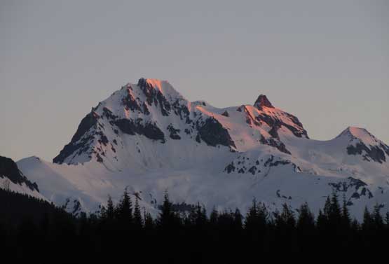
Alpenglow on Mt. Garibaldi massif from the first 3 km road walk

Morning view of Mt. Garibaldi / Atwell Peak massif

Vlad snowshoeing on the upper spur roads
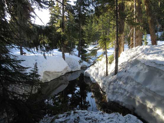
The snowpack is still very thick at this area

On the plod towards “Skullhead Pass”.

Arriving at this broad forested pass now.
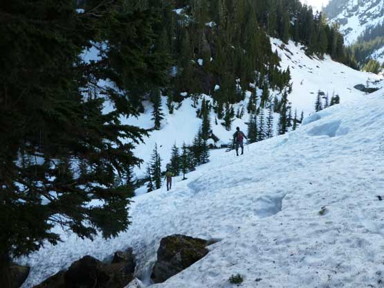
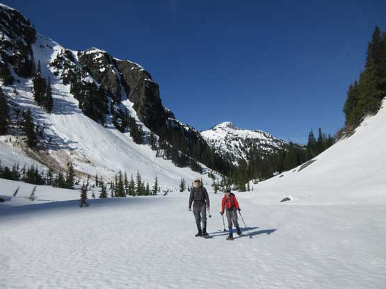
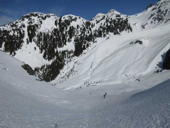
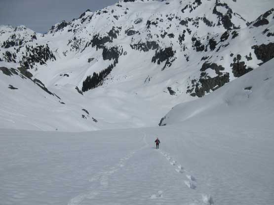
The descent on the east side of this forested pass was steeper than expected. My original plan was to cut a side-hill traverse to reduce elevation loss/regain but we soon realized that’s impossible. The traversing mode was blocked by some steep bluffs and we were forced to descend some steep forests (with snowshoes on) into the Paranoid Creek valley. This whole stage involves about 100 m of elevation loss. Unfortunately for us Paranoid Creek was already a raging torrent at this time of a year that a direct travel up the valley was no longer possible. We had to traverse some steep and frustrating terrain on the south bank of this creek and that also involved fair amount of route-finding. But the terrain did improve after about 500 m of side-hilling. Upon reaching the upper valley the creek became entirely filled-in and that surely saved our day. Plodding across the upper valley saw us having a drastic change of pace.

Vlad descending steep forest down from “Skullhead Pass”
Me and Vlad descending into the Paranoid Creek valley. Photo by Lily
Me traversing into the valley. Lots of unknown ahead. Photo by Lily

The creek is raging right now. We had to traverse on the bank
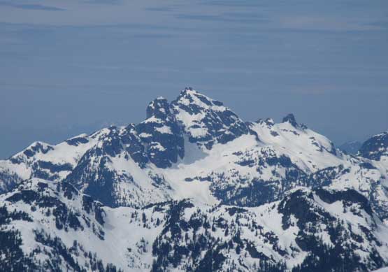
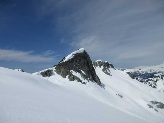
The north face of Dreadnought Peak looms above

Me and Lily negotiating the complex terrain. Photo by Vlad
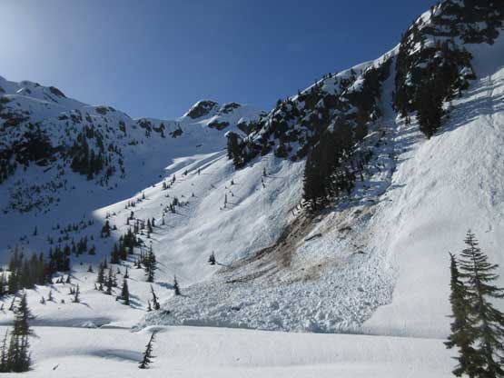
Huge slide paths on the south side of this valley
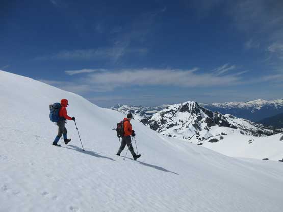
Vlad and Lily traversing into the upper valley

Me leading the way. Photo by Lily

Another shot of myself. Photo by Lily

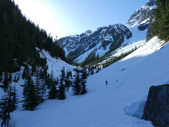
The plod’s getting much quicker now. Dreadnought Peak behind
At the headwaters of Paranoid Creek we trended southwards into a tributary and then up a small gulch feature to access the toe of Crawford’s north glacier. The glacier itself is far more impressive than what I was expecting. The original idea was to keep plodding up the valley to the broad pass between Crawford and Paranoid Peaks but after seeing that north glacier in person I made a spontaneous call to ascend the glacier instead. It’s a far more exciting line and certainly not too crazy neither. We pretty much ascended the middle of the fall line.
Trending south at the head of this valley. The terrain’s big

Lily and Vlad plodding upwards

First sight of the north glacier on Crawford Peak. Photo by Vlad

After seeing the glacier route we abandoned the original plan

Lily and Vlad traversing another steep slope to access the glacier

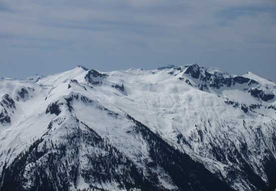
The north glacier close-up
Plodding up. It’s one-step-at-a-time kind of game
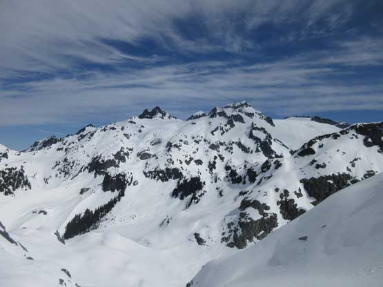
Looking back we could see the entire massif of Mamquam Mountain

A close-up shot of Mamquam Mountain – bagged a couple years ago
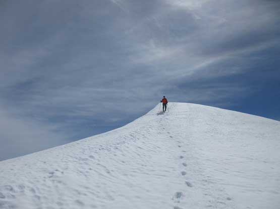
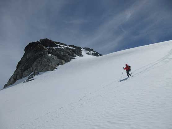
Towards the top the thin layer of high clouds started to dissipate and we were rewarded by some incredible views towards all directions. The actual summit was not too far away. It wasn’t the rocky outcrop that we’d been observing for the last hour or so, but rather a hump of snow. It had taken us about 6 hours to get here but there’s no need to rush. We did spend about an hour up there to soak in the views.

Me leading up the north glacier’s mundane plod. Photo by Vlad

We got some cool lights here. Photo by Vlad
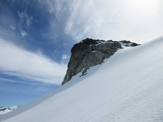
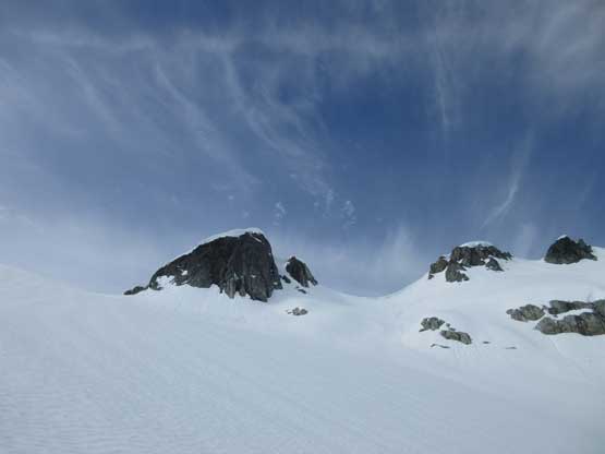
At first I thought this outcrop rock is the summit, but nope

Summit Panorama from Crawford Peak. Click to view large size.

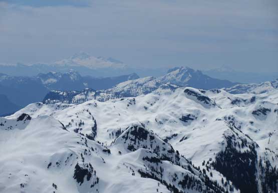
Mt. Pitt the most remote giant in Garibaldi Provincial Park

Snowcap Icefield area – Rain God Mountain, Snowcap Peak, etc.
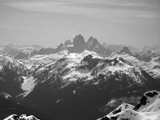
Mt. Judge Howay

Mt. Robie Reid
The east side of Sky Pilot Mountain and its satellite peaks
Pinecone Peak at al. looking south
Golden Ears and Mt. Baker on the southern horizon

Katzie Mountain on Stave Glacier rises behind Bucklin Peak

Matching colour between Lily and Vlad
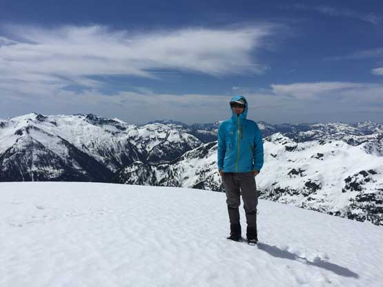
Me on the summit of Crawford Peak
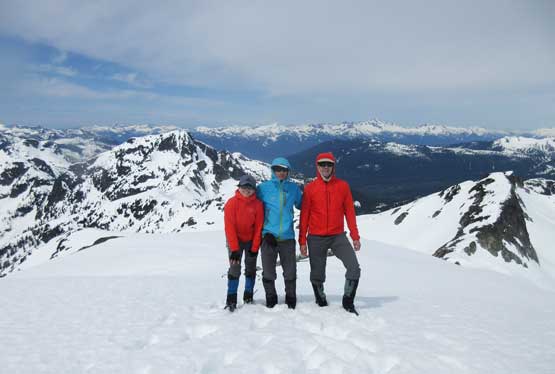
Our group shot on the summit of Crawford Peak
On the descent we started with just boot-packing but halfway down the glacier we strapped the snowshoes on. The post-holing was getting crazy (more than thigh deep). Plunging and slipping down on snowshoes was a fast and fun process and in no time we were back into the valley which certainly felt like an oven.
Leaving the summit behind.

The east face of Dreadnought Peak
Vlad and Lily boot-packing down the upper slope

Continuing down onto the north glacier
Just one of the many sub-summits on this peak.
Lily plunging down the north glacier.

It was fast and fun but the post-holing soon took over
The snowshoes were strapped on again. Vlad’s leading the way

Off the north glacier. Time to ascend Paranoid Peak
We had some discussions about the options but given that nobody was keen to travel up into this valley again we decided to push on, and the day continued with an ascent of Paranoid Peak.
