Agassiz Peak
March 13, 2017
3766m
Flagstaff, AZ
There are many reasons why the second highest peak in Arizona state is rarely ascended. First of all Agassiz Peak is illegal to climb and violators face about 500$ of fine and this is a wee bit more than what other park’s tickets worth. To make it legal you have to ascend in winter time when the alpine is covered in snow. Secondly this peak sits right beside the famous Humphreys Peak – aka. the Arizona state highest point. For that reason Agassiz Peak is often overlooked and nobody but the peak-baggers would consider. Of course my primary objective was also Humphreys Peak but since the two share the same approach I had to make this side detour to check off Agassiz Peak.
There’re more logistics associated with a winter ascent of Agassiz Peak. The shortest approach and pretty much the only one that makes sense is by directly plodding underneath the chairlifts of Arizona Snow Bowl ski resort, and just like most other resorts uphill travel is strictly prohibited. To not get caught by a ski patroller (hence, get turned around), you’ll have to ascend hours before they open the gate and that could mean a very “alpine start”. Arizona Snow Bowl does not open until 9 am in the morning but that doesn’t help. Considering the majority of the ascent would be done in the resort I figured a pre-dawn start was still essential. On the 5th day of this past spring break vacation my alarm went off at around 4:30 am. I quickly got out of my car, bought some food in the nearby McDonalds and then drove to the end of the access road which was about half an hour away.
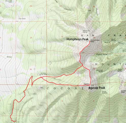
Ascent route for Agassiz Peak and Humphreys Peak. GPX DL
The condition of this winding and steep road was good – dry, smooth and paved. I drove up in my Toyota Corolla without an issue and there’s no fancy gear such as tire chains required. It certainly helped by sorting the gears out in the previous evening so all I had to do in the parking lot was to put the boots on, and then go. My plan was to snowshoe directly underneath “Sunset” chairlift but in the pitch dark it wasn’t that easy to stay oriented. I had little idea which was which so just went following common sense and the route I ended up taking was “North Star” blue run. This brought me to the top of “Sunset” chairlift nonetheless and then I turned left following the edge of the resort up. The terrain got steeper the higher I went but looking back the views were also gradually opening up. Near the top of “Grand Canyon Express” I got to watch some incredible morning alpenglow across the horizon.

Dawn at its finest
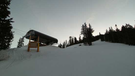
The typical grunt up the Arizona Bowl snow resort
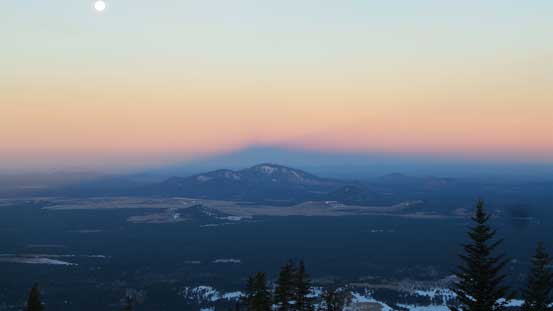
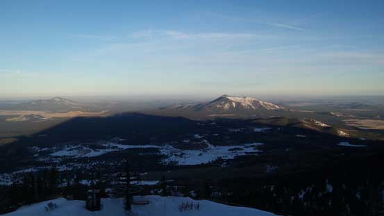
Just like other volcanic ascents, the San Francisco Peaks catch their shadow too.
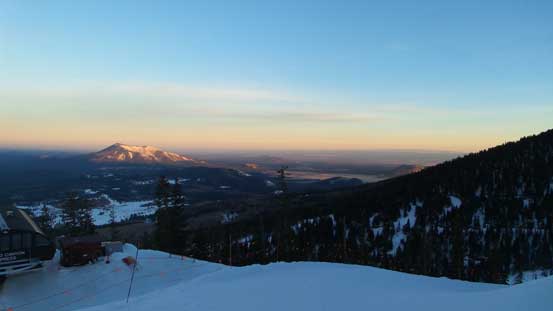
The morning alpenglow horizon
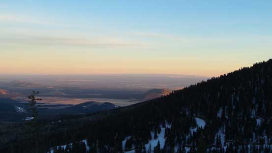
More about the morning colours
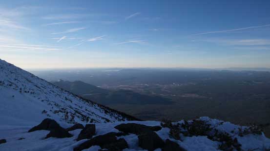
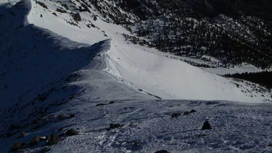
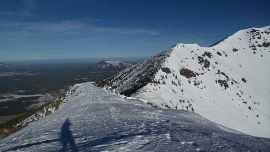
I did not bother to take too many pictures of the alpenglow as I was still in the resort. I wanted to be off the resort land for as fast as humanly possible. Another section of steep grunt following the “Upper Ridge” black run I made to the resort boundary at 11,500 feet. Beyond that was Coconino National Forest and there are signs clearly saying one cannot ascend Agassiz Peak by crossing the fence but it’s in winter time so those weren’t in effect. After hopping over the fence I still had a fair amount of elevation gain to do. That cold wind picked up near the false summit but thankfully died down a little bit as I slowly ascended the final summit ridge.

At the top of the resort limit, looking up

Looking sideways towards Humphreys Peak
Looking back, I was already higher than everything else now
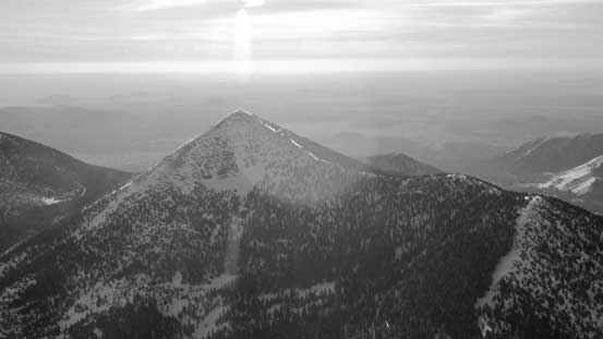
A zoomed-in view towards Kendrick Peak
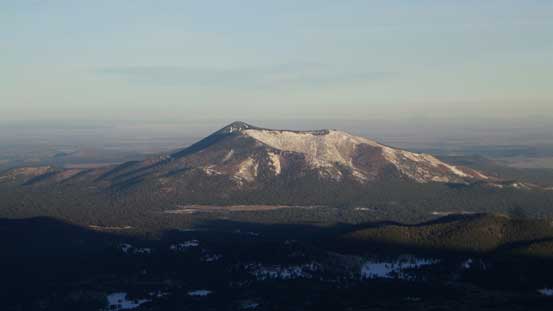
Humphreys Peak
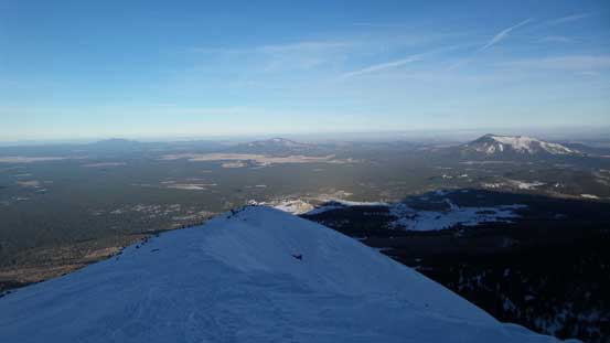
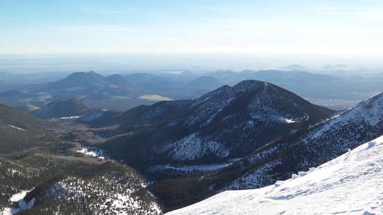
The southern horizon
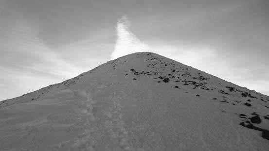
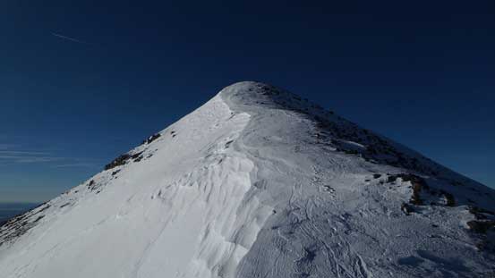
Plodding up the final summit ridge
Another shot looking back..
Despite being on the windward side, the snow in the alpine was nice and continuous and I managed to wear snowshoes right to the summit. I took a long break up there soaking in the views and more importantly, taking a well-deserved energy break as I didn’t really do many stops lower down.
Getting higher than Agassiz/Humphreys col now, started to see the other side
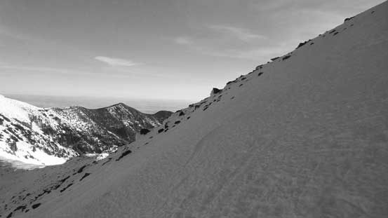
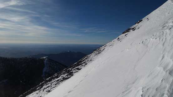
The last section was quite steep.
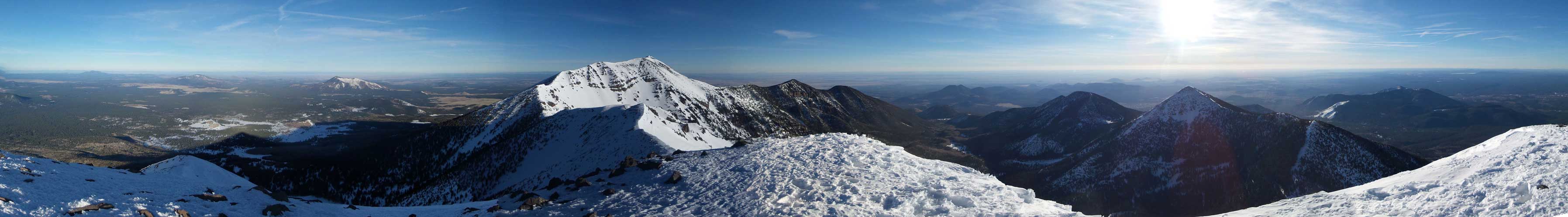
Summit Panorama from Agassiz Peak. Click to view large size.
Fremont Peak is the 3rd highest in Arizona and is even more rarely ascended..
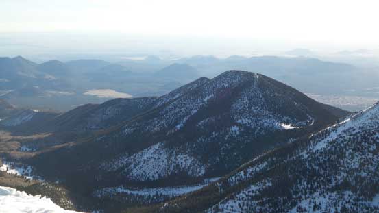
Doyle Peak which is also part of the San Francisco Peaks massif. Itself also above 11,000 feet.
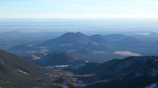
This is zooming in towards other volcanic features looking east. O’Leary Peak et al.

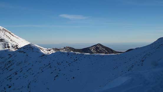
Other highpoints on the north-eastern arm of San Francisco Peaks
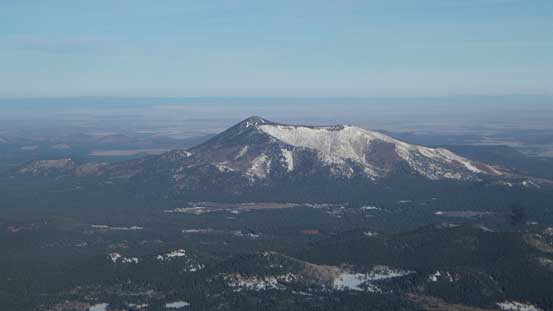
Kendrick Peak

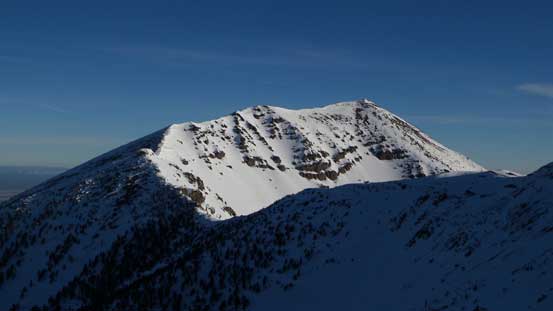
Another look at Humphreys Peak and the traverse ahead
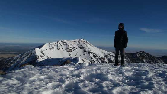
Me on the summit of Agassiz Peak
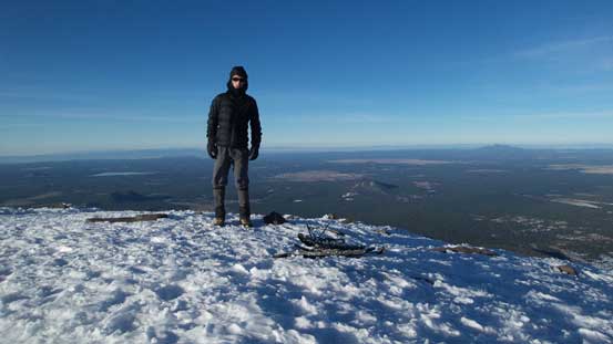
Another shot of me on the summit of Agassiz Peak
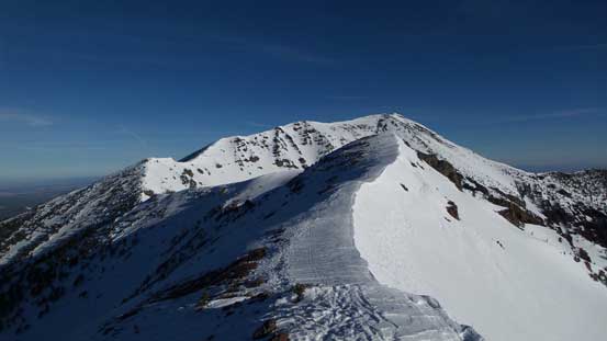
After finishing admiring the views I had to move on. There appeared to have a fairly substantial elevation loss along with some undulating sections towards Agassiz/Humphreys col. Indeed, the elevation loss was significant and the ridge had some up-and-downs, but given the downhill nature it didn’t take me long. The snow was in the perfect conditions for booting down. Snowshoes were no longer required and crampons were yet unnecessary.
Time to head down the north ridge
Another look into the inner crater. Doyle Peak in the foreground
Looking back at the initial descent off Agassiz Peak
A sideway view
Traversing over one of the few bumps

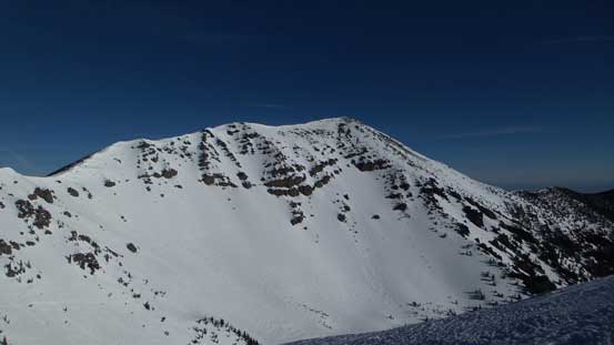
Agassiz Peak is a gorgeous one in its own.
The low saddle ahead
Humphreys Peak which will be my next objective
I took another break at Agassiz/Humphreys col before resuming my ascent of Humphreys Peak.
