Little Tahoma
June 28, 2017
3395m
Mt. Rainier National Park, WA
As much as a sub-peak of the mighty Mt. Rainier goes, Little Tahoma has one of the most unique and striking profiles in the Cascades and is well known as the 3rd highest peak in Washington state on the famous “100 Bulgers” list. But located next to Mt. Rainier means it’s overshadowed no-matter-what so as a result, on a good weekday it’s not uncommon to have the whole mountain to yourself. The first time I had my eyes on this peak was over a year ago when I climbed the classic Disappointment Cleaver route on Mt. Rainier, but my inspiration of making an ascent of Little Tahoma didn’t come until recently thank to a couple posts on “Washington Hikers and Climbers” Facebook group.
The standard route ascends from Fryingpan Creek and “Summerland” on the far east side of Mt. Rainier which is entirely different than the two most popular routes on Mt. Rainier itself (Disappointment Cleaver on the S/SE aspect and Emmons/Winthrop on the NE side). This further makes Little Tahoma “isolated” as you cannot easily combine Little Tahoma with Mt. Rainier in the same trip. The route is also more technical than Mt. Rainier thank to a snow slope approaching 40 degrees and some 3rd class climbing on unstable rocks. That being said, most parties seem to make it more dramatic than it actually is, while in fact it’s just an “Alpine II” and a moderate day-trip to me.
As usual the decision was made at the very last minute and arming with the recent beta detailed to the point of where exactly to fill up drinking water I really wasn’t expecting anything outrageous. Part of me was still tired from the Mt. Olympus death march. Apart from food and clothing, an ice axe, steel crampons and a helmet that’s all I brought for technical gears. The driving down south through Seattle metropolis wasn’t too bad at Tuesday night and eventually by about 12:30 midnight I had parked at the trail-head. Had I started right away I could have caught an amazing sunrise from above-the-clouds but the laziness kicked in and I opted to leisurely sleep a couple hours in the car.

Little Tahoma ascent route. GPX DL
A few hours later my alarm went off and after quickly consuming the sushi package bought in T&T Supermarket as breakfast I was ready to rock ‘n roll at just after 4:30 am. The initial few kilometers down Fryingpan Creek trail was boring in the dark with some steady elevation gain and views didn’t come until the trail turning into a westward direction after a few switchbacks. It was here that I started to encounter patchy snow and then it’s time to ditch the trail-runners and don mountaineering boots. Too bad it’s past sunrise already so I didn’t get the otherwise, amazing orange/red panorama. After plodding for another while I crossed the footbridge to the south side of Fryingpan Creek and then quickly lost the trail in the continuous snow. There were paths heading in different directions and I picked one ascending steeply up the forest which soon transitioned into a gulch feature. This eventually brought me to the treeline country at “Summerland” flats. Ahead would be the long and steep grunt towards Meany Crest.
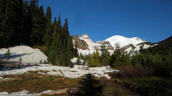
After hiking a long while I finally started to see some views
Above the Summerland flats now.
Looking ahead to the plod up towards Meany Crest
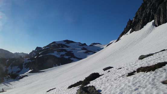
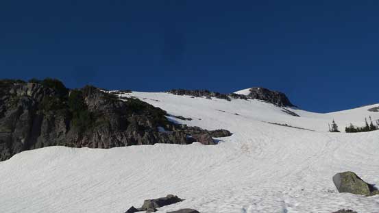
From reports I’ve read there seem to have quite a few ways to gain Meany Crest. On this day I just had to follow the boot tracks which worked more-or-less straight towards the ridgeline. The slope was long, foreshortening but not too steep but thank to the firm conditions I did have to don crampons. After a long while the slope angle eased and I arrived at a bench. The Meany Crest was the next bump ahead and I ascended from left to right on a ridge. The top of Meany Crest is a large, dry and flat area and I can totally see why most parties opt to camp here.
Plodding up towards Meany Crest with great views
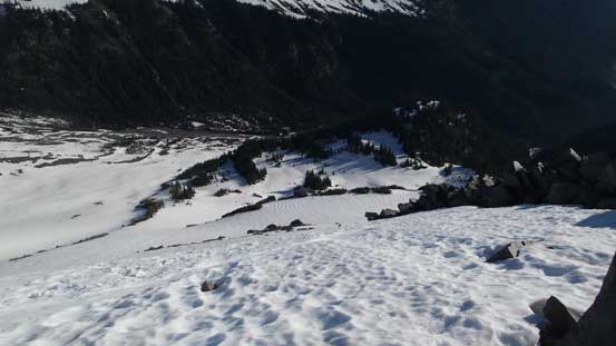
Looking down at this long and steep section

The top of Meany Crest is the bump ahead
Amazing valley inversion view
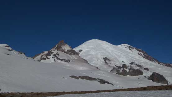
Little Tahoma and Mt. Rainier

A closer look at Little Tahoma from Meany Crest
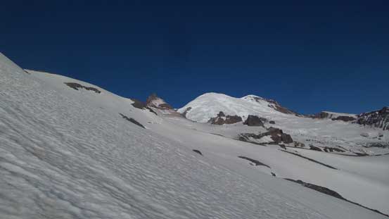
The next stage is a long and monotonous plod across the entire stretch of Fryingpan Glacier. Three route variations are possible – the early-season variation by a direct beeline towards an obvious saddle between Little Tahoma and Whitman Crest; the standard route ascends straight up the glacier towards Whitman Crest first before traversing higher up towards the saddle with some undulating gain-and-loss; and the last option ascends far to the climber’s left up Whitman Crest and is more often used for folks bivying up high. I took the “standard route” because it traverses a compressed zone hence the least crevassed area, and then dropped down the other side onto Whitman Glacier.
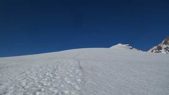
Plodding up Fryingpan Glacier

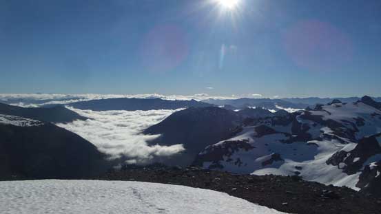
Nice to ascend above the clouds!

Long traverse across Fryingpan Glacier towards the col ahead
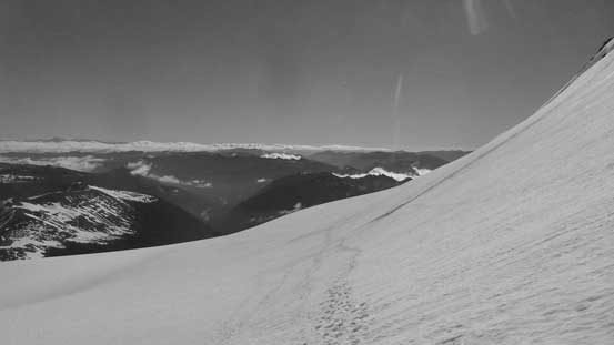
Looking back from this long traverse
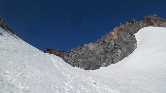
Arriving at the col separating Whitman Crest and Little Tahoma
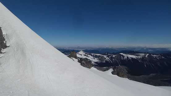
From the col, looking back down Fryingpan Glacier
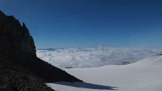
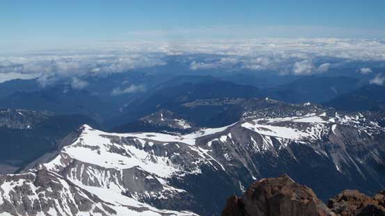
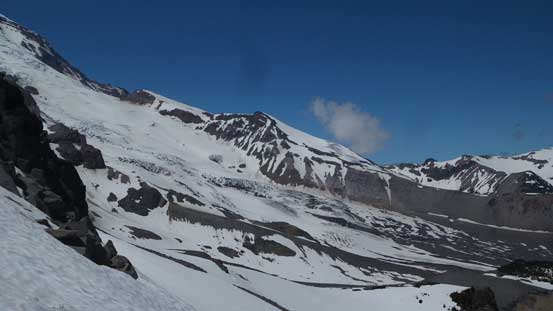
Awesome view looking at the other side.
The theme of this traversing thing continued as I crossed the lower stretch of Whitman Glacier towards the SE Face. By now I just simply followed the boot tracks and they led me traversing fairly high up and the purpose was to avoid a huge open crevasse lower down. I also came across the “water source” which was a mini waterfall cascading down the rocks. It’s tricky to get to with a sketchy moat and being there alone I had little desire to risk falling into a moat so continued onwards with very little drinking water left. In no time I was on my way ascending steeply up the SE Face and this stage would last quite a while. The slope is much longer than it looked from below and hundreds of meters of elevation gain was dispatched on this 30-35 degree slopes steepening towards 40 degrees higher up.

More about the low clouds inversion. Even Mt. Hood was visible on this day.

Mt. Adams looks grand

Traversing Whitman Glacier towards the SE Face
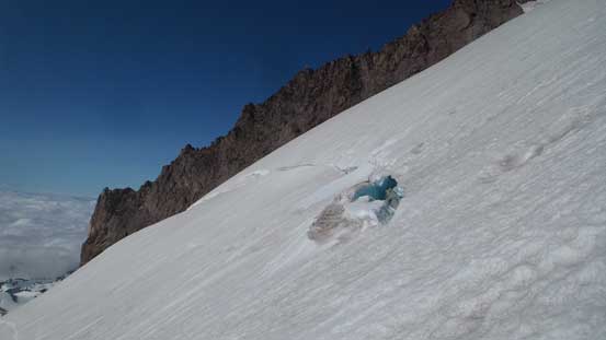
Quite a few open crevasses on the SE Face

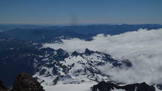
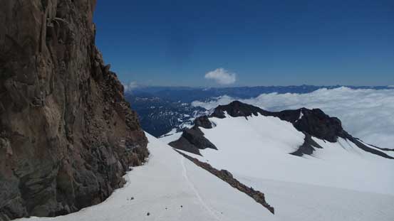
Getting much higher above the clouds now, looking down.

The SE Face is very foreshortened.
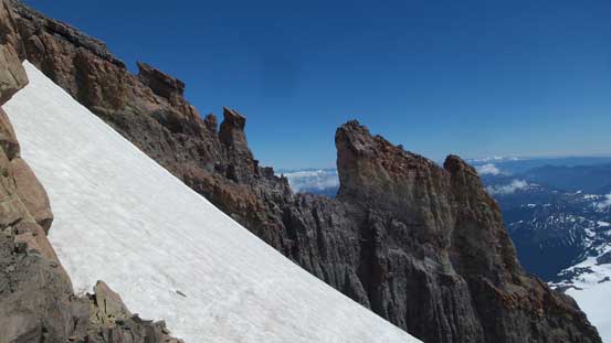
Near the top of the snow face I traversed climber’s left into a rocky gully. Ascending this gully involved a few 3rd class moves with crampons on rocks which wasn’t easy. I should have taken the crampons off but figured it’s a good practice of mixed climbing anyway. The exit of this gully dumped me onto another, but shorter snowfield and I again, kept a diagonal line aiming towards the “top left corner”.
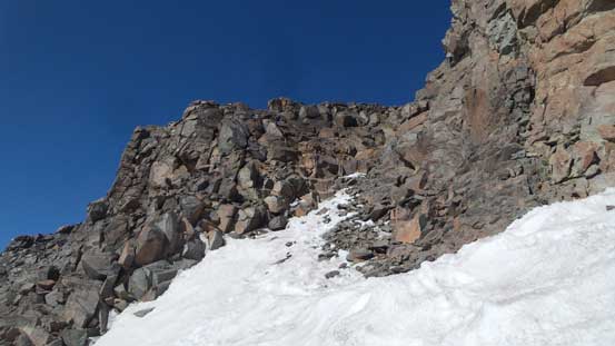
Traversing into the first rocky gully

From above the gully, looking down

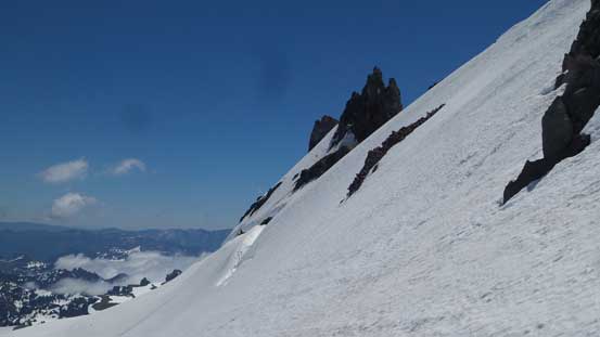
Ascending onto the upper snowfield
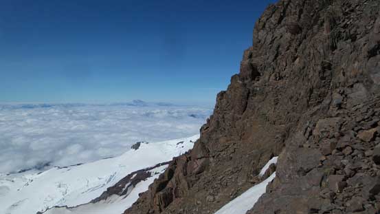
Looking sideways across the face
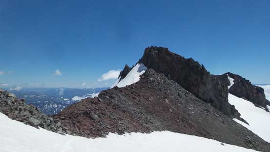
After exiting this upper snowfield it’s finally the time to take the snow gears off. The summit wasn’t far away and given the shortage of water I decided to just dump the entire backpack carrying only my camera, tripod and a GPS unit for recording purpose. I wouldn’t linger long up there as I was already dehydrated. There’s some minor route-finding issues to gain the summit ridge but basically I just followed the path of the least resistance, and once there I traversed over the false summit, down to a notch, then leftwards across a ledge then up a few 3rd class moves to the true summit. The scramble was quite straightforward despite what’s said on some other sources, and despite the lack of water I still lingered for about half an hour and it’s specially memorable to gaze at the gangs descending the D. Cleaver route on Mt. Rainier while having the summit of Little Tahoma to myself.
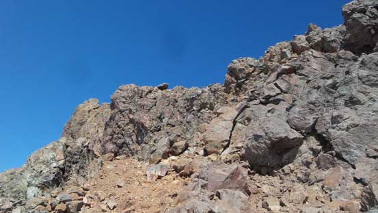
Some class 2 scrambling with route-finding to get onto the summit ridge
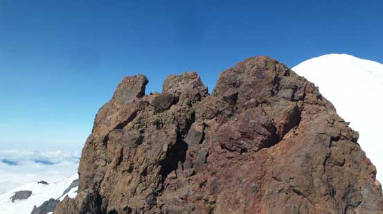
The true summit ahead
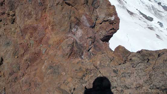
Down-climbing into the saddle separating the false and true summits
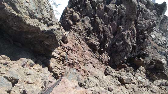
Traversed across this loose ledge and then up a 3rd class section to the summit
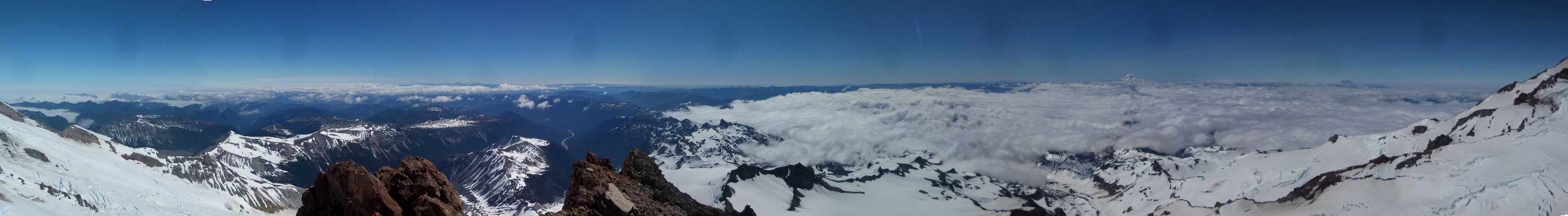
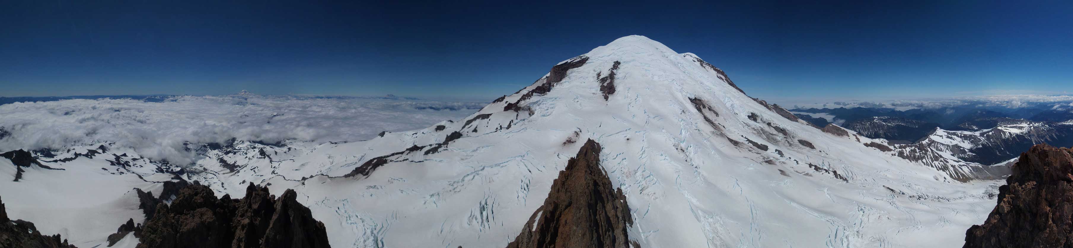
Summit Panorama from Little Tahoma. Click to view large size.

The west side is a shear drop down to LT/Rainier saddle

Looking north shows a sea of low clouds. Seattle must have been gloomy
Burroughs Mountain and the Yakima Park in the foreground
Cowlitz Chimneys in the foreground

The low clouds with Mt. Adams sticking out
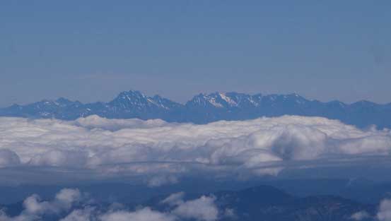
Mt. Stuart, Dragontail Peak and other Enchantments

A closer look at Mt. Adams
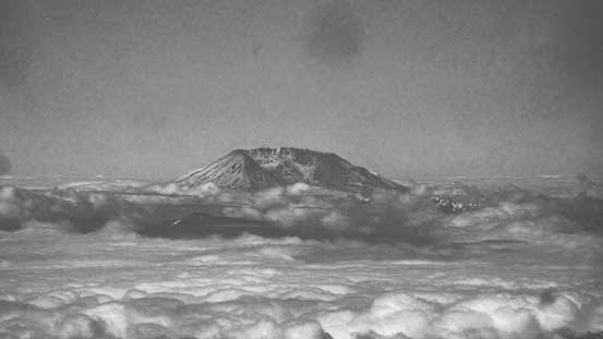
This is Mt. St. Helens

The middle stretch of Emmons Glacier
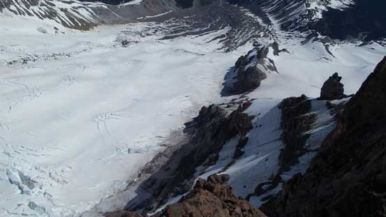
Looking straight down onto the lower Emmons Glacier
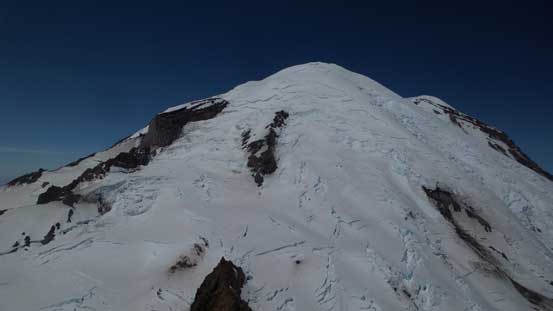
A full show of the upper mountain of Mt. Rainier

Ingraham Glacier

A zoomed-in shot at Ingraham Flats where parties make camp

A zoomed-in view towards Camp Muir

Me on the summit of Little Tahoma
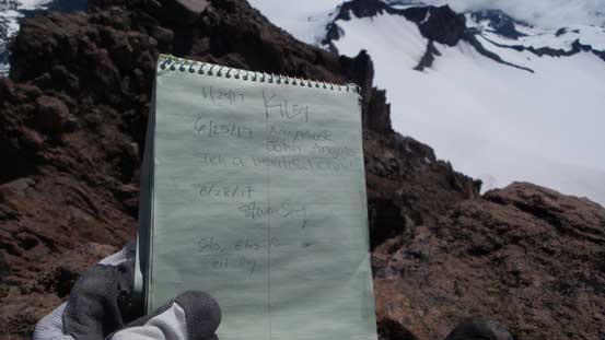
The register entry
Panorama showing Mt. Rainier. Click to view large size.

Another panorama. Hard to picture of scale of the terrain. Click to view large size.
Eventually it’s the time to leave this beautiful summit. Down-climbing from the true summit was easy peasy and then I reversed the route back to where I ditched the backpack. Coming down from above I could spot the path in a clearer way and it’s mostly just scree walking. The snow had softened up considerably which was perfect for plunging and boot-skiing. I still used crampons as who knows there might have a harder spot. For each step down I could glide a foot forward and made some very quick process. For more practice I kept the crampons on and down-climbed the gully and onto the lower SE Face which was again, a very enjoyable, but long plunge on softer snow.
Spires on the massif

Entering the upper SE Face

Deciding whether I should grab some water from this waterfall…
Continuing traversing down Whitman Glacier
Back at the low saddle now
Descending onto Fryingpan Glacier
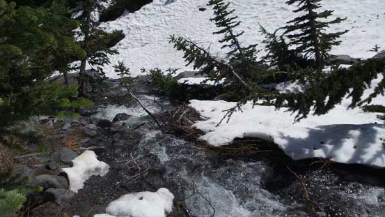
Back across the stretch of Fryingpan Glacier I spent little time lingering other than occasionally checking my Facebook status (there’s good cell reception on most parts of the route). Down from Meany Crest it looked like a better variation to descend far skier’s left on open slope into Fryingpan Creek rather than going into the forest. This worked out very well and I got down in no time. Reaching an open creek was a very welcoming thing given the fact I hadn’t been drinking water for hours and I took a lengthy break regathering some strength. The downside for this descent route was now I had to find a way crossing the raging creek to rejoin the trail. The first option I tried was a sketchy snow bridge. Even crawling over felt too sketchy for my like so I bailed on it and went further downstream to find a log crossing. This turned out to be very easy and I soon rejoined the trail. The rest of the descent was uneventful.

From Fryingpan Glacier, looking back at L. T. and Mt. Rainier

It’s a long haul back across Fryingpan Glacier

Clouds coming in and out obscuring Cowlitz Chimneys

Almost back down at Meany Crest (bump in foreground)

Talking about luxurious camp site…
The run of Emmons Glacier is huge..

Plunging down from Meany Crest

Lots of grand views into the heart of Rainier area

Goat Island Mountain
Down to Fryingpan Creek now
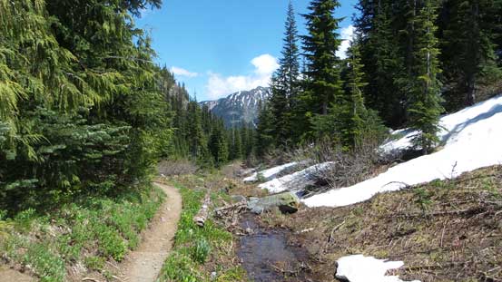
Back to the trail
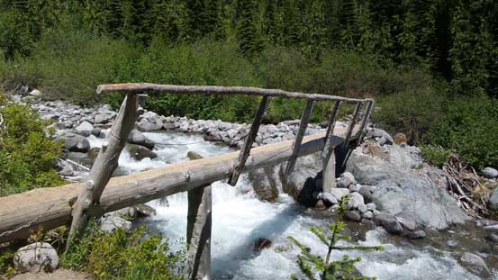
This is the bridge crossing Fryingpan Creek

Standing on the bridge with raging current below
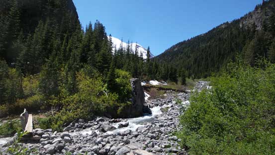
Another look at Fryingpan Creek

As much as the views from the hike out…
My round trip time was just under 10.5 hours which was pretty much as expected. Throughout the whole day I wasn’t rushing and took my time enjoying the scenery for as much as I could. It’s hard to get tired out the views from anywhere nearby Mt. Rainier and it’s no wonder why this is considered as a local classic. I’m sure I’ll be back to this area for some other smaller objectives even for just the views, but right now I had to face what might be the crux of the day – driving through the Seattle gong show at rush hour.. I took a nap at a pull-out on US-410 and spent about an hour killing time in Safeway and McDonalds in Maple Valley before committing to the drive. It was actually not too bad as for the most part I was travelling against the traffics and the rest of the way back home was fluent.
