Cerro Negro
December 29, 2022
4263m
Otavalo, Ecuador
Cerro Negro is the second highest peak on the volcanic massif surrounding Lagunas de Mojanda and is only marginally lower than Fuya Fuya. Cerro Negro also boasts a more rugged and iconic profile than Fuya Fuya and is considerably more difficult, making this a worthwhile objective in its own. It’s unfortunate that most trekkers in the area aren’t even aware of this secret objective. When Adam and I planned this trip we didn’t think about Cerro Negro neither, but our guide on Cayambe casually mentioned this objective to us. There’s a “trail” shown on my Gaia map coming from the south but the ascent eventually turned out much harder than a simple trail hike. The primary objective on this day was definitely Fuya Fuya. We extended the day simply because the weather was still looking great.
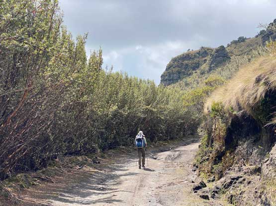
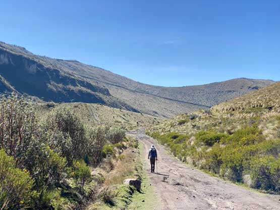
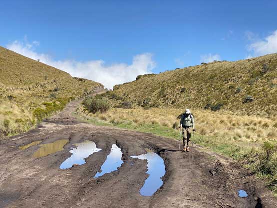
We had little information about the road conditions and we assumed it’d be possible to drive all the way to the south side of Cerro Negro as that’s also the road to connect down to Tabacundo, but we were being naive on that. After the previous night’s downpour the roads had become extremely muddy. Marquito was only able to drive us about 2 km beyond Fuya Fuya’s trail-head. We also tried the northern approach by trying to drive down to the south shore of Laguna Caricocha, but also to no avail. Adam and I had to accept the fate that even with a trusty Toyota Hilux equipped with “mountain tires” we’d be parked at least an hour’s walk away from the planned starting point so we had to cover all of the extra kilometers on foot. My initial thought was to abandon the ascent but I didn’t want to be defeated that easily. After some brief discussion we decided to dash the remaining 4-5 km distance in human powered fashion.
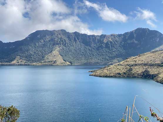

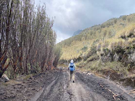
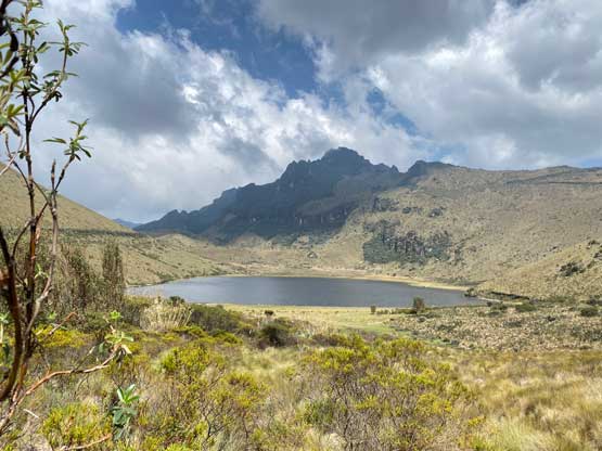
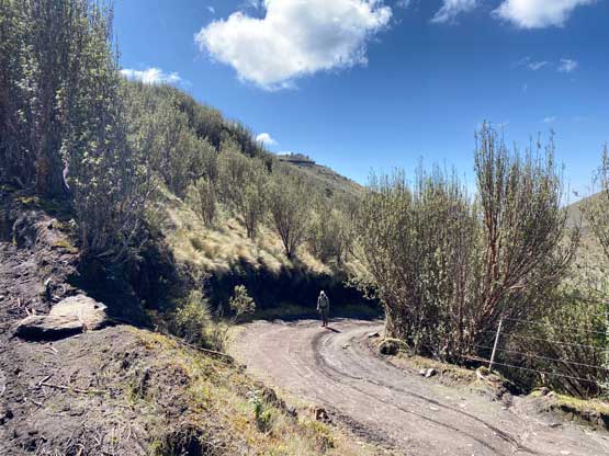
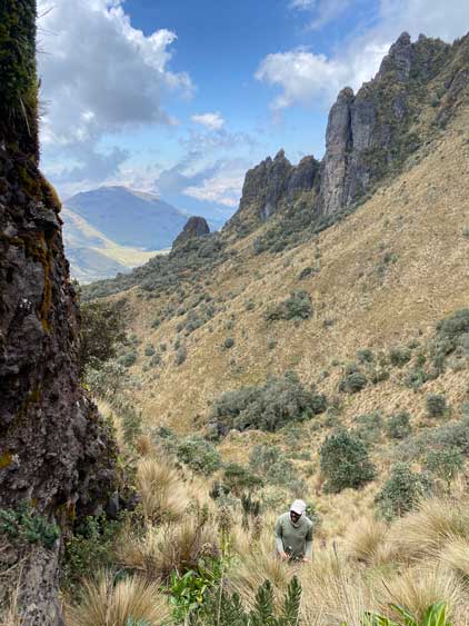
The initial 2 km to the shore of Laguna Chiriacu was mostly downhill so at least 50 m elevation must be regained a few hours later on the return. We sure were looking forward to that. This small lake was under some conservation and was fenced off, so we went directly onto the steep-ish roads heading for the saddle SW of Cerro Negro. This secondary road was clearly not in a driveable shape even in dry conditions so we didn’t end up doing that much of extra work after all. The remaining kilometer from the SW Ridge saddle to the trail-head was also mostly flat or downhill. The trail-head wasn’t obvious at all and I ended up walking past it without noticing. Adam then yelled loudly from behind and I realized the mistake. I was expecting a good trail or even a road but we only got a barely-distinguishable overgrown path.


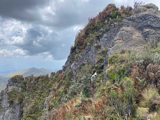
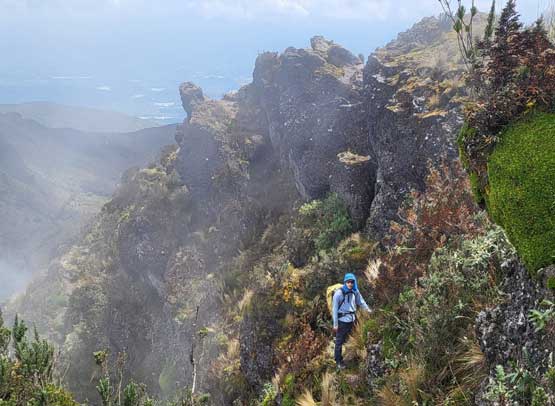
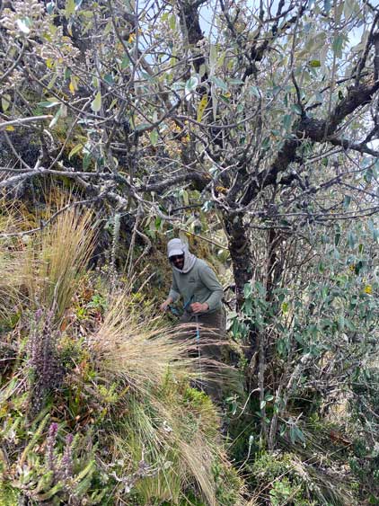
After taking a much-needed break we reluctantly started up the trail. The beginning 50 m elevation gain was particularly confusing with hardly even a trail to follow, but after a while the few possible paths did seem to converge into a trail. It’s very apparent that this peak doesn’t get ascended. Nonetheless we had no further problem to follow this trail trending climber’s right onto the south side of an eastern sub-summit and this entire stage (from the road to the ridge) was relentlessly steep and involved lots of high-steps on grass and mud.


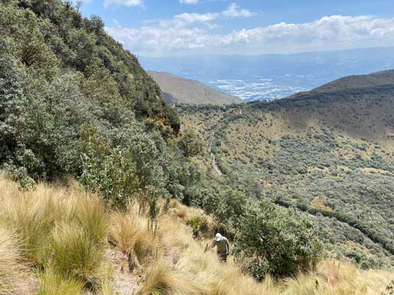
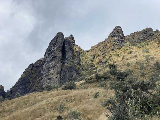

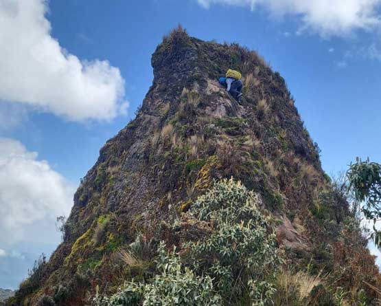
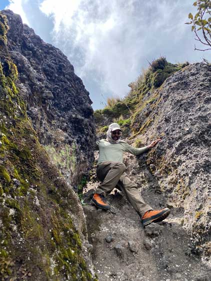
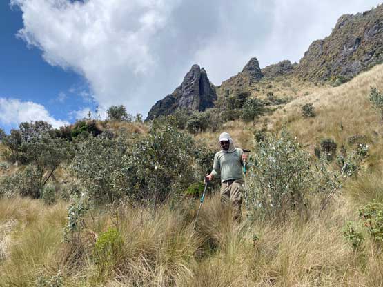
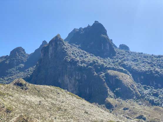
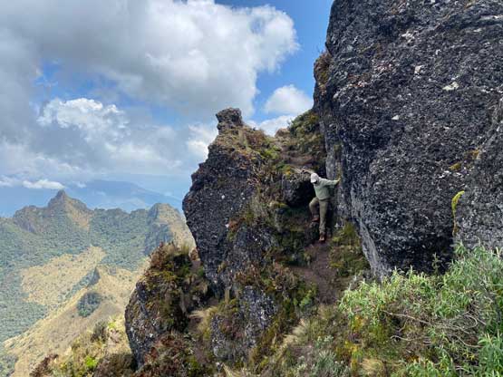
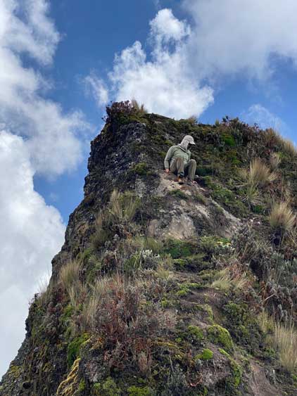
The trail then led us bypassing this eastern sub-summit by staying on the south side of the ridge with a minor drop, and then there came the fun parts. Adam and I had basically no “beta” about this mountain asides the trail marked on my Gaia map, so we didn’t come here expecting a serious scrambling ascent. The traverse across the summit ridge to the true summit involved some sustained class 2-3 scrambling on some exposed ledges. The path was actually easy to follow as there weren’t many options on this type of complicated terrain. There’s one notable false summit to ascend over and the down-climb of that false summit into the final saddle was the most awkward. It’s more like 3rd class on mud steps with exposure. I don’t think this peak is even doable in the rain and we sure were glad that the weather had been holding nicely into the early afternoon hours. By the time we finally reached the true summit the clouds finally came and we lost most of the views. But overall this was a very satisfying ascent as we had to figure out the route on-sight. This is also my first ever “jungle scramble” as previously I had never seen terrain and dense vegetation like this.


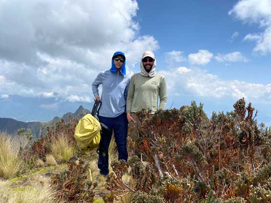
The ascent had taken longer than expected. We told Marquito that we’d be back in about 3 hours but it’s shaping up to be at least a 4-hour round trip, so we wanted to hurry up on the descent. Reversing the summit ridge scrambles wasn’t actually too bad since we already knew what exactly to expect. We then dashed down that insanely steep trail back to the road. Again, we took a long energy break but then dashed back to the truck in a single shot. Three Germans were on their way up so we crossed path with them. We were very surprised to see another party on this obscured peak, but honestly I doubted their ability to make the actual summit. After regrouping with Marquito we immediately drove down to Otavalo for a late lunch in our favourate restaurant, and then drove south to our home in Quito. The traffic entering Quito was very bad thank to a road closure, and we even got pulled over by a police asking for some bribes. Marquito paid then 20 dollars or something like that and we moved on.