Mosquito Mountain
January 2, 2013
2970m
Icefield Parkway (South), AB
The blisters I got from the Wapta ski trip was very serious and I couldn’t even walk properly for about 1 week after that trip.. After a 10-day break, I finally could walk without pain. The weather and avalanche condition lined up very nicely for the following week and I figured it’s the time to get out again. Ben and I had done a few good trips in the previous month and this time we were looking for some more ambitious ones. Mosquito Mountain was our objective for the first day which was also my 20th birthday. I got Grotto Mountain on my 19th birthday. It seems like bagging a summit has been the perfect birthday gift so far.
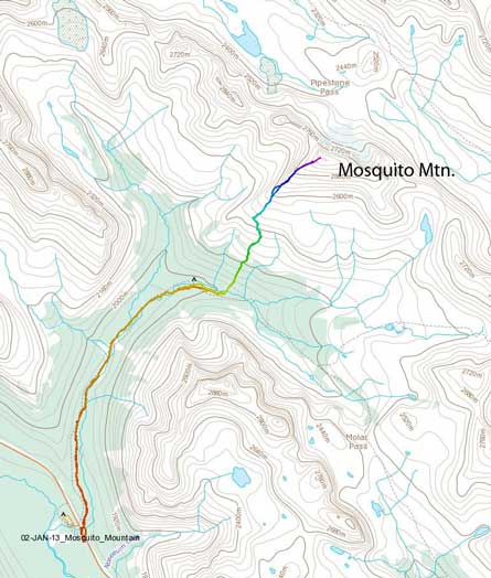
Mosquito Mountain standard route. GPX DL
The temperature dropped down to -23 at Mosquito Creek trail-head overnight and was brutal, but at least I didn’t have to car-camp this time. The nearby Hostel offered me a good rest and the next day we started the trudge by 7:50 am. Ben attempted Mosquito Mountain last year so he knew the approach. The trail was also hard packed, and was very easy to follow. It’s pretty flat for the most parts but involved fair amount of up-and-downs. Due to the coldness we marched on a fairly fast pace, and we made to M5 campsite in 1 hour.

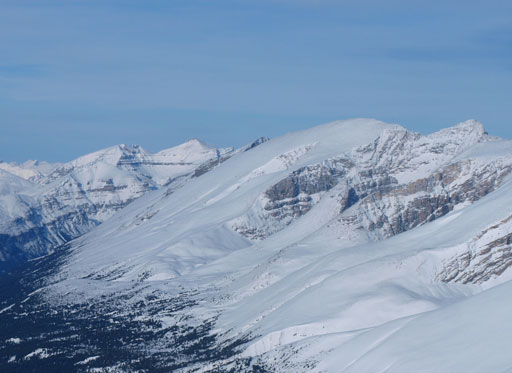
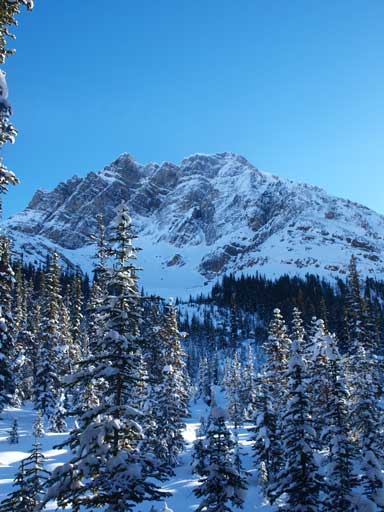
Morning view of our objective, Mosquito Mountain
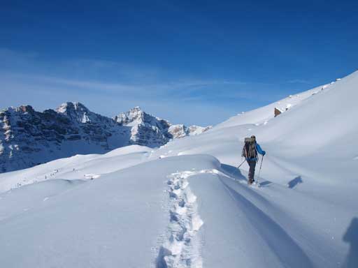
There are two routes up the forested slope from campsite. You can either start bushwhack right from the campsite, or continue on the trail for another 1-2 km. We picked the 2nd one because of the packed trail. But it wasn’t obvious where we should start going into the forest so after feeling like having travelled farther enough we picked a random spot and entered the forest. The terrain was not insanely steep, but the snow was bottomless and we sank passing our knees for pretty much every step, and our progress was painfully slow. There were a couple of very steep rolls below treeline. Even with 30′ snowshoes, I still post-holed to waist deep on uphill side (while switchbacking)… We took turn breaking trail, and it took us more than 1.5 hours to reach treeline (actually not a bad pace).

Typical trail-breaking below treeline.
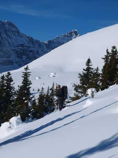
The condition got better on the alpine, so did the temperature. There was no wind and I even sweated a lot with only t-shirt. The temperature was well above freezing! We traversed diagonally towards climber’s left while going uphill, aiming for the left hand skyline ridge. There were a couple of steep slopes involved.

The upper slope of Mosquito Mountain

A look towards Molar Mountain
Neat alpine terrain. Would be great on skis!

Ben breaking trail up

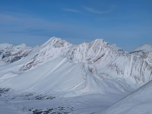
One of these peaks must be Watermelon Peak
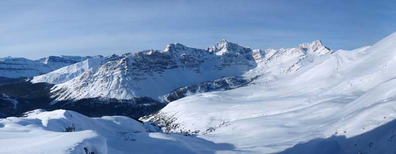
A wider view of this area. The Quartzite Col approach route to Willingdon goes up this valley
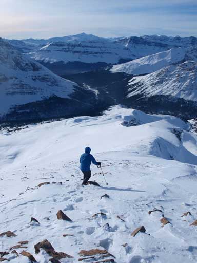
The slope was very foreshortened. It took us a long time to traverse to the left hand side ridge. We then followed the ridge up until it narrowed down to a shear drop-off, and then there came the crux. Under the snowy condition, the down-climb looked very involved than just “moderate scramble”.. I would go for it if that’s a must, but given the stable snow condition, we decided to by-pass it on skier’s right. The by-pass was very steep for about 5 meters but got better afterwards. The slope was probably above 40 degrees for a short while and it felt pretty exposed.
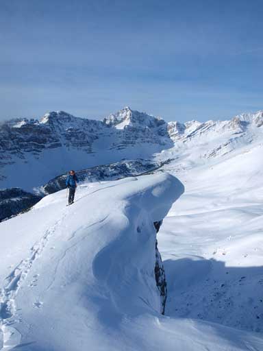
There are some big cornices on the ridge.
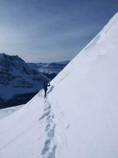
Bypassing the crux down-climb

We passed this rock formation soon after the crux

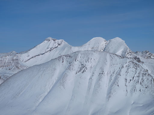
Ramp Peak

Quartzite Peak
Another view of Ramp Peak
The rest of the way was a pure slog. We took off snowshoes not much further up. My strategy was looking at Ramp and Quarzite as I knew we had to get up at least 100 m higher than both of those peaks before reaching the summit. The view was very nice under the blue sky.

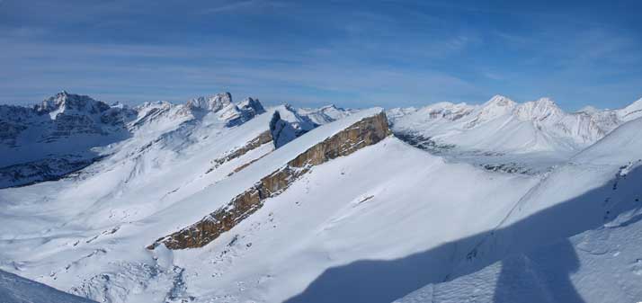
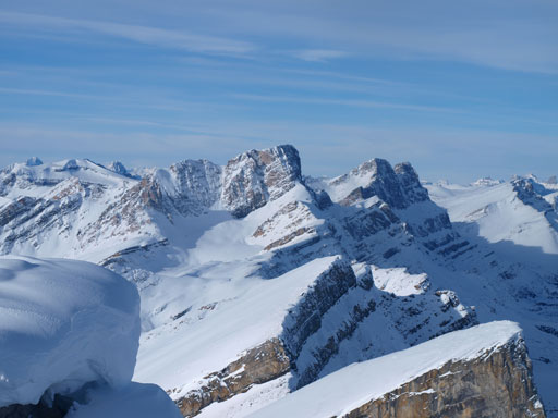
Summit view looking S and W. Click to view large size.

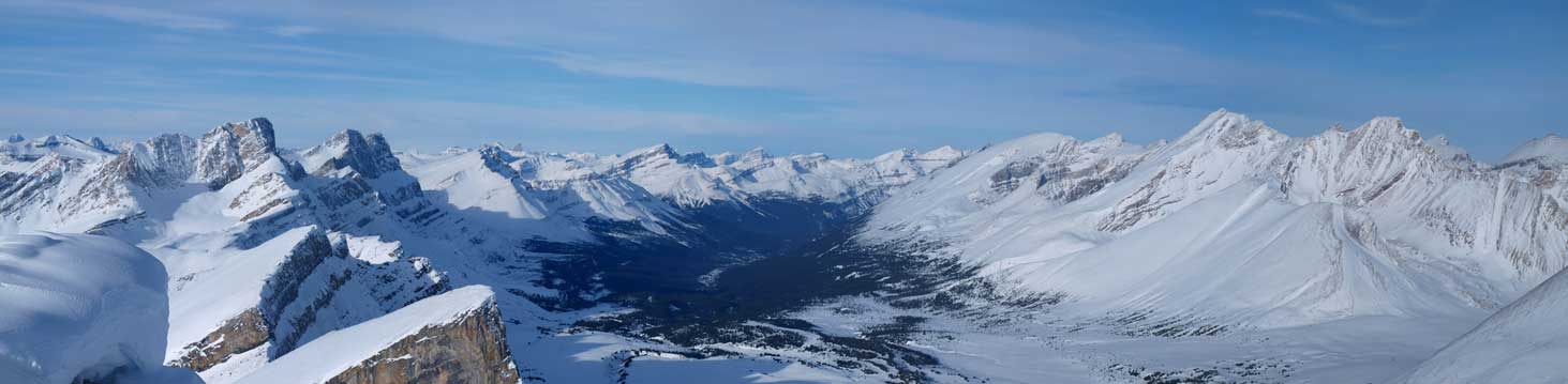
Summit view looking N and E. Click to view large size.
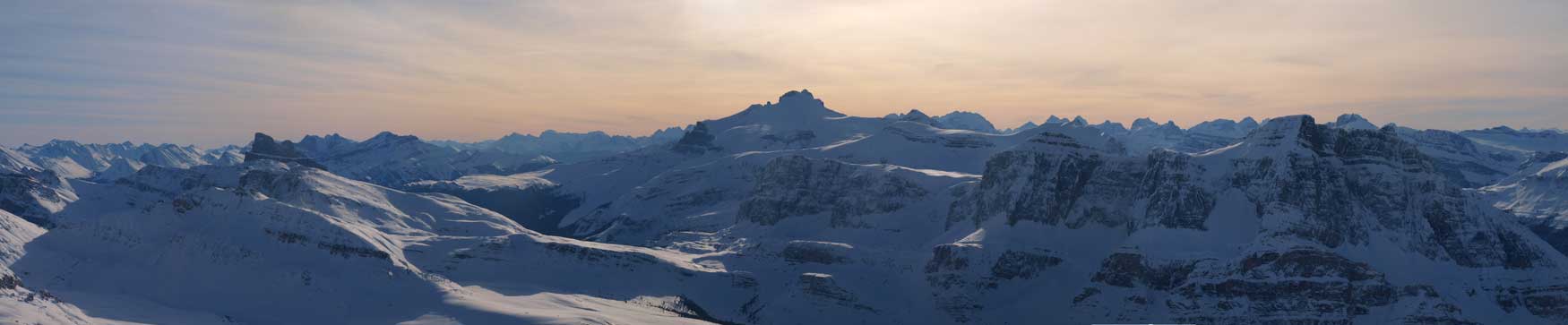
Panorama of Siffleur River Valley

The three peaks of Mount Willingdon, with Devon Mountain in the foreground.

The tallest peak is Cataract Peak. Most of them are unnamed front country peaks.
The prominent peak is Mount Hector.
Kentigern
Clearwater
Willingdon, Crown, and Tower

Cataract
Bobac

Hector

Siffleur River Valley

Me on the summit.
We didn’t stay long on the summit. Plunging step down the slope was a blast, we both crossed the crux slope without incidence, then it was a relaxing run down to the campsite. We slowed down a big on the final slog back to car.
Starting the descent

Crossing back the sketchy crux slope

Retracing our tracks
Lovely slopes
Noseeum Mountain

Noseeum Mountain again

Looking back at Mosquito Mountain

Walking back on the long Mosquito Creek Trail.
Our round trip time was 7.75 hours and apparently it wasn’t a bad pace given the shear amount of post-holing involved. We went back to Lake Louise hostel and checking the forecasts revealed some good news. It’s looking like another gorgeous day ahead and we had to take advantage of it.
