Hammerstein Peak
July 21, 2020
2264m
Clendinning Area, BC
“Hammerstein Peak” is the unofficial name of the long ridge that’s immediately north of “Inaccessible Pass” on the west side of Tinniswood Glacier, in the heart of the uber remote Clendinning area. This peak is mostly composed of gentle glaciers and snow slopes but does boast a somewhat rugged summit block, that all sides but the south ridge would require technical climbing. The south ridge is however, mostly just class 2 on loose blocks. On the 4th day of the traverse Alex, Vlad and I carried the heavy packs up and over the ridge of Hammerstein Peak from north to south. Earlier in the day we had ascended Blumlisalp Mountain.
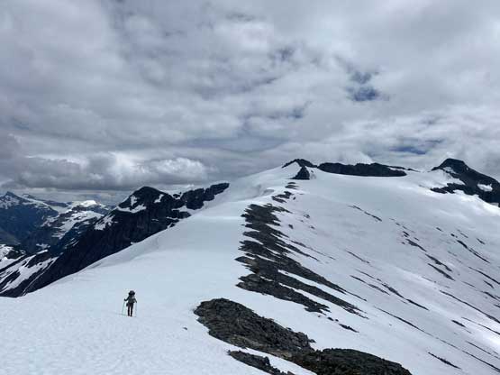
The section from Hammerstein Peak to Loquilts Peak
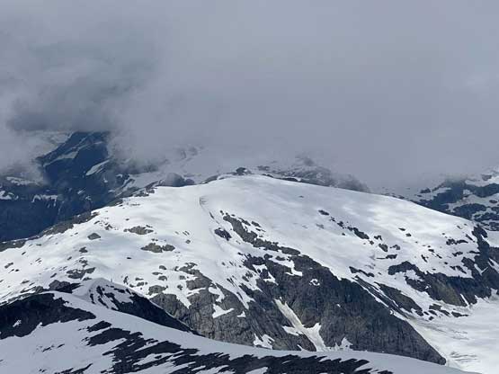
We did not come prepared for the difficulties of climbing the summit block and the north side appeared vertical from afar, but we did have studied the Google satellite images. The plan was to traverse over the col immediately north of the summit block, then traverse across the steep east face to a notch on the south side of the summit. The ascent onto the broad NW ridge from Blumlisalp/Hammerstein col involved a few scrambling steps of steep heather or snow with excellent views into Hunaechin Creek valley. Once gaining the NW ridge we had a long plod up what seemed like a never-ending snow ridge/ramp to the col north of the summit block. The north ridge did not look like “scrambling” so we had to resume our plan, traversing over to the south side hoping for a route form the opposite direction.
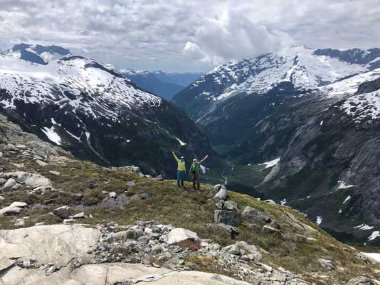
Alex and I with Hunaechin Creek valley behind. Photo by Vlad M.
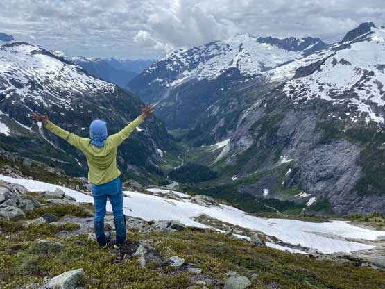
Me posing in front of Hunaechin Creek valley. Photo by Alex R.
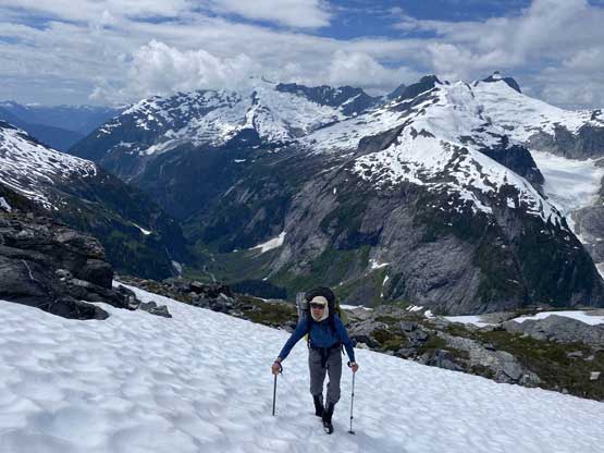
Vlad plodding on snow to gain the NW Ridge of Hammerstein Peak

Monk Peak and Hunaechin Lake

A closer look at Hunaechin Peak

Alex plodding up with Monk Peak behind

A closer look at Hunaechin Lake
Alex leading the plod across the never-ending NW ridge of Hammerstein
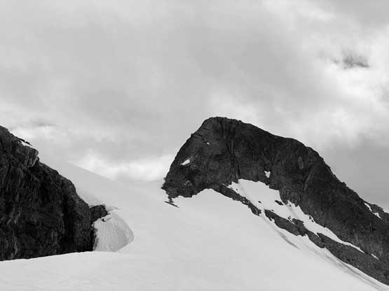
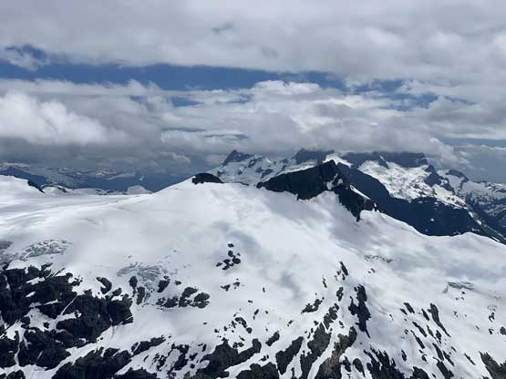
Aiming for the north col of Hammerstein’s summit block
One last photo of Monk Peak and its huge granite wall…
Mt. Vanstone in Sims Creek valley looks like a gigantic stone…
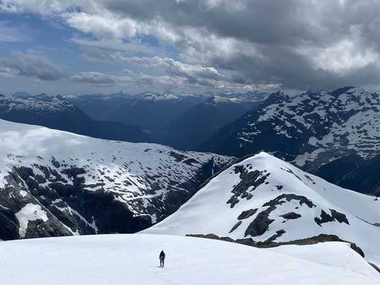
From the col we got some head-on views of Mt. Tinniswood but the east side snow traverse looked incredibly steep and somewhat exposed, so we took our time donning ice axe and crampons. I then led the way across the east side snow slope and climbed a short section of 45 degree exposed snow with a daunting moat crossing near the top. This dumped us at the notch immediately south of the summit block. The ascent of the south ridge did appear much friendly so we ditched the packs and went for a short scramble to tag the summit.

Alex starting the traverse across the east side snow bypass.

We climbed a short section of steep snow to regain the ridge

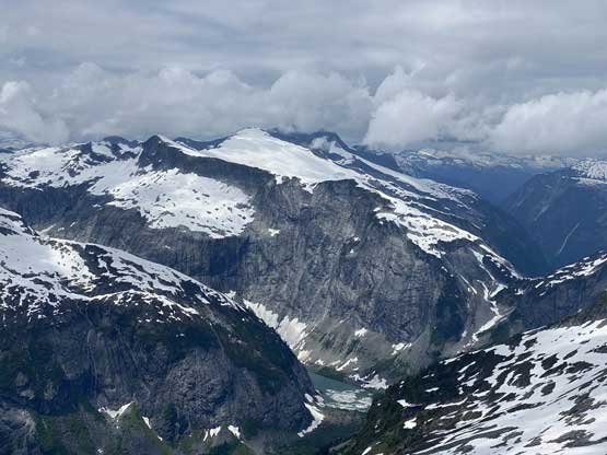
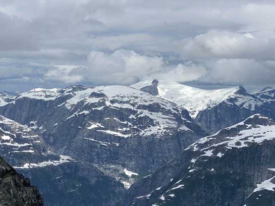
Partial Summit Panorama from Hammerstein Peak. Click to view large size.

Partial Summit Panorama from Hammerstein Peak. Click to view large size.

A closer look into Little Toba River valley with some dark clouds
Blumlisalp Mountain lighten by the sporadic sunlight

The impressive Tinniswood Glacier icefalls

It’s always a treat to discover John Clarke’s FA register

Me on the summit of Hammerstein Peak

Our group shot on the summit of Hammerstein Peak

The west face of Mt. Tinniswood
Mt. Albert (in clouds) behind Mt. George Edwards

Me in front of Mt. Tinniswood, our next day’s objective
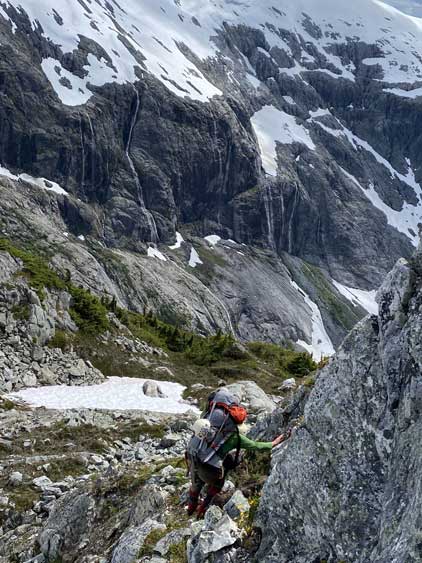
Once having enough photos we carefully made our way back to the backpacks and continued descending southwards aiming for the very aptly-named “Inaccessible Pass” somewhat 600 m below us in Hammerstein/George Edwards chasm. The initial couple hundred meters of descent was easy on mostly snow but soon we had to face some narrow sections of ridge and rock steps. The crux came about 2/3 of the way down when we faced a steep and bushy drop. We tried a couple routes that all would require rappels through steep bush. I almost convinced us to rappel but Vlad had more experience in this type of terrain and managed to find a hidden ramp and gully that went at “class 4 bush”. It was not very pleasant to thrash and lower ourselves down on the moss and branches but it worked. Then we had a couple more interesting steps but none imposed much of a problem, that in a while we were down at “Inaccessible Pass”.
Vlad heading down the south slopes of Hammerstein Peak
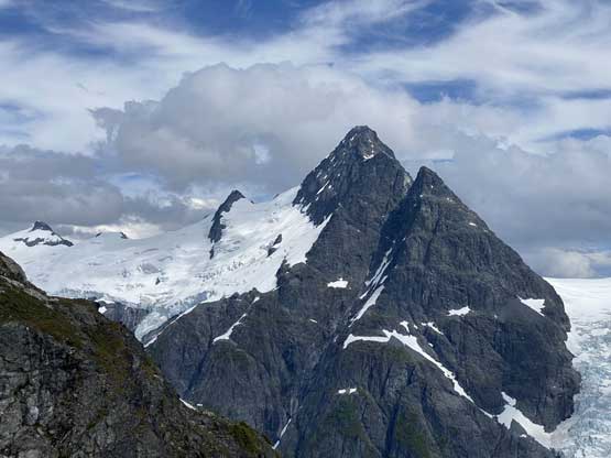
A closer look of Mt. Tinniswood from the west side

Me with Mt. Tinniswood behind. Photo by Alex R.

Vlad descending with Mt. Tinniswood as the backdrop

Vlad in front of Tinniswood Icefalls

The steep ascent onto Mt. George Edwards displayed directly ahead

Mt. Tinniswood and Tinniswood Glacier full show
Alex down-scrambling an exposed ledge
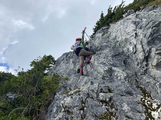
More of Alex down-scrambling

Down-climbing this wet and slippery heather gully

Intense bushwhacking for a while

Vlad showing the steep and bushy step that we just descended

Another photo of Tinniswood Glacier icefall

Mt. Perkins across Sims Creek valley

Alex and I resting at “Inaccessible Pass”. Photo by Vlad M.
At this point we had some discussions. I had two separate weather updates. One from Winnie/Mel and the other from Lily both saying 2-3 days of rain coming up soon. The laziest option was to wait it out here at a comfortable location but we all wanted to keep moving taking advantage of as much as “good weather” as possible. The degree of uncertainty was too high for us to kill time at the pass, so we carried on to ascend Mt. George Edwards in the evening and then Mt. Tinniswood the next morning.
