Boule Roche
June 4, 2013
2385m
Hinton, AB
Boule Roche is the second highest peak in Boule Range, the frontmost range in Hinton area, north of Athabasca River. It’s equally Hinton’s Yamuska, an eye-catching mountain when driving towards Jasper along Highway 16. If it’s in Canmore I’m sure there will be a ton of rock routes published. Despite it’s an impressive summit, there was no online trip report to rely on. The only information we could get was from Black Cat Ranch, that it being a scree slog. We couldn’t see the critical part of this route from the road, so it’s essentially another exploratory trip.
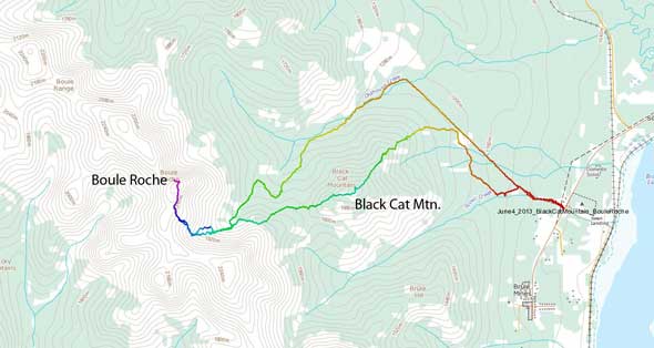
Black Cat Mountain to Boule Roche ascent route. GPX DL
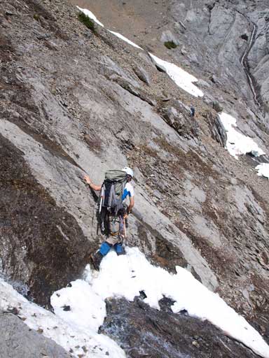
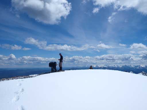
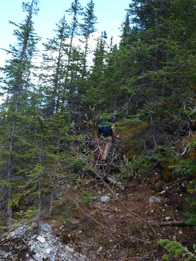
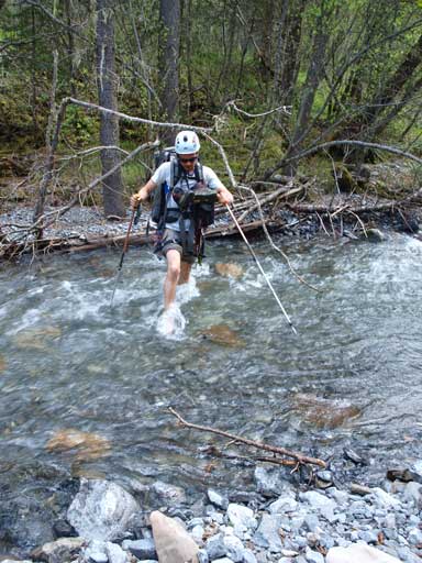
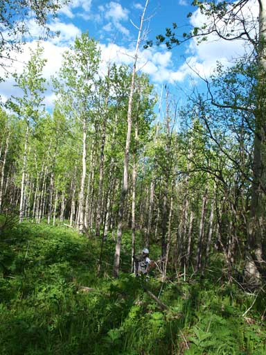
Due to a navigation error, Ben, Ken and I summitted the nearby Black Cat Mountain first before continuing towards our major objective. From our observation, we decided to stay on the ridge crest down to Black Cat/Unnamed col, up the other side to treeline, and contouring around, to give us the minimal amount of bushwhacking. So down we went. The open slope soon gave way to very steep forested slope. The bush was quite pleasant initially, but as we approached the col, it got thicker and thicker. The mosquitoes were out, and the vegetation was still wet and we got soaked in no time. There was a long section of intense whack being one of the three most miserable bushwhacking trips in my peak-bagging career to date, together with Southfork Mountain and Lightning Ridge. We were very happy to eventually clear this part and up the other side. Our line surprisingly avoided the isothermal forested snow, and brought us up to the base of a rock wall.
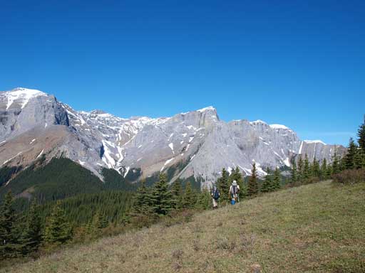
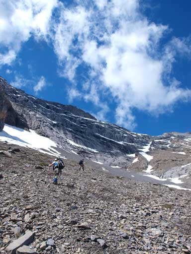
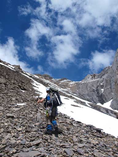
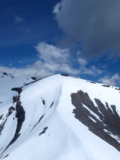
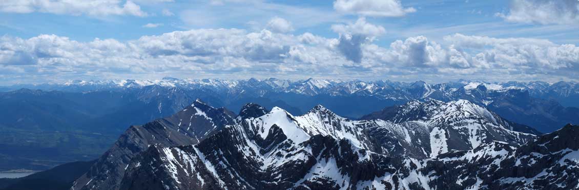
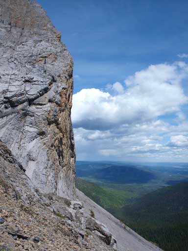
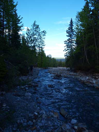
Hiking down an open slope. We just left the summit of Black Cat Mountain. Boule Roche is the high peak at center.

The initial part was steep, but not too bushwhacky

But this was the real part…

What a relieve to get out of the bush.

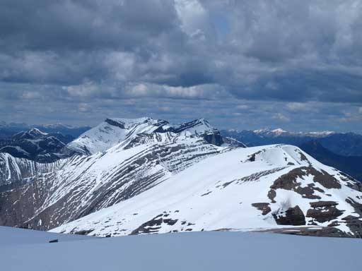
Looking back towards Black Cat Mountain
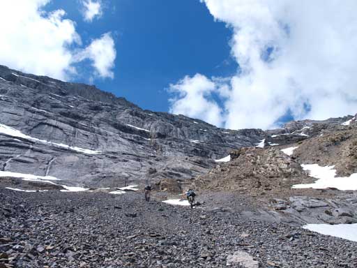
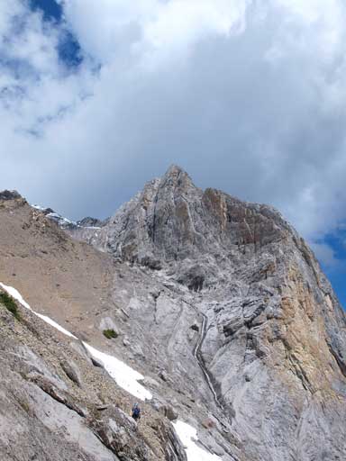
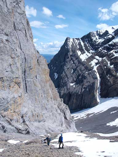
We contoured around the rock wall on loose scree, gaining and then losing elevation. Around a corner, we finally could see the first part of our ascent route. Still, we couldn’t see the entire route, and at this point, I was glad that I brought the crampons up. I was also glad to see a bit of elevation loss and a snow line on the route. That would give me a good relief as I was already very tired of the bush, and hopefully the change of terrain could brought my energy back. It did, and once we hit the snow, my energy boosted up. My boots were the greatest at step-kicking among us. The slope ahead was very foreshortened but the view of the surrounding rock scenery in this cirque/bowl was stunning. We finally could see the rest of the route when we slogged to the top of this bowl, and it appeared to be a true slog. We did a longer rest here.

Ben negotiating a moderate section while contouring around the rockwall

Around the corner, we could see the first part of the ascent. Black line showed the route

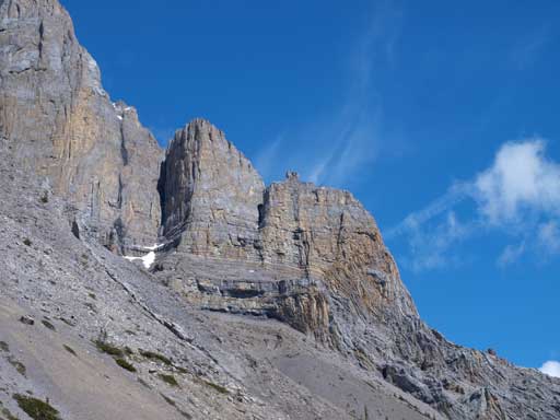
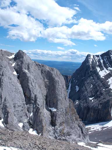
Boule Roche is impressive from all angles

Ken made for a contrast with the snow behind

If not because of the difficulty to access, this will be a popular rock climber’s playground
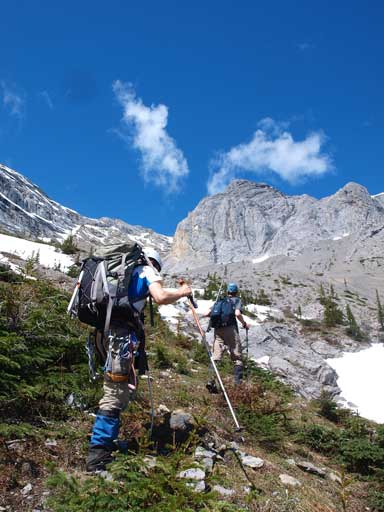
Ben and Ken hiking up some vegetated slope
This shot reminds me Mount Birdwood from partway up Smuts Pass
Scree slog, the theme of this ascent once out of the trees

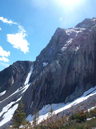
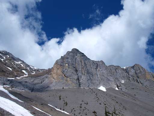
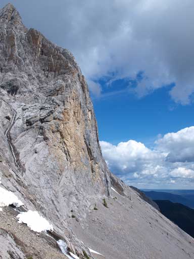
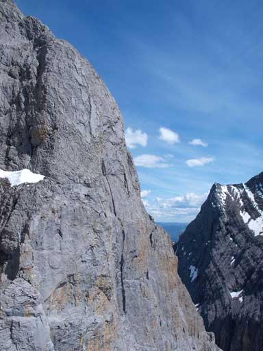
Impressive rock formation. The route goes behind this buttress
No rock climbers?
The same rock buttress

A closer look
Slogging to the top of this bowl
The technical crux of this trip was to gain the second part by crossing a tricky wet ledge that was also a bit exposed. It didn’t impose problem to us, and once we hit the other side, the rest of the way was a 400-meter true scree/talus slog. Now my energy was high and I could keep up with Ben and Ken, and we boosted up. The slog was very tedious, and near the top the terrain changed to isothermal snow. There was no chance we could traverse to Kephala on this day so we ditched gears at the start of snow. With the summit in mine, I post-holed all the way to the summit. It was very satisfying to have this Roche bagged. The summit view was great, offering sights of some rarely seen peaks in the northeastern Jasper Park. There was a cairn but no register. We placed a new one. From our observation, we could almost say Bedson Ridge being a scramble. The initial part of traverse towards Kephala could offer some challenge, but the rest of the way looked straightforward. Summit of Kephala was a long way from here so we couldn’t tell the terrain near the other end though.
Ben crossing the wet ledge
The rest of the slog (left) and the rock buttress (right)
Impressive cliff!
Looking back before venturing to the backside of this buttress
Typical scree slog. Note the gears we were carrying…

Impressive rock scenery
Getting higher
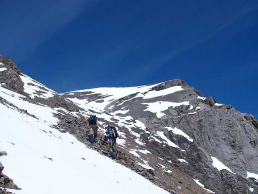
There was a couple false summits so be prepared
Gaining the summit ridge, looking towards the other side.
One more a bit steep part on snow. The summit is on left

Ken and Ben approaching the summit

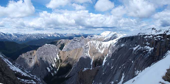
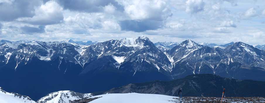
Summit Panorama. Click to view large size
Looking down at the bowl where we came up from
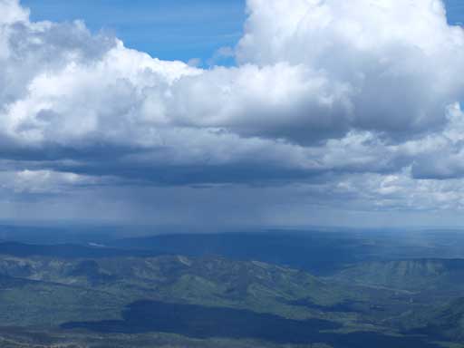
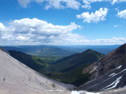
Some weather in the foothills
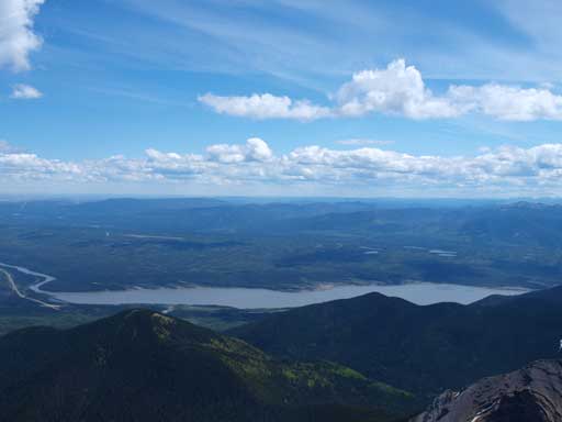
Brule Lake
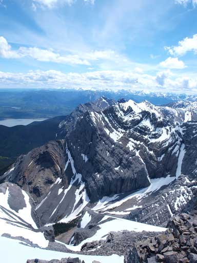
Peaks looking south. Looking closely you can see Fiddle and Miette Ranges. Bedson Ridge is the low bump on right side.

Athabasca River Valley. You can see Jasper and Talbot Lakes
Bosche Range with Mount Aeolus being the highest

The northern part of Bosche Range, all unnamed
Zooming-in towards Mount Kephala

Impressive East face of Boule Roche
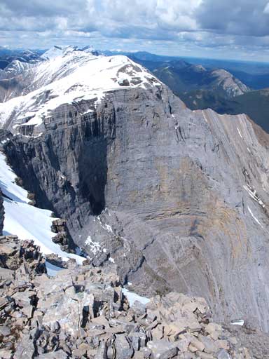
Same as above

The clouds made things more beautiful
Ken and Ben on the summit
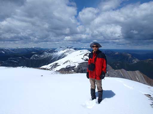
Me on the summit

This bump is Mount Solomon…
It was cold up here and we soon started the descent. Slogging back down the talus slope was fast, but energy consuming. I felt a great sense of relief to hit the snow lower down, and I followed snow for as much as I could. After retrieving Ben’s time-lapsing camera, we decided to give an alternate descent a go, via Oldhorse Creek, to try finding where that “trail” was. If we could find that trail, we potentially avoided the thickest bush, as well as the elevation regain. The most direct line was to slog back up to the summit of Black Cat Mountain, but I was already bagged and didn’t feel like doing that much of elevation regain. Ken also suggested going back up to the col, and descended the other side and follow Seovil Creek out. In retrospect we probably chose the slowest way back, but we did prove that there was no such “trail”, and every possible line involves probably one of the most intense bushwhacking in even a hardcore scrambler’s career. That also explains why nobody goes up this mountain…

Descending snow
Someone volunteering to publish a first ascent of one of the faces?
Descending the scree/talus, with impressive rock formation all around

The other side of this bowl
Rock cliff

Looking back

Snow helped our knees on the descent
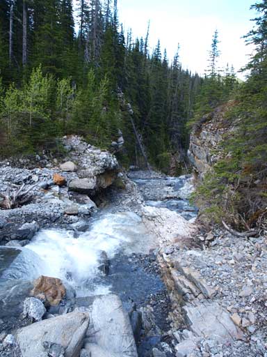
The Oldhorse Creek went smoothly initially, but it soon gave way to a challenging canyon-like stream. The water was too high that we couldn’t easily cross back and forth, so the bushwhacking started. We had no choice but going into the forest on the right side.. From here on, the next 1 to 2 hours was probably the most miserable bushwhacking experience in my career… Also, being on side-hilling terrain meant, we were constantly dealing with elevation gain, loss, and regain.. We got tired of the side-hilling and decided to bail down to the creed but once we got down, it was far from easy. Alright, more bush. On this pace, being more than 5km from the road, we would spend the rest of this day whacking in the forest no doubt. I already consumed all of my food and water. I’m not used to be the slowest in my group, but this day, I had no choice but letting Ben and Ken constantly wait for me in the forest. I don’t have much to describe except for that you have to be very, very patient. We made down to the creek at some point, and followed it for a few hundred meters, and the thick bush would force us bailing to the other side. Ben forded it, while Ken and I climbed up and over a natural log bridge. The scrambling opportunity helped me a big time boosting up my energy. Oh well, my energy level has a strong positive correlation with the positiveness of my mind. I can still remember how slow I was on Mount Pierre Elliot Trudeau after failing to discover an alternate descent route, and yet how fast I was when we cleared all the difficulties and back to the trail…

Oldhorse Creek went smooth initially
But it soon gave way to this…
So the bushwhack starts

Typical bushwhacking for the next few kilometers
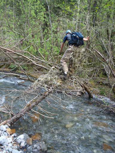
Ken crossing the creek on a natural log bridge
Ben decided to ford it
The further we went down the creek, the better the bush got. Eventually it became an open forest just like in the morning, and at one point we picked an old ATV trail. Following it for a couple hundred meters, we forded the creek to its other side, and picked another set of ATV track. This trail was quite straight, though not perfect. Checking the GPS, Ben found out that we were on the cutline now, and we were only about 3km from our car! Great! We were all very high on energy now, and with Ken setting up a fast pace again, we made up and down this cutline in no time. At one point we came across an abandoned truck that was apparently got really stuck… The trail split up again, and we picked the one directly ahead, though it was the narrower one, and we eventually made to where we started in the morning. Now we finally realized how we missed this cutline… We had the opportunity to keep following the ATV trail out, but we opted to go back to Seovil Creek since Ken lost his bear spray in the morning. Too bad we could retrieve it. Our round trip time was 13 hours. Awesome 2-peak day in the mountain again.
Terrain got easier lower down

And some good views

An abandoned truck. Don’t know why it traveled so deeply into ATV terrain…
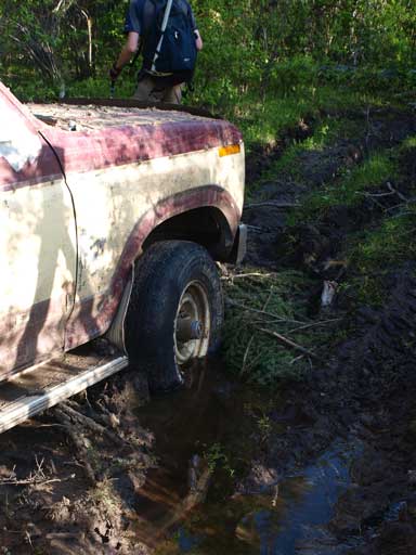
It was obviously very stuck
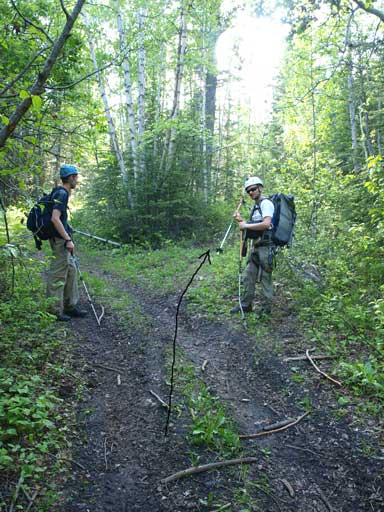
Ben and Ken showing the correct turn to start this cutline.
Back to Seovil Creek. Not far from our car now!

How long does the approach to the buttress take distance/elevation/time wise?
Distance wise it’s about 9km ish. Our RT distance was 21km. Our up route was the faster one, and if you use the cutline it will be even faster. It took us 5.5 hours to get to this buttress. The real difficulty is the intense bushwhack after Black Cat Mountain. That’s probably why this mountain isn’t popular.
That’s rather funny, you must have not looked that closely for registers. They are actually two up there. One that we placed this mid-may, and another that was wet and placed I think in 2008.
That’s weird. All three of us checked the cairn and none of us found one. Probably we didn’t look closely since we were not expecting a register on a mountain with no trip report. Oh woops, just saw your trip report on Facebook, but it doesn’t show up on google search.
Strange strange strange. Ah well. The more the merrier I guess. 🙂 Ya my friend wrote one, I’m afraid Im quite lazy when it comes to writing trip reports.
Hey are you the same guys, or do you at least know the guys who published the peakbaggers guides to the canadian rockies? Too many of the names, routes, and descriptions match up for it to just be a coincidence! My brother and I just completed the black cat to Boule Roche route and loved ir despite the challenges, we were very thankful for your descriptions of the routes and your experience!
Hey, yes my buddy Ben Nearingburg was the one who wrote that book and I was his main partner back in the days. Glad you enjoyed it