Survey Peak
April 26, 2013
2672m
Icefield Parkway (North), AB
Now the school term is over, and I have a lot more flexibility to bag peaks. Last weekend was super awesome, and it took me quite a while to sort the photos and write trip reports. I got everything done about 2 days after the trip. And then the third day, I found myself planning the next ascent, a peak guarding Saskatchewan Crossing again… Survey Peak is well documented in Andrew Nugara’s Snowshoeing in the Canadian Rockies and reading his description I was fully expecting some arduous work and lots of bushwhacking. The weather was a bit questionable, and temperature was far from ideal – too warm for a snowshoeing ascent. However Vern and I were being optimistic and decided to give it a try anyway. It turned out that everything except for the wind was better than expected. Good call again.
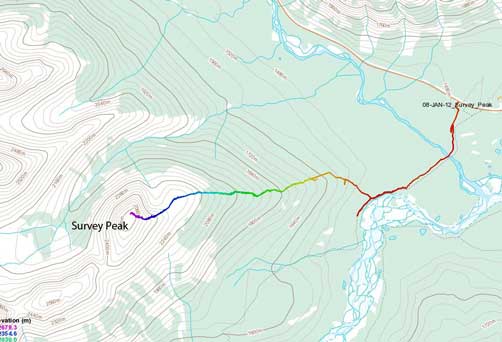
Survey Peak standard snowshoeing ascent route
Usually a snowshoeing ascent in late April requires a very early start – at the first light by the latest. However, since Vern would be driving from Calgary in the morning, and Saskatchewan Crossing is quite a drive from Calgary, we decided to meet somewhere around 7-7:30 am. I would be just sleeping at trail-head. For this particular day, it really doesn’t matter that much since the temperature was like 9 degrees for the entire night. The snow never got a solid freeze. From our experience on Mount Wilson 4 days ago, we knew that there wouldn’t be any snow on the lower forest, so we’d be carrying our snowshoes for a long time in the bush, and then due to the warm temperature, we were psyched for post-holing in isothermal snow. We were also psyched for a cloudy and maybe no-view day since it was raining overnight. That might be a good thing since otherwise we definitely had to post-hole a lot.
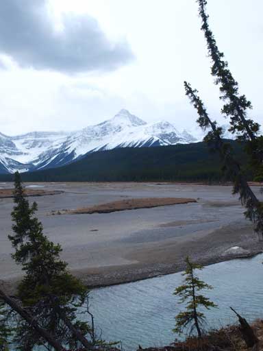
The Glacier Lake trail, as expected, was snow free except for a few icy sections. The ice could be avoided by following either side of the trail. The terrain was rolling and we were going down more than going up. That was very fine on the way in, but we knew it would be a slog on the way back. There’s a long and impressive (by Rockies standard) bridge crossing North Saskatchewan/Alexandra River, and after more rolling terrain, eventually we made down to Hawse River where we got some view of Outram and Sarbach, cloudy view though.

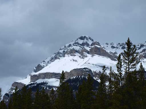
Mount Murchison seen from the large bridge crossing N. Sask/Alexandra River

Another view of this river. Murchison in the background

Panorama of Hawse River area. Sarbach and Outram on left, and our objective, the treed slope, on right

This will be our objective, Survey Peak
After a quick check of GPS and my map, we decided to leave the trail not far after this since that would give us the most direct line to the broad and flat treed ridge. My snowshoes are bulky and I had some hard time weaving through thick bushes. The bush was thick, but overall not too bad. We were also following a faint trail for quite a long time, but it eventually disappeared once the snow started to snow up. The next half an hour had the worst bush. Once the snow got deep enough to cover most of the dead-falls we decided to strap snowshoes on. The snow was surprisingly, quite supportive. Travelling was a lot easier than expected, and progress was made quickly. The view was foreshortened, well, you cannot really see anything yet, but still, it felt like eternity to get closer to treeline. We came across a set of snowshoe tracks, and followed them up until they disappeared. We assume they turned around since we didn’t see any indication of recent tracks afterwards. Eventually we made to treeline, where wind suddenly picked up. We took a quick break and added a layer on. Not far up I had to take out my ski goggles.
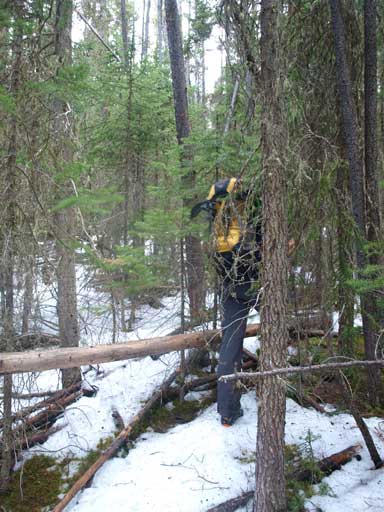
Typical bush for quite a while
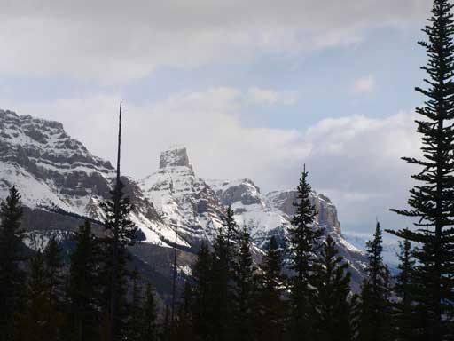
An impressive pinnacle on the Wilson massive.

Higher up the bushwhacking got much better.
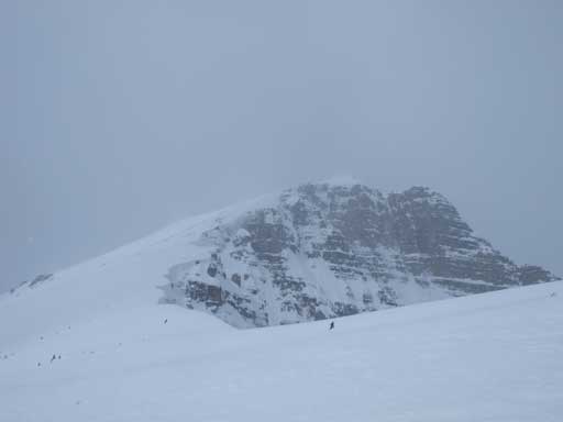
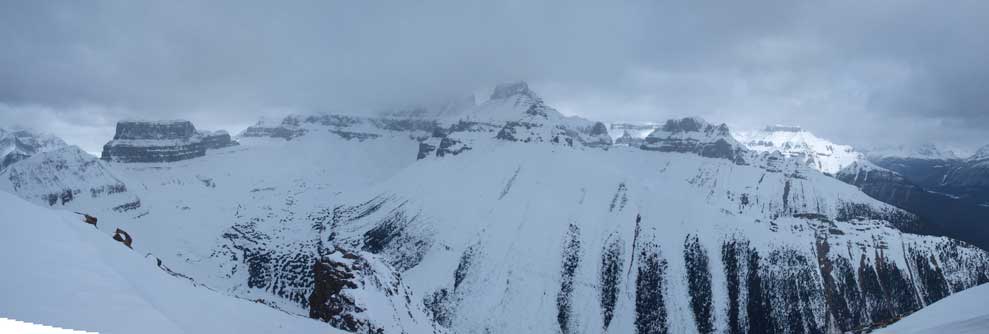
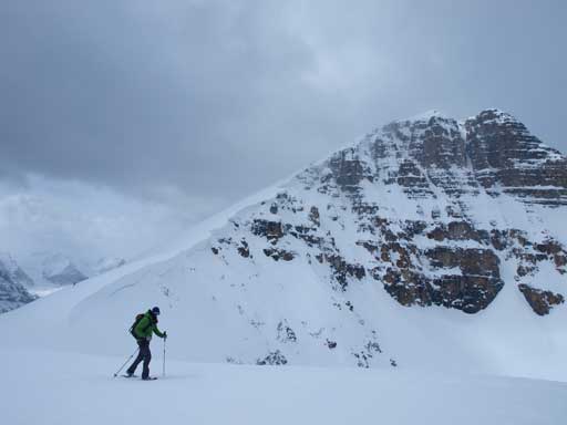
Visibility was actually pretty good, and we could see all the nearby mountains. The sky was not blue though. Wind was brutal on this day and I nearly got blown away several times. We got great visibility towards our ascent route since if in a white-out you might step onto the cornices on climber’s right. They are massive and you’d better stay away. The main ascent slope shouldn’t be rated “difficult” by Nugara Snowshoeing book’s standard. It’s not too steep, and it was quite wind-blown. However it is still in the avalanche terrain though. The steepest part was near the start. We soon made to the rockier sections and followed the scree/snow line up. I could only remember the gusting wind and the foreshortened view from this part. Oh well, the view was gradually improving. The ceiling lifted up a bit and we could see the nearby mountain tops.
The upper slope from the shoulder. It’s here where the wind picked up to crazy..

Looking back at Vern snowshoeing up steep slope

This shot gives a sense of the terrain. It was pretty safe for this day, but it’s definitely in avalanche terrain.
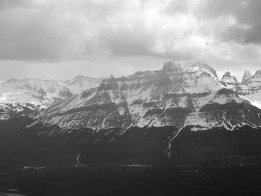
After battling against the wind for a long time we made to the summit. Despite the cloudy sky, we some some okay views. Erasmus looks to be impressive. It looks like Mount Alberta from this angle. No wonder why it only got climbed 2 or 3 times. Outram was always the impressive peak seen from this ascent. It could be a scramble though. Across Hawse River is Mount Sarbach. I had only good memories from that ascent. And across the highway was the big ones, Murchison and Wilson. I only got one of them, and still had to do the other.
Mount Eramus was hidden in the clouds. Even its sub peaks are impressive

Looking south into Hawse River Valley

Mount Outram looks impressive. Forbes didn’t show up for us.
Wow this sub peak of Erasmus should get a name!

Vern approaching the summit, Howse River below

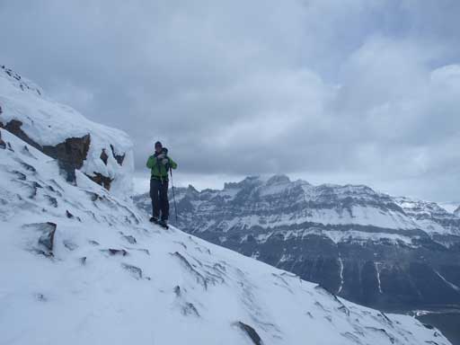
Vern soaking in the views
We didn’t linger any longer due to the wind. Descending was fast since the snow was relatively soft. We took another break at treeline, and got ready for the fun plunging-step down the treed slope. By now the snow had softened considerably but still could hold our weight. Excellent! That’s exactly what we wanted for the descent. However we did discover a couple weak spots though, but they only added the fun of this day. In no time we made to the previous snowshoe tracks and we decided to follow their tracks down since their route looked to be on a trail. The trail was short lived and we still encountered think bush lower down. I don’t know which route is better. I slightly prefer our ascent route since it’s shorter. By whatever route I think thick bush cannot be avoided. Vern set up a fast pace down the miles and miles of bushes. After a long time we eventually made back to Glacier Lake Trail. Looking back, oh wow the bushes. That’s quite a lot of work to get up there!

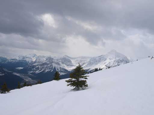
Weather cleared up a bit on the way down, and I took this panorama shot.

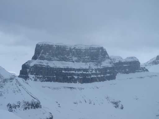
The massive Mt. Wilson
The massive Mt. Murchison
Vern looks higher than Wilson. We did get higher than it last weekend, though a bit lower than the summit antenna..
On the way down, looking back towards Survey. It looks quite impressive from this angle
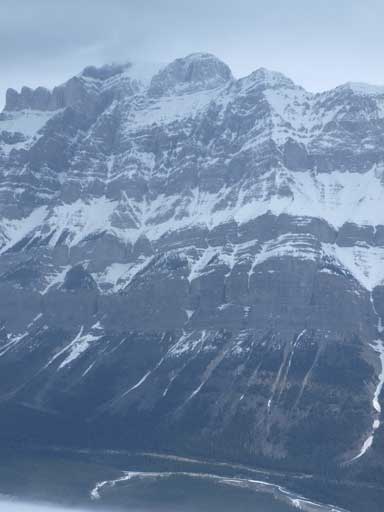
Oh wow the west face of Wilson. 2000 vertical meters from summit to highway!
Almost back into the trees
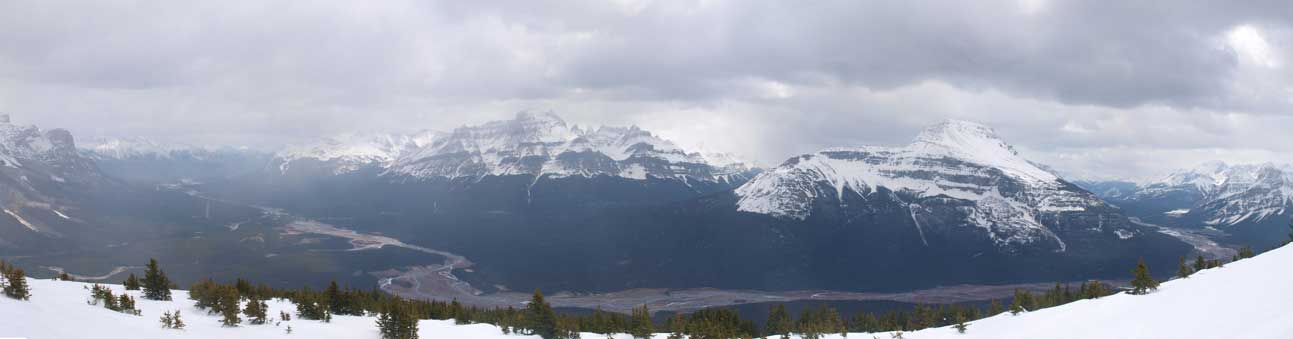
Another panorama

Looking back towards Survey. Note the miles and miles of bush we’d just covered.
From there on it was a pleasant hike back. It wasn’t a hard day, nor a long day, so that’s why the hike was pleasant. There was quite a lot of elevation regain but we’d already psyched for that. The sky never came blue, and round trip time was 7.25 hours.

Mount Murchison!
Mount Outram and Hawse River

Back to the large bridge

Afternoon view. I took the same photo in the morning.
Zooming-in towards the mighty Wilson
Summer is coming!
Vern drove back home, and I drove to Canmore for some internet access afterwards. I needed to figure out what I will do the day after.. Overall, a great day in the mountains again! Good call Vern again for doing Survey Peak, I thought snowshoeing/skiing was out of condition for this weekend. And the next day!

[…] April 26 2013 I joined Steven Song for an ascent of Survey Peak along the icefields parkway at Saskatchewan Crossing. As you can see […]