Mount Collembola
June 25, 2012
2768m
Kananaskis – Highway 40, AB
Mt. Collembola is not a small peak near Kananaskis Village, but doesn’t seem to be very popular probably because it’s not included in Alan Kane’s Scrambles in the Canadian Rockies. The ascent via its south slopes is a mere “easy scramble” and some folks will prefer to do it in winter saving for some more dramatic scenery. The traverse from the nearby Mt. Allan offers another route choice but is considerably more challenging thank to a few rock bands.
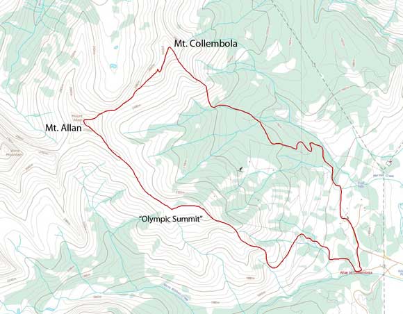
Mt. Allan to Mt. Collembola traverse route
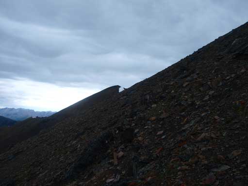
The descent from Mt. Allan to Allan/Collembola col went on pretty quick. It wasn’t scree run but still loose which helped a lot on the knees. Then solid ground quickly led me up to the false summit of Collembola, where I faced a series of moderate down-climbs. I was too lazy to skirt around for most of them. I descent slightly towards skier’s right for the last one in order to find a weakness. The rock was wet so I couldn’t trust the friction, and that’s why I didn’t downclimb that band directly. Dark clouds were building above me and I knew thunderstorm was gonna come. I descent about 20 m on the talus slope for a bit of security. The clouds passed by after about 10 min and I used the talus slope for the rest of the ascent. Thankfully the last section didn’t take me long. I quickly took a panorama and signed the register. The last entry was Jeff Shaw’s, in December, 2011. The pencil was in bad shape.
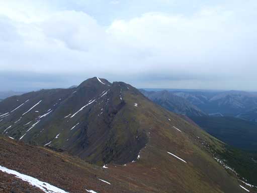
Mount Collembola seen from partway down from Allan.
Slog up Collembola.
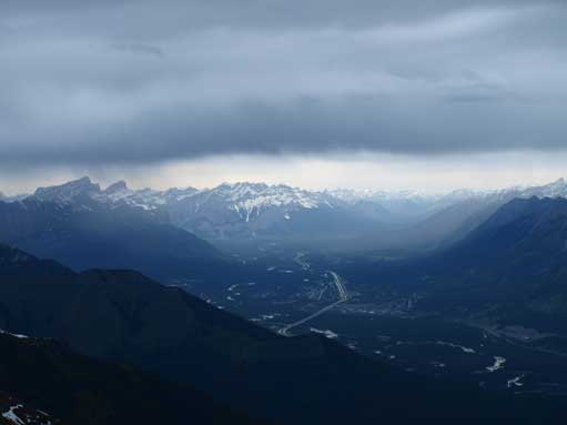
Looking up Bow Valley towards Cascade Mountain.
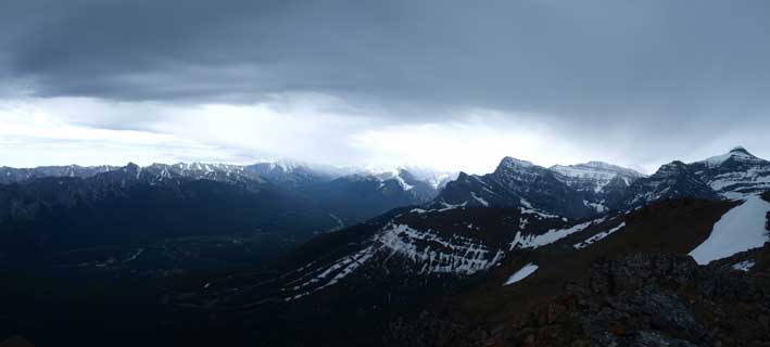
Wow, the thunderstorm was really on its way.
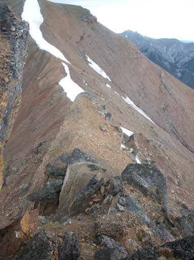
The crux down-climb

The dark clouds passed by, and blue sky showed up.

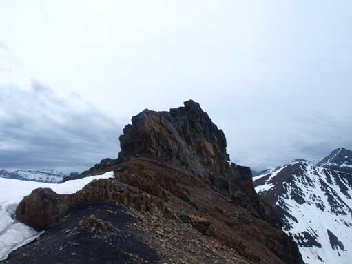
The summit ahead.
Looking back at the crux band. The way goes on the climber’s left side (skier’s right side).

Summit Panorama. Click to view large size.
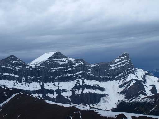
Mount Lougheed
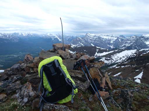
The summit cairn
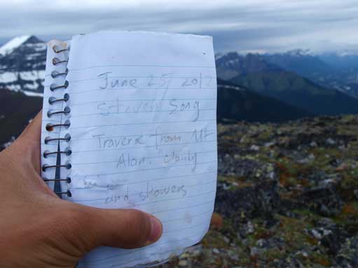
The register and my entry
I didn’t like bushwhacking solo so if not because of the thunderstorm I would side-slope around Mount Allan to get to Olympic Summit and descent Centennial Ridge Trail to get back. However, this time I didn’t have a choice, instead I quickly made my way down the SE ridge. It took me no time to get down this slope. Just about getting to the drainage, severe thunderstorm hit from behind – lightnings, thunders, and downpour. From the drainage you have to bushwhack about 1km to get to the ski hills by Nakiska. The bush was quite thick, and since rain was falling I got soaked in no time. The next half an hour was the most miserable of the day. I got lost in the forest and din’t know exactly where was the road nor ski runs. I just picked a straight line with massive amount of bushwhacking hoping over tens and tens of dead-falls, and got completely soaked inside out. While listening to thunders above, I had to shout loudly for scare the bears away. I had no reference except for my watch. I knew I shouldn’t spend too much time for just 1km distance. I eventually reached a ski run, and followed it down. I still had to make calls as bears love these open slopes. The slope went on forever and finally I reached the Skogan Pass Trail, which was joined by Marmot Basin Road soon. Another 1km or so, I was at Nakiska Ski Resort. Note it was down-pouring all the way from the start of bushwhacking to Nakiska Resort… That was awful, but since I had extra clothing in car it shouldn’t be a problem. Because I was moving I could keep myself warm. I didn’t bother to use the Hidden Trail, instead I picked a longer way along the road to get to Ribbon Creek parking lot (avoid bear problem for as much as I could).

I’ve been considering this traverse, good to see someone’s confirmed it goes for me! Thanks for this, and all your other awesome reports.
Trying to decide which way to do the loop… what do you think? do you think the scramble difficulty is similar in either direction? Is there a lot more scree to utilize in either direction?
Cheers!
Thanks. I think from Allen-Collembola has more scree to use on descent but you have to down-climb the crux. The opposite way you up-climb the crux and descend a trail. Hard to say which would be the better way. Providing navigation off-trail isn’t an issue I probably still recommend Allen-Collembola. The descent was fast.
Awesome, thanks!