Anvil Peak (Forge NW)
February 28, 2021
2005m
Logan Lake / Ashcroft, BC
“Anvil Peak” is the unofficial name of the highest point of a large area of Thompson-Okanagan Plateau sandwiched between Ashcroft-Logan Lake Highway (97C) and Highway 1 between Cache Creek and Kamloops. The name was rather randomly assigned by bivouac.com due to “Forge and Blacksmith theme of the region”. The officially-named Forge Mountain locates a few kilometers to the south-east and is only about 20 meters lower, so in my opinion this peak should rather be just called “Forge NW Peak” or something like that. The topography of this area is nothing magic but this peak boasts over 1200 m of prominence. This area seems rather industrial with very minimal tourism attraction. There’s a gigantic copper mine just to the south of the highway that literally reminded me Chile, and the forests around “Anvil Peak” are heavily logged to within 100 vertical meters from the summit. The logging roads that run on the lower slopes of these hills are more of a maze.
The only reason that one would tag this gigantic forested hill is prominence as the “Ribu” or “P4K” status does make it a decent attraction. I’m sure the locals living in Logan Lake or Ashcroft/Cache Creek have likely never heard of this prominence measurement nor the name “Anvil Peak” but yet peakbaggers from Vancouver and Seattle had driven all the hell up there for the sake reason of bagging it. To do this peak in summer is just a short bushwhack with hardly any elevation gain as one can easily drive up those forestry logging roads. I’m all in to bag a peak in the most efficient fashion but on the other hand I’ve figured the chance of being in that area in summer time is rather minimal, and I would not make a long drive out that way on a precious summer day just to bag “Anvil Peak”. To do this peak in winter on snowshoes I likely would need to walk the whole stretch of the roads but the statistics aren’t bad – under 20 km distance with under 700 m elevation gain. The quality of the snowpack could be horrendous in that area but I was hoping there’d have some 4×4 and sled traffic on those roads. The locals had to recreate somehow.
The weather on this past Sunday was terrible anywhere near the coast but not too bad in the interior, but unfortunately I couldn’t convince anyone to come along. I drove out of the Lower Mainland after work on Saturday night at 9 pm through some downpour in the Fraser Valley then some winter conditions up the Coquihalla corridor. The driving wasn’t too bad but it was snowing and I had to concentrate. The winter conditions lasted all the way to the Ashcroft-Logan Lake Highway as the roads weren’t actively plowed at night and the snow only became heavier as I drove past Logan Lake. I eventually made to the start of the logging roads at 1:30 am. The roads did seem to have a bit of truck traffic but it’s clear that my Taco wouldn’t get any farther on that road, so I parked and slept in the truck.
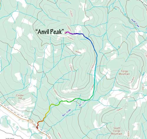
“Anvil Peak” via south side logging roads. GPX DL
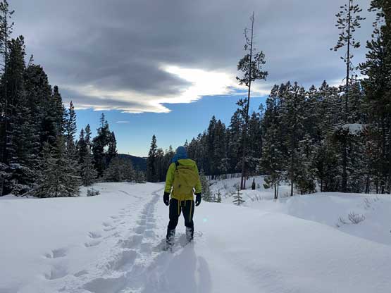
The next morning I woke up at around 8 am, cooked some Ramen inside my truck and leisurely started the plod with snowshoes on right from the start. The previous night’s storm had deposited a few cm of snow but the storm had stopped. The weather was still 100% overcast and would stay like that for the rest of this day, but the cloud layer was high enough such that there would have some views. The truck’s tire tracks unfortunately stopped only 1 km into the trip and then I was on my own, breaking trail knee deep in my 30 inches of Lightning Ascents snowshoes. I was hoping that the branch of logging road that came from Cinder Hills would have some truck or sled traffics as otherwise I probably would turn around right here. Indeed, after plowing through a couple kilometers of this crap I came across a set of sled track that obviously came from the other road, and easily followed it up. The other road was indeed much bigger with a lot more sled traffics so I had another 2 km ish of cruise-sailing. Just when I thought this trip would turn out to be an enjoyable hike the sled tracks did a 90-degree turn towards South Forge Mountain upon reaching a critical junction. The branch that went northwards towards Forge/Anvil pass had nothing but virgin snow so I was on my own again. The trail-breaking up this branch was even worse – calf-to-knee deep and the snow was heavy. There seemed to have a semi-supportive layer about a foot down but that layer could only occasionally support my weight. Whenever I ended up breaking through that layer the going was extremely rough.
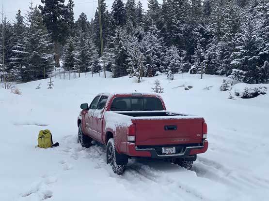
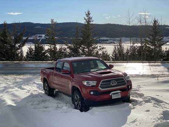
My truck parked at the start right off Highway 97C
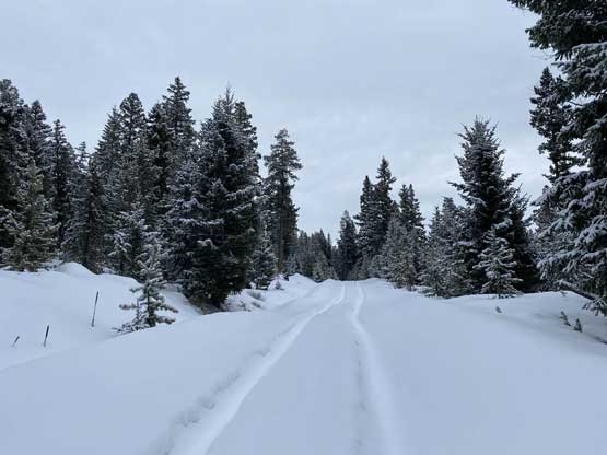
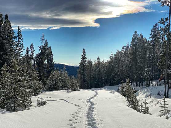
I had tire tracks to follow but only for 1 kilometer

After the tire tracks I was down to calf deep most of the time

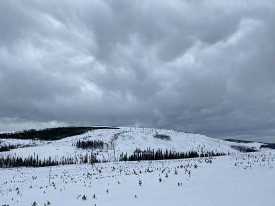
This bump has an official name – Cinder Hill

I was not happy to see this 2 km marker after a long while of wallowing

After a couple km of cruising on a sled track I was back in post-holing…

Road maintained or not doesn’t affect me in winter as I was on my own anyway
I persisted through this piece of shit for about an hour before the conditions gradually improved towards Forge/Anvil pass. The terrain became more open and wind-affected and the trail-breaking had greatly eased. The wind had unfortunately picked up and the sun never came out so the next hour’s plod was pretty cold. The views of the marvelous cut-blocks were better than my expectation but still, the only things to see around here were the cut-blocks and rolling hills. I followed the road to as far as the highest cut-block. The ascent through the cut-block was not a problem with a thick winter snowpack and neither was the final 100 m gain in the mature forest. The trail-breaking in the uppermost forest was also surprisingly easy-going but to determine the exact location of the highest point I did have to wonder around a bit. There was some selected views to the west towards Lytton and the Stein area of the Coast Mountains, which was also to my surprise but I’d take that rather than complaining.

Above Forge/Anvil pass now, looking back

The glamorous summit of “Anvil Peak” ahead somewhere in the trees…
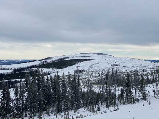
Looking back at Forge Mountain which is only marginally lower

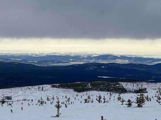
Summit view from “Anvil Peak” looking south

Could see a little bit of the South Coast ranges
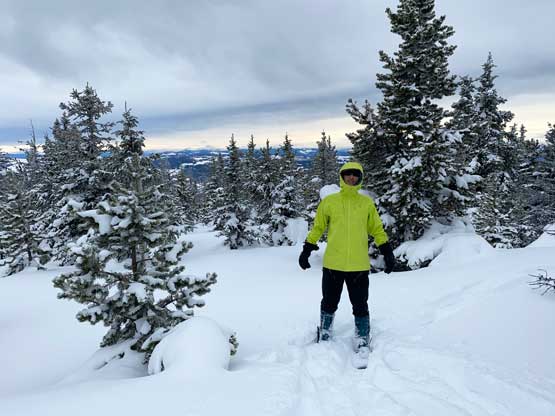
Me on the summit of “Anvil Peak”
I didn’t linger too long on the summit because there’s simply no point. I debated about going for Forge Mountain but I was tired of the cold wind and the post-holing. I usually do not skip a summit but for a few reasons I opted to play the game of laziness on this day. I consider “Anvil Peak” as an alternative of the officially-named Forge Mountain as if not because of the prominence thing I would choose to bag Forge Mountain instead of this crappy made-up-named summit. The descent back through those stretches of knee-deep post-holing was not nearly as easy as I thought as I ended up post-holing on top of my own tracks. It was an exhausting game. I had to take an energy break during the descent as my legs were tired of the lifting. One usually doesn’t have to lift much while snowshoeing downhill but this trip was an exception. Towards the end of the downhill slog the sun finally came out granting a bit of sunnier views near the end.

As you can see the forested travel at the very top was nice and open

Me back at the edge of the marvelous cut-blocks
A view into the Interior BC – Mt. Tod left of center the easiest “Ultra” nearby

Chuwhels Mountain is a P600m objective near Kamloops
Forge Mountain ahead on the descent

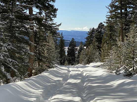
As typical as the view from the descent on those logging roads

Klowa Mountain, Nikaia Mountain and Mt. Roach showed up

Siwhe Mountain at center – one of the taller peaks in SW BC

Hard to figure out but those are Skihist and Petlushkwohap – two highest in SW BC

Another view of Cinder Hill. I was not in the mood to slog there on this day…

Me descending the roads
The sun finally decided to come out at the end of this trip

Looking back from a couple km away from truck
My lone snowshoe tracks in the afternoon sun
Another photo of me descending the roads.
Finally back to the tire tracks
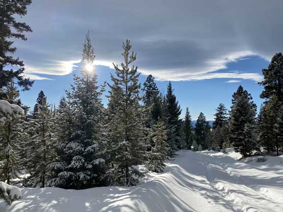
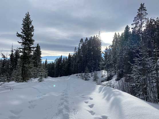
One last photo of the logging road
Taco parked at the “trail-head”…

I stopped at the copper mine for some photos
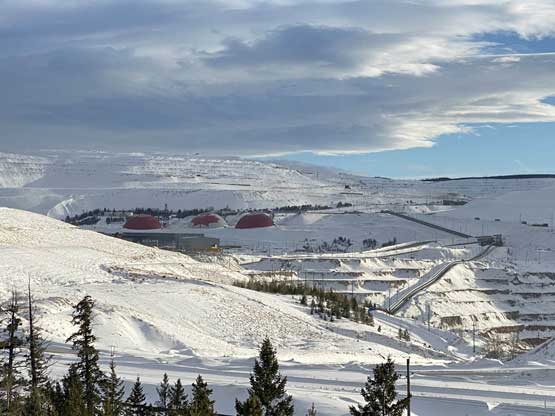
This mine site is rather gigantic…
The round trip time was 7.5 hours but felt longer thank to the solo effort of trail-breaking. While driving back I stopped at the copper mine for some photos as that’s not something I got to see everyday. I made to Merritt at dinner time, took a long ass break and eventually made back home at 9 pm. The drive back up and over Coquihalla Pass still had winter conditions as it was still snowing and raining out there.
