Tricouni Peak
August 3, 2019
2122m
Squamish / Chance Creek FSR, BC
Not to be confused with Tricouni Peak on the northern edge of Inspiration Icecap in North Cascades, this one is a popular scramble/alpine climb north of Squamish in British Columbia. The scramble route is well written in Matt Gunn’s Scrambles in SW British Columbia while the north and east ridges offer some easy alpine climbing routes. The access of these routes is very easy assuming one owns a trusty 4×4 vehicle and because of that, this is also one of the more popular peaks in the Sea to Sky Corridor. Over the past several years I on purposely saved this peak for a “type 1 fun” kind of outing with friends especially when energy/time had to be conserved.
This turned out to be the case on Saturday of this past August long weekend. Adam (Gimplator) wanted to come peak-bagging in SW British Columbia taking advantage of the incredible weather and Mel O. also wanted to get out but they gave me the power to pick an objective. Considering we all had multiple big plans in the next few days I chose Tricouni Peak and only by the standard scramble route. I did however want to do some exploration, that instead of following Matt Gunn’s approach from Squamish Valley we would take a “newly published” access from Chance Creek FSR. This approach is essentially the climber’s descent route for those climbing the north ridge and the advantage of it over the standard approach is a more direct finish and a slightly higher starting elevation.
On Friday evening Adam drove to B.C. and slept in my home but in the morning we drove separately to Squamish because Adam wanted to stay there for at least a week longer. I picked Mel up from North Vancouver and we regrouped at the start of Chance Creek FSR. The start of the road had lots of “No Parking” sign so we continued driving up the logging road in two vehicles. After about 1 km up the road we found a nice pull out to park Adam’s Subaru and then I had no problem driving the three of us to the regular starting point in my Tacoma. An aggressive 4×4 driver could push all the way to the trail-head saving at least 40 min of walking but that was not me.
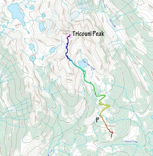
Tricouni Peak via High Falls Lake variation approach. GPX DL
As mentioned above the initial 40 minutes or so was a boring walk up the rest of the logging road to the trail-head. Adam and Mel set up a blistering pace and I struggled pretty hard to keep up the pace. The trail was overgrown and soaked from the recent rain event that in short time we were all soaked too. The trail was also very muddy and boggy at places that wearing trail-runners might not be the smartest idea. The hike towards High Falls Lake was not very pleasant in such soggy condition, but the lake itself was quite a scenic spot to linger around. We took a lengthy break there and I changed my footwear from trail-runners to Trango Ice Cubes mountaineering boots.

The start of the boring road walk.

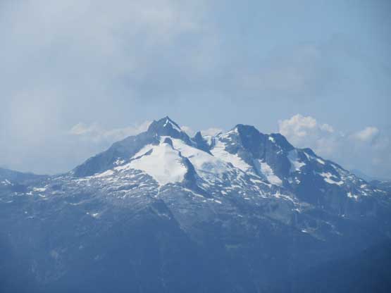
The massif of Pelion Mountain and Ossa Mountain

Cloudburst Mountain to the south

Almost at the trail-head now. Oh the boring road walk…

The trail wasn’t very pleasant because of mud and wet bush
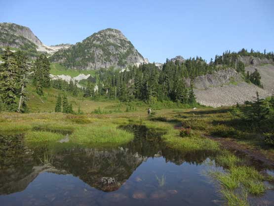
A neat pond of water provided some nice reflection views
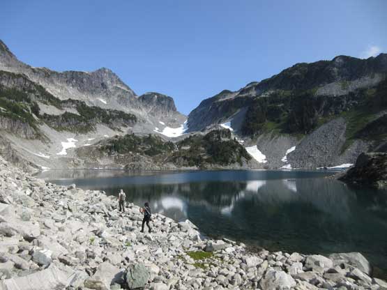
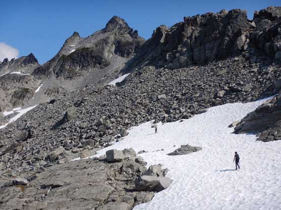
The ascent from High Falls Lake to a notch on Tricouni’s long south ridge was tougher than I thought. First of all we had to hop across the lake’s outflow stream. We barely got it done without wetting the boots. Then it appeared we couldn’t just traverse around the west shore of High Falls Lake and had to start a side-hilling rising traverse with a lot of scrambling on unstable talus. The upper section to gain the notch required some steep grass and (thankfully) some firm patches of snow to ease the travelling difficulties. At the notch I wasn’t sure where exactly to go and opted to cut high across the west side. This led me onto some wet and exposed 4th class slabs so turned around shortly after. The only other way was to descend some (firm) snow and traverse at a bench about 30 vertical meters lower than the notch. The snowfield was barely doable without crampons.
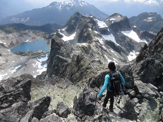
Walking around High Falls Lake on talus

We had to start a long rising traverse here

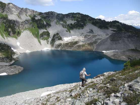
Another photo of High Falls Lake
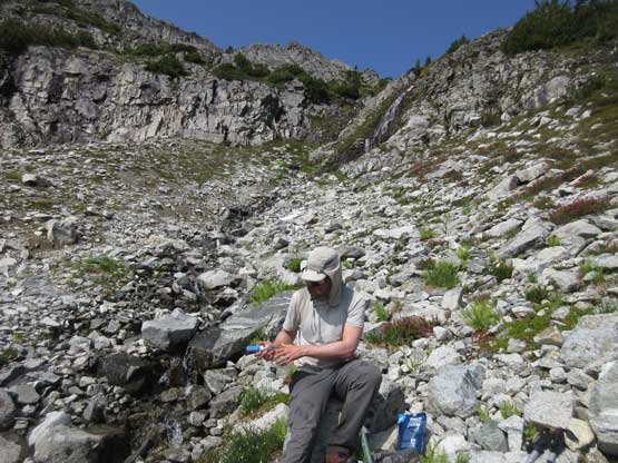
Adam filling up water. There were plenty of water sources
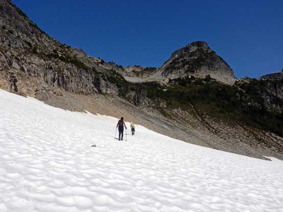
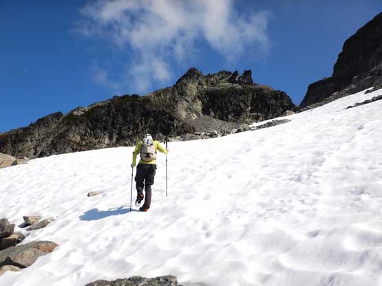
Me and Mel plodding up a snowfield. Photo by Adam W.
Cresting the notch now, looking down into the west side
If you look closely you can see Mel descending from the notch.

The snow was icy and almost required us to don crampons

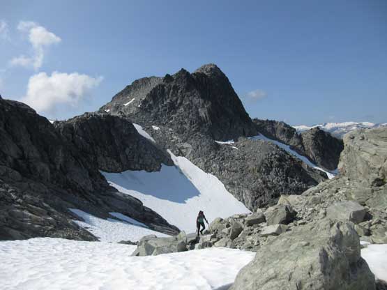
Adam wondering about the next section of the route.
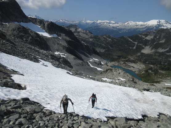
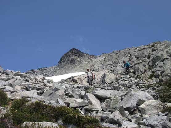
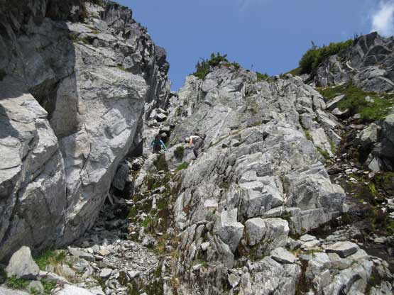
The bench traverse wasn’t as pleasant as I was expecting neither with a lot of micro terrain up-and-downs and talus hopping. Thankfully there was still abundant snow coverage to smooth things out. Near the base of the peak we aimed towards the standard “SW Gully”. The scramble up this gully involved some wet and mossy 3rd class with moderate exposure so wasn’t as easy as we thought neither. I admitted that I did zero homework and hadn’t touch the scramble book for ages. The rest of the ascent to the summit was mostly class 2 on open terrain.
Mel on the bench traverse with a sub-summit behind
Me and Mel taking as much advantage of snow as we could. Photo by Adam W.

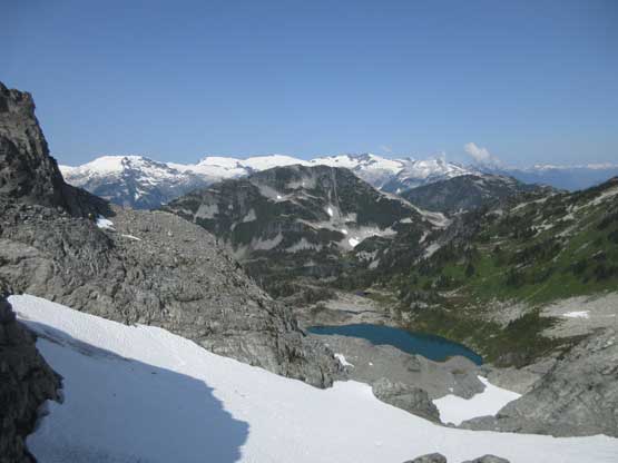
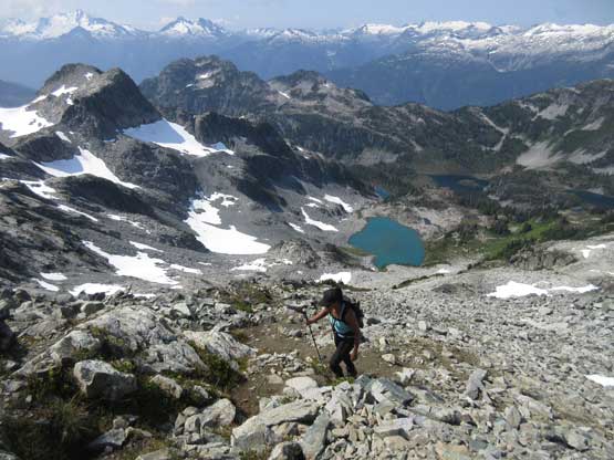
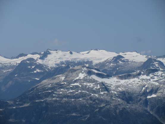
There are lots of tarns on the standard approach side
Me kicking step up another patch of snow. Photo by Adam W.
Adam and Mel gaining rock from snow
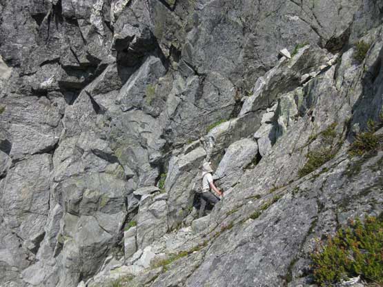
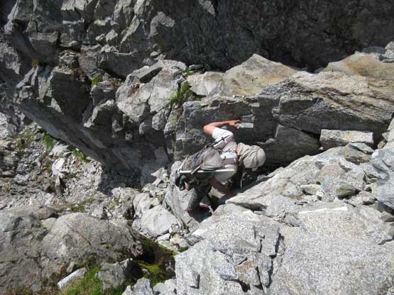
Adam in the SW Gully now wondering if we were on route or not
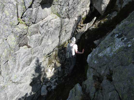
Adam continued climbing the gully while I bailed onto the rib to the right
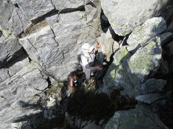
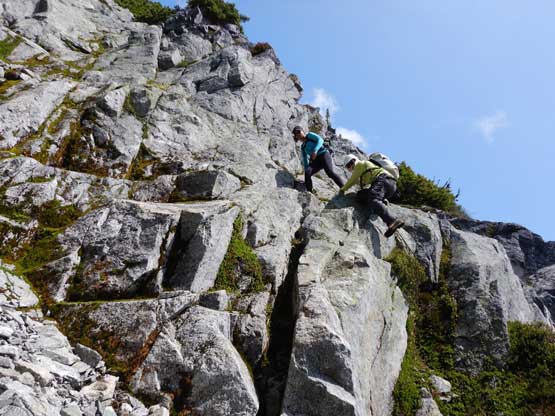
Adam and Mel likely off-route here but looked fun
Mel finishing the gully now, and onto the upper mountain

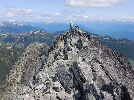
Mel near the summit now.
Me coming up to the same spot. Photo by Adam W.
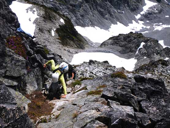
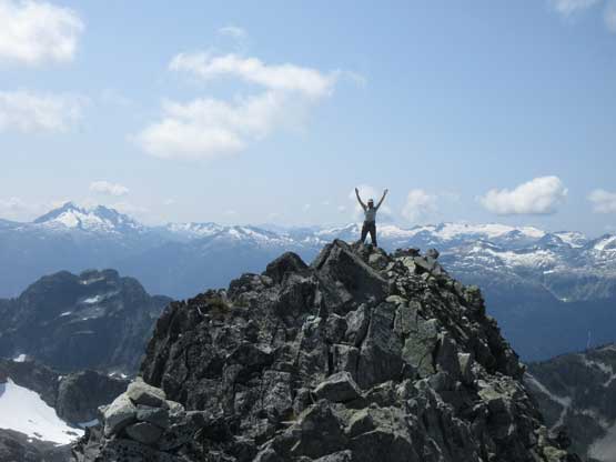
Me on the last few 3rd class moves to the summit. Photo by Adam W.
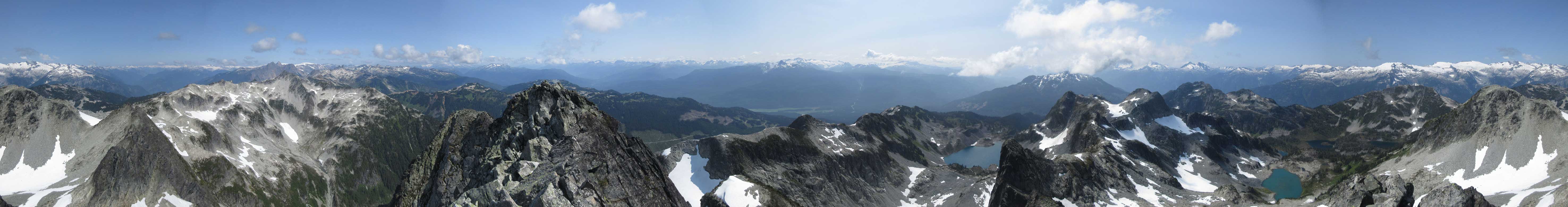
Summit Panorama from Tricouni Peak. Click to view large size.
The towers in front is Mt. Fee
The massif of Mt. Cayley
Pelion Mountain and Ossa Mountain
That glaciated massif is Mt. Jimmy Jimmy
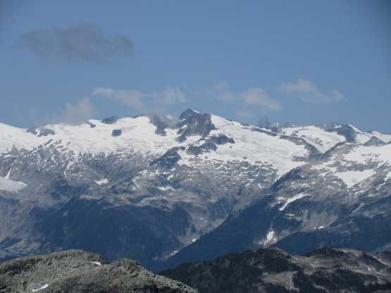
Icecap Peak on Ashlu-Elaho Divide
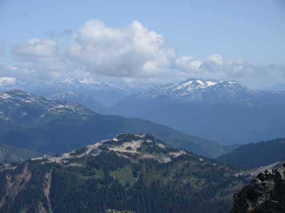
This is a northern view into Callaghan Valley

A closer look at Mt. Tantalus
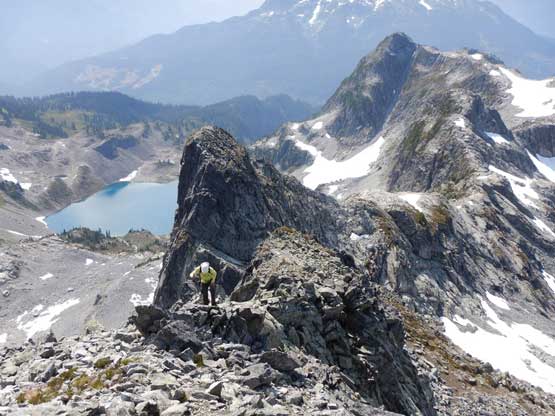
Adam on the southern summit
Me and Mel on the northern summit. Photo by Adam W.
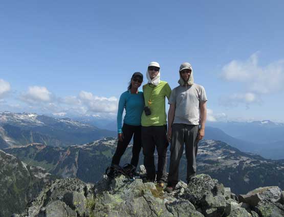
Our group shot on the summit of Tricouni Peak

Me on the summit of Tricouni Peak
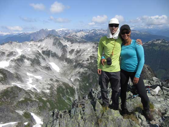
Mel and I on the summit of Tricouni Peak
We lingered on the summit for over an hour because we all got lazy at this point. On the descent we had to be careful not slipping on moss down-scrambling the gully and then had no problem reversing the bench traverse, then up and over the notch. The descent to High Falls Lake wasn’t very pleasant but at least went by quickly. The rest of the hike-out was uneventful but very boring. I wished we had Mel’s Jeep so that we wouldn’t need to walk the stupid road.
Mel heading off from the summit

Adam carefully working his way down some 3rd class near the summit
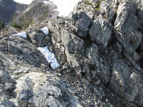
The talus field on the upper mountain
Adam down-climbing into the gully now
Mel and I working our way down a different line. Photo by Adam W.
Mel and Adam down-climbing the bottom of the gully

Lots of snow and talus on the traverse to the notch
Mel descending towards High Falls Lake

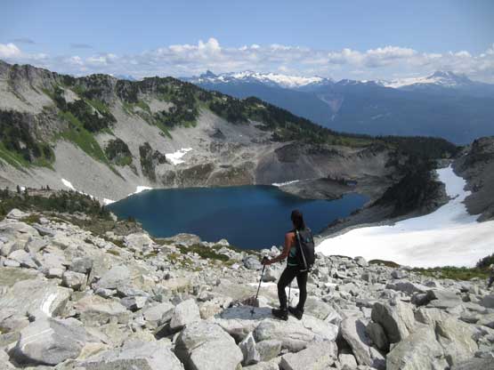
A panorama of High Falls Lake from high above. Click to view large size.

Another photo of Mel descending towards the lake

Mt. Garibaldi was too shy to show up on this day
Adam and High Falls Lake

This is gotta be one of the prettiest lakes in this region

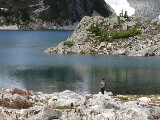
Mel and High Falls Lake

One last panorama of High Falls Lake. Click to view large size.

Mel hopping back across the lake’s outflow
Mel taking a well-deserved break at the lake’s shore

Time to go down again. Cloudburst Mountain looms in front

Mel on the boggy section of this trail

Back to the road now.

A closer look at The Barrier that holds all of the water in Garibaldi Lake in place…

Oh the boring road walk…
On the way back home Mel and I went to the same place that my friends Jake, Tyler and Fletcher showed up back in April for dinner because the food there was both awesome and cheap.
