Gunung Karang
August 17, 2023
1778m
Java, Indonesia
Gunung Karang is the highest peak in Banten on the far western reach of Java, west of Jakarta. Despite the low elevation this peak is completely detached from the rest of the mountains on this island so it still boasts enough prominence to be an “ultra”. The only trail that goes to the true summit starts from the village of Kaduengang to the north-east at around 845 m elevation. The climate of the area is hot and humid even in the dry season so an early start is essential. Adam and I booked a fancy hotel in Pandeglang at the base of the mountain and we decided to leave at 4:30 am in the pitch dark to beat the heat. We arrived at the hotel earlier than expected in the previous evening and did some exploration of the nearby areas. The food was excellent but a bit too spicy even for us.
The alarms went off at 3:30 am and within half an hour we were down to the lobby. We had ordered our breakfast to be ready at 4 am and for once, it was not late. The food was the classic Nasi Goreng with some chicken and fruits, and was plenty enough. The drive to the trail-head was longer than expected due to the roads being quite rough. There were two ways and we opted to follow Rob Woodall’s driving direction. I suspect the other way (closer to Pandeglang and recommended by Google) would be better as Rob’s route was quite rough for a section in the middle. After the two routes merged together the road condition actually improved due to the increased habituation. The final section before the registration office at the trail-head was incredibly steep but didn’t impose too much of a problem to our vehicle. The registration was closed at this time of a day, but our driver would wait for us at the office and we would pay the belated fees upon returning. This was Indonesia’s Independence Day and we anticipated the peak to be busy, but we only encountered the hordes on the summit and the descent.

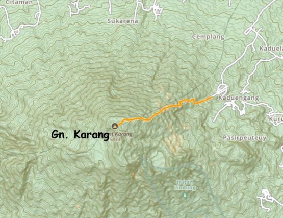
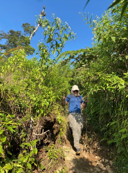
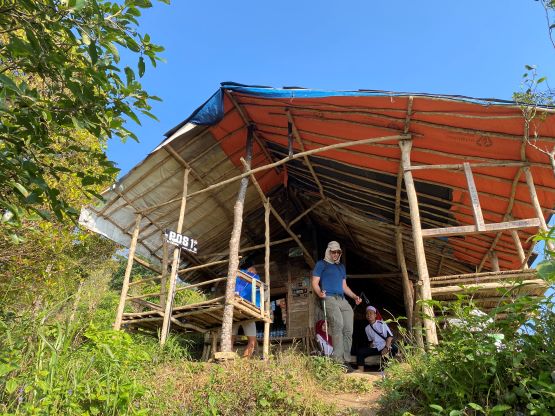
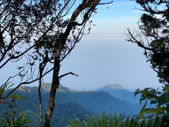
Despite the slow driving we still arrived at the trail-head in the dark and the first half an hour were done using head-lamps. We had not needed head-lamps for a while in this trip and I believe the last time I even carried a head-lamp was on Gunung Raung. It might seem like we could have driven further but the road quickly degraded into a cobblestone trail. The trail would be too rough/narrow even for ojeks so we did make the correct decision to park at the registration office. I never enjoyed walking on this kind of cobblestone pavement as the rocks were sharp and irregular and we must pay enough concentration to the ground. The trail was quite narrow at places such that my legs were constantly brushing against the damp vegetation. I had opted to wear shorts but I carried my pants in case the trail became overgrown. Not far up we came to a critical junction and the left turn goes to “Pos 1”. This had been mentioned in Rob’s trip report. The section beyond “Pos 1” was on some open farm lands and we timed ourselves well enough to watch sunrise from near the top of this open zone. Had we started 10 min. earlier we would miss the sunrise.


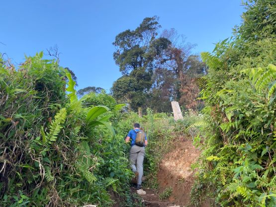


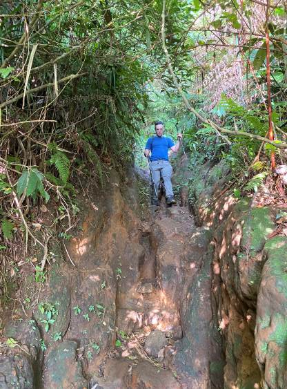
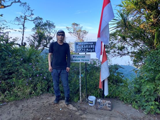
Beyond the farm lands we dived back into the jungles and the trail was mostly a muddy tunnel. There was still enough light that we didn’t need head-lamps, but the tunnels were quite dark in the early morning hours. The tunnels on Gn. Karang were also considerably muddier and wetter than expected such that we had to pay some extra attention to not slip and fall. There’s frequent use of hands and there’s also plenty of scrambling on steep and slippery tree roots, at times I would rate class 2+. We eventually reached a false summit just when I thought the summit was within a stone’s throw, and about 20 m precious elevation must then be lost to surmount this false peak. The final plod to the true summit also dragged on for longer than expected with some micro-terrains. There was already a large group camping near the summit and they were just about to start the praying, presumedly for the Independence Day. The true summit was slightly beyond their camp and was forested with limited views. This mountain is considered sacred by the local people so I wasn’t sure if they appreciated our presence especially on this particular day. All of the people we encountered on the summit or on the descent seemed serious. Very few showed us their smiles.


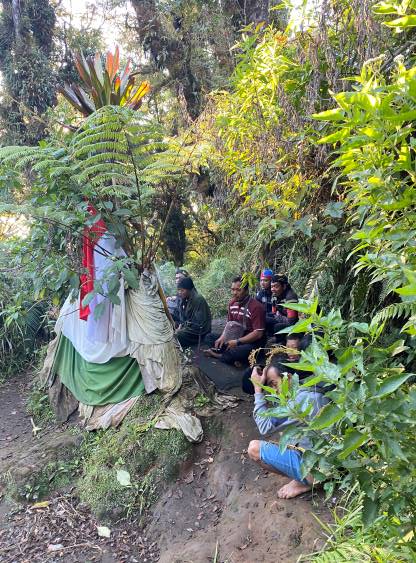
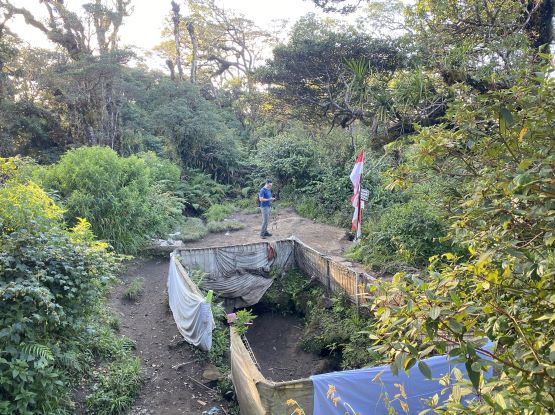

The praying sounded quite serious and stressful and it started to remind me some horror movies I had watched in the past. I’ve researched that in some areas of Indonesia such as West Papua the locals could definitely kill the tourists for robbery or religious purposes, so after taking a few photos we immediately started the descent. A shit ton of people were on their way up, and I mostly did not bother to interact with them. Quite a few of them showed their strange faces. It’s understandable as I bet foreigners were probably not supposed to be here after all. In any case Adam and I made a single dash down to the trail-head and finished the round trip in exactly 3 hours. Our driver told us that the registration required us to pay 100,000 rupiah each, but he thought that’s too much and bargained down to 75,000 rupiah, which we greatly appreciated. We got back to the hotel still in the breakfast time so Adam and I got a secondary buffet styled breakfast, which we considered as the “brunch”. We then drove eastwards for 3 hours to the base of Gn. Salak, and the traffic was much better than anticipated.