Mount Livingstone
May 12, 2013
2434m
Kananaskis Country (South), AB
After finishing Mount Hornecker, Windy Peak, and Saddle Mountain, Raff and I were going up the last summit of this day. Mount Livingstone is the namesake peak in Livingstone Range and although not the highest, it’s still a worthwhile objective in its own. The best time to bag this peak is “shoulder season” when the bigger objectives are out of shape. This would also be the highest summit of our day. There’re many routes to bag this peak (as it’s pretty tame from any side) and our plan was to ascend its east side (back side) from Saddle/Livingstone col, and descent the NW slope straight towards Raff’s Jeep, to make this day a full loop.

The Livingstone 4-peak traverse route
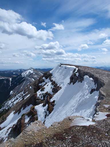
The east side of this mountain is steep, and still held lots of snow in the forest. Luckily for us, we could spot a relatively tree free line so we could avoid most of the isothermal crap. The line actually parallels a man-made fence initially, and involves some hands-on scrambling higher up. We took a couple breaks in the trees taking advantage of the windless condition before breaking through the treeline. And once we were on the summit ridge, the wind picked up suddenly, like expected. Mount Livingstone has two summits, with the first one having a much bigger cairn, but it looked like the second one could be slightly higher so we went for both. I would call the second summit (south summit) being the true peak though.
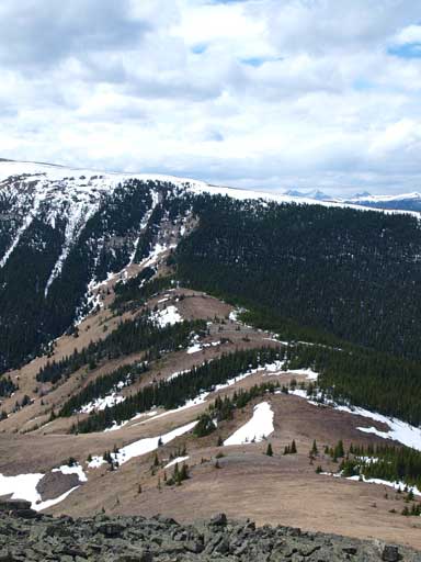
Looks like we could avoid most of the forested snow except for the last bit
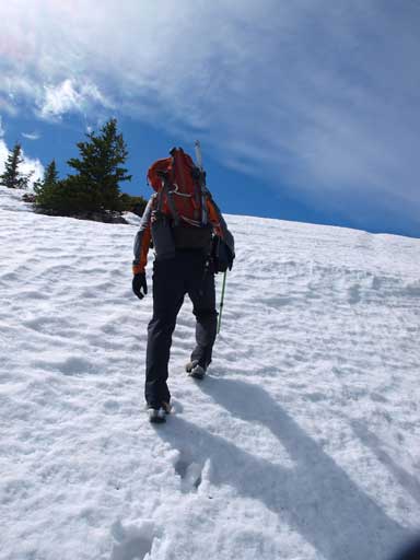
And the last bit was actually pleasant step-kicking rather than isothermal crap
Great view from the summit ridge

Me with the big cairn on first summit. As you can see, it was extremely windy. We could barely take this shot
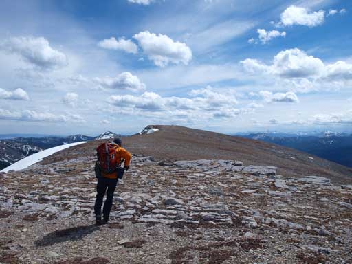
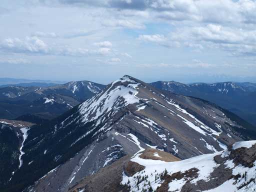
Raff hiking towards the slightly higher south summit

Raff
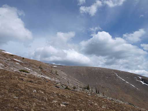
Near the summit, the East side is pretty steep
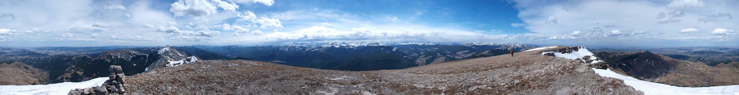
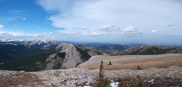
Summit Panorama. Click to view large size
Coffin Mountain towards south

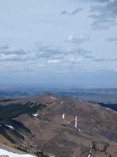
Sheep Mountain, our original objective for this day

Looking south towards Oldman River and then Crowsnest Pass area.

Plateau Mountain and Hailstone Butte towards north

Clouds over High Rock Range. Tornado Mountain is the high peak on left side
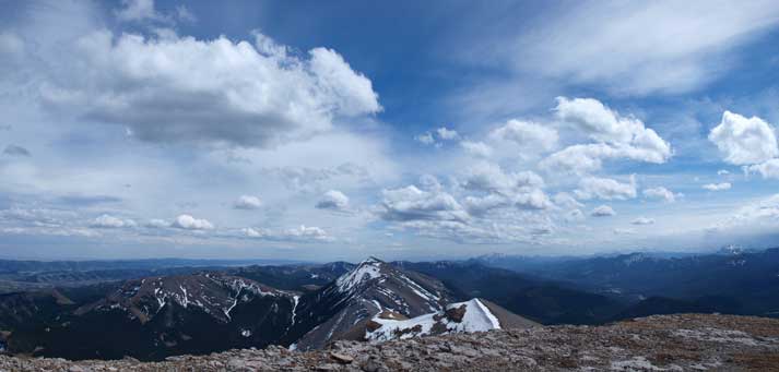
Beautiful clouds towards south
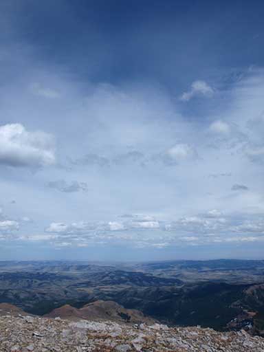
Beautiful sky above the foothills and prairie

Me on the summit
Looking over the two summits of Saddle Mountain

Weather was getting worse around the divide, thankfully it never reached us
After taking some obligatory summit shots, we started our descent line. We contoured around the north summit (false summit) on its west side, nearly being knocked down several times by the gusting wind. The wind also carried the running water and smashed them into our faces. I once thought it was raining. It was definitely raining near the continental divide though, but the dark clouds never came to our area. A typical chinook situation in the Rockies! The bush in the forest was much better than expected. Like on Mount Hornecker, the slope was quite open. It didn’t take us long to get down the steep slope. The last obstacle would be crossing a (quite wide and deep) stream. There were a couple logs making for some fun looking photos. After this bit it was a pleasant hike back to Raff’s Jeep.
Looking back towards the summit area from near treeline. What you cannot see is the wind
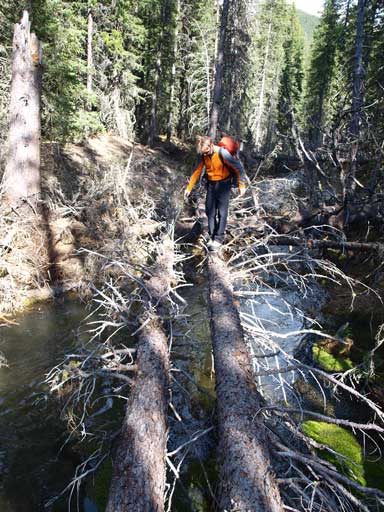
Raff crossing an interesting stream
Our round trip time was less than 8 hours in a very relaxing pace. I need to thank Raff for going up Livingstone for his second time, as well as waiting for me going up Windy Peak. His Jeep also made Highway 532 not a big deal. My car would probably run into trouble at a couple places.
