Mount Whyte
August 17, 2012
2983m
Lake Louise, AB
I had a big plan lined up for this past Saturday so I decided to either rest up or do a short objective on Friday. My original plan was Mt. Jimmy Simpson but as I drove west towards Lake Louise, I decided to change my plan to Mt. Whyte as I wanted more scrambling. The weather and condition was simply too good and I figured I just had to do something more challenging… Mt. Whyte is one of the “difficult scrambles” nearby Lake Louise and while hordes of tourists attempt to go up Mt. Niblock every year, few actually venture up the harder neighbour.

Mt. Whyte standard scramble route
I ascended Mt. Niblock less than a month ago, so I had all of the fresh memories regarding the entire route. I don’t want to describe the approach for too much, as everyone who can walk should be able to make to Lake Agnes tea house without problem… Just follow the well beaten trail and the challenge could be passing the millions of tourists along the trail… It was a bit ridiculous but I did manage to pass most of them.

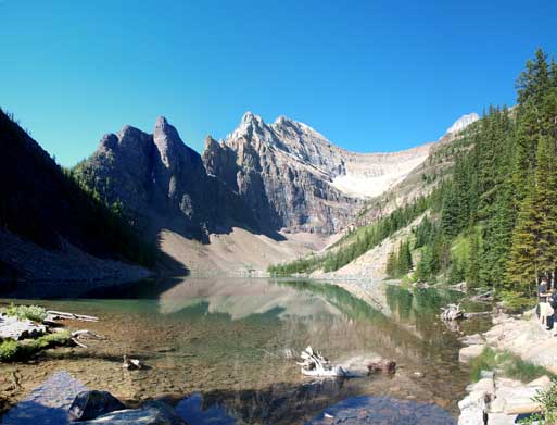
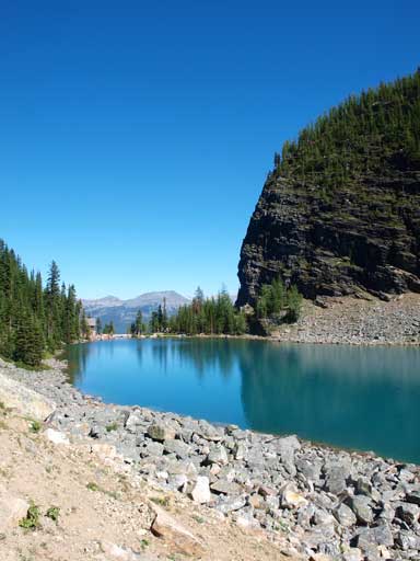
An obligatory shot of Lake Louise
An obligatory shot of Mt. Victoria
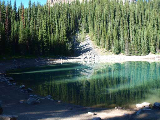
Mirror Lake was calm and clear
A look at The Beehive
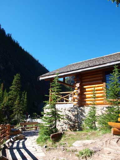
Lake Agnes Tea House
This was my 4th time at Lake Agnes, and the first time getting bluebird sky. I took a short break and started circumventing Lake Agnes. Before venturing onto the boulder field at the west end, I looked for a faint trail going into the trees. I then followed it to the base of the rock pile. Trudging up the rock pile was tedious and tiring but I made to the first rock band in no time.
The classic view of Lake Agnes
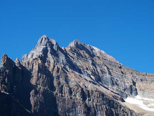
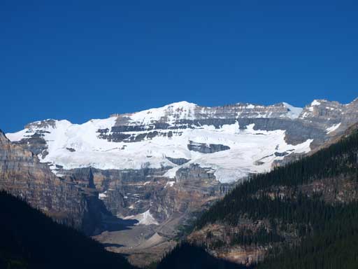
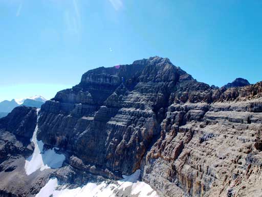
A closer look at Mt. Whyte – my objective
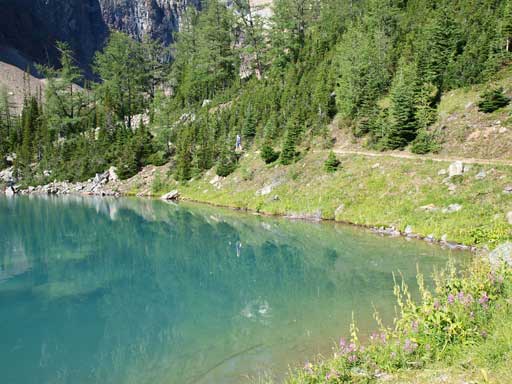
I like the water in this lake

Route goes up this scree cone, and then up the waterfall rock band
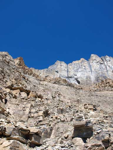
The rock band involved a series of 5-meter “moderate scrambling” steps. If wet, then use caution. The terrain became increasingly loose the higher I went, but there were always abundant paths helping me staying on track. It was pretty easy to follow and I soon gained Niblock/Whyte col. This is a good place to take a break as looking back you’ll see the different colors of Lake Louise and Lake Agnes.
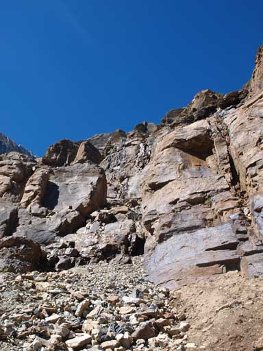
An idea of what to expect of those rock bands

Here’s the upper bowl. Niblock/Whyte col above
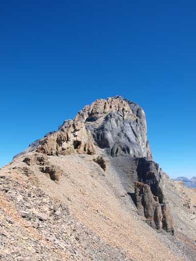
Looking at Mt. Whyte
Slogging up the upper slope
Mount Niblock from the col
From Niblock/Whyte col. Mt. Whyte on left
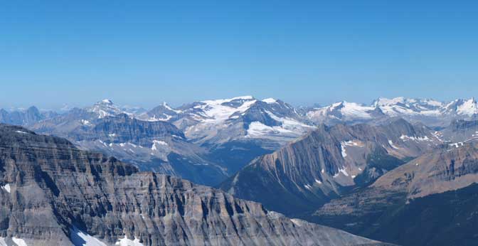
The other side opened up. Looking towards the distant Wapta
To get to Mt. Whyte, I descended a short distance while following the connecting ridge all the way to the base of the rock cliffs. Here I was blocked by a short wall, but by traversing climber’s right for 10 m I managed to spot a line regaining the ridge. There were some cairns here marking the route. I then stayed on the ridge crest until seeing a beaten path traversing climber’s left horizontally. I followed this path to the obvious loose down-sloping gully that Kane warned not to get into. The gully wasn’t bad and I scrambled up the right hand side on some moderate but loose terrain. The gully led me to a narrow col and then I dropped down the other side. Now I got to traverse on another beaten path for 20 m towards the crux.

Traversing ledges below some cliff bands. This is the typical terrain.
There were again, cairns marking the crux. You’ll encounter a similar col as the one you’ve just done, do not drop down the other side, instead climb straight up the steep wall to re-gain the ridge crest. This is the crux. I felt this part as easy side of difficult scrambling, but I did have to do a good amount of hands-on work on this mountain and the terrain was fairly loose.
After the crux I got to balance over a short, but exposed ridge section. At the next wall, I traversed again on climber’s right on a beaten path until I could spot some easy terrain to regain the ridge crest. There’s a not-so-obvious gully which was the easiest line (I used it on the way down, but I used the rock on the way up). And once back onto the ridge I just had to follow the ridge up again, circumventing several pinnacles, usually on climber’s left. A short upper moderate section led me to the summit.
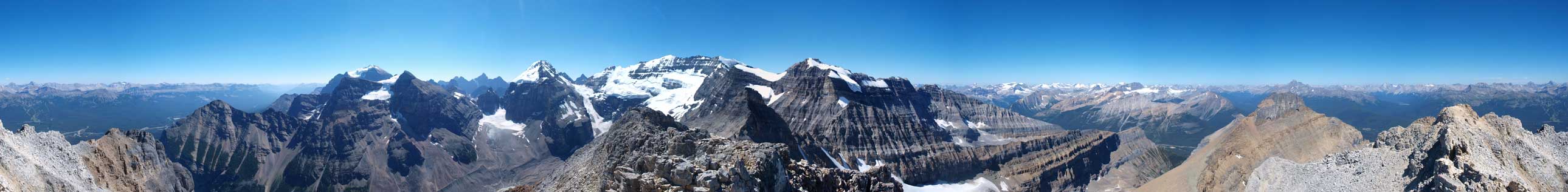
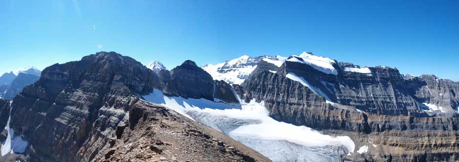
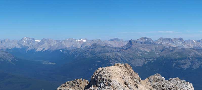
Summit Panorama. Click to view large size

Mount Lefroy
The Death Trap and Abbot Pass

Mount Victoria

Popes Peak
The Presidents at center

Mt. Balfour poking behind Mt. Daly
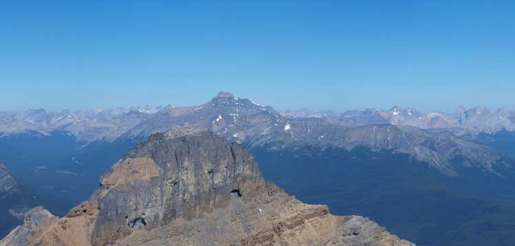
Mt. Hector rises behind Mt. Niblock
The Pipestone Valley and Skoki Area peaks

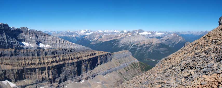
Castle Mountain Massive
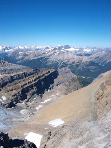
This valley offers a winter route up Mt. Niblock
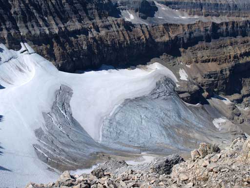
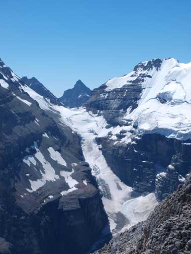
Winter route goes up this fractured glacier
There’s no mean to rush, and I took my time on the way down the loose terrain. Once back to the col, I decided not to do Mount Niblock as I’ve already done it. Because of the big traverse plan the next day, I had to save as much energy as I could. From the col down, it was easy to lose the path. Look for cairns. But with the basic sense of route-finding, it wasn’t an issue. The rest of the return along Lake Agnes trail was uneventful.
Looking down from near the summit.

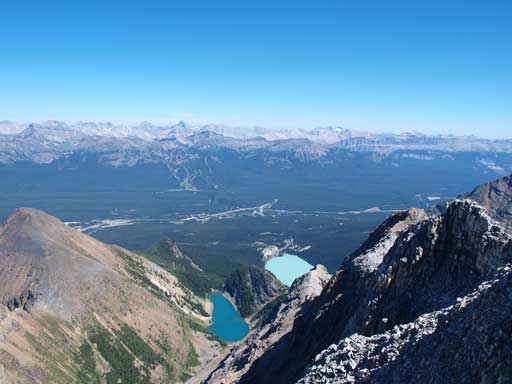
The classic double-lake shot
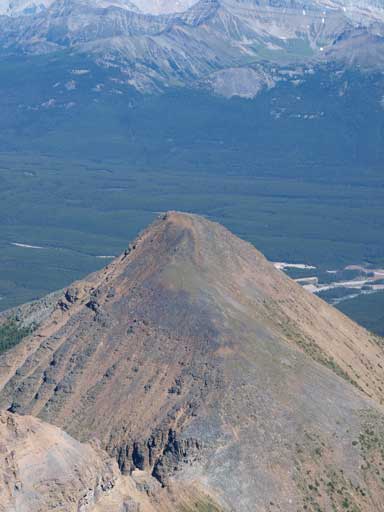
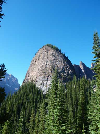
The summit of Mt. St. Piran
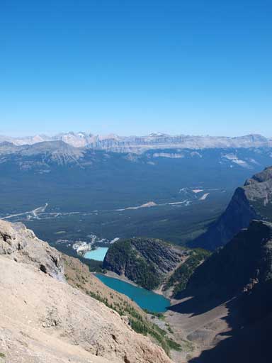
Back to Niblock/Whyte col, looking down towards Lake Agnes and Lake Louise

At the waterfall rock band, looking towards Mount St. Piran
Back down to Lake Agnes

A zoomed-in view towards The Teahouse on the other side

Paint brushes

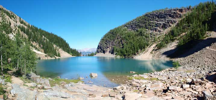
Lake Agnes

Crystal clear water
Another look

This is that tea house

Down to Lake Louise now
Again, if not because of the plan on Saturday, I should have done Devil’s Thumb to finish my Lake Agnes area considering the weather, but obviously this wasn’t a smart idea for this day. I leisurely walked back to car, and drove to Canmore.
