Castleguard Mountain
May 12, 2012
3090m
Columbia Icefield, AB
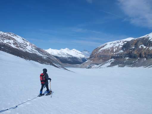
Castleguard Mountain, a mere “baby” guarding the southern boundary of Columbia Icefield comparing to the nearby 11,000ers, does offer one of the most unique summit panoramic views in the Canadian Rockies. The approach is via the bloody long Saskatchewan Glacier – a straightforward and much less crevassed approach comparing with Athabasca Glacier. I had this trip planned with Jeff Shaw (jeffs78 from ClubTread) for a while but once the condition and weather lined up nicely he was off to the west coast for Mt. Rainier. Rather than doing the entire ascent by myself I decided to take my mom out for a tour up the Saskatchewan Glacier.
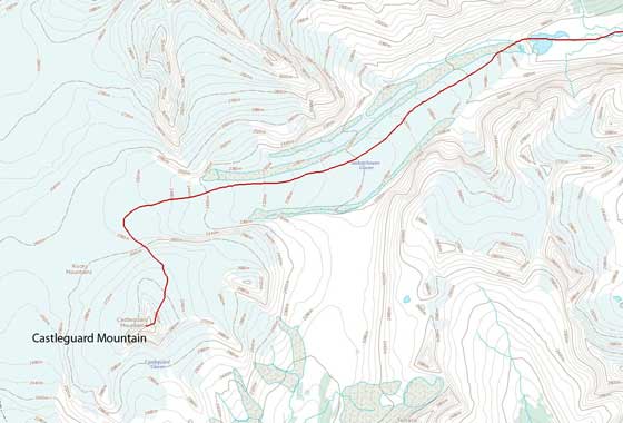
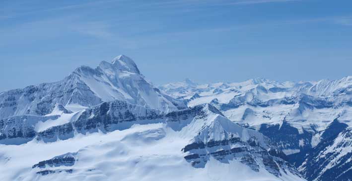
Castleguard Mountain ascent route via Saskatchewan Glacier
Chic Scott’s book says the round trip distance is 30 km which I thought was overly optimistic. I did not own a GPS unit but after some careful measurement on the topographic map I figured the distance should be around 36 km. The forecasted -15 degree overnight temperature never reached but it was still fairly cold in the morning. The snow bridge bridging the initial river crossing was gone but thankfully we brought 4 plastic bags just for for the river crossing purposes. With the bags we didn’t have to take the boots off which was always nice. For some reasons we weren’t able to locate the skier’s tracks leading into the forest but we did mange to find the trail at some point. After ascending up and over a small hill we found the avalanche path on the other side had already slid. We traversed and descended to the valley floor.
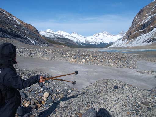
From the valley bottom to the toe of Saskatchewan Glacier, it’s a mix of moraine and snow… This is probably the worst type of terrain especially on the way down when the snow has softened. On top of that we had to battle against a not-overly-strong, but cold and sustained head wind. After trying to stay on snow for a few kilometers we got tired of the hopping so removed the snowshoes and just walked on the moraine. We stayed on the left side of the main stream and ended up being on the left side of the thawing lake. An overhanging glacier blocked our way in… We had to back track for about 500 m to find a solid place to cross to the other side. It did work, but lots of up-and-downs were involved. Near the toe, there are several mini stream crossings and mom carelessly slipped into one and got her boots soaked…
Up and over the forested hill, we got first beam of sunlight. Andromeda in the far distance. It’s gonna be a long way in.
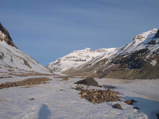
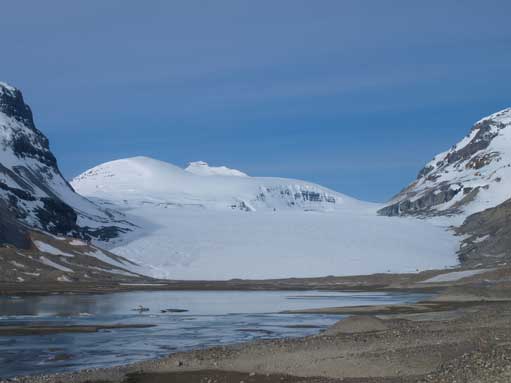
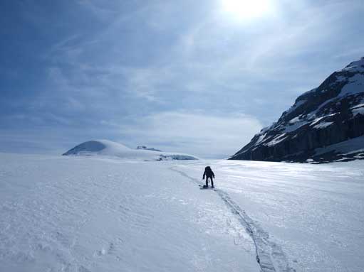
Now we got our first view of Saskatchewan Glacier
The glacial lake was thawing… We were forced to backtrack to the other side.

We had to negotiate a maze of possible paths. Got turned back several times.
Now we were on the correct side, still km’s of moraine to negotiate.
We weren’t quite sure what to expect for the glacier but immediately after the initial rise I found bare ice that’s clearly due to wind blown. Probing through, I found the snow was actually quite shallow and we roped up soon. I agreed with what Nugara described in his book: walking on Saskatchewan Glacier is like driving to Saskatchewan… There’s little to explain, just to follow the glacier, staying on right of center. You will find a medial moraine seperating the main glacier from the branch coming from the slope of Andromeda. Staying left of this moraine and follow it up. Near Castleguard Meadows, the glacier swings right slightly and gets steeper for a short section. For the next several kilometers towards the final headwall, we could see the impressive ice falls along the slope of Mount Andromeda, which makes the approach a little bit more interesting.
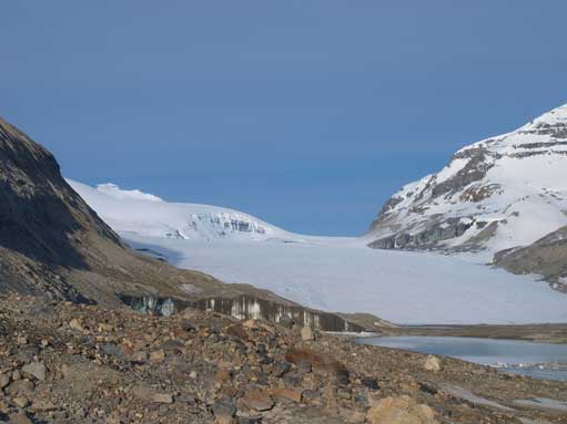
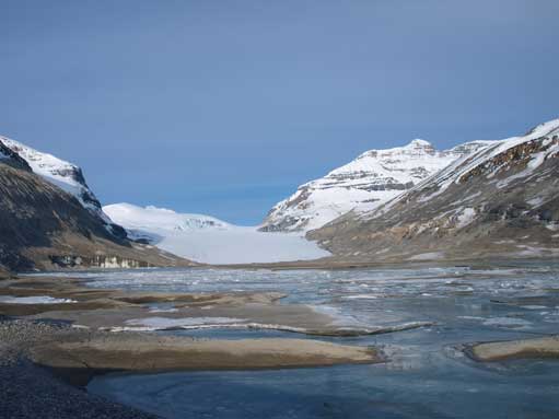
The start of Saskatchewan Glacier. It becomes bigger and bigger as we were approaching, and then, it’s a massive chuck of snow field when we actually stepped onto it.

Impressive ice scenery on Mt. Athabasca
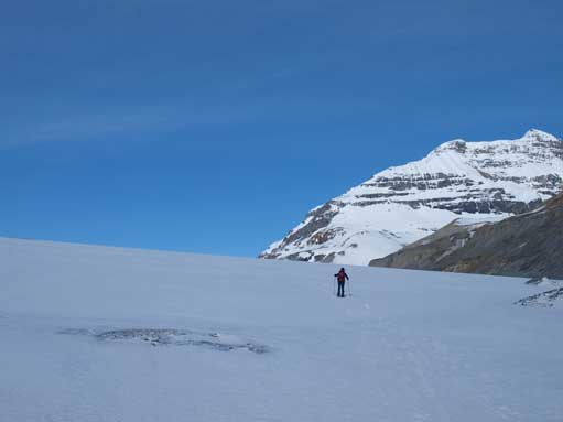
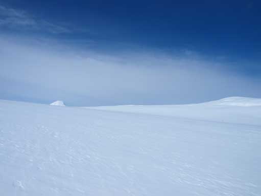
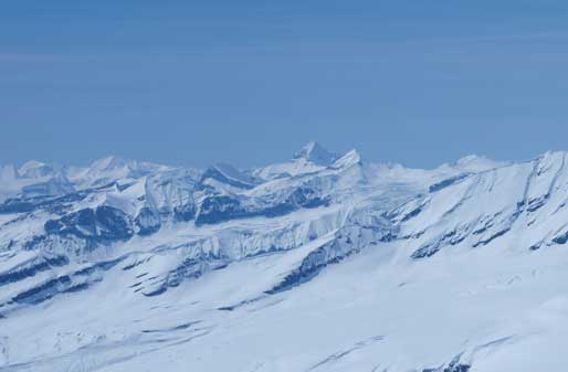
Now we were km’s up the glacier, and the objective just wouldn’t appear to be any closer.
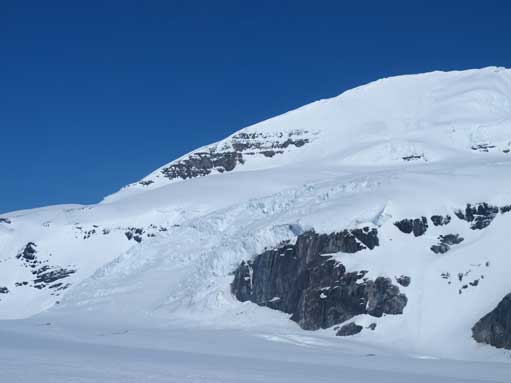
We were approaching this impressive icefall coming down from Mt. Andromeda

Going up the glacier. Typical view.
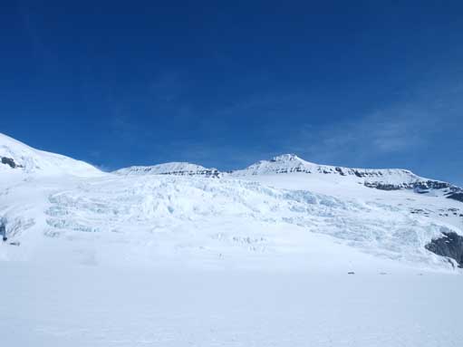
The icefall coming down from Andromeda
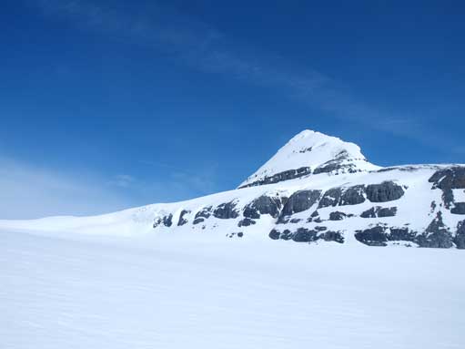
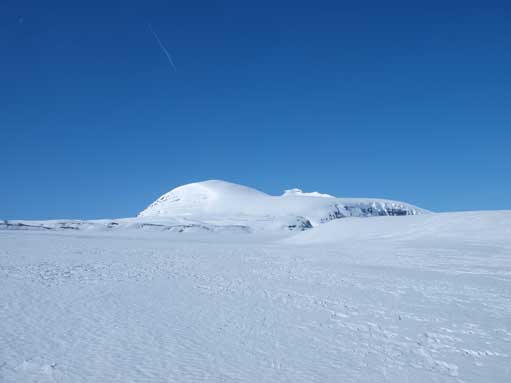
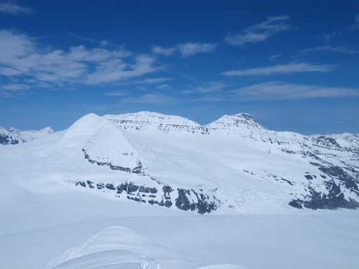
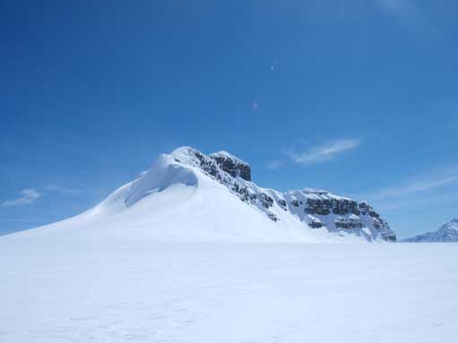
An outlier of Andromeda.
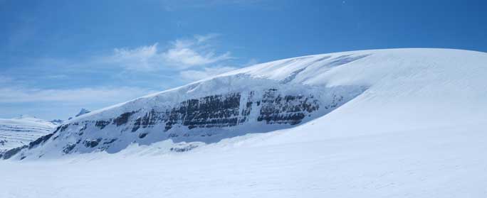
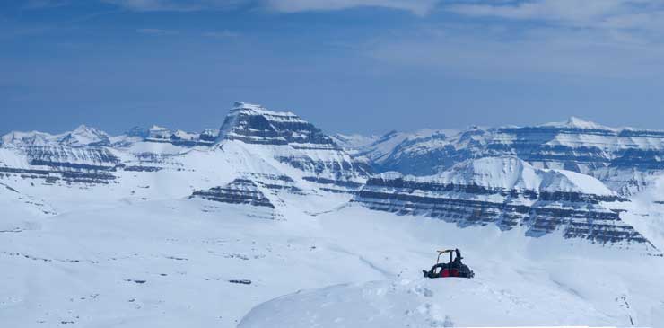
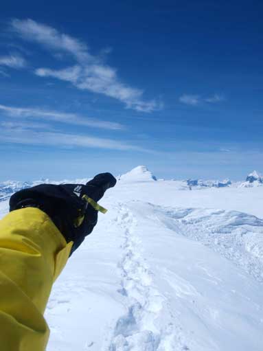
One more uphill, we would top out on the Neve.
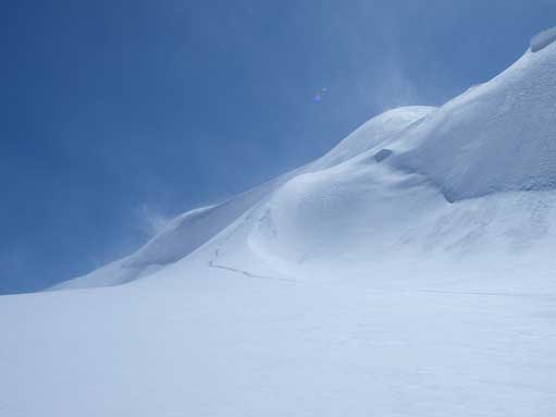
The ramp up the north slope of Castleguard appeared immediately to our left, but actually quite far away. We kept marching up and the round-shaped Snow Dome gradually showed up behind the horizon, followed by the “white whale” – Mt. Columbia. At this point, mom couldn’t continue due to physical limit just like the day on Wapta Icefield last month. After some hesitation and internal debating I made the call to resume the ascent solo, while mom would wait for me on the icefield. As I slowly gaining height up the north-facing slope ahead, North & South Twin slowly appeared behind and the immense Columbia Icefield slowly showed up its entire entity. My objective, Castleguard Mountain looked completely different from its base than from afar so I got confused as which ridge to take. I ascended a steep wind scoop, but only to find that I still topped out on the wrong (north) ridge… Well, I did have Andrew Nugara’s trip report in my memory so I knew how to correct my mistake. After some steep traversing I did mange to make to the final slope and some step-kicking up a 40-degree slope later I arrived at the summit, with mind-blowing views towards every direction.
Mt. Columbia started to show up, as I gradually gaining elevation.

I went up the wrong rib, and the terrain was very steep.

And I had to cross the snow filled bergschund…
Cross this snow lip/cornice due to off-route.
Back on track. Now I was on the correct snow face.

Getting closer to the summit. The Twins in the background.

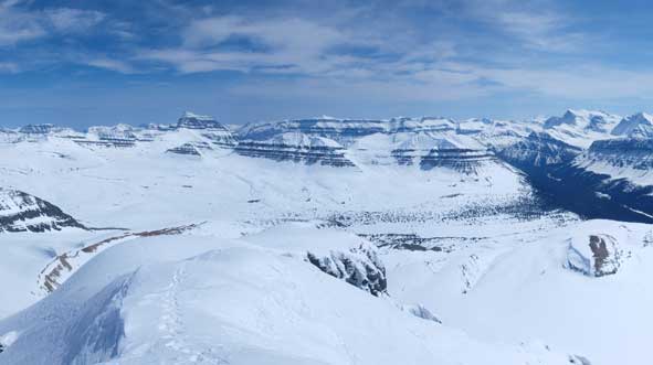
Summit Panorama. It’s my all-time favourite. Click to view large size.

Looking down the long approach and Castleguard Meadows
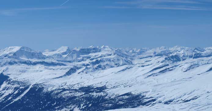
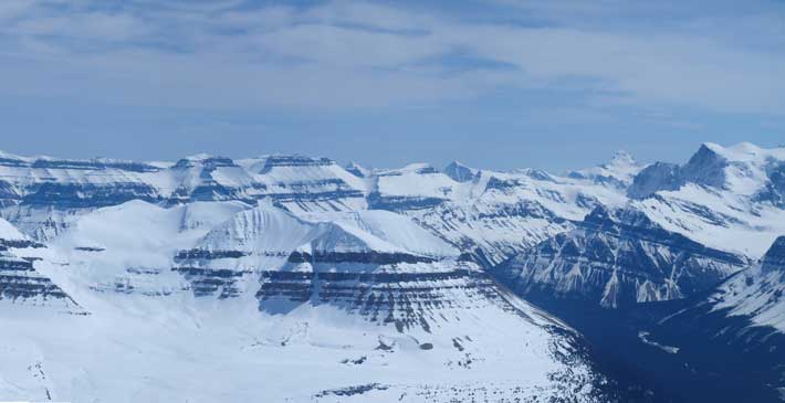
Impressive mountains – Saskatchewan, Amery, etc.

Alexandra River Valley, with Forbes, Lyells, Alexandra in the background.

Mount Bryce, and behind it is the Bush River Valley

Looking down another ridge, and you can also see a heavily crevassed area.
The distant Selkirks. Don’t really know their names.
The impressive Mount Bryce
Tsar Mountain in the far distance
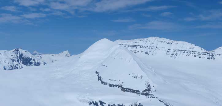
An outlier of Andromeda, with Mt. Andromeda on the right side.
Mount Columbia

Looking over some unofficial peaks towards Cirrus Mountain in the background.
Mount Saskatchewan
On the left skyline is part of Monchy Icefield. Mt. Forbes pokes from behind on right skyline
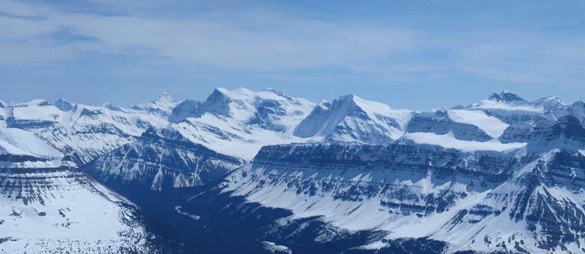
Mt. Forbes rises behind Lyell I, II, III. Oppy Mountain right of center and Mt. Alexandra on far right.

Mt. Spring-Rice on left.
Andromeda and Athabasca

Snow Dome

South Twin and North Twin

Panorama of Columbia Icefield
Now I want this!
After taking the numerous panoramas, I didn’t linger any longer but heading down soon. I used the correct east ridge on the way down, and it was way much easier than the “wind scoop/north ridge/cliff base traverse” route. If I took this way up, I could probably save half an hour. Descending took no time and I soon re-joined my mom at the base of the north slope. We had a quick lunch break. Due to the wet boots/foot, mom was getting very cold and we must kept moving.
Looking back towards my up-tracks. This is NOT the correct route.
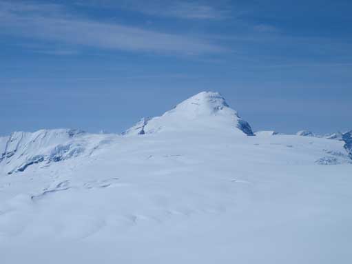
Castleguard Mountain. I was up there 1 hour ago.
Descending Saskatchewan Glacier provided the best example of “marching asleep”. Needless to say, it was very boring. I kinda hope to do this mountain as a ski trip because the terrain is so gentle and my skiing skill can probably handle it. Repeating the same motion again and again and again… After the glacier swings left, snow got slushy. I forgot how long it took us down to the toe. We took a long break at the toe, getting all the glacier gears into backpack, and taking off snowshoes. The final 8km back to car proved to be the hardest. The moraine got muddy unsupportive and snow got isothermal. Post-holing the last 3-4km was a nightmare for us, sometimes calf deep, mostly knee deep, and sometimes thigh deep. We also lost our tracks on the way in and were forced to bushwhack a kilometer or so, thankfully no bears. The final grind up the hill was a slog but thankfully the avalanche debris provided some harder snow to step on. Since our boots were all wet, we didn’t bother to use plastic bags for the final river crossing, but using the river to wash our boots instead.
Now comes the long walk. I tried to see how long I could close my eyes without falling…
Looking back. Oh the long Sask Glacier…
Exited the Glacier. Time for moraine walk. It became muddy unsupportive, and snow got isothermal.. Oh man…

Walking passing the North face of Big Bend Peak.
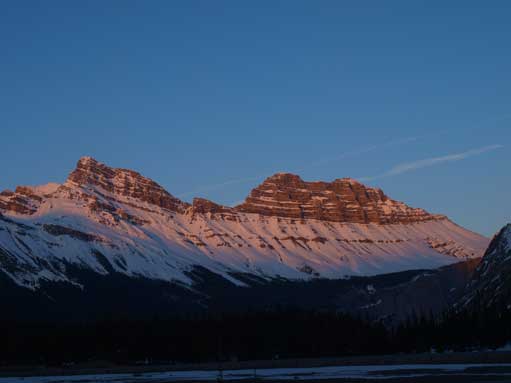
Sun was getting low by the time made to the river crossing.
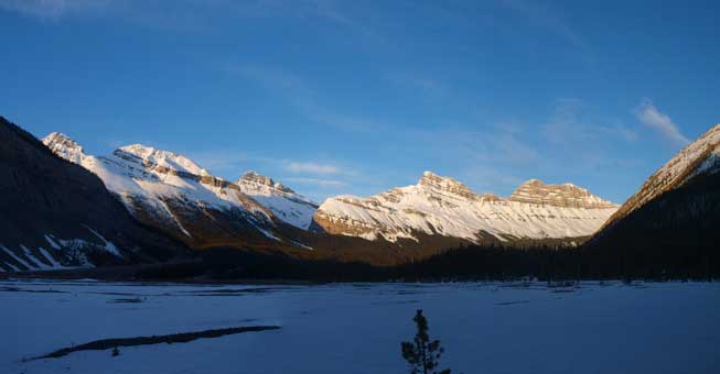
Cirrus Mountain at dusk.
I should say I underestimated the challenge. Although exhausted, I didn’t get blisters, so I might have the energy to make another smaller summit on Sunday like Big Bend Peak. However, mom felt like having a cold so I decided to drive to Jasper to get some hot stuffs in the following morning. On Sunday morning, I felt a slight injury on my right thigh’s muscle… Although Cinquefoil Mountain is in shape now (well, the only one in shape in Jasper area), I had to save it for another day… After taking some morning photos on Patricia and Pyramid Lakes, we drove back home. Anyway, with a big mountain done, I’m quite satisfied with the weekend.

Did you take the man made log bridge over the North Saskatchewan? And was it as dangerous as people say it is?
Old post, but the question seem to be unanswered…
I don’t know how it would be in May, but in summer months, the log bridge is very easy to cross. It looks rickety but an elephant could cross it. It has been there, in photographs, literally, for decades.
Old question, but seems to be unanswered…
It has been there for decades, with photographic evidence. There’s nothing hard or dangerous about it except that you look down into a churning chasm on the way. An elephant could cross it. I’ve been there in both August and September, never in May. I don’t know how it would appear with snow.
When I did Castleguard in May, I simply used snow bridges to cross the river. It’s well bridges.
I came back for Mt. Saskatchewan a few years later in August, and I waded the river wearing river crossing shoes. Knee deep, not too bad. I was aware of that bridge but that would add distance into trip, so I opted for the shorter option.