Cirque Peak
July 24, 2011
2993m
Icefield Parkway (South), AB
Coming back to Canada after winning gold medal in IChO, Turkey, I decided to do some scrambling and hiking which I had been thinking about since last summer. Cirque Peak was my first objective, located in Icefield Parkway Area, Banff National Park. I did have some experience of scrambling on The Black Tusk in 2009, but this was the first time I summitted a scrambler’s peak. Also, this was the first trip after IChO, as well as the intense studies in Grade 12. I hadn’t been hiking since last September. Although the difficulty of Cirque Peak is only “easy”, the lack of experience and lack of exercising made things harder. At that time, I still had trouble slogging up scree slope.

Cirque Peak standard scramble route
The trail head is located 33.2km north of Highway 1 on the Icefield Parkway. It’s the same as Helen Lake / Dolomite Pass trailhead, so not surprisingly, there were already many cars by the time we arrived. The initial part went by slowly and I had to catch my breathe regularly on steeper sections. Not far up, we were treated with the view of Crowfoot Mountain and Bow Peak. Further up, the trail enters alpine meadow terrain and we followed this highway to Helen Lake. There were at least 5 marmots bagging for food. I guess they’re already food conditioned… I hope tourists don’t feed bears though… We took a break at the lake while soaking in the views.
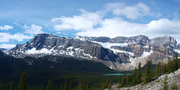
Crowfoot Mountain and Crowfoot Glacier

Bow Peak
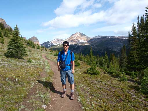
Me on Helen Lake Trail, with Cirque Peak behind
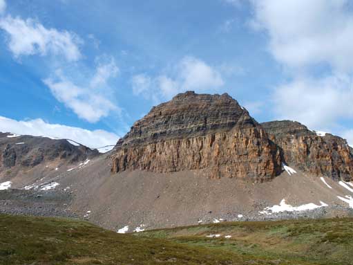
Crystal Ridge on left; Cirque Peak on right
At Helen Lake now, Cirque Peak behind
One of the interesting rock features on Crystal Ridge
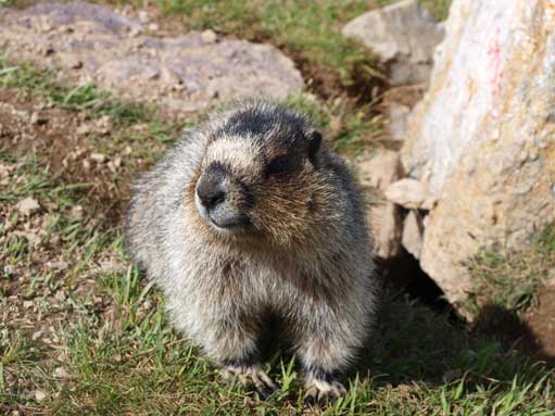
Lovely marmot

The same marmot
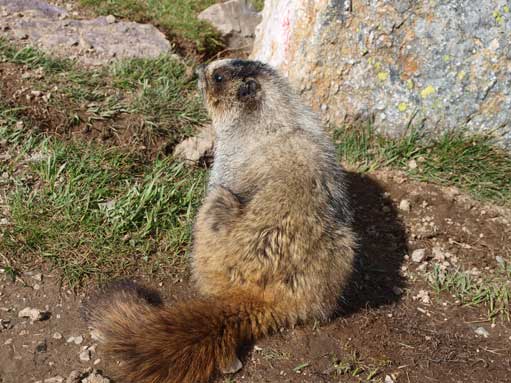
Another shot of this creature
Another shot of Helen Lake
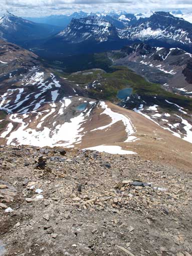
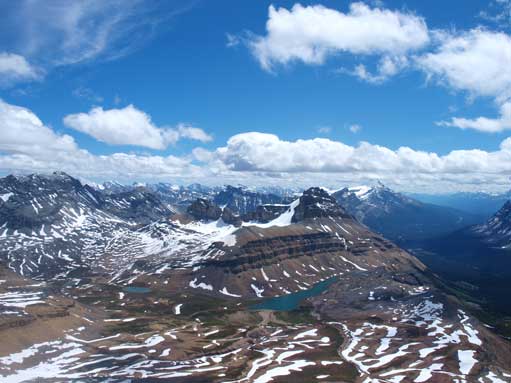
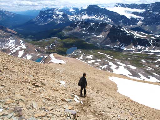
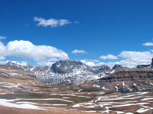
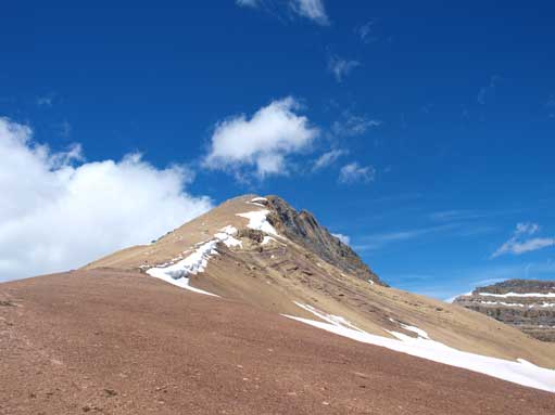
Passing the lake, the trail rises steeply up a headwall. By the time of July 2011, I was more of a hiker than scrambler so I felt this part was a bit exposed and I had to move carefully not to slip. The correct ascend line to Cirque Peak skirts around the base of the obvious cliff bands but we had to ascend the cliff bands due to snow patches lingering on the east side of the slope. Thankfully the cliff bands are well cairned and easy to negotiate. After that, it’s mainly a scree slog up. Initially the scree is firm but the higher you go, the looser the ground is. I wasn’t very comfortable on loose ground and I was pretty scared near the top. A short hands-on section led me to the false summit. I waited for 15min on the false summit for dad to show up. Despite this false summit is lower, it has better view than the true summit. We got head-on view towards Bow Lake and Wapta Icefield. This was my first time seeing the Wapta, and I was amazed. We carefully made our way towards the true summit, mainly butt-shuffling. From the true summit, we got good view of the 3 summits of Willingdon.
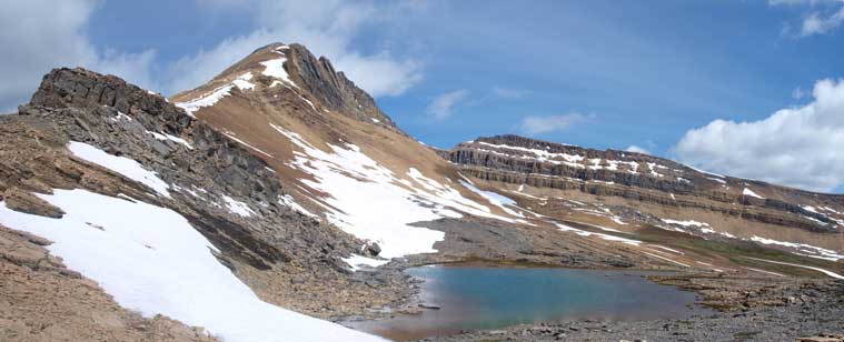
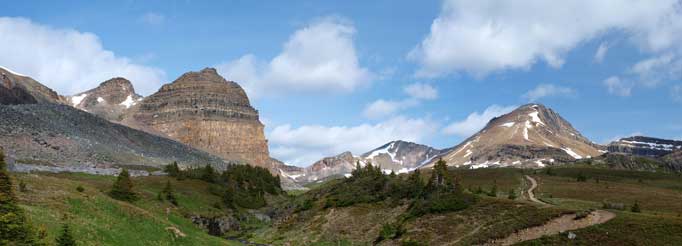
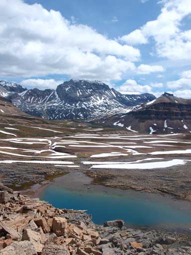
The route goes on left skyline overcomes the obvious rock band. The tarn is unnamed
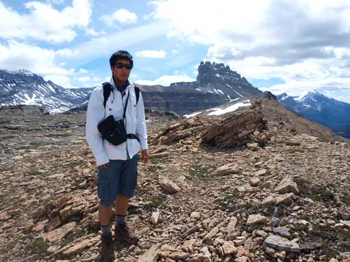
Me on the shoulder, with Dolomite Peak behind
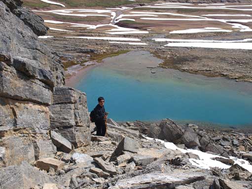
Dad scrambling through the rock band, with the unnamed tarn below
Looking down at Helen Lake. Bow Peak and BowCrow Peak behind
Watermelon Peak behind.
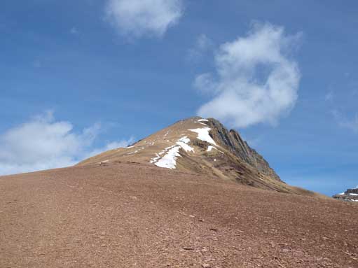
The typical slog up Cirque
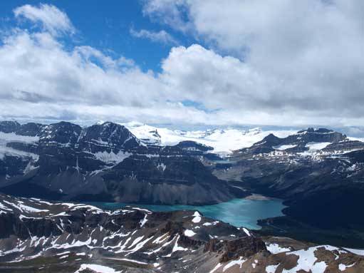
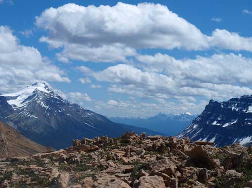
Nice view towards Bow Lake and Wapta Icefield
Zooming-in towards Wapta Icefield
Looking back at dad slogging up scree

There’s a steeper section requires some hands-on moves. You don’t go straight up this rock face though.
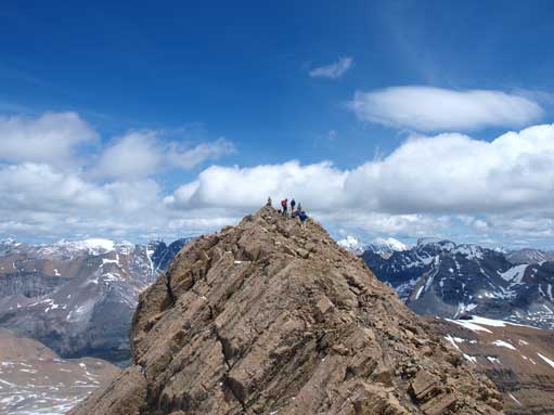
True summit seen from false summit

Looking North from false/true col
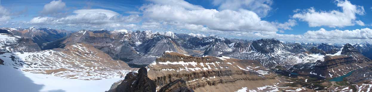
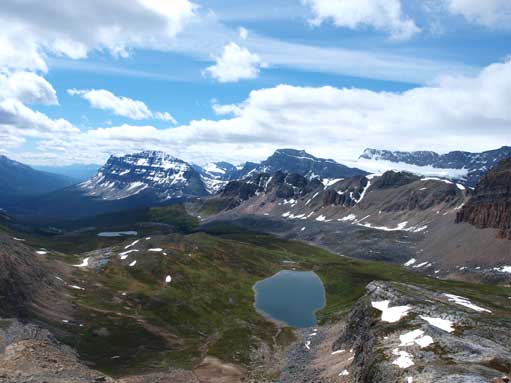
Panorama looking towards the front range peaks, from true summit
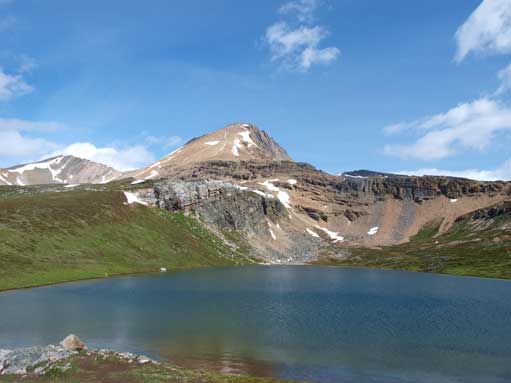
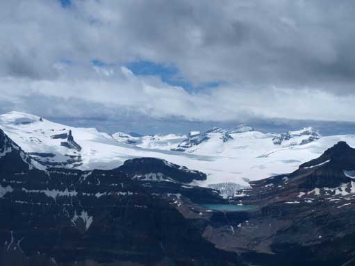
Dolomite Peak with Lake Katherine below
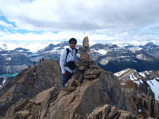
Me on the summit
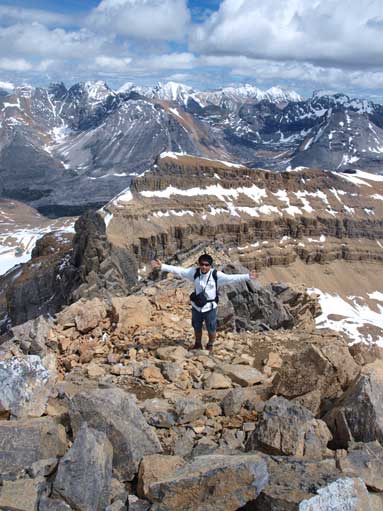
I went down the East side for a bit, posing for a shot
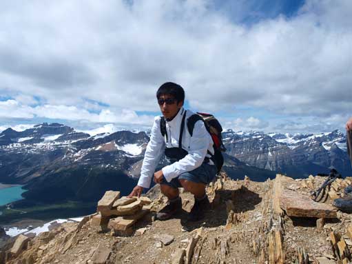
Me on the false summit
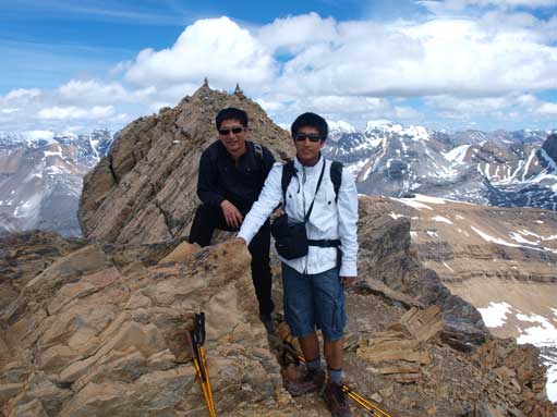
Dad and I on false summit
We stayed on the summit for about half an hour, and slowly moved down the loose slope. We didn’t linger around the trail long as there were more and more tourists coming in afternoon. The weather also cleared up quite a bit by the time we got back to Helen Lake. I could feel blisters on my feet by this time. The hike back to car felt much longer and we stopped at Bow Lake for photos after finishing the trip.
Descending
Watermelon Peak
Looking back. Weather was getting nicer
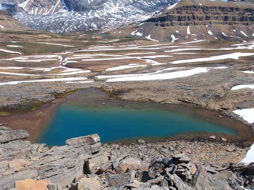
The unnamed tarn
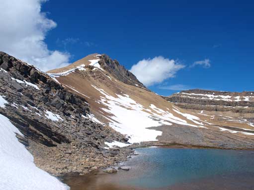
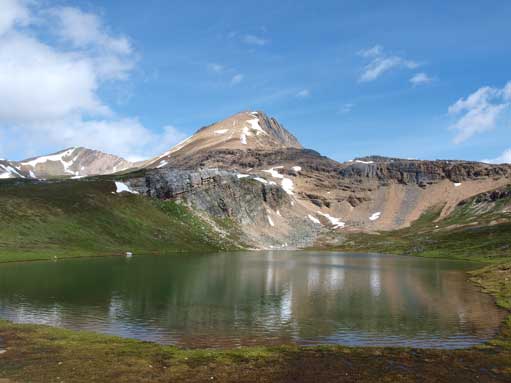
Cirque Peak and the tarn
Mount Hector on left
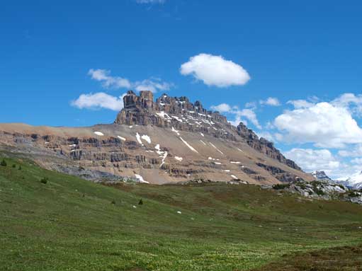
Dolomite Peak
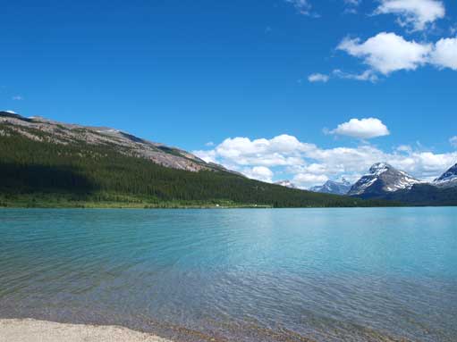
Back to Bow Lake

First of all, I’ve learned that you are the only ever Canadian to win a gold medal at any Chemistry olympiad. That is fascinating!!
The way you’ve chosen the career and hobby paths are as intriguing.
Some would have went for research to someday get the Nobel prize for chemistry, not sure if you have such goals in mind, perhaps Piolet d’or.
Cheers