Sierra La Laguna High Point
March 20-21, 2022
2080m
Baja California Sur, Mexico
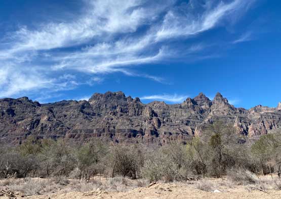
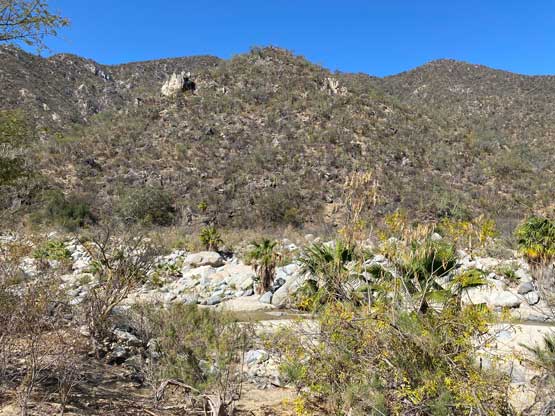
Sierra La Laguna is a mountain range on the very southern tip of the Baja peninsula. The highest point of this range does not have a name, but boasts close to 2000 m prominence and over 300 km isolation and is also the highest point of the state of Baja California Sur. This area is like the oasis of the vast desert. The mountain range is actually mostly covered by trees with some running creeks and rivers and wildlifes that aren’t typical in the deserts. The trail system is excellent but to reach the highest point one has to hike over 15 km each way as no road goes anywhere close to it. There are two published approach options. The western approach was used to be the standard route, but the road access requires a 4WD vehicle and is subjected to some fees and gate hours associated with a private ranch. The eastern approach is longer with more up-and-downs but the road access is much easier. Though still unpaved, the “beta” says a 2WD vehicle is sufficient enough. Doug, Arthur and I initially planned on taking the shorter western approach but eventually opted for the access certainty. We only had a Subaru Forester which is not bad, but definitely not the best 4WD vehicle out there neither. We eventually improved this eastern approach to the point that it’s not longer than the west side route anymore, such that I believe our route would become the new “standard route” for the future parties.

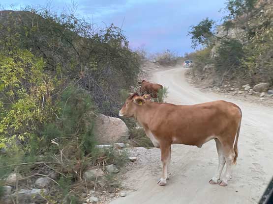
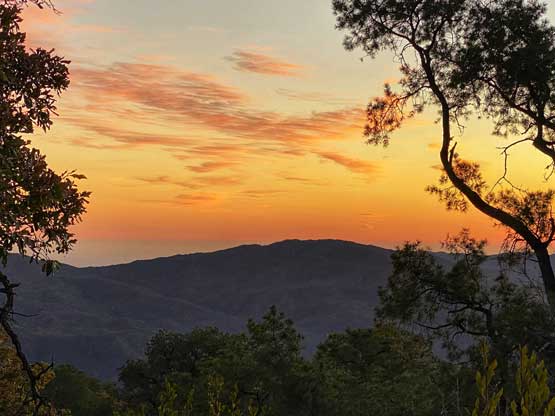
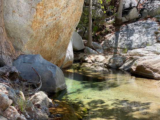
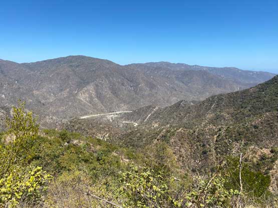
Earlier in the trip we had ascended Volcán Las Tres Vírgenes in the central part of the peninsula and now we had to drive about a full day down south to the very southern tip past La Paz. About half an hour past Santa Rosalia we stopped for a breakfast of burritos and then resumed onward. As expected the drive itself was scenic with views of both sea and the mountains. We could see some impressive walls and peaks and checking the peakbagger app we realized that none of them has seen much activity, likely due to the access issues. About halfway into the long drive we followed the highway to cross the main ranges from the east shoreline to the west, descending into Ciudad Insurgentes and then it’s a long and boring drive down south-east towards La Paz, without much views anymore. We arrived in La Paz in the late afternoon hours and spent at least one hour shopping for food and supplies. There’s still about 2 hours of driving and our last stop was a local Mexican restaurant called Pericu in the small village of Santiago (not the Santiago in Chile). The food was extremely good and the owner even speaks English. The drive from Santiago to the trail-head was about 20 miles and took about an hour if not more. The road was indeed “2WD” but was unpaved and windy enough that care must be taken the whole way. We eventually made to the trail-head when it’s already pitch dark and the decision was made to plod at least 10 km to the “halfway camp” beside the biggest running creek on the route.

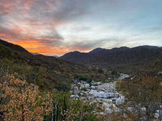
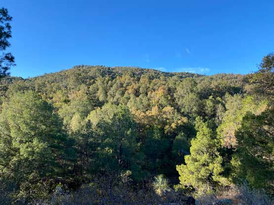
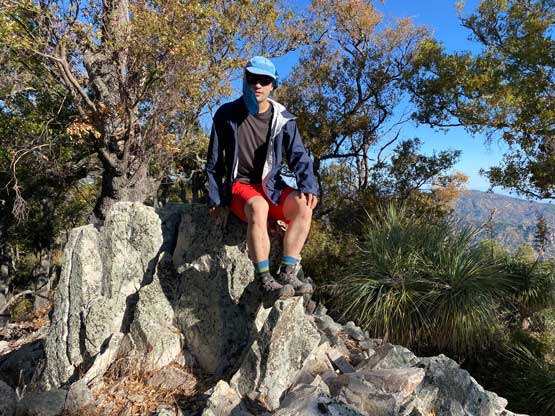
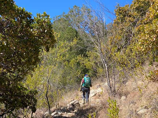
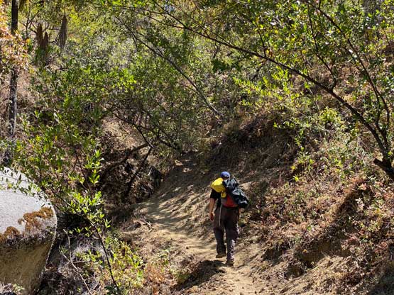
At this far down south the climate was quite different than the typical deserts we are used to in the SW US states. The forecast was calling for temperatures in the range of mid 20 to mid 30s such that both Arthur and I made a spontaneous decision to just wear shorts, which turned out to be a bad call but more on that later. I also went shirtless for the approach to keep my hiking shirt dry for the next day. The 10-km approach to the camp was entirely on a trail and I hated boring approaches like this, especially in the pitch dark so I plodded behind the others and listened to music the whole way to kill time. The trail was also not the type that I’m used to in the Pacific NW. The sandy conditions meant more effort was needed per kilometer of hiking and I was not particularly stoked about that. The trail also did numerous short descents which was fine for now, but could become a pain in the ass a day later on the return. A few hours later we arrived at the camp, happy to hear sounds of water but the better sites were already occupied. The three of us had to squeeze into one site. It was definitely not roomy for the three tents but we made it work nonetheless.

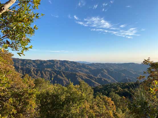
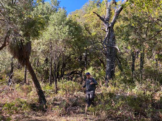
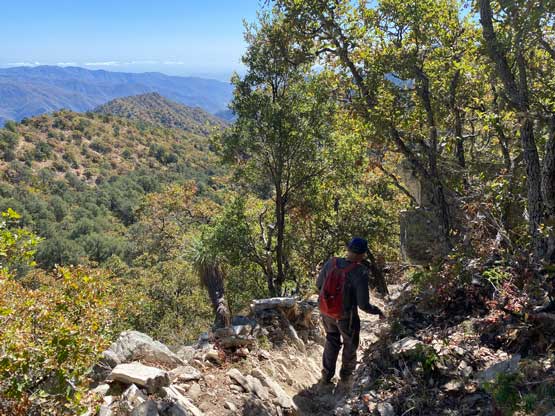
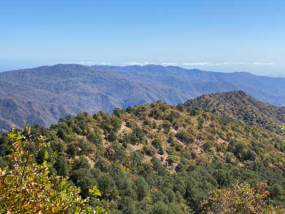
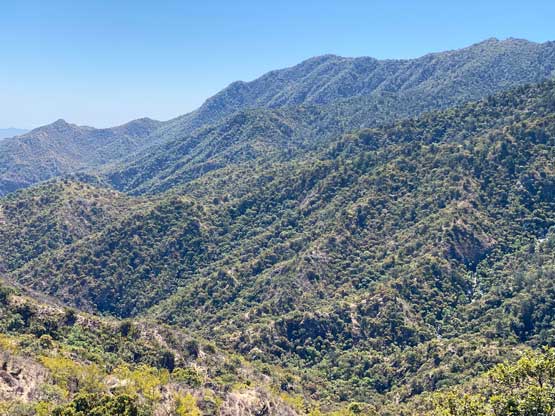
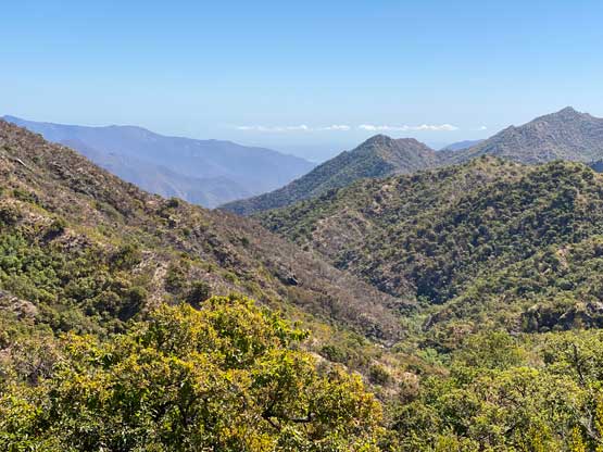
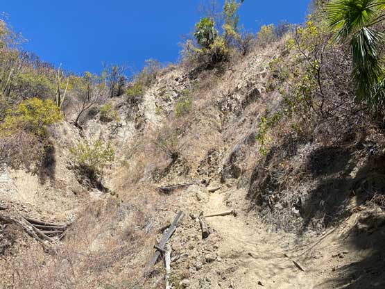
Doug and I decided to wake up at 4 am to ascend most of the way in the dark to beat the heat. Arthur, being the fastest person I’ve ever hiked with, opted to start a few hours later to catch up with Doug and I near the summit. I opted to start about 10 minutes behind Doug so that I could plod at my own pace and also to keep listening to music to kill time. Sierra La Laguna is rather just a long ass boring slog on a trail which is kind of my least favourate type of peak-bagging. Eventually the terrain sort of petered out at around 1500 m where we were greeted by the morning sun. The improved views had boosted my motivation a little bit but we still had over 5 km of boring plod to the base of the “summit block”. The reference GPX track continues due west over some undulating terrain for a few more kilometers before making an ascent towards the summit on some less-defined path for another few more kilometers. I looked at the map and talked to Doug about an idea to short-cut this entire stretch by directly ascending the north slopes. This surely would involve bushwhacking but would shave off about 4 km each way on the trail and the associated up-and-downs. Doug agreed with this idea and followed me for the adventure.


My motivation now got a sudden boost as I liked exploring parts that seemed totally doable but had no “beta” on the internet. We initially had to ascend up and over one minor bump and the bushwhacking was at a sustained level 2+ out of a scale of 5. The going was harder than I thought overall, but wasn’t too bad as the bushes were mostly free of thorns. We did encounter a few bands of brambles but those were very short-lived and not really bothering. Once starting the actual 250-m ascent towards the summit we actually picked up game trails here and there and by connecting them we actually avoided most of the bushwhacking for at least 2/3 of the way. The upper 1/3 had some unavoidable bushwhacking and the route-finding to avoid the worst of it was rather tricky, but honestly all we needed was some patience and positive attitude. We eventually nailed a line to avoid any real level-3 bushwhacking but on the other hand, it was definitely not an “easy off-trail stroll” neither. The summit was occupied by some ugly communication towers with no view whatsoever. Little did we know that we could actually climb the vertical ladder to the top of these observatory structures. I didn’t even bother to check out that kind of options as I wasn’t thinking outside the box here, so for us this was rather a dumpster, no-view summit. But some others got that 360-degree panorama…

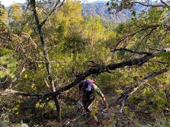


To descend we simply retraced our GPS track for as close as possible but we still briefly got off-track here and there. Thankfully we corrected those mistakes not far after realizing. Wearing shorts had taken a toll on me by this stage. Despite that the route had very little thorny stuffs, the bushwhacking was consistent and the brushes were mostly stiff and pokey. My legs were literally destroyed by the time we made back to the main trail. We weren’t sure what Arthur was doing at the moment, so just leisurely plodded back towards camp. I went ahead of Doug and made back about 15 minutes earlier. Arthur was nowhere to see, so we assumed that he took the longer route around to the west side of the summit block. Arthur eventually showed up over an hour later with beta that the “standard route sucked”. Judging by the look of his legs Doug and I were even happier about our decision to take that short-cut. The last few kilometers on the “trail route” was rather bushwhacking on a path.


After spending some time to pack our camping gears we soon set out on the final 10-km death march to get out, now in the 30+ degrees heat. Again, we all went on our own pace since it was kind of important to get into our own rhythm for slog fests like this. I eventually felt some hotspots on my left foot. I stopped a few times to dry off the socks but that’s all I could do. I brought nothing to treat a developing blister since I had confidence about these trusty trail runners, but on this day they let me down. I developed two blisters with one being rather massive. I could barely walk after changing footwear at the end of the day, making me having some concerns for the rest of this trip. It turned out that the blisters mostly healed over the next two days so the mission was not affected.


We finished the trip in the late afternoon hours and drove straight back to that Mexican restaurant for some massive dinners. I ended up ordering 6 Tacos and a bowl of Nachos which was more than Doug and Arthur’s food combined. I actually finished most of the food and the leftovers would be served as breakfast in the following day. We drove back to the same supermercado in La Paz for more shopping before resuming the drive northwards. We pushed to about 1 hour into the darkness. Doug found a neat spot to camp about 5 km off the main highway, so we pulled in and slept. Again, I just opted to sleep inside the vehicle for simplicity.

