Eagle Pass Mountain
August 29, 2020
2347m
Revelstoke / Sicamus, BC
Eagle Pass Mountain sits about halfway between Revelstoke and Sicamus in the Highway 1 corridor in the central Monashees. This peak boasts decent amount of prominence and is very easy in terms of access and technical difficulties. With a 4×4, high clearance vehicle one can drive up the Crazy Creek drainage and partially up the SW Ridge to within 900 vertical meters from the summit, and there’s a well-maintained trail running all the way to the summit with only a few steps of scrambling here and there. The summit also boasts a sizeable lookout site that one can bring a sleeping bag to overnight up there. For all said, this is a fairly popular hike among the locals living in the interior BC.
I was aware of this peak by simply browsing the maps over the past years but the decision to hike it was a spontaneous one. I happened to be in the area after finishing the 11,000ers list in the Canadian Rockies. I was driving back home and the weather was clearing up. I had a few extra hours to kill. I had not done much in the Monashees yet and I was looking forward to the views. The research stage took literally only a few minutes as the trail and roads were all marked on my Gaia app, so all I needed was to download the map to save for offline use.
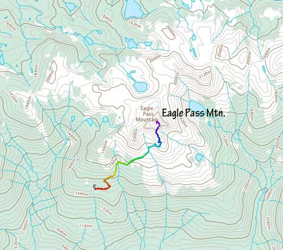
Eagle Pass Mountain hiking route. GPX DL
The drive on the logging roads was quite long and definitely required decent amount of clearance towards the upper end. It did not boast much of a problem to my trusty Tacoma. The first half of the hike was rather boring in the thinning sub-alpine forest and the views didn’t open up until above 1800 m elevation where I traversed into the alpine meadows zone. I spent some time taking photos of the flowers.

Flower photo is a must for August..

The trail and the sub-alpine meadows
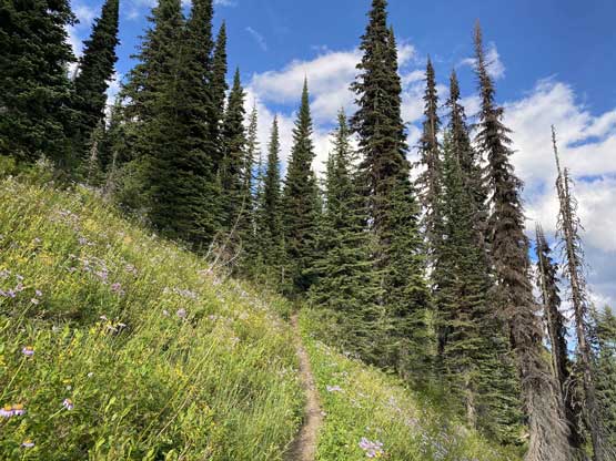
More about the trail…
The trail was a little bit confusing and indistinct but was at least well-marked by cairns. There’s one ledge traverse to get onto the SE aspect of the peak and then the trail did some steep ascents onto the SE Ridge and then the summit. There were a few batman ropes to aid the steepest spot near the top. I was not aware of the lookout site on the summit and I regretted for not hauling my sleeping bag up there to stay a night. There were two ladies in the hut already and they were going to spent the night there. I stayed on the summit for about an hour watching the ever-changing lighting.

My objective looks pretty impressive

Looking up towards a sub-summit

Mt. Begbie and Mt. Tilley that I ascended in 2017

Almost onto the SE Ridge now

Mt. Sir Donald pokes to the east
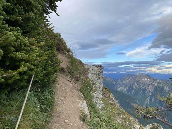
A batman rope to facilitate a steep and narrow spot

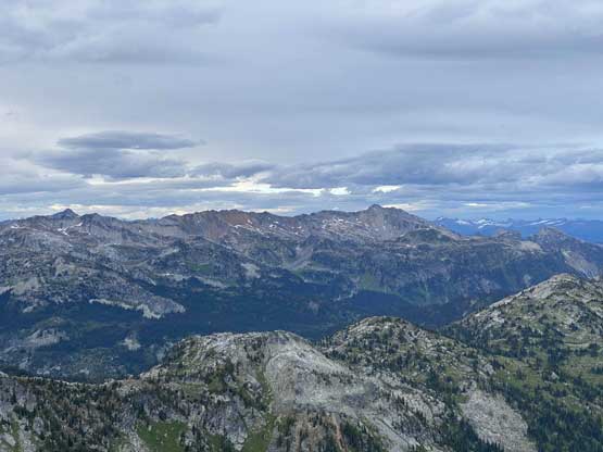
Partial Summit Panorama from Eagle Pass Mountain. Click to view large size.

Partial Summit Panorama from Eagle Pass Mountain. Click to view large size.
Mt. Copeland on Copeland Ridge to the north
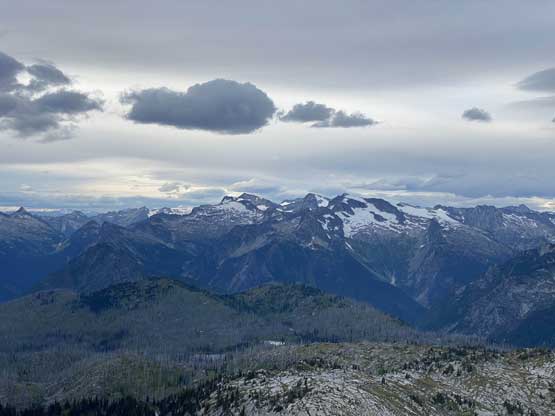
More about the peaks to the north in the Monashees

Lots of unnamed peaks in Anstey Range of the Monashees
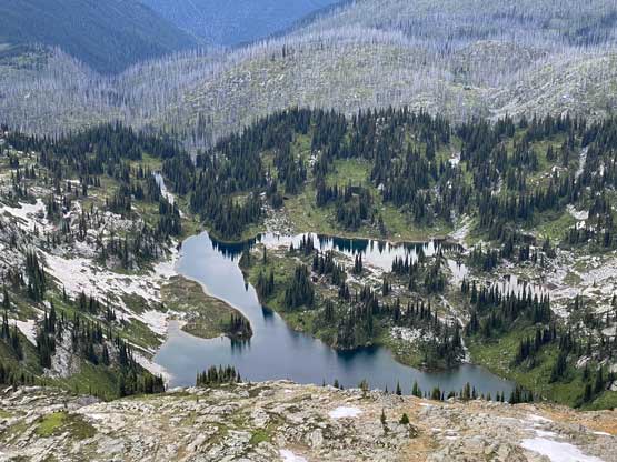
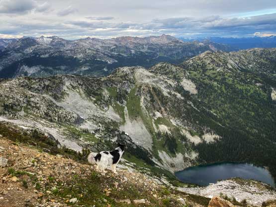
One of the sub-alpine lakes

Mt. English south of Highway 1
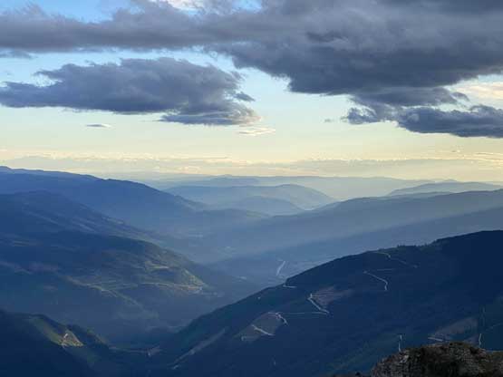
Looking west towards the Okanagan-Shuswap Highlands

A beastie on the summit
The two girls went to grab some snow for water
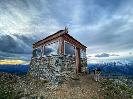
The luxurious summit hut!
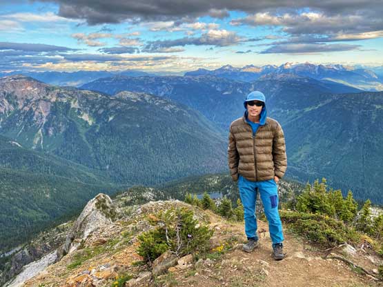
Me on the summit of Eagle Pass Mountain

One of the girls taking in the scenery

The beastie and the hut
One more photo of the beastie!

Mt. English at dusk
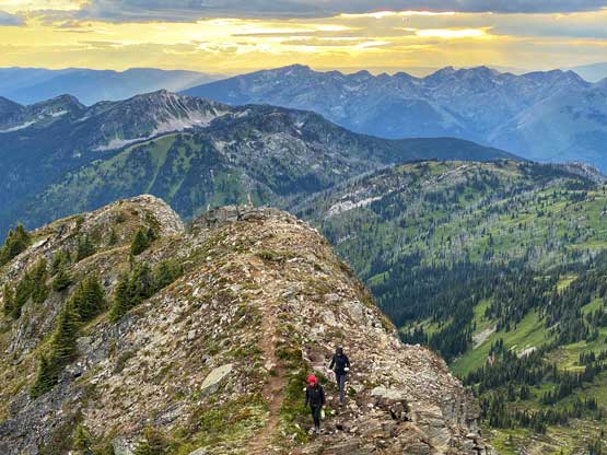
Eventually it’s the time to head down. I caught the best of sunset about 100 m below the summit and took my time taking more photos. The rest of the descent was uneventful and I did need to use my head-lamp for a while.
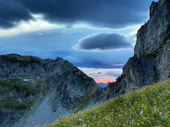
Back down the SE Ridge, time to watch sunset through this gap

The sunset was incredible!
I debated about going to Sicamus for food but nothing’s open at the late hours so I just slept in my truck on a random pull-out on Crazy Creek FSR. I also forgot to bring fuel for the stoves so I had to eat some cold Congees for dinner, which was OK but not ideal. In the next morning I drove to Sicamus for some more proper breakfast and then made an ascent of Morton Peak.
