Burt’s Bluff
June 11, 2022
527m
Gambier Island, BC
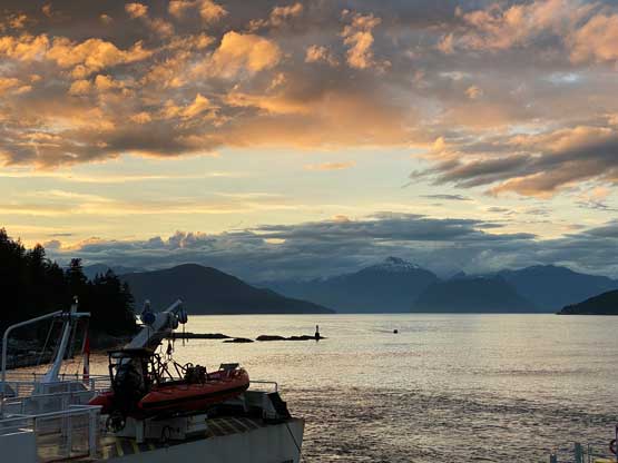
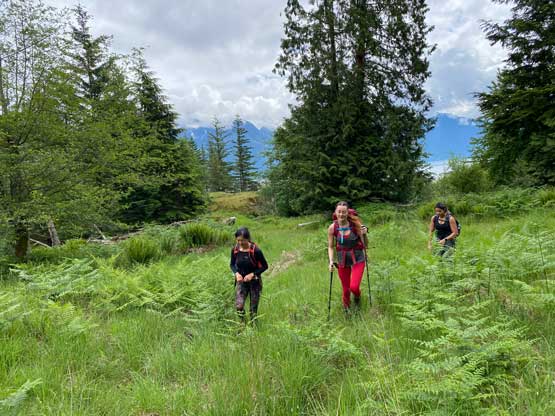
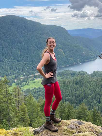
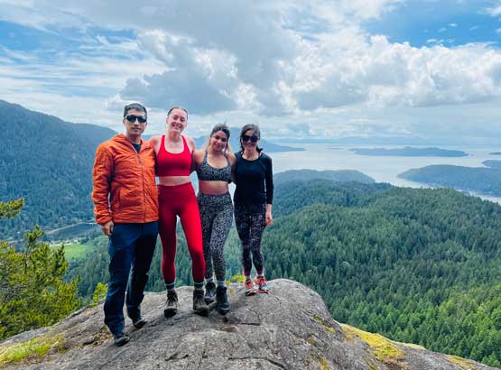
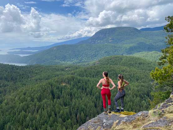
“Burt’s Bluff” is the lowest of the 4 or 5 named summits on Gambier Island but in my opinion the most interesting one. The name “Burt’s Bluff” refers to the viewpoint on the south side of the south summit but that’s not the highest point. The true summit is about 50 m taller but is entirely forested with no view. The true summit still shares the same name as the lookout. After completing the peaks on Gambier Island I would say the lookout on Burt’s Bluff actually offers the finest views so this is actually a must-do peak for hikers based in Vancouver. The access of this peak is trickier as it’s located on the more remote east side of the island and to get to this side one needs to take a private water taxi from Horseshoe Bay. Earlier in the day Ni, Preeti, Caitlin and myself took a taxi to Camp Fircom and then traversed over Mt. Artaban. The plan was to then traverse over “Burt’s Bluff” and plod all the way to New Brighton.

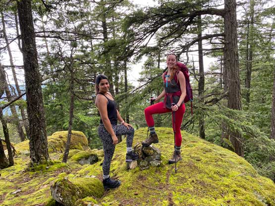
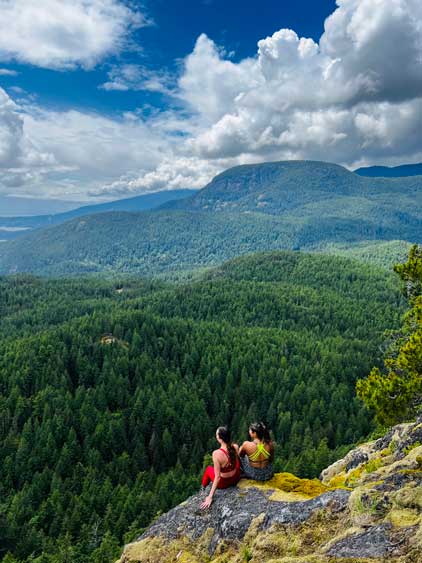
I led the group taking a short-cut beside someone’s house right at the start as the official trail was doing some weird roundabout route, probably to avoid trespassing that private property. I, on the other hand, always aim for the most efficient path. We then picked up the trail and plodded to the saddle between the true and the south summits. This section was quite a grunt. Two of us ditched the backpacks at the saddle and then proceeded to the true summit, which as advertised offered no view. We then backtracked and plodded to the south summit viewpoint. The views were exceeding my expectation so we lingered there for at least another half an hour.

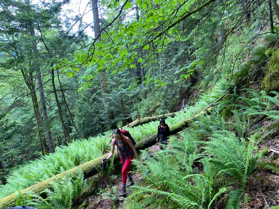


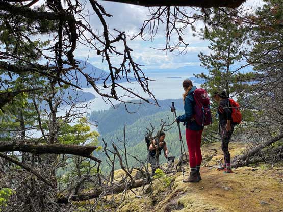
We soon realized that we weren’t doing good on time. The original plan was to catch the 4:30 pm or the 5:30 pm ferry from New Brighton to Langdale but now it seemed like we might not even catch the last, 6:30 pm ride. The last ride needed to be reserved on phone so Ni did a quick phone call. The reception was quite weak but at least they got our message. Ni asked if it’s possible to pick us up later than 6:30 pm but the reply was no, so we must hurry up. Descending the west side of “Burt’s Bluff” was not as obvious as I thought. The trail was decently marked by flagging but the foot bed was not obvious at all. It’s rather just a route than a “trail” in my opinion. The trail condition improved near Lost Lake and then we faced a stretch of undulating terrain. We then took an experimental short-cut towards “West Bay to Lake” connector to avoid going all the way to Gambier Lake. The bushwhacking was not bad at all, but there were fair amount of micro-terrain to content with including a few mossy bluffs. Needless to say our progress wasn’t very efficient, but likely sufficient enough to catch the 6:30 pm ride.

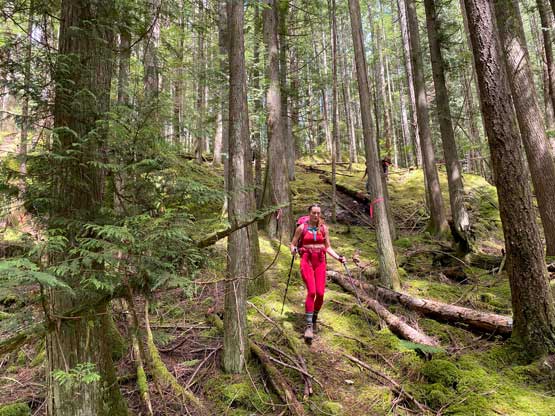

There was another 100 m or so elevation gain to plod back onto that aforementioned connector trail, which was rather just a deactivated road. We followed this road/trail down to West Bay and then picked up the logging road contouring the west side of the bay. This stretch of logging road had another 100 m gain and loss which was rather frustrating. And then we had another 60 m elevation gain and loss to plod to New Brighton. We eventually made there at 6:10 pm with 20 minutes of spare. The boat did come to pick us up in time but then we had to wait for 1 hour at Langdale for the ride back to Horseshoe Bay. The BC Ferry from Langdale to Horseshoe Bay is free. For Ni and I the plodding wasn’t over yet as we had another 1 km of uphill walking at the very end to reach of free parking lot in Horseshoe Bay. I eventually got back home at 9:30 pm, happy to have finally bagged all peaks on Gambier Island.