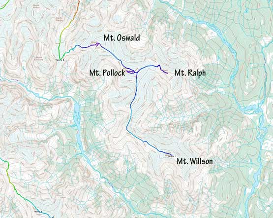
Mount Pollock
July 18, 2020
2496m
Sims Creek / Clendinning Area, BC
Mt. Pollock is one of those glaciated summits on the Sims-Clendinning divide that aren’t difficult to climb, but are extremely difficult to access. Mt. Pollock is slightly lower in elevation than its neighbours – Mt. Ralph and Mt. Oswald but does boast a somewhat interesting profile on the north and west aspects. The peak consists of two summits that are roughly equal in elevation, so to claim it one needs to ascend both summits just to be sure. The traverse of the two peaks has some interesting scrambling. Alex, Vlad and I did it as the 3rd objective of the first day of the traverse across Clendinning Range, after tagging Mt. Willson and Mt. Ralph earlier in the morning.
The first day – Mt. Willson to Mt. Oswald.
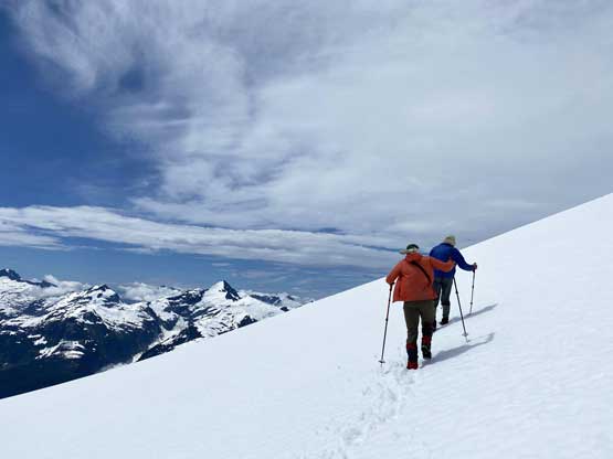
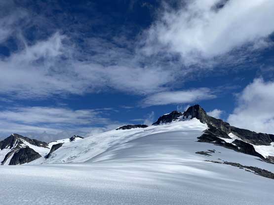
We picked up our backpacks and carried them over to the east shoulder of the east summit and ditched them again. We opted to ascend the west summit first, which took a bit of detouring but involved only “class 2” terrain. From the top we unfortunately saw that the east summit was at least equal in elevation, if not slightly higher.

The huge windscoop at the east shoulder of east summit where we ditched the packs
Vlad and Alex plodding around the south side of east summit

Vlad scrambling the typical terrain on the west summit

Summit Panorama from Mt. Pollock (west summit). Click to view large size.
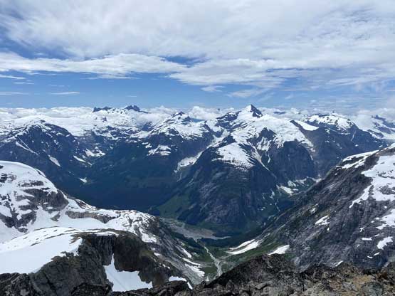
Mt. Tinniswood looms behind the deep Sims Creek valley

Mt. Albert massif looms behind Loquilts Peak

A closer look down into Sims Creek valley

Me on Mt. Pollock – west summit

Looking across Clendinning Creek valley towards north

Our group shot on Mt. Pollock – west summit
Instead of retracing to our packs and ascend the easier east ridge we opted to explore out the traverse of the two summits. I did not fully expect the route would go, but it turned out to be only “class 4” with a few spicy spots on questionable rocks. Once making to the east summit we descended easily down the east ridge to our packs. There was one stream of running creek that we loaded up the water bottles.

Me heading for the connecting ridge. Photo by Alex R.
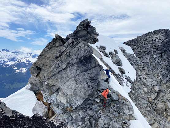
Negotiating a tricky stretch

The rocks were pretty loose on this peak

The north glacier of Mt. Willson

Our group shot on Mt. Pollock – east summit
There then came a short but awkward down-climb on steep snow to get into that col east of the east summit, and from there we had no further problem plodding down some easy glacier into Pollock/Oswald col, and there came the 4th summit of this trip, Mt. Oswald.

Me down-climbing a bit of steep snow. Photo by Alex R.

Vlad down-climbing the same spot. This photo justifies the angle of the terrain

Alex plodding down the NW slopes of Mt. Pollock towards Mt. Oswald
At Pollock/Oswald col looking back towards Mt. Pollock
