Guard Mountain
March 17, 2021
2177m
Garibaldi Provincial Park, BC
Guard Mountain “guards” the south-east end of Garibaldi Lake. Although not the tallest nor the most prominent peak in its vicinity, this is one of the more iconic-looking objectives in that area, and because of that it draws attention from zillions of tourists who hike to Garibaldi Lake each year. My first time seeing Guard Mountain was in 2009 as a Grade 10 high school student. At the time I had never thought about to ascend it but I took a few photos and figured out its name. The status of Guard Mountain is fairly obscured from mountaineering perspective. The standard route via south ridge is a mere class 3-4 scramble but such rating reflects the dry conditions in summer. To access Guard Mountain in summer requires a contrived and multi-day circumnavigation of Garibaldi Lake over 4 or 5 major elevation gain/losses or carrying an inflatable boat for 9 km with 800 m elevation gain to the lake followed by 5 km of paddling in still water. None of these options sounds practically appealing to me. The easiest way to cross Garibaldi Lake is a simple dash across the surface in winter but such timing upgrades the ascent (possibly) into the realm of mixed climbing. After a few years of debates I opted to trade access difficulties for technical challenges. Winnie had been talking about Guard Mountain for a few months. I was eventually convinced after we successfully climbed Harvey’s Pup.
The timing requirement for this ascent was a bomber snowpack stability and some decent weather and this past Wednesday shaped up to be one of the best windows so far in this season. I anticipated a 14+ hour day but we didn’t opt to start crazily early thank to the cooler temperature and the forecasted high clouds. We figured the snow conditions would stay great for the whole day. Our packs were heavy-as-fuck though as we did have to carry rope, pickets, rock gears, snowshoes, two ice tools and steel crampons, as well as food and water for an exhaustingly long day. My pack weighed 32 lb at the start and Winnie’s weighed just under 30 lb. We left Vancouver at 4 am and started the long-ass plod about two hours later. There was one good news for us as the road to the Rubble Creek trail-head was plowed this year, shaving 2+ km of walking each way.

Guard Mountain via south ridge. GPX DL
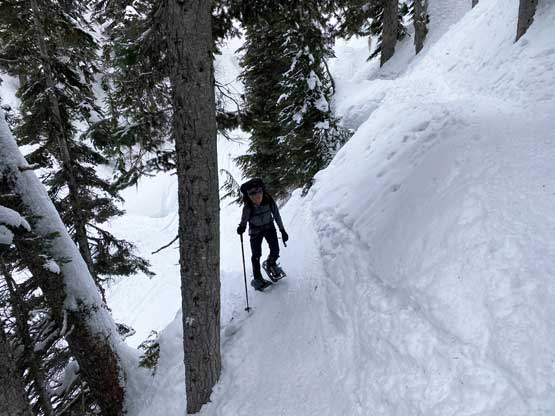
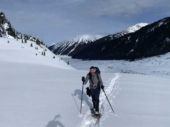
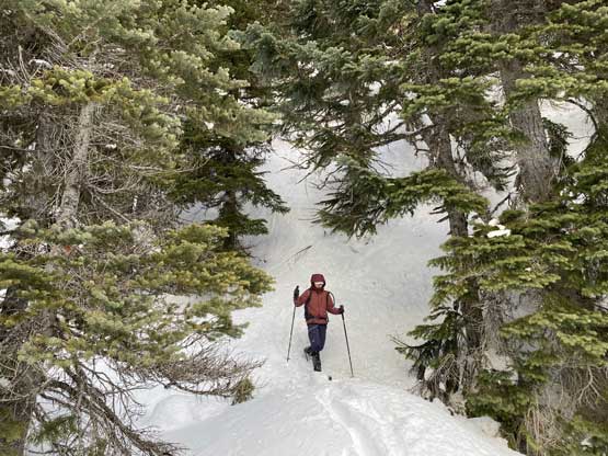
There was more snow at the lower elevation zone that I thought and the trail had been extremely icy that we both questioned the decision to leave microspikes at home. About 500 m before the first switchback we were forced to strap snowshoes on as the icy conditions were becoming a little sketchy. The snowshoes surely helped gaining traction. An hour into the plod we tuned off the head-lamps and we also wanted to take short-cut for as many switchbacks as possible. For the second set of switchbacks where the terrain wasn’t that steep we opted to ascend straight up cutting 5 or 6 of the annoying switchbacks. It took us just over an hour and half to reach the 6-km junction and because of the short-cuts my GPS only showed under 5.5 km at this point, and I felt satisfied. It took us under an hour from this point to Garibaldi Lake where we were welcomed by some cold temperatures and wind. We took the first energy break and picked up the set of tracks aiming for Burton Hut. Another hour an half later we were on the far side of the lake.

Dropping onto the frozen Barrier Lake
The steep trail contouring around Lesser Garibaldi Lake

Our first break of the day – on the cold and frozen Garibaldi Lake

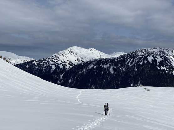
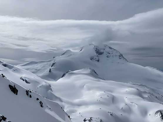
Guard Mountain, our objective looms on the right

Lenticular clouds forming above Castle Towers Mountain

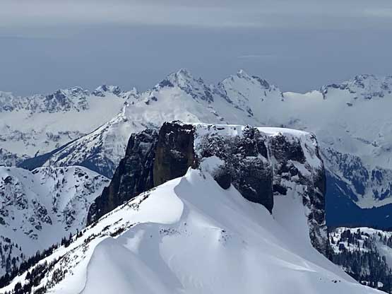
The iconic The Table with Mt. Garibaldi poking behind
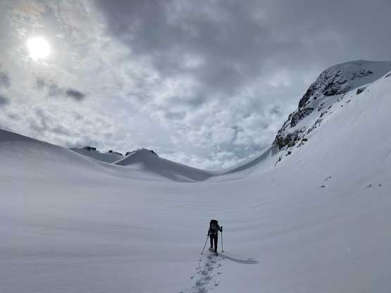
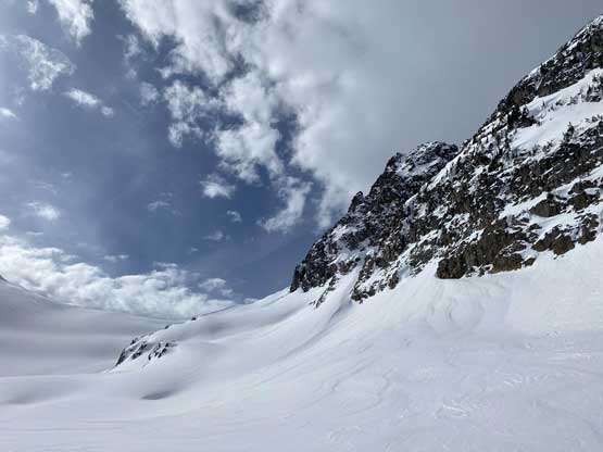
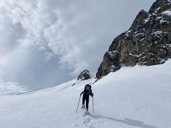
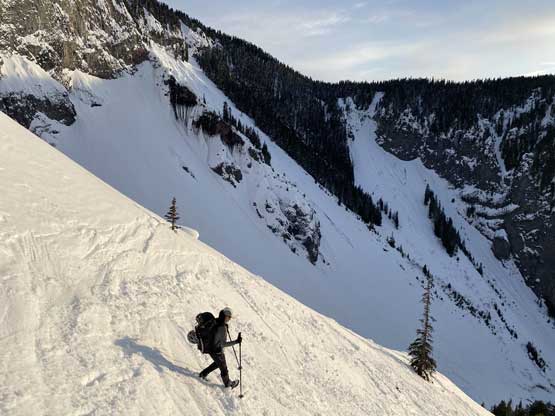
At this point we were exactly 4 hours into the trip and we needed the second energy break. The tracks had unfortunately stopped meaning we were on some heavy duty trail-breaking from Burton Hut to Deception/Guard col. I started by roughly following my own GPS tracks taken on Deception Peak’s ascent five years ago. After gaining the first steep roll we decided to stay more on climber’s right side than my previous track. This resulted in more traveling in avalanche terrain (avalanche was not a concern on this particular day) but a shortened distance. The trail-breaking was tiring on the heavy snow so we took turn on the duty. Higher up we veered further right, traversed a long stretch of steep slope and snowshoed straight up to aim for a high col on Guard Mountain’s south ridge. This route decision was planned to avoid a couple pinnacles on the lower south ridge. The gully leading to the col steepened to around 40 degrees but the soft snow meant we were able to tackle the terrain without taking snowshoes off. We found a sheltered and dry spot to take the next long break and ditch some unnecessary gears.
Already above the first steep roll above Sphinx Bay

A zoomed-in view of Deception Peak
Winnie plodding towards Deception/Guard col
The east face of Guard Mountain. We took that series of ramps center shot
Plodding up with Gentian Peak behind

Looking back at Castle Towers Mountain and Phyllis’s Engine
Winnie breaking trail onto the increasingly steep side-hill ramps
Deception Peak with the sun dog

Big terrain that we covered in this section, aiming for the distant high col
Now we were switchbacking up the steep and thin slopes

Almost at the col now, it was about 40 degrees steep
A head-on view of Mt. Garibaldi massif
The Table close-up shot from Guard Mountain’s south ridge
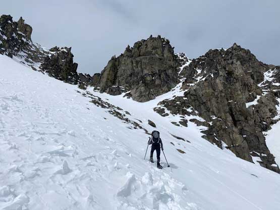
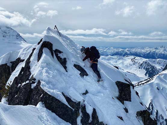
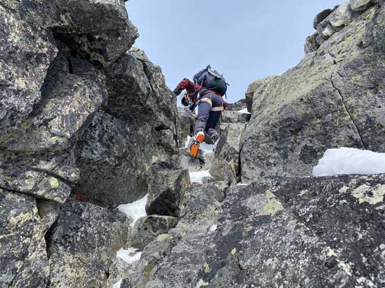
There were unfortunately still one or two pinnacles to scramble up and over. I for some reason didn’t feel comfortable on a down-sloping ledge and after wasting a few minutes of trying I decided to find an alternative route around. Beyond that step we had a long stretch of knee-to-waist deep wallowing on thin and isothermal snow. The low-angled terrain on this ridge was definitely not very enjoyable. Thankfully once the scrambling picked up again the wallowing also came to an end. To get onto the false summit Winnie and I picked slightly different lines with mine sticking closer to the ridge crest. There were a couple 3rd class moves on the route I took. The two lines merged into a shallow gully which also went at 3rd class and then we were on the false summit.

I for some reasons didn’t like this spot and opted to walk around it

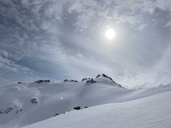
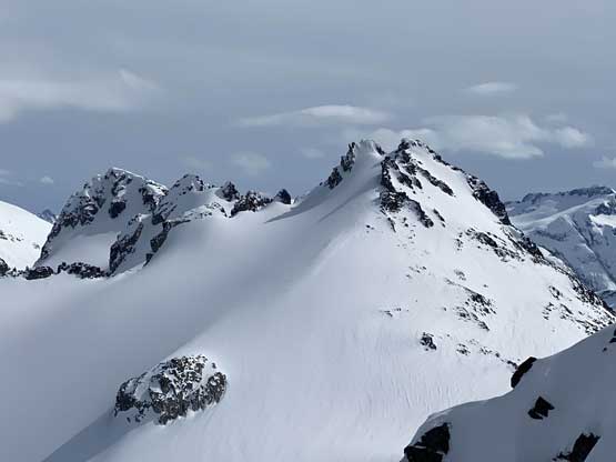
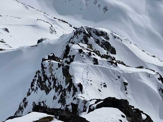
This is the south ridge of Guard Mountain

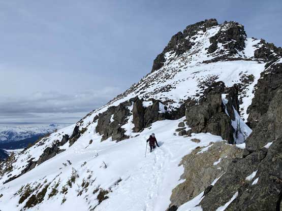
By picking our high col route we skipped this obvious tower in foreground

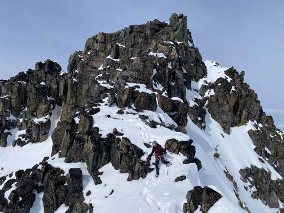
After a long while of wallowing on mellow terrain we were at the base of false summit

Winnie naturally went for a more challenging line
Winnie scrambling her line. I stuck closer to the ridge
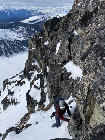
The true summit of Guard Mountain is a debatable one as it didn’t really appear higher than where we were standing, but I also know that based on others’ reports the first summit didn’t appear any higher from the far summit. I believe that the height difference between the two summits is less than half a meter. Depends on how pure you are on peak-bagging you might can just claim this peak by stopping at the first summit, but that’s not an option for me. I had to be very sure of summitting this mountain, so we must press on. The traverse to the true summit was the technical crux of this trip but turned out easier than we thought. There’s one tricky down-climb into the saddle and then we had to climb a 4th class chimney on the far side. It took me a while to figure out the moves to climb the upper part of this chimney without using a rope. Winnie, being a climber, simply climbed a direct line.
The true summit seen from the false summit

Me down-climbing the first challenging spot off the false summit
Winnie negotiating some steep snow to that rocky step

Winnie about to down-climb that rocky knife-edge step

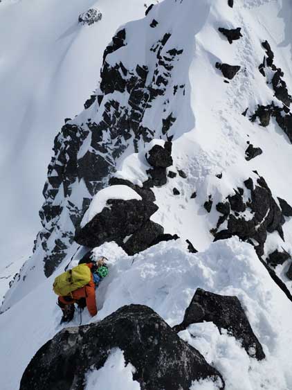
Me ascending the chimney on the true summit

Winnie searching for some ice tool placements

Winnie and I definitely used different techniques on the climb here

Winnie topping out on the true summit.

Partial Summit Panorama from Guard Mountain. Click to view large size.

Partial Summit Panorama from Guard Mountain. Click to view large size.

Looking at the dead volcano Mt. Price

Zooming-in looking back at our tracks and the false summit
Another photo of Deception Peak

The Sphinx that I ascended on the same day with Deception Peak

Winnie on the summit of Guard Mountain
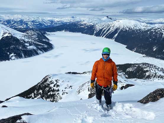
Me on the summit of Guard Mountain with Garibaldi Lake behind
I was counting on rappelling the chimney but after some discussion I agreed to try down-climbing without a rope. I would drop in first and if I was not comfortable then Winnie could throw the rope down. It turned out easier than I thought as I already knew the sequence of the moves. The climb back onto the false summit was also not too bad, that Winnie even went for a direct attack on the knife-edge ridge. The down-climb from the false summit to where we ditched gears was rather uneventful and we took anther long break at the gear cache.
Me down-climbing exposed snow above the chimney

Winnie finishing the chimney down-climb

This section on the false summit was quite exposed
Winnie now down-climbing the easier chimney off the false summit
Looking down at our tracks on the easier and lower stretches on this ridge
Winnie finishing off the scrambling sections
As you can see, deep wallowing was required on the lower ridge
I decided to glissade the short-cut gully and that turned out to be very enjoyable. Once down to the traversing tracks we took our time strapping snowshoes back on. The descent from there down to Garibaldi Lake was fast and fun but we knew the next few hours would be a different game. Once committed I simply did not give a fuck and led us dashing across the lake at a reasonably fast pace without taking any break. The next rest stop was on the end of the lake slog where I took the rope out of Winnie’s pack.

Winnie plunging down my glissade tracks

Fast forward. Down to Garibaldi Lake now looking at Mt. Price

As typical as the 5 km plod back across the lake

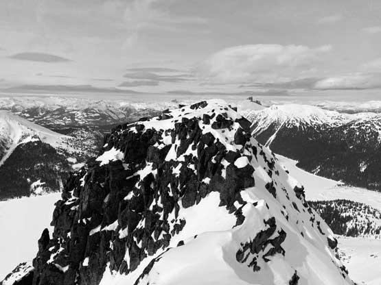
A review shot of Guard Mountain’s summit block
The slog back to Lesser Garibaldi Lake was just as boring and the hardpacked trail was also hard on our knees. I said we should take the Barrier’s exit. I had previously gone down that route on skis 5 years ago and I knew it’s a cool variation with a lot more views. This turned out to be an excellent call as we timed it right at sunset. The snow was slushy on the surface but the base of the snowpack was reasonably solid. The grade was a bit too steep for comfortable snowshoeing but the snow was a bit too soft to just walk down. We both used a combined techniques of “technical snowshoeing”, glissading, down-climbing and post-holing (sometimes waist deep) to descend this long stretch of steep slopes. Once down to the bottom we strapped the snowshoes back on and followed the skiers’ tracks a long ways past the point to rejoin the trail. I had some doubts about taking Rubble Creek too far down but the ski tracks were quite abundant that I secretly hoped those guys knew what they were doing. Eventually at about 500 m from the trail-head we ran out of snow and came to a confluence of a small creek running into the main Rubble Creek. It’s unclear whether or not this exit could bring us back to the parking lot so we opted for the safer but less aesthetic option to bushwhack 50 m upwards to rejoin the trail. The last portion of the descent on this trail was still icy and slippery as fuck and we also had to turn on the head-lamps. I was hoping to beat the head-lamp time but we were beaten by about 15 minutes.
We LOVE short-cutting the trails wherever that’s a possibility

Me leading us into the skiers’ Barrier exit.
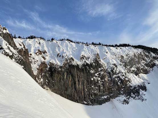
The awesome view of The Barrier
No snowshoe tracks here so we were going to put in some.
Another photo of the Barrier exit at sunset hour
We were both boot-packing at this point

We discovered a shit ton of deep holes on the lower stretch of this slope

Finally down to the bottom

About to plod out via Rubble Creek

We kept following the tracks down past where we should rejoin the trail
Eventually we ran out of snow…

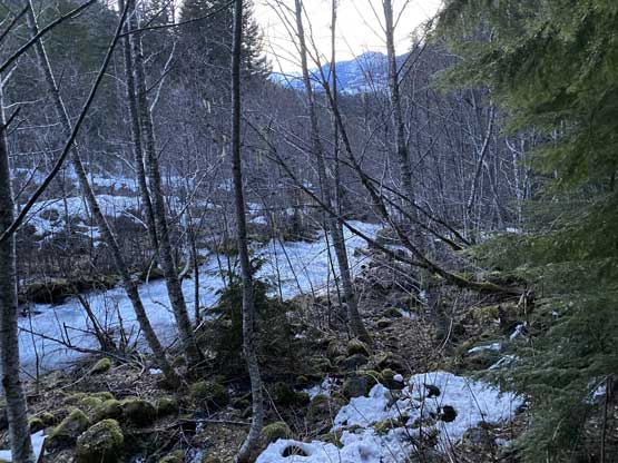
Bushwhacking to rejoin the trail about 500 m from the parking lot
Our round trip time was exactly 14 hours covering 31.5 km of distance. What really made this slog painful was our heavy packs and the fact we were wearing mountaineering boots for the whole way. It was already 8 pm by the time we started the drive so we opted to have dinner in Squamish before resuming the drive back home.
