Wapiti Mountain
October 11-13, 2013
3033m
Ya-Ha-Tinda Ranch, AB
Situating at roughly halfway between Highway 11 and Highway 1, the “Olds – Sundre – Ya Ha Tinda” corridor offers another straightforward way to access the Rockies from Alberta’s side. To many people, even the peak-baggers, this is a “blind corner” in the Alberta Rockies. I’d never been to this area before so I was keen to check it out. There wasn’t much beta regarding the peak-bagging opportunities except for Rick Collier’s trip reports on bivouac. Wapiti Mountain is the biggest and highest in this area, and I’d like to use it as an introductory.
Collier’s group ascended this mountain via a long traverse from Tomahawk, and that route has several technical pitches. Their descent route, the west ridge, sounds “easy” since Rick didn’t give any detailed comment on that, so this would be the way to go. This is also a long trek, about 25km one-way just getting to the base, but with the majority on a well defined trail (road). Ben and I decided to use the technique we’d been practising in the past month, starting in the previous day’s evening with head-lamps on. Well, the first thing to do was getting to the “trail-head”. The road, though gravel for tens of kilometers, was in a much better shape than expected and we made there with no issue. We drove down the road to the farthest we could (without trespassing issue), and parked at Bighorn Campground.

Wapiti Mountain scramble route. GPX DL
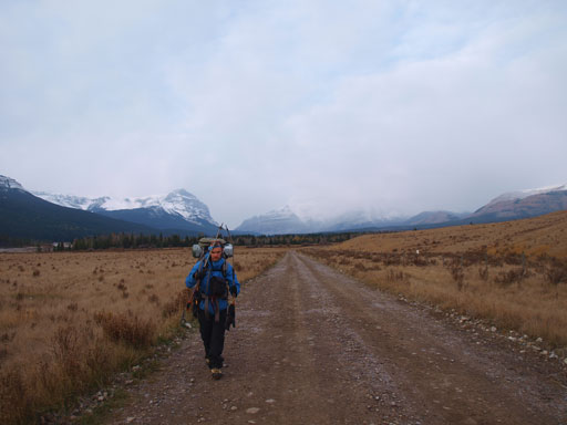
It’s about 8pm (Friday) when we started our trek. Initially it’s a bit confusing as where’s the trail-head. We spent some time looking around but it turned out to be just the road itself… The first part of this lengthy approach was slogging 13km to the Banff Park’s boundary. There’s really nothing in between worth noting except for near the boundary, there’s a “Outpost of Warden Rock”. We didn’t check it out but it appears to be a private owning “lodge” that offers food and drink. (This is a very popular area for horse traffic, just not for hikers). To reduce this numbing hike and to speed things up, you should consider biking it. We pressed on passing the park’s boundary for another 1 hour or so before committing to a perfectly looking bivy spot that’s right beside Red Deer River. The night wasn’t very cold and after catching up several hours’ sleep, we woke up at 6:10 in the morning, ready for the long day ahead.
It’s 6.4km between Park’s boundary and Tyrrell Creek, and once hitting Tyrrell Creek, the trail disappeared. According to the government map, the trail continues on the other side but we didn’t want to wet our feet to check it out so we followed the wide Tyrrell Creek up. There’s intermittent horse tracks on this side so people must have been using it. It took us quite a while to eventually relocating the trail, and this should be the one leading towards Tomahawk Pass. Judging by the fresh horse tracks, this trail sees more visitors than we thought, but it’s a lot narrower than the main Red Deer River Trail. But still, it’s very easy to follow. We continued on for another few kilometers passing a major side drainage before ditching our heavy gears.
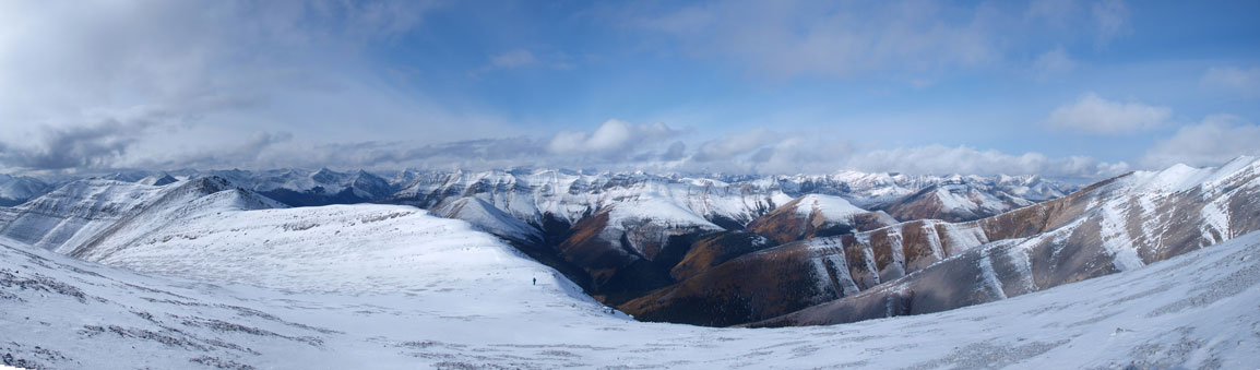
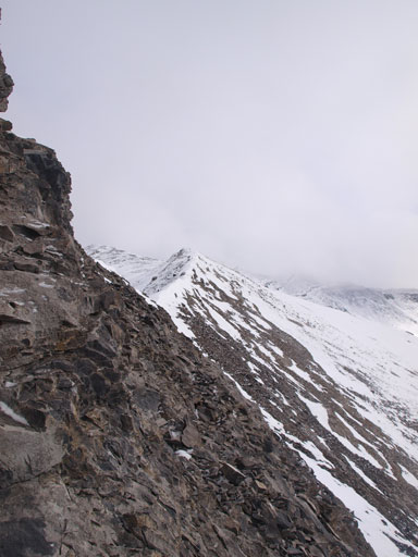
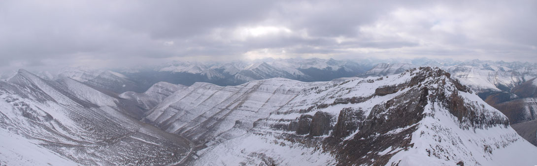
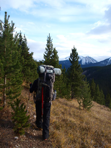
Now it’s finally the time to ascend the mountain! The bush, as expected, was very easy to negotiate and we gained elevation in no time. There’s wasn’t much of route-finding and we just picked a line aiming slightly towards climber’s left. The slope is very foreshortened and it took us a long time to hit the ridge above. This long U-shaped ridge would eventually lead us to the summit. Speaking easily, it’d be just a matter of following it up. The views were excellent at this point and we could see many rarely seen peaks in the eastern slopes.

The bush wasn’t bad
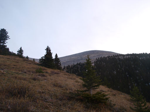
Typical view looking up from near treeline
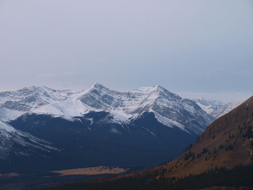
Prow Mountain
Mount White
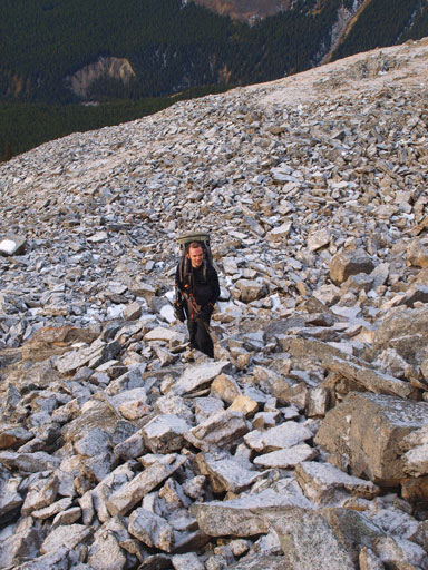
There’s a section of boulder field (with a thin coating of snow)
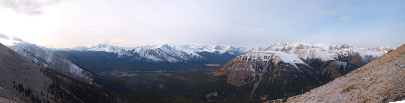
Panorama from above treeline.

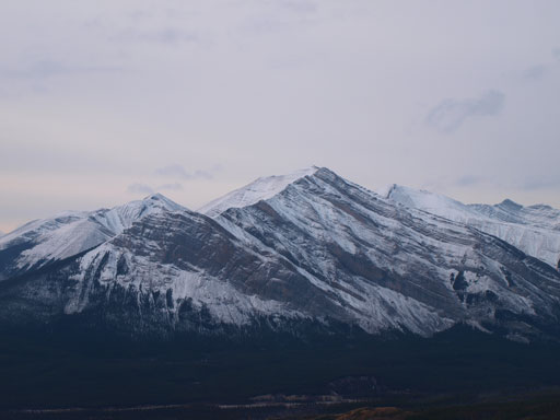
Unnamed peaks in Bare Range, looking south
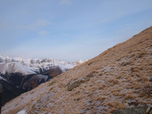
Grassy slope offered easy travel
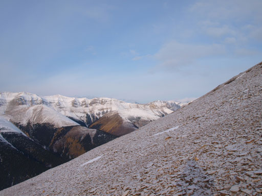
Scree like this wasn’t bad neither
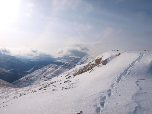
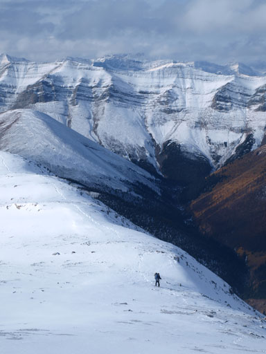
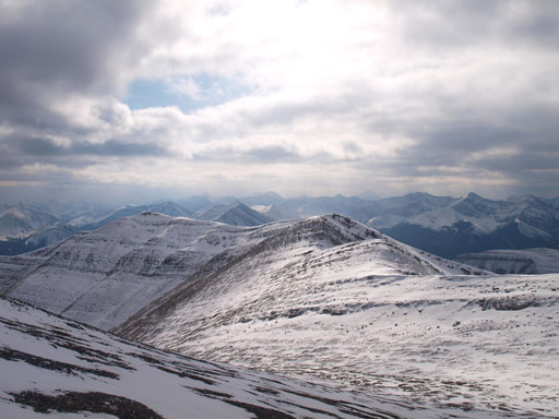
Hitting the ridge, we got a view of the upper mountain
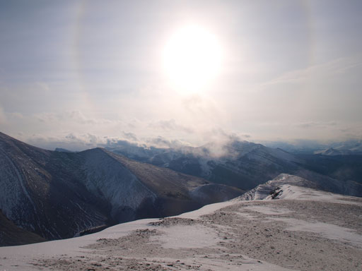
Interesting “sun ring” thing..

A zoomed-in panorama shot of Mount Tyrrell. Click to view large size.
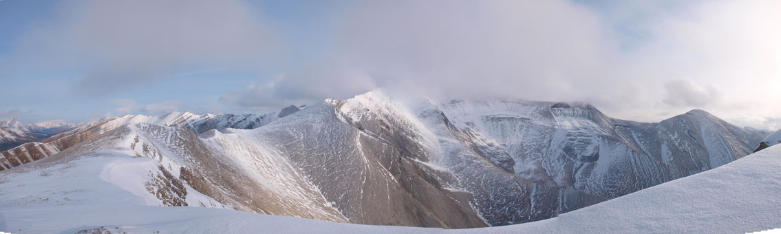
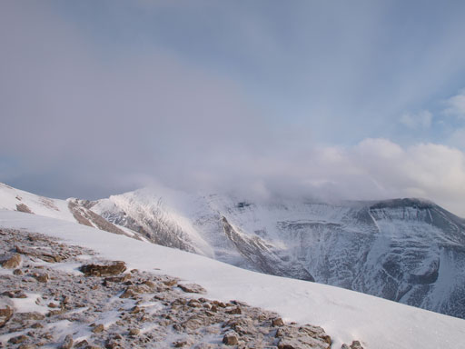
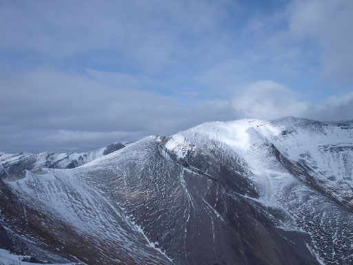
Panorama of the upper mountain of Wapiti.
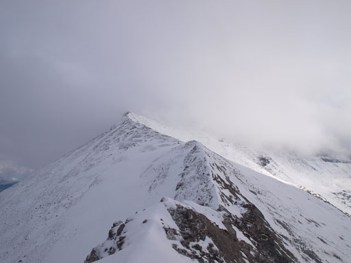
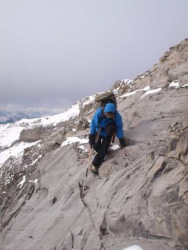
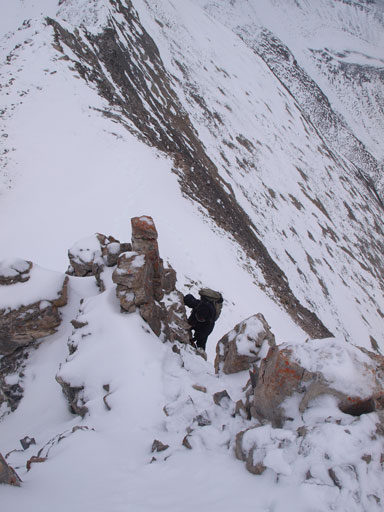
There were apparently several elevation losses (that aren’t clear from topo map) consuming up our time. One of them involved interesting scrambling on snow covered terrain that offered a warm-up for what’s coming next. The weather also started to deteriorate at this point, and in short time the blue sky was gone. The broad slope narrowed down to a sharp ridge higher up and we were soon facing several down-climbs. The first down-climb was the crux for our trip (difficult scrambling in dry condition). The second down-climb involved a short slabby traverse that’s thankfully dry, followed by balancing over an exposed snow covered ridge.

Panorama of the North side. So many unnamed peaks
Our tracks. There’s some post-holing at sections.
Ben in his parka
One last panorama before the clouds rolled in.
Looking back at Ben ascending a broad part

Looking back at the 1st down-climb
Looking ahead. The 2nd down-climb would arrive soon.
Slabs at the 2nd down-climb
Traversing around to avoid a drop-off
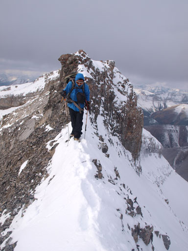
And then, balancing over a thin snow covered ridge
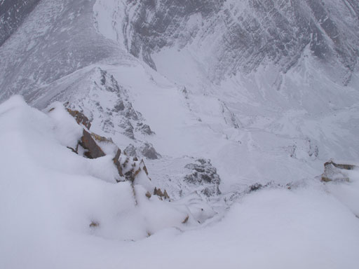
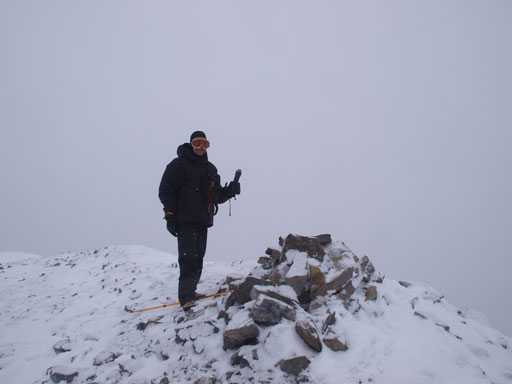
Higher up the exposure on climber’s left side increased significantly. It’s a long way down! We had to be extra careful on this narrow ridge especially given the new coating of snow. Near the false summit there were a few spots requiring short detour to climber’s right side but nothing too tricky. By now we were high enough that visibility was pretty bad. We eventually ditched our backpacks at the saddle between false and true summits. Up the true summit, it’s a white-out. Thankfully the big summit cairn and the register confirming our success. We did manage to open the register but the booklet was frozen solid and stuck inside. I was very curious to see who had been up here since Collier’s ascent, but too bad we couldn’t check it out.

Ahead is the false summit. True summit is shortly behind
The NE side is a huge drop-off. Base jump?

Some occasional views
Ben on the summit

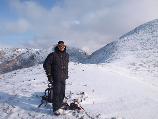
Me on the summit
We started to discuss the possible alternate descent lines that avoid the exposure on the west ridge, but that would add a ton of elevation regain, and it appeared we might still need to deal with slippery rock bands. Not liking to take a chance we went down the same way. Descending this required even more care, as a slip to skier’s right meant base-jumping 500 meters for the least! The few cruxes were easier on our way back since we would be up-climbing them. Lower down the weather improved a bit and we got some nice views. We could see the distant giants like St. Bride and Cataract. The NE face of Cataract Peak looks particularly impressive. Wapiti Mountain certainly took us longer than expected and by the time we made back to Tomahawk Pass trail, the sun was already getting down.

Slippery rocks require extra caution

Descending the ridge
Panorama view from the descent

Ahead are the two up-climbs

Traversing slabs
Up the crux
Weather was improving!
Looking back at the west ridge
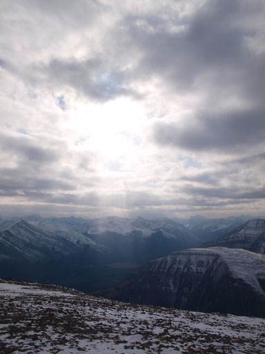
Interesting column of sun beam

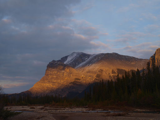
In the distance is Gable Mountain across Red Deer River
To make our lives easier on Sunday, we slogged all the way back to the Park’s boundary. There were a couple nice bivy spots on the east side of park’s gate but we couldn’t find any nearby water source (creeks were bone dry). Red Deer River was the nearest water source, so too bad, we had to bushwhack down there. After a well-deserved dinner we slogged back to the trail. I managed to catch up a couple hours’ sleep but Ben didn’t due to dehydration.
Back to Tomahawk Pass Trail
We crossed this big drainage.

A lonely tree

Hiking back, with Warden Rock in the background
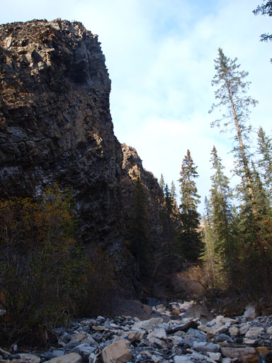
A closer look at Warden Rock

Rick said you need to wait ’till mid winter to cross Red Deer River, but it looks very fordable to me in October.
Up at 6:20 on Sunday morning, what was left was the final 13km slog back to the parking lot! I was very glad that I packed my iPod for this section as it’s extremely boring. It’s cloudy so there wasn’t much of the views. We thought about ascending Maze Peak in the afternoon but the weather wasn’t looking inspiring and we were very tired so it’s the time to go home. According to Ben’s GPS, our total distance was about 56km, and round trip time was about 39 hours.

Grassland everywhere. I guess that’s why horses like here.
The long hike back. Wapiti Mountain in the background obscured in clouds.
Overall, it’s a very satisfying trip. Wapiti is certainly one of the biggest mountains we could do in mid-October, and given the unstable weather I’m just glad we could, and did, have it bagged. The summit view was certainly disappointing but apart from that I’m not complaining the weather. Temperature was mild and wind was near non-existent! This area is easy to access and the trail system is excellent, and I’m sure I’ll be back in this area to bag other peaks like Tomahawk, Tyrrell, White, and Barrier.

I am sure glad we biked the road. Car to to car we were 14 hours, then got to enjoy JD, salsa and chips in camp and sleep on a nice big foamy.
[…] only reference for this route on Wapiti was a trip report from Steven Song where he, Ben and Eric struggled to the summit in mid October in snowy, cold conditions. He […]