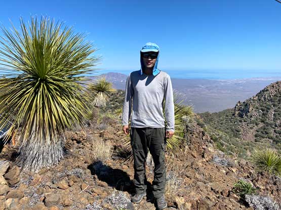
Volcán Las Tres Vírgenes
March 19, 2022
1951m
Baja California Sur, Mexico
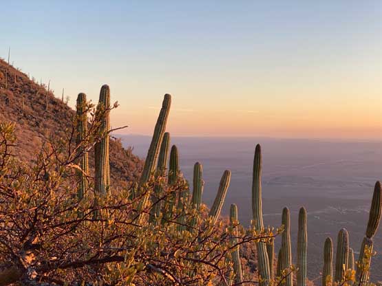
In English the name means “The Three Virgins Volcano”. This is one of the three ultra-prominent peaks on the Baja peninsula in Mexico. The three Ultras spreads perfectly from north to south across the peninsula and this is the “middle one”. It’s the least significant among the three from statistics perspective but in some ways it’s the most painful to ascend. The peak has gained a nickname of “cactus virgin” and there’s a reason for that. I came here expecting one of the worst bushwhacks in my entire peak-bagging career but with this expectation the ascent turned out easier, and much more pleasant than anticipated.
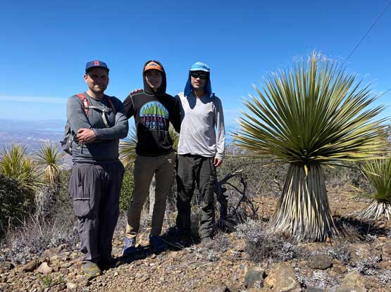
About a month prior to the trip someone had started a discussion about these three Baja Ultras on the “Baggers without Border” forum. I made a comment that I’d be interested in, if timing overlaps with the high school’s winter and/or spring break. Douglas Harris immediately sent me an invite to join him and his son, Arthur Harris on a road trip in this March. It took me a while to decide as I wasn’t particularly thinking to do this trip right away, and I was also on a separate invite to climb the 4 Ultras in El Salvador in the same time frame. About a week later I made up my mind to join Doug and Arthur for a variety of reasons. One reason was the ability to completely avoid international air travel as we are still dealing with all sorts of inconvenience and uncertainties due to the pandemic. Doug and Arthur would start the road trip from Denver, Colorado so I booked my round trip flights from Seattle to Denver. I planned to extend the trip by a week into early April, since I had not done anything in Colorado and that’s one state worth to spend time to explore. I also opted to drive from Vancouver to Seattle to take the domestic flights within U.S. so that this trip wouldn’t be subjected to the stupid Covid test result. By crossing the U.S./Canada border by land I do not need to take that stupid test.
My flight from Seattle to Denver was at 12:30 pm and the weather forecast on March 17th in Seattle area wasn’t terrible. I made a spontaneous decision to leave home in the previous evening to hike Squak Mountain before catching the flight. This worked out perfectly. I parked my car at Skyway Inn airport parking at 10:30 am, paid 150 USD for the 19-day period and took their shuttle service to the airport. The United flight had no delay whatsoever (but the flight back would be a different story). I arrived in Denver at around 4 pm and immediately connected with the A Line and then the W Line train routes to Golden, which is rather just a small part of the greater Denver area but on the west side. Doug picked me up from Jefferson Gov. Station at around 6:30 pm and we immediately went for a shopping routine to buy food that I needed for the Mexico road trip. The original plan was to leave in the morning of the 18th but we decided to start driving right away, to not waste any time. The three of us took turn pushing through the night and about 12 hours later we arrived in Phoenix at daybreak. Another few hours later we were in Yuma and then there came the U.S./Mexico border crossing. To cross into Mexico we were legally required to obtain the “tourism card” on the Mexican government website, which costs about 30 USD per person. It turned out that nobody checked anything out of any of us when we drove across the border. This was by far the easiest border crossing I’ve ever done (no check point and not a single question being asked). Mexicali is a small city but looked rather chaotic so we quickly drove through.
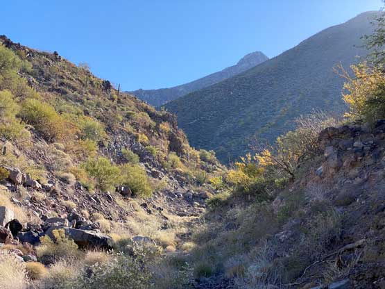
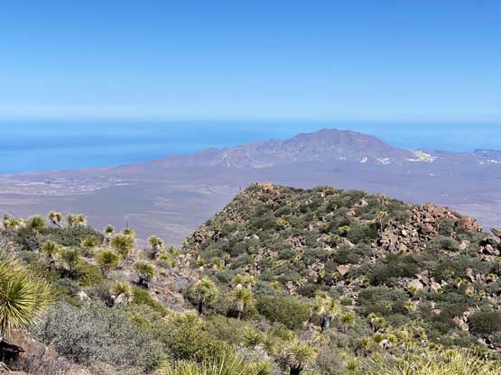
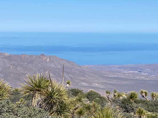
We had decided to spend this afternoon to quickly dash up Cerro Pescadores which is a “P1000m” objective in the very northern part of the Baja, but the trail-head looked sketchy and the road was rather sandy. We decided that it wasn’t worth to push our luck on a bonus peak, so resumed the drive southwards. The three of us then took turn pushing another 6 hours to within 3 hours of drive to Tres Vírgenes. By this point we were already one full day ahead of schedule. We were happy about the progress, so settled to camp at a semi-official spot on the west coast. The passenger seat of Arthur’s Subaru was comfortable enough such that I decided to just sleep inside the car to avoid pitching a tent and blowing up the air pad. The next morning we woke up at 4 am and resumed the drive southwards in the pitch dark. At around daybreak we came across another security checkpoint. The first one we crossed the day before was easy by handling the guard a few bottles of Gatorades. This one was no longer as easy as the guy spent a thorough 40 minutes to check every single item of ours. Eventually we were allowed to go. The dirt road leading to the base of our objective wasn’t labelled on my Gaia map, but Doug had done his homework and correctly directed us to the trail-head, where another vehicle was parked which seemed like a rental.


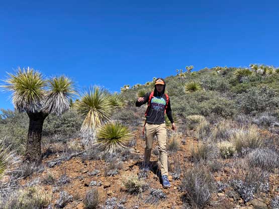
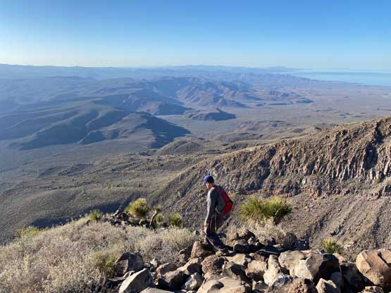
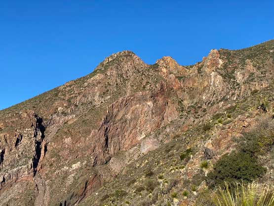
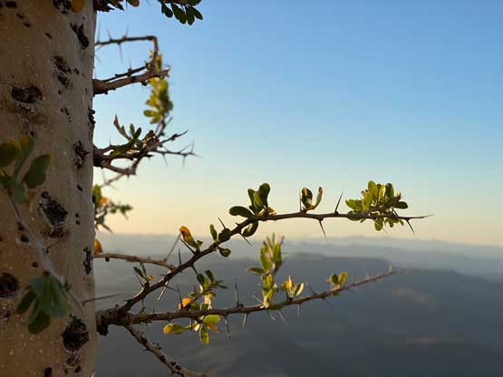
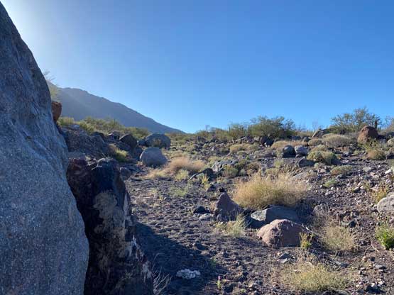
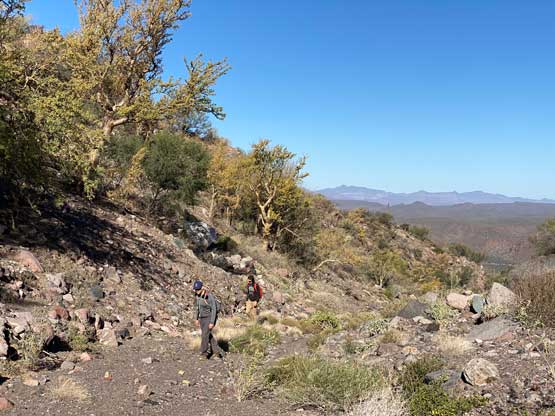
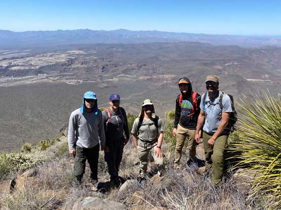
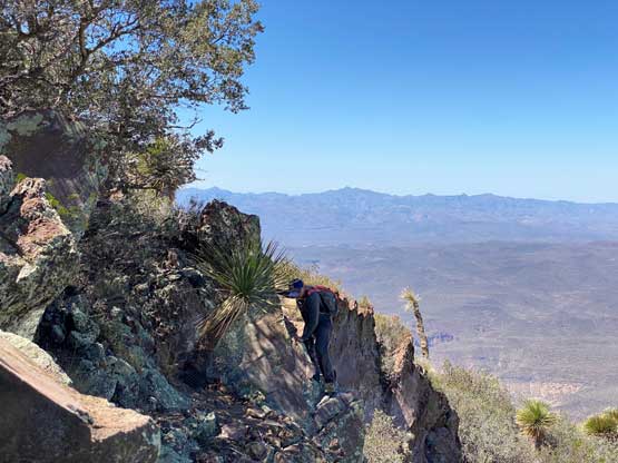
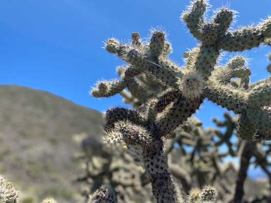
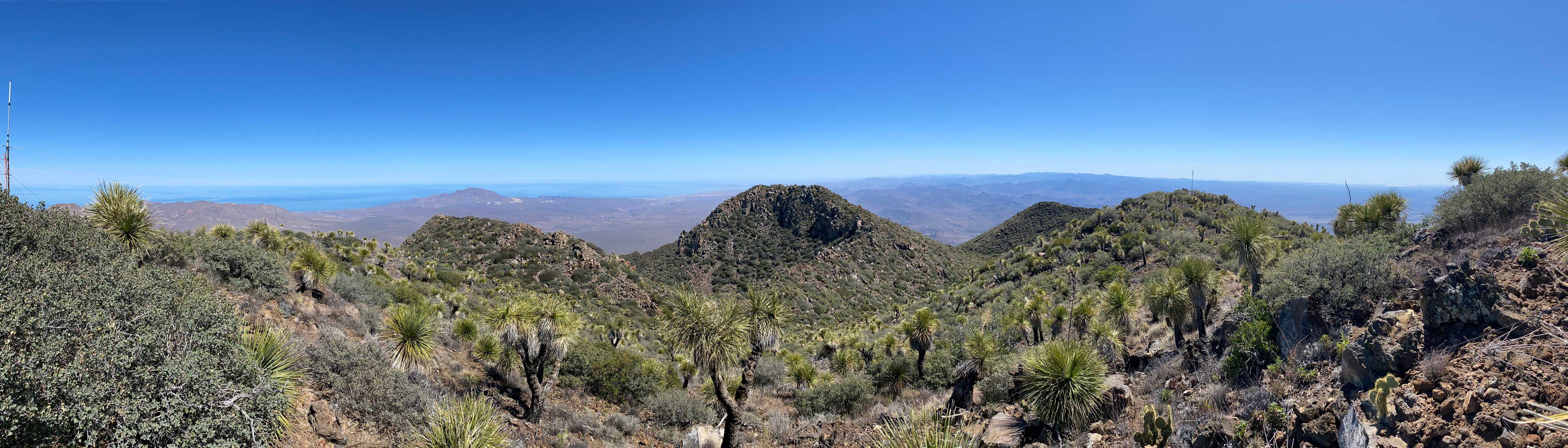
This peak has been done a few times by some of the most prominent peak-baggers in the world so the “beta” was rather mature. The first stage was plodding up a dry wash for a couple kilometers until directly underneath some of the ribs on the west slopes of Tres Vírgenes. This part was rather easy. From the bottom of the actual ascent to the summit we only had about 1000 m elevation gain and the route didn’t look to be that terrible. The initial 200 m gain was shitty mostly because of the treadmill scree. The scree was indeed one of the worst I’ve dealt with but at least the cactus was mostly easily avoidable. We started by mostly following Rob Woodall’s GPX track but the cactus kept pushing us more northwards onto a different, but paralleling rib. We figured the terrain would be similar on any of these ribs, so went on our own route here. To get onto the rib proper had the worst bushwhacking (which we avoided on the descent by taking a line farther to the north) but once onto the rib the going was mostly just boulder-hopping without much bushwhacking to speak of. About an hour later we rejoined Rob Woodall’s GPX track and from there all tracks converged. Nearing the 1600-m bump we crossed path with the other team that turned out to be Craig Barlow from California and “Mountain Climber” from Wyoming. The five of us immediately recognized each other from peakbagger.com.


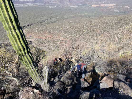
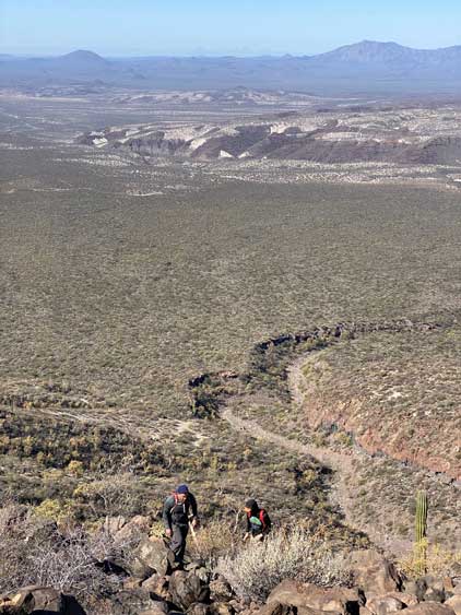
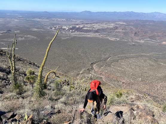
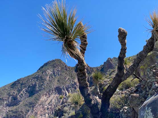
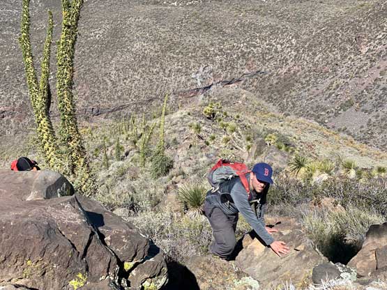
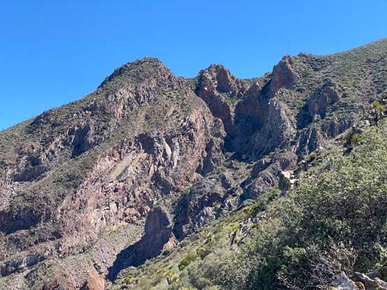
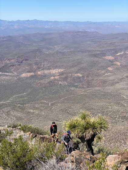
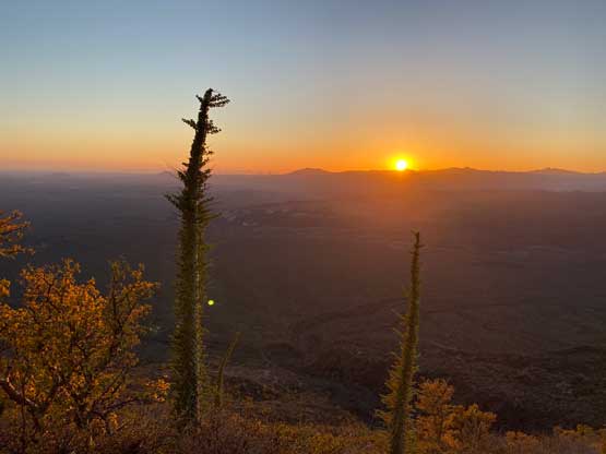
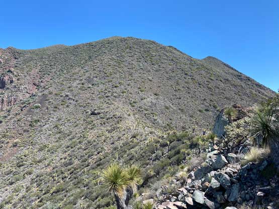
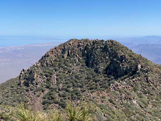
About half an hour later we had to resume our own path as the other two had already tagged the summit and were on their way down. The ascent onto the 1600-m bump was a more pleasant part of the trip. I opted to lead us a line staying low to bypass the actual summit of that bump, since I did not want to add any unnecessary elevation gain. The bypass turned out to be not as straightforward as expected, so on the return we would just simply plod up and over the bump. The descent to the saddle between the bump and the true summit was rather easy. The final 350-m grunt to the summit was not very pleasant as the terrain had transitioned back to that loose scree. The bushwhacking was also slightly worse than lower down, but nothing beyond the tolerable range. We did have to pick our line zig-zagging around some dense bands of cactus but that’s it.

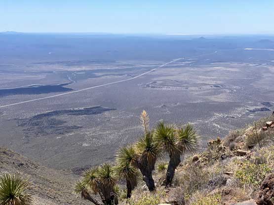


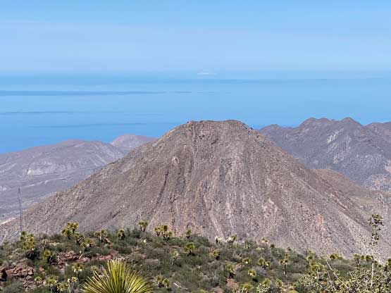
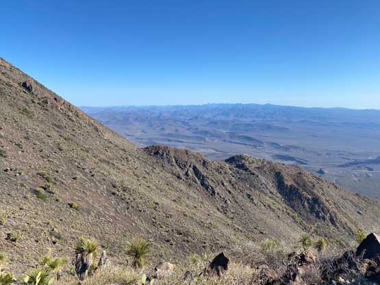
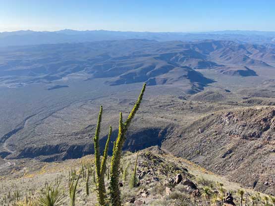
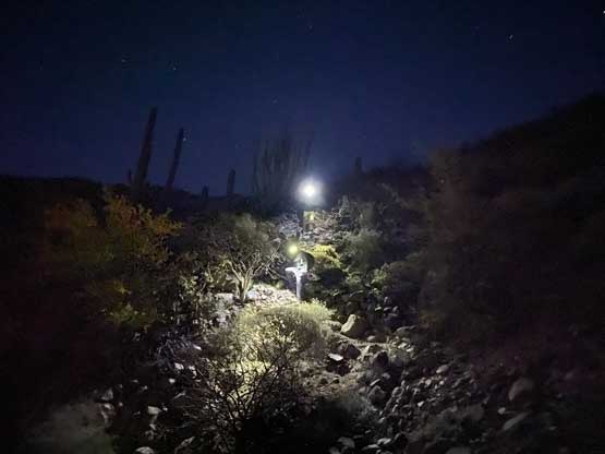
The summit had some ugly structures and wasn’t offering a nice 360-degree panoramic view, so we didn’t linger too long. The descent back to the saddle and then up to that 1600-m bump was generally pretty easy. The descent from the bump down onto the never-ending ribs was not as pleasant due to the endless unstable boulders, so took us a long while. Eventually we had to watch sunset and turn on the head-lamps. Nearing the point where the tracks split I made a spontaneous decision to check out an exploratory route further to the north, which looked more open on the satellite images. We still had to deal with fair amount of thrashing down some steep gullies, but at least most of the plants weren’t thorny. Nearing the end we got to enjoy a fast and furious 150-m plunge down the treadmill scree. The rest of the plod back to the vehicle was rather uneventful but seemed long. That night we drove back to the main highway and camped at a quieter spot. The next morning we would wake up at daybreak to resume the 12-hour drive southwards towards our next objective, Sierra La Laguna High Point.