Black Cat Mountain
June 4, 2013
1801m
Hinton, AB
Weather wasn’t suitable for a trip in the Rockies in this past weekend so we decided to postpone the trip for a couple days and on sunny Tuesday, it was Ben, Ken, and myself heading to Hinton for an attempt at Boule Roche, another mountain with no available trip report to rely on. This is also my first trip with Ken Harris, another extremely fit scrambler based in Edmonton. Our group is growing bigger! This time we left Edmonton at 3:30am in the morning to give us an early start. Ben got an email from Black Cat Ranch that there is a trail starting at the Ranch and goes to the base of Boule Roche along Oldhorse Creek, but after a closer examination on both government and Google maps, we agreed to use the cutline starting from a bridge crossing Seovil Creek to short-cut the route. There is no information online regarding the “trail”, and we didn’t want to count on that. We all knew what a Jasper styled creek-side bushwhack means… The Boule Range is an impressive rock range that everyone has an eye on when driving to Jasper (from Edmonton), but very few people go explore here. I’ve done the nearby treed bump named Mount Solomon back in October 2012, and that was my only trip in Hinton area, north of Athabasca River.
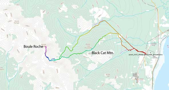
Black Cat Mountain to Boule Roche ascent route. GPX DL
As we were driving towards the mountain, we noticed a fair bit amount of snow at higher elevation, but after discussing about the alternate objectives we decided to keep our original plan. The fog patches around Hinton prevented us from getting a closer look at our objective, but thankfully we broke through the low clouds on Brule Mine Road. Boule Roche appeared to be largely snow free, and the fog provided great morning photography opportunities.
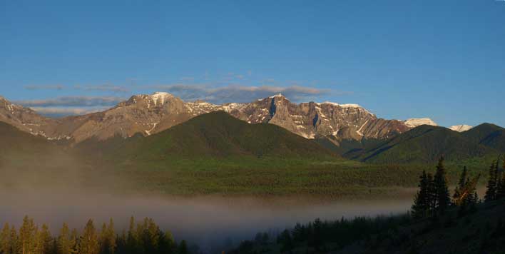
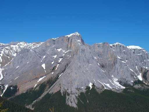
Boule Roche right of center. Black Cat Mountain is the treed bump in foreground.
After some quick photos we drove to Seovil Creek and started our day there. The creek walk was initially Canmore styled, wide and open. But the water channel was quite wide and deep, not easy to cross. A few hundreds of meters in, we were forced to bushwhack to avoid wetting our boots. We left the creek when seeing a well-set ATV trail on our right side and followed it to a major intersection, where the supposed cutline starts. There are three branches splitting from here, and the cutline was the narrowest and the most overgrown… We picked the leftmost one, and it soon brought us back to the creek. We went back and picked the middle one. It also brought us back to the creek further up. We got tired finding the cutline and started our day-of-the-bush by leaving the tracks. Aiming climber’s right avoiding gaining too much elevation we thought we would hit the cutline eventually. But after 1 hour or so’s searching we started to question if that cutline is ever existing. The bushwhacking in this part was very pleasant compared to later in the day. By now we’d actually contoured a good portion around Black Cat Mountain. We made the call of going straight up and over the summit of Black Cat, because this would give us the most direct line. It seemed to be miles of bushwhacking by whatever route we chose anyway. Black Cat Mountain is officially named, but not an attractive objective. It’s a treed bump and we expected no summit view. That’s why it wasn’t on our original plan. I thought about grabbing this peak on the way down from Boule Roche since it’s overall an official summit, but wasn’t planning to summit it first.

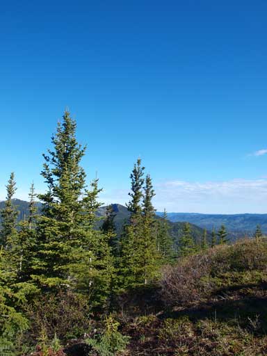
Typical bush initially. It was very pleasant here.

A bluebird day was waiting for us.
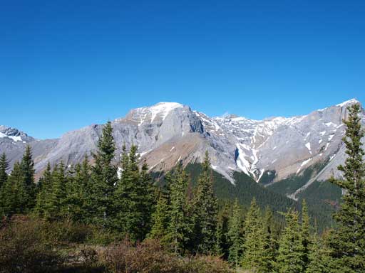
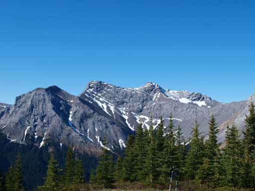
The grade steepened considerably after we changed our plan to grabbing Black Cat Mountain first. Ken, king-of-the-bush, set up a blistering pace up the steep treed slope, over one deadfall after another. Ben followed shortly behind. Probably because of the 2 hours of sleep, or I really suck in the bush, I struggled behind to keep up with these guys. I pretty much used the fastest pace I could but still felt pushing a bit. After a few hundred vertical meters I started to fall behind (not too far though). It took us a long time to get up the false summit, and from there on, the true summit was still far away. This one definitely has a lot more elevation gain than expected. We came across a surprisingly, maintained trail, midway up, and followed it up pretty much all the way to the summit. There was a clearing area on the top, and the view was, surprisingly, great. We got a great view of Boule Range especially our primary objective, Boule Roche.
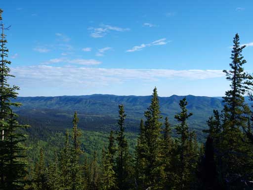
The view was rare from the entire ascent. We could occasionally get a glimpse.
But the summit has an open area. This is an unnamed summit in Boule Roche
The impressive Boule Roche

This bump also has a name, Prime Mountain (unofficial though)
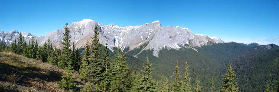
Panorama from the summit. Click to view large size.
Another unnamed summit in Boule Roche.

More great views

Zooming-in towards Fiddle Range
Another view from the top

Me on the summit of Black Cat Mountain
After a break and some obligatory shots, we continued to our next objective.

yo~interesting website!
Thanks man!