Canoe Mountain
November 10, 2012
2651m
Valemount, BC
It’s been a month since my last trip in the mountains and now came the November long weekend, and weather forecast predicted a high pressure system moving in. This would bring in blue sky, but also -20 ish temperature.. Well, that’s still better than having no view. The city of Edmonton got about 40 cm of dump on Wednesday and Thursday, and roads got covered with a layer of ice so the crux would be the drive out of my neighbourhood. The road condition improved dramatically near Hinton but still, it took me much longer than anticipated and I eventually arrived at Valemount by 1 am. Temperature had already dropped to -12 degree, and I soon fell asleep. The next morning, I woke up in a temperature of -18 degree… Good thing I could quickly move into the nearby A&W for warmth. It could be a challenging day ahead…
Canoe Mountain is a “fat” mountain at roughly 15 km south of Valemount, in the Monashee Range of Columbia Mountains. It’s the northernmost summit of the Monashees. Towards west across Kinbasket Lake are the west slopes of Canadian Rockies. Towards east is the Cariboo Range. The location guarantees great views from the top. In summer people can ATV up the access road all the way to the summit. In winter, for folks like me now owning a snowmobile, it would be 1850 vertical meters of trail-breaking on snowshoes or skis… My mom came along for this trip but I figured there’s now way she could make to the summit, so we decided to go separately. I would plod ahead solo while she would go as far as she wanted following my tracks.

Canoe Mountain hiking/snowshoeing ascent route
The access road (trail) is 15 km south of the Valemount’s main street, according to the info I found. However, there are several other branches nearby which caused some confusion especially for folks like me not having a GPS unit… I forgot to take a photo of the entrance, but I remembered it being almost exactly 15 km south of the A&W. Due to the snow, I couldn’t drive in so I just parked on the shoulder of the highway.
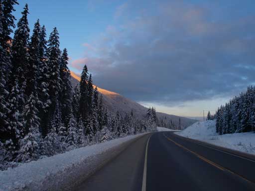
Looking North from where I parked
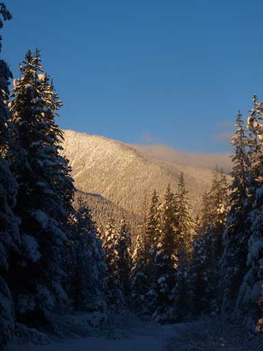
Snow was about 10-15cm deep initially, not deep enough for snowshoes. However the road was very slippery but I didn’t bring microspikes. Therefore I just put on snowshoes at about 200m in. They gave me much traction and I could go much faster. There’s very little to describe the slog. The snow gradually got deeper. The road went on and on. It’s the theme of this area. It reminds me the tedious slog up the nearby Mt. Terry Fox in July. The views won’t show up until you make a good amount of elevation gain, typically around 1000m mark…
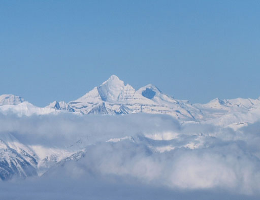
Morning view looking across N. Thompson Corridor.

Mount Pierre Elliot Trudeau

A typical view from Canoe Mountain ATV Road
It’s already winter here!
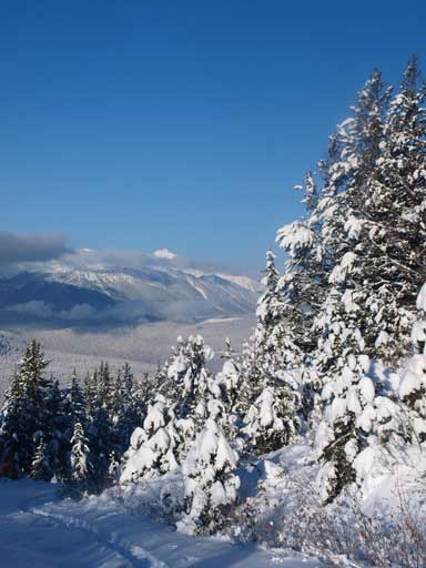
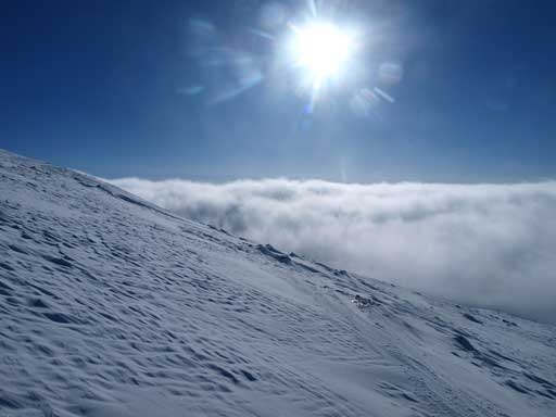
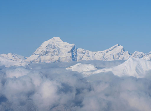
The post-holing started to get very tedious as approaching treeline. Instead of following the road up, I decided to take a short-cut and went straight up the slope. This way I could save some distance, and therefore doing less post-holing.. Not far up I started to enter the clouds… Oh no!! At treeline, it was extremely cold, and white-out.. With the peak in mind, I kept marching on. All the sudden, wow!! I topped out above the ceiling! Mount Robson, Whitehorn, and other Cariboo giants started to show up above the low clouds.
Topping above the low clouds ceiling!!
Just above the low clouds. Now I got the motivation!
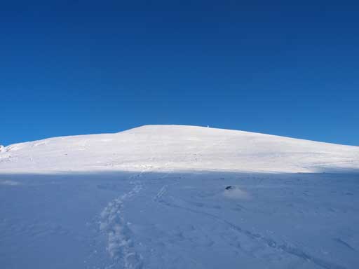
And now I could finally see the summit. That’s still a long way to go. But with the view like this, I didn’t slow down. I picked a straight line up the slope. Later in the season when avalanche is more of a concern, you probably want to traverse towards climber’s right to aim for the least steep area. Another big wow moment was waiting for me once I made to the summit ridge. The other side fully opened up. I took hundreds of photo before continuing my way to the true top. There was still a good amount of work to get to the true summit, mainly because of the post-holing…
Panorama of Premier Range. The highest peak is Mount Sir Wilfred Laurier

Panorama of Mount Robson area

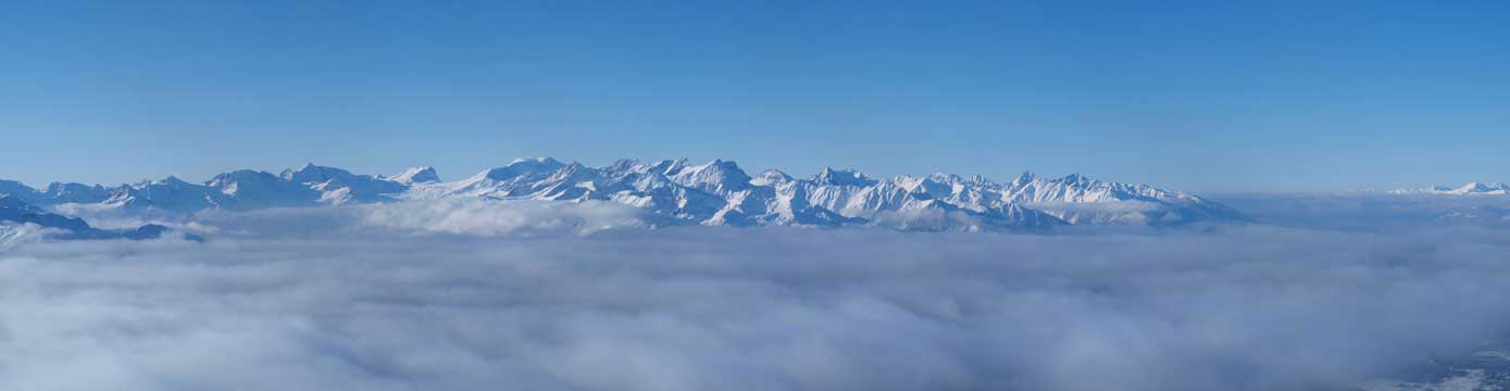
Panorama of the Rockies. They are in the west range, and mostly unnamed.

A closer look at Kinbasket Lake, 1900 vertical meters below
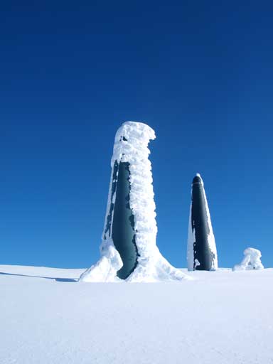
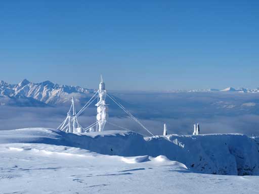
There are some weird “green towers”.
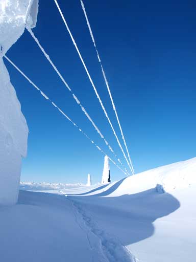
I like the snowy cables of this structure
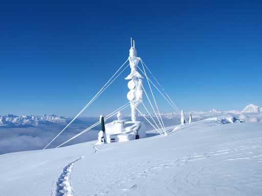
The weather station, which is about 10min from true summit

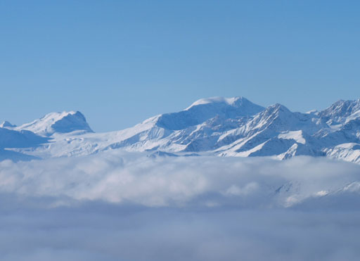
The peak at center is Mount Thompson. This is zooming in looking SW
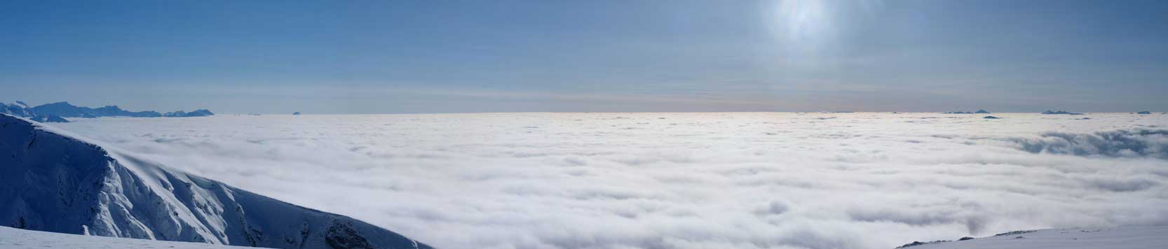
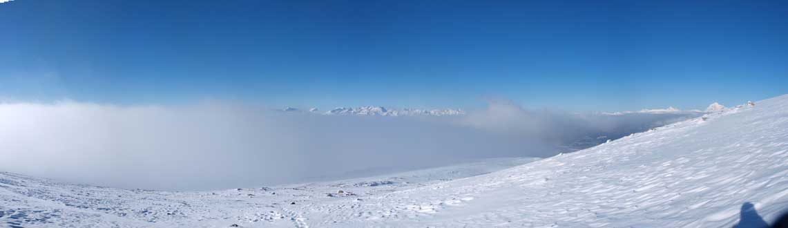
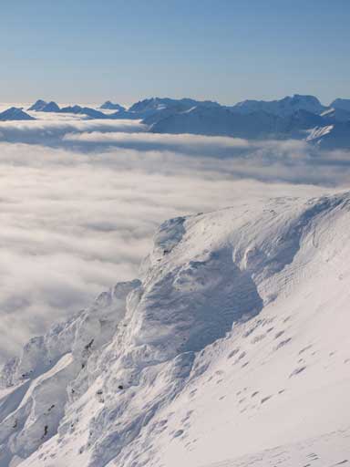
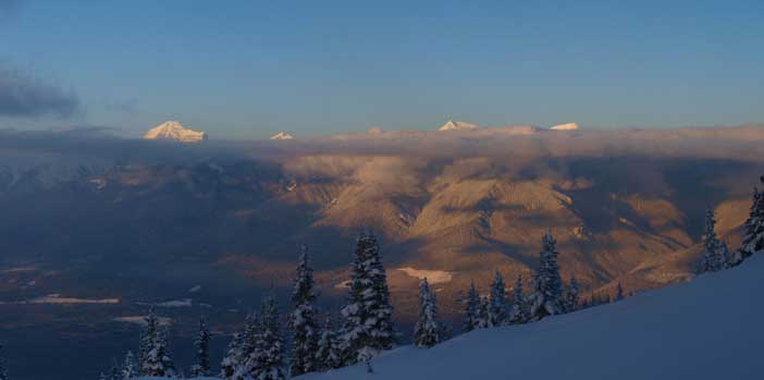
The sea of clouds over North Thompson Corridor and BC Interior

A panorama of Premier Range. The peaks there are high enough to poke through the clouds.
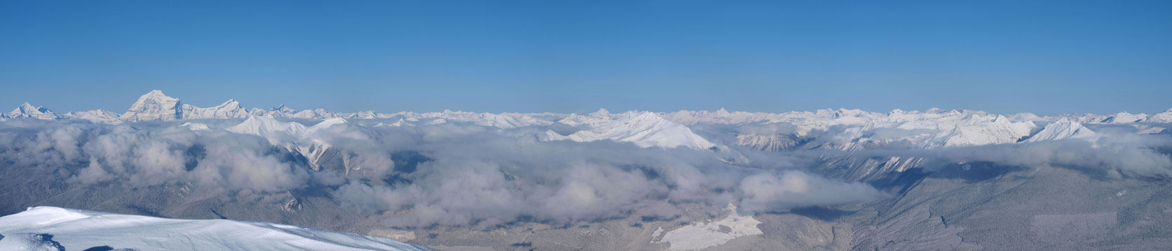
Another zooming-in panorama of Robson area, and the Rockies
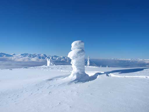
Neat structures on the summit plateau
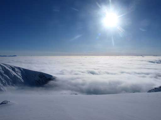
The low clouds and the sun

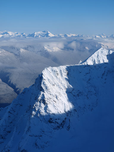
The connecting ridge to Thompson, not so inviting for winter travel
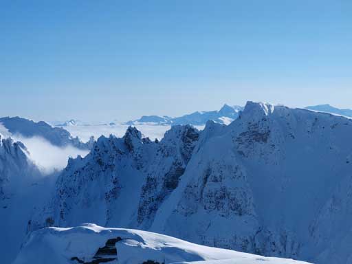
The jagged ridge to Mount Thompson
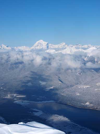
Mount Robson and Resplendent Mountain, with Kinbasket Lake below

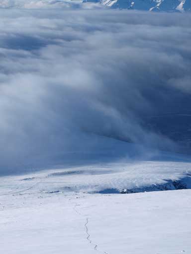
Low clouds scenery
More scenery
Looking back at the weather station.
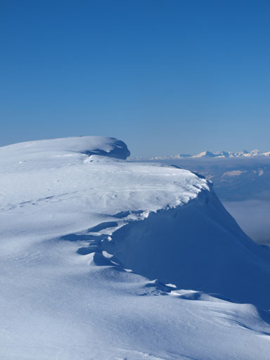
It’s only November and there’s already a big cornice
Sunlight shone on an outlier
Zooming-in view of Mount Sir Wilfred Laurier
Whitehorn Mountain
A zooming-in view of Robson and Resplendent

Panorama of the BC Interior side, the sea of clouds

Panorama of the Rockies side, the Trench, and Kinbasket Lake
It took me 6 hours to get up. But in November we only have a bit more than 9 hours of daylight time, so I had to descend soon. Retracing my steps down was much easier and faster. It took me no time to descend back into the clouds. It wasn’t that cold this time. I met a local solo skier on the way down. He turned out to be Reiner Thoni, an extreme alpinist based in Valemount.
Time to go down
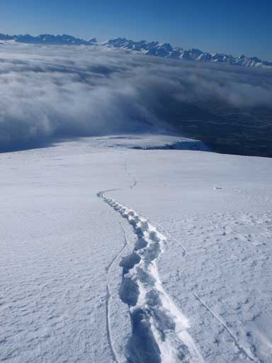
Following my tracks
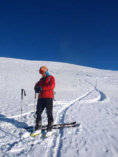
Reiner. This guy has skied the Kane Face of Mount Robson, and climbed the N. Face in November..

Reiner took a photo of myself
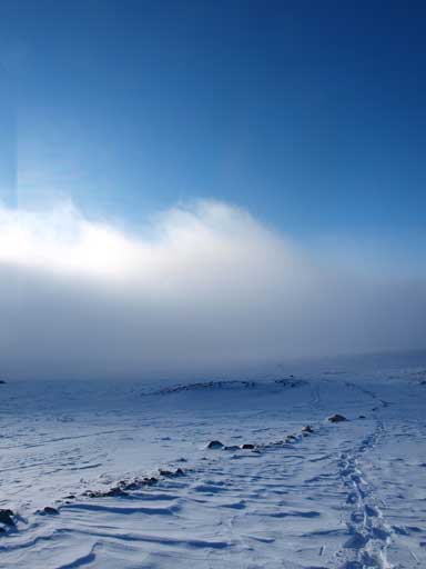
Back into the clouds
A last look at the upper slope of Canoe Mountain

Sun was getting lower
A last look at Mount Robson

Evening colours looking down the Rocky Mountain Trench towards McBride

Panorama of Valemount Area

A last look at Kinbasket Lake

Zoomed-in view of Valemount

Sunset

Mount Pierre Elliot Trudeau in dusk
I rejoined mom lower down and we barely made back before head-lamp time. Our round Trip Time was 10 hours. Overall, this is a highly recommended peak in winter. This’s another highlight of this already awesome year. You probably want to do it on skis, but make sure you get mentally prepared for the 1850 vertical meters of trail-breaking..

Absolutely amazing! Both your effort and the photo’s – Bravo.
I worked as the diesel technician on the microwave system that was on the mountain for a number of years. The view is wonderful, on a nice day, not great when the wind was blowing at 40 kmh driving the snow into your eyeballs and visibility was down to 2 feet. Enjoyed being up there in the summer much more.
This is a former microwave tower for CNCP’s transCanada microwave system, built in 1963. I worked as a m/w radio tech from 1981 to 1994 servicing five of these towers in Alberta, starting with Pyramid Mountain. In ~2000 the system was shutdown and replaced with Fibre. The Yellowhead Amateur Radio Assn is leasing the building to house a ham radio repeater as part of a public service linking system to extend from Edmonton to Vancouver, BC. As we are a non profit organization and this is a work in progress, public support is most welcome. Also search youtube for “VE7YCR”, to see associated videos.