Whitehorn Mountain
August 9-11, 2017
3395m
Mt. Robson Provincial Park, BC
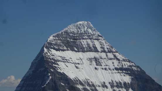
As much as being part of the “Robson Group”, the northernmost 11,000er namely Whitehorn Mountain is completely unattached to the massif of Mt. Robson, separated by the white waters of Robson River and the Valley of a Thousand Falls. This striking horn of snow, ice and rocks is a inspiring and yet frightening-looking peak from any side and the profile is a good match to some of the more famed giants further to the south. It is therefore the proximity to Mt. Robson that puts a damper on things which is very much unfortunate. Like Corbett mentions in his The 11,000ers of Canadian Rockies, “[this] handsome peak would draw considerably more attention if located elsewhere”.
From climbing perspective there isn’t any form of aesthetic climbing other than the NW Face, often done in spring on snow/mixed terrain. Ben and Josh managed to pull it off in a 26-hour return from a high camp above Phillips Creek and the requirement of highly technical mixed climbing means it’s off my league. The original first ascent route namely the West Ridge (5.4) involves a long and contrived glaciated approach and thank to the climate change those glaciers are literally dying making hours and hours of weaving around man-eating crevasses. This does not sound appealing at all so there goes the third route, a loose and largely unprotectable South Ridge (5.3) that has more-or-less become the standard route nowadays. There are two ways to get onto the south ridge, the SE Glacier and the “Valley to the South” with the latter a fairly new and unknown option that avoids glacier travel all together. The downside is that approach being one of the ugliest in the 11,000ers family just so you get warned so don’t get too excited yet…
Over this summer I’ve been talking to Steven Noel for quite a while and eventually there came this past week when things finally lined up nicely for some 11,000ers. Steven is a younger climber from Edmonton studying in U of Alberta super keen to progress further in this mountaineering game. Fryatt or Whitehorn was the question but with an exploratory head we picked the latter. There hasn’t had any form of a detailed “trip report” for a summer ascent of Whitehorn yet making it a more exciting objective compared with Fryatt which is already well-blogged dating back to 5 years ago. This time thank to a shorter drive I didn’t leave Vancouver until the noon of Tuesday and even with a major traffic delay I still made to Valemount before midnight. I went a bit of ways towards Kinbasket Lake for a nice and quiet car-camping and the next day I met Steven at the Robson’s parking lot around 9 am local time.
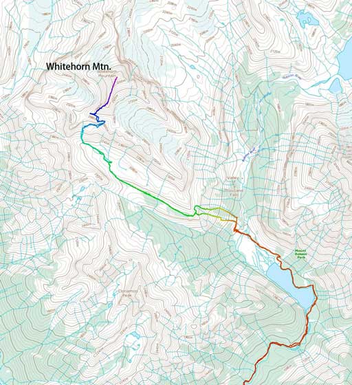
Whitehorn Mountain via South Ridge. GPX DL
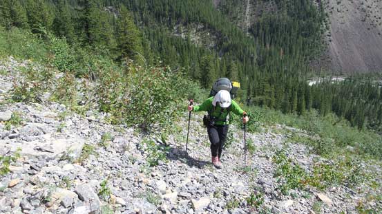
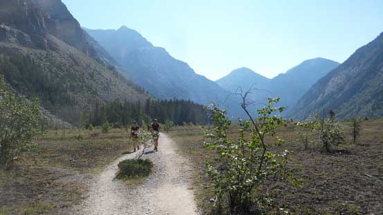
Given the freezing level as high as 4200 meters it’s an easy decision to avoid glacier travel for as much as possible so the “valley to the south” and that’s it. Right off the bat we could feel the heat beating down but with lots of chatting the initial march to Kinney Lake was actually quite enjoyable and soon enough we passed the Patterson’s Spur turn-off and then it’s all “new ground” to me. The circumvention of Kinney Lake was a bit of a grunt but at least the views were inspiring. The trail then did more up-and-downs on the hillside of Kinney Flats before dropping down and crossing the braided Robson River on a couple foot bridges. One of the crossings was a major one that without the bridge there’d be no way. We continued to the base of a set of switchbacks before taking the first break applying sunscreen, having some food/drinks and most importantly, switching footwear from trail-runners to my Trango Ice Cubes.
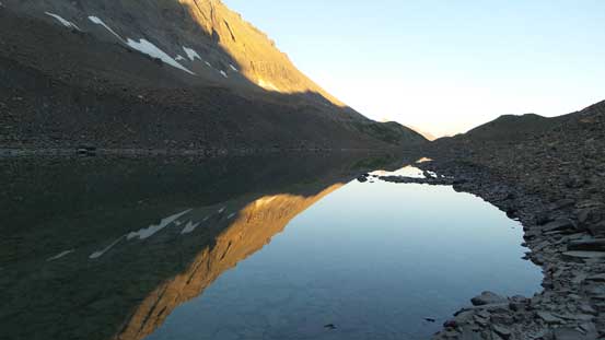
The classic view from bridge crossing Kinney Lake’s outflow
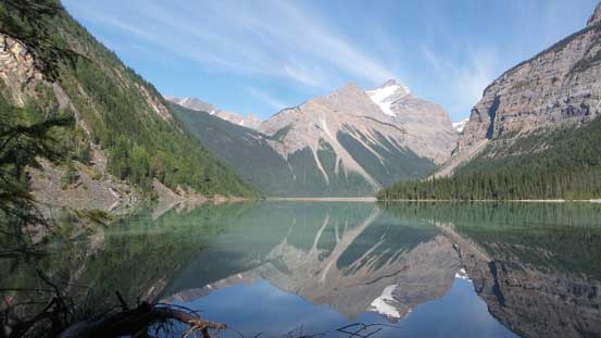
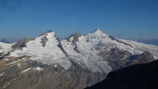
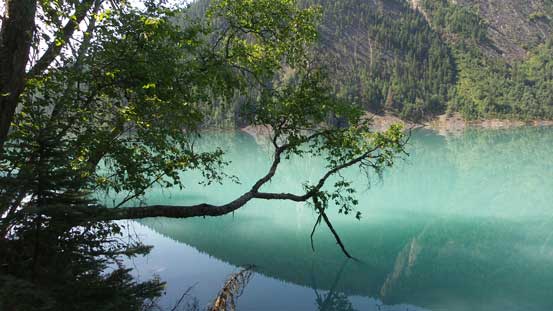
Whitehorn Mountain reflected in Kinney Lake

A closer look at out objective

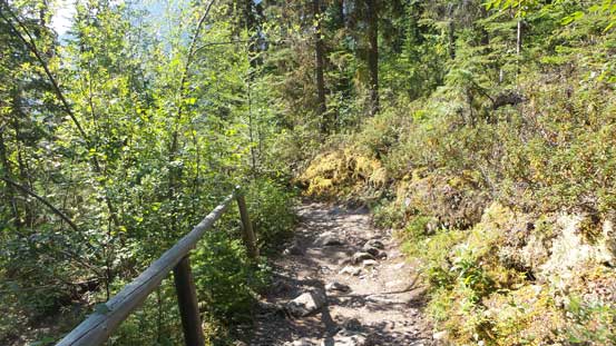
As much as the trail around Kinney Lake
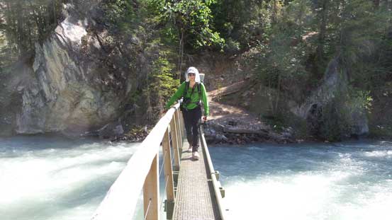
Steven crossing a foot bridge over Robson River

Kinney Flats

Red – our ascent route. Yellow – descent route, slightly better…
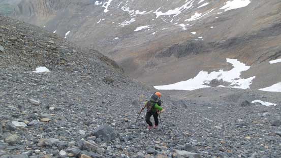
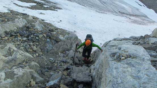
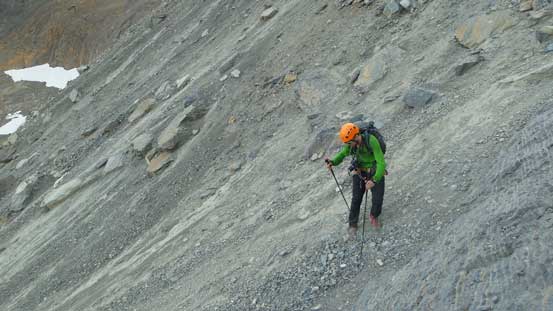
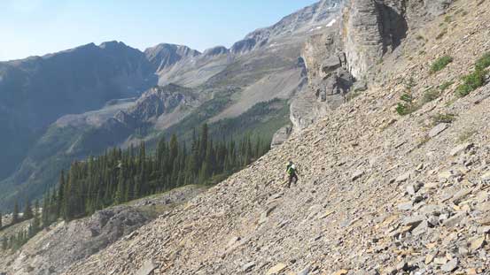
The start of that “big ass scree gully” is about two or three switchbacks higher up but once there it’s very obvious where we should leave the trail. The heat was really taking its toll and we knew the next couple hours would be downright miserable, but let’s face it. About 800 m of elevation must be gained in this stage despite the very foreshortening views. About a couple hundred meters up we started to realize the ground wasn’t much of scree at all and in fact, it’s mostly a layer of dirt/scree on top of compact moraine. The higher we went the steeper the terrain and the thinner the layer of soft scree became and soon enough we were edging on the moraine choss struggling to make any further uphill progress. Everything we touched would move and anything we sent down would tumble at least a couple hundred meters without coming to a stop whether it’s a pebble, baseball or a microwave. Ascending parallel to each other and having no party above was the key to survive this gully and even so some dedicated balancing was required as we could not afford a slip. It was so horrible that after eventually topping out on the “treed shoulder” I had to look around for alternative descent options as there’s absolutely no way would I get myself into that top part of the gully again in this lifetime.

Time to trudge up the big ass slope…
Not very pleasant in this temperature…

At least the view looking back at Kinney Lake was great

As typical as it gets in the lower part.

The choss layer gets thinner now. Oh the compact moraine…
This part was such a horror show..

This was the easy part, trust me…

Finally gaining the treed shoulder

A very zoomed-in shot of Emperor Falls

Mt. Robson the majesty. Very satisfying to look back at this beast…
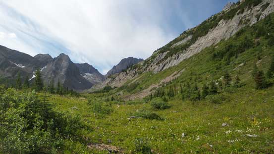
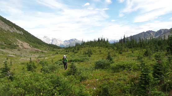
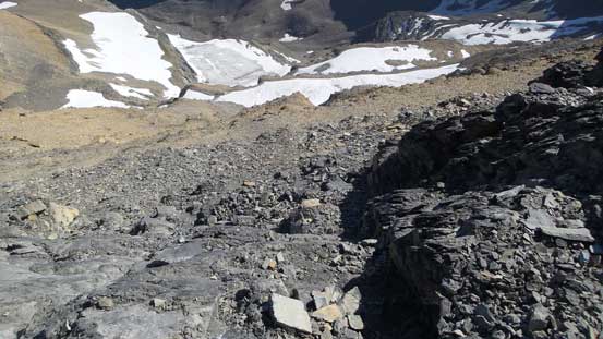
We took a lengthy break regaining some mental strength but there’s no water source nearby and we were both running low on water so let’s move on. Traversing around the corner required some very short-lived bushwhacking but by maintaining the height we did come to that “grassy bench” without doing much of a detour. The grassy bench traverses about 2 km due west and went much easier than we thought. There’s hardly any elevation loss/regain nor any form of bushwhacking but the problem was, that “creek” on the far side of the bench was bone dry so once again, a short break later we had to carry on. Now we had absolutely no water left (that’s given that we each hauled more than 2 L up from the trail) and the only hope was a small tarn on the opposite (north) side of a broad ridge feature. Getting there required lots of rubble-fuck hopping on unstable ground but the tarn was still there and the water looked clean enough so that we just drank straight from it. We debated about carrying on to a “high camp” somewhere further up the valley but realistically we were both too spent to push any further. The rest of the evening was spent rehydrating, erecting the tent and then cooking dinner. The night was almost too warm even in my +2 degree sleeping bag..
Accessing this obvious grassy ledge.
Very easy travel but now we had no water left…

About 2 km later we found this creek was dry as desert…
At least the views were still very good…

Cresting a broad ridge feature now, time to find water…

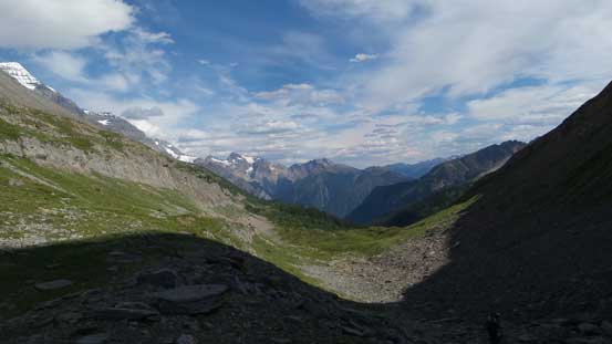
Looking ahead shows the rest of the approach which we’d do the next morning
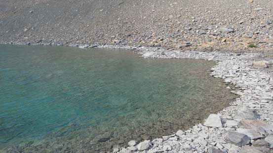
Finally found the only water source on this route…
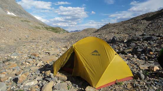
This is Steven’s 2 person tent. Much more luxurious than mine..
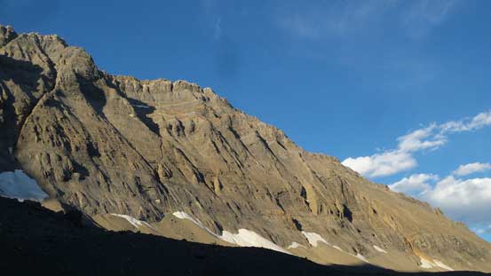
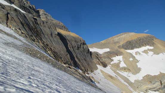
Impressive walls all around, but no view of Robson..
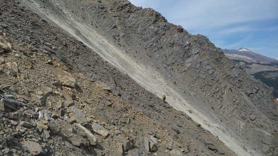
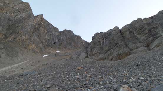
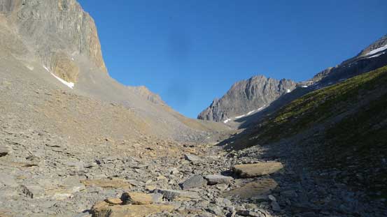
With a longer summit day we agreed to wake up early, but not too early as we didn’t want to negotiate the shitty moraine in dark. It appeared complicated to access the upper remnant glacier and bench and we wanted at least some daylight for that part. After a whole process of morning routine we eventually got going with only 20 minutes of travel assisted by head-lamps skirting around the south shore of that tarn. And then we went into a depression zone and traversed a long ways due west and this whole section was nothing but rubble-fuck hopping and once at the base of a moraine cone we turned right and began the trudge. Slogging up this moraine section was downright dreary. At places as soon as I put some pressure on the scree and whole cone would slide down starting from 30 feet above. Immediately jumping over to the side I thought I was going to get rock-avalanched off the slope.. And of course once the slope angle increased the choss layer became thinner and we gotta deal with edging on compact ground which was sketchy to say the least. There’s a band of “4th class black rocks” farther on climber’s right which we on purposely ascended. The worst type of terrain on Hungabee or Deltaform felt super solid and enjoyable here by comparison…
This is already past the worst part.
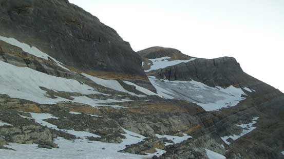
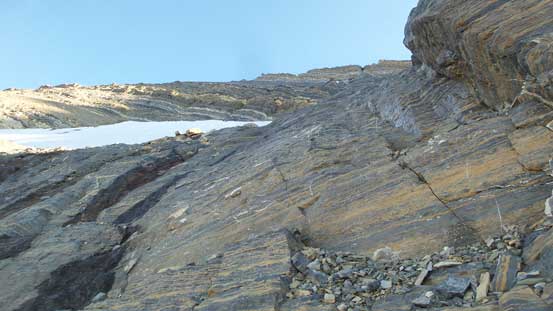
Relieved to finally top out above this moraine cone we still had at least 200 vertical meters of trudge on nothing but treadmill scree or rubble-fuck to access the hanging remnant glacier with a couple 3rd class choss bands thrown here and there. The glacier was a nice welcoming site though with a tiny stream running into a tarn for some drinking water. From there onwards the only route that makes sense was to traverse a long ways due east (climber’s right) before making working back left on one of the scree/snow ledges to access the col high above us on the L.H.S skyline ridge. The glacier travel was tame and easy and we didn’t even need to use crampons thank to the soft snow. Once making sense we ascended a short shooting gallery to gain a lower scree/snow band and traversed about halfway back across the bottom of that triangular-face. At here we made a critical decision to abandon the traversing line and went straight up a snow slope to a 4th class weakness (rap station above) which joined Paul Zizka’s description. The rest of the traverse was done on the upper scree ledge which was loose and exposed but at this point we just sucked it up.
More treadmill scree. At least better than the moraine..
We decided to traverse all the way across to that pocket glacier
Ascending the glacier with Cinnamon Peak behind
Picking a weakness to get onto the “low bench”
Finally hitting some sunshine, time to traverse the low bench
About halfway across we went straight up to break this rock band
After traversing the “high bench” we were treated by some great views

Around a corner we arrived at the “col” we were aiming at
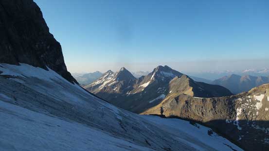
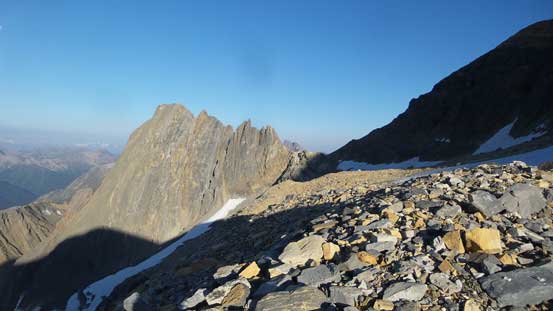
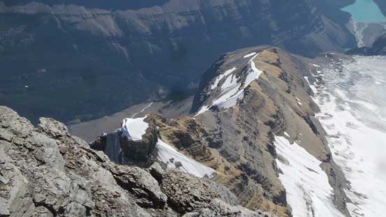
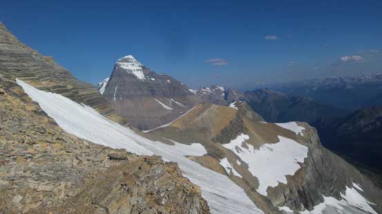
The first sight of Mt. Longstaff was inspiring.
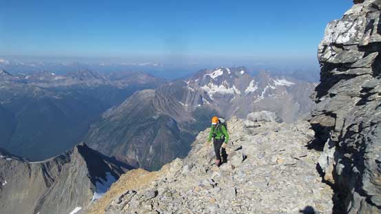
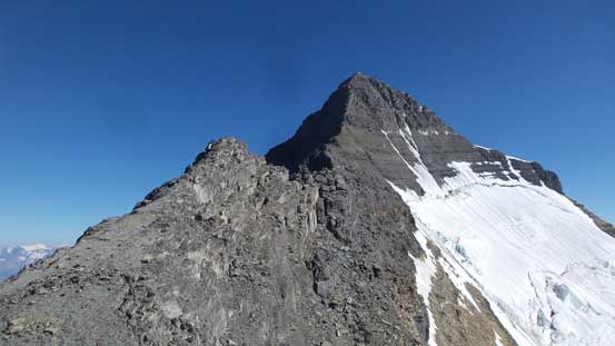
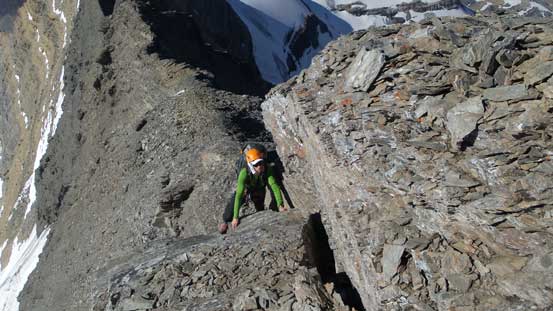
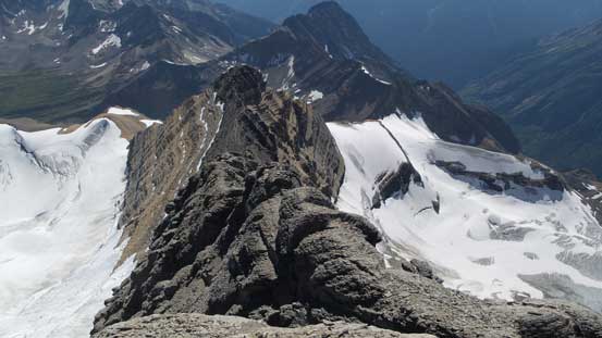
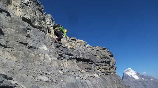
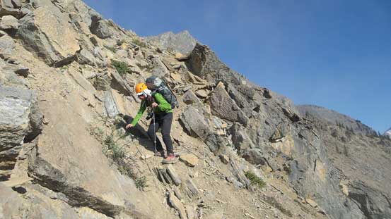
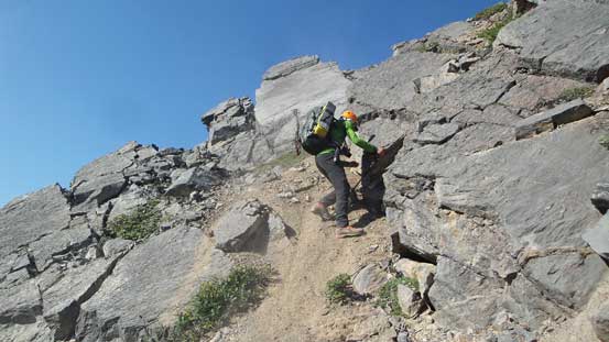
Finally we were officially “on route” as whether you come from the SE Glacier or “Valley to the south” this marks the start-point of the south ridge route. The lower triangular face is attacked on the L.H.S skyline ridge which should go as a mere “difficult scramble”. With that in mind we often had to detour to climber’s right to bypass technical climbing. This stage felt very much similar to the limestone rib on Hungabee’s middle section although the rock quality was worse. The nature of the ridge felt more like on Deltaform with lots of big resting ledges so it’s not sustained. Towards the top it did get more difficult and both Steven’s line and mine involved a few tricky moves with considerable exposure, but then we topped out above the triangular face with the south ridge straight ahead.

Excited about the scrambling ahead.
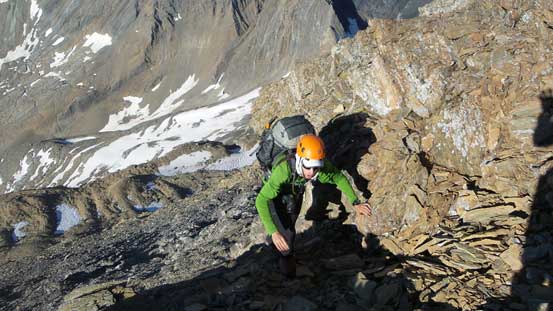
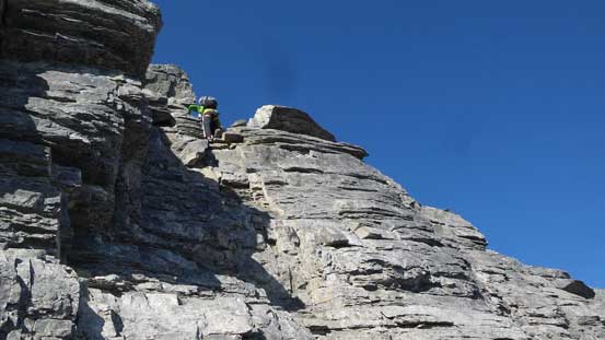
Steven working his way up some of the lower steps
As typical as it gets.
Classic!
Traversing around to find more weaknesses
And then, scrambling up.
Attacking a harder move..
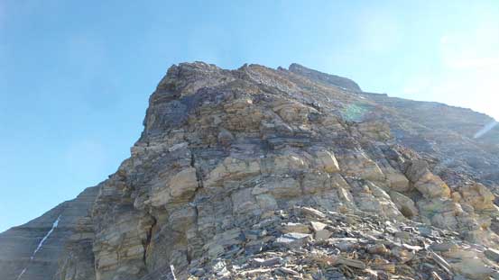
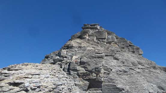
Top of the triangular face looking at the south ridge.
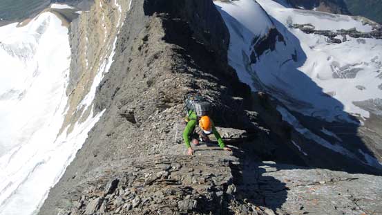
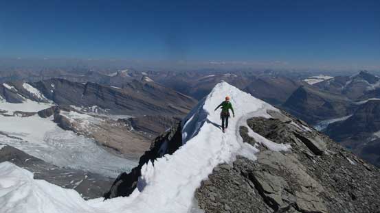
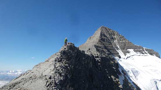
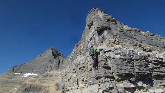
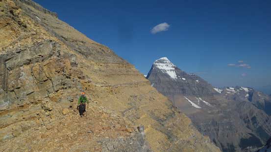
After a well-needed break we resumed on. The next section was a flat ridge connecting the lower triangular face to the upper south ridge. This part appeared super exposed but actually not that bad. For the most part we managed to stay right on top although at places the ridge was only a feet wide. A couple drop-offs were bypassed by detouring and traversing on the right (east) side ledges, and before realizing the angle of the slope increased again and now came the upper south ridge. Again, it started off mostly just “difficult scrambling” although we could feel the texture of the rocks changing to the infamous “down-sloping egg shells” warned by others. The “egg shell” part was fine as it couldn’t get worse than the moraine we just did, but the “down-sloping” nature did make holds less trustworthy.
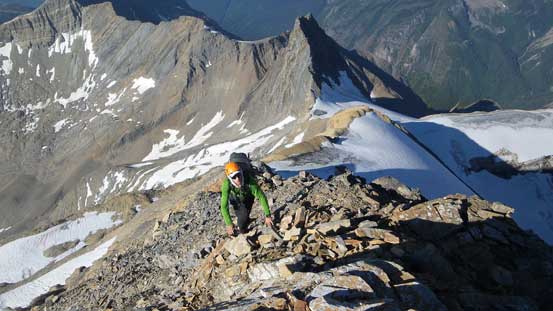
Traversing the horizontal section towards the horn
At places we had to do this to bypass impassible drop-offs
At other times it’s just easy hike, albeit with deadly exposure on both sides..

It’s getting steeper now
Lots of choss.
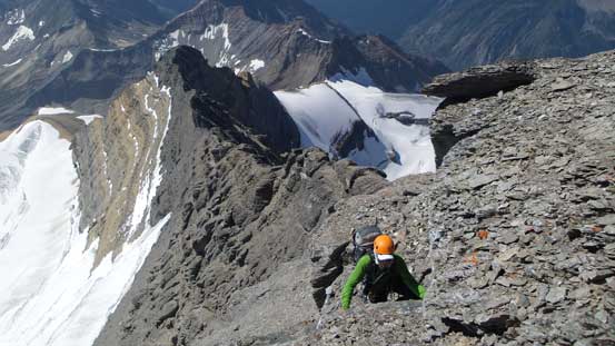
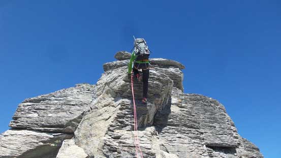
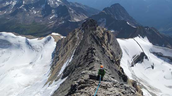
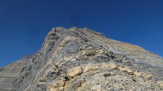
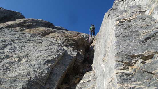
Steven soloing the first short pitch of 5th class
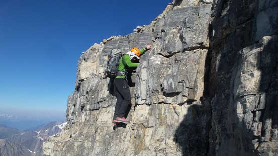
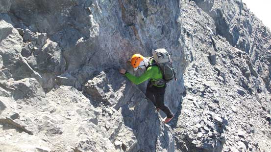
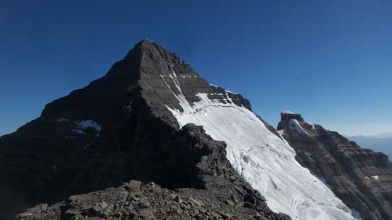
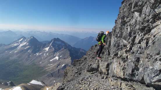
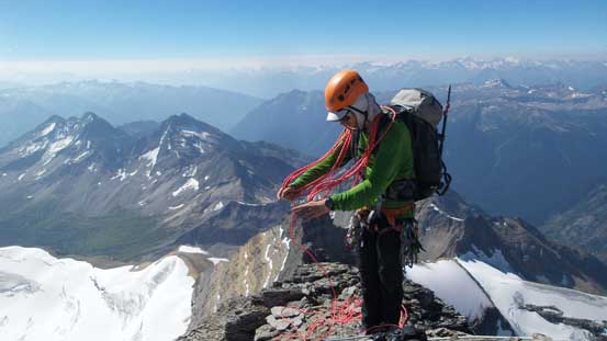
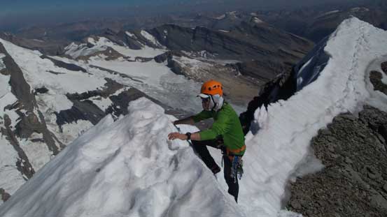
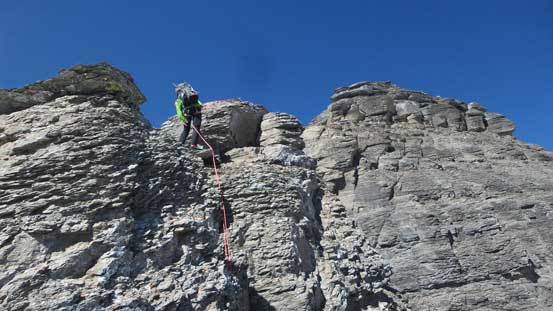
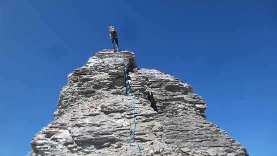
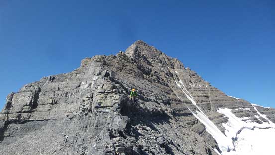
In general on this type of down-sloping terrain the steps would turn out harder than it looked from below. We both soloed the first short pitch and I continued on soloing the second pitch. It ran much hairy than I thought but I made to the upper station nonetheless and tossed the rope down to Steven for a added bit of security. After that we properly pitched out a couple steps with Steven and I swinging on lead and then the terrain transitioned back to “scrambling” so we packed the rope. There went another 5th class pitch with a gendarme feature bypassed on loose, down-sloping ledges on climber’s right side, followed by another exposed and awkward ledge and then we were staring at the summit block. The block was attacked on climber’s right side by a series of steps and we all soloed no problem. The terrain soon eased off and there goes my 44th 11,000er in the bag. We lingered on the summit for at least 1.5 hours soaking in the views and taking a nap. Meanwhile I got bitten by mosquitoes and that tells how toasty that day was…
We continued soloing another short pitch, but things are getting airy..

Time to pitch out. Right off the bat I got a nut completely stuck.. .

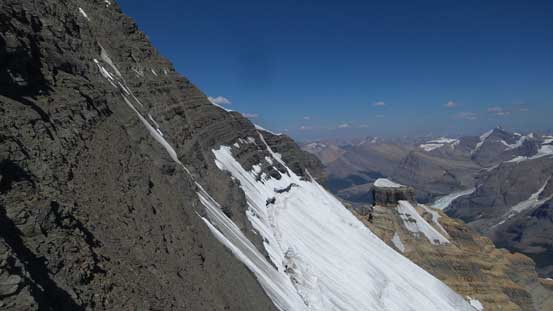
Looking sideways across the SE Face
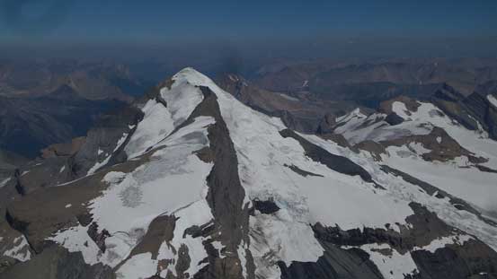
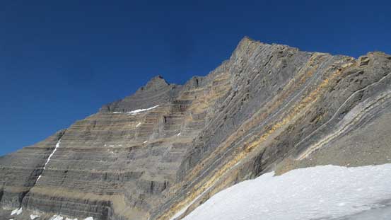
The typical view of the upper south ridge
Rope management is the key

Back to soloing after a few pitches of down-sloping egg shells..
The last move before terrain eased off

Summit Panorama from Whitehorn Mountain. Click to view large size.
Looking down the North Ridge/NW Face.
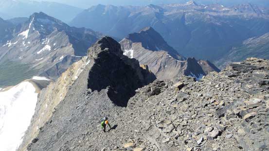
Exploring the summit ridge

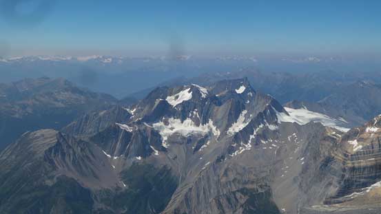
Mt. Robson and Berg Lake from a lower sub-summit
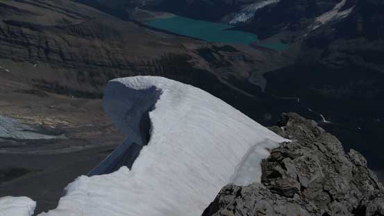
A massive cornice hanging on the north face
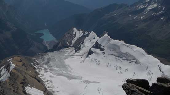
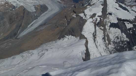
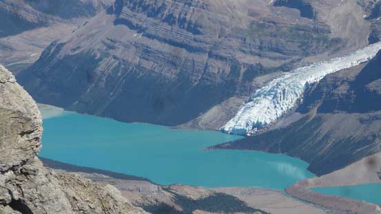
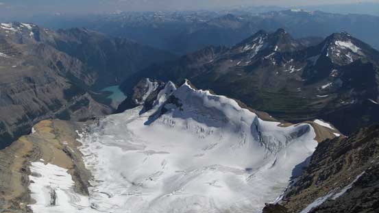
The SE Glacier with Kinney Lake way below
Mt. Phillips to the north
The East Ridge
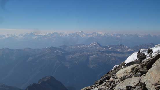
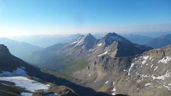
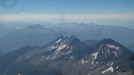
A smoky view towards the distant Cariboo giants – Sir Wilfred Laurier et al.
More exploration on the summit ridge
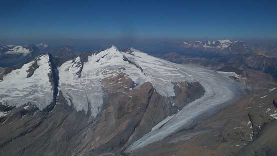
Mt. Longstaff is such a gorgeous peak
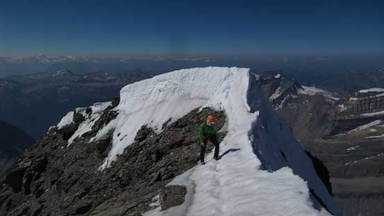
Climbing back up the snow lip to the main summit
Not sure if those peaks have names, but they look cool…
Cinnamon Peak looks tiny now in the foreground

Looking over a sub-summit of Mt. Longstaff towards more unnamed peaks
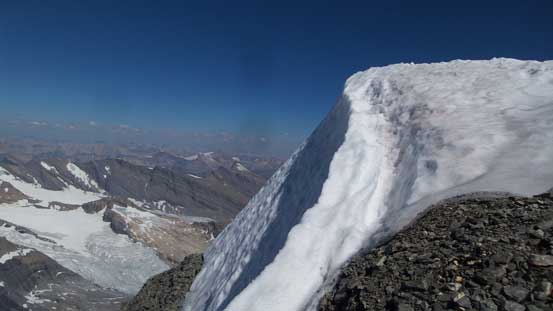
This summit cornice provided us essential source of water
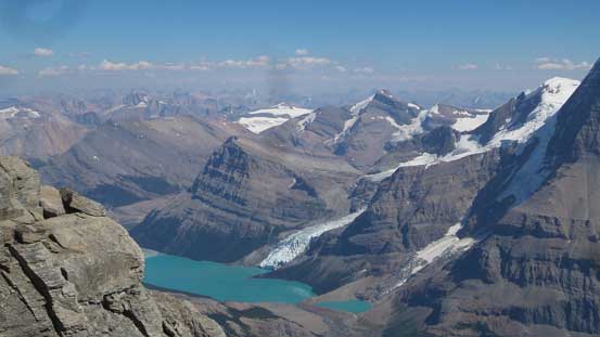
Berg Lake with Lynx Mountain behind
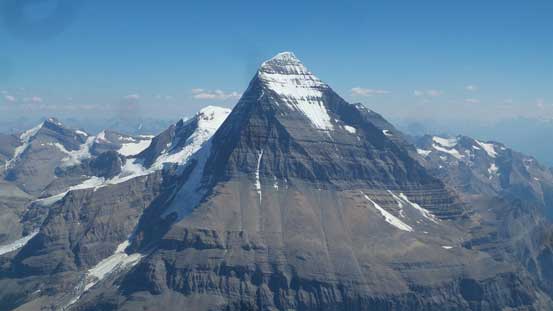
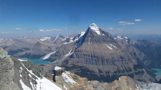
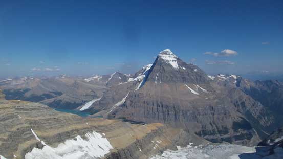
Mt. Robson
A closer look at the Emperor Ridge of Mt. Robson
Berg Lake. I actually haven’t been there yet…

Mt. Chown way to the north is actually quite close to 11,000 feet…
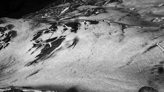
Can you see a set of ski tracks on the north glacier?!
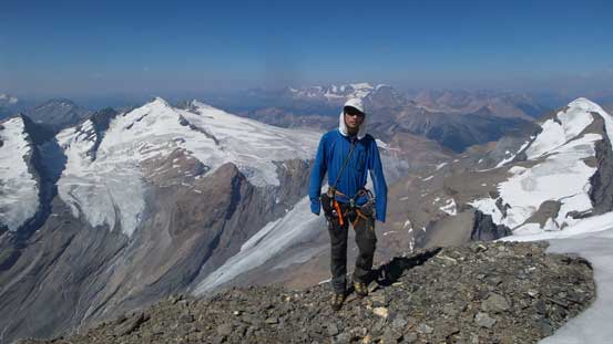
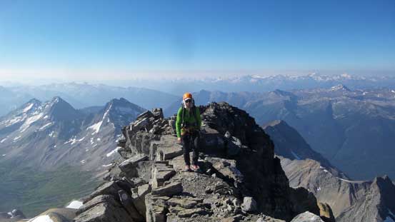
Me on the summit of Whitehorn Mountain. #44 /58
Descending the south ridge would not be pleasant but definitely doable with lots of tats and rappelling stations above the difficult steps. We did not see a reason to descend the west ridge as many other parties did so down the south ridge we went. For some reasons there wasn’t a anchor above the summit block pitch so we had to leave a long cord behind. That’s fine as we brought more-than-enough cords just for that purpose. And then 3-4 more short rappels using single 30-m rope got us down the steep part of the south ridge and then we were back to scrambling. Lots of care was required to walk back across the flat part of that ridge and then lots of treacherous down-climbing later we were back to the col. Traversing back across the upper scree ledge was at least fast going and then we tied the two ropes together to make a full-length rappel off the “4th class weakness”. There’s already a waterfall running down the weakness and at this point of a day none of us was in the mood to down-climb 4th class choss.
Time to go down..
The first rappel

A bit of exposed down-climbing traverse
The second rappel
Mt. Robson looks better in the afternoon lighting
Another rappel
The SE Glacier offers an alternative access
Just another rappel…

The west face ledges connect the lower south ridge to the west ridge
The SE Face might still haven’t seen an ascent yet
Descending…
More careful balancing…
Cannot stop shooting this giant…
Down-climbing the lower face/ridge
Typical, typical..
Choss fest at its finest…
It goes on and on and on..
A bit of a rest ledge
And then back to down-climbing
At least we had Mt. Robson in view
Back to the “col” now, time to grab the ditched snow gears and move on.
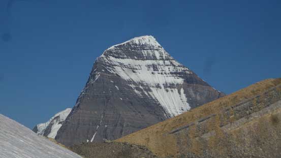
One last look at Mt. Robson
A full length rappel to avoid down-climbing 4th class waterfall…
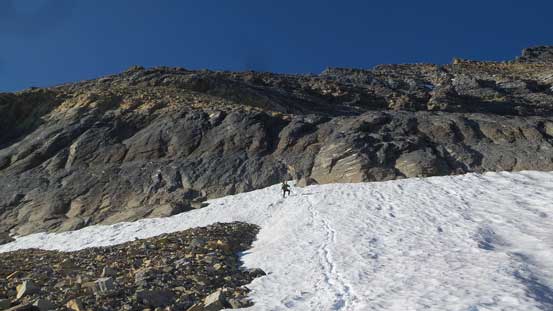
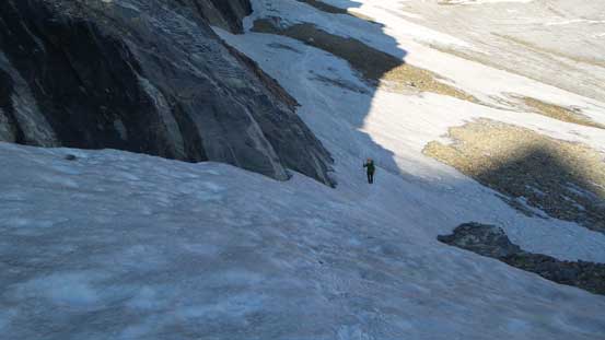
Descending snow was much easier.
Traversing back across the lower snow/scree ledge we opted to stay on the soft snow to save our knees, and then there came the most enjoyable part of the entire trip – a fantastic boot-ski down that pocket glacier. But soon enough we were back to the choss fest but at least going down a moraine was far better than trudging it up. Riding the scree avalanche was kinda interesting too… It’s not over yet as we still had about over a kilometer of hoping on either unstable boulders or rubble-fuck… At least the timing was right as we did manage to get back to camp when the sun was setting. That meant after the evening routine we could just pass out without having to worry about the heat. The bugs were terrible at camp by the way… And of course I still sweated in my +2 bag overnight…
Traversing on snow across the “low ledge”

Aiming for that glacier.
A bit of regain after the glacial descent. Traversing back skier’s right now.

You gotta like this .
And, you gotta find a way to enjoy this…
Finally back to camp. It’s sunset time already.
The next morning we managed to get going at a reasonable hour. It wasn’t early as the sun was already up for a while, but good enough. Walking back across that grassy ledge was a welcomed change of pace but then we had to face that gully section. Using our earlier observation we regained some height and traversed farther down-climber’s left. The ridge didn’t look much better but at least avoids much of the rock-fall issue comparing with the gully route. There’s still a ton of scrambling on moraines and we sent lots of microwaves down both sides. Even the refrigerators were moving when we touched and that did not look feel right… Eventually we got out of the hell and then into the bush. 500 vertical meters of “BC bush” wasn’t appealing but better than risking slipping on the moraine.
Time to go home..
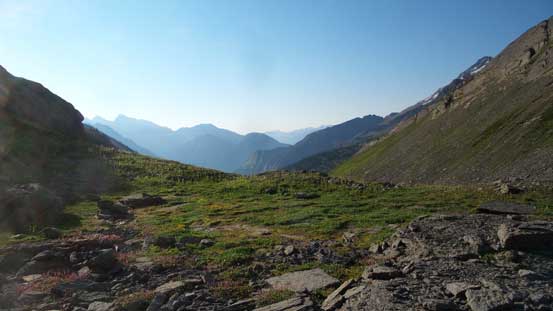
The long grassy bench

Ready for the moraine fest?!!
We opted to use a different, but experimental route. Hopefully it works…
It started out fine.

Sent lots of microwaves down… It’s a Friday and we were worried.

This shot shows where we were descending towards
Everything moves and between blocks was hardpacked moraine.

Into the bush was a relief
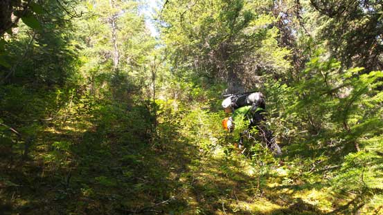
It’s steep and bushy but felt easy…
Back to the trail now I could finally say the 44th 11,000er was in the bag. Changing my footwear back to the trail-runners was the second happiest thing on this trip (after that boot-skiing).. The 9-km return eventually turned into a death march but again, on a pair of trail-runners it wasn’t too bad. It’s super satisfactory to look back at Robson and Whitehorn knowing I had just knocked the two (very different) beasts off in the last month.
Back to the trail now.
Kinney Flats. Lots of tourists around…

There’s even a cabin here… Felt more American than Canadian…
Kinney Lake

Reflection of Whitehorn in Kinney Lake
Finishing the trip at a mere 12:30 noon meant I had the whole day ahead driving back to Vancouver. I didn’t know whether or not I could make it but guess I was more exited about Whitehorn than Hungabee. Unlike a week ago I managed to pull the whole drive down in a single shot other than a couple stops for gas and dinner. I even had enough energy to make a Facebook update when I got back home at midnight which was surprising.
That being said I would recommend Whitehorn to NOBODY except for those who just “have to” finish the list. If you a better technical climber than consider the NW Face mixed climb or at least, use the SE Glacier to access South Ridge rather than the route we took. It was downright shitty. I think Whitehorn beats Sir Douglas to be the worst 11,000er I’ve done to date and there’s absolutely no way would I repeat any part of this climb in any manner… On the other hand, both Steven and I kept our spirits positive which made this another efficient and successful 11,000ers trip so I’m super stoked about that nonetheless. Nothing beats making a new friend on such a beasty objective.
