Compression Ridge
June 7, 2012
2500m
Kananaskis – Elbow/Jumpingpound Area, AB
After finishing Mount Fullerton and Nihahi Ridge, I decided to make the final decision at Nihahi/Compression col. Judging by the uncertain weather forecast for Friday, I made the decision for either grabbing Mt. Howard or Compression Ridge as this way I could take the most use of the good weather. Time didn’t allow me to grab both of them. Mt. Howard appeared longer so the decision was made to traverse Compression Ridge. Speaking this objective, it’s also well documented in Alan Kane’s scramble book and peak-baggers often combine it with Nihahi Ridge to make a full day. The traverse has lots of options for difficult scrambling (some avoidable and some not).

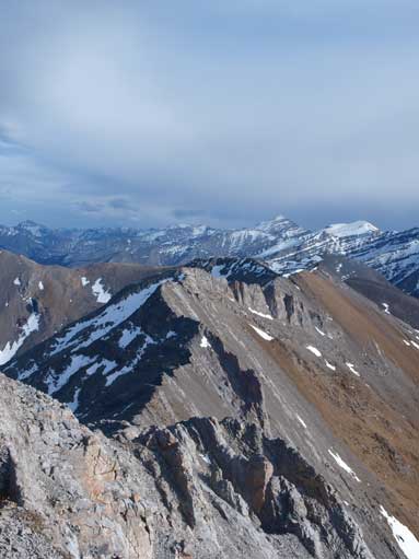
Mt. Fullerton, Nihahi Ridge and Compression Ridge scramble route link-up
The traverse started pretty easy, not much different from Nihahi Ridge. During which, I searched carefully the descend route. I had Kane’s Scrambles in Canadian Rockies book in my backpack, but it doesn’t show the descend route from 2nd window. If I traverse the entire ridge and descend to Canyon Creek, I would have to walk an extra 8km… I read Vern’s trip report about 1 month ago, and I still can remember some of it. I knew he descended from 2nd window so it would work. Even though, I still took some zoomed-in photos for later use.
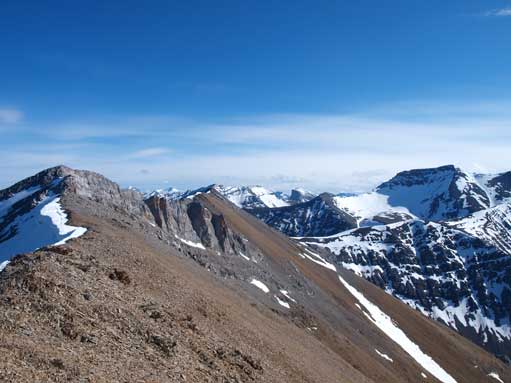
At one point, the ridge suddenly narrows, with jagged up and downs. This part can be avoided by dropped down the rubble slope on climber’s left. But I stayed on the ridge crest and enjoyed the first part of difficult section. Not far after this, the rock fin comes. I could vaguely recognize this feature from distance, but I forgot how did other scramblers overcame it. The source I had in my hand was Kane’s book, and it suggests to go around it on the left side, so I went that way. The rubble was tedious to descend, and much more tedious to ascend. I got tired of it and ascend the rock rib at the base of the fin. After the rock fin, more difficult sections came. I have to point it out here, the difficulty on Compression Ridge is about exposure, not about climbing. After negotiating some sections of ridge with a feet or so wide and drop-off on both sides, I made to the summit of Compression Ridge.
Looking back towards Nihahi from Nihahi/Compression col

This is the boring and long Nihahi Creek. I could have come down this way to finish the day earlier.
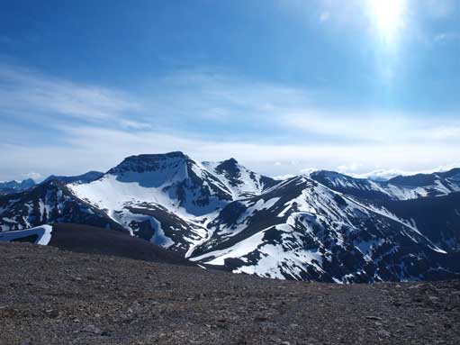
Mount Howard was still snowy
The start was pretty easy

Looking down Prairie Creek. This would be the way I went out.
Terrain soon became interesting.
Interesting view looking back.
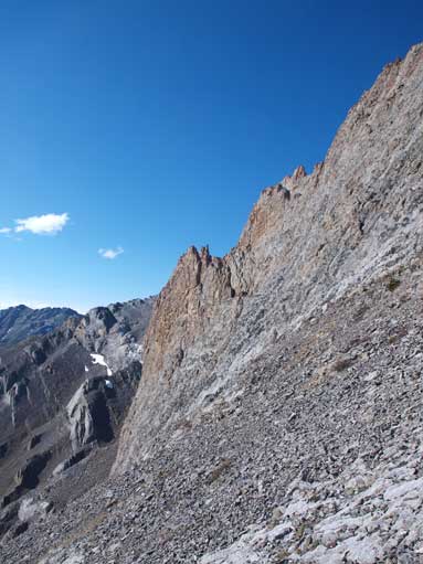
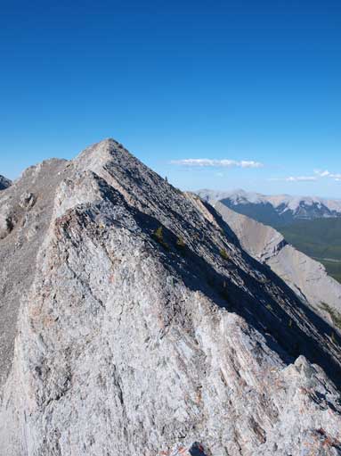
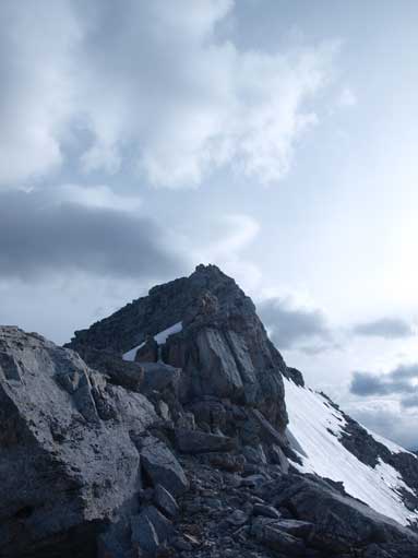
The rock fin
I went around it to save some exposed scrambling

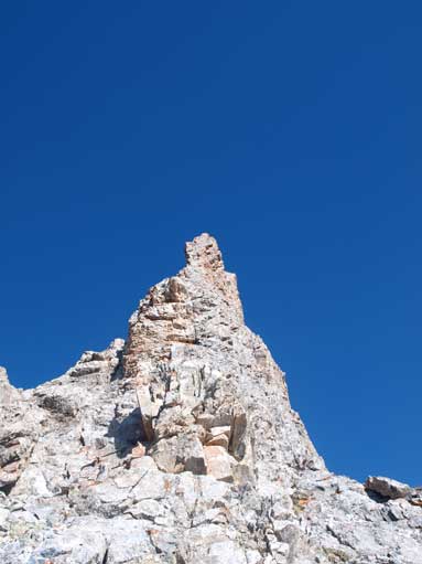
More exposed sections before the summit

See? Exposure

Just balanced over this part

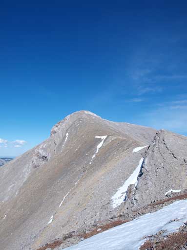
From this angle Compression Ridge looks like The Great Wall..
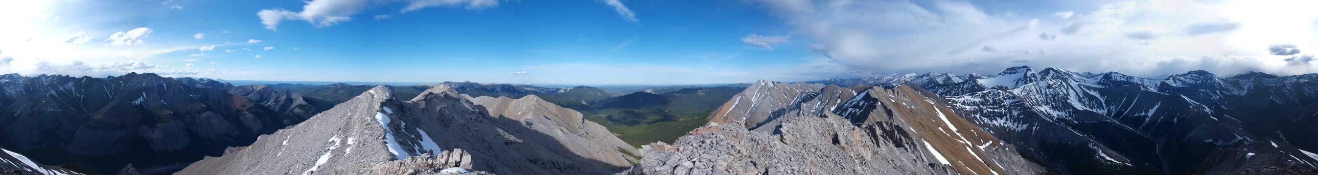
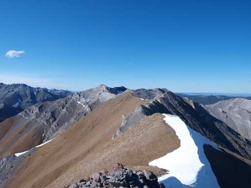
Summit Panorama. Click to view large size.
I like the colour of rocks

My backpack on the summit.
I didn’t linger any longer except for taking an obligatory panorama, and started the descend. You have to stay on top of the ridge to the next high two high points, while overcoming several “upper moderate” sections. When the ridge starts to drop, watch carefully for the 1st window. You shouldn’t be on any more section of 30cm wide ridge. When the ridge narrows again, drop down on climber’s right, and you’ll soon find out the 1st window on your left. From here, I traversed around those pinnacles on moderate terrain until 2nd window. The scree gully to my right looked perfect for descending and I got back to treeline in no time.
Time to go down
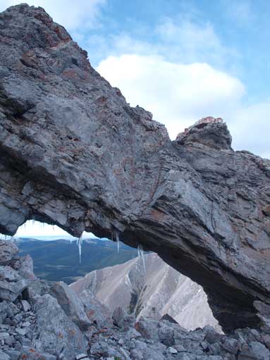
1st window

Traversing some exposed slabs

More interesting terrain. I went around this one on right side.

2nd window. Time to head skier’s right and have some scree skiing.
After about 10 min bushwhacking, I was at the bottom of the valley and I found the creek bed. I started to make bear calls about every 20-second. According to my map, I still had 5-6 km to go before reaching Powderface Trail (Road). Initially, following the creek bed was quite pleasant. I felt still good on energy at this point. I was actually walking on a faster pace then my regular hiking pace, partially because I didn’t want to linger too long in bear country by myself. I soon got to the large meadow/opening area, where I lost the creek… The terrain on the other side of the meadow was slightly uphill. I checked my photos taken on the ridge crest, and it showed I should go straight across the meadow, and I did exactly. From here, the ground got very boggy, and my boots were soaked pretty quick. There were lots of young grown as well, which slowed me down quite a bit. When I found the creek bed again, it had already become a flowing river, with boggy ground around. But what could I do? Just walk, walk, and walk, and finally I found a hiker’s sign on the right side of the creek. Aiming for it, I found another sign on the left side, which indicates I had to cross the creek. After that, a muddy trail led me to Powderface Trail.
It was almost 10 pm, and I wasn’t expect to find any car at this time… After consuming my last muffin, I started the final 11km trudge back to the parking lot at Little Elbow. Again, I was walking on a faster pace because of the fear of bear encountering. The road also has up-and-downs which was quite frustrating. The only reference was Nihahi Ridge on my right. I knew I had to pass all of it before getting to Highway 66. I don’t want to describe this section for too much, as there wan’t too much to say neither. I started to use head lamp at about 11 pm and another hour pasted, a car came by from behind. Thank the guy for taking me a ride, which saved me about 2km distance.
The distance and elevation gain indicates an epic trip, but I have to say, everything was in my control. I didn’t get into any bad situation, for example, bear encounter or getting stranded. My way (1 car, no biking) isn’t a smart way to tick off these three mountains, but on the positive side, it gets me prepared for any future longer trips.

I only did Fullerton with 5km bike approach and it felt enough for me.
Your stamina proved later to what you’re capable of achieving.
Astounding.
BTW Paul the guy I meet on this trip rode his bike to the base of Fullerton.