Chawuthen Peak
May 8, 2019
1537m
Hope, BC
The unofficially named “Chawuthen Peak” is the broad but wooded summit that boasts Chawuthen Creek and Falls near the town of Hope. The name of “Chawuthen” is better known for the creek and falls but seldom heard in the hiking community even among the die-hard peak-baggers. The steep north slopes drops just shy of one vertical mile of meters into the Fraser Valley. Logging roads system in the Hunter Creek drainage to the west and south of this peak has reduced the access difficulty to nothing. Active logging seemed to be taking in place and one can easily drive to the snow line in a HC 4×4 vehicle, and the spur roads extend to within 100 vertical meters from the summit.
I was looking to do a short and easy objective in the morning of this Wednesday as a “before work exercise”. I was originally planning on Harrison Hill but Chris H. got me convinced to explore some wooded ridges in Hunter Creek drainage following what Simon C. had recently done. I had previously never heard of the name “Chawuthen Peak” due to its unofficial status, but some simple research on bivouac.com and Gaia map led to the conclusion that this was indeed a suitable objective. Because of the relatively fresh beta we did not have to plan much in terms of contingency so agreed to meet at Abbotsford at 6:30 am. The drive to Hope was without event. I turned on the Gaia GPS and navigated to the start of Hunter Creek FSR. The road was steep and loose but by BC standard I wouldn’t call this “rough”. It somehow gave Chris’ Jeep issues and we were forced to park a bit lower than expected because the transmission line was overheated. A pile of fallen logs and several boulders on the road would nonetheless require effort to clear and we were happy to make to ~900 m elevation. That was about 1.5 km short of where Simon parked.
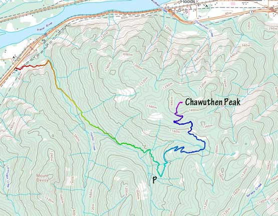
Chawuthen Peak via Hunter Creek FSR. GPX DL
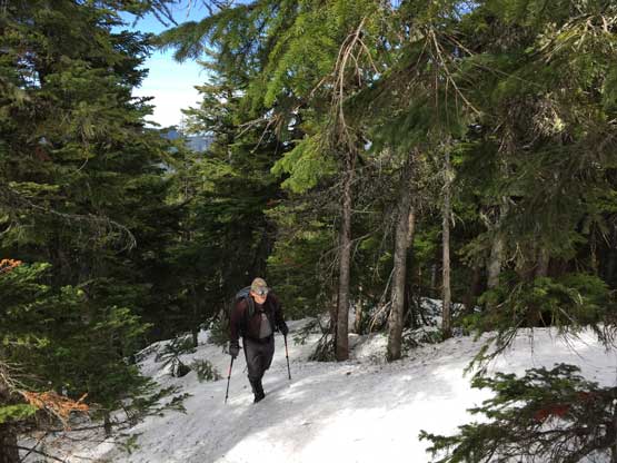
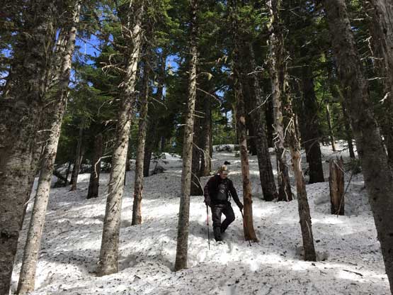
The ascent was mostly a no-brainer as we just had to plod up the logging road. Not sure what exactly to expect we decided to take snowshoes that needed to see some fresh air… The ascent did not require snowshoes on this day but we brought them for contingency. Other than that aforementioned pile of fallen trees and a few zones with boulders on road there was no major obstacle on this road. The road was snow covered for about 300 m distance traversing the northern slopes of “Insight Peak”. The post-holing was a bit tedious but because of the shortness of the stretches we didn’t bother to don snowshoes. Once the road ascended onto the southern aspects it became dry again.
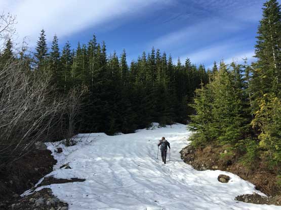
The first patch of snow we encountered

Chris H. post-holing on isothermal snow

The south aspect of “Chawuthen Peak” that we’d hike up
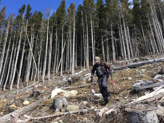
The highest spur of the road ascends higher than what Google satellite images suggests and we were able to get to within 100 vertical from the summit without touching bush. The transition into the mature forest involved a stretch of log hopping on a clear-cut but that was short-lived. Once into the mature forest we soon hit continuous snow but the snow was supportive enough that snowshoes weren’t required. The ascent to the highest point was trivial and the summit actually offered nice views down into Fraser Valley and the town of Hope, which was not expected. Given the satellite images I thought the summit would be completely forested with no view whatsoever.
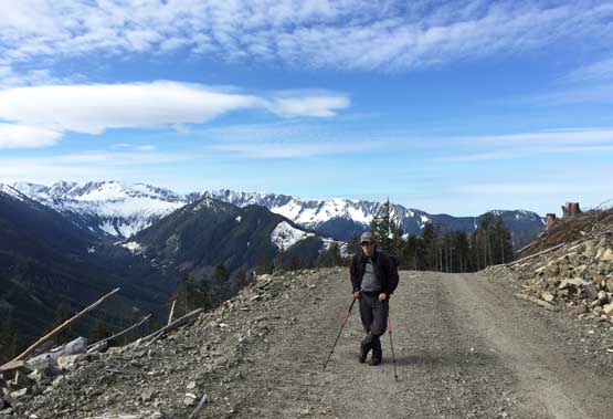
Chris higher up on the spur roads

Ascending the clear-cut
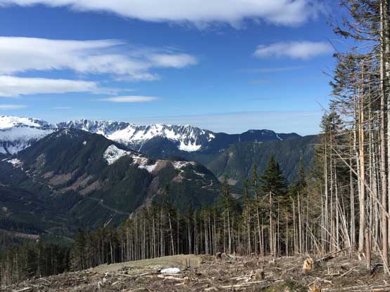
This is looking towards Mt. Barr from the highest of that clear-cut

Entering the forest.
As typical as the forest went. Continuous snow in the woods

The summit offers surprisingly good view of Fraser Valley and Dog Mountain

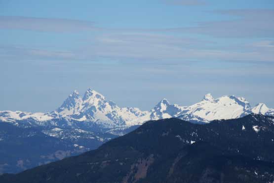
Zoomed-in shot of The Old Settler
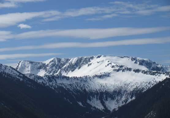
Mt. Judge Howay and the Stonerabbit Group

Mt. Baird

Hope Mountain
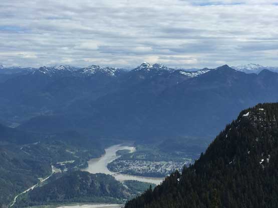
The town of Hope with Jorgenson Peak behind

Fraser River..

A closer view of Hope
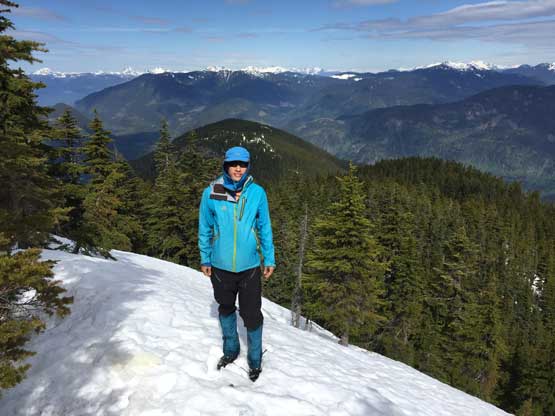
Me on the summit of Chawuthen Peak

Chris and I on the summit of Chawuthen Peak
We stayed on the summit for about half an hour. We had to deal with some post-holing in the forest. Once back onto the road the rest of the descent was uneventful other than the monotonicity.
Plunging down in the woods
Back to that clear-cut

Back to the logging road now. Looking at Isolillock Peak behind “Insight Peak”
“Sowerby Peak” which is basically just the higher/East summit of Mt. Barr
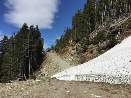
A slide path on the upper spur roads

It’s almost summer down low. That ridge is background is Slollicum Peak

Chris hiking down the road… As exciting as it seemed…
Chris’ Jeep did not overheat on the descent. The rest of the drive back home was easy, but the traffic on 16th Ave was a bit heavy. I got back home by 1:30 pm. There’s just enough time for food, shower and the obligatory internet updates so I didn’t get to take a nap, and that put the afternoon/evening work a bit tiring, but that’s okay…
