Thar Peak
February 5, 2019
1940m
Coquihalla Pass, BC
The stretch of Zopkios Ridge rises abruptly off the busy Coquihalla Highway and Thar Peak is the easternmost summit along the ridge. It’s rather geologically insignificant, and not nearly as iconic as the nearby Yak Peak, but does attract skiers in the South Coast because of the short approach and the sweet (and steep) terrain on its slopes. The standard route goes up the broad S/SE flanks that has a consistent grade of 30+ degrees, and the north side bowl offers some of the best, and easily accessible powder in the area. For ambitious skiers and climbers the north couloir offers another exciting line, shooting 500 vertical meters straight up from Falls Lake. A few years ago I had bagged Zoa Peak and Nak Peak in Coquihalla Pass but never returned for Thar Peak nor Yak Peak. Their easiness of access meant both could be done in half of a day and I was in no hurry for trips like that. I had wanted to save Thar Peak for a “morning exercise” – to drive out in the dark, climb in the morning and get back to Vancouver for work in afternoon.
This past Tuesday seemed like the right day with favourable weather along with some bomber avalanche conditions. The downside was the extremely cold temperature because we were hitting by an arctic high pressure system. I was expecting something like -20 degrees in the alpine with possible of strong outflow wind but such was not a reason to play the laziness game when I’m determined to head out. As usual I had trouble falling asleep before midnight so as a result I only got about three hours of sleep before the alarm went off at 4 am. I dragged my tired self out of the comfort zone of home and started driving eastwards down Highway 1. The outflow wind was crazy. I could see the speed-limit plates making some 60+ degrees angle with the vertical axis and I had to gas harder than normal in order to keep the 110 km/h speed (travelling directly against the wind). The temperature was reasonable in Fraser Valley but dipped rapidly as I ascended onto the Coquihalla, that by the time I exited at Falls Lake my thermometer was showing a burly -25 degrees… It was more brutal than expected, but at this point I just had to suck it up.
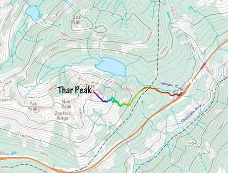
Thar Peak standard ski or snowshoe route. GPX DL
Stepping out of the truck was difficult but the worse was strapping snowshoes on. The rubber straps were so stiff (due to the extreme coldness) that I had to pull very hard to barely fit my boots to the ‘shoes. This gear transition took quite a bit of strength out of me and for some reason I was feeling an unusual lack of energy right off the bat. The first kilometer down the closed road went without event and then I turned left up the cutblock. The cutblock was completely tracked out by skiers but I could see that nobody had gone here since Sunday’s precipitation. There’s more elevation gain in the cutblock than anticipated. I correctly picked a set of skin tracks and entered the forest where the road turned downhill. It might be difficult to locate where exactly to bail into the forest, but any spot in that general zone would work, in my opinion. It seemed like the track was made by more than just one group of skiers so from this point onward I decided to just follow the tracks. The skin track deviated from my planned route and went farther climber’s right (NE) than expected, but again I decided to put my fate on the track, so carried on.

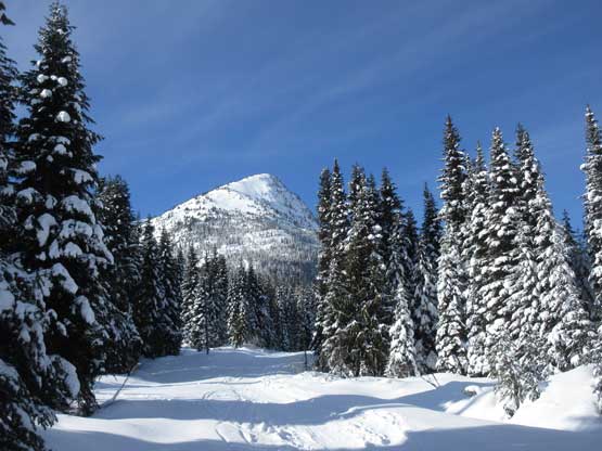
Thar Peak from near the parking lot.
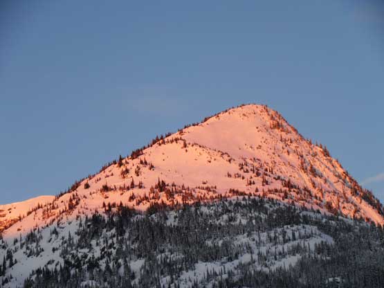
Thar Peak on alpenglow

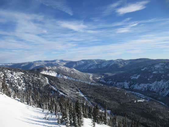
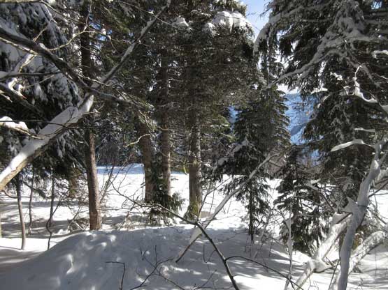
At the summer parking lot of Falls Lake. This cutblock goes up to Zoa Peak

I turned left and ascended this (steeper) cutblock
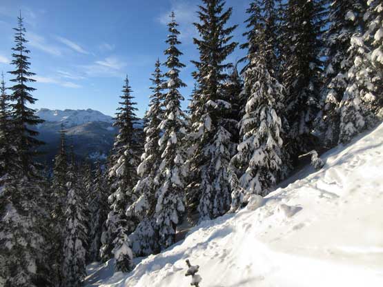
After a while I finally stepped into sunshine.

As you can see, the skin tracks were buried by the fresh snow and wind drifts

Some other parts of the skin tracks had survived the wind
There were sections where I couldn’t see the main set of skin track anymore due to the recent precipitation along with the wind transportation, but with a bit of guess work it’s not difficult to pick up the track again. About one third to halfway up the track dumped me right underneath an imposing bluff and started traversing horizontally out climber’s right (NE) skirting the base of the bluff. This traversing direction was opposite of what I had researched, but at this point it seemed like following the track was the smartest idea, so I carried on. The traverse was steep, narrow and moderately exposed that snowshoes barely worked. Higher up I followed the track zig-zagging a few times and made a long traverse climber’s left (SW). The route finally made sense now.

Nice and neat terrain. I see why skiers come here.
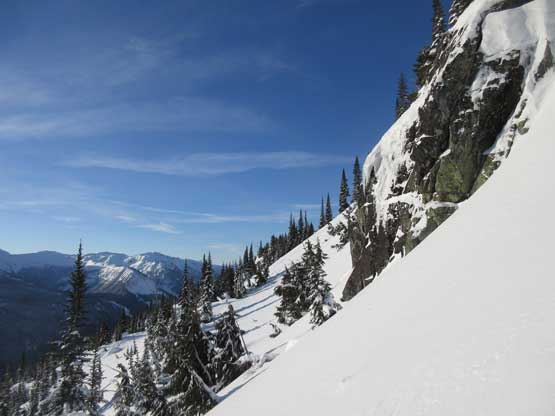
This is under that bluff where I traversed way out climber’s left
Looking back down to the Coquihalla Highway.
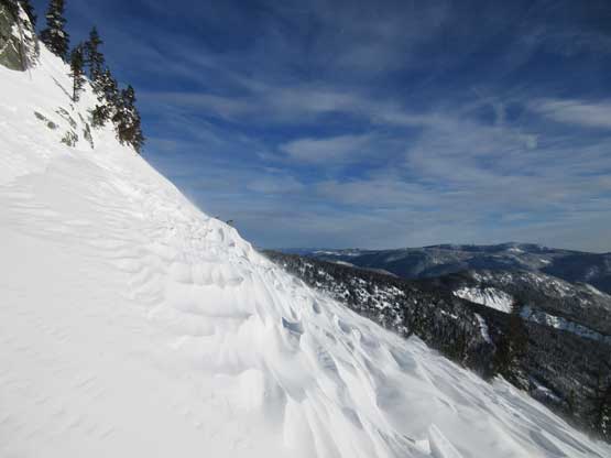
The sastrugi suggests how windy it was here…
Ahead was another steep section and the skin track stopped abruptly and the wind picked up suddenly. I assumed that they either turned around, or went boot-packing with the boot tracks already buried by the wind-drifted snow. With my 30′ Lightning Ascents (should have picked the 25′ pair) I had no issue ascending straight up the roll but any other snowshoe model wouldn’t work here. I kept a diagonal traversing mode aiming climber’s left overcoming a few more open slopes before joining the broad, sparsely-vegetated SE Ridge of Thar Peak. The rest of the ascent on SE Ridge was technically easy, but painful due to the extreme coldness and the gusty wind. I almost had to don parka but opted to power it through saving a not-needed transition. The parka was buried in the bottom of my pack and I was too lazy to dig it out. Unfortunately a broad band of high clouds had rolled in. I could see a clearing trend to the west but by estimate it would take at least half an hour to fully clear up: too cold to wait for that long.

This is the typical grunt on the SE Ridge. It’s steeper than appeared here
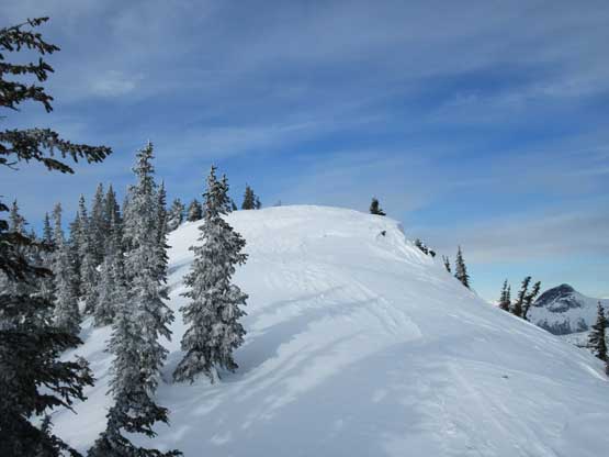
The last few meters to the summit

Summit Panorama from Thar Peak. Click to view large size.

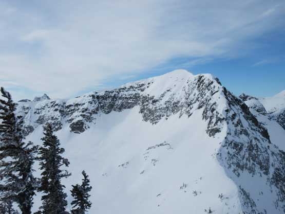
Jim Kelly Peak (L) and Coquihalla Mountain (R)

Vicuna Peak (L) and Guanaco Peak (R)

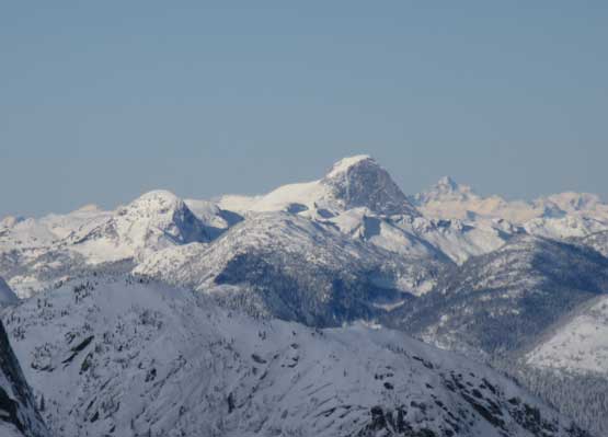
Yak Peak

Another shot of Yak Peak. This peak looks impressive from anywhere
Nak Peak

This is looking down the deep Coq. River valley towards Skagit giants
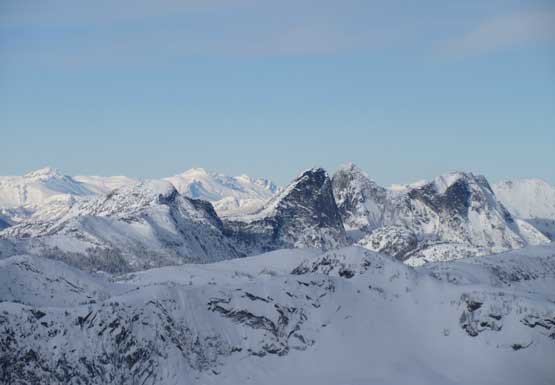
A zoomed-in view of the Steinbok/Ibex Group
Mt. Urquhart in the distance
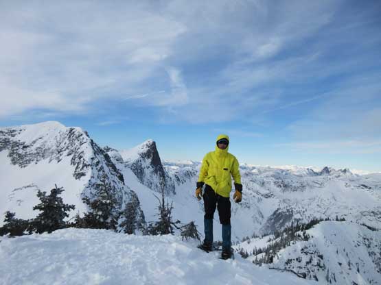
Me on the summit of Thar Peak
I soon started the descent. Plunging and slipping down the upper SE Ridge was not as easy as I thought with a few steeper rolls descended by “down-climbing facing-in” while wearing snowshoes. It was far from what’s recommended in textbook, but worked well for my kind of snowshoeing experience… I did have to take the snowshoes off to descend that long stretch of steep zone after bailing off the SE Ridge proper. I started by down-climbing while holding the ‘shoes and poles in my hand but turned around soon after hitting an icy spot. I went back up a little bit to escape from the icy spot and made an annoying (and awkward) transition donning crampons and taking the ice axe out. The snowshoes were strapped to by pack. I then properly down-climbed the icy zone with sections of front-pointing. Too annoyed to do more unnecessary transitions I decided to keep the crampons on until I absolutely had to don snowshoes. This involved a few long stretches of post-holing but given the bomber snowpack under the most recent precipitation I really didn’t need snowshoes until very low down. Negotiating that horizontal traverse under a bluff was more comfortable on crampons than snowshoes as well. After passing all of the sketchy spots I made one last transition storing the ice axe and swapping crampons for snowshoes. The air had warmed up considerably and I had a pleasant hike back to the parking lot, finishing the trip in under 4.5 hours leaving plenty of time driving back for work.

Time to head down. This is where I donned crampons
Fast forward. After a long while of post-holing I was back at the bluff traverse

Post-holing back across the traverse. Almost time to don snowshoes again.

This is looking up at the bluff. Any mixed climber?

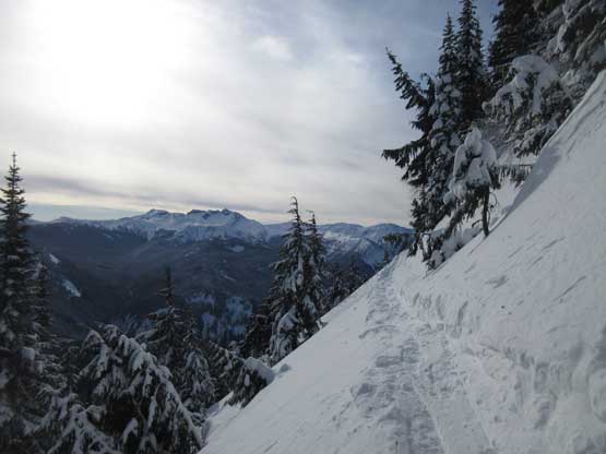
The rest was easy snowshoeing
Almost back to the logging road or cutblock.

Back to the road now.

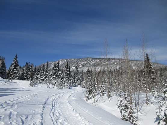
One can clearly see the cutblock going up to Zoa’s ridge

As you can see this was a pleasant hike-out

Looking back at the steep roll that I just descended
A review shot of Thar Peak from the hike-out

Thar Peak

The last one-kilometer hike-out was also quite scenic
One last shot looking back. It’s Zoa Peak up there.
On the way back to work I stopped for gas and A&W near Abbotsford. My original plan was going home first and swapping the truck for my Corolla heading for work but with some rough calculation I decided to cut straight to White Rock taking 16th Ave. I could have gone back home first but then I would have to rush a bit with no spare time to rest… I was too tired to think about work at this point so really needed to take a short nap. I guess I’m not as tough as a few years ago… It turned out that I got to White Rock by 2:30 pm and earned myself a valuable hour of sleep… I eventually got back home at 9 pm after work, exhausted but satisfied.
