Warden Rock
March 29, 2015
2694m
Ya-Ha-Tinda Ranch, AB
Though not nearly the biggest in its vicinity, Warden Rock is certainly a striking peak guarding the gateway to Banff National Park from East along Red Deer River. It kept catching my attention during multiple visits to Ya-Ha-Tinda area over the past two years. Through some careful examination of my pictures and thorough research on the Internet it’s apparently not a difficult peak to ascend technically but getting there is not an easy task neither. The lengthy driving on gravel road, the long approach on foot and the requirement to ford Red Deer River together has probably deterred most scramblers from even thinking about this ascent. Ben, Vern and I are hardcore peak-baggers so that’s not going to be the case for us. To make this major river crossing feasible we just had to do it in the off-season.

Warden Rock scramble route. GPX DL
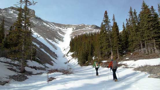
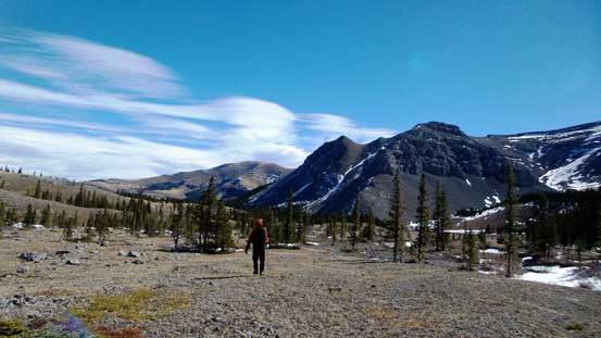
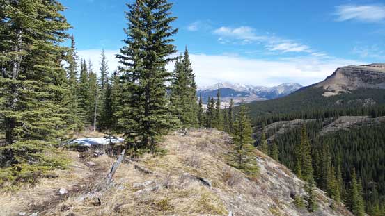
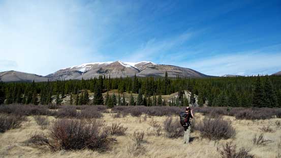
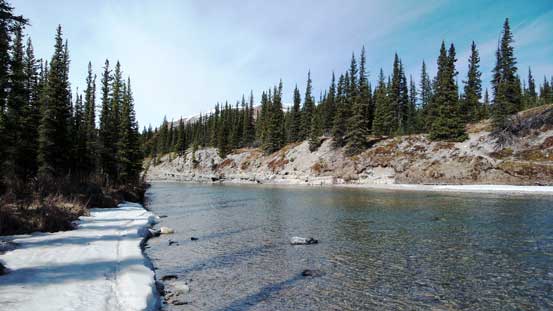
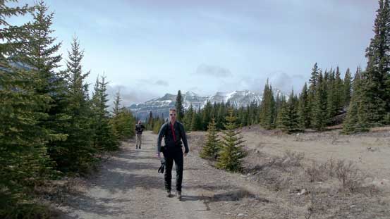
Taking advantage of the fact we camped at Bighorn Campground the previous night, we decided to wake up at 4 am in the dark to facilitate this long trek. It’s a Sunday trip so we all wanted to get back home early. The first 6 km or so would be a boring hike along the decommissioned road towards Banff Park boundary. Even though Ben and I had done this approach before we still made a navigation error this time. We missed an unsigned short-cut (ATV track) in the dark and ended up following the truck road veering more towards north than west. It got us back on track eventually but the path was much more circumventing than necessary. In just over 1 hour we left the trail and bashed our way downwards to the bank of Red Deer River. At this time of a year the fording was easy and refreshing and by this point it finally got bright enough to not need headlamps.
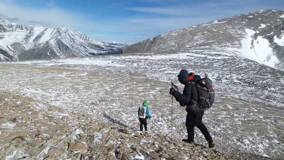
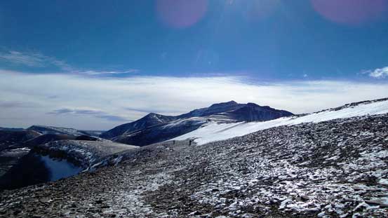
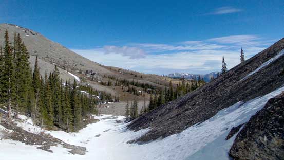
Loosely ascending the obvious drainage that came down from the basin beneath Warden Rock and Barrier Mountain on the west side of the creek we accidently came across a well-defined horse trail. Note that this is not the “Hidden Falls” trail described on the government trail guide but rather a mythical trail unknown to most people, including us. This trail brought us a long ways up the forested slope high above the creek bed and shaved off a couple kilometers of bushwhacking for us. But despite that, it’s still a tediously long bash to the large cirque at the base of our objective. At roughly 2 km from the ascending slope we came across some large patches of snow (knee deep) and lost the trail so there was still some bushwhacking to do. The wind also picked up considerably at treeline and this got us mentally prepared of what exactly to expect once hitting the summit ridge.
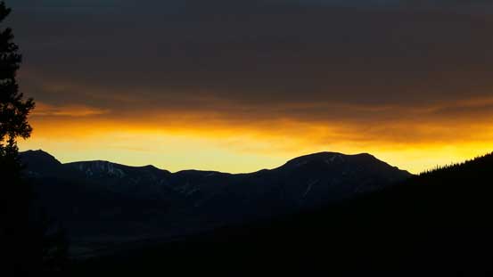
A band of morning colour on the Eastern horizon
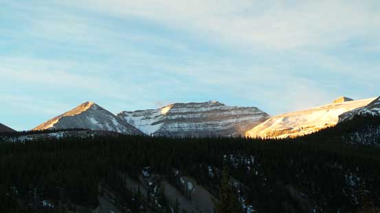
A bit of alpenglow on Barrier Mountain
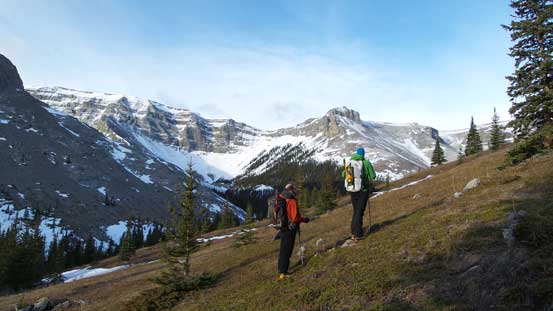
Vern and Ben hiking into the cirque/bowl beneath our objective
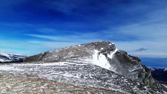
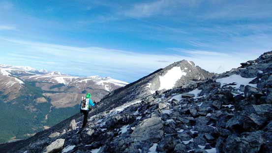
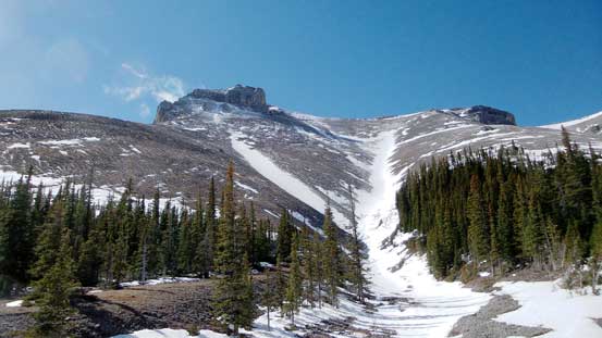
Warden Rock ahead
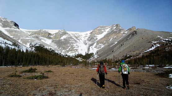
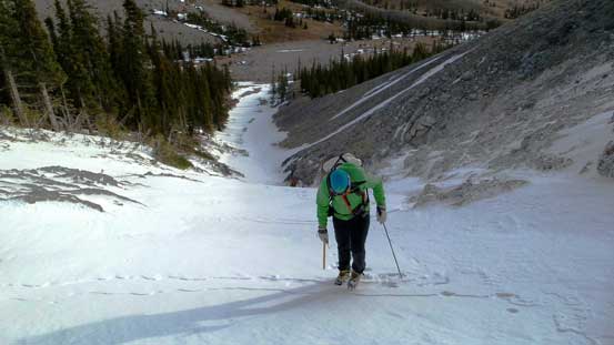
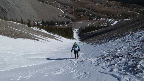
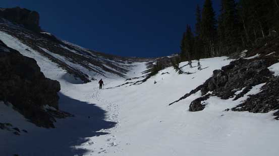
The slog from this cirque to the summit ridge of Warden Rock appeared to be very steep and ugly but thankfully there was a snow gully assisting our ascent. The gully wasn’t as steep as it looked and the snow was rock hard making some fast travelling conditions. For about 1/3 to half of the length we were able to front-point straight up. Once exiting the gully we still had to slog up some ugly scree before cresting the broad summit ridge.
We found a fast way up!!
Nice to squeeze in some fun snow climbing into objectives like this.

We were welcomed by a group of sheep
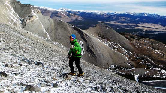
Vern slogging up scree higher up

Ben just about to tackle the last snow slope before the summit ridge
It was here that the wind finally picked up to crazy to the point that we barely could stand up… Traversing the broad summit ridge was nothing rocket science but given the wind gusting to perhaps 100 kph we really had to fight with it. It’s also quite a long way to go thank to the foreshortened view. The final traverse to the true summit was somewhat narrow and exposed towards climber’s right side making some interesting moments in the wind but nothing overly tricky (it’s an easy scramble overall). I kept my center of gravity fairly low for more control in case of a sudden gust. Thankfully the wind wasn’t as crazy near the summit as it was lower down on the broad ridge/plateau.
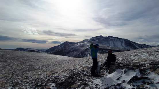
Vern and Ben putting their balaclavas on… The wind was crazy.
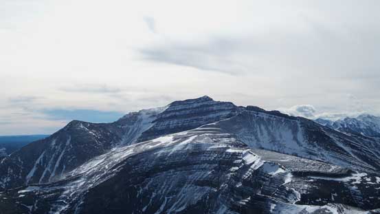
The broad summit ridge isn’t as easy as it looks in the gusting wind.
Vern and Ben fighting with the strong gusts.

Great view of Gable Mountain towards west
The final traverse to the true summit
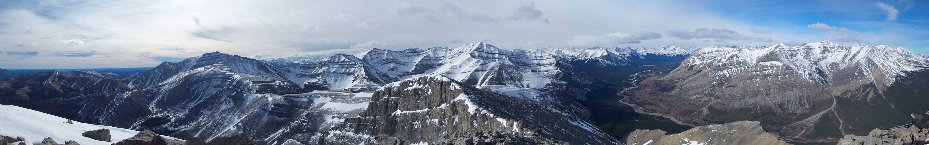
Summit Panorama looking west. Click to view large size.

Summit Panorama looking East including me myself. Photo by Vern.
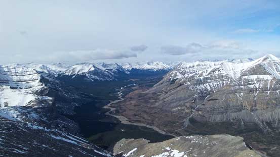
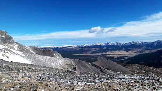
Red Deer River valley
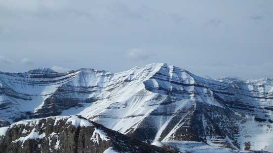
Gable Mountain
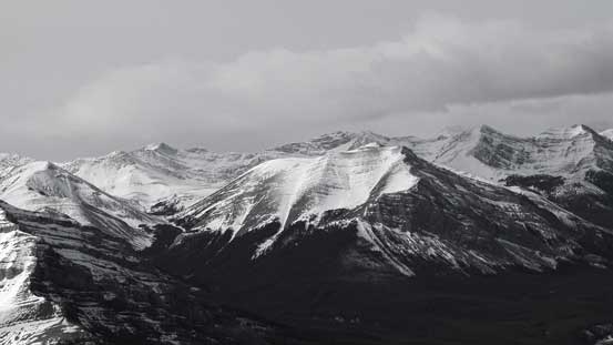
This one in the foreground is Mt. White, with Prow Mountain behind on the far right
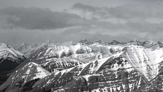
Peaks behind the shoulder of Wapiti Mountain including Mt. Tyrrell

Red Deer River Valley. We were able to spot the broad trail leading into BNP

Some easy-looking peaks towards North
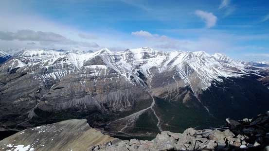
The huge bulk of Wapiti Mountain
Barrier Mountain towards south
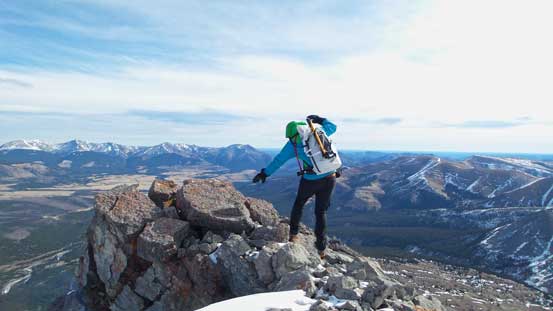
Vern balancing his way to the edge
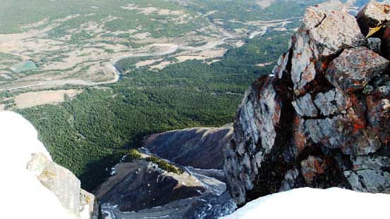
The north face is a shear drop-off!
For obvious reasons we didn’t linger any longer than necessary on the summit so immediately started the descent. The wind got even stronger by now and I even got picked up once while descending the broad ridge. It was just fierce… The steep descent down the scree and then snow was fast and fun and in short time we were back to the broad bowl/cirque at treeline. I think this would be a great bivy spot. By now the hard work was finally over and it was merely putting one foot in front of another down the horse trail back to Red Deer River. Fording the river felt very refreshing but the final slog along that decommissioned road was tedious.
We would have enjoyed it much more if the wind wasn’t nearly as strong
Traversing back along the broad ridge

Descending the smaller snow slope near the ridge crest
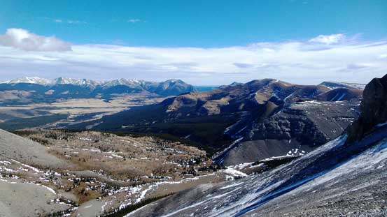
Great view towards the Ranch
Vern descending the main gully
Ben walking down the snow
Into the broad bowl
Looking back at our ascending gully
It was still very windy here!
Now we were sheltered from the wind. Time to enjoy this beautiful afternoon!
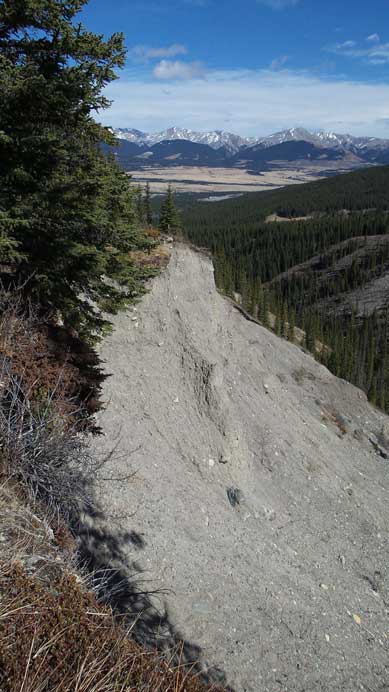
A massive erosion feature.
Ben hiking down the horse trail
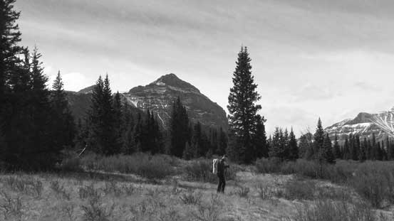
Down to the river flats, looking back towards Warden Rock
The broad peak ahead is locally known as Well Site Mountain
Back to Red Deer River
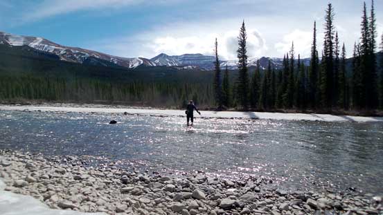
Vern fording the river
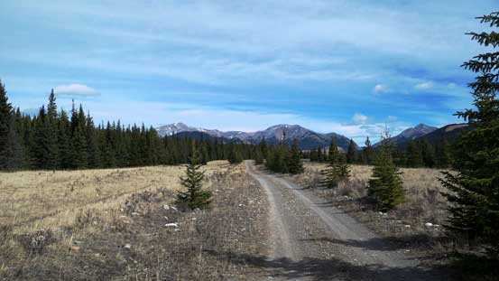
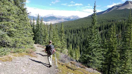
Oh the final slog along that road. Very boring and tedious…
Vern and Ben hiking back along the road

Weather was moving in once we got back to the trail-head. Well timed!
Our round trip time was 10.5 hours on a fast pace which was just as expected. It’s a satisfactory ascent but I probably will only recommend Warden Rock to scramblers capable of long days and don’t mind quality suffering. Breaking it into 2 days isn’t a bad idea neither since most part of the ascent is pure slogging.

[…] Here’s some information if you’re interested in summiting Warden Rock. […]