Mount Balfour
February 8-10, 2014
3284m
Yoho / Waputik Icefield, AB/BC
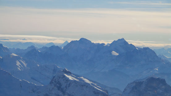
Mount Balfour, king-of-the-Wapta, is the highest, and one of the ‘sexiest’ peaks on Wapta/Waputik Icefields. I’ve done quite some peaks in Lake Louise area, and Mt. Balfour its always the one that stands out from the sea of mountains. Getting a photo of its giant glaciated east face has become an ‘obligatory’ for all the scrambles nearby. Needless to say I’ve been eyeing on it for quite a while already. Previously I wanted to ascend it in summer mainly due to the (relative) easiness to access. (The shortest way to get Balfour is from Takakkaw Falls parking lot, crossing Yoho River and bushwhacking up the west slopes to access Fairy Glacier). But this is not gonna be the case in the dead winter as Yoho Valley Road is closed. People have ski’d it via quite a few ways, via St. Nicolas/Olive col, via Hector Lake or via Daly/Niles col, all of which are traditional routes to access the Wapta Icefields. No matter what way you go, it’s definitely a full day outing just to get to its base camp (Balfour Hut or Scott Duncan Hut).
Usually the icefields ski ascent season doesn’t start until spring time (mid-March ish). Early February is still considered as ‘early season’ for skiing especially in this year due to the low amount of snow fall. However, after seeing the forecast for the past weekend, I figured it’s the time to push things a bit harder. The weather was blue bird a couple days in a roll, and avalanche hazard was low/low/low. This is the very ‘unusual’ Rockies condition that rarely happens in winter months. But once it happens, we have to take full use of it. Our original plan was Mt. MacPherson and Fred Laing Ridge in Revelstoke area, but they can wait as those peaks are doable all year round, so I threw out my plan: depends on how many days we have, 3-day ascent of Mt. Balfour, 2-day ascent of Mt. Baker, or a 1-day ascent of Mt. Olive. Eventually Eric, Ben and I agreed to climb Balfour from Saturday to Monday, via Niles/Daly col and Scott Duncan Hut. Note that this is a slightly longer approach route than from Balfour Hut, but considerably safer speaking the crevasse hazard.
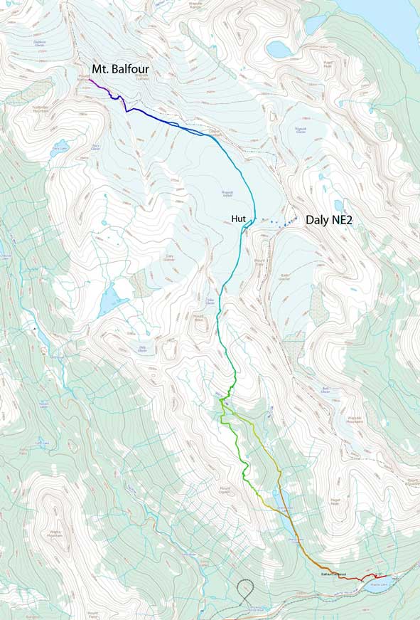
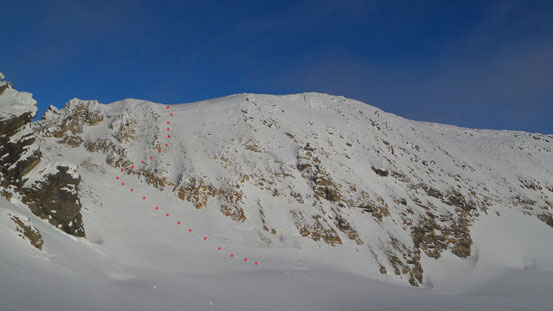
Mt. Balfour ski ascent route via Scott Duncan Hut. GPX DL
Now comes the detailed planning stage. Neither the approach nor the ascent is straightforward and we had to do some thorough research. My strategy was breaking the entire ascent into many short sections and every part must go correctly otherwise we wouldn’t make it. I mean, even locating the hut isn’t an easy task since none of us had been to Scott Duncan Hut before. Combing my photos taken from Paget Peak, the fact I’d just scrambled Daly and Niles last year, Chic Scott’s Summit and Icefields book and Vern’s trip report, it became pretty clear. Well, we still ended up making a big navigation error (blame the darkness and the yoyo skiers)…
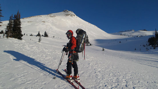
Obviously this would be the coldest trip ever… Forecast was calling for low temperature around -35 degrees in Yoho for all of these days. I’d never gone out in this condition before and this would be the first time. We’d also haul our -20 sleeping bags up since Scott Duncan Hut doesn’t have heating and we had doubt if it’s insulated enough for this temperature… The trip also started with the coldest car camping ever.. Eric bravely volunteered to sleep in his bivy sack outside the car which was even colder. Ben and I slept inside the car and I still had to keep all the layers on inside my -20 bag.. Two nights in a hut was already ridiculously expansive and we figured it’s not necessary to spend another 37 bucks for a hostel stay (for only a few hours anyway). One big advantage of car camping is giving us a much faster starting, and at 4:30am, we found ourself already skinning up the Sherbrook Lake approach trail.
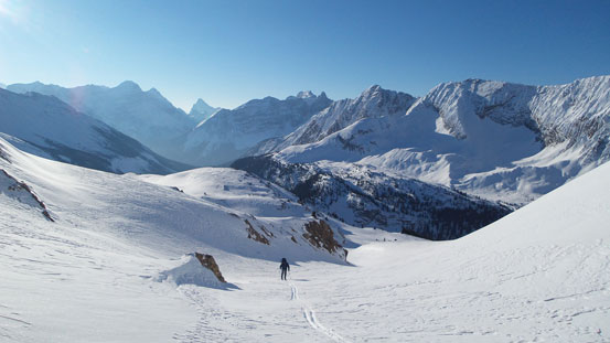
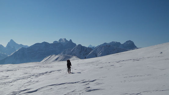
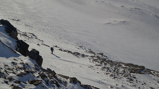
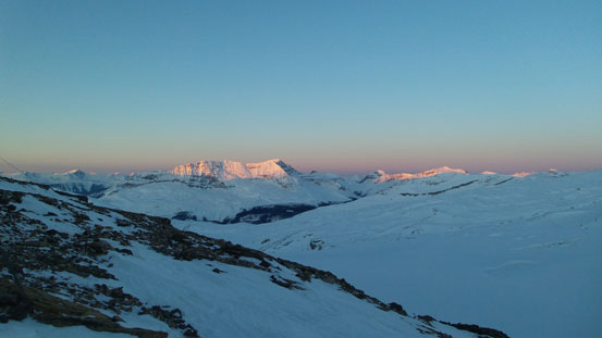
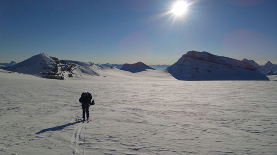
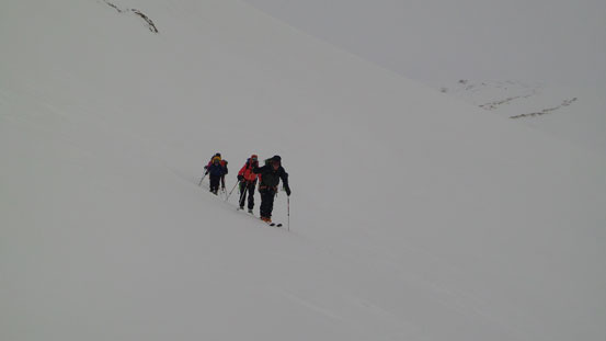
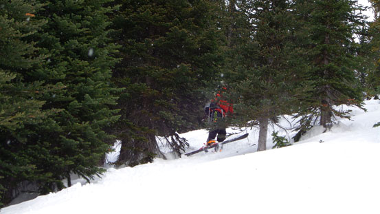
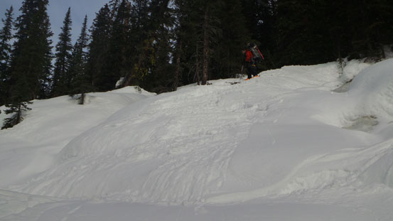
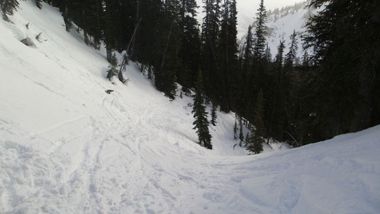
The trail was packed down by all kinds of traffics (skiers, snowshoeers and boot-ers), and we made to Sherbrook Lake in good time. This lake was much colder than the trail, even colder than the parking lot, and we were cruising across it as fast as we could in order to stay warm. It was still pitch dark and we couldn’t see anything more than just the outlines of the surrounding mountains. A major branch of the ski track was deviating more towards the left side. We made a huge mistake trusting this set of tracks and ended up wasting at least an hour and perhaps a ton of energy… It’s pretty funny that by following my instinct I don’t remember making this kind of mistakes. Everytime it was always trying to follow a ‘route description’. The book describes the other side of this lake having a narrow terrain trap and waterfall so skiers should go climber’s left, up and over a hill, so… In fact this tracks were made by yoyo skiers skiing the slopes high on Mt. Ogden. By the time we realized our mistake it was too late and we were too high on Ogden’s shoulder already. Checking my GPS it was very hopeless. We left the “trail” immediately and lost some elevation to a lower ridge hoping to find a way to regain on proper route, at a couple hundred meters vertically down on our right side… If there’s no easy way down, we had to ski all the way back to Sherbrook Lake. Thankfully the other side appeared to be ‘doable‘. It’s a giant slope.. Given the good stability we decided to traverse this slope in order to eventually rejoin the Sherbrook Creek at its upper end (not at the lake’s level). I nervously led the way down here. Traversing this slope was dicey and really reminded me the crux slope traverse on Mt. Wilson. Lower down we kept traversing at treeline about the lower cliff bands, and eventually at near Niles Meadows, we ski’d down to the upper Sherbrook Creek.
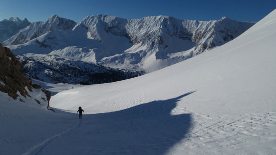
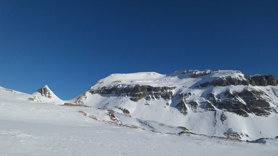
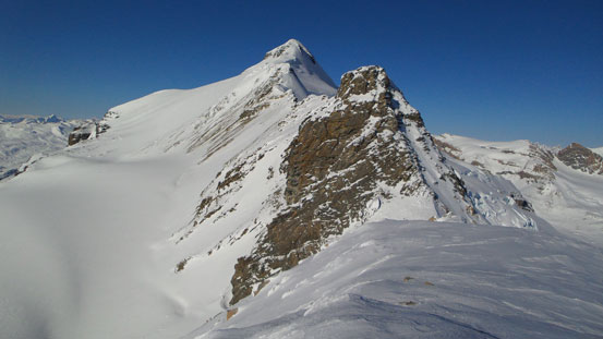
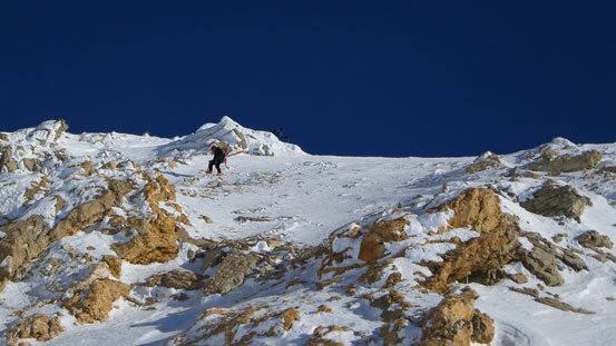
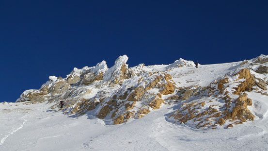
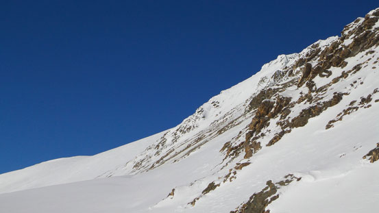
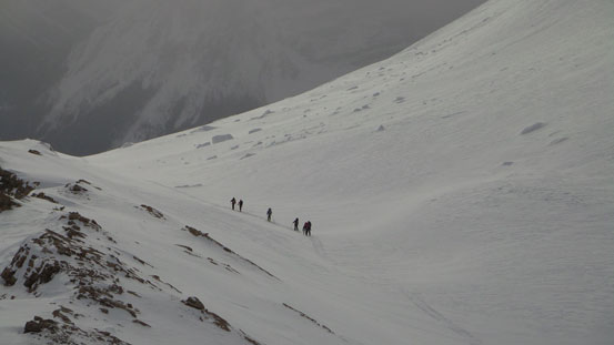
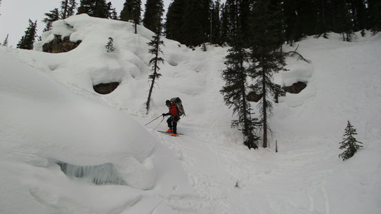
We couldn’t find skin tracks on the opposite side but given what we just did I paid much closer attention to the GPS and from here on we didn’t make any more navigation error. After skinning up a very steep and crusty creek section (Ben and I actually put ski crampons on here), we cut climber’s right and switchbacked steeply up a treed slope. After a long time we finally broke through the treeline again. Around the shoulder, up a couple gullies and slopes, we finally got our eyes on the distant Niles and Daly. It’s also here that the winter route finally re-joins the summer route. Getting closer to the base of Mount Niles, we had to traverse a couple steep slopes with cornices hanging high on the left side ridge. The hardest part came at just beneath Niles. At this point we were actually on a tiny glacier and there’s a steep scoop to traverse over. It was too icy and steep that even ski crampons wouldn’t help and we had no choice but losing more elevation to go around at its bottom. And then, up again, we were at Daly/Niles col. (There’s a little ‘Pyramid’ in between and the proper route goes through Niles/Pyramid col).
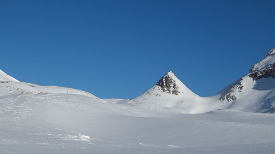
An unnamed peak north of Mt. Ogden
Ben skinning towards Niles’ shoulder

Then up this gully
Looking back at Eric skinning up this gully
Higher up
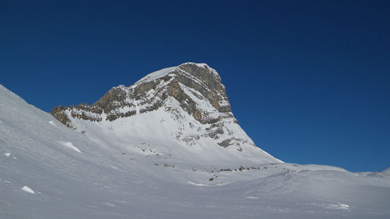
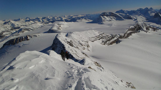
Finally could see Mount Niles
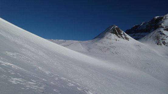
The col is to the left of this ‘pyramid’
This area is subjected from cornice fail
Icy and crusty snow around here
We had to traverse across this scoop

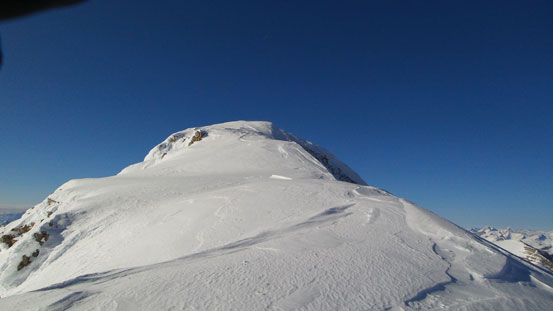
Then looking back at Niles from Niles/Daly col
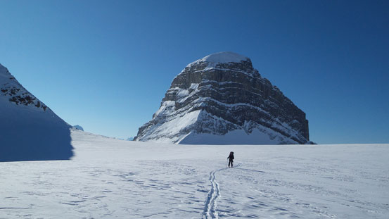
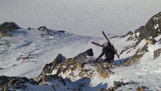
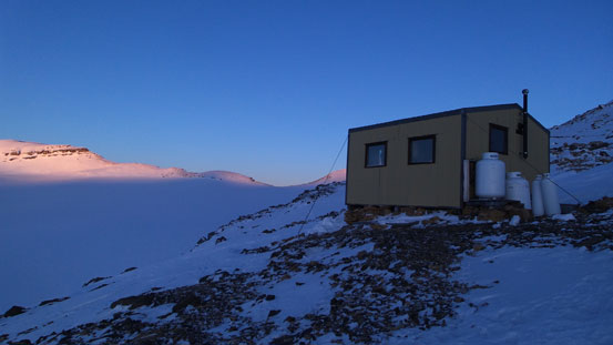
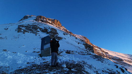
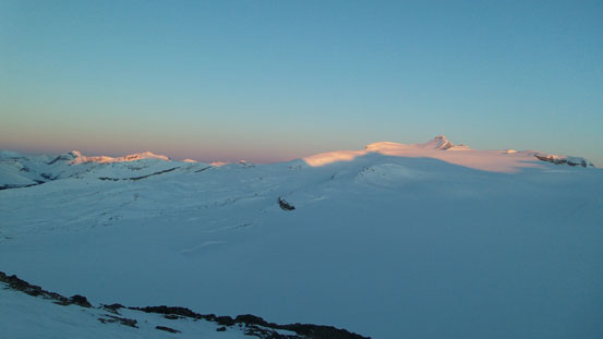
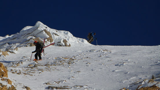
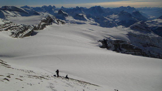
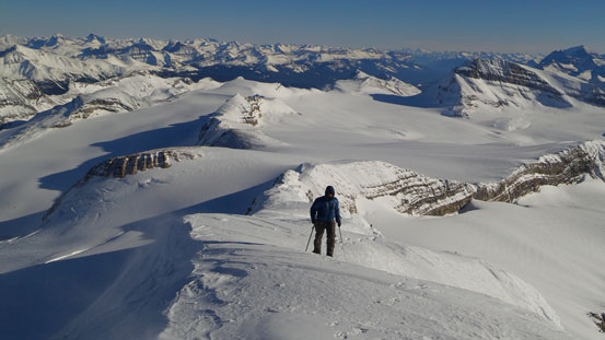
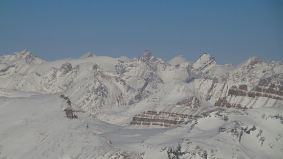
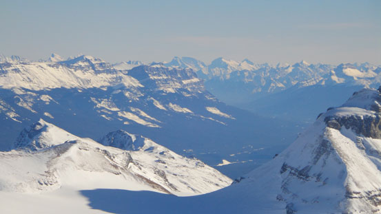
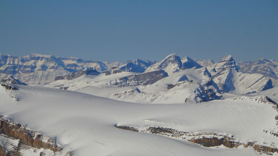
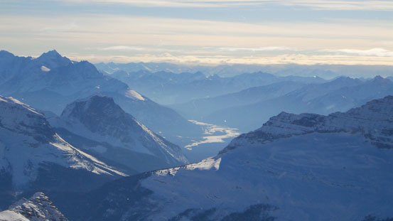
Over the other side we were officially on the Waputik Icefield, and we finally got a view of our objective, a long way ahead. Scott Duncan Hut is on a rocky ledge at the NW end of Mount Daly and we aimed straight towards it. It’s much longer than appears (well, kinda the theme of any sort of icefield travel). Near the hut, the proper route goes down and around while losing 50 meters or so elevation. On this particular day we didn’t find the need to do that and decided to scramble up a steep rocky/snow slope to directly gain the hut. Actually, it turned to be more difficult than expected. If we knew it’s that difficult we’d choose to go down and around. The last part required traversing a steep, icy and exposed slope following by climbing up a short but very steep couloir. We had to strap the skis on our backpacks and boot-crampon up it. This hut was at a very scenic corner and granted us a whole panorama of the Waputik Icefield. Obviously we’d have the hut to ourselves (at least for the first night).
Looking back towards Mt. Niles from Waputik Icefield
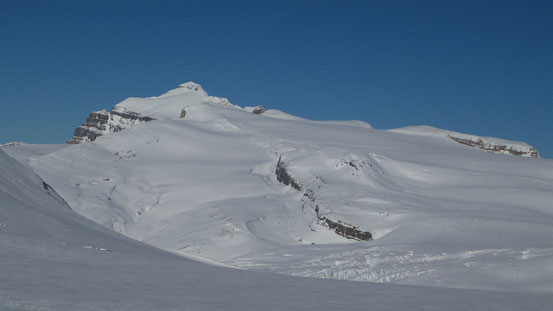
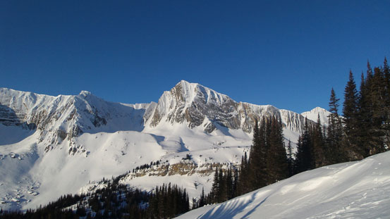
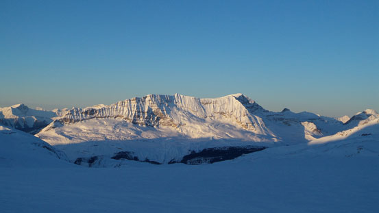
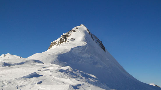
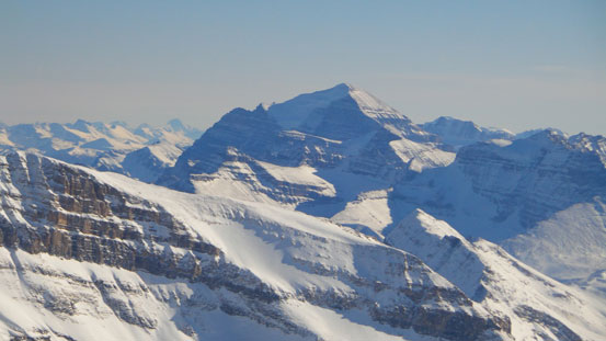
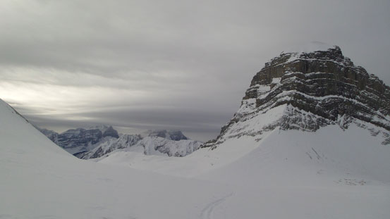
Mount Balfour, our objective
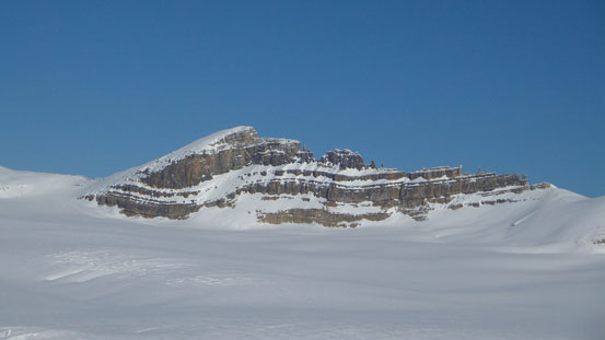
Lilliput Mountain. We didn’t have enough time to bag it on this trip.
Kiwetinok Peak and Mt. McArthur in the Little Yoho valley
Ben coming up the steep and exposed short-cut
Eric skinning towards this short-cut
Ben coming up the hardest step
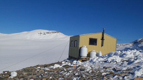
And then, here’s Scott Duncan Hut
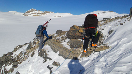
Eric coming up this short-cut slope. Pretty tricky indeed.
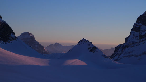
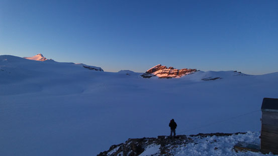
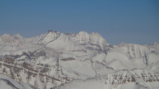
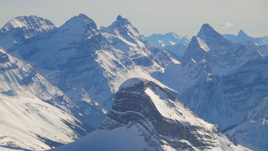
It was 2:30pm ish and the unnamed peak on the opposite side of Mt. Daly started to catch my attention. According to the map, it’s slightly higher than Lilliput and has about 120 meter prominence so should qualify a separate peak. Ben and Eric wanted to stay around and since I had a couple hours to kill before sunset, I decided to check it out first. It doesn’t have an official name but since it’s about 2 km northeast of Daly, I’ll name it Daly NE2, and this part is covered in a separate trip report. Coming back to the hut from the scenic summit of Daly NE2, we were ready for shooting the sunset photos. Mount Niles looks ridiculously impressive from this angle and since Scott Duncan Hut stands about 50 m higher than the massive Icefield, we got some excellent dusk photos.
Scott Duncan Hut at sunset
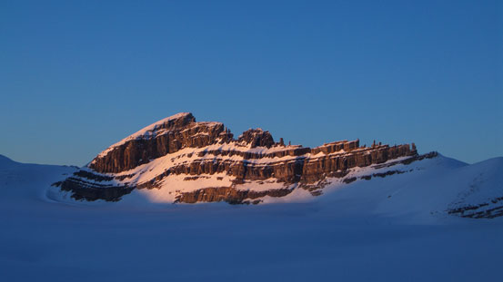
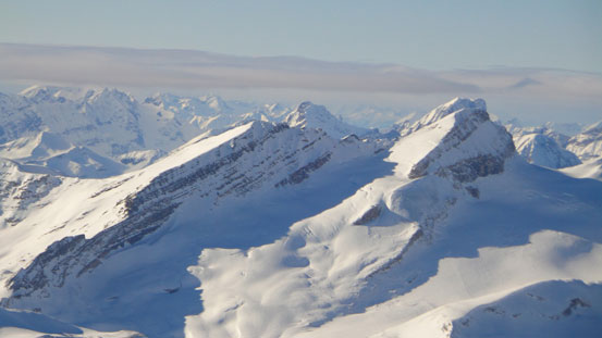
Lilliput Mountain
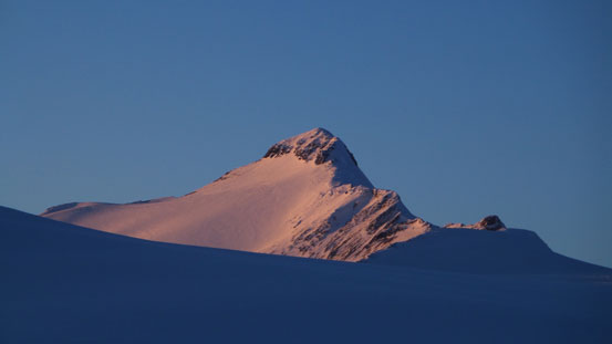
Mount Balfour
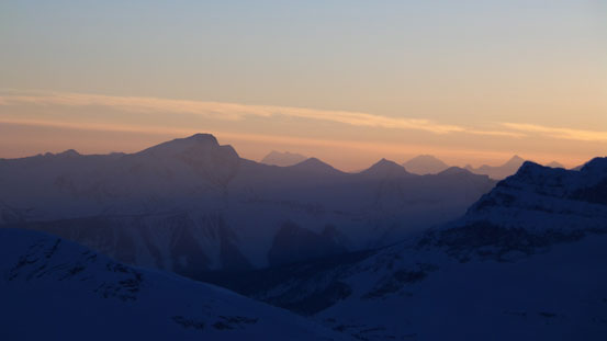
Dusk over Yoho N. Park

Mount Niles
‘Pyramid’ and Niles/Daly col
Ben shooting sunset photos, Mt. Daly behind

Looking towards Daly/Niles col and Mount Niles
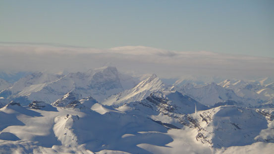
The Waputik Icefield which we’d cross the next day
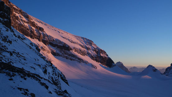
Evening glow on Mount Daly
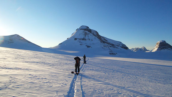
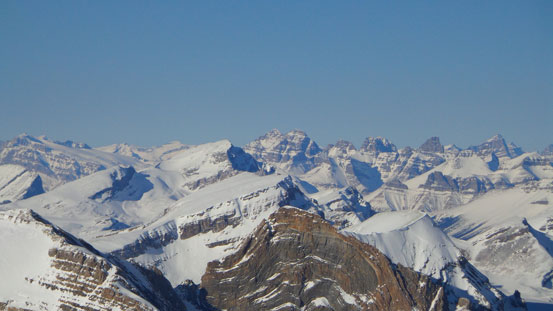
The night was frosty inside the hut. Temperature didn’t rise higher than -10 degrees, and we were glad to have brought the winter bags up here. After a long night we woke up at 7. (I actually woke up at around 5 and then killed 2 hours with my iPod). We got outside and saw a million stars. Good! After having breakfast and gearing up we eventually started at alpenglow time. It’s a bit later than my expectation but since we had the entire Sunday to ascend Balfour and Lilliput and back to the hut, we thought that would definitely give us enough time. Well, at the end we just barely had enough time to climb Balfour and still had to come a long ways back in the dark, oh well… Guess we should have taken it more seriously after realizing it took Vern’s group 8 hours from Balfour hut. It’s a lot steeper on that side which meant a much faster descent. From Scott Duncan Hut it’s at least 2 km longer and much flatter and crossing the entire Waputik Icefield is tedious to say the least. Combing back we still had to keep ropes and skins on and that would slow down the pace significantly as well.
Alpenglow on The Presidents
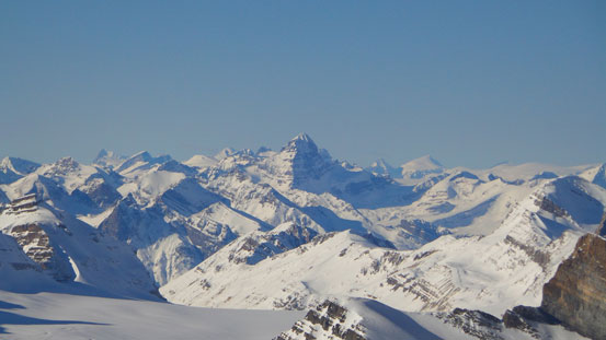
Waputik Icefield and our objective at alpenglow

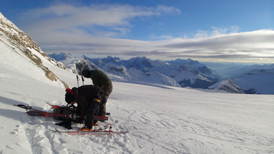
Roping up
The proper route to cross Waputik Icefield is by staying way on climber’s right side. Last year a skier unfortunately fell into a deep hole on this Icefield and died, on climber’s left side of the proper route. The crevasses aren’t very obvious viewing from above (from Balfour High Col), and if you make a straight line from the high col towards Scott Duncan Hut, then you’d go over this crevasse field. That group were coming down that section with poor visibility and unroped and that’s why the tragedy happened. Travelling the opposite direction (from hut to col), the crevasses are very obvious. There’s nothing else to say about this section of tedious slog. Well, the views were good but more or less ‘unchanging’. There’s a steeper roll to go over just after crossing over to the other side of Lilliput Mountain, and then the wind picked up and we had to put more layers on. Ben and Eric actually had to put parkas on. My jacket was thicker and I was fine without parka at this point.
The Presidents

Crossing Waputik Icefield
Looking back towards Mount Daly
Higher up on the icefield
Towards the Balfour High Col we traversed climber’s left to gain the rocky ridge without actually standing on the high col. We would not make the same mistake as Vern’s group did since we came prepared here. The steep down-climb would come at the high end of this ridge, so we unroped and then strapped the skis on our backpacks and bootpacked up this ridge (also carrying the ropes). Here’s also the first gear-switching of the day. (There were at least 9 gear-switching from the high col to summit back to high col if I remember correctly, and that’s very time consuming and frustrating, and definitely one of the main reasons why it took us that long). The down-climb looked to be ridiculously steep from above. If not because I had clear memory from Vern’s report, I would not be easily convinced that this was actually the way down… Ice axe out and crampons on, I carefully led the way down this big slope, step by step. Near the end it became more rockier than expected and I had to traverse a bit skier’s right to find a spot that’s just wide enough to step across without stepping on thin snow covered slabs. This move was kind of awkward especially with skis on the backpack, but manageable. Then I plunged-step down a snow line to the lower glacier. We regrouped on this lower glacier. Crampons off and skis on, rope on, we were ready for the next stage.
Big terrain ahead. Looking towards the summit from top of this downclimb
Ben and Eric descending this very steep slope
A closer look

Ben traversing the awkward rock step
Ben and Eric negotiating this down-climb
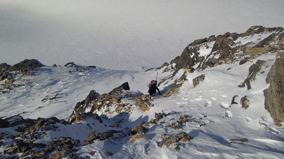
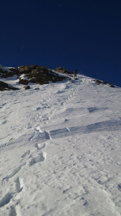
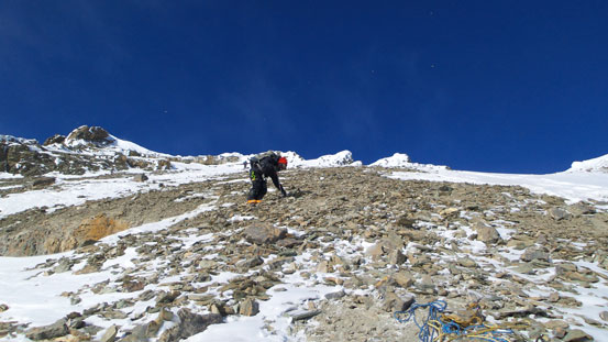
The next step was skiing towards a ‘dicey south facing slope’. This slope didn’t look dicey to us at all since it was blown bare. However, the lack of snow would make the access of this slope more interesting as there’s apparently a bergschrund to go over. It was visible from the summit of Mt. Daly in summer, and on this particular day, it showed a big sagging and we had to find a way around it. And once hitting the base of this big south facing (scree) slope we decided to finally ditch the skis and ropes and proceed on foot. The scree was miserable to say the least. I mean, even in summer this is the worst type of scree (a thin layer of loose stuff covering hard frozen base, on very steep terrain), let along on ski boots… After struggling up trying not knocking down rocks to each other, we finally escaped from the scree. Crampons on and ice axe out, and then up some steep snow with a few short rock steps, we eventually crested the ridge.
We’d ski towards the scree slope at center of this photo
Looking back from above this scree slope. Our skin tracks are visible
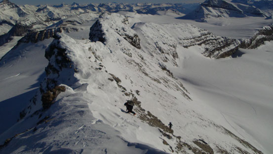
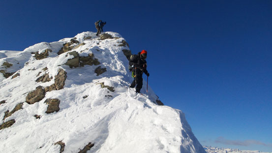
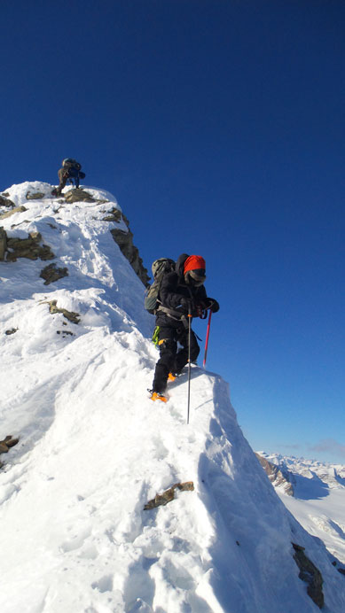
Steep snow slope brought us to the ridge crest
The summit ridge has 4 sections, with the first section being the most difficult. Immediately after climbing up a steep section we were looking at a steep, narrow and corniced section ahead. Crux came at the top of this section as we must go over a short but exposed rock step without much of a hand hold. The 2nd section was a flat ridge, easy going but post-holing was tedious. At this point the wind was gusting pretty fiercely and I finally had to put my parka on. Since I was breaking trail pretty much the entire way from the Hut to here I was pretty tired. I hadn’t drink anything yet on this day since my water bottle was leaking. Ben and Eric had ditched their packs lower down so I’d have no water until combing back down to here. Well, that’s okay as we were pretty close now. The 3rd section was again, step-kicking and front-pointing up a steep slope, and the last section was a flatter walk, then we’re on the top! The views were kicking-ass, amazing towards each direction. But on the mean time, we noticed a band of clouds moving in at a fast pace from west. It was also extremely cold. Ben’s thermometer recorded -28 air temperature and the wind was at least at 40-50 kph and that would put the ‘felt like’ temperature below -50 degrees, definitely the coldest summit ever…
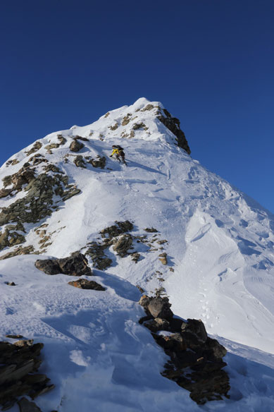
Me climbing up the first steep section. Photo by Ben Nearingburg
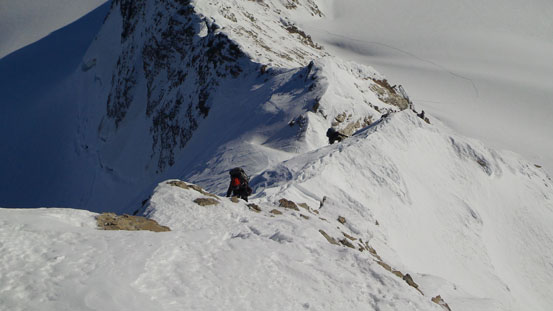
Ben climbing up the ridge
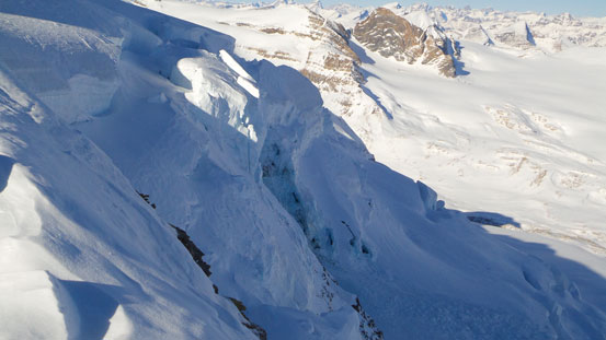
Massive seracs hanging on Balfour’s east face
The upper ridge

This is the route from Balfour Hut to Balfour High Col. Lots of crevasses and serac fall danger
Staying away from the crest here to avoid the cornices
The final push
Eric approaching the summit of Mt. Balfour!
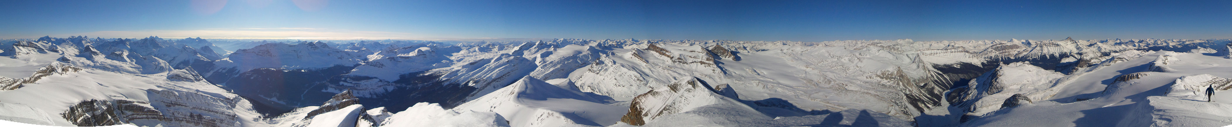
Summit Panorama. Click to view large size.
Recondite Peak at center
Mt. Douglas and Mt. St. Bride

Bonnet Peak in the distance
Castle Mountain massive and Bow Valley
Lefroy, Victoria, Hungabee, Biddle
Mt. Goodsir rises behind Mt. Stephen
Mt. Vaux
Mt. Laussedat and the approaching system
Mt. Des Poilus

Mt. Mummery
Mt. Forbes
Hawse Peak and Mt. Chephren
Mt. Murchison massive
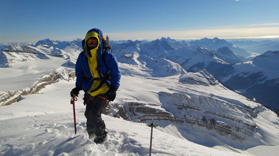
Me on the summit of Mount Balfour!
We didn’t linger any longer due to this hell-like temperature. Coming down the ridge was much easier and faster since we’d just plunge-step our up-tracks. Back down to where Ben and Eric ditched their backpacks, I finally could drink some water. Thank Ben for offering me some hot drink. Lower down, the crux felt easier than on the way up. Back to the scree slope, we put crampons and ice axes away. Descending the miserable scree, it’s time to rope on and skis on again. At this point, that band of clouds had moved in. The summit was socked in already and we’d lost blue sky pretty soon. It’s also getting very late in the day and we’d have just about 1 hour before sunset. The last major uphill came at reversing the ‘down-climb’. Again, carrying ropes and skis up this slope, then down the rocky ridge, it came the last gear-switching. Ice axe and crampons away, skis and ropes on, we were ready for the long slog back to Scott Duncan Hut.
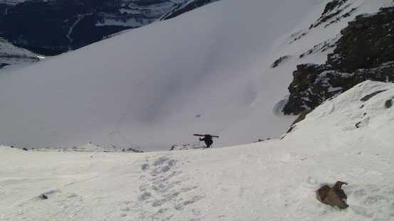
Eric descending a steep slope
Great view of Kicking Horse Valley. I guess Balfour is visible from Highway 1 if you look for it.
Ben negotiating a narrow section while Eric downclimbing the crux step
Same as above

Eric descending another steep ridge section
Horrible scree
Looking up the ‘down-climb’ that we had to reverse
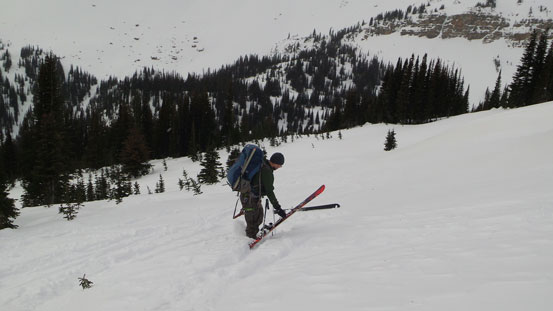
Strapping skis to our backpacks
Weather is definitely moving in…
Eric coming up the last few meters of this reverse
Due to the gusting wind our up-tracks were mostly covered, but thankfully not fully covered. It was just clear enough for me to see it. Oh by the way, from the ridge I noticed a group of skiers descending towards Scott Duncan Hut (which turned out to be ACC Edmonton section’s group doing the Wapta Traverse led by Rob Densen). A big thank to them for packing down the tracks, otherwise we’d need to GPS this upper section given the near white-out condition. Lower down, the weather started to get a bit better, but sun finally decided to go away. Thankfully we had no problem following the ski tracks eventually back to the hut with headlamps on. 11 hours round trip hut to hut was certainly much longer than expected.
The evening was fun with lots of chatting between the two groups. It’s also a lot warmer thank to the 6 extra people. Temperature was kept at about +10 degrees and it’s almost ‘liveable’. But at the mean time wind was howling even crazier. Well, I was just hoping we didn’t need to ski out in a white-out. Again, stuffs like iPod came handy for hut trips and I had a nice sleep.
We woke up at sunrise the next morning. The weather was indeed better than expected. It looked dark towards west, but clear above us. We were the first group heading out, and Rob’s group was following shortly behind. Instead of rapping down our up-route, we ski’d down and around on the icefield. There was lots of elevation regain on this part of the traverse, especially near the hut and near Daly/Niles col. We all kept the skins on and that was a good call. Skins off at the col, it’s time for survival skiing on the crusty snow. Crossing back Nile’s shoulder was tedious due to the uphill slog on icy slopes. We all managed that part without the need to put skins back on. My ski crampons are nice that I can put it on/off with just my poles. Those crampons came pretty handy at this slope and I was travelling considerably faster than the others. After this bit, it’s finally the time for the real downhill.

Rob Densen’s group is catching us up at Daly/Niles col
Mount Niles
Side-sloping across Niles shoulder
The crusty slopes were a real practice for survival skiing, especially for Ben and I. There’s little to enjoy here and our legs were burnt out pretty quickly. Lower down into the trees the snow got slightly better but not by too much. The steepest section reminded me Wiseman Peak, but with worse snow. Again, Eric did a good job leading down, and by following his tracks it was easier since I no longer needed to think about where to make turns (well, kick-turns actually). Lower down into the upper Sherbrook Creek, the skiing finally got better. This is the only enjoyable part (not crusty and not flat neither). Once this creek joins Niles Creek the route becomes much flatter and sloggy. We followed the ACC group’s tracks down that waterfall section without the need to detour skier’s right. Onto Sherbrook Lake, I spent a couple minutes waxing my skis in order to save some energy. At the mean time the other two guys were cruising across this frosty lake at a fast pace, so even with wax on, I didn’t manage to catch them up. On the other side of this lake, the trail kept going uphill for at least 1 km… That was ridiculous and frustrating, and once we started to downhill, it was still pretty bad. It was snowpawing the entire way down this steep and narrow trail.
Rob’s group
The skiing was so terrible that even Eric took a fall here
Ben carefully negotiating the steep treed section
Awkward spot for skiing…
Crusty snow prevented us from enjoying this part

Here comes the only good section for skiing.
Ben descending the waterfall in Niles Creek
Overall, it was a big success to have Mount Balfour bagged in early February. And for Ben and I, to be able to finish a big trip like this on skis was also a success. (My success rate on skis was pretty bad compared to snowshoeing and I definitely need trips like this to build up the confidence). Speaking this objective, it’s a serious trip in winter requiring 3 days (unless you can manage the entire approach or return in dark which I wouldn’t recommend). The trip involves crossing big south facing slopes on the approach, crossing the entire Waputik Icefield and ascending semi-technical steep snow ridge. Wait until good weather and condition line up and it’s a sweet one to do on skis. It’s definitely one of my favourites to date. Top 5 certainly.

Congrats buddy. Glad my TR helped you guys out!