Keystone Peak
November 15-16, 2014
2371m
Big Bend Highway / Revelstoke, BC
The town of Revelstoke locates on the western edge of Selkirks, about 1 hour’s drive further than Rogers Pass, and certainly among the few “long drives” for a weekend trip from Edmonton… But being right on the Trans-Canada Highway this area does draw some attention to climbers. The most famous mountaineering objective is of course Mt. Begbie but just like some other BC communities, winter recreation, especially snowmobiling, is much more popular. I do not own snowmobiles but I can take advantage of the snowmobile trails for a bush-free access to the alpine for many of the nearby mountains. Keystone Peak is one of them. To get there one has to drive 50 km up Big Bend Highway (Highway 23) northwards from Revelstoke before taking a steep 4×4 forestry service road for an additional 16 km which also brings you almost 1000 vertical meters high above the valley floor.
This’s a new area for Ben, Eric and I so we all felt excited about it. However, it was mid-November so we’d expect lots of post-holing, and for the most important, we had no clue how far we could drive up that logging road. The trail-head has elevation of 1600 m and based on our previous weekend’s experience we knew there’s no way to drive all the way up. Solution? Let’s bivy somewhere up the mountain and make it a 2-day trip. This turned out to be an awesome plan. Given the stable weather pattern we got treated with awesome sunset and sunrise views.
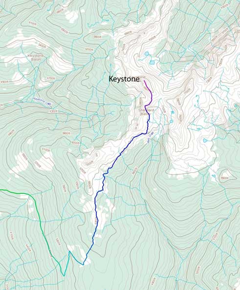
Keystone Peak hiking route. GPX DL
After driving more than 750 km from Edmonton we came to the experimental part. Eric did an absolutely fantastic job negotiating the steep, narrow and snow covered road in his Volvo, and by the time we figured we’d pushed enough there’s already a foot of snow coverage. Checking odometer we already cut more than 13 km (one-way) out of the way. That was much farther than my expectation but it wasn’t without intense moment though. At one point the Volvo started slipping towards the side and we got stuck in the deep snow (thankfully we managed to free it by pushing). We parked shortly after but we could also smell the engine being overheated. Thankfully again it didn’t cause any major damage. It was midnight and nobody was looking forward to sleep outside given the coldness and the snow, so we were “forced” to find a creative car-camping method so all three of us were fit inside.
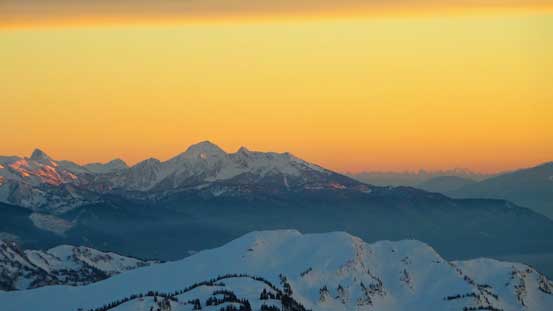
On Saturday morning we started just after it’s bright enough. Snow was already deep enough for us to strap snowshoes on right from the start. Previous snowmobiles had packed down the trail and assisted us significantly. At this point we were hoping for a packed-down trail all the way to “the Standard Cabin” but we were wrong. The rest of the logging road led us switchbacking two times and in less than an hour we made to the official trail-head. To our surprise November 15 was still in the legal closure of this trail for motorized vehicles, so the snowmobiles turned around. That meant we’d be on our own. On the other hand we could already see some of the giant mountains in the central Monashees including Frenchman Cap and we were all psyched for the views once hitting the alpine.
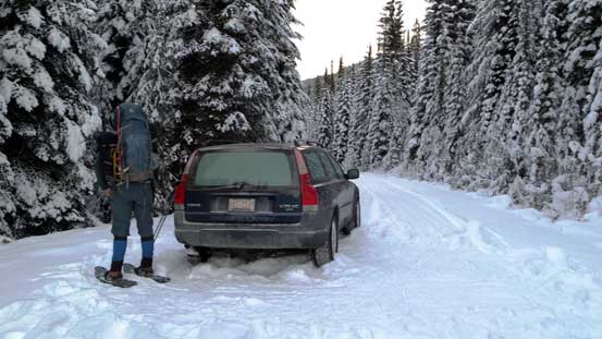
Eric’s Volvo was the hero!
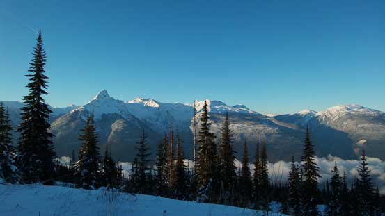
Already great view towards the Monashees. The pointy peak is Frenchman Cap
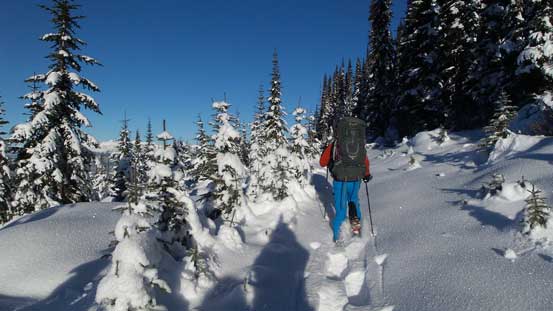
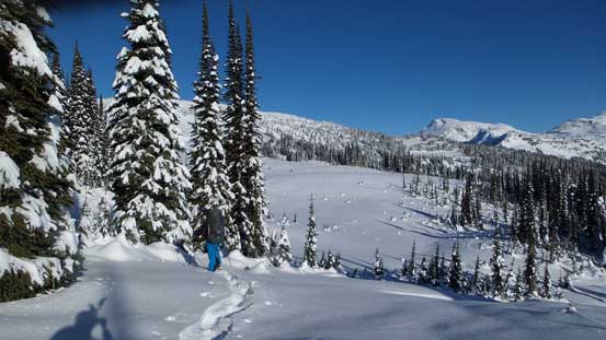
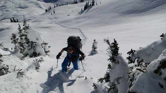
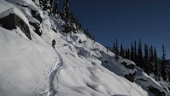
We had to break trail from the official trail-head thank to a snowmobile closure
Keystone-Standard Basin trail is among the few relatively popular trails in this area and we managed to download a GPS track before the trip. The snow coverage made trail difficult to follow but the GPS track helped us staying more-or-less on track. In short time we made to treeline zone and got some nice view of the Selkirks. From here on we’d travel at or below treeline for the next few hours, aiming relatively straight towards the distant Keystone Peak. We abandoned the trail a few times and did some brief bushwhacking. The post-holing was not as bad as we thought thank to a hard crust at about 30-40 cm down.

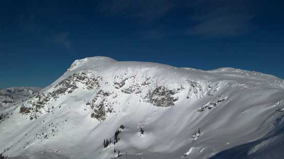
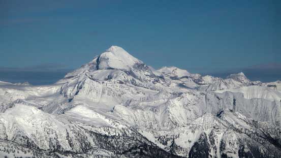
A zoomed-in view of our objective. As easy as it looks but there’re a few steep slopes
Hitting treeline zone. View suddenly opened up

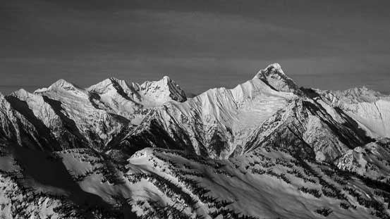
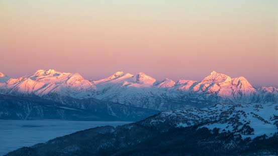
Could see many peaks in the Selkirks. This’s our first time seeing these mountains
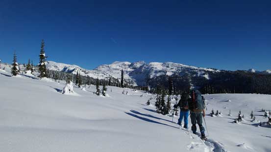
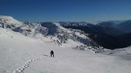
Ben and Eric breaking trail towards our distant objective
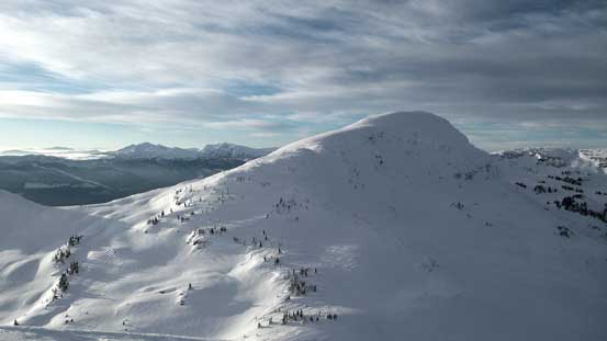
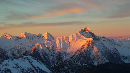
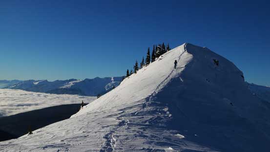
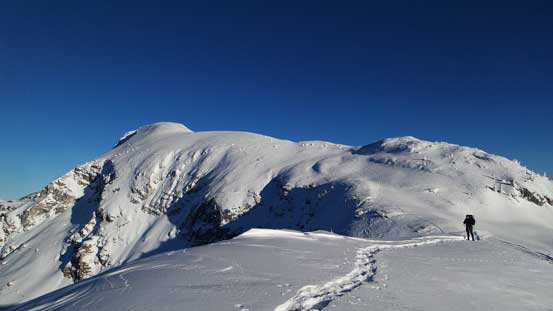
Terrain started to become complex as we slowly approaching Standard Basin. Following the trail we had to cross a few large open slopes that could certainly slide in right conditions. Up and around a corner we were in the Standard Basin, but looking ahead we had to ascend another steep slope. To our left was the official summit of Keystone Peak and to our right was a higher, but unnamed peak. We agreed to ascend the official one first so attacked the steep slope head-on, climber’s left. After a long haul putting one foot in front of another post-holing straight-up we crested the ridge. The views were already incredible towards each direction, but trust me, this was just the start!
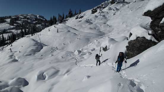
Crossing a big slope
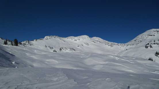
Now we were in Standard Basin. Would be awesome ski terrain!
Ascending steeply up a slope to crest the ridge
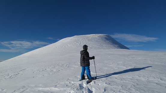
Now on the ridge, we could see the true summit ahead.
The U-shaped ridge crest would eventually lead us to the summit of Keystone. Checking our watches we made the decision to ditch our packs at a low saddle, bagging Keystone Peak first and watch sunset on the summit of the higher unnamed peak. Slogging up Keystone Peak was as easy as it appeared but took us quite a while. What actually took us longer was picturing the mountains!! It was hard to resist taking pictures of everything even though we knew an hour or two later would be way more epic. Another instant decision we made at this point was our bivy location. Our initial plan was bivying near Keystone/unnamed col but after seeing the natural windscoop beside the “mythic summit green tower” I asked, why not just sleep here?! Eric and Ben agreed.

Looking towards the broad col between Keystone and Unnamed (“Voussoir”)
Eric ascending the typical slope on Keystone Peak

Eric with “Voussoir” behind. We’d ascend it later in this day too.
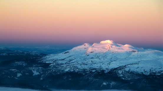
Ben and the true summit of Keystone Peak
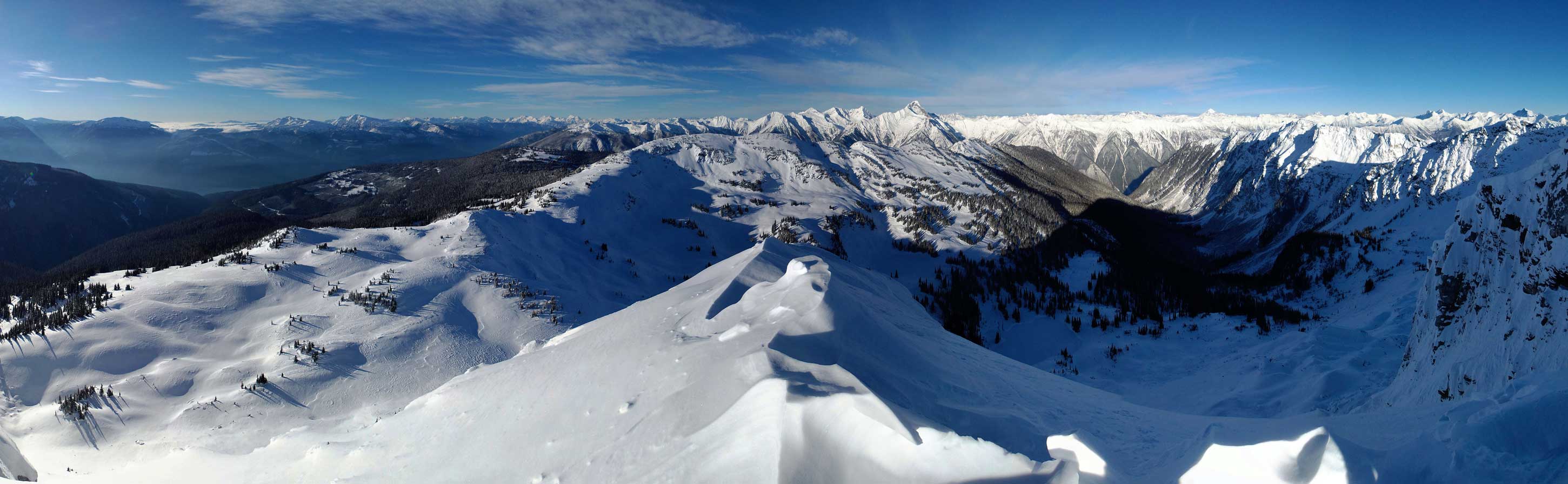
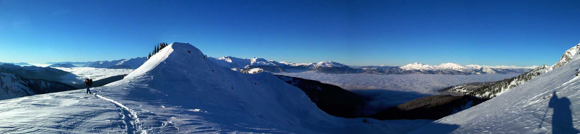
Summit Panorama from Keystone Peak. Click to view large size.
Zooming-in looking towards Revelstoke. Click to view large.
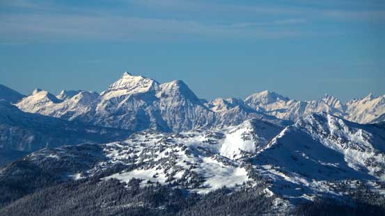
Big peak in the Monashees – Gordon Horne Peak
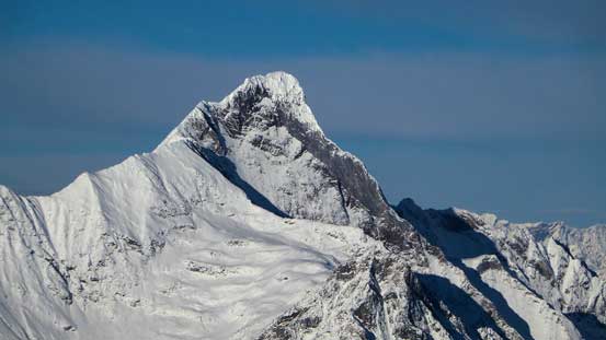
The super sexy Downie Peak. Its right hand ridge has been climbed – multipitch 5.8
Boulder Peak and Downie Peak dominates the skyline looking north

Looking over “Voussoir” towards Carnes Group
The huge bulk of Mt. Sir Sandford is the highest peak in Columbia Mountains
Eric on the summit of Keystone Peak
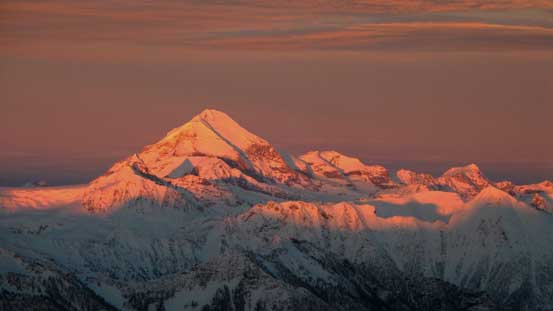
To get sunset views from the nearby unnamed peak (we named it “Voussoir Peak” due to its proximity to Keystone) we had to move quickly. Since we now decided to bivy on the summit of Keystone we no longer had to carry backpacks down to the col. After quickly hydrating ourselves we set off with minimal supply. Ascending this peak was nothing rocket science but the slope was a wee bit steeper than appeared. Thankfully the snowpack was stable. We made to the top at about half an hour before sunset time, and needless to say, the next 40 minutes or so was among some of my highlights in this year in terms of views!
Ascending the unnamed, but higher peak (“Voussoir”)
Looking back towards Keystone Peak
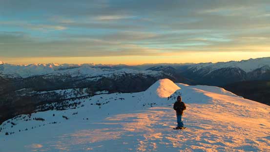
Ben on “Voussoir”, ready for the sunset views!
Carnes Peak is the highest in this group (Carnes Group).

This is the Adament Group – with Adament Mountain being the highest
Mt. Moloch is another major summit in the northern Selkirks
Mt. Cartier and Mt. MacKenzie way in the distance south of Revelstoke

This is even further – Dunn Peak dominates the skyline on the western edge of Monashees
Downie Peak
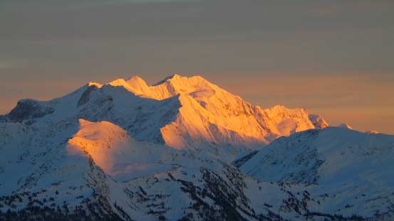
Mt. Sir Sandford on evening glow
Mt. Holway on evening glow
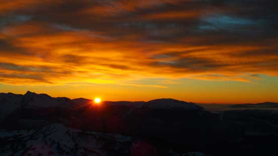
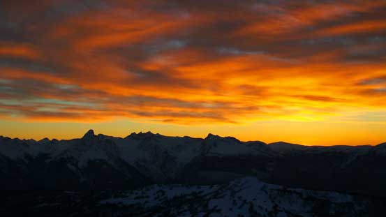
Sunset over the Monashees

The last sunbeam shone on Adament Mountain
Dusk over Monashee giants (Frenchman Cap et al.)
More dusk colours
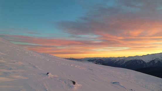
We eventually got enough of the views (and the coldness) so leisurely went back to Keystone’s shoulder. Backpacks on, we slowly re-ascended to the summit of Keystone. Unfortunately wind picked up but it wasn’t crazily strong so we still decided to bivy there. This was my first time winter-camping above treeline so it’s an excellent opportunity to learn. We spent an hour or so building some snow wall and digging out a sleeping area. The wall didn’t do a good job blocking the wind though, but still better than having nothing. Melting snow and cooking also took forever (I should have dug out a snow cave for my stove, but oh well).. Nonetheless after some basic “camp stuffs” I wend to bed early, at about 8 pm ish. We were all hoping for the best alpenglow 12 hours later.

Star picture from the summit of Keystone Peak. Photo by Ben N
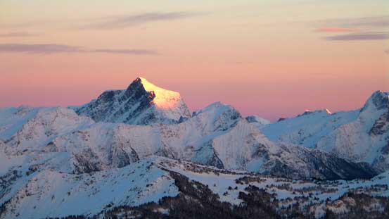
And we were right. We woke up with crystal clear sky and low valley clouds hanging above Lake Revelstoke. It’s going to be an awesome morning! On the other hand, as usual for overnight snowshoe trip our boots were more-or-less soaked and frozen. But here’s one of the biggest advantages of bivying on summit. We could wake up, wondering around and taking pictures with our booties on! Great…
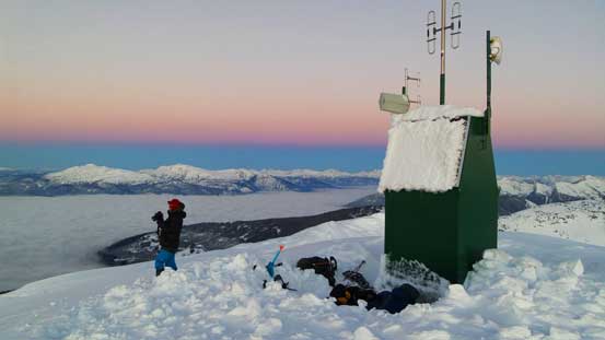
This is our bivy site. Except for the wind everything else was perfect.

Frenchman Cap just before alpenglow

Mt. Sir Sandford on alpenglow

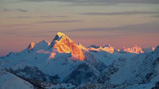
Frenchman Cap on alpenglow

Downie Peak on glow
This is one of the many unnamed peaks in Monashees.

Sunrise over an unnamed, but pointy peak in Selkirks
Gordon Horne Peak and its nearby unnamed peaks on glow
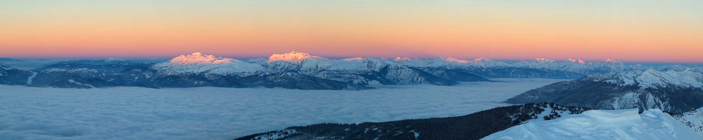
Panorama of the alpenglow. Click to view large size.
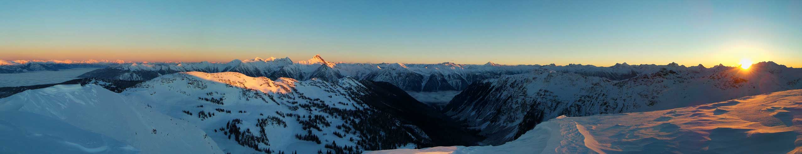
Panorama looking north and east. Click to view large size.

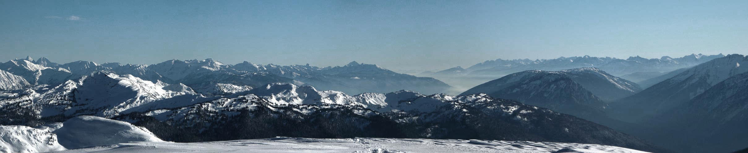
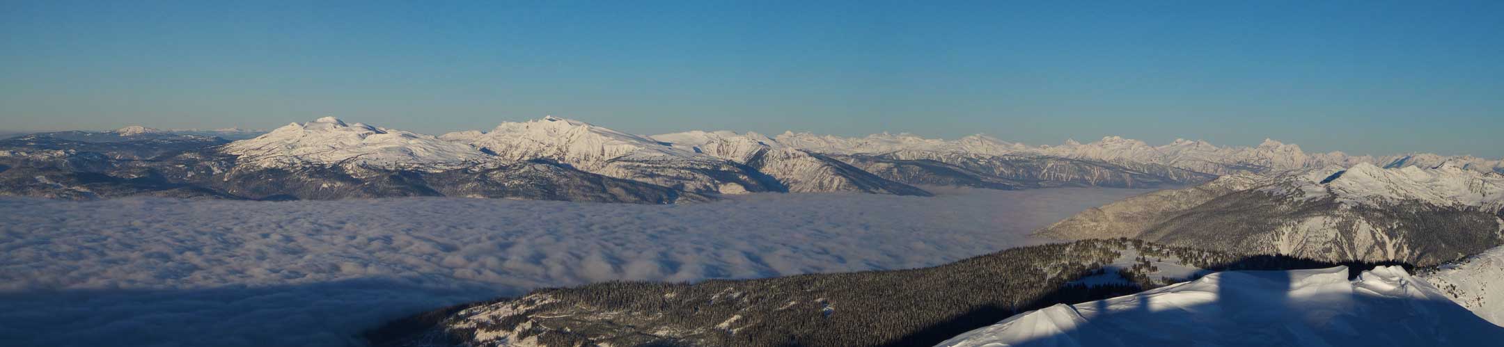
Panorama of the valley clouds with Monashees poking behind. Click to view large size.

Frenchman Cap poking behind the clouds
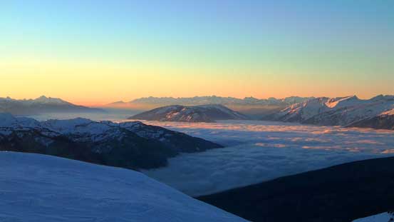
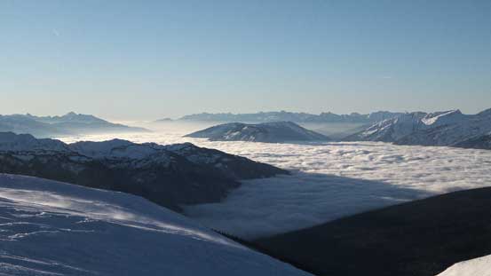
Valley clouds looking way south towards Revelstoke

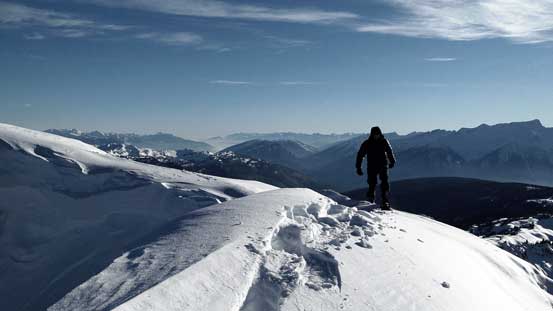
Ben soaking in the views

The rounded “island” is Frisby Ridge
Looking towards the same direction, but half an hour later
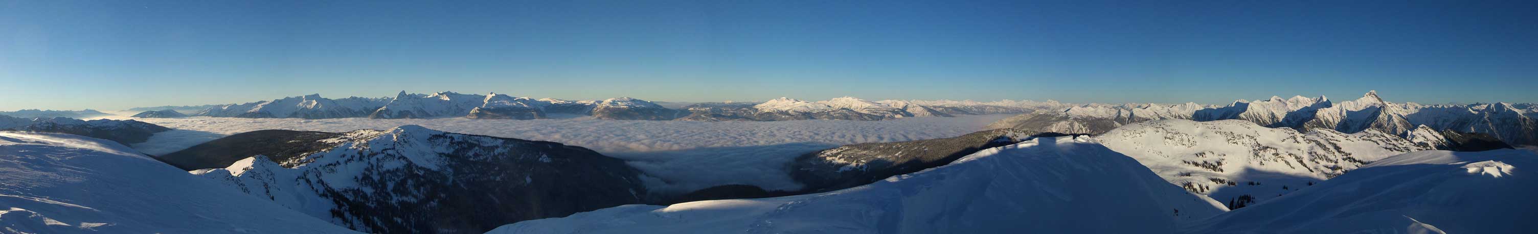
Panorama of the valley clouds and the Monashees. Click to view large size.
One last panorama before descending. Click to view large size.
After watching the sky changing colour from purple to orange and finally to blue, we realized there’s still a long journey back home. On this day (Sunday) we had to descend, drive down that snow covered road (crux) and then another 750 km all the way back to Edmonton… Oh well. Let’s do these steps one by one. Firstly we had to pack up. I somehow ripped apart the compression sack for my bulky sleeping bag… Well, part of it had to dangle outside but that’s still okay, at least for a shorter period of time. Then came the descent. Snowshoeing downhill on soft powder (steeper rolls) or using our tracks (flat sections) was effortless and scenic and our progress was fast. Near the end my compression sack completely failed and I had to hand-carry my sleeping bag. That was awkward but by this point we only had 4-5 km to go so wasn’t too terrible.
Another panorama. Click to view large size.
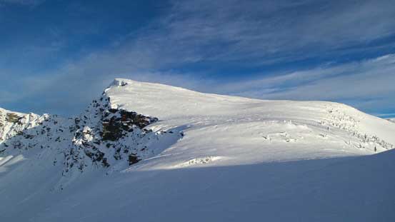
Ben re-ascending to a minor bump
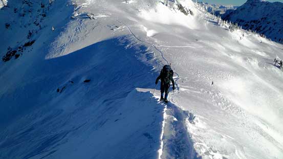
Eric on this snow arete
Looking back towards Keystone

In Standard Basin
Descending some complex terrain

Back to the treeline travel

It’s already afternoon and the valley clouds hadn’t lifted yet
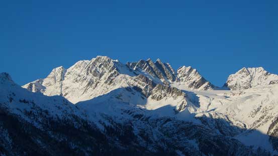
Eventually came the crux – driving down that logging road. Since we pushed too much on the way up we now had to face a more challenging situation. Driving down felt even more difficult with the lack of control but Eric again, did a fantastic job getting us down safely. Driving from Big Bend Highway to Revelstoke, Rogers Pass and finally Golden was also nice and scenic. We stopped many times for road-side photos. Mt. Sir Donald looked ridiculously huge and I couldn’t believe I’d already climbed it.
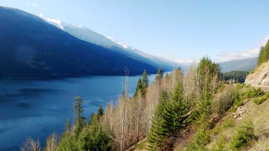
Lake Revelstoke. This’s my first time seeing this lake

The rest of the drive back home wasn’t nearly as fun though. Good thing we had three guys and we could take turn driving. Overall, this was an awesome trip for our first time visiting Revelstoke area and I’m sure we’ll be back. There’re plenty of winter opportunities even when the snowpack is less than ideal, and Mt. Begbie itself will obviously be my primary objective for summer mountaineering in this area.

I was dreaming of doing a winter trip to Keystone Valley, your photos and story just make me want to do it more. Thanks for sharing your experience.