Mount Ludwig
May 24, 2020
1396m
Jones Lake / Fraser Valley, BC
Mt. Ludwig is rather just a wooded bump in the Fraser Valley but is very visible from the highway for a long stretch between Chilliwack and Hope. The sides facing the highway (west and north) boast some steep and dense west coast rainforest while the other side facing Jones Lake was heavily logged to pretty much within 200 vertical meters from the summit. The east side logging roads appear to be deactivated long time ago and are now very overgrown. The status of this peak had been mysterious because there wasn’t even one single trip report available online, including bivouac.com suggesting it’s pretty much untouched at least in this modern era. I also do not know a single person that had even tried to reach this summit, so for these reasons this peak had been pretty high on my list.
My plan was to utilize one of those logging roads on the east side to access the wooded NE Ridge and then bushwhack 600 vertical meters up this ridge, avoiding the seriously-overgrown upper roads. Though I’d been thinking about Mt. Ludwig for years, the decision to pull the trigger on this past Sunday was a spontaneous one. Alex and I were keen to get out but the weather forecast was not looking very promising. I threw out the idea of Mt. Ludwig and Alex agreed. After a familiar drive down east we made to the Jones Lake FSR at around 8 am, but then the drive up to Jones Lake was a slow crawl due to a million of potholes. Considering the amount of traffic this road receives I was not impressed by the status of it. We also discovered that the spur road (BC Hydro recreational site) was closed and gated at the start. This was not part of the plan but at this point we just had to suck it up and walk the road instead.
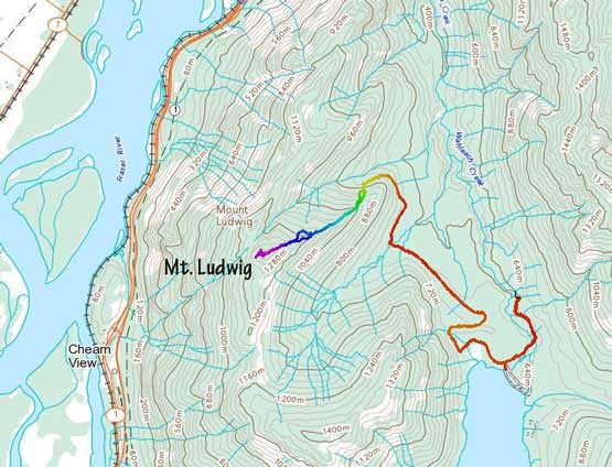
Mt. Ludwig from Jones Lake. GPX DL
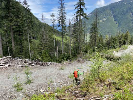
We parked in front of the gate and easily walked down to the shore of Jones Lake. There were zillions of closure signs all over the place. We continued walking the road navigating a maze of intersections and found out that the road had another gate not far up from the recreational site. The farther gate had some clear languages of “no motorized access” that even parking in front of that gate was prohibited. This meant we only had to walk half an hour’s extra distance each way, which was then not bad at all. Furthermore, the closed road was pulled the washed-out in less than a kilometer from the gate near a creek crossing so that further meant we didn’t lose much. Beyond the wash-out the road was in a generally good shape for walking but did have a couple annoying stretches of dead-falls plus one annoying creek crossing that required me to take my shoes off. Near the bottom of the NE Ridge we took the higher spur road on the left and walked easily to the end where a massive cut-block laid ahead.
Walking down the gated road towards the north shore of Jones Lake
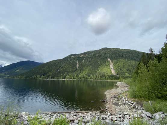
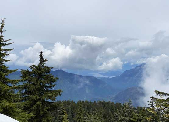
This is the north shore of Jones Lake looking towards Four Brothers

Jones Lake and the partially-visible Cheam Range peaks

There’s another gate. This one looked like permanent rather than for COVID

Not far beyond this second gate the road was washed out

This is the first messed-up section

There’s a stretch of stick hopping somewhere here

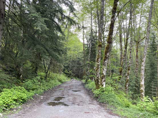
For the most part the road was in a good shape for walking
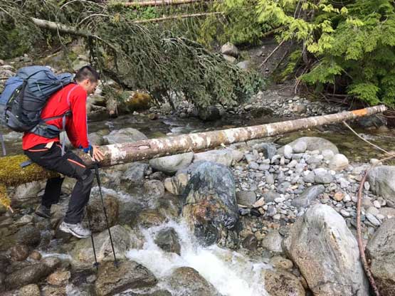
Me trying to au-cheval across the creek… Photo by Alex R.

Alex rock-hopping across the creek.

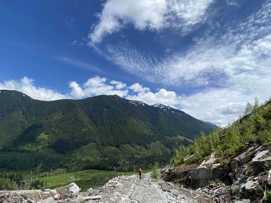
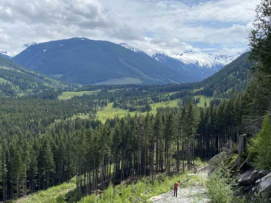
Taking the steeper spur near the end of the road walking
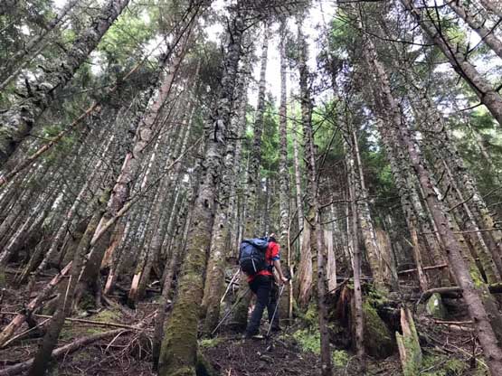
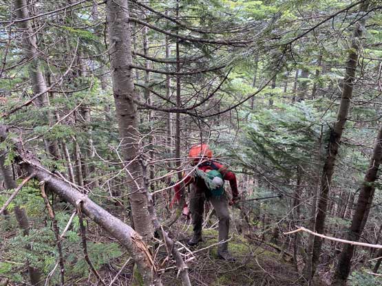
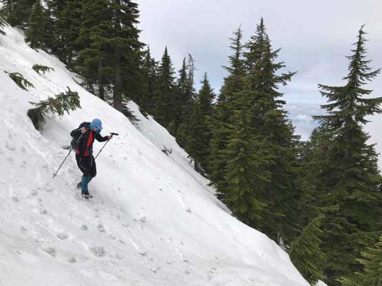
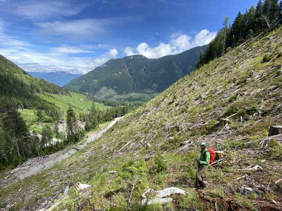
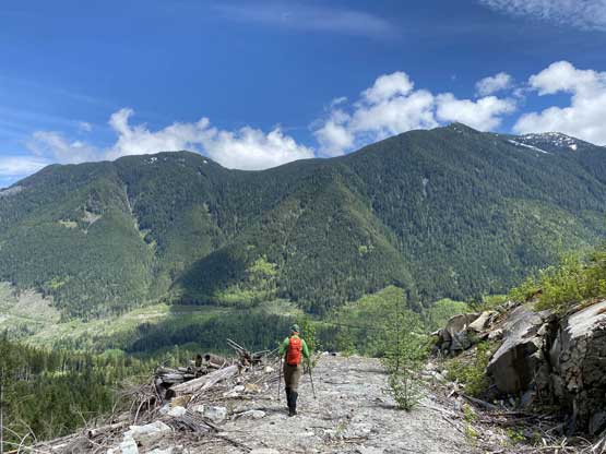
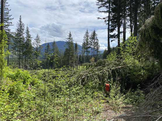
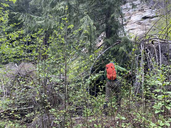
I took my time swapping trail-runners for mountaineering boots and then up the cut-block we went. The going was very steep but not bad for a west coast cut-block standard, except for the slippery footings and some prickly type of brushes. We merged right into the forest and scrambled a long stretch of steep stuffs (with again, very slippery footings) and the next thing we came to a seriously-overgrown road once joining the NE Ridge of Mt. Ludwig. We bushwhacked across this road carefully avoiding the brambles back into the forest. The bushwhacking on the NE Ridge had a lot of tight timbers to push through, but again not too bad by the west coast standard. In a while we started to encounter patchy snow and the snow soon became continuous at around 1100 m. The rest of the ascent to the summit was a cruise-sailing on the supportive snow. The true summit had no views but we were doing good on time, so opted to descend the west side to explore some potential viewpoints. We surely put in some determination and found a neat bluffy platform with good views of the Fraser Valley after at least 30 m elevation drop.
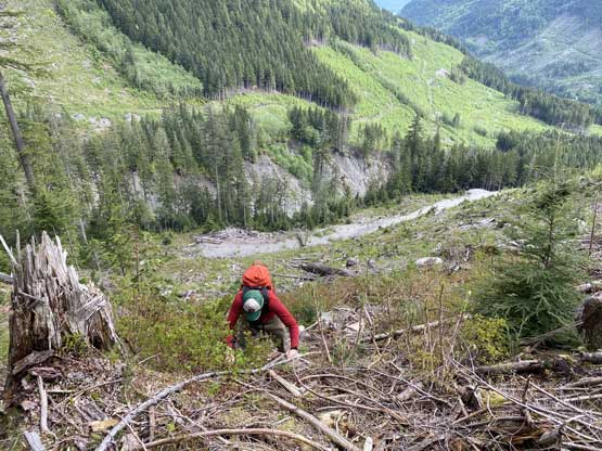
Alex scrambling up this steep cut-block. Wasn’t very fun…
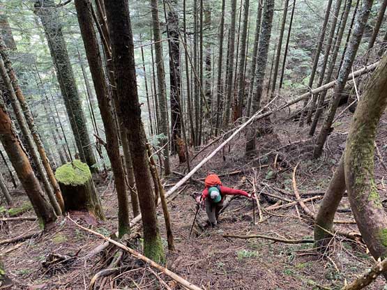
Then, there’s a section of very steep and slippery forest
Me heading up. Photo by Alex R.

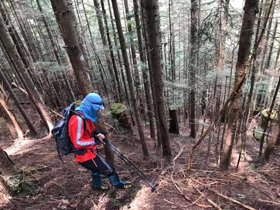
We popped out on this fucked-up road, crossed it and kept bushwhacking
Bushwhacking on the NE Ridge of Mt. Ludwig

Finally hitting snow for the last 400 vertical meters…
Harrison Lake tried to show up in the distance
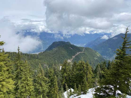
This is looking over a northern sub-summit

Me near the summit of Mt. Ludwig

Past the true summit we came down to this viewpoint of Fraser Valley

Me on the Fraser Valley lookout point near the summit of Mt. Ludwig

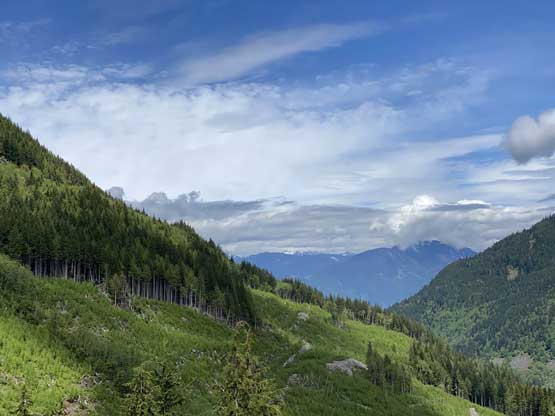
The very tips of Lady Peak and Cheam Peak tried to show up

Foley Peak and the other Cheam Range peaks behind the clouds
It appeared that the weather was not going to improve so we reluctantly slogged back to the summit and then had some fast and furious run down the upper NE Ridge on snow. We took a short detour variation to take advantage of the fall-line boot skiing but eventually had to face that bushwhacking section. The going was much easier on the downhill direction that I didn’t find the bush to be annoying. For the cut-block we decided to avoid it for as much as we could, but eventually a section of cliffs forced us to traverse into the cut-block anyway. We opted to stay on the skier’s left side of the block and managed to avoid most of the brambles as well as the slippery spots. The road-walk back to my truck involved more uphill slogging than we had anticipated for. We didn’t pay attention how much elevation we had lost earlier in the morning. For that creek crossing I managed to jump on three big boulders instead of fording on bare feet.

Alex walking down the upper NE Ridge
Me trying to boot-ski. Photo by Alex R.
Me carefully descending the steep and slippery forest.
Alex traversing into the cutblock now.
Finishing the cut-block descent
Alex walking the road with part of Mt. Barr ahead
The northern view towards Hope area
The spur road and Mt. Barr

More about the spur road walking

The only brief view of Conway Peak on this day
One last photo of this relatively scenic section
The main road had some bushwhacking

This particular spot was really bad but thankfully short-lived

The creek crossing

Me balancing on two logs more than 1 m above the ground…
Alex tackling another messed-up stretch.
Our round trip time was about 6 hours covering over 16 km distance. Overall the effort to tag Mt. Ludwig was not as much as I would have anticipated, and overall this was not a bad day exploring. This area might have seen more traffic by loggers and hikers back in the ancient time but not in this modern internet era.
