Mount Nelson
July 27, 2013
3315m
Invermere, BC
Mount Nelson is a big mountain that you can see from the town of Invermere. I think it is the most photographed mountain in this area. And to get to this lofty summit it’s only a moderate to difficult scramble. It had bumped up my to-do list ever since I went up Swansea Mountain about one month ago. I only got one day break between the 3-day Brazeau trip and this Invermere trip. After leaving Edmonton at 5:30 pm, Eric and I made to Invermere at midnight. However, we forgot to refuel Eric’s Volvo so we had to sleep in Invermere and wait until 6:30 am to get some gas. This did waste us some time but in retrospect, we didn’t lose much in terms of views. Mt. Nelson isn’t a mountain that you can wish to start in dark and get alpenglow views.
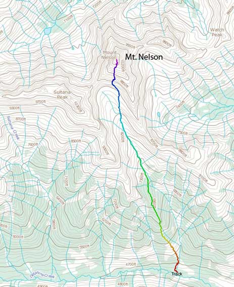
Mt. Nelson standard scramble route. GPX DL
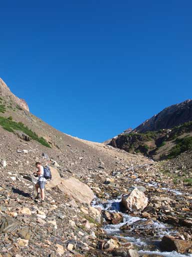
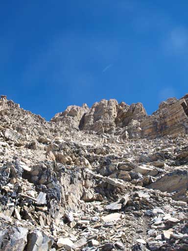
We didn’t know that Toby Creek FSR was closed after passing Panorama resort. There was a big barrier but someone had cut through a lane on its right side. Eric’s Volvo did a great job and we barely made through. The last 2km on Delphine Creek FSR was also in a rough shape. There were two grooves that provided a bit of challenges but we managed to make all the way to trail-head. There are multiple trails starting from here and the correct one is on the other side of a big washout. After crossing this rushing stream using an unstable log, we picked the trail and followed it steeply up. Like the hiking guidebook mentions, the next 1.5 to 2 hours was gonna be a true test to us. This trail went straight up steeply without switchbacks. It reminded me two trails that I’d done, the infamous Grouse Grind, and the Wedgemount Lake. Both of them are in the Coast Mountains.
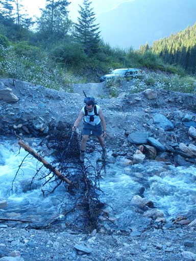
Eric crossing the wash-out just before the trail-head
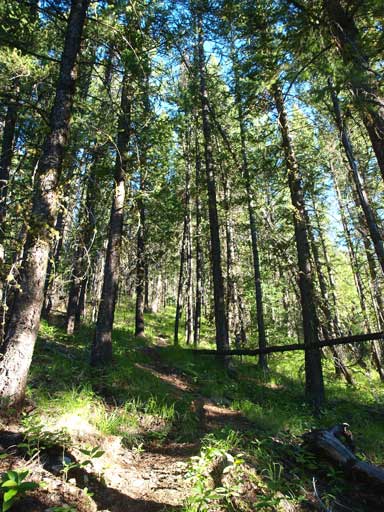
Typical view in the forest…
The trail eventually brought us to a ridge line and we followed it up for a short while. We somehow managed to miss the turn-off where we should pick the right side branch. By following the wrong trail we had to do some light bushwhacking. Essentially it doesn’t matter that much which trail you take. They’ll all lead you to the upper Nelson basin. Once at the basin the goal was to follow the creek up. This part went on longer than expected, and reminded me the Resolute Mountain’s approach.

Paint brushes

Some flowers
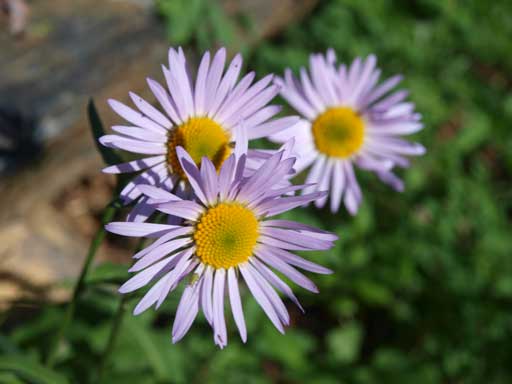
Asters
Eric hiking up the approach drainage
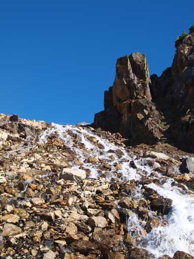
Lovely waterfalls
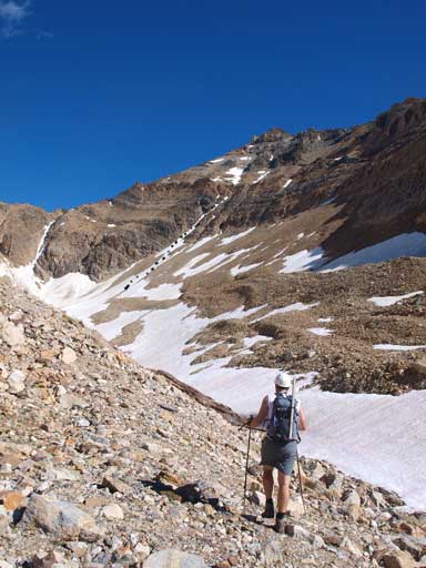
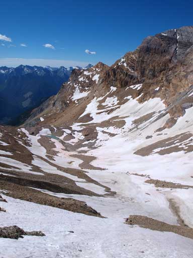
Hiking towards the base of Nelson’s face. We would go up the obvious snow gully left of center.
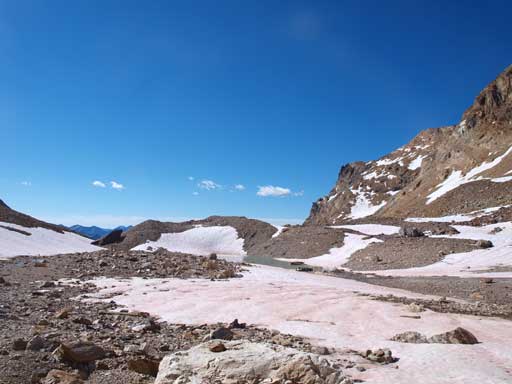
Lovely area. Upper Nelson Basin.
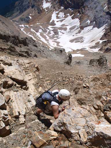
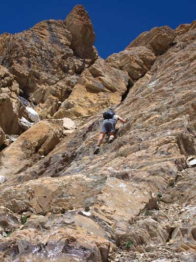
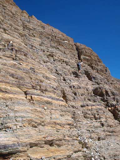
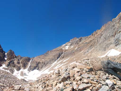
Once we arrived at the base of Nelson’s ascent face, I decided to use the obvious snow gully. Well, having brought crampons up I wanted to have more fun. Eric would follow me up and if the snow got hard he would bail the gully to climber’s right side. I managed to finish the entire gully. It’s probably more difficult than going up the moderate terrain on climber’s right, but I did have some fun on the snow. After merging to the rock we scrambled straight up overcoming difficult terrain. The terrain might get easier if we kept traversing climber’s right here, but we didn’t bother since we wanted more hands-on stuffs than scree slog. This entire section also took us forever. Oh well, I forgot this mountain has 2000 vertical meter’s elevation gain…

Going up the steep snow gully
Looking back

Looking down to Eric

Higher up
Good view of Coppercrown Mountain

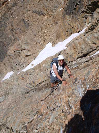
Eric ready to scramble up the crux section
Good rock, good scrambling
Eric finishing this steep part

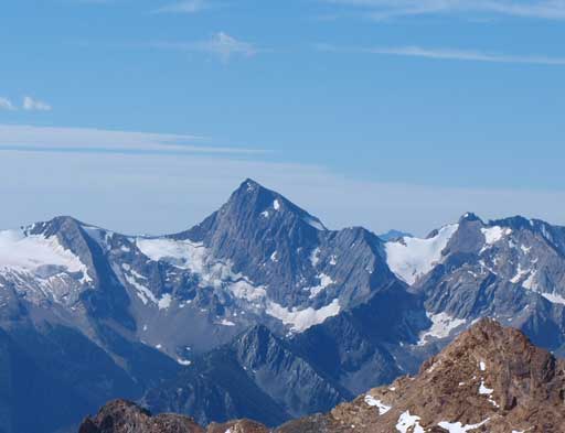
Gorgeous view of Sultana Peak, a difficult scramble.
After clearing this crux section we went straight up. The terrain got confusing here since we couldn’t figure out where to go. The described route goes up climber’s left but is looser than the one we took. Our route is still easy to moderate scrambling but with less scree slog. Once we got higher enough we could finally see the summit block on our left side. By now we finally got higher than Sultana Peak, thus magnificent views started to show up, with many visible Purcell 11,000ers including Jumbo, Delphine, and Farnham. On the summit block we took a difficult line but there exists a much easier line to our climber’s left that we’d discovered on the way back. And minutes away we were standing on this lofty summit identifying hundreds of mountains.
Typical terrain on the upper slope

The summit block
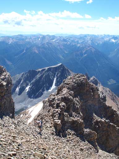
Eric hitting the summit ridge

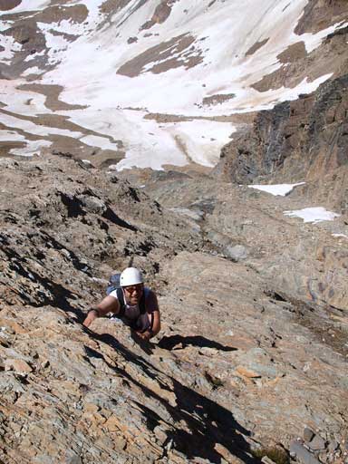
Scrambling up a difficult route
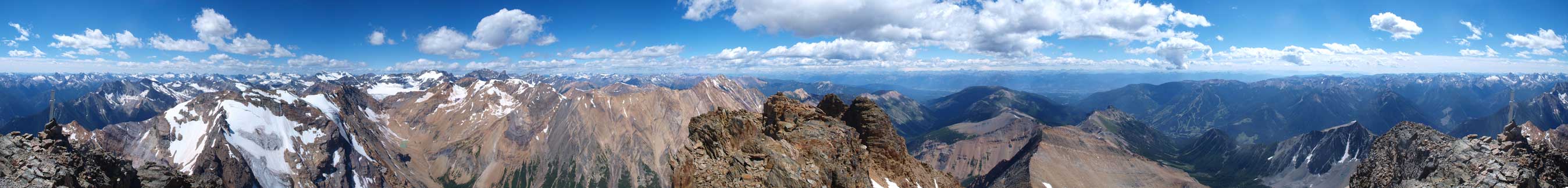
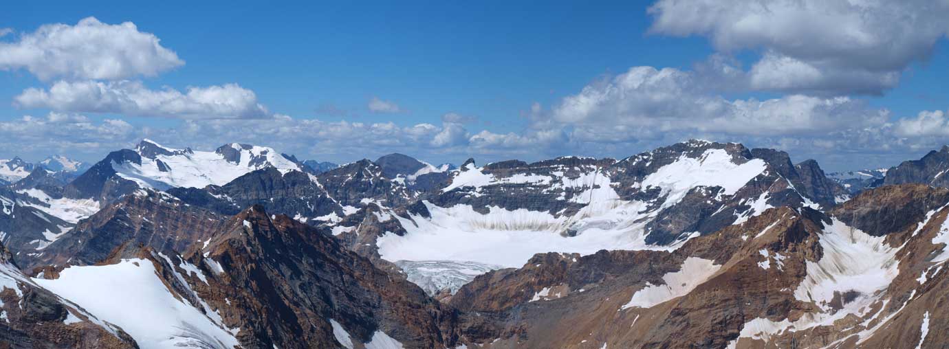
Summit Panorama. Click to view large size.

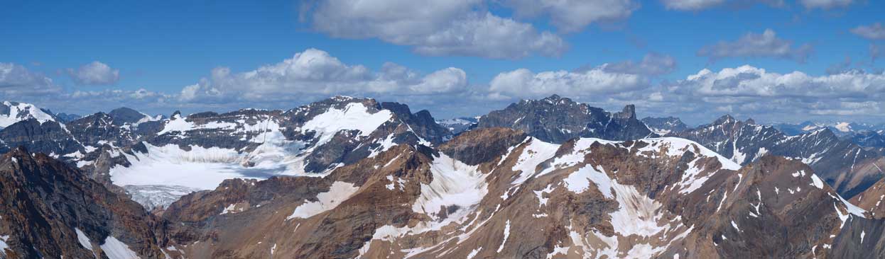
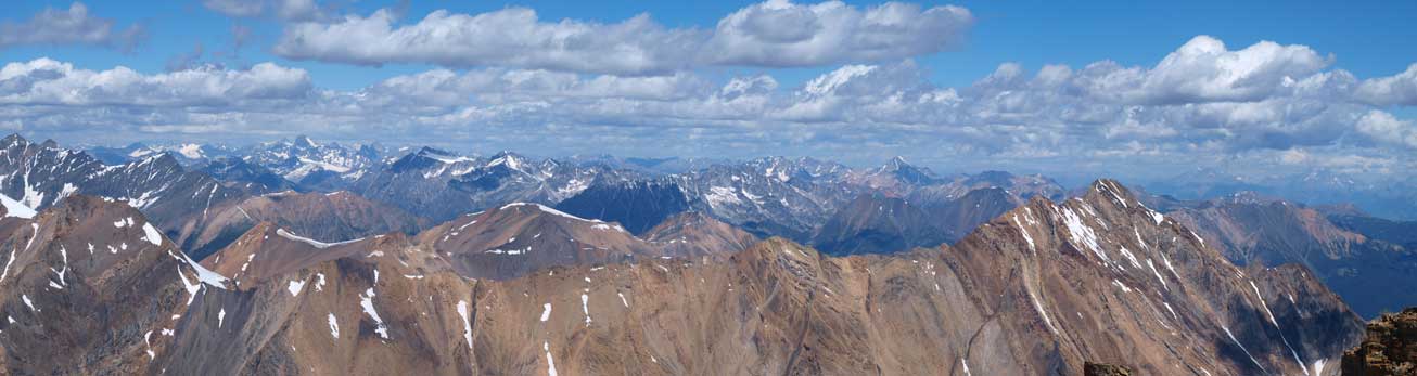
Panorama looking East

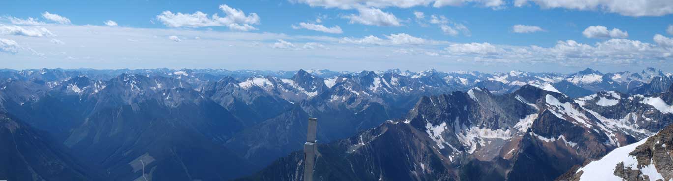
Panorama looking West
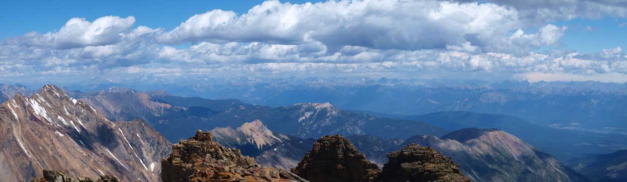
Looking north
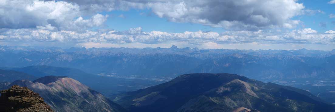
The Columbia Valley. You can see the mighty Assiniboine on the horizon.
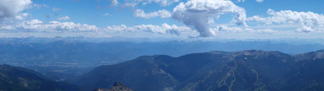
More about Columbia Valley. Town of Invermere on the bottom left
Looking south. Coppercrown Mountain looks small now (at center)
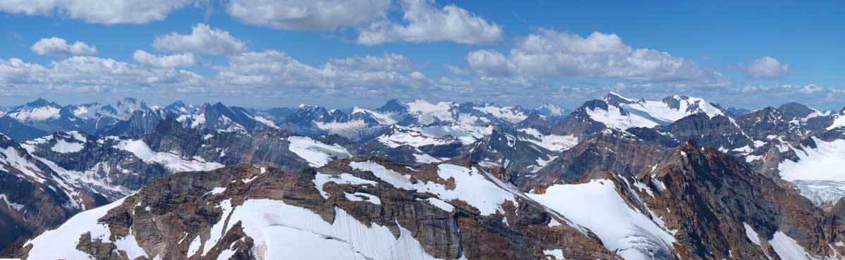
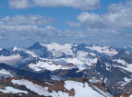
Distant glaciated peaks
The familiar Purcell 11,000ers.
And a sea of peaks looking northwest
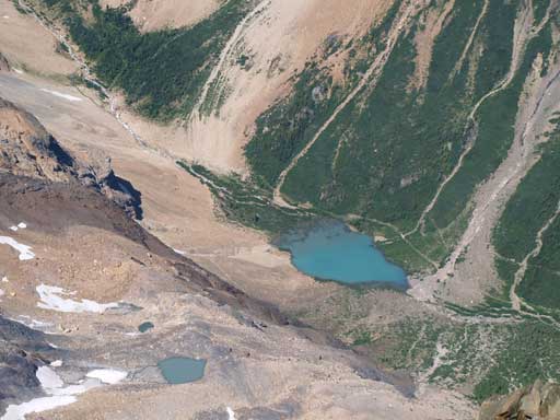
Lovely alpine tarns

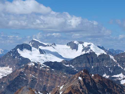
Glacier on Sultana Peak
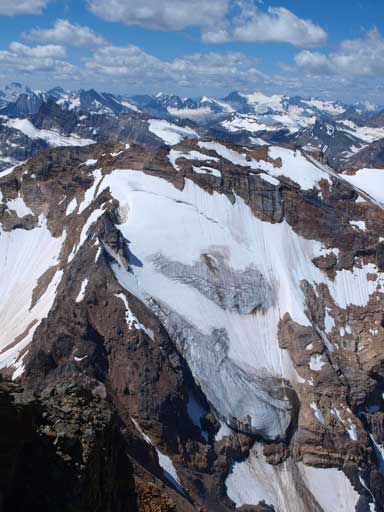
Sultana Peak

Mount Farnham
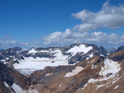
Truce Mountain and Horseshoe Glacier area.
Jumbo and Commander

Howser, Pigeon, Snowpatch, Bugaboo Spire

These must be somewhere near Mount Toby and Mount Katherine
Mount Delphine

One of them must be Mount Ethelbert.
A long shot of Jumbo and Delphine

Mount Assiniboine
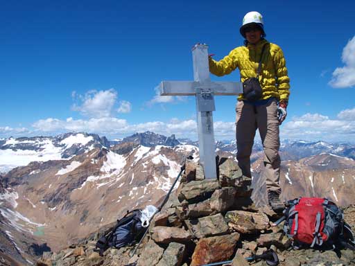
Me on the summit.
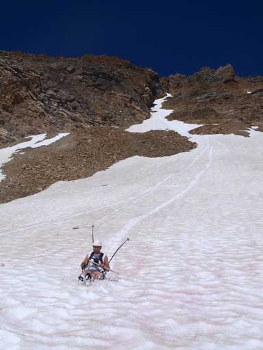
After staying more than 1 hour on the top, we finally decided to descent. We took the easier line to descend the summit block, and then kept skier’s right and found a long scree run that brought us back to the middle section. We down-climbed what we came up, and then stayed on skier’s left of the snow gully. About halfway down we merged to snow and got some steep glissading. It was so steep that we had to slide while facing inwards and self-arresting. A bit awkward but that’s still faster than descending the rock. Lower down we finally could enjoy a long slide back to the upper Nelson basin. Our hands were cold and we took a long break there.
Eric started the descending

Down-climb the crux section
Down-climbing
Steep terrain
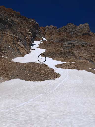
Eric (in the black circle) enjoys the glissading
Eric finishing the long run

Back to this lovely tarn
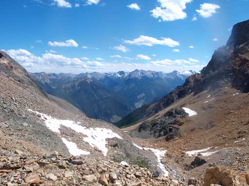
Good views from the descent
Looking back to Mt. Nelson

The steep descent in trees.
Now the fun parts were gone and what was left was slogging back to the parking-lot. We managed to use snow for as much as we could but after that it was just a steep descent that every step would get to our knees especially after regaining the trail. But at least we lost elevation in no time on this steep trail. Our round trip time was 9 hours including 1 hour’s summit stay. We had no trouble driving back through the barrier that blocks the Toby Creek FSR, and after taking a break at Invermere we started the longer drive up to the Bugaboos. Eastpost Spire the next day!

great details—hikes in bugaboos?
Fantastic to run in to your photos. I climbed this with a group of 13 & 14-year olds from Rocky Mountain Boys’ Camp in July 1970. Brings back exciting memories. (They wouldn’t let kids do this kind of thing now, I don’t think!)