Mount Washington (OR)
July 2, 2018
2376m
Bend / Mount Washington Wilderness, OR
This is the third peak officially named “Mt. Washington” I’ve climbed and I can assure you there’ll be more to come, so don’t get confused with the other “Mt. Washington”s on this continent. This is an ancient volcano on the Pacific Crest of central Oregon and thank to the erosion the summit nowadays is a rocky tower that has no easy route to the top. The easiest option also the standard route is North Ridge but some 5th class climbing is still required, and don’t forget this is on chossy volcanic cookie rocks… The access is short and easy via Pacific Crest Trail so despite the technical difficulties this is a popular objective among the Oregon locals.
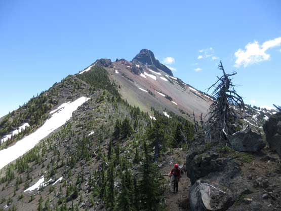
The plan for Lily and myself was to combine Mt. Washington with the nearby Three Fingered Jack to make a 3-day road trip. The two climbs are very similar in many aspects but Mt. Washington has longer pitches. On the last day of this trip we woke up under a thick layer of low clouds in Big Lake campground but still decided to go for the summit. We figured the clouds would give way to sunny skies as we ascending into the alpine.
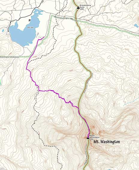
Mt. Washington via North Ridge. GPX DL
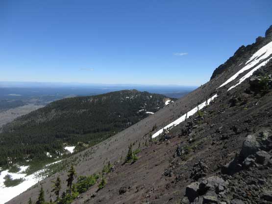
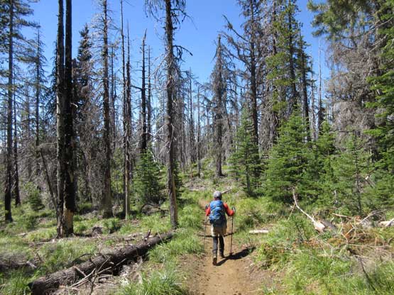
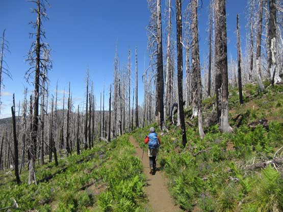
There are multiple ways to start the hike. Our reference was the tracks on peakbagger.com that starts from Pacific Crest Trail. We challenged that because we saw a marked trail on Gaia GPS map starting out from Big Lake youth’s campground that potentially shaves one kilometer off the slog. We weren’t allowed to park inside the camp but we did find a small pull-out nearby and walked to the trail-head. This is apparently a “user-maintained” trail so probably not very well known. It does connect with the main trail and in a decent shape. We then followed the main PCT for a while before branching off on the climber’s trail marked by a big cairn. This climber’s trail also saw some maintenance and was easy to follow with only minor blowdown issue. We gained elevation quickly.
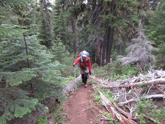
Hiking up the climber’s access trail
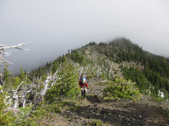
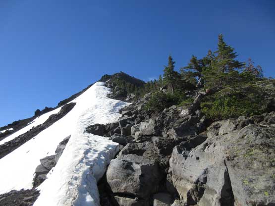
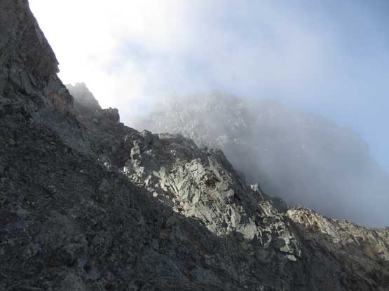
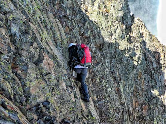
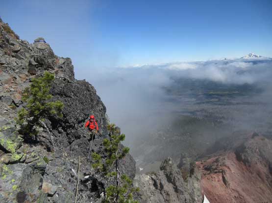
There’s about 150 meters section that we briefly lost the trail but the general direction was very easy to navigate. At that point we just had to work upwards onto the north ridge proper and once on the ridge the trail reappeared. Patches of snow on ground probably had obscured the trail but who knows. The “trail” on the north ridge itself was also in a decent shape which surprised us. We weren’t expecting a path on the ridge at all but I guess we underestimated the popularity of this climb. At this point the weather’s slowly lifting with more and more blue skies showing up, but occasionally thick clouds would still blow in and we were suddenly in a disorienting white-out.

Onto the North Ridge. The clouds were rolling in and out
Lily on a flatter section of the lower North Ridge
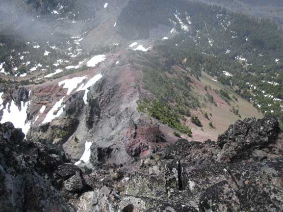
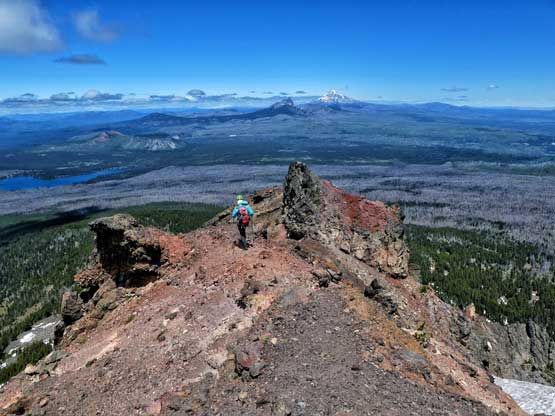
Onto volcanic rocks now. Note the redness
Upwards and onward
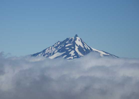
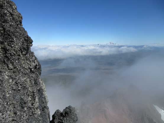
Mt. Jefferson pokes above the low clouds layer
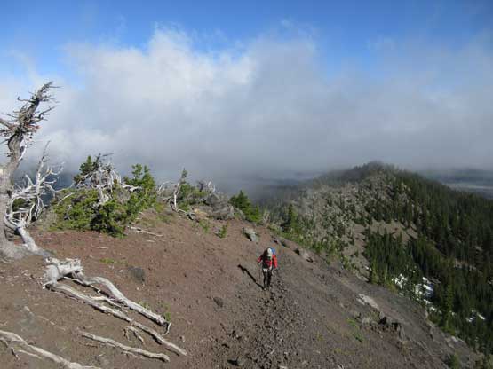
The clouds really added to the drama on this day
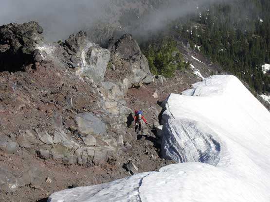
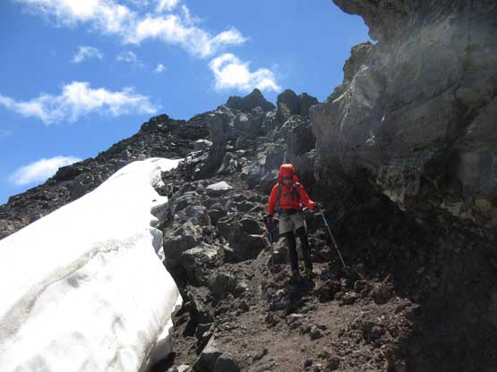
Lily ascending between snow and the ridge crest

A closer look at the summit tower
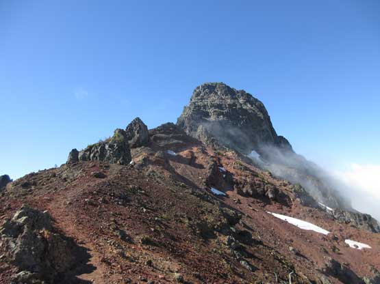
Same as above, but a wider view
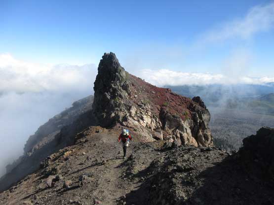
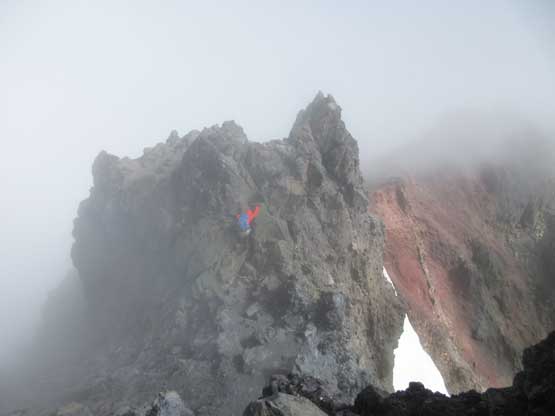
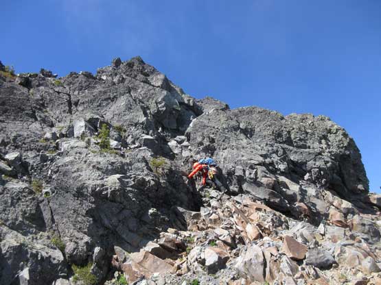
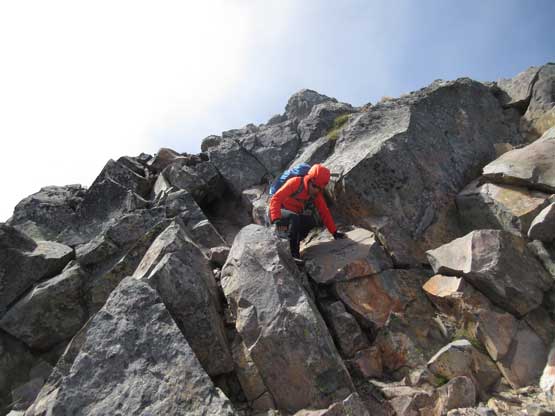
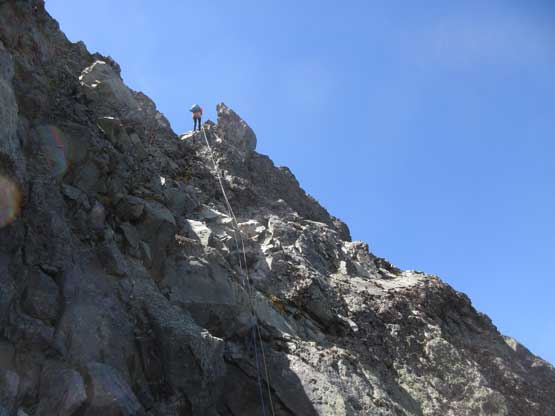
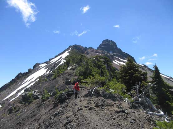
Higher up on the North Ridge now. Quite a few pinnacles
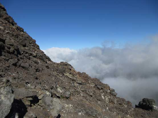
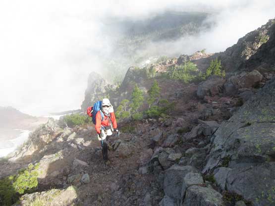
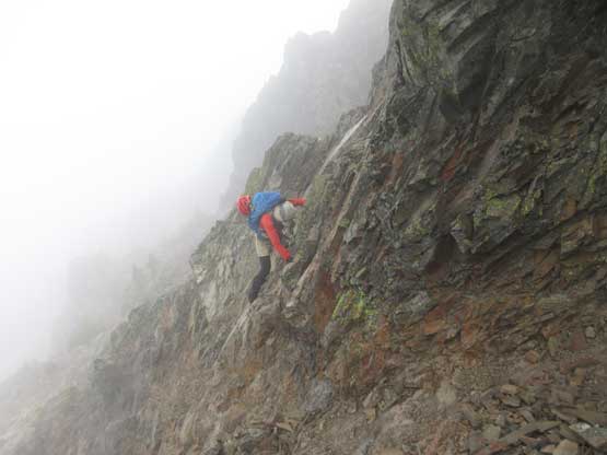
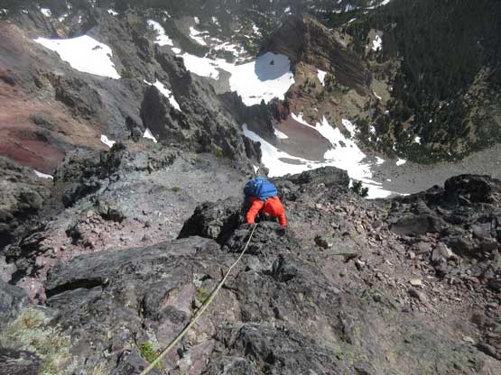
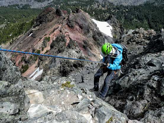
The ridge steepens as we slowly approaching the summit tower and the ground’s getting loose. One of the major bumps needs some class-2 scrambling on choss and after that we were not far from the fun part. Before attacking the summit tower we had to bypass a couple pinnacles on climber’s right (west) side but I wasn’t aware of that thank to the lack of research. And thank to the clouds rolling in and out Lily and I had lost visibility for much of this section so all of the route-finding decisions had to be guessed. I made a couple wrong moves for staying too high on the ridge and that involved some sketchy 3rd class scrambling along with some frustrating backtracking. The last false tower could be down-climbed but involved a couple tricky moves near the bottom.
Upwards into the mist. The route-finding wasn’t easy without visibility
Where the heck are we going?
Me leading across an off-route cruxy spot. Photo by Lily Q.
Lily following across this interesting spot.
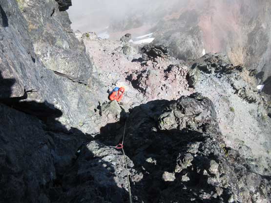
After a while the clouds cleared and we could again see where to go

We bypassed this tower without even noticing the existence of it

We got off-route here again by ascending to the crest.

I down-climbed the nose into the notch. This is the start of the summit tower
Lily on the false tower with some dramatic background behind
A fraction of second later Lily’s in a white-out again..
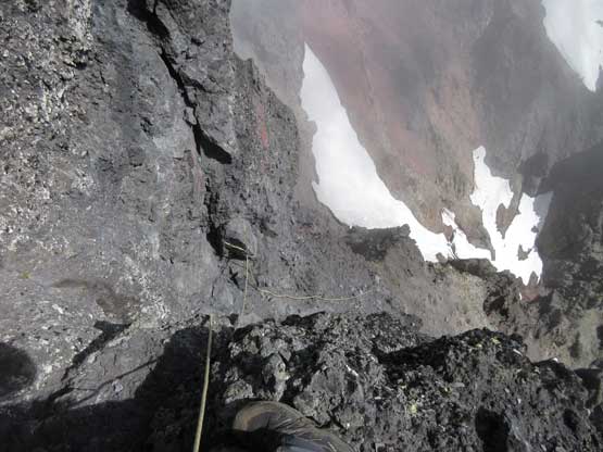
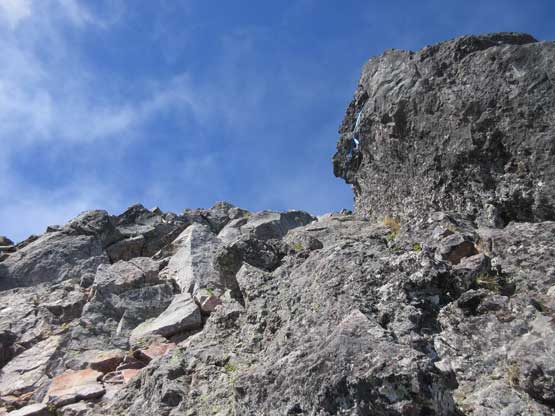
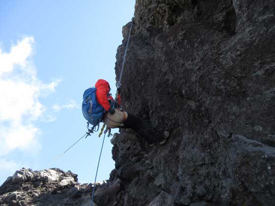
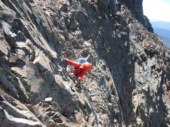
Once at the base of the summit tower we easily located that ramp system referred in other trip reports. The route-finding on the first (nose) pitch wasn’t difficult as we just had to work leftwards and then upwards but the exposure is huge. After checking out the exposure we decided to pitch it out despite the coldness and wind. It’s really not fun to be stuck there in the wind. I volunteered to lead the pitch which required a couple shitty moves on Oreo kind of choss to start with, but once entering the upper chimney the climbing became fun. In no time I topped out and belayed Lily up using a small tree. I veered far to the left just so we could sort of see each other for communication.
Partway up the first pitch (the Oreo pitch). Looking down…
A sideways view shows the slope angle and the low clouds
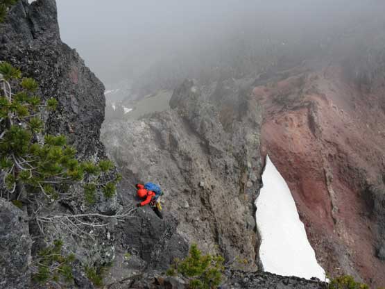
Lily climbing up the crux move on the first pitch
Almost done Pitch #1. The position is superb
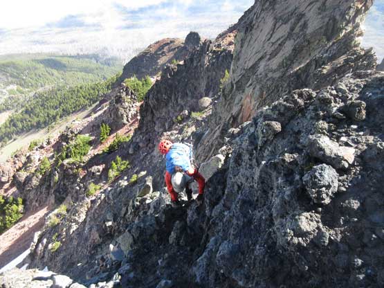
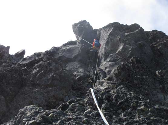
The terrain then transitioned back to scrambling so we packed the ropes and headed up. It’s really easy going for a while until we faced the upper chimney. This one looked pretty tame but I was unsure what’s laying beyond the visible range so asked for another belay. In retrospect this belay wasn’t necessary but it’s fun to put two cams into the cracks. Once finishing the upper pitch the summit was only 10 meters away.
Above the first pitch we were back to scrambling
Partway up the upper chimney pitch, looking down
The summit’s pretty much right there.
Lily climbing up the chimney pitch near the top
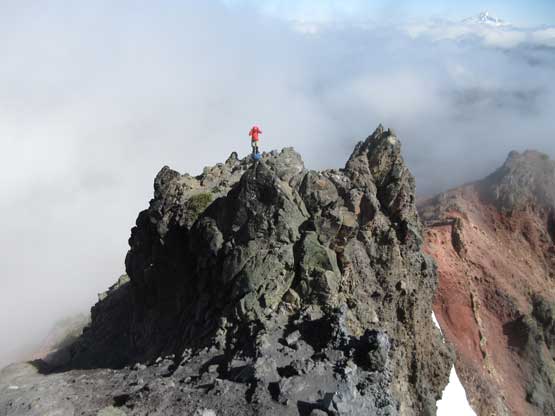
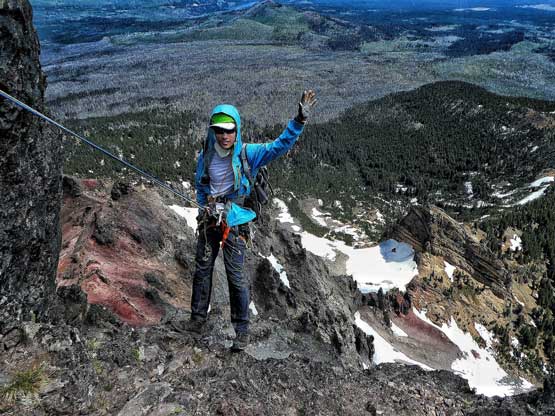
Lily walking to the highest point. Happy to be here finally.
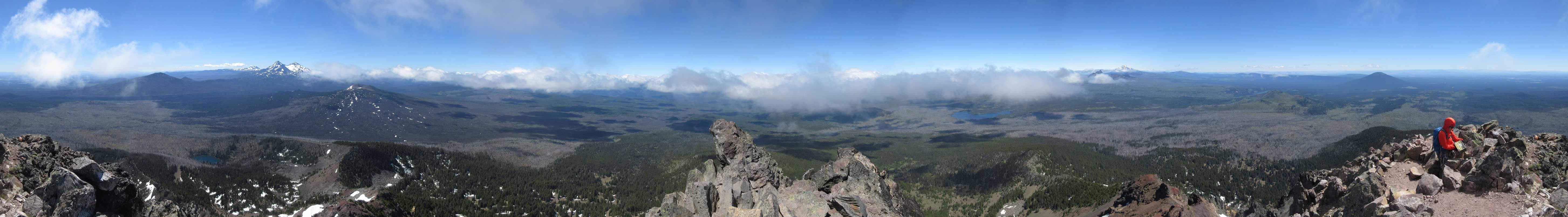
Summit Panorama from Mt. Washington (OR). Click to view large size.
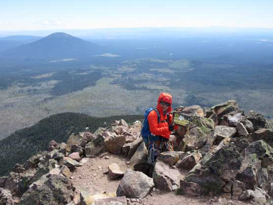
Checking out the register and see if there’s familiar names
The south side is a vertical drop for hundreds of feet
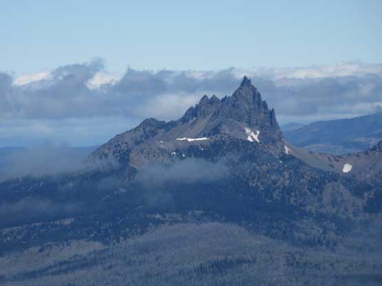
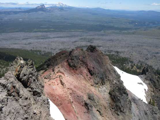
A closer look at Three Fingered Jack
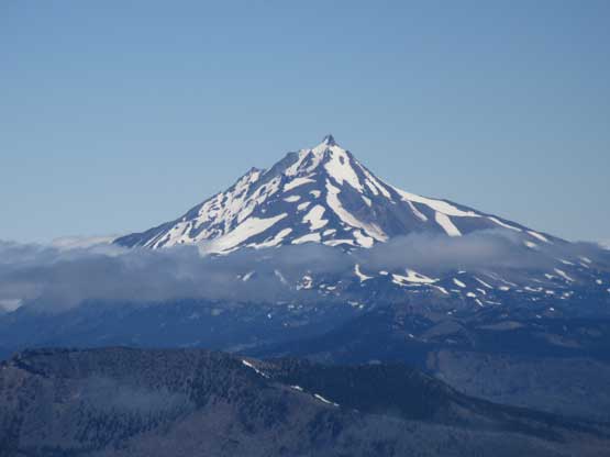
A zoomed-in shot of Mt. Jefferson

North Sister and South Sister to the south
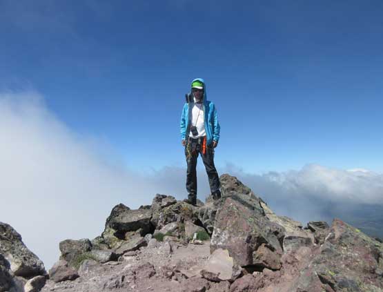
Me on the summit of Mt. Washington (OR)
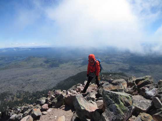
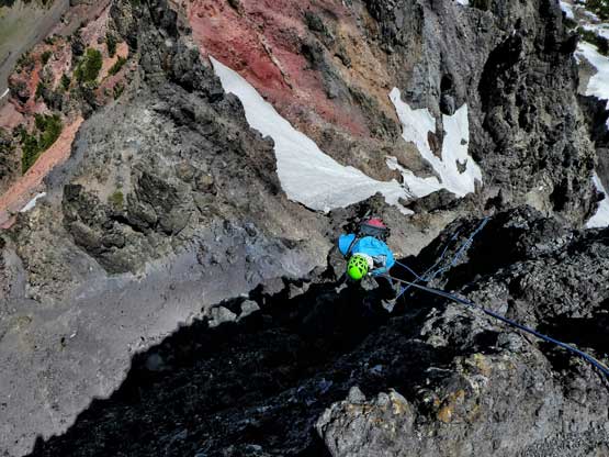
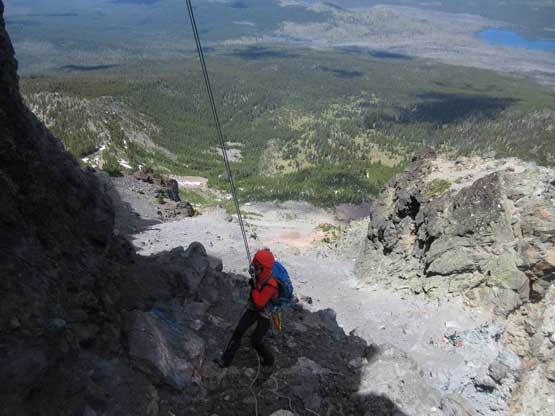
Thank to the coldness we didn’t want to linger too long on the summit. On the descent we did three 30-m rappels from station to station (with a bit of walking in between). I was in no mood of down-climbing at this point and just wanted to play with the ropes. The 3rd rappel was the worse because of the wind and the rope drags. The wind was really whipping on us that throwing the ropes down was quite a pain in the ass, but we did manage to sort it out after a few frustrating tries. Reversing the pinnacles section required some degree of caution but we managed to find a lesser technical line on the way back, staying well below the ridge crest. The rest of the hike out was uneventful and the weather did improve. Having Three Fingered Jack and Mt. Jefferson displaced in front was quite an accomplishing sight.
Descending off from the summit.
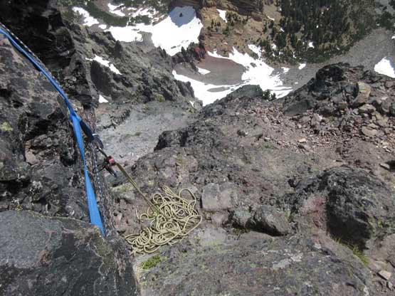
Arriving at the anchor of Rappel #1. We had left a rope and gears here
Me starting the first rappel. Photo by Lily Q.
Lily rappelling the upper chimney pitch
The second rappel is optional but why not. Photo by Lily Q.
Lily on the Rappel #2
Me leading down the last rappel down the Oreo pitch. Photo by Lily Q.

Quite a few rappel rings on this anchor…
Lily almost down the last rappel but got stuck.
I had to scramble up a bit to free one of the rope which was caught…

Three Fingered Jack and Mt. Jefferson in one shot
I really liked the colours on this mountain.

Lily continuing down the last rappel

A closer look at Lily rappelling
Harnesses off now, but still some concentration required
We decided to reverse that tricky traverse
Me hiking down easier ground now. Photo by Lily Q.
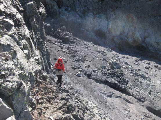
Descending the ridge but still on loose rocks
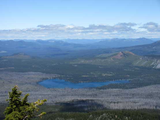
This is Big Lake where we camped last night
Continuing down the North Ridge on the typical terrain
Not a bad view looking east
One last shot looking towards the summit
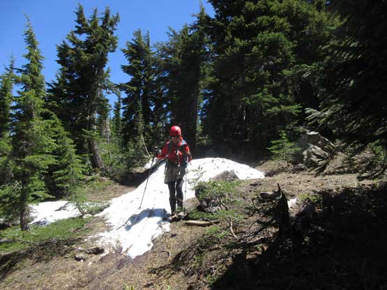
Into the woods now. Note the patchy snow
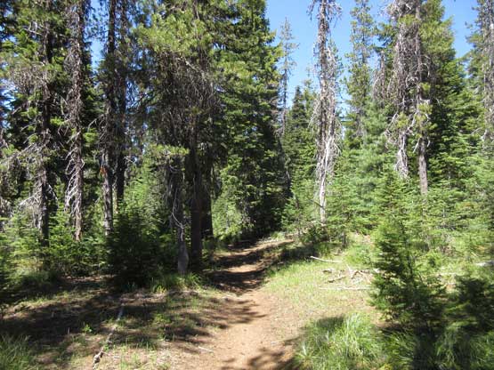
Back to Pacific Crest Trail
I didn’t enjoy hiking under a hot afternoon sun
The last couple kilometers were quite a slog
Not doing too much of lingering we immediately started the long drive up north. I was more awake so volunteered to put down the entire drive. In one push we made back to Salem, OR and called for a break for gas and dinner, and in another push I got us all the way back to Exit 260 past Bellingham, WA. This was an exhausting pitch but I did fine. After another gas break the third push got us back home in Vancouver, before midnight. Not bad, not bad….
