Alexandra Peak
December 4, 2021
1983m
Vancouver Island, BC
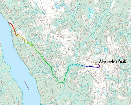
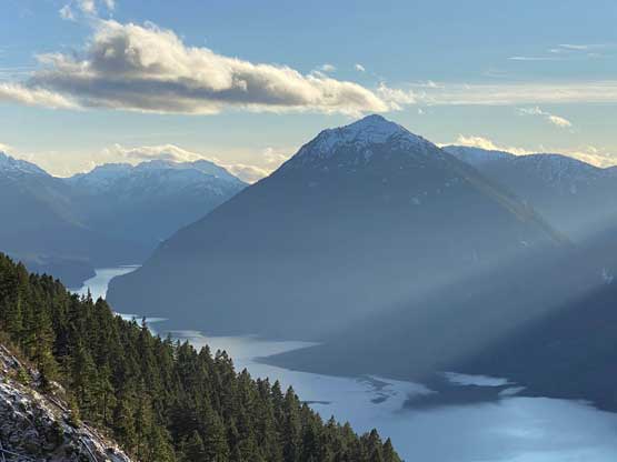
Alexandra Peak of central Vancouver Island locates just outside the boundary of Strathcona Provincial Park and thank to the lack of protection, the area is owned by some private logging companies and because of that, the access has always been an issue. This is unfortunate as the peak is one of the taller summits on the island with mountaineering potential. The area are riddled with logging roads but one could not expect to just drive them up. The road system in Oyster River valley to the east might make the most sense but there are more than one gate blocking the access from more than 15 km away. The west side access from Buttle Lake is now the “standard route”. In the past summer there had been a period when one could drive to within 1 km from the trail-head at 1250 m, but such luxury was short-lived. The gate at the bottom has been locked and the gate bypass secretly used by climbers was blocked. From the bottom of the FSR one has to walk or (push the) bike about 11 km with close to 1000 m elevation gain just to reach the trail-head.
Matt and I had been discussing Alexandra Peak for a while because this is one of the 51 peaks in our local “SW BC” region with more than 1000 m prominence. Matt had even made an attempt a few months ago in summer, but turned around due to the lack of commitment and the thicker-than-expected bushwhacking. We agreed to give it a try in this so-called “early winter” conditions to minimize bushwhacking but I was only half-hearted as to nail the timing game in this time of a year is sure a difficult, if not impossible task. Most ascents of this peak had been in summer or spring and most parties did end up finding that trail so I was positive that I did not have to do it in winter. However, after a series of Atmospheric River events with record-breaking warm temperatures a cold snap was scheduled to arrive to bring down the avalanche danger to low/low/low. The weather also cooperated, at last. After some discussions Matt and I made the commitment to book the Friday evening’s ferry ride and to get there on time I had to bail 2 hours of work. I normally would not do that in this time of a year, but for Alexandra Peak I had to.
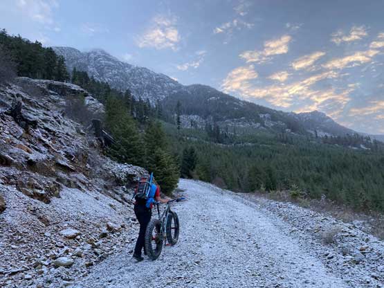
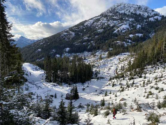
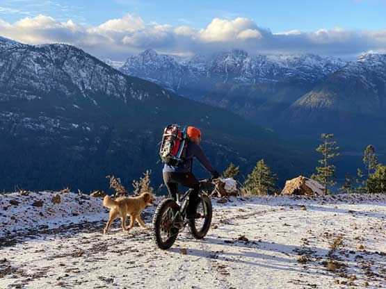
On Friday evening I loaded up all the gears including the fat bike and went directly from work to Matt’s place in North Vancouver. I showed up there at 8:45 pm and we were at the ferry terminal half an hour later. Matt knows a secret car-camping spot on the island and we made there at around 1 am. The weather at night and in the morning was not supposed to be “great” but there’s a clearing trend throughout the day, so we opted for a later-than-normal start. We woke up at 5:45 am, grabbed some coffee and drove to the bottom of Westmin Mine Road at 7:30 am. The gate was locked as expected and the weather was also clearing, as expected. In terms of gears we decided to bring two axes each, but I opted for the lighter Trango Tech mountaineering boots and Irvis Hybrid crampons. Later on I would have regretted this decision but on a trip with Matt I did also have to prioritize weight-saving.
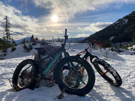
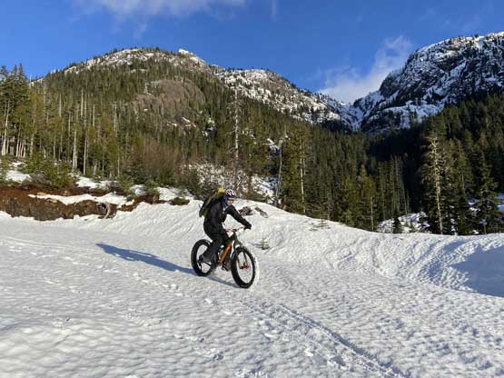
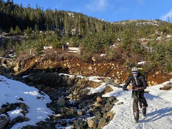
I had heard stories from different partners about how “insane” this access road was. I honestly did not find it to be that gnarly from exposure perspective. Had the gate been open I was sure I could have no problem driving the Tacoma all the way up if there’s no rock slide. However, the steepness of this road was indeed quite insane. From the start at 250 m to that infamous exposed traverse at 1000 m zone the elevation gain was unrelenting. There were a few short flat-ish stretches but otherwise, even Matt had to push the bike most of the way up. I felt even pushing the bike was quite exhausting. There was surface hoar growing on the road making additional friction to slow down our progress. A couple hours later we crested the first highpoint and made a fast descent into the valley separating Mt. Adrian and Alexandra Peak, losing about 50 m elevation. We then pushed/rode the bikes for another 2 km to the road’s driveable end where we started to encounter continuous snow. I thought about to ditch the bikes there, but Matt suggested to push the bikes all the way to the trail-head as he was confident that we could ride down the firm snow later in the day.


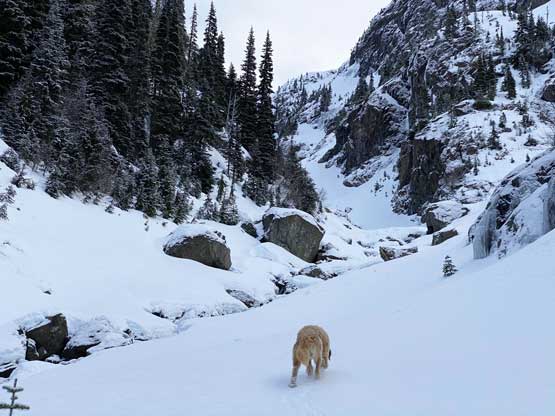
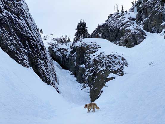
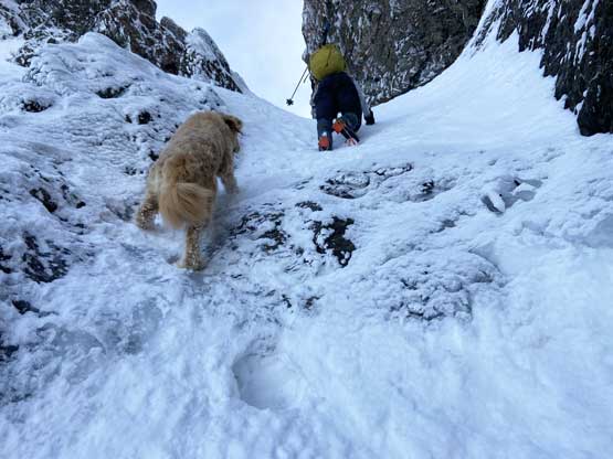
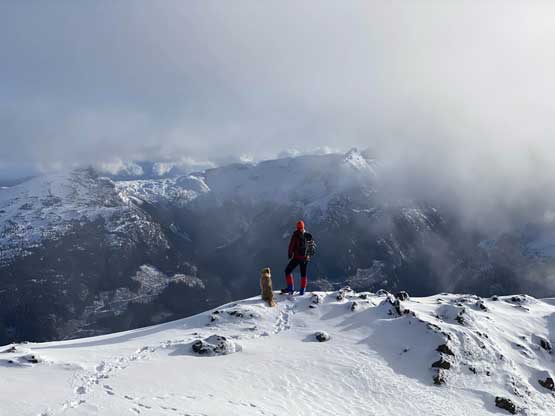
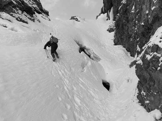
The first lengthy break of this day was taken at the “trail-head” where we had to make the gear transition from biking to snowshoeing. I was happy to ditch probably half of the pack’s weight. We easily snowshoed up the cut-block and actually found the tapes to mark the trail-head. Of course in winter conditions we did not have to stick to the trail. The cross-country travel in the mature forest was quite straightforward. We kept a rightwards traversing bearing and merged into the gigantic west-facing gully a short while later. The creek was running in the middle of the gulley. I crossed to the south side while Matt stayed on the north side and the two options converged higher. The snowpack was rock hard such that we should have already dropped snowshoes, but we were too stubborn to make that transition. The terrain started to become committing above 1500 m. The main gully was still showing creek and rock steps so we used a somewhat exposed ramp system on climber’s right to access the final lip. The last 20 m to exit this gully was the steepest. I was able to keep the snowshoes on, but not without some intense moves. Matt was smart enough to take a few minutes break to swap for crampons, while Twig made both of us embarrassed by not using any traction device.


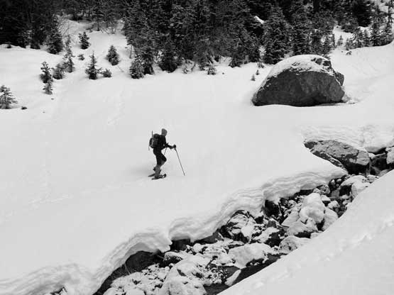
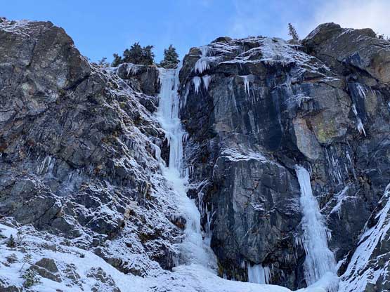


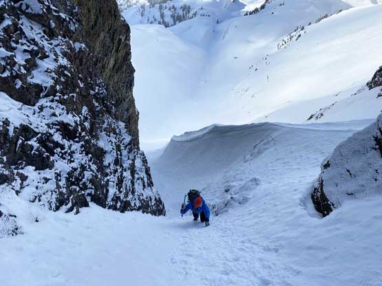
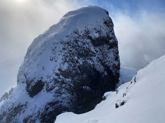
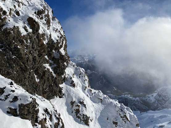
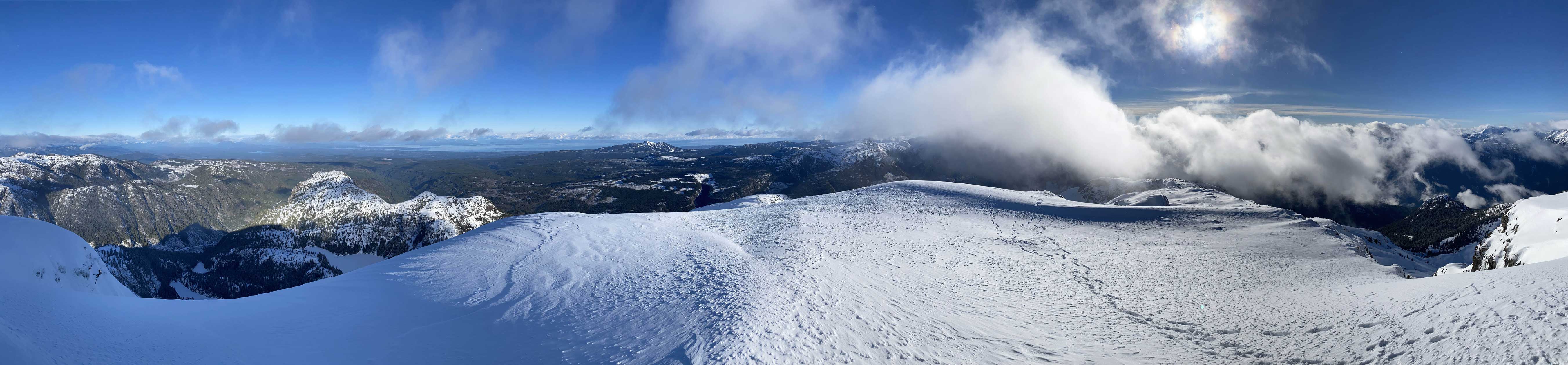
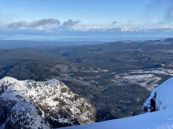
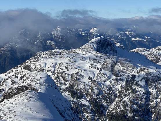
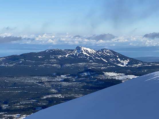
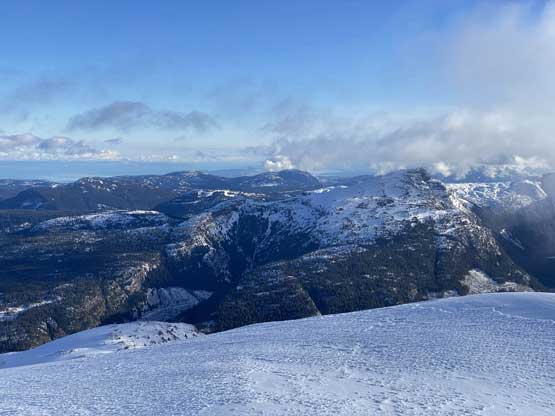
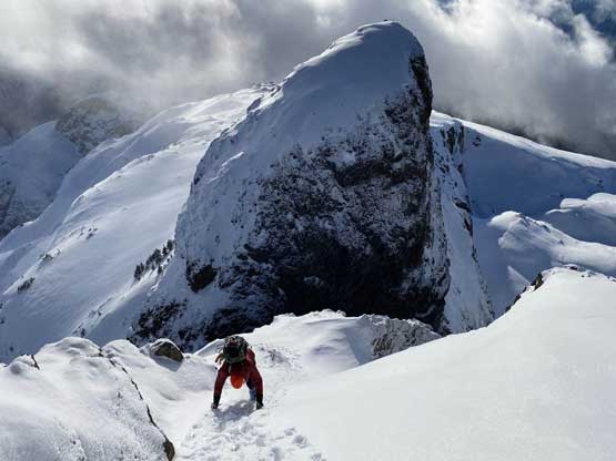
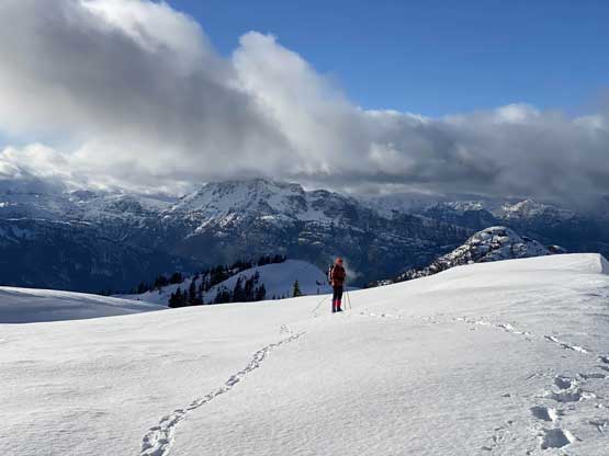
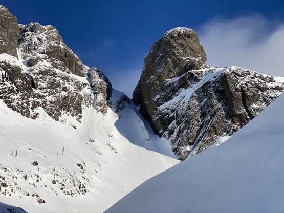
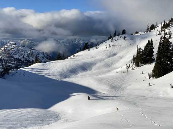
The upper draw of Alexandra Peak was a special place to linger around, but we were on a tight day-trip schedule so we had to press on. The snow coverage appeared sufficient so out of the three route options we opted for the middle one, also the most direct one. We aimed for the steep chute between the summit and “The Thumb”. I finally spent that few minutes to ditch snowshoes for crampons and meanwhile Matt already started the climb into the narrow part. The upper chute appeared rather “easy” but turned out harder than we thought. The condition was very icy. We should have climbed the left hand side of the gully but decided to stick close to the wall on “The Thumb” side. This got us sucked into a very narrow constraint with a 2-m ice step. Having brought two ice tools each made this section possible but I had to chop some steps on the ice. Above this crux step the terrain eased but we still had a long section of front-pointing to top out at the notch where we were greeted by some expansive views but also the winds.
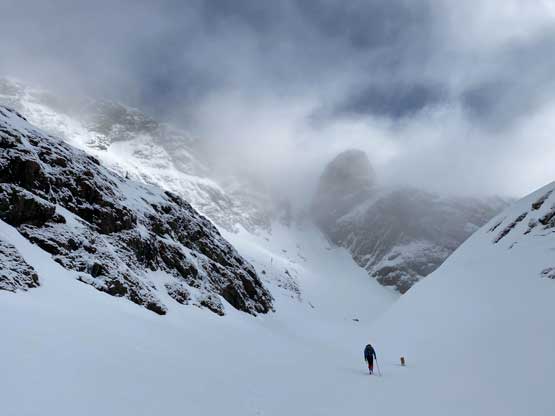


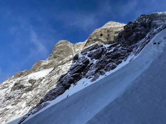

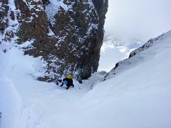
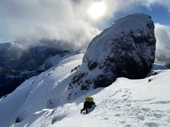
The terrain immediately above the notch appeared troublesome. I knew the spring time parties made this section looked “easy” other than the steepness. In this “early winter” conditions we had a mix of rock and snow. We examined the direct attack of the rock band. It was possible, but none of us was keen on mixed-climbing so then Matt led a horizontal snow traverse to the right to search for another possible route. Around the corner Matt led a pitch of 50 degree snow with the steepest spot being particularly icy to get us back on track. This section reminded me a little bit of Robertson Peak’s summit block, but felt much harder. At this point I knew the summit was finally attainable but we still had a long section of snow climbing (45 degrees ish) on hard snow to top out on the summit plateau. The true summit was on the far side of the plateau so we enjoyed a scenic traverse to get there.
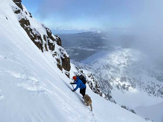


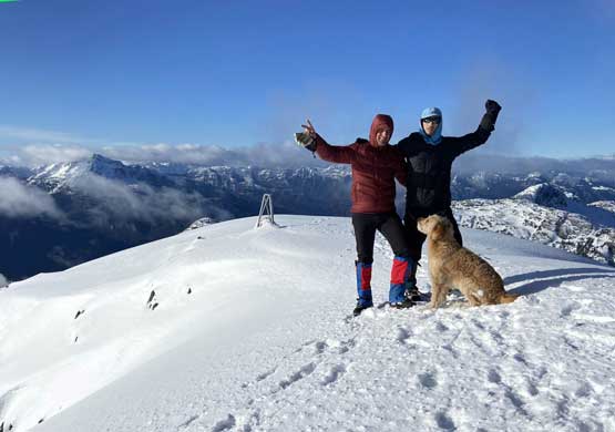
The summit was cold and windy so we didn’t stay for too long. The upper route had to be reversed so we gingerly down-climbed to where we topped out that 50-degree pitch. I became impatient and started down-climbing right away while Matt opted to look for an alternative solution. The few steps around the steepest spot took a while as I simply couldn’t trust my soft-ish boots and crampons. By the time I finished the worst spot Matt was already done with the down-climb and I still had a section of 45-degree snow to content with. We then reversed the traverse back to the “thumb notch” and dropped back into the chute. This time we would stay skier’s right to avoid that ice step, but the down-climb was still not as straightforward as I was hoping for. The grade was a sustained 40-45 degrees but the snow condition was icy and rimy such that every single step had to be down-climbed with caution. About 2/3 of the way down Matt went for a fast and furious glissade. I thought about that too, but I didn’t want to do that with crampons on and I also had just ripped the pants two weeks ago by glissading.


We took another break at the spot where I ditched the snowshoes. The snowpack was firm enough that we both opted to descend with crampons instead of using the snowshoes. This proved to be a good call. The steep sections in that lower gully were much easier now with the proper footwear and the forest lower down was still firm enough to hold our weight even without the snowshoes. We did post-hole a few times around weak spots near buried trees. We kept crampons on all the way to where we ditched the bikes. Another long break later it’s time to enjoy the ride. This was my first time trying to fatbike on snow and I have to say it wasn’t as easy as I thought. The snowpack gave way unpredictably to give surprises here and there, but it was fun. The descent from 1050 m “highpoint” back to the vehicle was a rather survival game. There were a few sections where I struggled to keep a controllable speed and I had to break as humanly hard as I could. Even the break was starting to fail about 2/3 of the way down (likely due to heat), but thankfully the function was back a few seconds later. Considering how high-tech our fat bikes are, I’m sure this approach could not be possible for the average bikes we mountaineers use.


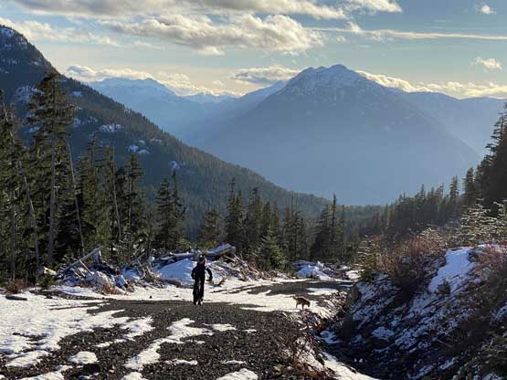


Our round trip time was 8 hours and we even managed to do this trip without the use of head-lamps. Considering most parties who had to start the walk from the bottom needed 2 days, our pace was surely not bad. The amount of work out we had done surely did not reflect the time. Now even one day later my legs were still sore and I definitely do not get that on a normal 8-hour hike. Matt then did an excellent job driving us back to Nanaimo but we had to wait 2 hours for the ferry. We used that time to have a proper dinner and I eventually got back to White Rock at 12:30 am.
