Brins Mesa (Brins Ridge)
March 14, 2017
1707m
Sedona, AZ
Brins Mesa is rather just a plateau sandwiched between Capitol Butte to the west and the massive Wilson Mountain to the east, and itself is more well-known as part of the Soldiers Pass – Brins Mesa loop which is advertised by many as the most beautiful and worthwhile hike in the core area of Sedona. Of course the statement is bold and likely not agreed by everyone but it does show how famed this hike is. This is largely due to the elevation being “low to medium” throughout the hike which gives some of the best perspectives of the nearby red/brown/yellow sandstone towers, and at the same time it is long enough to cover a good variety of terrain.
As a visitor I sure wanted to hike this but I’m not particularly motivated without ascending a named summit so I went for some digging on the internet. The plateau has two distinct highpoints with the NE one being the official Brins Mesa summit and the SW one unofficially named “Brins Ridge”. The SW summit – “Brins Ridge” is clearly the higher and the more picturesque of the two but I figured I had to ascend both just for the sake of “claiming” this peak. This would add considerably amount of distance and elevation gain on top of the loop and it certainly did not help when planning to hike it in the middle of a hot day under the 30+ degree Sedona sun. To make things even more challenging I had just completed a scramble up Capitol Butte which involved more than 700 m of elevation gain on off-trail terrain.. But oh well, I drove close to 2500 km to see this place so I had to push it hard.
Soldiers Pass – Brins Mesa loop with “Brins Ridge”. GPX DL
The crux of this trip was negotiating the parking and trail-head gong show. The lot could only occupy 15 cars and not to my surprise it was full. Lots of others were lining up from behind. I did not have the patience to wait in a line up so drove back, and managed to find a place to about 500 m back on the street which was ridiculous. Thankfully there wasn’t a jam of line up on the trail as I passed hordes and hordes of tourists, and just like most other busy places once I ventured 500 m into the trail the hordes were largely gone. After that it was a cruise sailing to Soldiers Pass, albeit quite a bit of a drag considering the temperature and the south-facing terrain.

A look at Coffeepot Rock from the parking lot
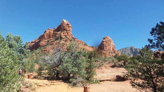
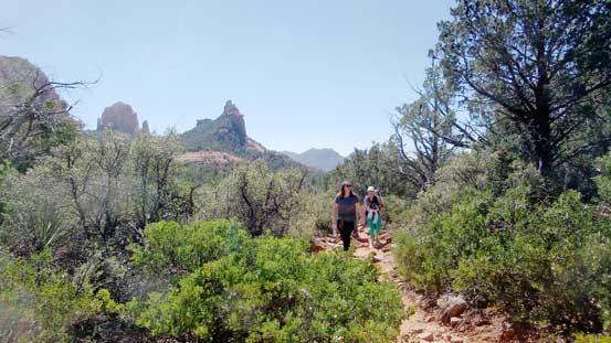
The trail-head view. No wonder why tourists like here…
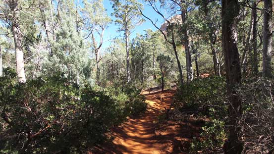
The initial stretch of the hike goes pretty much in the forest
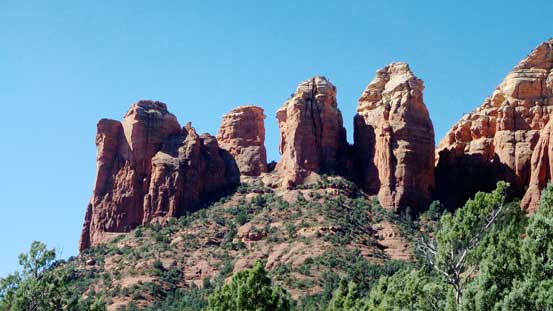
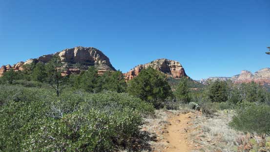
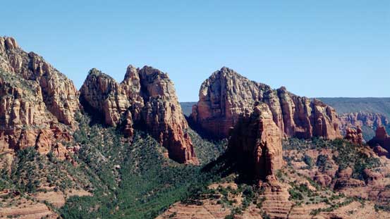
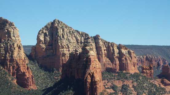
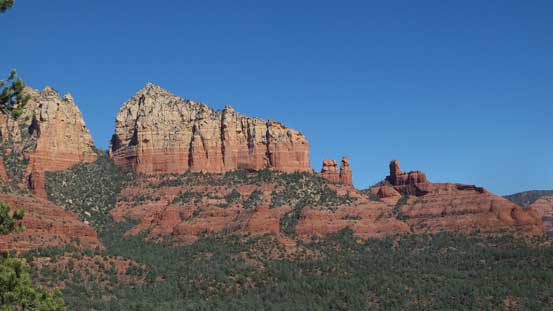
Coffeepot Rock – the official one is the leftmost although not the highest.
The sums up the upper portion of the hike towards Soldiers Pass

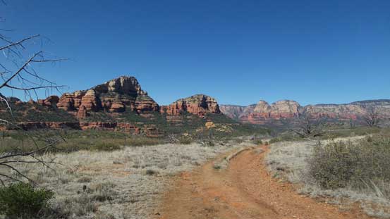
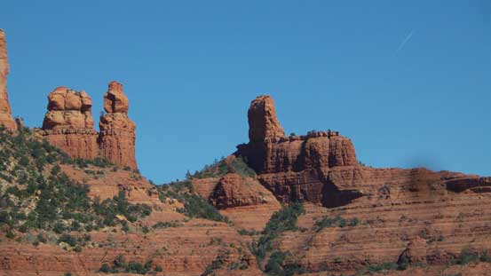
This is a view looking back from Soldiers Pass. “Brins Ridge” at center
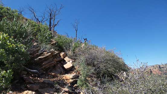
The next stage was following the well-constructed trail looping back due south-east towards the high plateau of Brins Mesa. Under the last tree I took a lengthy break as I didn’t expect there’d be anymore sheltered place after this. I followed the trail (which was more like a Jeep road here) all the way to the edge just before descending to make the loop, and from there I picked up a well-beaten, but unmarked trail heading towards Brins Ridge.
Following the trail upwards and onwards. This is looking back.
Onto the Brins Mesa plateau
More more shelter for a while..
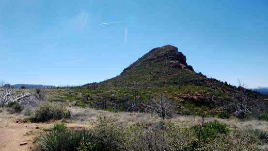
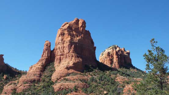
“Brins Ridge” which will be my objective
The trail merges onto a Jeep road

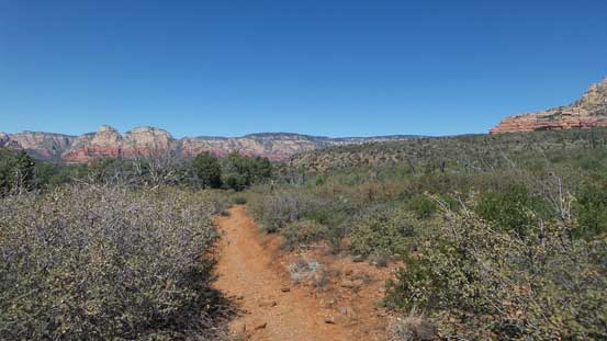
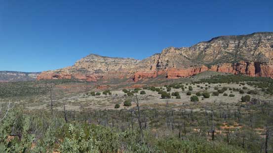
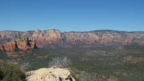
The typical view from the mesa plateau.
This unofficial trail led me switching-back up the NE slopes of Brins Ridge fairly effortlessly and in short time I made to the crest. The views were already inspiring but I waited till the true summit before dropping the gears. There were a few scrambling moves to get to the highest point but nothing worthy noting. I continued down the ridgeline for another hundred meters or so just to check out more views.
Partway up the “Brins Ridge”, looking back.

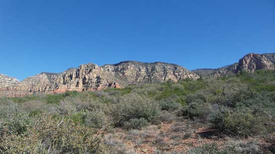
Looking at part of the Wilson Mountain massif
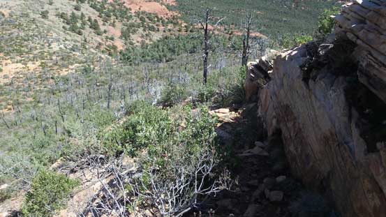
Looking down at the trail
This is looking up. It’s a game path, but easy to follow.

Cresting the ridge now, got a head-on view towards Capitol Butte
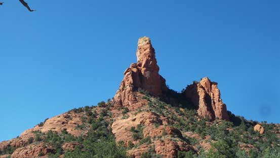
The true summit ahead
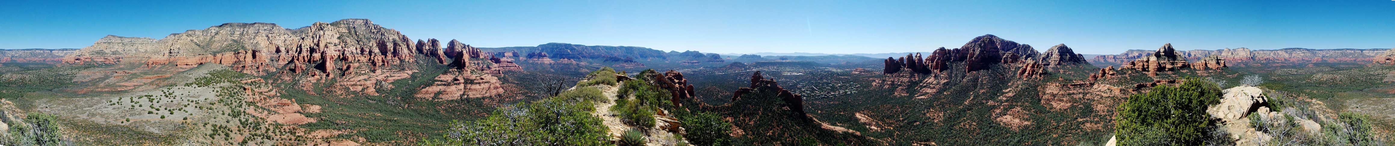
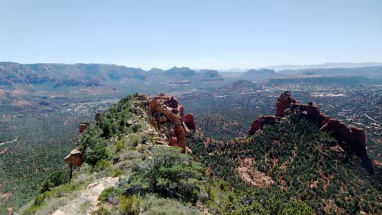
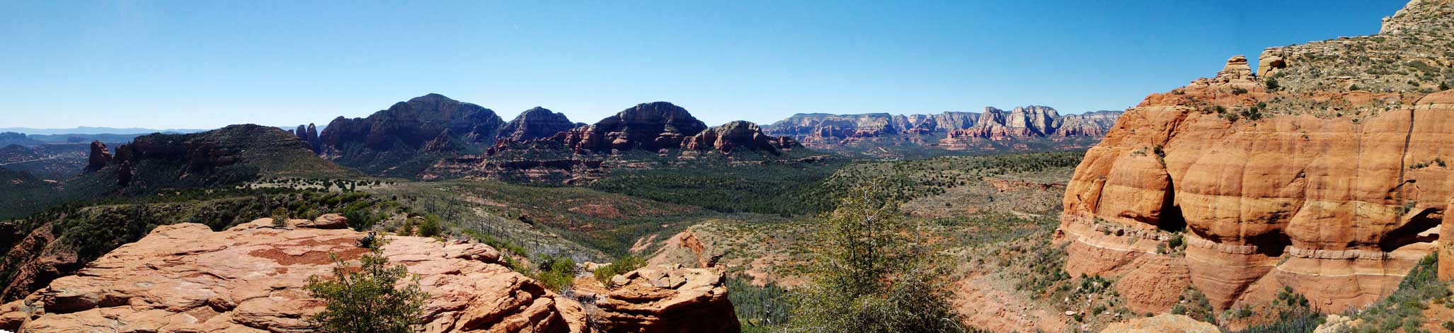
Summit Panorama from “Brins Ridge”. Click to view large size.
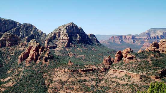
Morning Glory Spire at center with the Sedona backdrop behind
These are some unnamed spires on Wilson Mountain massif.

Part of Wilson Mountain
This is also part of Wilson Mountain.
This is zooming-in looking north. I’m too lazy to figure out their names.
As far as I know this peak also has no name.
Coffeepot Rock
Zooming-in towards the summit of Brins Mesa plateau.
I checked out this ridge for a bit to see what else in sight.
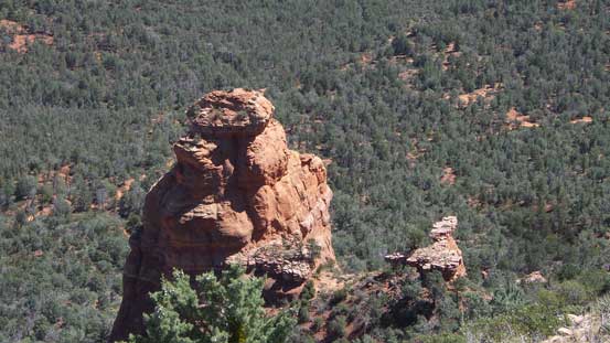
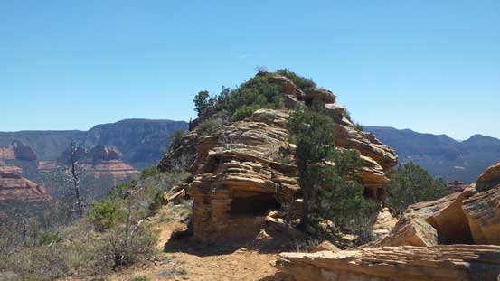
Found this spire hidden underneath.
Another look at this impressive spire on Wilson massif
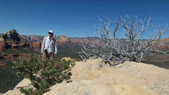
Me on the summit of “Brins Ridge”
The trail was overall a bit rocky at places so I changed footwear to my La Sportiva Trango on the descent. I really did not have to haul those extra weight but since I brought them up I had make use of them otherwise I’d feel pretty bad at making that decision. Once down to the mesa plateau I changed footwear again and then ditched the mountaineering boots. The hike up to the high point of Brins Mesa was easy but long. There’s not much of change in terms of scenery but the top did offer some unique perspectives towards the walls on Wilson Mountain.
Going down “Brins Ridge” now.

Now, slogging up towards the highpoint of Brins Mesa

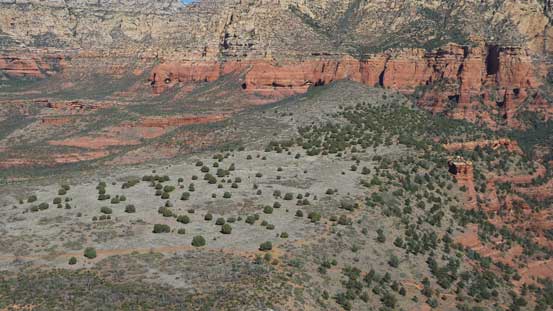
The typical scenery and vegetation on the mesa

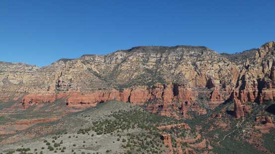
Walls like this are the “norm” in this area.
Panorama from the highpoint of Brins Mesa. Click to view large size.
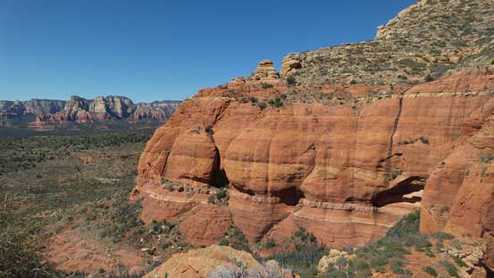
Impressive sandstone formation everywhere
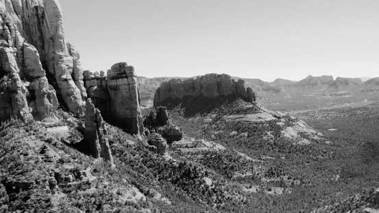
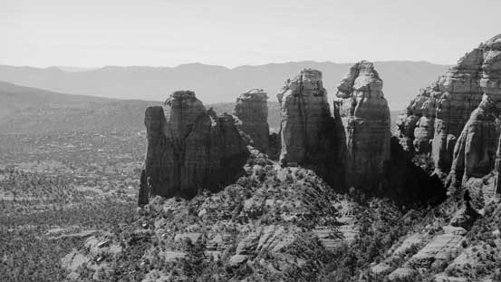
A rare black-and-white shot of the Sedona scenery
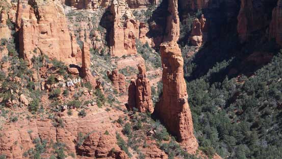
Lots and lots of spires around
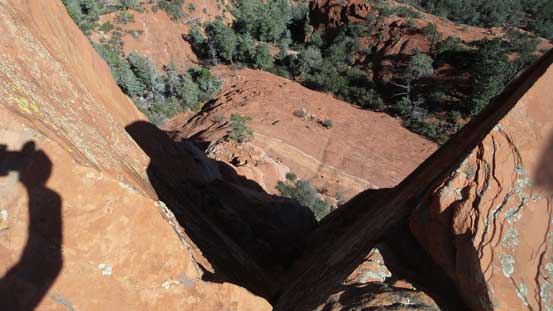
If you don’t like height then don’t look down…
In short time I was back at the cross junction and joined other hikers resuming the rest of this “Brins Mesa loop”. The descent down into Mormon Canyon drainage was fairly boring but that might due to the fact I had already seen most of the views. After what seemed like a long while I turned right upon reaching an intersection and after a short ascend I came to the last pass of the day. Descending due west added another highlight to this already-awesome hike as the towers of Morning Glory Spire and Jap Head really stole the show.

Another hiker followed me up the highpoint of Brins Mesa

Time to head down.

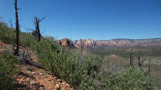
As much as the views go on this depproach trail
The third picture showing this impressive spire on Wilson Mountain
Steamboat Rock

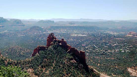
Over the pass, I got this view of Morning Glory Spire (L) and Jap Head (C)
A closer look at “Jap Head”
And, a closer look at “Morning Glory Spire”
Back to the parking lot some tourists had already gone but I still had to face that extra half-a-mile walk to where I parked. I drove back to the McDonalds for a much-needed shelter (and cool air) and from there I’d decide what should I do next. Apparently there’s still some time till sunset so I had to do something.
