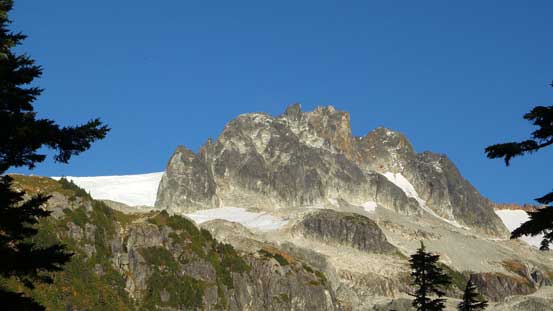
Mamquam Mountain
September 29, 2015
2595m
Garibaldi Provincial Park, BC
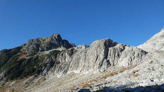
At elevation of close to 2600 m, Mamquam Mountain is the highest peak on its namesake Icefield dominating the southern Garibaldi Park, and one of the few “highly visible” peaks that strike out from the sea of summits and yet reasonably close to the city of Vancouver. From mountaineering objective, this is one peak that draws significant attention from every peak-bagger, so when Michelle, Brian and Gordon brought it up I was instantly game, despite the fact I just ascended Hadley Peak and then Mount Habrich in the previous two days. For once again our inspiration was mostly came from Simon’s excellent trip report and we’d follow the exact route he took.
The logistics for accessing this once-considered-remote area had been significantly simplified by this past summer, thank to the construction of Skookum Dam (thus, the dramatic improvement of the logging road access), as well as a newly built “Darling Lake Trail” by BCMC. However, this status is rumoured to change in the short term future as some “authorities” are going to remove the critical log bridge crossing the raging Paranoid Creek. That’s one reason why I was pushing to ascend it this year. Technically the trail had only been completed from the parking area to the bridge crossing Paranoid Creek, but there’s supposed to have a well-flagged route up the steep forest on the other side. Unfortunately for us, those flags were no longer there so we were facing a 600 m bushwhacking fest for that section. Thankfully the other three had attempted this objective a few months ago so we knew where to go…
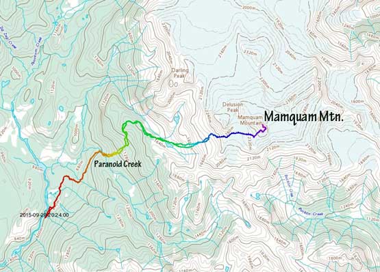
Mamquam Mountain via SW Glacier and SE Ridge. GPX DL
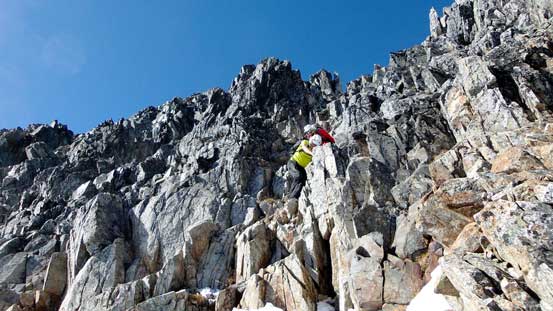
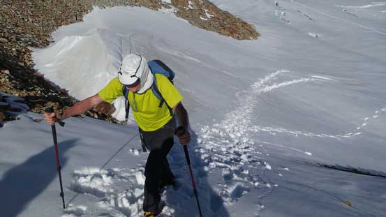
After catching only a few hours sleep I was up by 3:50 am at home, met Michelle, Brian and Gordon at 5 am in West Vancouver, and two hours later we started the trudge. The first hour or so was following the main deactivated logging road that’d eventually turned into some overgrown narrow branches, all the way to Paranoid Creek. Thank to the BCMC folks the alders had been cleared otherwise it would have been “swimming” up the road… Then it came that critical log bridge. As of October the creek wasn’t flowing nearly as high as I was expecting but still, the bridge made a much simpler deal. The other three simply walked across but the log was too wet for my like, so I spent a few extra minutes strapping crampons on (and off), and problem solved…

Crossing the slippery log, Paranoid Creek
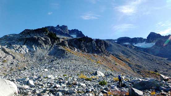
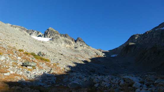
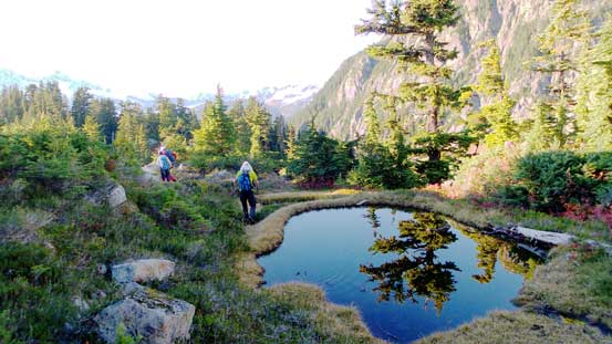
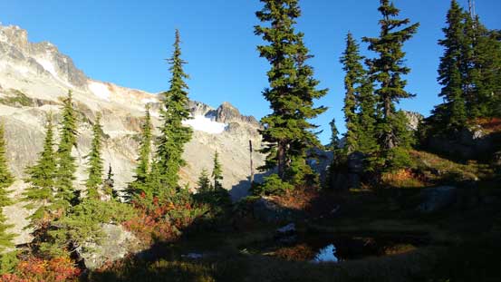
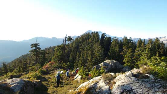
Then up the other side. Initially there’s a bit of faint paths here and there but soon enough we were on our own. I had to say the bushwhacking was better than expected for the West Coast standard. There’s still some Devil’s Club and deadfalls field but in general we were able to aim directly at where we wanted, without wondering too much back and forth. At one point Brian led us traversing a long ways over to the climber’s left followed by more steep forest. Oh another note for this section, it’s very foreshortening… 600 vertical meters of bush would take a good 2 hours and there’s no exception for us… The connecting ridge from the shoulder to Darling Lake was not easy neither and there’s still some micro-terrain route-finding as well as bushwhacking, a lot of side-hilling and a bit of boulder hopping… But nonetheless, we arrived at the Lake 3.5 hours after leaving the car in the morning.

Finally cresting the ridge after 2 hours of bushwhacking

Dropping down to the Darling Lake’s drainage
Ahead is the next section of grind – straight up the talus slope…

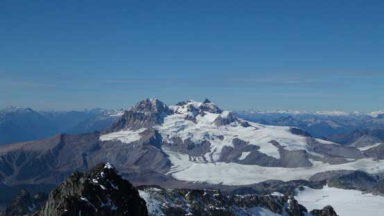
Mt. Garibaldi stealing the show
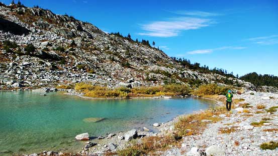
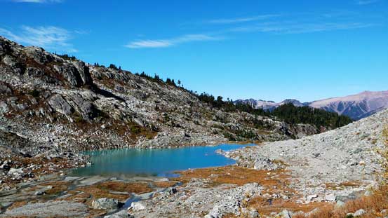
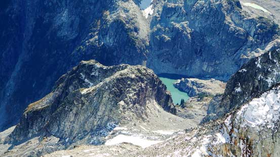
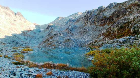
Darling Lake.. I’d love to bivy here but we only had 1 day…
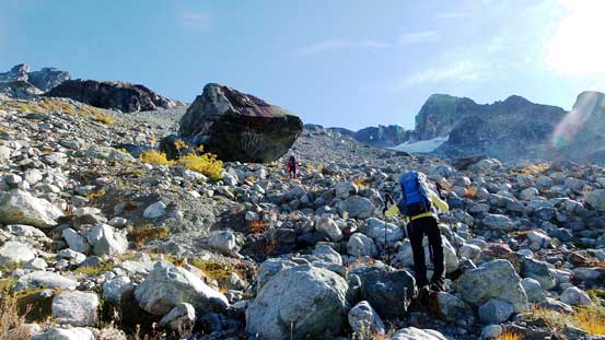
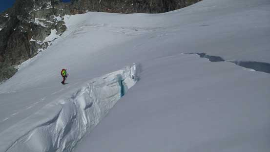
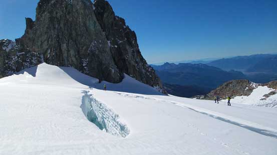
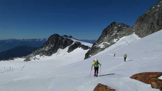
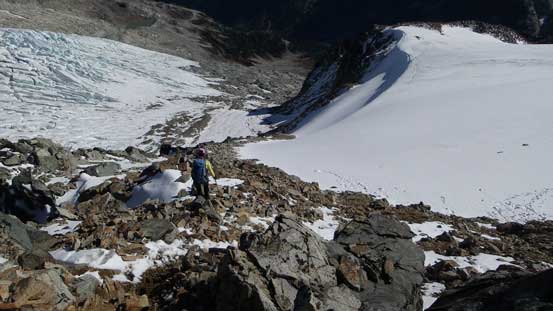
The lake was a beautiful place but we had to press on… The next section would be another hack of a grind – straight up the talus slope ahead for another good hour or two. There’s not much to say about here except for patience… It’s loose, and very tedious, but well we didn’t have a choice. Now came to the first glacier where technically we didn’t have to step onto. We did so exactly bypassing it on climber’s left, up through another loose moraine/scree slope and now it’s the second glacier. Here we had a few choices. I strapped crampons on and went up the snow/ice slope straight up. Michelle and Gordon followed me more or less but Brian opted to stay on the (slippery) rock on climber’s right side. By either route there’s still a very loose section to overcome in order to exit this glacier to the upper icefield. In a high snow year I bet that part would be filled in, but we weren’t as lucky…
Oh the boulder slog… Endless
Looking back at Darling Lake

Typical, typical…
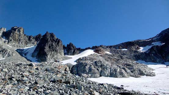
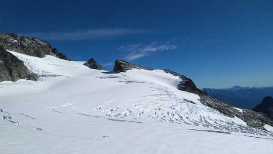
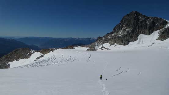
The first glacier on right; second glacier up high at middle

Looking across the crevassed lower glacier
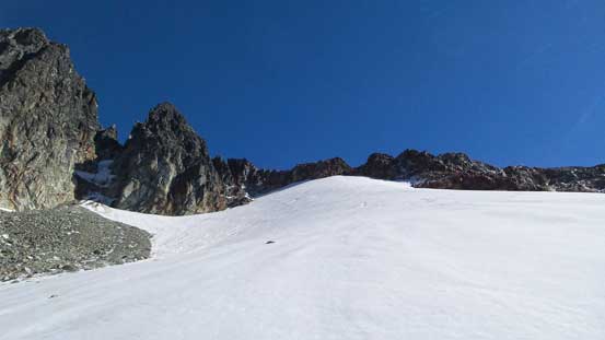
Time to ascend the second glacier

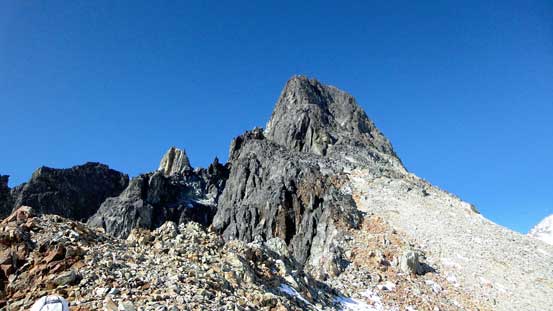
The typical rock formation around here
Brian opted to ascend the rock just to the right of this glacier

Michelle and Gordon following me up the snow/ice
The moat on top of this glacier

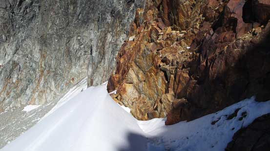
Tricky scrambling up loose ground to crest the notch
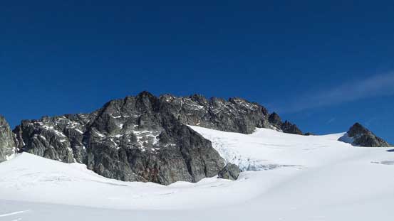
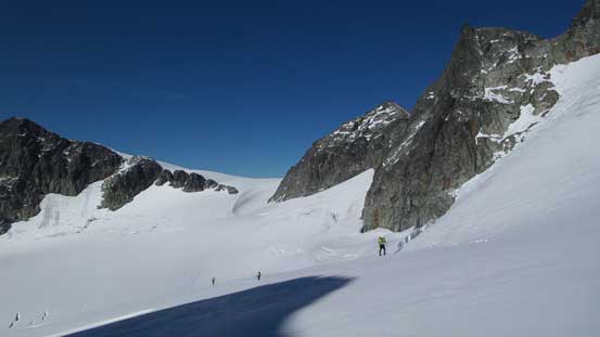
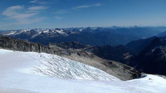
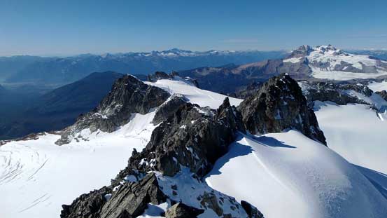
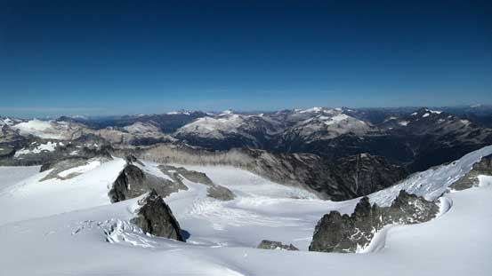
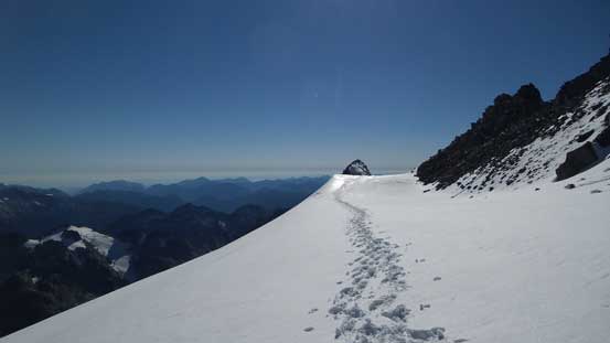
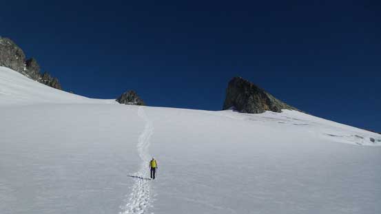
Ahead was the third, also the largest (SW) glacier of Mamquam massive. It appeared fairly crevassed and covered by a good layer of fresh snow. Earlier in the stage we made the call of leaving every piece of technical equipment in the car except for crampons as we had to be light-and-fast given the shortened daylight time in late September.. Without rope there’s considerable amount of care needed to overcome this glacier and I led the way across, probing almost every step ahead (a bit mentally taxing). There were indeed a few cracks to wonder around or step across. Eventually we made to the high shoulder, around a corner, and ahead would be the upper SE Ridge.
The much-bigger SW Glacier that we had to cross

Interesting glacier formation
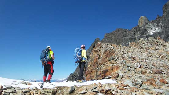
Brian and Michelle on the shoulder waiting for Gordon to show up
Then it’s time to focus on the task ahead

Crevasses… Thankfully we didn’t have to go there…

Starting the glacier travel
Marching up…
Looking back across that crevasse field
Another (big) crevasse
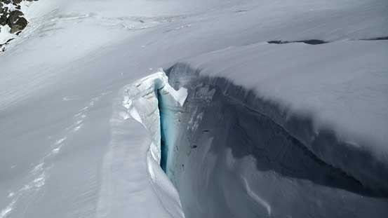
Had to find a way around this one..
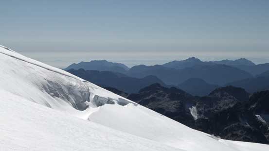
Gorgeous views though.
Brian and the two paralleling crevasses
Looking back. We traversed between the two slots

It just kept going. Note the saggings
Almost there!
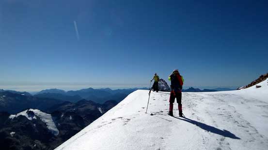
Around the south ridge and onto this bench
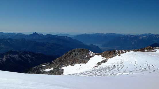
The view opened up considerably
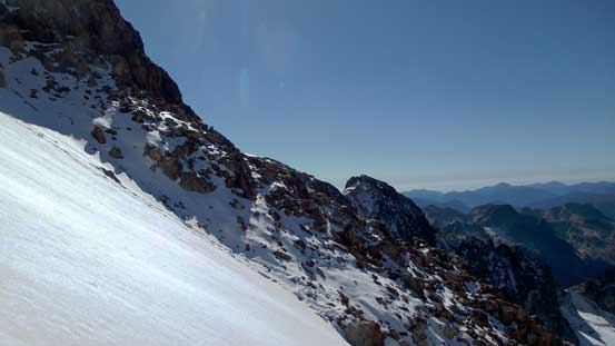
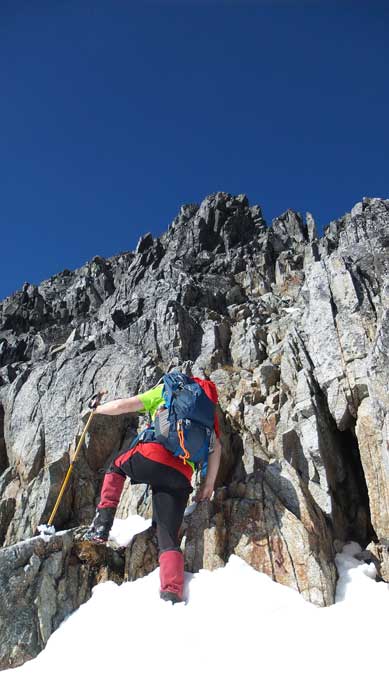
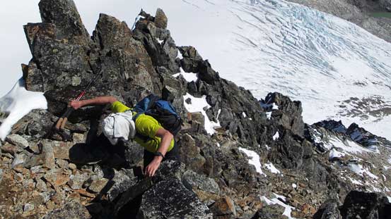
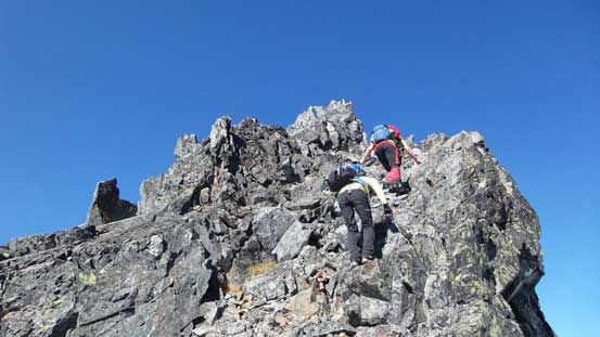
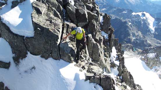
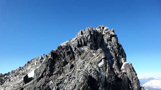
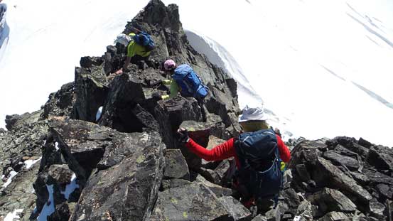
The upper SE Ridge was rated Class 3 and covered by fresh snow at places. From here Brian and Michelle took over the lead and we stayed close to each other to minimize rock fall danger. The rock was very loose at the start but improved higher up. It’s a very enjoyable scramble but fairly sustained and quite a bit longer than I thought. At one place it got fairly exposed towards right and after that it’s a notch on the ridge. Up the opposite side we soon stood on the summit, 7 hours after started the trip with mind-blowing views towards all directions.
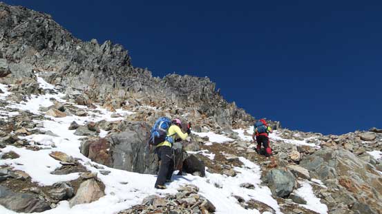
The initial part was very loose
Brian leading the way
Gordon following up the typical terrain
Lots of hands-on scrambling
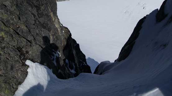
Looking down a deep notch
Gordon getting into the notch
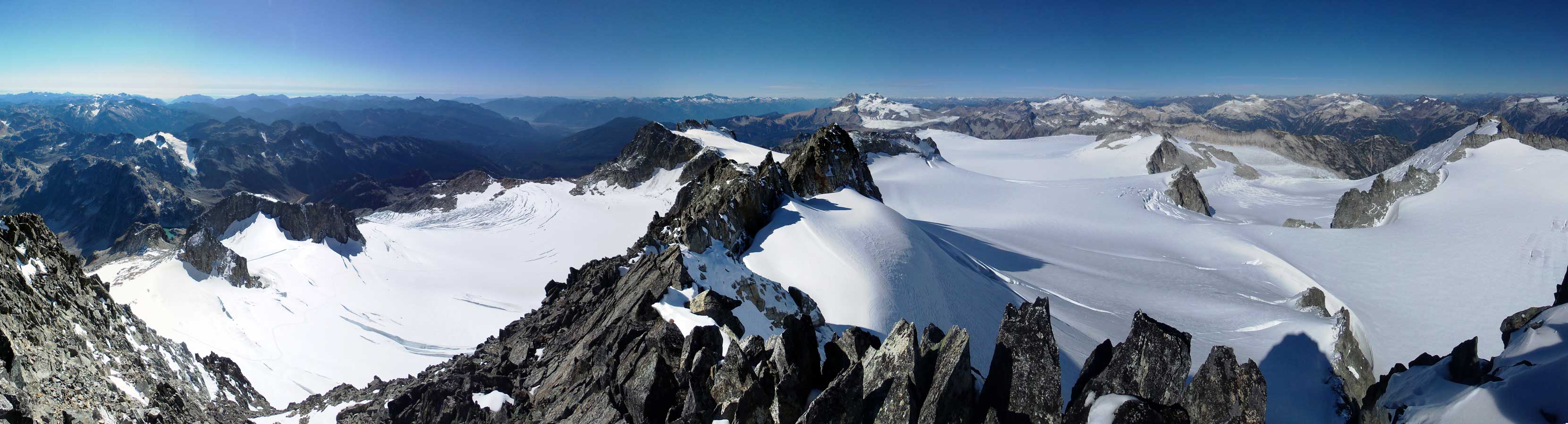
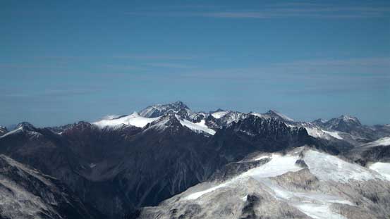
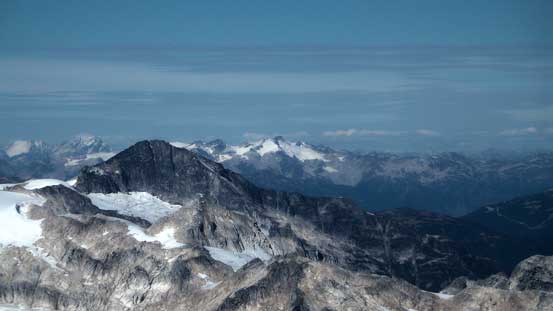
Partial summit panorama from Mamquam Mountain. Click to view large size.

Partial summit panorama from Mamquam Mountain. Click to view large size.
Looking down the jagged ridge towards Delusion Peak in the foreground
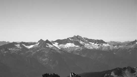
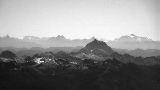
The mighty Mt. Tantalus dominates the skyline
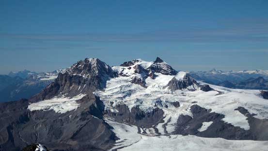
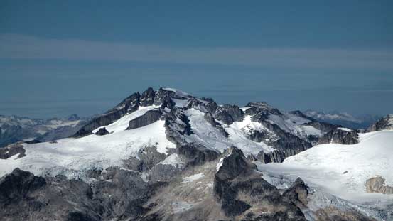
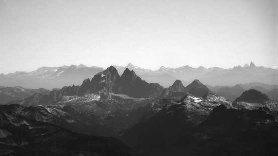
Mt. Garibaldi is a giant no matter where you look at it from
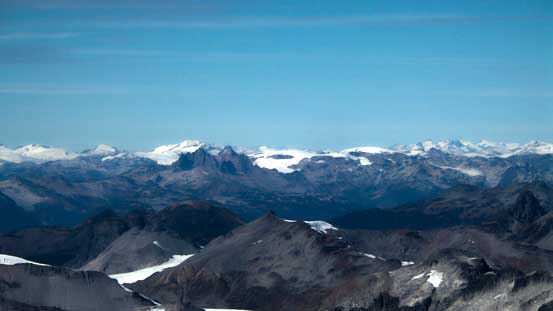
In the distance we could see Icefields by Pemberton area

In the foreground are The Black Tusk and The Sphinx. Both on my to-do list…
Wedge Mountain looking north. It’s the highest in Garibaldi Park
Castle Towers that I ascended a couple weeks ago
Mt. Davidson (left, foreground) is a remote summit

The crevasse field

Meslilloet Mountain

Looking down at the North Shore Mountains
Even the Sky Pilot group are looking tiny!
Can’t get rid of this giant…
Another look towards Castle Towers
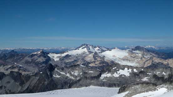
Looking over Mamquam Icefield towards some obscured peaks
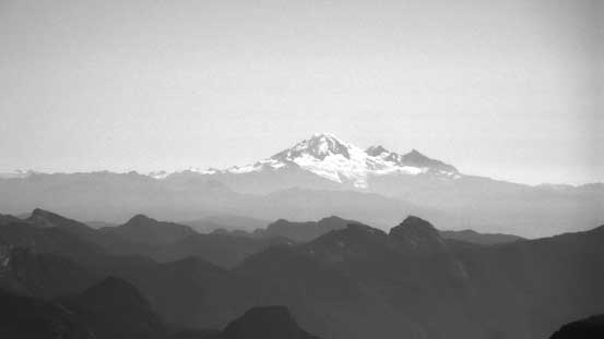
An obligatory shot of Mt. Baker
Mt. Robie Reid in the foreground
Mt. Judge Howay is apparently another tough one to access
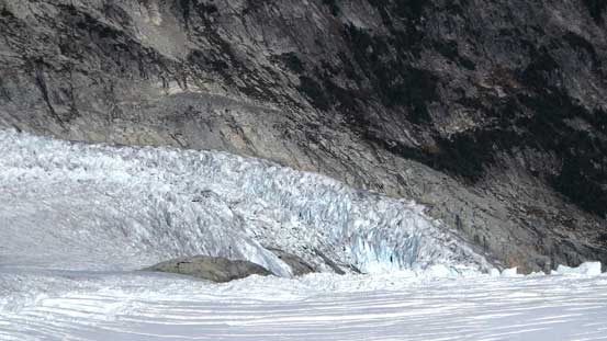
Icefalls!

More features on Mamquam Icefield
Some lakes that probably rarely see visitors

Me on the summit of Mamquam Mountain
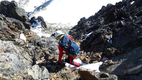
Eventually it’s the time to get down… And again, down-climbing the SE Ridge required some care in a group of 4 due to the loose rocks. We managed it with no problem. Then plunging down the SW Glacier was much simpler and a lot faster as we just had to retrace the tracks. And then back up to the shoulder, down the loose step, and onto the lower glacier. We again, opted to descend the steep snow/ice rather than the slippery rock. This section needed some great care as well since we didn’t bring ice axes up… And now what? The very tedious slog down the rubble slope back to Darling Lake, for hundreds of meters every step it’s hard on our knees.. There’s no scree around. It’s all brisk sized boulders and painful to say the least. By now the I finally started to feel the elevation gain I’d done in the past two days and I felt quite bagged already. But time was running out and we had to press on…

Time to head down
Looking back
A bit of exposure…

A bit of down-climb…
And, a bit of loose rock…
It goes on and on…
Done the SE Ridge descent…
Onto the glacial bench

Down through the crevassed SW Glacier

Enjoying the views
Plunging down this roll was fast

Done the SW Glacier
Ascending back up to the shoulder
A view of Delusion SW1

Descend the loose and tricky step above the lower glacier

A bit of careful foot placements here..

Almost done this glacier

Onto the loose and tedious talus slopes…
Done the talus slope, looking back…
Traversing the Manic Peak’s shoulder back to the bushwhacking section went relatively uneventful, and then it’s the 600 vertical meters of forest. We only had roughly 1 hour’s daylight time and it’s a race against darkness. I pulled out my GPS and led our group down staying relatively close to the up-track. It went well and plunging down the soft and mossy ground was fast and furious. We eventually did manage to beat the darkness to get back to the log bridge across Paranoid Creek. I again, strapped crampons on while the others simply walked across. And after that it’s the mind-numbing 1-hour logging road walk back to the truck..
One last look at Darling Lake
From the shoulder of Manic Peak, looking towards Darling Peak
One of the few tarns
Traversing on this broad shoulder
Had to wonder around to find the best way
An impressive peak above

One last view before entering the bushwhacking part…
Our round trip time was about 13.5 hours and overall this was a great success to bag a major and rarely ascended summit that’s visible from almost every good vantage point in the North Shore or Sea-to-Sky Corridor. Exhausted and time to rest up and I bet not many people would do Hadley, Habrich and Mamquam 3 days in a roll…
