Mount Callaghan
May 31, 2026
2409m
Whistler, BC
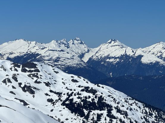
Mt. Callaghan is one of Whistler’s principle peaks and subsequently boasts over 900 m prominence. The standard route is also well written in Matt Gunn’s Scrambles in SW British Columbia. It’s a relatively long haul but doesn’t involve bushwhacking, so over the course of the past decade most of my friends, old or new, had already done it. I was never too keen on Mt. Callaghan as it lacks obscurity or any sort of a “challenge” and in fact, my plan had always been the north glacier route from Squamish Valley FSR. I was also not too keen on driving that far up the FSR as that road is known for having a zillion pot-holes and I no longer have the Tacoma anymore, so I never ended up doing it.
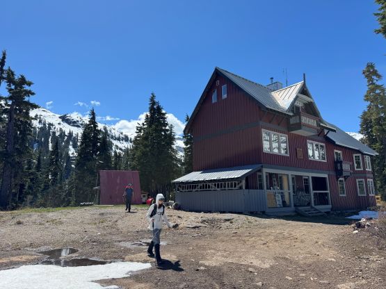
All the sudden I saw a post on Facebook that the Callaghan Valley Road had already melted out to the standard summer trail-head but the up-to-date satellite images suggested mostly snow further up in the valley. I thought I might as well take advantage of the update and do the summer route on snowshoes, as some friends had done such in shoulder season conditions and it seemed like a viable option. I talked to Adam W. about the idea and Adam invited Fletcher and Dave, and Fletcher would bring his girlfriend Laura so I eventually did Mt. Callaghan with four Americans. I’m not surprised at all as I was probably the only Canadian peak-bagger who hadn’t done it. The carpooling situation was grim as all of us had different plans over the weekend so we drove 4 separate vehicles to the trail-head, which was very inefficient on gas. The plan was to camp at the trail-head. They all managed to get there by late afternoon or early evening but I wouldn’t be finishing work until late in the evening, so I didn’t pull in until midnight. The road was mostly as expected, “easy” in a Subaru but there were water bars and several steep and loose stretches.
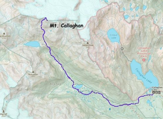
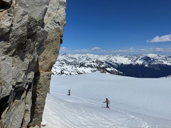
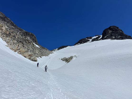
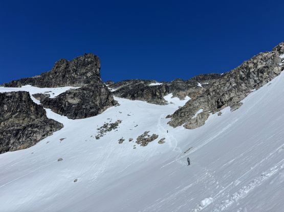
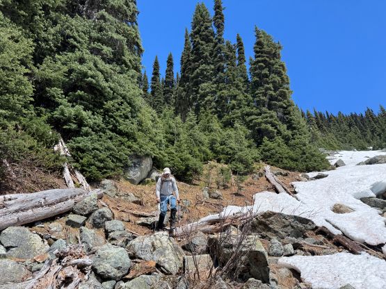
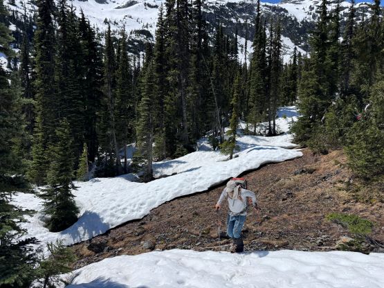
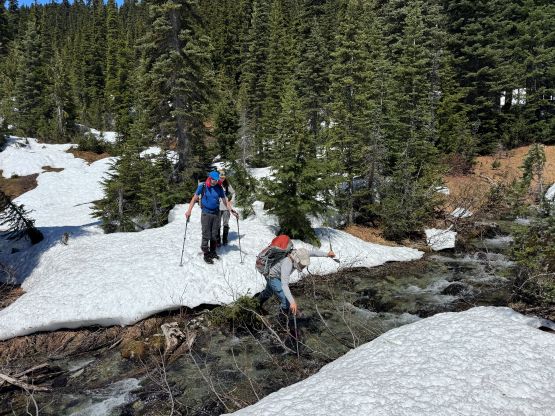
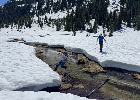
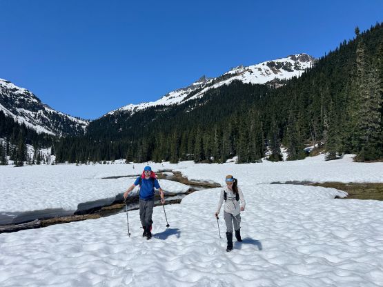
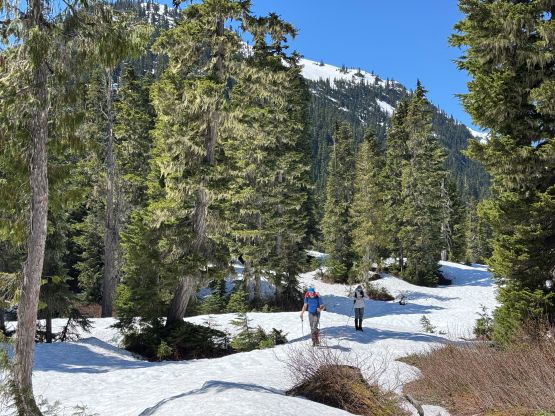
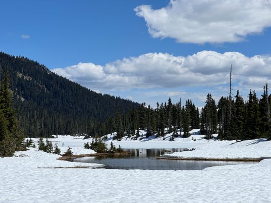
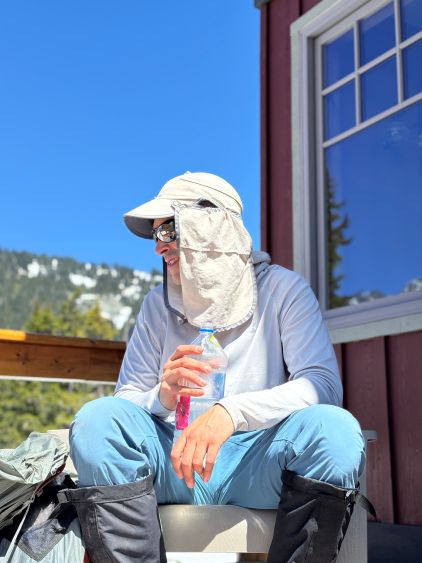
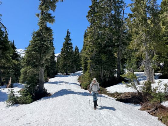
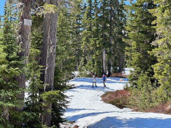
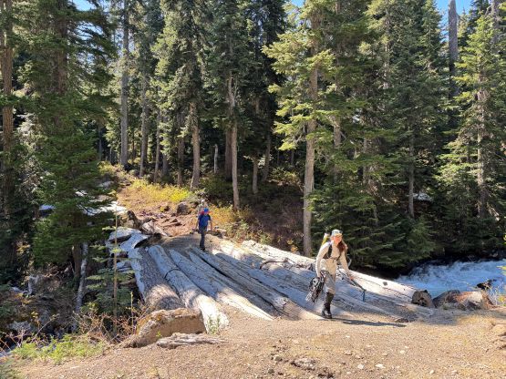
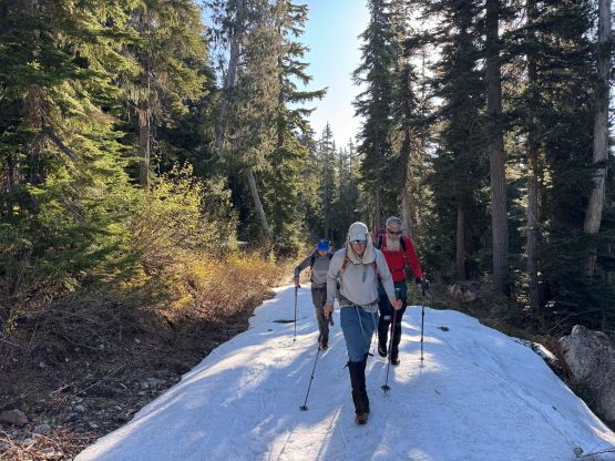
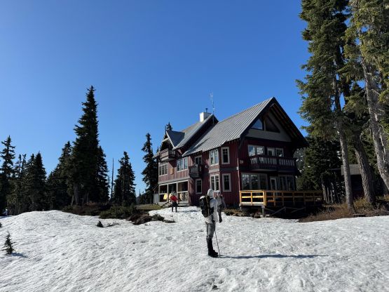
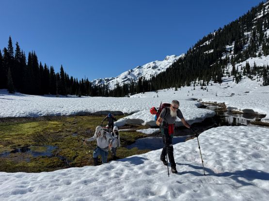
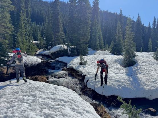
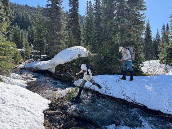
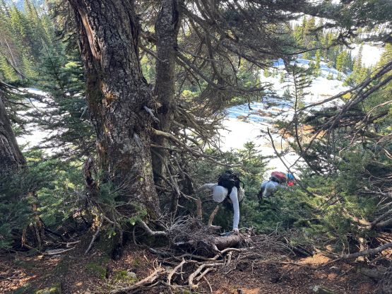
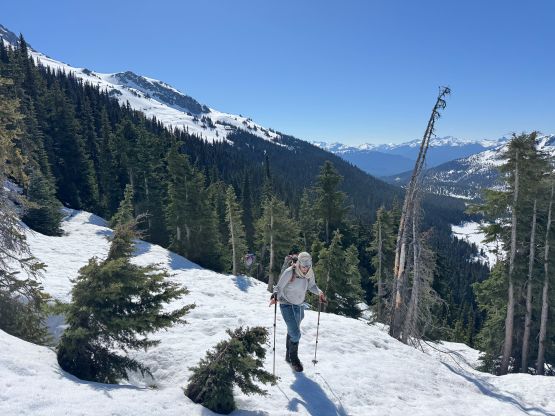
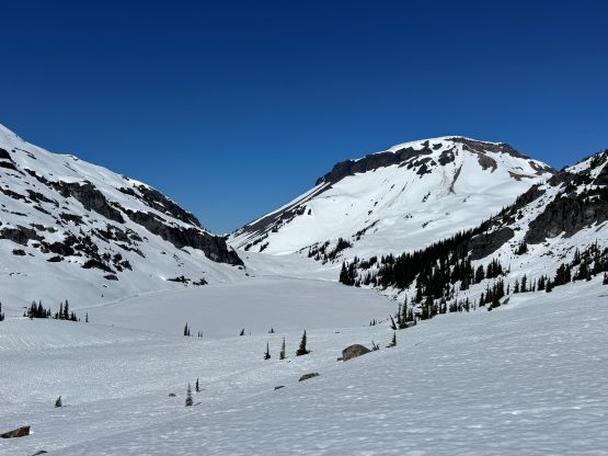
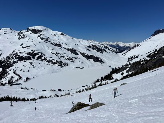
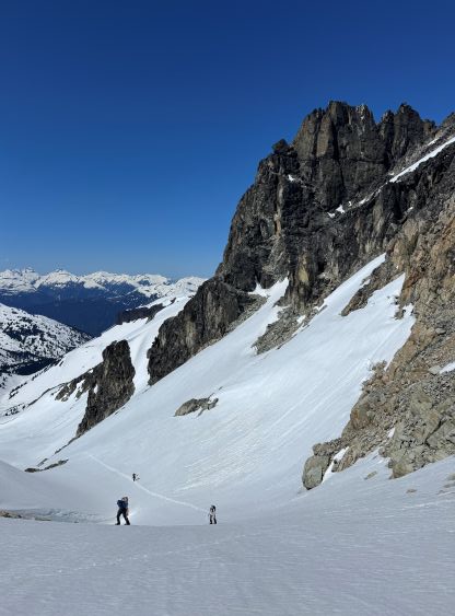
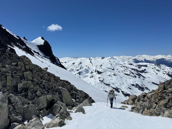
Given the deep overnight freeze we opted for a lazy 7 AM starting time. Adam and I relocated our vehicles down to the actual trail-head whereas the rest of the team started the trek from the campground. A few of us opted to wear trail-runners while carrying mountaineering boots and this proved to be unnecessary. We only managed to wear the runners for at most 2 km and that’s with the snow being bullet proof. Later on the return we all wore the cumbersome boots back to the trail-head as the snow had become soft. I could have insisted on wearing the runners but I wanted them to be dry for the following day. Given the wintery conditions we also opted to take the (gated) road that mostly parallels the summer trail, as trying to staying on the trail would be difficult, if not impossible. We picked up a set of snowshoe tracks but they stopped at Journeyman Lodge, so we were on our own route-finding from Conflict Lake onward. At this point the snow was still bullet proof so we mostly wouldn’t be able to use the snowshoes, but we carried them nevertheless. For the ascent to Ring Lake we also ignored the summer trail and went for our own route staying more in the valley. I knew from reading at least one trip report, that there’s one troublesome creek crossing and the best way of crossing that would be staying low. We did so, and avoided having to take the boots off. There was some minor bushwhacking and at least one section of boulder fields covered in thin snow afterwards, but we generally picked an efficient line ascending to the “shoulder” above Ring Lake and only used the summer trail for less than a quarter of a mile.
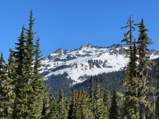
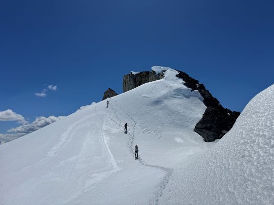
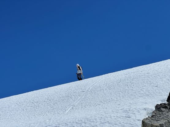
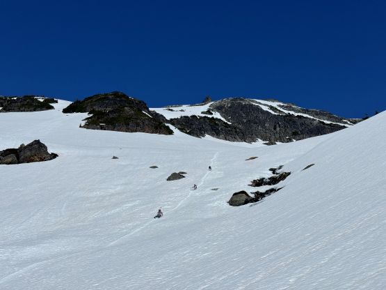
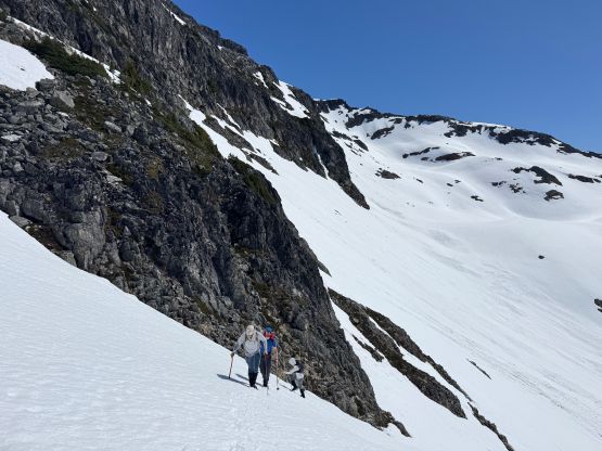
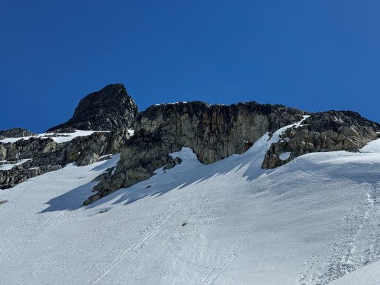
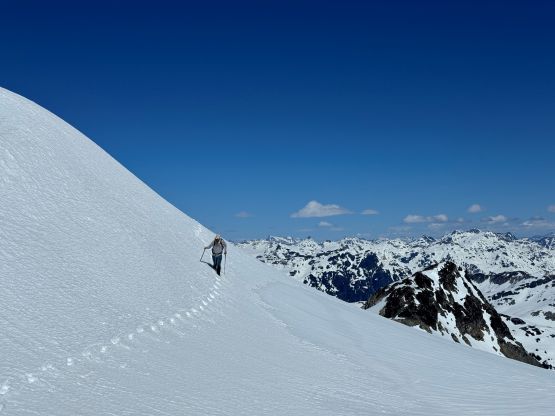
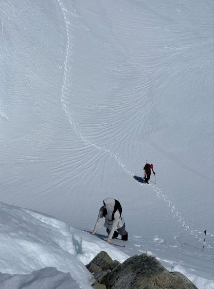
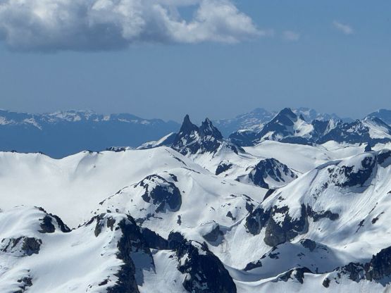
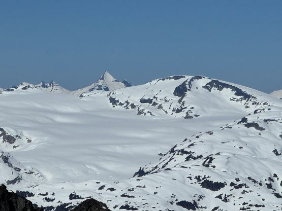
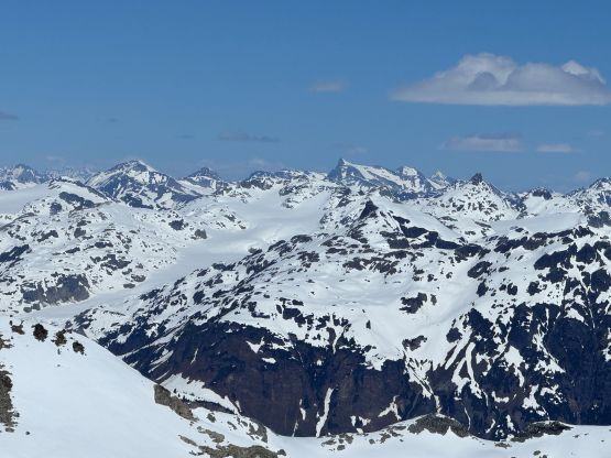
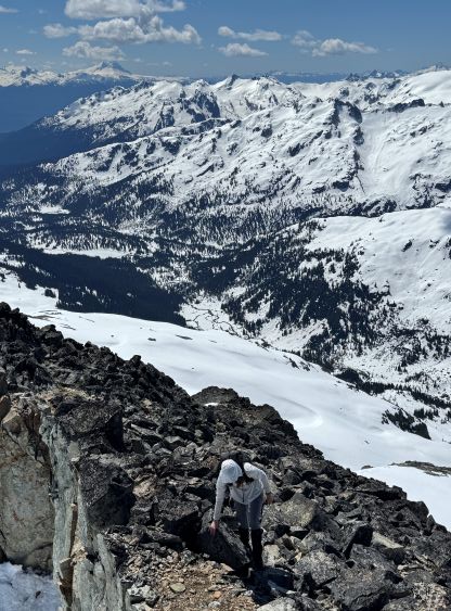
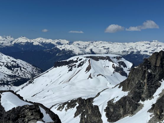
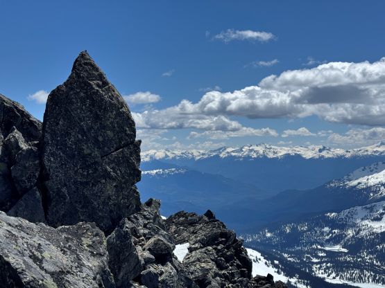
At this point it had become obvious that we wouldn’t be needing the snowshoes so we swapped them for crampons. The crampons wouldn’t be needed right now but somewhere higher up we would have to make a transition, so we might as well do it right now while taking a break. I had opted to bring the hybrid crampons with a pair of dyneema strings and I planned to use some different strapping techniques to see if the crampons could stay a little bit tighter. I think the experiment was successful as I never had to stop to adjust the crampons. There was about 700 m ascent from Ring Lake to the summit of Mt. Callaghan and we again, mostly ignored the summer route. I did download a set of GPX tracks but wherever people go in summer wouldn’t make sense for an ascent on snow. Instead, we opted to stay as much in the “depression zones” as we humanly could, as such could maximize the time on snow, and the snow wouldn’t be too thin to create post-holes. The plan worked out nicely and we eventually wrapped around to the NW side of the summit block touching the edge of the north glacier. I took the ice axe out and led the NW Ridge direct finish whereas Adam went around to scramble into the notch separating the main peak and the “Instagram spire”.
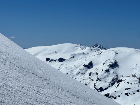
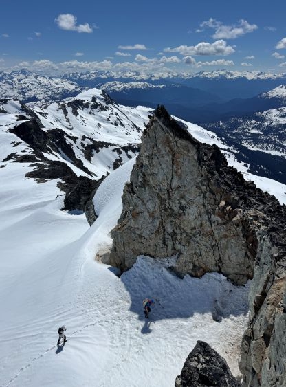
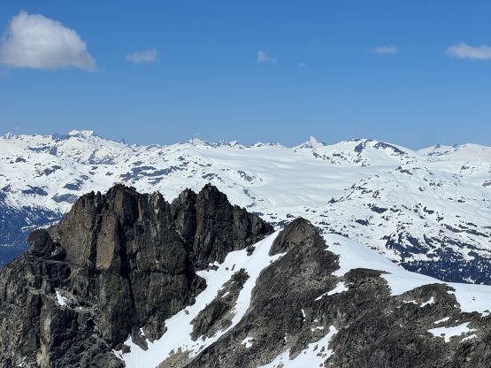
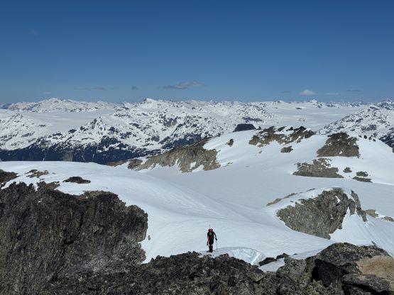
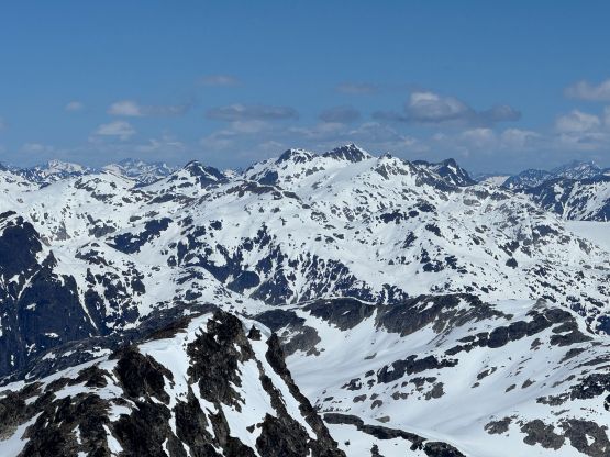
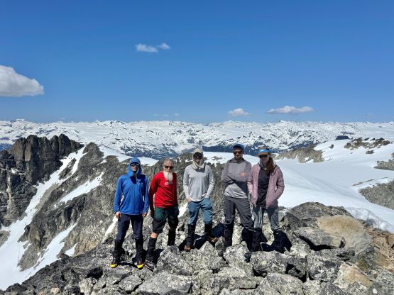
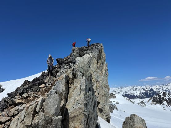
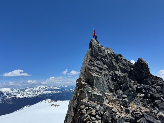
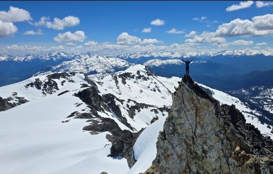
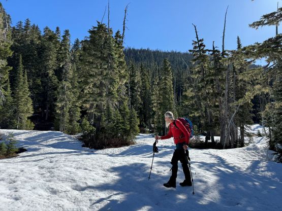
After taking in enough of the views we all descended Adam’s route (which was still not the summer route). Dave and I then took turn summitting that “Instagram spire” for photos. Dave was keen on tagging another peak but I wasn’t too keen on adding Ring Mountain given the intense peak-bagging itinerary on the next two days. Dave suggested traversing up and over “Hidden Peak” but I did that one back in 2019. The rest of the team wasn’t keen on adding anything so Dave pressed on alone, and the rest of us descended together (better done so as it’s in grizzly country). The descent to Ring Lake was furious and fun. The upper route offered some of the nicest boot skiing whereas the lower half was basically a long glissade. We then followed our own footprints down into the valley dealing with minor bushwhacking and route-finding issues. Crossing that creek was without a problem, but the rest of the plodding back to the trail-head was a slog. We stopped for another long break at Journeyman Lodge for some European styled treatment, and eventually finished the round trip in 8 hours 40 minutes. The snowshoes were used for a few kilometers of plodding on the FSR but they weren’t needed. Adam didn’t bother to snowshoe and he wasn’t falling behind.