East Lion
September 5, 2015
1606m
North Shore Mountains, BC
Among the peaks by Vancouver’s North Shore Mountains, East Lion is among the most striking and definitely one of the hardest. While hordes of scramblers and tourists go up West Lion every day in the summer months, few people are committed enough to make an ascent of its lower neighbour. The standard line is via the S. Face and goes at “4th class”. I’m aware there’s an easier but obscured line on the east side of this peak called “The Great Thrash” – essentially pulling yourself up the mountain while grabbing the bush… That didn’t sound very appealing to me so the South Face and that’s it. This seemed like the right objective as my introductory to the Coast Mountains.
Earlier in the day I went up West Lion and met a local hardcore scrambler, Vlad (Culator) from ClubTread. After some discussion Vlad decided to change his original plan and join me on the climb of East Lion. There are a few good trip reports of East Lion’s South Face on ClubTread and my reference was Dean Perez’s report (which also has an excellent route line). All the reports I’ve read involved some rope work at least for the descent but yet, the route is rated “4th class”. Normally in the Canadian Rockies if the route is rated 4th class I’ll never bother with rope but I was aware that climbers from different ranges tend to rate things differently. To take it more cautiously I hauled two 30-meter ropes, harness and some webbing and slings in case it’s harder than I thought. Vlad’s original objective was just Enchantment Peak so he didn’t have any climbing gear, but we figured that could still work, just a bit slower.

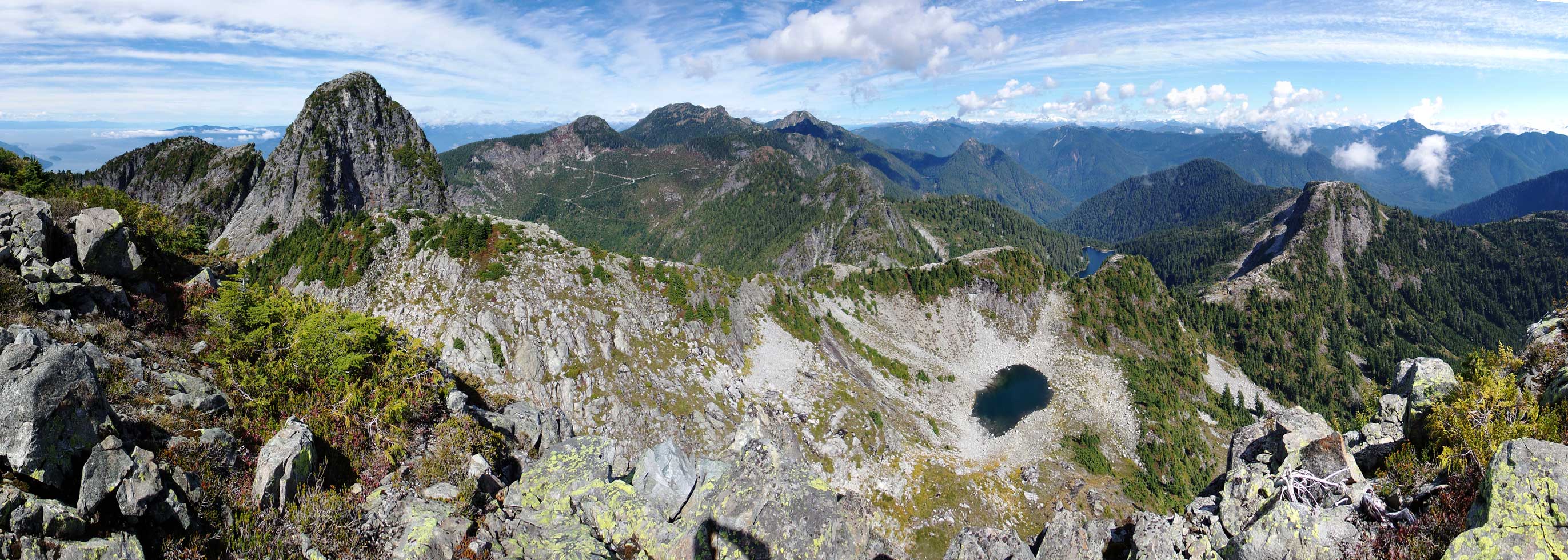
East Lion and West Lion standard routes. GPX DL
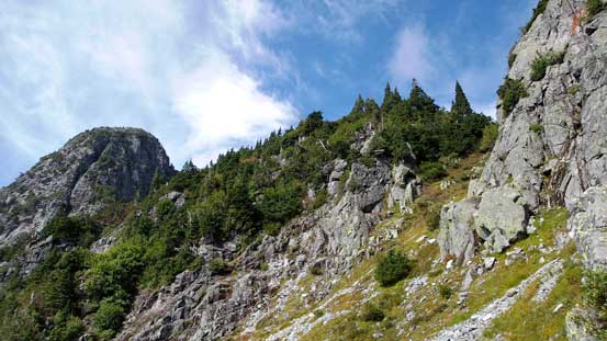
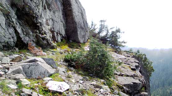
Getting down from West Lion’s shoulder to the base of East Lion involved more height loss than I imagined. Another thing I didn’t know was that bump between the two Lions actually had a name – “Thomas Peak”… There’s a good trail (HSCT) that leads from from West Lion to WL/Thomas col but we left it earlier and went down to the bowl. That way we could pick a more direct line to access the key ledge at the base of East Lion’s South Face. There’s some minor bushwhacking and then some slogging on the boulders with a bit of elevation loss/regain then we were at that ledge. It’s a lot wider than appeared but down-sloping, exposed and unfortunately, wet… But still, we traversed it with no problem, then around the corner we got to see the south face ahead.

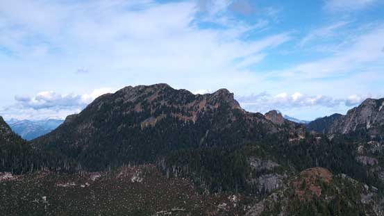
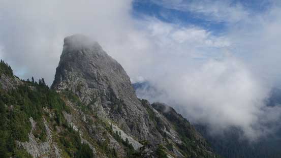
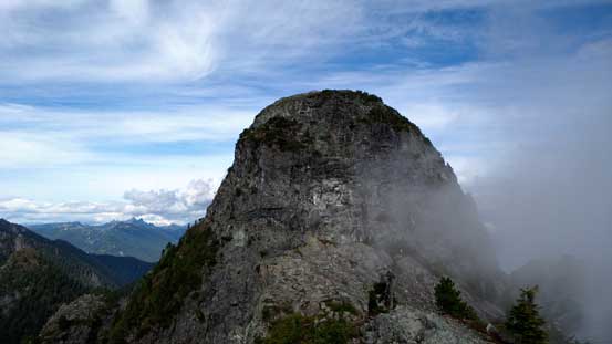
East Lion and our approximate route shown
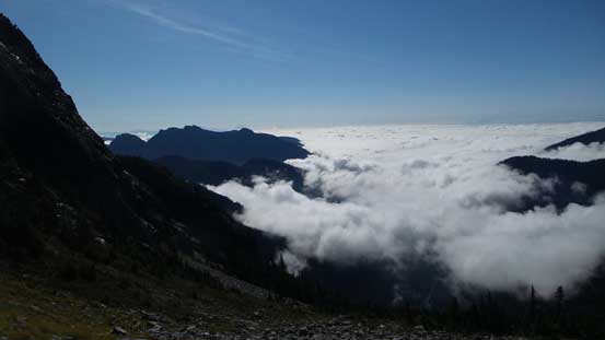
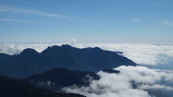
Low clouds covering the lower mainland

Getting to the base of our objective
The key ledge traverse
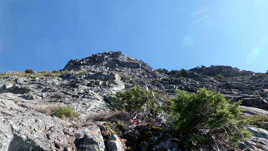
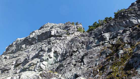
After the ledge, looking up S. Face. It doesn’t look too hard from here
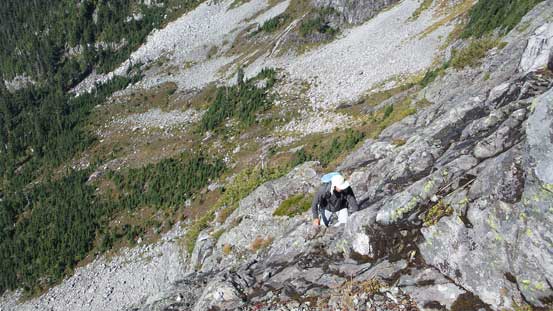
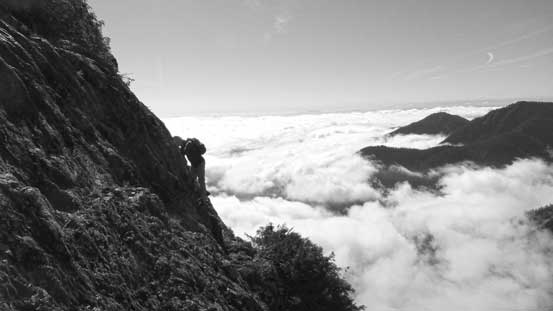
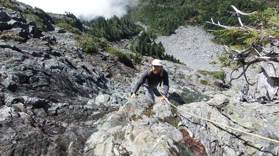
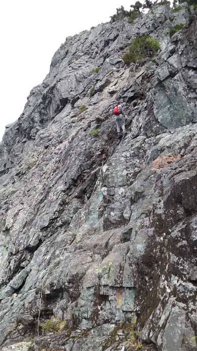
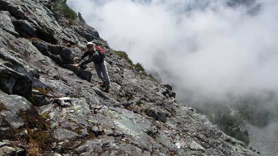
The face didn’t look too bad from our angle so up we went. The basic direction was “up and climber’s right”. There’s quite a bit of zig-zagging involved but it’s impossible to tell the exact line. I remember at one point we traversed a long ways over to the right, and in between the traverses there’s some low-angled 3rd class climbing on down-sloping rocks. We ascended the lower face fairly efficiently and before I realized we were already at the ledge below the 4th class gully. It didn’t look very scrambler friendly to me but how hard can a 4th class route be, right?!… Oh well, I took out the rope and ditched my pack and started the pitch solo. I didn’t bring much pros nor did Vlad have a belay device so we couldn’t pitch it out. And thank to the previous few days’ downpouring and Vancouver’s humidity that gully was very wet adding a few harder moves as I couldn’t trust some sloping foot holds… On top of that the exposure is huge – a slip would send me all the way down the face and there’s no doubt on that… But, after a full rope length of climbing with 100% concentration I made to the anchor above, and then it’s time to belay Vlad up.
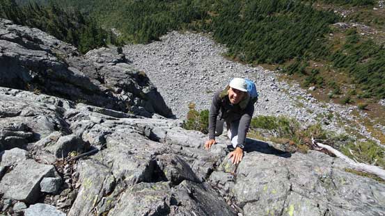
The scrambling began

Exposed…
More scrambling

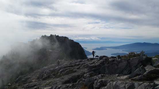
Looking across the Face towards West Lion
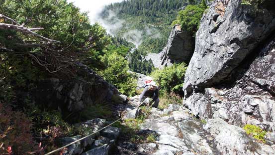
At the base of the crux gully now
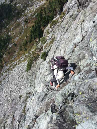
Vlad making his way up the typical terrain
Vlad climbing up the crux pitch
Vlad higher up on the crux pitch
I was surprised the climbing wasn’t over yet. If dry then it’d be just scrambling to the top from here but the next few meters was again, down-sloping, exposed and wet so we repeated the sequence again with me leading up solo. And another full pitch I finally got out the gully, using a dead tree as anchor to bring Vlad up, and then the summit was ‘right there’. Upon topping out we could see at least 20 people on West Lion – some on the summit, some on descent, some on ascent and many more on the approach.
Vlad climbing up the last pitch
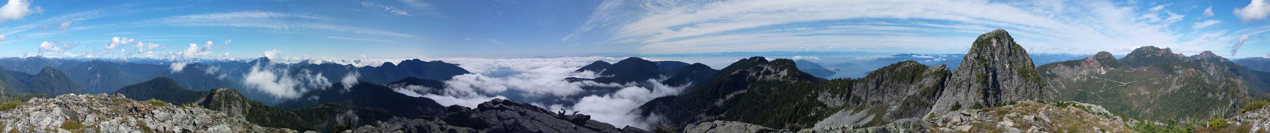
Summit Panorama. Click to view large size.

I like low clouds scenery!

West Lion
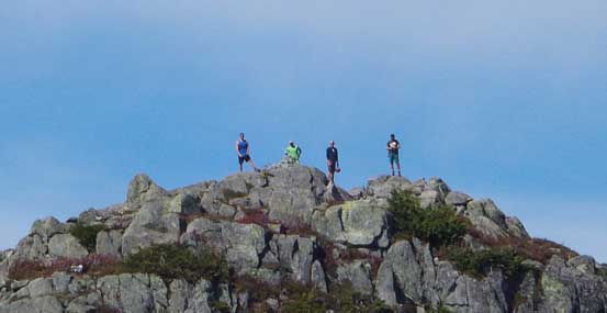
People on West Lion were all looking at us…
Brunswick Mountain
Mt. Hanover
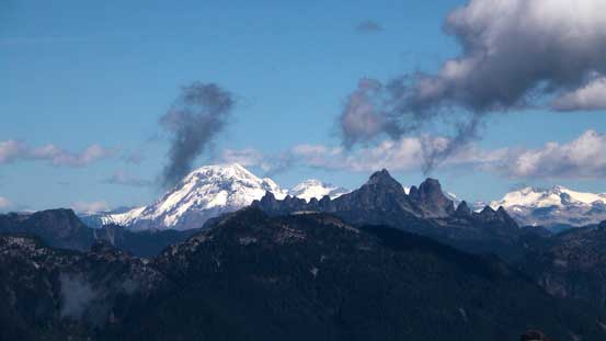
Mt. Garibaldi and Sky Pilot Mountain
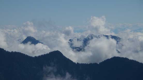
Some mysterious peaks showed up behind the low clouds

This is the lowly Enchantment Peak
Crown Mountain is another Vancouver’s classic
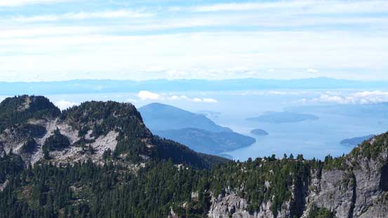
Howe Sound
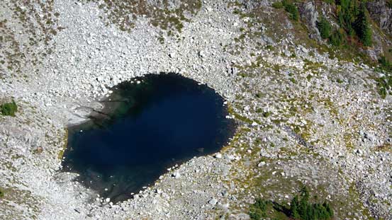
This is that small tarn just north of Thomas/East Lion col
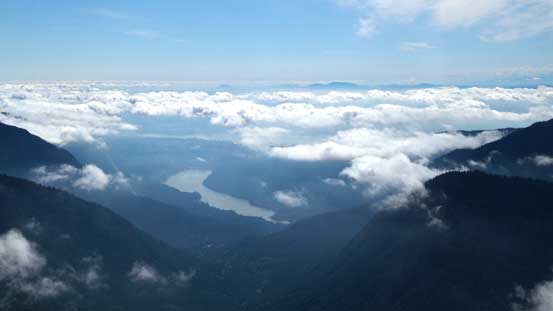
Capilano Lake and the low clouds

Me on the summit of East Lion
Another panorama from the summit. Click to view large size.
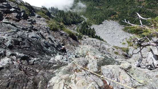
Having only one harness between the two of us I knew the descent could take fair a bit of time. Our strategy was to down-climb for as much as we could and rappel where we absolutely had to – that was, down the crux gully. For the first pitch I belayed Vlad down-climbing it and then made a 30-meter rappel myself. The second pitch (crux) was too hard for any of us to down-climb especially given the wetness so we all opted to rappel. I rapped first, then attached both my harness and belay device to one of the two ropes. Then Vlad would pull it up, put the harness on and complete his rappel. That indeed took fair a bit of time but worked out nicely. For the lower slabs/ledges we all felt comfortable down-climbing so I packed up the gears and down we went. There’s some route-finding, some tricky moves and a lot of exposure, but nothing terribly difficult.

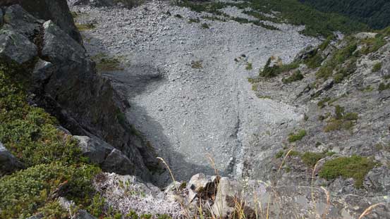
This picture shows the angle of the terrain around the crux
Vlad rappelling the crux pitch
Then, down-scrambling the lower face

Trying to figure out where to go…
Me down-climbing. Photo by Vlad

A few trickier moves
Almost done, looking towards Thomas Peak
Looking back at the wide ledge
Now it’s time to make a decision. I was tempted to join Vlad on the ascent of Enchantment Peak (I’m overall a peak-bagger so hard to say no to another summit), so we went up and over Thomas/East Lion col and down the north side. But then I was looking at the lowly Enchantment Peak thinking how many more hours it’d take. I started to get lazy and figured I probably should be back home not too late for the dinner. So I turned around there and let Vlad to tag it on his own. As I mentioned earlier, the bump between the two Lions had a name so I went up there instead. Near the summit of Thomas Peak I rejoined the HSCT and from there on it’s basically a cruise sailing all the way back to car. There’s little to worry about at this point other than putting one foot in front of another.

Enchantment Peak ahead
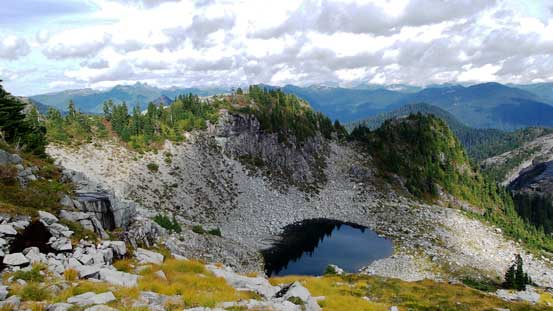
That small tarn

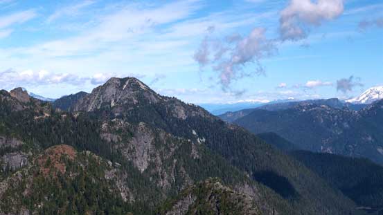
East Lion looks super impressive from here

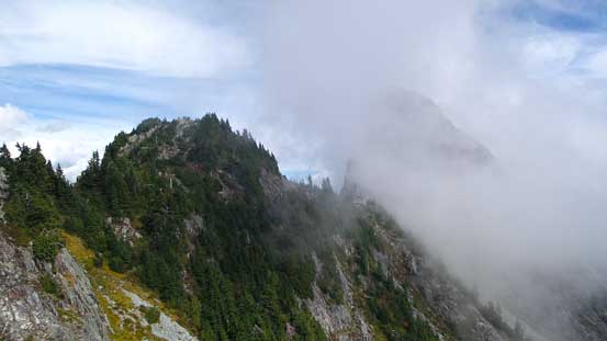
Clouds coming in hovering around West Lion

Looking north across West Lion’s face

The Trail actually goes across this obvious ledge
Looking back towards Thomas Peak
And, East Lion
Once regaining the shoulder of West Lion it’s pretty much all down-hill, but yes, there’s a LOT of down-hill. There’s not much to document the hiking section other than the hordes and hordes of hikers and backpackers. I was impressed by the popularity of this area given the fact there’s quite a bit of work to get to the base of the Lions… In the Rockies if you venture a couple kilometers up any trail you’re unlikely to see more than a few groups of people, with the exception of Lake Louise area of course.

Some people were waiting at the start of W. Lion’s scramble route
Hikers on Howe Sound Crest Trail
There’s some impressive drop-offs around here!!
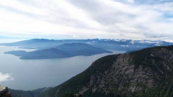
Howe Sound
One last look at West Lion’s scramble face

Down to the rocky shoulder by Lions Trail now, looking back. West Lion on left, the bump on right

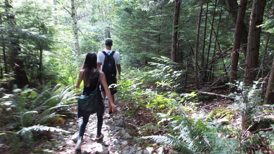
The coastal rainforest
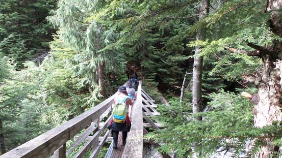
Traffic jam on the bridge!!
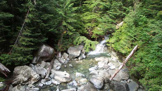
Harvey Creek
Hikers descending Lions Trail

The trail joins the old logging road lower down

A waterfall by Alberta Creek
Overall this was a great one as my first “real” peak-bagging trip in the Coast Mountains. Regarding East Lion itself, it did not disappoint me. Despite the Class 4 rating it’s considerably harder than any of the scrambles I’ve done in the Rockie’s scrambling guides and felt more like the crux pitch on E. Ridge of Edith Cavell or W. Ridge of Pigeon Spire. Given the wetness it actually felt both harder and more sustained than those two, and just as exposed. So in the end, it’s a very satisfactory trip and I’m also happy to make a new friend. I’m looking forward to meet up with Vlad again and certainly I’m starting to realize how wonder the Coast Mountains are.
