Recondite Peak
August 16-18, 2013
3356m
Siffleur Wilderness, AB
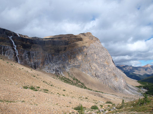
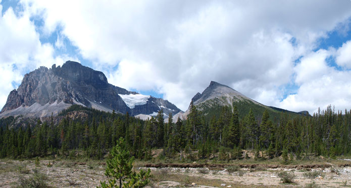
Recondite Peak is the lowest among the 54 11,000ers in Canadian Rockies, and yet, it’s also one of the most remote 11,000ers. Not surprisingly, “recondite” means “obscured” or “remote”. It has two publicly accepted approach routes, one via the Icefield Parkway, and the other via Siffleur River. The standard approach from Icefield Parkway is a 40km trek through variable terrain. The Siffleur approach is slightly shorter and shaves off considerable amount of elevation gain, but the trails are not maintained and nobody knows its condition. Eric Coulthard has proposed a short-cut route via Silverhorn Creek that potentially shaves off about 30km distance but adds considerable amount of elevation gain. But again, no one had been up that creek so condition was relatively unknown.
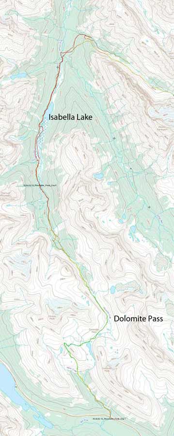
The approach. GPX DL
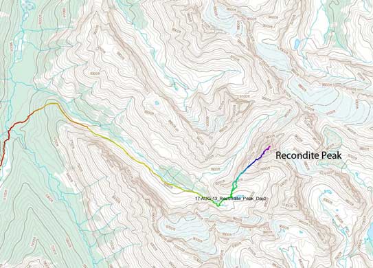
Recondite Peak climbing route. GPX DL (summit day)
[Update in 2025: thank to the exploration by parties in the past decade a new approach had been published by deviating from Mt. Willingdon’s standard route. This approach might involve more elevation gain, but avoids most, if not all of the river crossings and bushwhacking. In my opinion the new way is better than the old route that my group took, but I do not regret taking this old way as it did bring us into some of the remote countries that I would otherwise never end up visiting. Devan Peterson had sent me his approach GPX track as well as the climb track.]
About a week before the trip, Vern, Ben, Eric and I started to plan a long trek into this rarely visited area, via the standard approach starting at Helen Creek trail-head. Of course I’m interested in! By the time I got back to Calgary from a successful ascent up the mighty Mount Assiniboine, I got confirmed that the trip was still a go. Alright, that meant I would only get 1-day’s break in Calgary before driving up the Icefield Parkway for the longest trek I’ve ever done! It’s nuts not having enough rest before Recondite, but oh well. Not having enough time making back to Edmonton, I had to “refuel” in the not-so-familiar Calgary. This time I wouldn’t have the delicious meal made by my mom. Not liking Calgary’s traffic I drove to the more-familiar Canmore. At least I knew where Safeway was in Canmore, and I quickly grabbed whatever I thought I would need. The last piece of gear was a pair of rain pants that I bought in Banff. It was already 9:30 pm by the time I made to Helen Creek Trail-head.
I have to admit that till now I still don’t know the exact gears I need for a 3-day trip. Unlike the other boys, I don’t have the extensive backpacking experience. The 3-day Brazeau’s trip was the only “real” alpine bivy trip I’d done before this one, and that 3 days had no comparison with these. (8, 9, 5 hours on leisurely pace versus 14, 14, 6 hours on full force). Travelling light was essential for a trip like this, and overall I think I did a great job at leaving extra gears behind. I packed just enough food so that I didn’t have any leftover at the end of the trip. We all left ice axe and crampons behind, and extra.
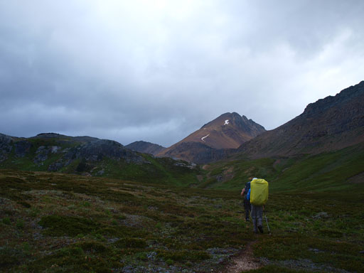
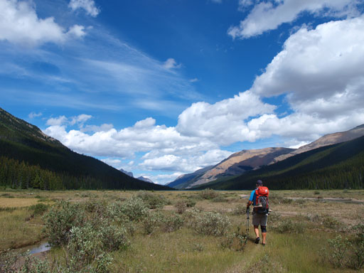
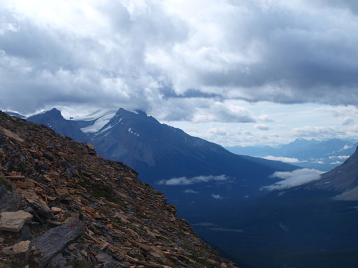
It was showering throughout the night and by the time 4 of us started our trek at 7 am on Friday morning, it was also raining. The first part of the (long) approach was the same as Dolomite Peak’s, and having just finished Dolomite Peak in July, I quickly located the trail which wasn’t very obvious from the parking lot. This trail, compared to the more-popular Helen Lake trail, was much less travelled, but still easy to follow. There were two very interesting mud creek crossings and after that, the trail gains elevation steeply towards the treeline. Grizzly bears must love this area so much that a significant part of the trail got completely dug out. In short time we made to the open meadows and would soon join Helen Lake trail. The next short section was the same as Cirque Peak’s scramble route. We kept following the trail steeply up and over a ridge crest, and then instead of going towards Cirque Peak, we would drop 100-meter or so down towards Lake Katherine, aiming for the distant Dolomite Pass.

Hiking up Helen Creek Trail under gloomy weather
Looking ahead to the familiar Cirque Peak
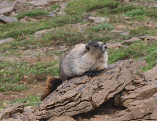
Many marmots around
Down to Lake Katherine
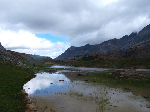
And then passed another unnamed tarn
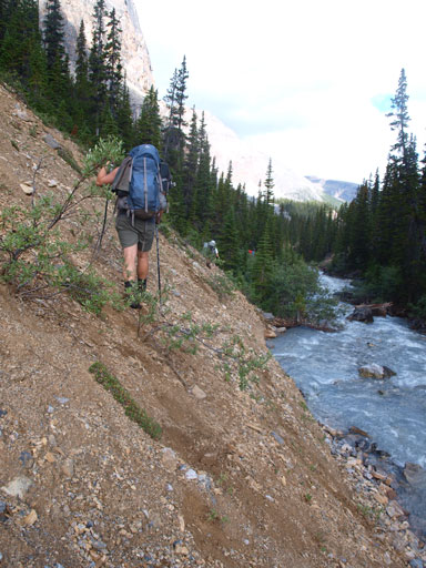
The trail then swings left following Dolomite Creek. A significant portion of the entire approach was following this valley (downwards). The proper trail swings back and forth between Dolomite Creek’s banks and not wanting to do extra fordings we managed to stay on the left side bank for a long time even though the trail got faint at places. We made a big mistake ignoring a big cairn on the opposite side. We kept following the left side bank overcoming bushy and side-hilling terrain before a canyon forced us to ford the creek (1st fording). We couldn’t locate the trail on the opposite side so entered straight into the bush, and eventually found the trail which apparently deviated from the main creek for quite a ways. Not complaining too much about the extra work, we knew we’d wasted valuable time here.
Dropping down into the lovely Dolomite Creek Valley
Looking back
Finally got some sunshine now

Looking ahead to the massive elevation loss. Conical Peak ahead
Looking familiar from the Daybreak Peak trip?
The punishment of not following the trail
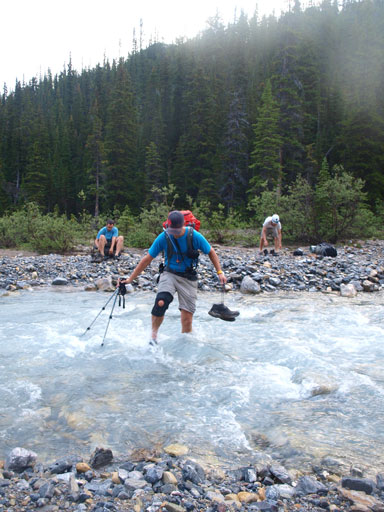
Dolomite Creek crossing #1
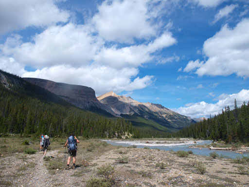
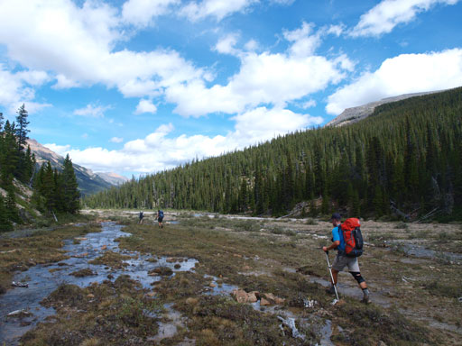
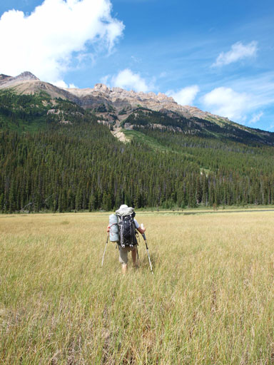
It was a pleasure welcome to be back on the trail. The trail dropped a significant amount of elevation in the next short while before the 2nd fording. This time we wouldn’t make the same mistake so forded the river, and by now, we’d just made to the “long flats” that eventually will lead us to Isabella Lake. The trail got faint and “disappeared” into a swampy section just before the valley finally opened up and we could see the distant Isabella Lake. By following Bill Corbett’s direction, we would soon don running shoes and slush across the long flats ahead of us. The majority of this section wasn’t that bad as we constantly got refreshment from many, many short crossings. Things got worse as we approaching the lake. We would soon enter a swamp section and the next while would be tedious knee-deep post-holing in the mud/swamp. Unlike post-holing in snow, we couldn’t use previous person’s tracks so everybody had to his own work. Getting through this part was painfully slow. By the time we finally escaped the punishment we were not far from the Isabella Lake’s warden cabin.
Now we’re on the long flats. Marmot Mountain is the lower one on right

Dolomite Creek crossing #2
The valley opens up
Warriors marching on!
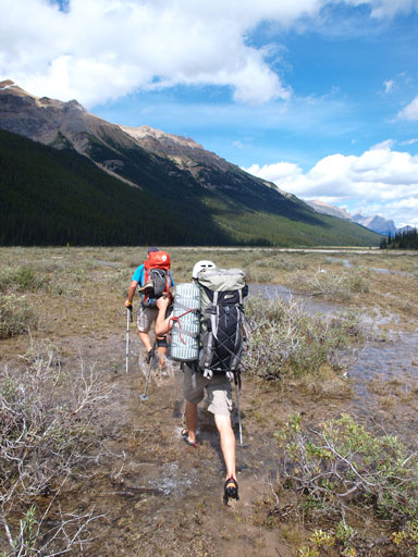
Time to slush across the long flats using sandals/running shoes

One of the many, many fordings in this area
More blue colours started to show up. Beautiful view!
Now come the bog/swamp…

Uhh….

Post-holing in swamp…
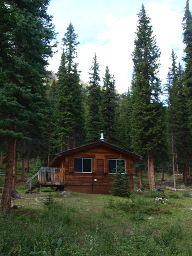
Finally we made to the warden cabin
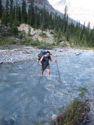
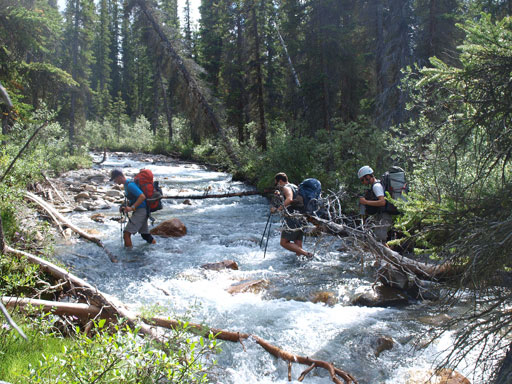
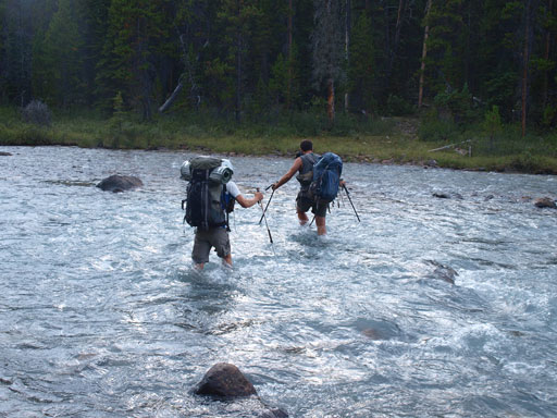
We kept following the trail, and after 4km or so it came to a junction. This is one critical point of the trip that we would soon ford the (much bigger) Dolomite Creek to the other (eastern) side. Despite what’s said on Corbett’s book, this is the deepest fording of our ascent. Ignoring the trail that swings southeast, we would keep following Dolomite Creek’s eastern bank for another few hundreds’ meters. At this point we were officially entering the wilderness. The non-trailed terrain starts at here. The Siffleur River must have splitted into two channels at this point and we forded them consecutively. They were both small compared to the big one we just forded. After the last fording it was finally the time to switch to my usual scrambling pants versus the not-so-breathable rain pants. And then the long section of bushwhacking officially started. At this point we were 100 or 200 vertical meters below our starting point, and we knew we had to gain all of them back..
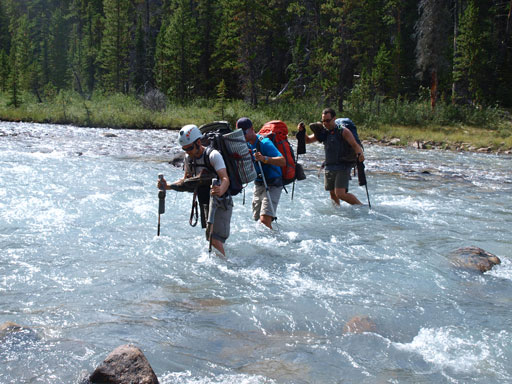
Simul crossing the raging Dolomite Creek.
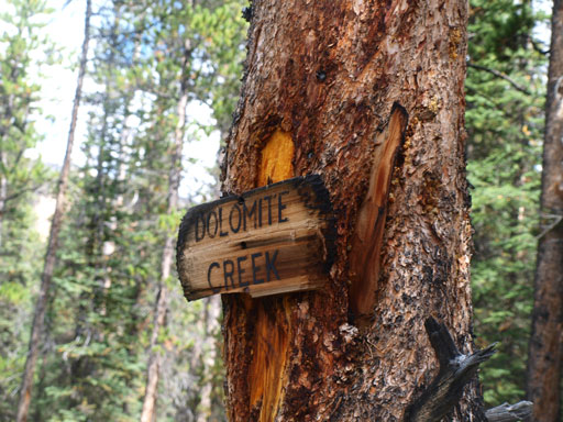
You should recognize this sign. This is a critical point of the approach
Fording Siffleur River
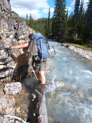
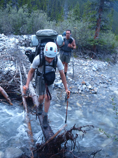
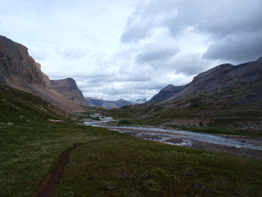
Vern did a great job GPS navigating the next 2km or so in the bush, leading us into the correct valley, the “Recondite Valley”. After reading Bill Corbett’s epic failures I was pretty paranoid of entering a wrong valley. By the time we finally hit the “Recondite Creek” we decided to follow it’s right side (southwestern) bank up. Ironically I found this creek being much higher than Siffleur River and would be troublesome to ford. Not knowing the route we came to a waterfall. Vern again, located a ramp that’s marked by a couple cairns. We were very pleased to “be back on track”, only to find this ramp coming to a dead-end. There’s no way we could cross this waterfall section and we had no choice but backtracking. Eric and I decided to cross “Recondite Creek” lower down using a log bridge. It was much harder than it looked as the log only crossed 2/3 of the creek. We had no choice but switching to running shoes on the middle of the log which was quite sketchy. We had to be extra careful not losing any gears into the creek. It took maybe 10 minutes for each of us to cross over. Vern and Ben, after watching Eric and I struggling on this log, decided to do a longer detour up and over the treed ramp and thus completely avoid the waterfall section.
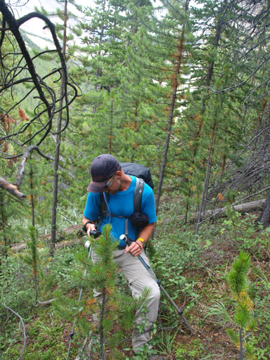
Bushwhacking starts

Now what we gonna do..
Vern led us up a ledge but it ended at a dead-end
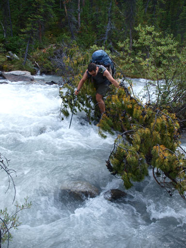
Backtracking. Eric and I decided to cross the raging torrent using this log.

On the other side, the terrain wasn’t pleasant neither
At least we managed not to slip into the torrent

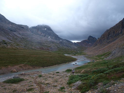
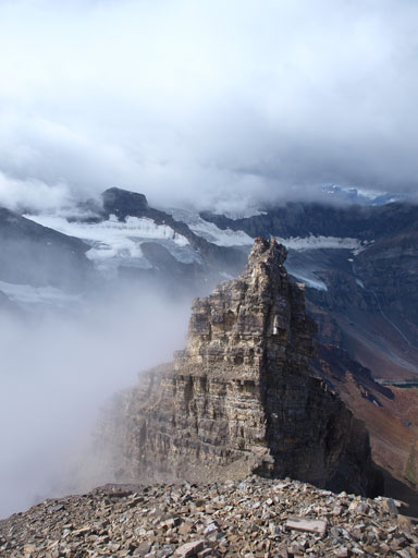
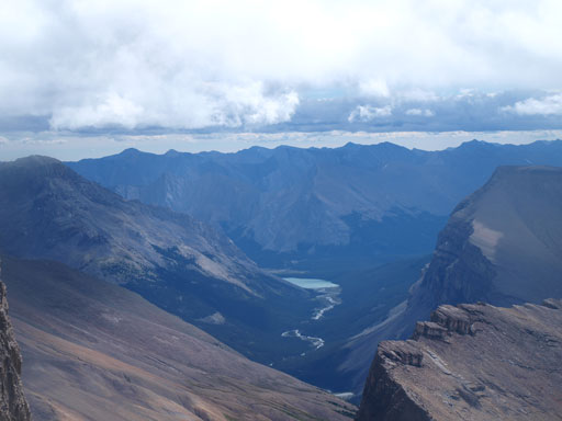
Looking ahead to this “innocent” looking valley. Still a long freakin’ way to go.
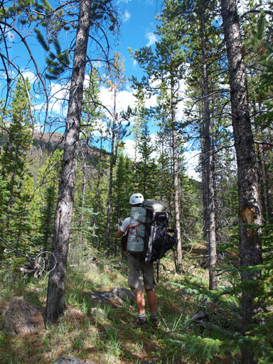
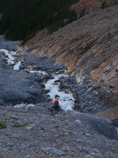
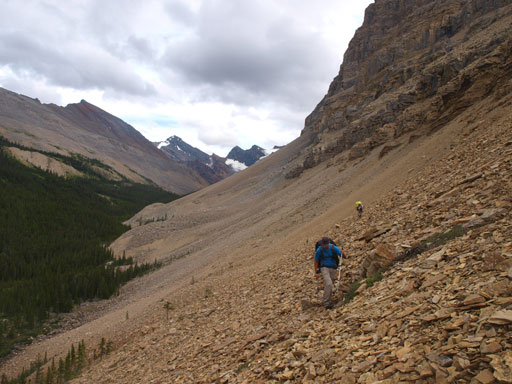
We regrouped further up. Eric and I kept following the right side of the creek, while Vern and Ben stayed on the other side. Eventually Eric and I had to cross over to the other side due to bushy terrain. For the rest of the approach we’d be sticking to climber’s right side of the creek, overcoming bush, boulders, and long section of side-hilling on rubble. We basically had two choices, side-hilling on rubble and boulders, or bushwhacking along the creek. On the way in we opted for more bushwhacking. Either way the going was slow. Eventually after trudging about 35km in, we finally escaped from the trees again, and finally got our eyes on the objective, Recondite Peak. The approach hadn’t done yet. We would be keeping following the creek up a foreshortened moraine slope before veering left passing a small tarn, and our bivy site would be right beside a bigger lake. Our approach time was 14 hours, and distance wise it was about 40km. We made there just in time to give us enough time setting up the camp before it’s took dark. Sounds nasty, right?! Obviously this is the hardest, longest, and the roughest approach we had done. But I didn’t find it being “that” bad mainly due to two reasons. Firstly, we were constantly doing different things, elevation gains 600 meters, losses 700, and then regains all of them back. The terrain switches between long section of on-trail hiking swamp wallowing, boulder hoping, bushwhacking, river crossing, back-tracking, and scree/moraine bashing. Except for the upper Recondite Valley I never found our approach being that tedious. (Of course the return would be very different, but it’s not the time to think about the return yet). Secondly, I’m very glad to do this trip in a group of 4. Eric, Ben and Vern are my regular climbing partners, and with all of the chatting and laughing we surely reduced the pain.
Eric and I forded the creek again to rejoin Ben and Vern
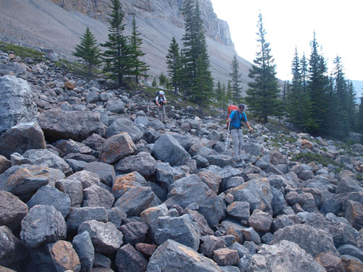
Now comes the boulder field!
At least the scenery kept improving

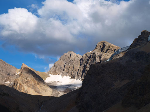
Finally got our eye on Recondite Peak!
Slogging up scree and then moraine. Painful to say the least..
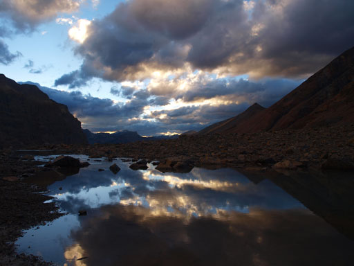
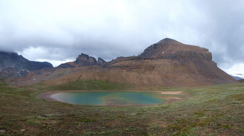
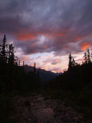
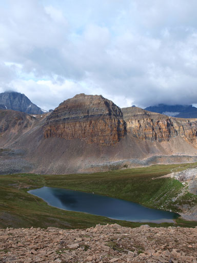
Beautiful evening scenery from a small tarn
This small tarn
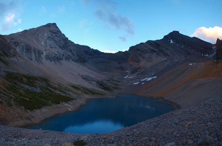
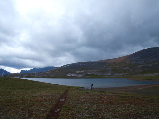
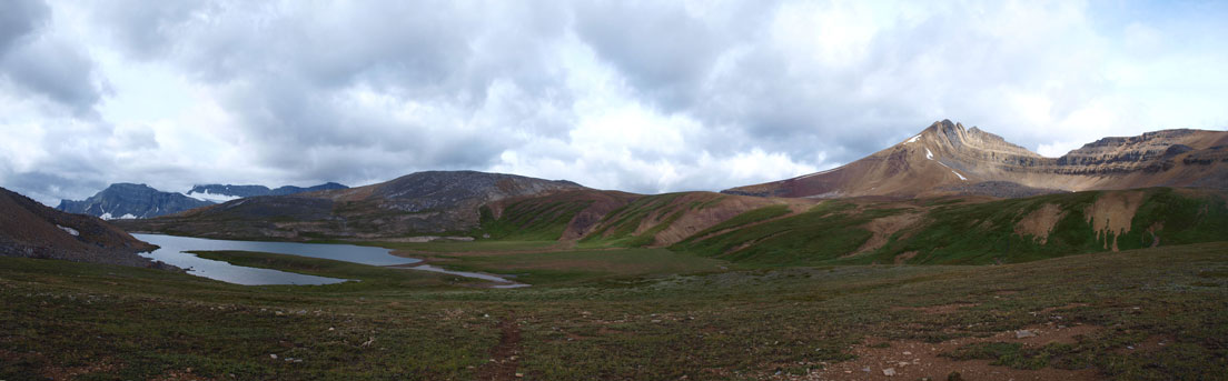
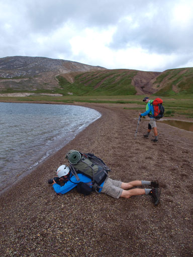
This would be our day 1’s ultimate destination, this high alpine lake

Time to cook dinner and then sleep
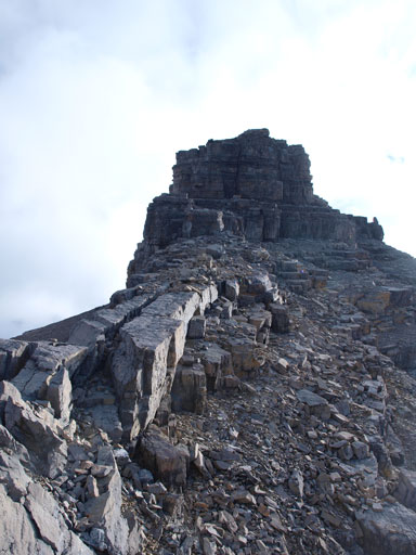
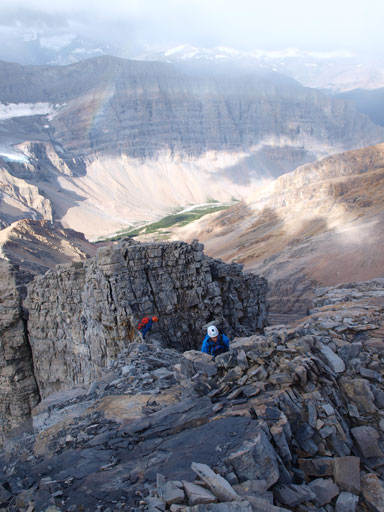
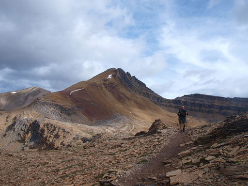
Based on the weather pattern in recent weeks we would expect clear skies overnight and in the morning. This time we were wrong, so did the weather forecasters.. It rained on us overnight, and we woke up at 6am under partly cloudy sky. We all had some doubts with the weather but since we were there so we had to give it a go, so off we went. The first thing to do was ascending a steep grass/scree slope to gain the (extremely foreshortened) southwest ridge. By the time we were on the ridge I thought we would only need about half an hour to reach the false summit. Oh well, did I just mention “foreshortened”? I think this section took us at least 1.5 hours… Just after we started traversing climber’s right at a critical point marked by a cairn, a nasty storm came from the west, but narrowly missed us and hit Willingdon area instead. “The poor ACC group”.. Well, it’s not the time to laugh yet as we were still not on the summit yet.

Morning glow
Mount Kentigern

An outlier of Kentigern
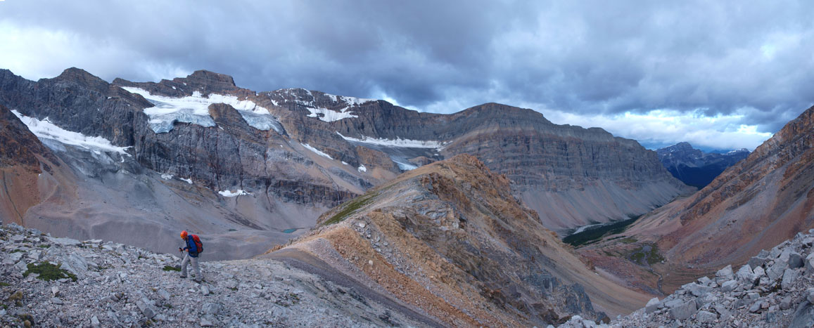
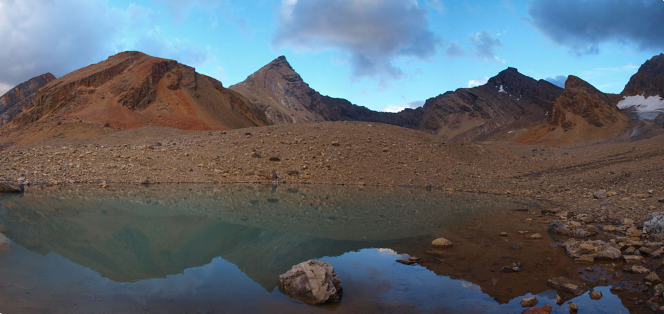
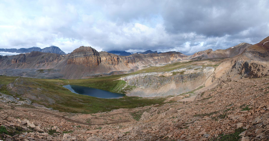
Panorama view from the SW Ridge of Recondite
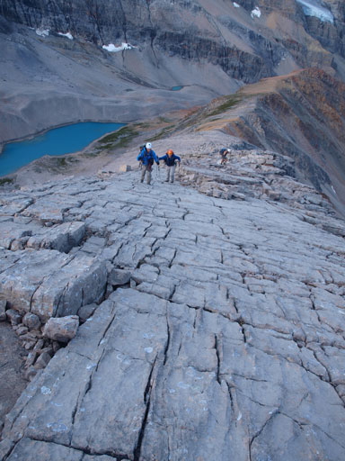
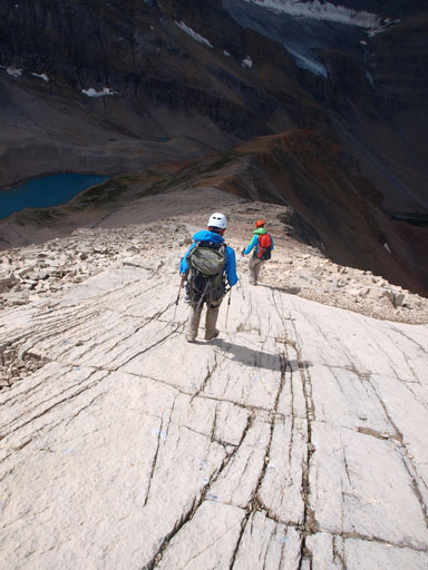
Hiking up the pavement

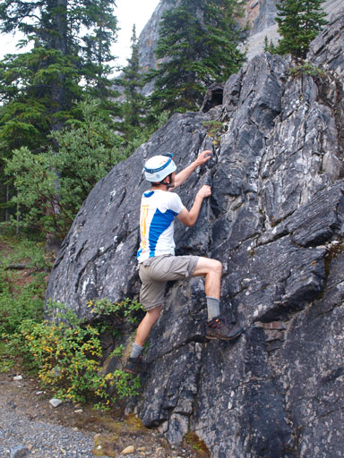
Good practice of slab climbing!
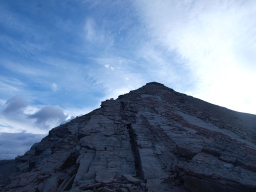
Looking up. Very foreshortened!

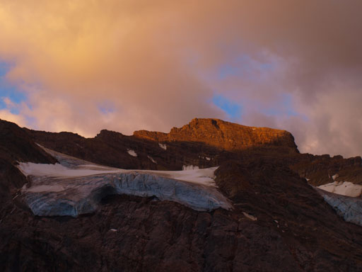
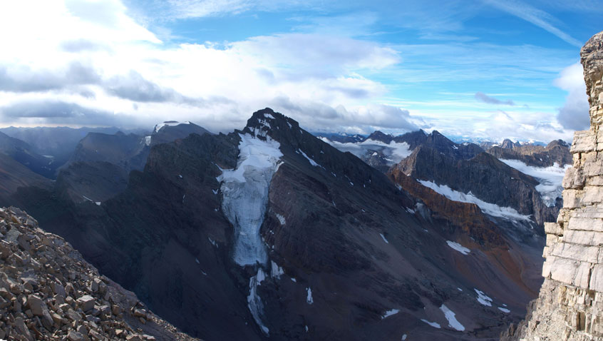
This icefield is rarely seen. It’s between Clearwater and Willingdon
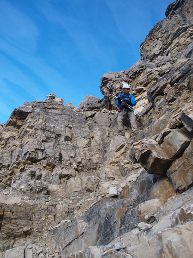
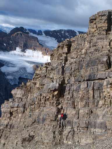
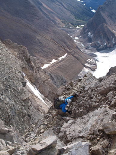
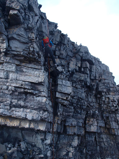
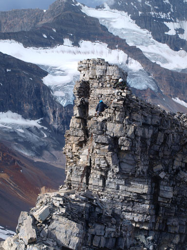
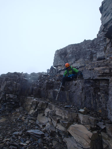
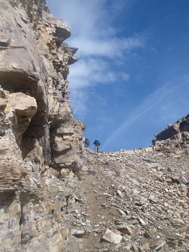
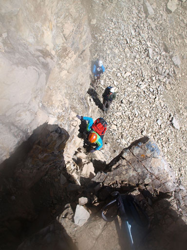
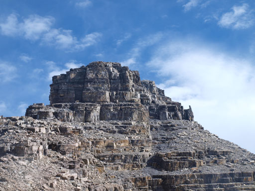
The next section was mostly a difficult scramble on very loose terrain as we worked our way around the south face. There were two difficult chimneys to down-climb. Route-finding was fairly simple since we could always find cairns here and there. Soon after the second down-climb the route swings back climber’s left to regain the SW ridge proper, and on the meantime we bypassed a impossible-looking tower on the ridge. We kept following the ridge up for a short while overcoming an awkward move on it’s climber’s left side, before traversing climber’s right again due to the impossible-looking cliffs ahead. We managed to find the shortest cliffs to break through and eventually worked our way back climber’s left to join the ridge, and right in front us would be the infamous 5.3 rappel. Now we’d just run out of luck with the weather. Looking west, another nasty storm was coming towards us in a rapid pace. We quickly set up a rap anchor, slinging around a big boulder. The storm hit us just before we started the rappel. With all of the ice crystals smashing on my face I was the first one. I firstly tried to rap straight down the nose but backed off due to a massive overhanging, and then I tried skier’s right which looked to be the least steep. Vern, Ben and Eric managed to convince me to rap off towards skier’s left and that was where I eventually went. The last few meters were still overhanging but not too-bad. I had vague memory from Bill Corbett’s book that the crux is on the other side though. Vern followed my line down and confirmed that we should have rapped down skier’s right side, at least there’d be where we up-climb on the return. While waiting for Eric and Ben rapping the crux, Vern and I speeded up to tag the summit. It’s still not easy to gain the summit block as we traversed climber’s left into down-sloping and loose terrain. It’s still difficult scrambling. But thankfully the summit shortly arrived. The celebration was short lived (for obvious reason). Our ascent time was 3 hours from bivy. We quickly started the descent after signing the register.
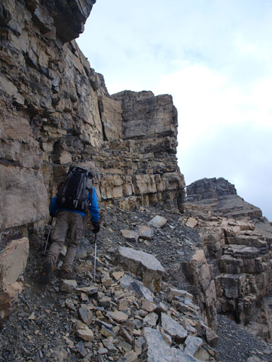
Started to traverse on climber’s right

The 1st difficult chimney
The north glacier on Mount Augusta
Traversing steep terrain

The 2nd difficult chimney

Same as above
Vern and Eric down-climbing the 2nd chimney

We bypassed this impossibly looking tower on the ridge
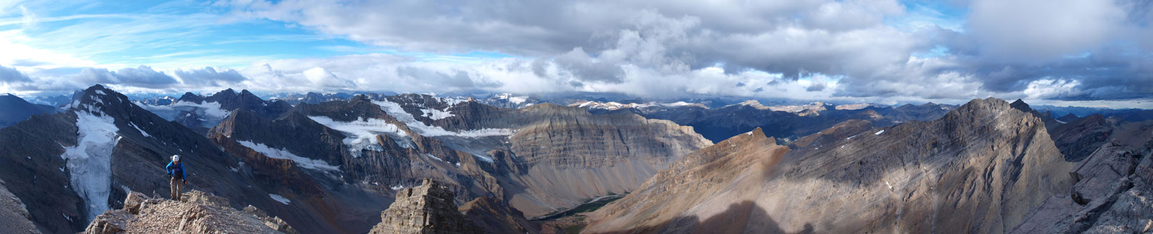
My favourite panorama from this trip
Looking ahead
Ben negotiating difficult terrain
Back onto the ridge crest
Vern rapping the 5.3 crux

Same as above
Ben’s turn
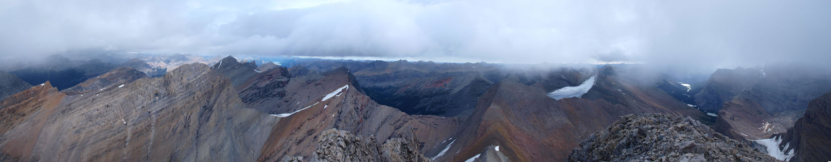
Summit panorama looking east.

Eric rappeling
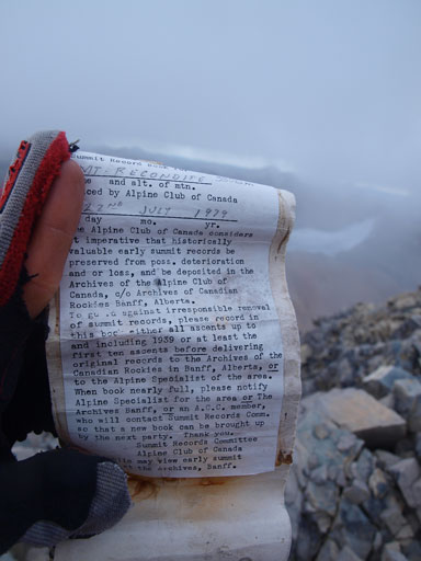
The old register placed in 1979
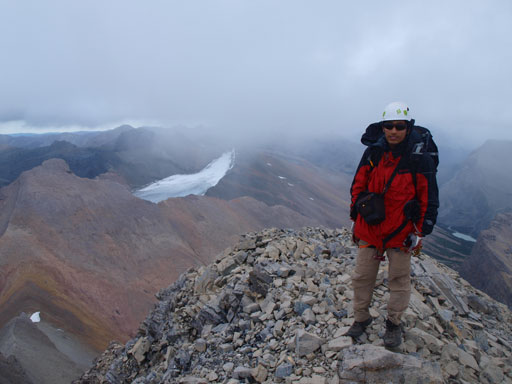
Me on the summit of Recondite Peak
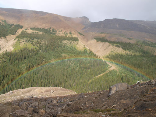
Back to the rap, we were already in a total blizzard. We all up-climbed the crux using a prussik as self-belay. Given the wetness and the looseness I was very grateful to have a rope handy. This section deserves its 5th class rating. We quickly packed the gears and started the (extremely) careful descent. With all the snow and rain we couldn’t easily trust any friction hold. Thankfully this is not a quartzite mountain.. Overall it was easier than anticipated. By the time we made back to the two up-climbs the storm had already passed by, revealing incredible scenery. Sometimes you can expect unusual views in a rainy day, the unique clouds pattern, and the rainbow.
Descending the summit block
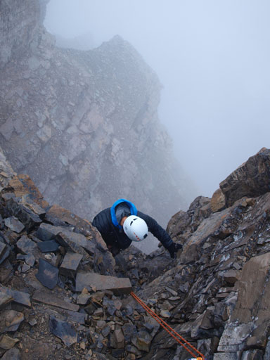
Ben climbing up the 5.3 crux in a blizzard

Continue the descent in a blizzard

The storm passed by

But it was still wet
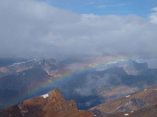
A rainbow!

Mount Augusta looks very attractive
Some unique clouds pattern that you can always expect in a rainy day

Struggling on an awkward move
Time to switch to south face again

Great view towards the front ranges
Climbing up the 2nd chimney
Zooming-in towards the distant Clearwater River Valley
Looking back towards Recondite!

Vern climbing up the 1st chimney
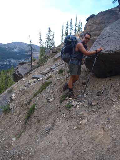
Back to the easy terrain, the slabs were still very grippy despite the rain/snow. We could managed to walk down most of them. This surely made our descent more pleasant. The worst part came until the last when we finally bailed the SW ridge. The grass couldn’t dry off quickly so we had to use a scree gully. The scree was concrete hard and it was very painful on the knees. Nothing technical, it’s all about patience. Back to the camp, it’s time to pack up. Our plan was knocking off any long as we could on Saturday to make Sunday easier.
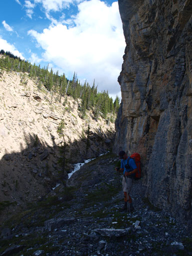
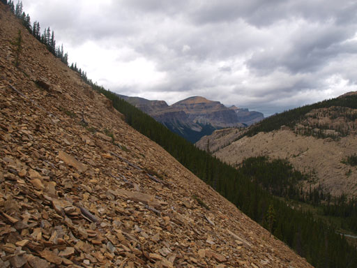
We made the decision to complete avoid bushwhacking while side-hilling on skier’s left to get out the entire “Recondite Valley”. This meant more than 5km’s side-hilling on moraine, rubble, and boulders. Compared to wondering back and forth in the bush, we did pick a faster route out, but the price we paid was hours’ of mental concentration. I always have trouble concentrating on the de-proach and this day wasn’t an exception. I called for a rest stop after getting a big scratch on my arm while slipping on boulders. There’s no way I could do such a long period of boulder hoping in one push. Rain storms also came in and out. I don’t want to describe this section for too much except for extreme patience and (mental) endurance.
Waking down the pavement

Time to leave the camp

Onto the long side-hilling terrain
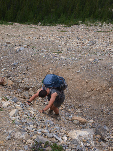
Eric negotiating the hard moraine
Another storm passed by, so another rainbow
Oh the side-hilling
It almost came to the end. Almost into the bush now.
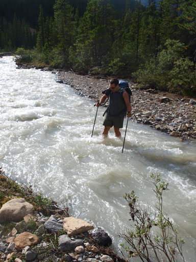
Back into the bush, Vern again, did a great job navigating using his GPS. We aimed directly towards the distant Siffleur River crossing. This section also went on forever and at the same time we lost a ton of elevation. Just about to cross Siffleur River we lost Eric. After yelling and searching for 10 minutes or so we decided to ford it first and wait for Eric at the campground just before the major Dolomite Creek’s crossing. Thankfully he did show up shortly after. Also thank to the rain the Dolomite Creek was already thigh deep but we all crossed it with no issue. Back to the trail now!!
Typical bush
Vern did a great job navigating using his GPS
Crossing the thigh-deep Dolomite Creek back to the trail
Now pretty much all the mental work had done. What was left was the 28km or so’s slog back to the car. Back to Isabella Lake, we decided to stick to the trail on its right (west) side, hoping to avoid the swamp wallowing. There were quite a few very indistinct, muddy, and marshy sections, but we managed to walk through them without switching to river shoes, and without soaking our boots wet. I have to admit that we were on a different mood at this time of the day. We basically kept exploring the trail. I wouldn’t worry too much if getting my boots wet. Things would be very different on the way in though, especially given the description in Bill Corbett’s book. In any case you should avoid the swamp section by staying way on the west side of this flats. We kept following the trail out until the darkness finally arrived. There was a very lovely spot right beside the Dolomite Creek so we set up the camp. Another 14-hour day on full force! It rained on us, heavily, overnight, but whatever. I’m not complaining anything now.

Panorama of Isabella Lake
The trail wasn’t very distinct at places
On Sunday morning we woke up at 5 in dark. Still a long trek to go, slogging 700 vertical meter back to Dolomite Pass, and losing 600 of them back to the parking lot, in a total distance of 20km or so. This time we would make no mistake on the trail. Still two more fordings to go. Weather was slightly better on Sunday and we all enjoyed the view once above treeline. Looking back, oh the long long valley. I can say goodbye to Recondite now, but I’m sure I’ll return to this lovely area someday. There’re many, many objectives being relatively unexplored. The hike out was mundane, but scenic. Our round trip time was 52 hours.
Morning glow on Sunday
Vern crossing the (cold) Dolomite Creek
Ben found another bouldering opportunity
We would soon leave this lovely valley behind

The not-so-familiar side of Dolomite Peak
Panorama from Dolomite Pass

Bow Peak seen from Lake Katherine
Ben
Back to the familiar country now. This is Helen Lake
Panorama from the ridge crest just below Cirque Peak
Anyone hasn’t done Cirque yet?
Even more familiar views started to show up. Don’t need to introduce this peak I guess..

Doing this was pretty tiring at the tailing end of the trip
Crossing an interesting mud creek. Dolomite Peak behind.
Overall, I felt a great sense of accomplishment to have Recondite Peak bagged on my first try. This one gives me more satisfaction than the Canadian Rockies’ icon, Mount Assiniboine. Apart from the success on my 8th 11,000er, I fully enjoyed the 3-day wilderness adventure with 3 good friends, Ben, Vern, and Eric. The experience would sit in my memory and this is a trip that I’ll not gonna forget. I’m already looking forward to the next expedition with those guys!
Make sure you take a look at Vern’s excellent short video of our trip.

Hell yeah! What a great adventure Recondite was…