Mount Kerr
August 4, 2012
2863m
Yoho National Park, BC
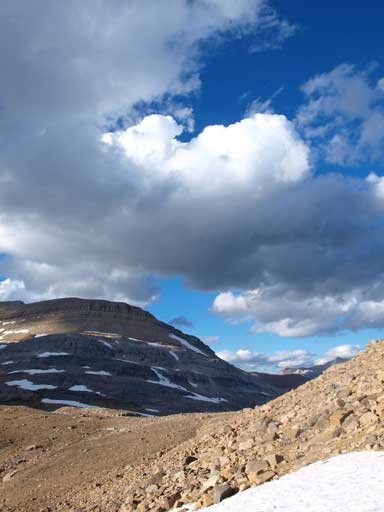
Having already finished Kiwetinok Peak, Mount Pollinger and Mount McArthur, Mike and I took a necessary energy break at Kiwetinok Pass. We thought about leaving Mount Kerr for the next day, but I didn’t agree with this plan as we were uncertain about the weather… I’d like to get up Mt. Kerr in good weather. This is probably the most popular scramble in the Little Yoho judging by the abundance of cairns and paths.
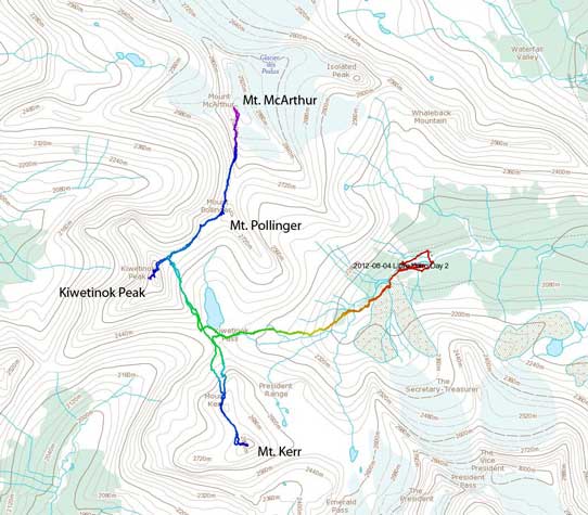
Ascent routes for Kiwetinok, Pollinger, McArthur and Kerr
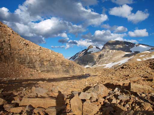
With basic sense of route-finding, it was hard to get lost. There’s some confusion as which of the two summits being the “true” one. The government map labels the lower north summit as the official summit but the south peak is much higher. The register is also on the south peak, so in order to make sure we have to climb them both. Getting to the first summit (official summit) was nothing but putting one foot in front of another.
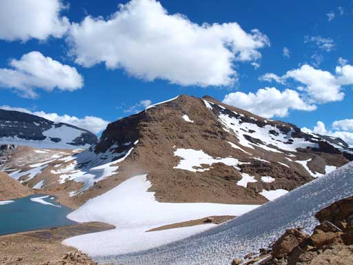
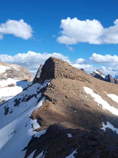
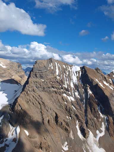
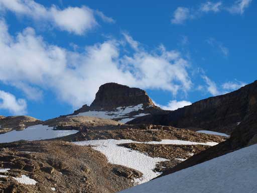
This is the lower summit of Mount Kerr. The true summit is behind.
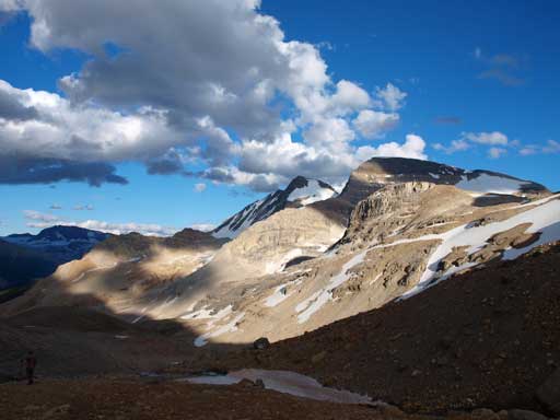
Looking back at Kiwetinok Lake. Mount Pollinger is the bump on right skyline
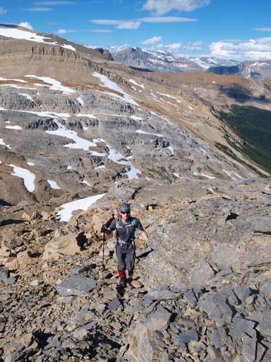
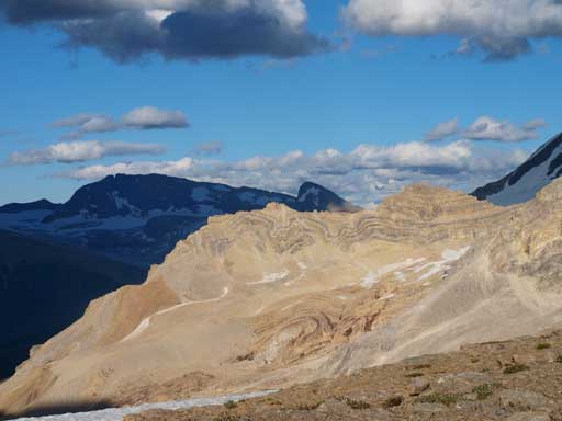
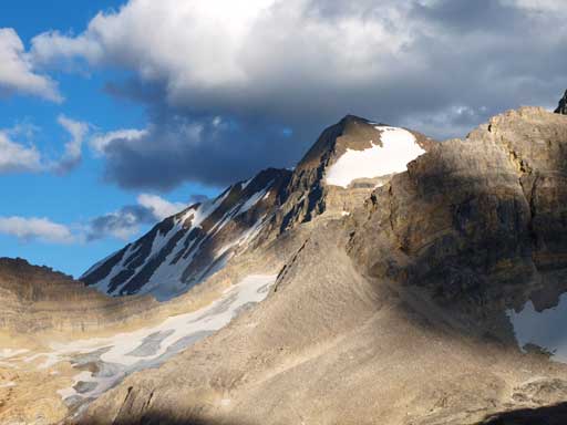
Most of the scrambling on Kerr is off-trail hiking
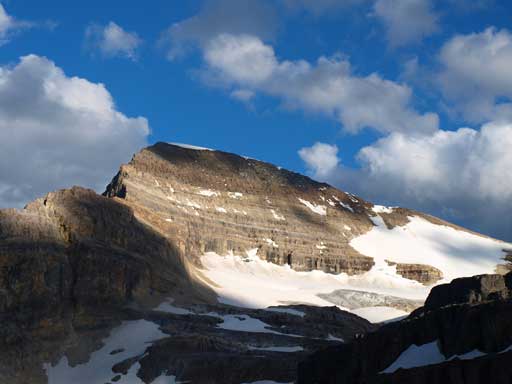
This is the true summit
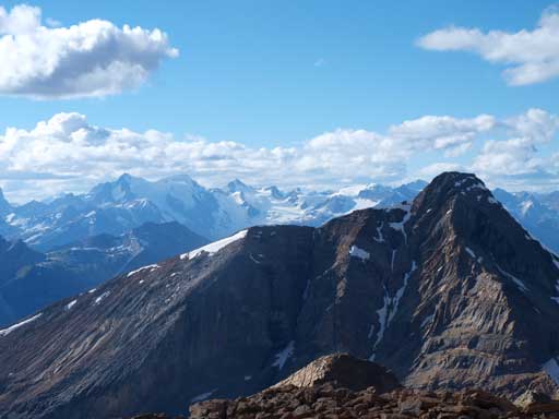
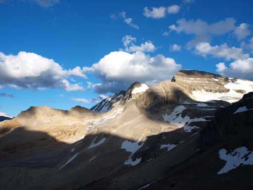
Mount Gordon and Mount Balfour from the false summit
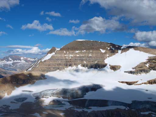
Daly Glacier and Mount Daly
There’s about 100 m elevation loss in between the two summits, which was frustrating… Minor rock bands on the connecting ridge presented some route-finding issues, and we had to drop usually towards skier’s left to overcome them. The final trudge up the true summit reminded Mike about Read’s Tower. It’s an easy scramble. The summit cairn was huge, and to get a panorama, I had to climb up it, which was a bit sketchy…
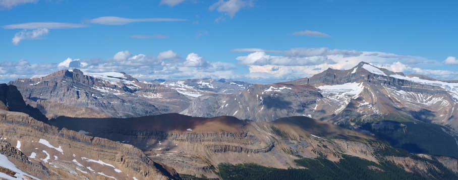
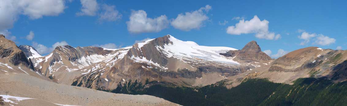
Partial Summit Panorama
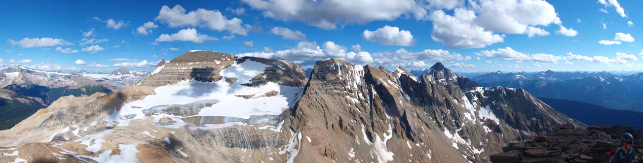
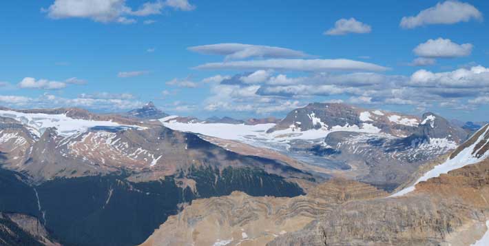
Partial Summit Panorama
Mount Marpole

Mount Carnarvon
Looking over the west shoulder of Kiwetinok Peak
The President

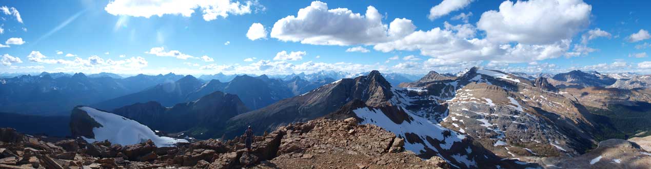
The summit cairn is huge. I had to climb up it to get a panorama.
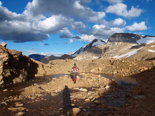
We took our time on the way down due to the looseness of the ground. It was easy to twist an ankle when you’re tired. We could also find a snow slope which offered great plunging-step. The rest of the day back to camp was a slog, but due to the evening sun, we got great views. This is definitely the highlight of summer 2012 so far. Success on 4 remote peaks, difficult fun scrambling, snow climb, great company, and the view like this.
Nice views from the descent.
Interesting rock spine
Gorgeous evening lighting
Going back to camp
Spectacular!
The Presidents
Looking back at Mount Kerr
Another look at Presidents
The Vice President
The President
After a well-deserved dinner we went to bed. The following morning we woke up under clear sky again. Andrea’s group was going for Isolated to Whaleback, while Mike and I had already finished our objectives. We slept in a bit. Due to the promising weather, we decided to take Iceline Trail back, despite the extra elevation gain. Due to the sun direction, we lingered around the camp until almost noon before starting packing. My sandwiches were gone so my pack was lighter than on the way in. But I didn’t feel lighter, probably due to the sore muscles anyway.
There’s nothing to describe the trail itself, as it’s a hiking on a maintained trail. The views are awesome towards all direction. Because we were travelling at low elevation (relatively to the peaks), we got closer view of the lakes and glaciers. At the end of the trail we were constantly treated by the head-on view of Takakkaw Falls, which was not visible from any of the scrambles in that area… Apart from the heavy pack, the downside was the amount of tourists… 100 people for the least.. I could even hear people talking in Chinese. It’s understandable though, as Iceline Trail is one of the several must-do trails in the Rockies. Comparing to Lake O’Hara, Berg Lake, Northover Ridge, and Assniboine, this one is much shorter and can be done in a reasonable one day for most hikers.
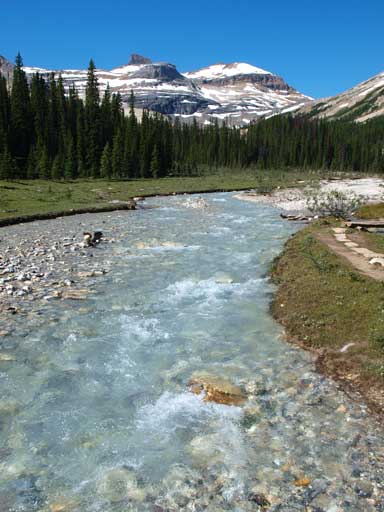
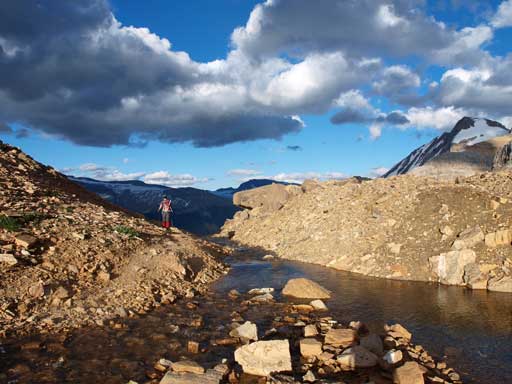
Crossing Little Yoho River in the morning.

The Vice President and its glaciers
Looking back to Kiwetinok, McArthur, Isolated Peak
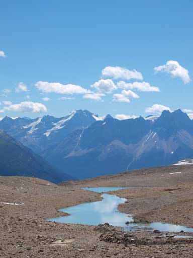
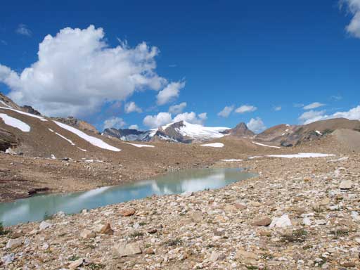
There’re many tarns like this on Iceline Trail.
One of the best trails that should be on every hiker’s list.
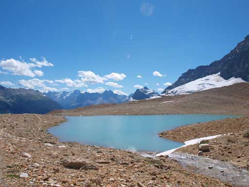
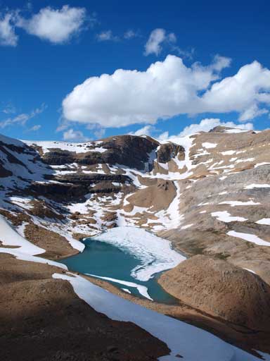
Another beautiful alpine tarn

Takakkaw Falls
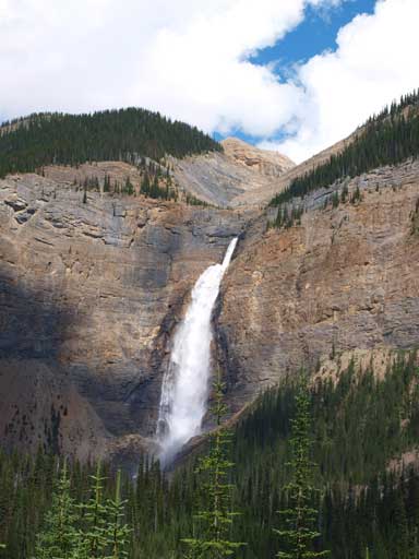
Takakkaw Falls

Hi,
How long did it take to do all these four mountains? Distance? Elevation gained?
Thanks
Hey Jenny, I remember it took us 13 hours from camp to camp, but some of us were not moving fast. I’d say our group pace was kinda the average scramblers’ pace. You can check my friend, Mike’s trip report for the elevation/distance, etc. I didn’t have recording devices at that time.
http://giantsgate.com/destinations/little_yoho_valley_day2/