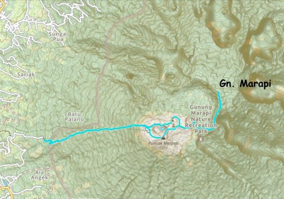
Gunung Marapi
August 26, 2023
2891m
Sumatra, Indonesia
The name of this mountain spells slightly differently than Gn. Merapi in Central Java but the meaning is the same, the “mountain of fire”. This peak is slightly taller than the neighbour, Gn. Singgalang and subsequently boasts over 2000 m prominence in the vicinity of Bukittinggi. This is one of the most popular objectives in West Sumatra because of the views in the crater areas, but the true summit (Puncak Garuda) lies about 2 km to the east in the impenetrable jungles that 99.9% of the hikers do not end up visiting. There’s no view whatsoever, so it’s pointless except for the peak-baggers who believe there are only two outcomes of a peak-bagging mission. The only way to make a successful claim is by reaching the highest point, otherwise it’s a failure. Adam and I belong to that 0.1% so we either plan to make the true summit or skip this peak entirely. We opted for the former. Our reference was Rob and Deividas’ 2022 trip in which they found the overgrown path and penetrated the 2 km jungle in 2 hours. Without their GPX track I don’t think we would bother to make this attempt. Rob had make an attempt in 2007 with Adam Helman but failed to find that “trail” and turned around after a mere 100 m into the jungle. Even with this trail the bushwhacking is heavy and sustained.
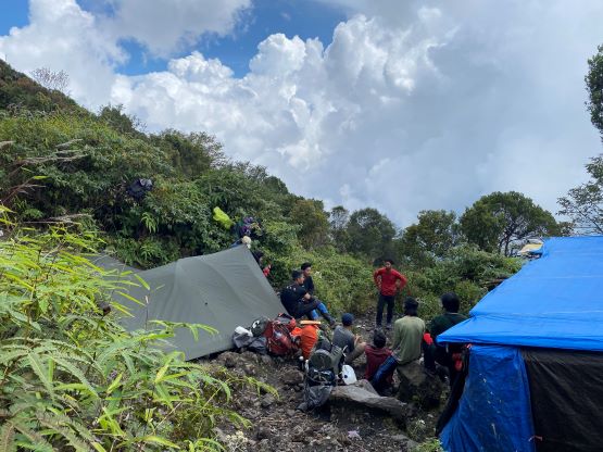
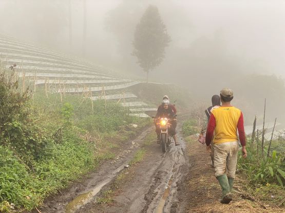
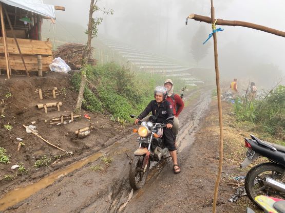
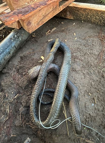
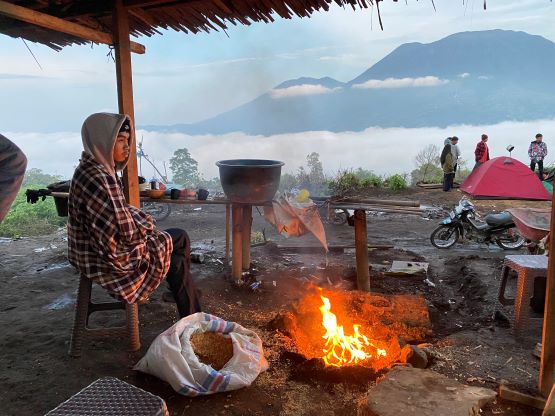
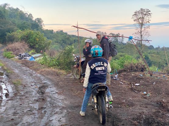
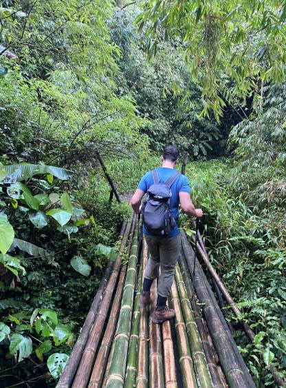
We took a rest day after Singgalang because we were tired and the weather was shitty. The Norwegian forecast turned out to be the most accurate that it indeed poured cats and dogs for most of the day. Meanwhile our driver helped us arranging the ojeks such that they would show up at 6 am. It’s not entirely needed to take ojeks on Gn. Marapi because they could only shave off 2 km distance with 200 m elevation gain comparing to Rob and Deividas’ track, but at this stage of the trip we would take any form of assist if possible. The ojeks showed up on time, but the drive to the basecamp (registration post) was longer than expected. Checking the maps I realized that we took a gradual but roundabout path. They charged us 155,000 IDR per pax at the registration post. There’s one massively fat but dead cobra and I assumed that they killed it at the camp. I didn’t know what the feeling was considering we had several hours of bushwhacking to do in this jungle. This island is known to have cobras and tigers, but we came here knowing that and we had already decided to accept the risks so we resumed the plan. We then hopped back onto the ojeks and rode for another kilometer or so. The road continued further, but one creek crossing had a missing bridge (they bridged it by a bundle of bamboo sticks) so that’s the drivable end for the motorcycles.
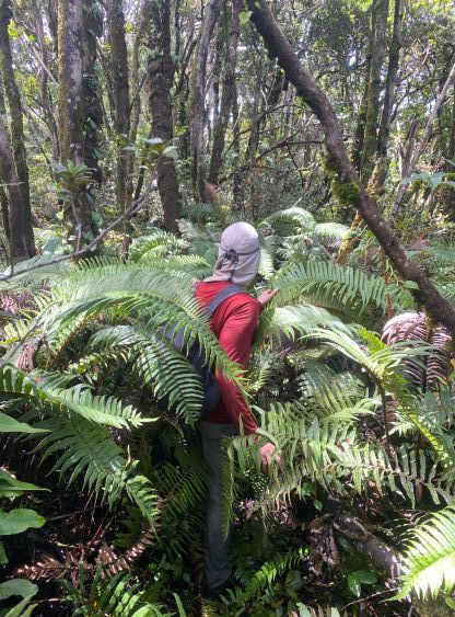
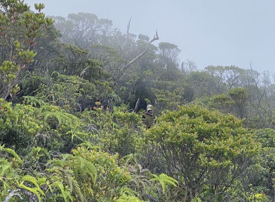
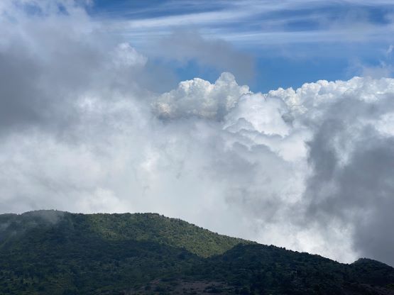
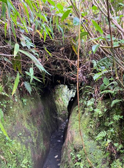
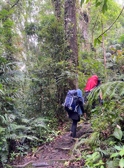
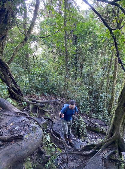
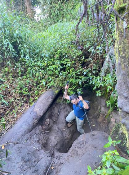
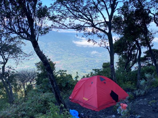
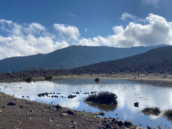
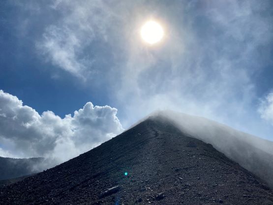
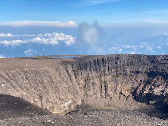
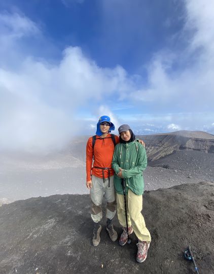
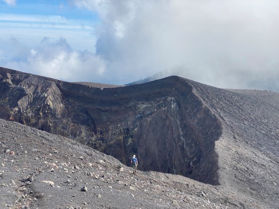
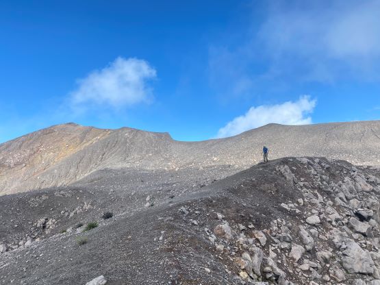
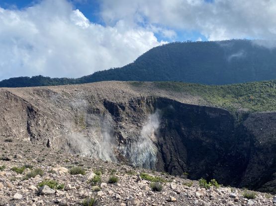
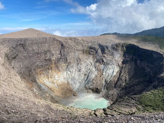
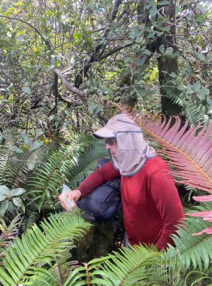
We parked at 1500 m elevation and there’s not much worth noting about the grunt to the treeline camp about 1000 vertical meters higher. The trail was “easy” by the area’s standard and was made by the typical mud steps, tunnels, trenches and tree roots. The path was mostly wide and there was no leech to be seen. Near the high camp I took a wrong path to a dead end. I turned around, took another path and came to a dead end again. I turned around again with fair amount of backtracking and found the correct path diverging climber’s left across a rocky gully, and then I arrived at the camp. The terrain had become rocky from here to the crater areas at 2700 m, and the going was not as straightforward as I was hoping for. The footings were mostly loose and the grade was steep. We took a mandatory break at the rim to don sun protections, and carried on southwards towards Puncak Merpati, a subsidiary bump but the end goal for most hikers. I could understand why this peak is popular, as the views were indeed spectacular.
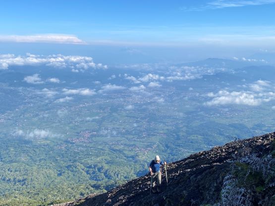
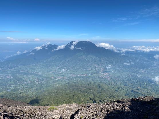


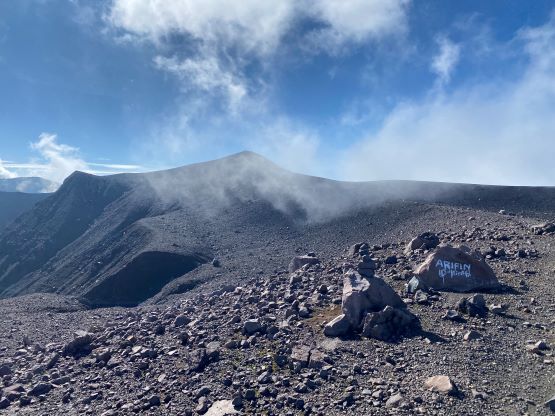


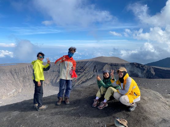
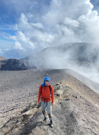
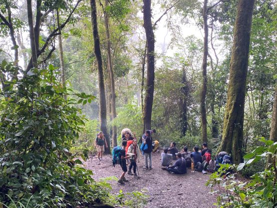
Adam was a few minutes behind but carried on to the other side of Merpati without stopping on the summit. Meanwhile I was socializing with a group of locals. It then took me a while to catch up. The descent involved near-100 m elevation loss and the path was non-existent at places. It was loose wherever we couldn’t stay on the path. We then traversed around a few more impressive craters and the final stop was a boulder under the summit of Puncak Terbakar minutes before entering the jungle. This would be our last break before embracing the hours of bushwhacking so we might as well take in the scenery. We also ditched some unnecessary weight and that proved to be the right choice.

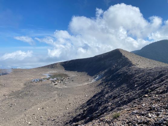
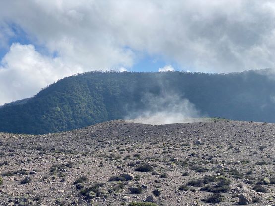
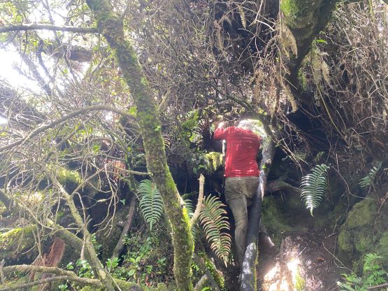
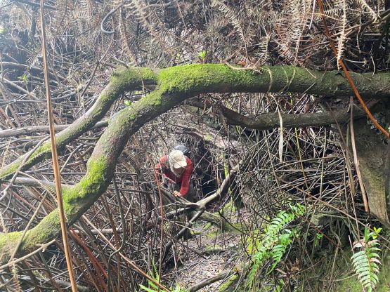
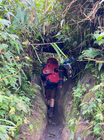
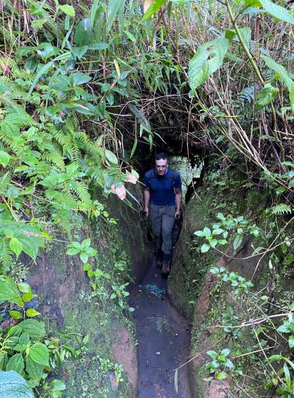
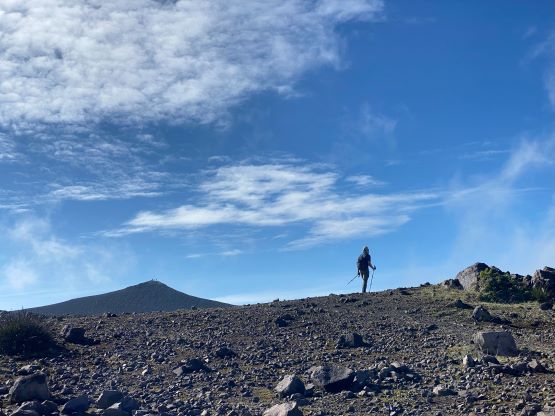
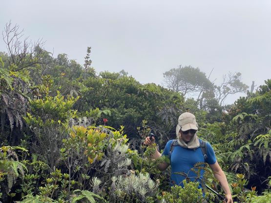
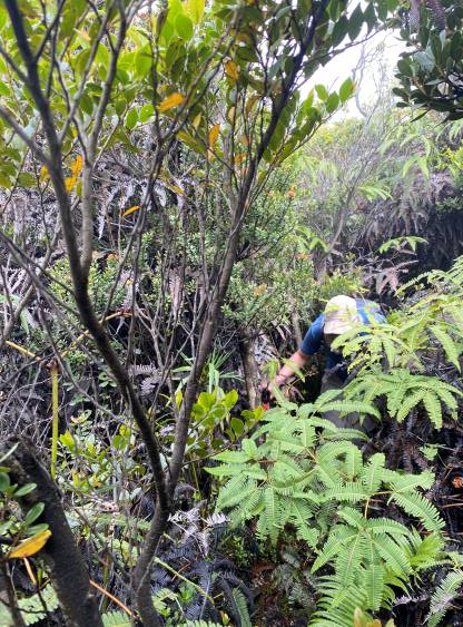
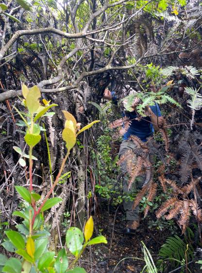
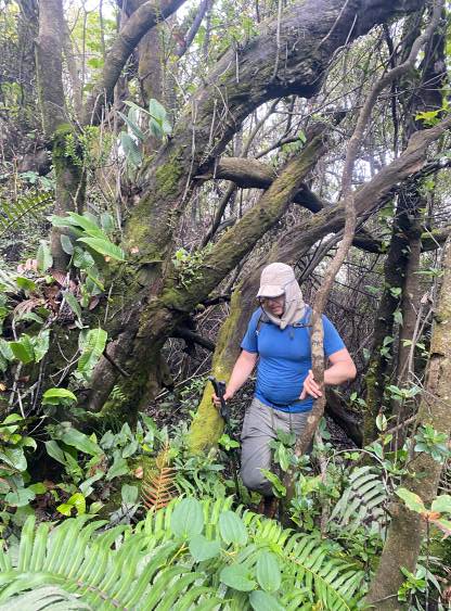
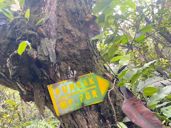
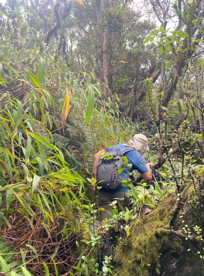
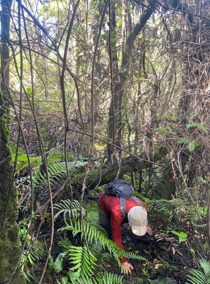
The jungle started before the summit of Puncak Terbakar and the climber’s path heading towards Puncak Garuda (true summit) branches off below the summit of this bump, which I missed from Rob’s description. Adam and I ended up summitting Terbakar and descending the opposite (wrong) side on a game path. A few minutes later we turned around and found the correct path. It was not obvious and could be impossible to see without the GPX track. There’s about 50 m drop into Terbakar/Garuda saddle and things became bad after a few minutes into the thrash. The trail was actually not that difficult to follow, but was completely overgrown with all kinds of obstacles. It was basically a sustained “BW3” bushwhack on top of a trail. The ascent of the true summit can be roughly divided into three stages – the descent and traverse across the saddle, the south ridge and the summit push in ferns. The middle section was the easiest and was mostly cruise-sailing, but the first and the last stage was terrible. The first stage involved a shit ton loads of crawling through “dog holes” and some brambles, whereas the last stage was a sustained thrash in the tall ferns. I thought we should do us a favour for the return, so slowed down and did some trail maintenance. The ferns were painful but easy to bend, so I bent most of them while whacking through. Our ascent time was more than an hour shorter than Deividas/Rob’s but that’s mostly due to having a higher starting point. Our paces to penetrate this jungle trail were basically the same – about 2 hours up, and just over 1 hour back.


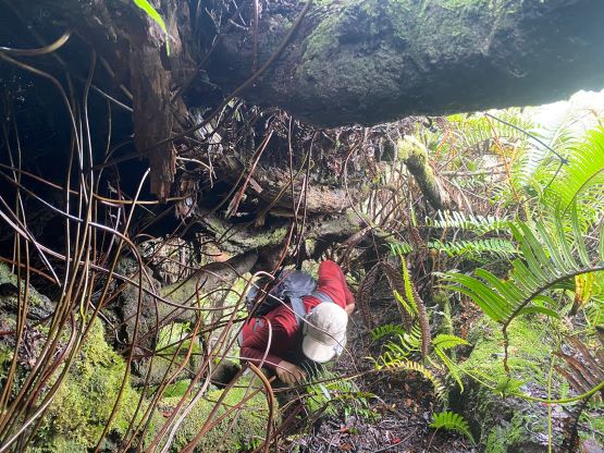

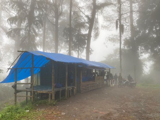
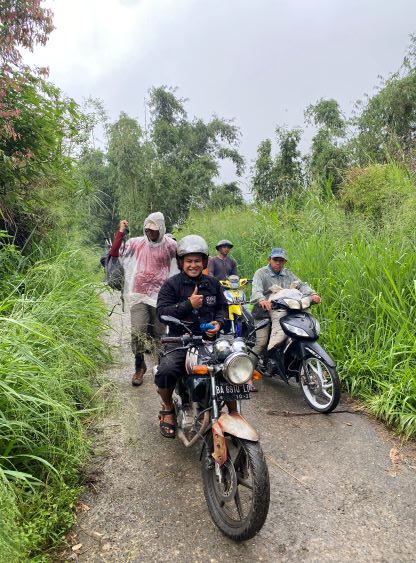
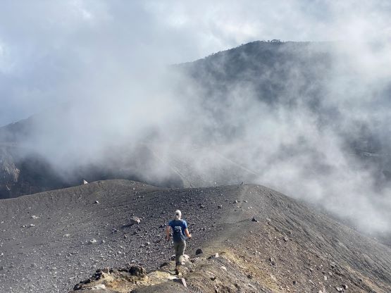
The descent was easier as we already made the trail clearer. We also knew what exactly to expect so it was mentally easier. Those holes were still the worst. I don’t know why they cut the trail for dog travel as it’s extremely painful for human beings. We literally had to crawl on our knees. After getting back to the crater areas we were soaked in the clouds. I opted to lead us back across the zone by following the northern of the two routes, but there was no view to be seen. There’s one bump with 20 m prominence. I was planning a bypass but Adam needed it, so I tagged it as well. We were still in the clouds and started to receive some drops of rain, so made a quick dash back to the jungle trails. The descent of the loose terrain down to that high camp required some careful work, but the rest of the descent was relatively straightforward, albeit long and exhausting. Our round trip time as 9 hours 20 minutes and we were completely beaten in the end. Originally I asked the ojek drivers to wait for us at the road’s end at 1 pm, but thankfully I caught some cell receptions up high. I texted them to be there at 3:30 pm and we got down at 3:45 pm. The ride back to the highway was sort of eventful as it finally started to piss. Again, that Norwegian forecast predicted it really well. There’s also a downed bundle of bamboos that stopped all ojek traffics momentarily, but Adam and I used that break to don rain shells, which was actually quite important. There’s a warung at the bottom of this peak so we had a massive lunch/dinner, and then drover another hour or two eastwards to Payakumbuh to relocate ourselves for the next objective.