Mount Walker
February 26, 2023
855m
Olympic Peninsula, WA
Mt. Walker is a mere foothill on the far eastern slopes of Quilcene Range of the Olympics but boasts over 600 m prominence as it’s a stand-alone hill detached from the rest of the mountains. A service road goes all the way to the summit but the road is closed in winter due to snow and ice. Even if the road’s open I wouldn’t opt to take the lazy way. There’s a well-maintained trail that goes up the forested south ridge directly out of Mt. Walker’s prominence saddle and that’s the route I decided to take. Even by hiking to the summit the outing would be too short to justify the long drive and/or the ferry logistics and I needed to come up with a secondary objective to fill in the day. Nikita and I made the spontaneous decision after seeing some pockets of sunnier weather in the Olympics. In fact, most, if not all of the other areas within a few hours of driving from Vancouver would be soaked in rain/snow so we really had to come this way to see some blue skies. I decided for us that the secondary objective would be Gold Mountain, a rather dumpster peak on Kitsap Peninsula that boasts over 400 m prominence.
The evening of Saturday saw 15-20 cm of snow in the Lower Mainland and the traffic dropped dead. Nikita was planning to come over at 11:40 pm but the Uber cancelled on her at the last minute. It was snowing hard and my planned departure was 4 am from White Rock so the only way to make this trip happen was for me to drive to Richmond to pick her up, right now. Thankfully I had the Tacoma with me so I turned on the 4×4 and cruised to Richmond in full concentration. The entire highway was covered in snow and slush and many cars were mangled in the ditch. We were back to White Rock at 1:30 am. The alarm was set at 3:30 am as I had no idea about the road conditions down south and I wanted to be 120% sure to not miss the first ride of Coupeville-Port Townsend ferry. The roads were actually better in Washington but I still needed to drive at a snail’s pace as the weather was still terrible. I earned myself enough time for gas and then McDonalds and eventually rolled into the ferry terminal at 6:40 am with half an hour’s spare. I had actually reserved the ride but they still required us to show up more than half an hour earlier to secure our spot. It turned out that the ferry was at most 10% full…
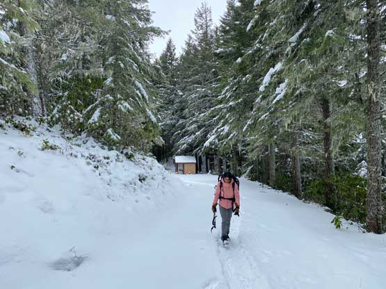
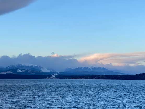
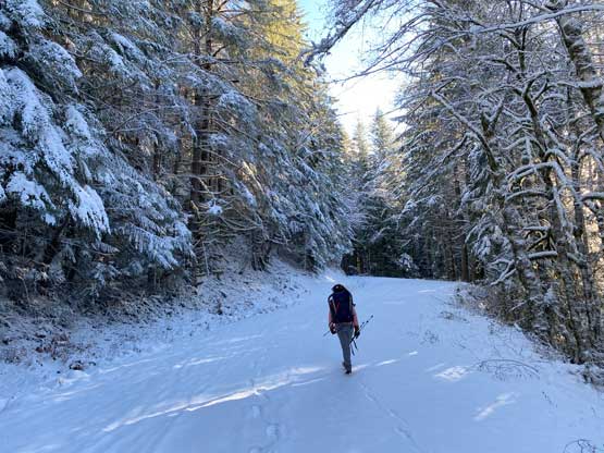
The weather as forecasted, drastically improved to the west so I walked upstairs to the Sun Deck for some views. Most of the high peaks on the eastern slopes of the Olympics were visible and that was not to be expected. The ferry ride took 40 minutes and the drive on the other side took another 40 minutes. Nearing Mt. Walker we started to encounter snow on the roads again and I turned around and parked in front of the winter closure gate. There’s no way to know the exact amount of the fresh snow on the higher elevation so I made us to bring snowshoes and microspikes.


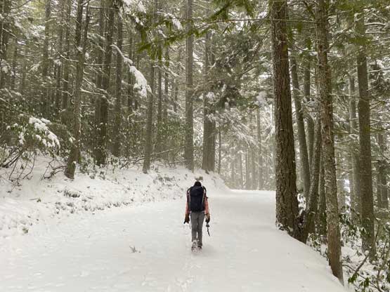
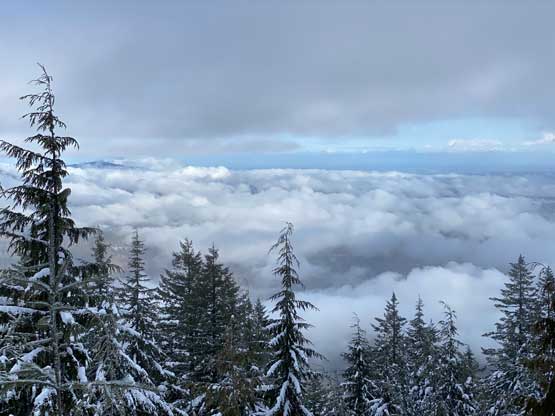
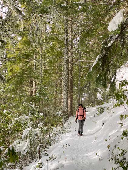
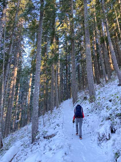
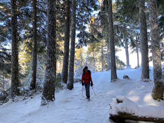
Nikita opted to don microspikes from the start but I brought them only for that 1% extra contingency so I left them in the backpack. My boots gave me enough traction anyway. About 200 m up the road we picked up the trail. One hiker had started earlier than us so all we needed was to put one foot in front of another while following his tracks. The snow depth did not increase for the 600 m elevation difference from the parking lot to the summit, so we carried our snowshoes for exercise. There’s nothing worth documenting about this ascent as it’s such a no-brainer hiker. We checked out the “north viewpoint” first as that’s where the true summit is, and then walked to the “south viewpoint”. The previous hiker had stopped at the “north viewpoint” so we broke our own trail southwards for over 1 km distance. The snowshoes were still not required. The clouds had unfortunately rolled in so we did this 2-km detour for very marginal gain. I was anticipating a very Instagramable spot at this “south viewpoint” but the result was disappointing.


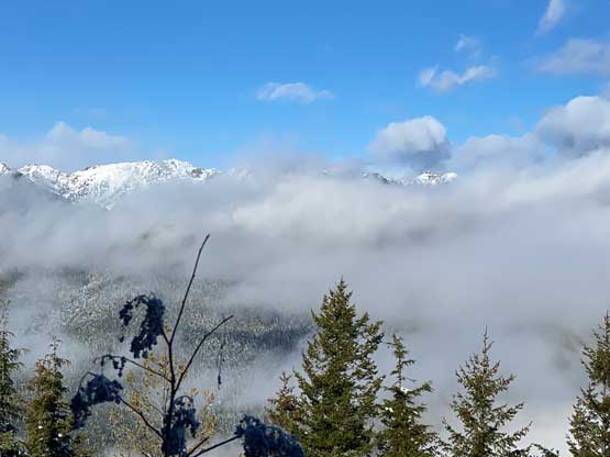


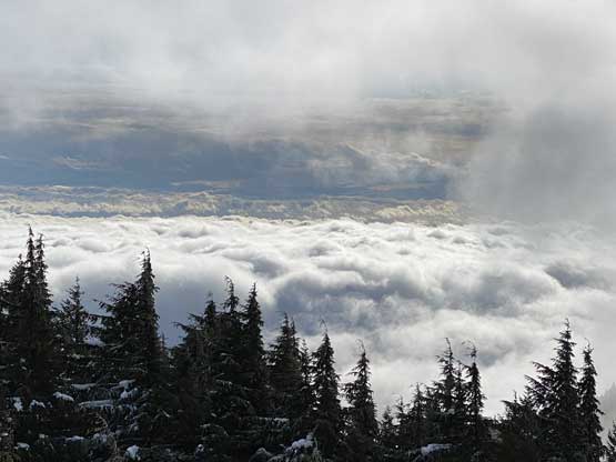
After waiting for 20 minutes I reluctantly made the call to go back. The view did improve a little bit but it was still not nearly as Instagramable as I was hoping for. The plod back to the “north viewpoint”/true summit was actually quite boring. From there we made a single dash down. Multiple groups of hikers were on their way up so this was overall a fairly popular hike, at least among the locals. We finished the hike at noon and immediately drove away towards our secondary objective. The weather was actually improving so I was hoping for some views there.