Mount Boardman
July 19-20, 2020
2671m
Clendinning Area, BC
Mt. Boardman is truly a massif, heavily glaciated on all sides and is the highest peak in the Clendinning area or anywhere south of Elaho Mountain between Elaho and Toba Rivers. This is a major summit by any measure, but the double-spire summit pyramid isn’t as visible nor iconic as Mt. Tinniswood which is slightly closer to the civilization. Most explorers and peak-baggers in the South Coast have at least recognized Mt. Tinniswood in this area but to me, Mt. Boardman is equally important, if not more. The location of this peak is truly in the heart of South Coast and on a clear day, one can see hundreds of miles from the coastal inlets to Mt. Waddington to the Chilcotins and all the way to the familiar Garibaldi and Sea to Sky areas, and not to mention the immense icefields and glaciers in the foreground.
Alex had been planning a traverse across the Clendinning Range for several years and we almost pulled the trigger last year but the weather and condition never aligned well. This year saw some significant snow coverage of the glaciers and the high country but the weather had been somewhat unpredictable. We knew from condition perspective mid to late July would be the prime time, but unfortunately we only had 3-4 days of guaranteed weather before an unstable period of 3-4 days coming into the area. The long range model looked stable after a week. We debated for two days and opted to pull the trigger at the very last minute. On the first day we flew to the summit of Mt. Willson and then made ascents of Mt. Ralph, Mt. Pollock and Mt. Oswald and camped at the deep chasm of Oswald/Vanstone col covering 26 km distance and 1500 m cumulative elevation gain carrying 24 kg of backpack.

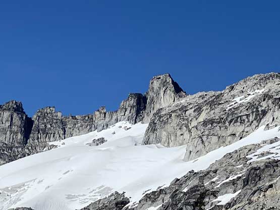
The section from Mt. Boardman to Blumlisalp Mountain.
The original plan was to ascend the east face of Mt. Vanstone and then traverse up and over Mt. Perkins before dropping 900 m down to the upper reach of Whiting Glacier but upon closer inspection of the face we opted for taking the long way around Mt. Perkins skipping these two summits. We had spent hours and hours digging up photos and mapping the satellite images and had been discussing this section for pretty much the whole evening. It wasn’t an easy decision to skip especially Mt. Perkins but given the unknown terrain and our heavy packs we opted to focus more on the main objectives in this trip. The detour around Mt. Perkins involved dropping down to 1000 m elevation and then ascending Whiting Creek and then Whiting Glacier. Much of this day’s coverage was full-on exploratory on boulders, bush and snow with literally zero information that could be dug out on the internet. The only part we were sort of sure was that this route likely involve no technical issues. After breaking camp we easily plodded down the glacier northwards from Oswald/Vanstone col and continued down on mostly easy boulders and snow to about 1100 m elevation. Only the bottom 100 m or so involved some fairly dense bushwhacking. The brush wasn’t too bad but there had zillions of caterpillars that were extremely gross. We linked up a few boulder fields to avoid some of the worst bush.

We camped at Oswald/Vanstone col on the previous night

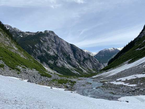
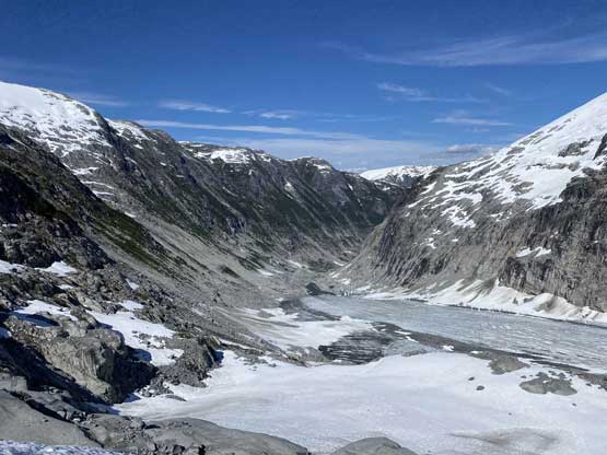
Going down this valley into the unknown

Looking back at the small glacier at Oswald/Vanstone col

Vlad trying to stay on snow for as much as we could
Eventually we had to face the west coast characters once the snow’s out

Alex bushwhacking…

After a while we found ourselves going up again into Whiting Creek drainage
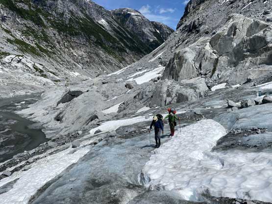
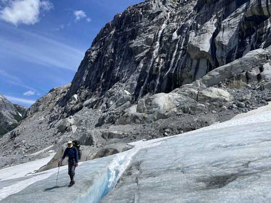
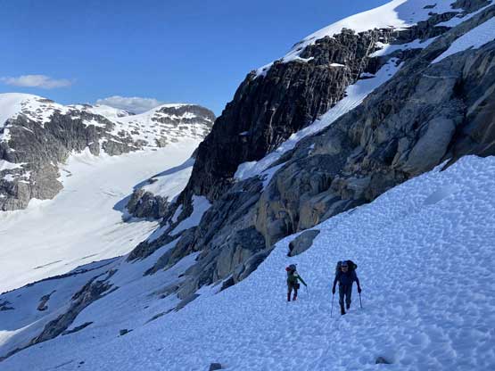
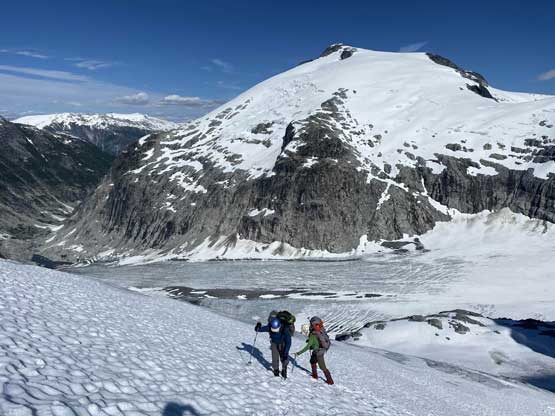
Once into the Whiting Creek drainage we had another kilometer or so’s slow travel on boulders and bushes but once we dropped to the creek level the travel became much more of a cruise, on either open country or snow. The progress slowed down a bit as we approached the toe of Whiting Glacier because of strips of moraines that made some tricky route-finding in the micro terrain. I saw several options to get onto the glacier and in the end just opted to plod to the toe of the glacier to check things out. Unfortunately we couldn’t gain the glacier at the toe, but the climber’s left side looked feasible. To access a gentler bench we had to plod up a cone of extremely loose shits (moraine and dirt covering ice) and zig-zag through some open crevasses. Once we hit snow on the glacier we took a long break discussing what to do next. Based on the time and our position we made the final decision to skip Mt. Perkins and then we also made a decision to short-cut the ascent of Mt. Boardman upon field observation. We spotted a diagonal ramp that would lead us right to be the base of Mt. Boardman instead of ascending up and over Mt. Whiting. This would save us at least several hours in total. The slog across Whiting Glacier to the base of that diagonal ramp was slow though.
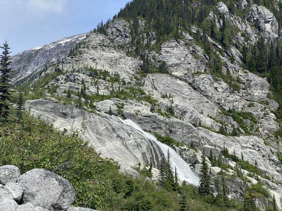
The first sight of Whiting Creek is this impressive waterfall

Looking down Whiting Creek into Clendinning Creek that isn’t visible

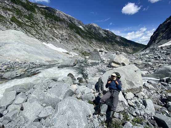
Boulder hopping is the key here.

Sometimes we had to enter some thick bush…
Snow’s definitely a welcoming sign.
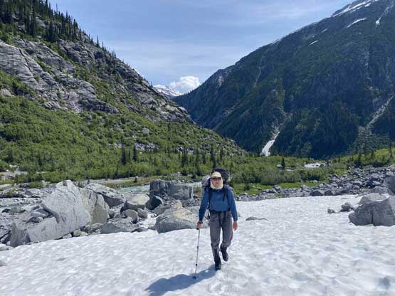
Alex leading us into the Whiting Creek valley
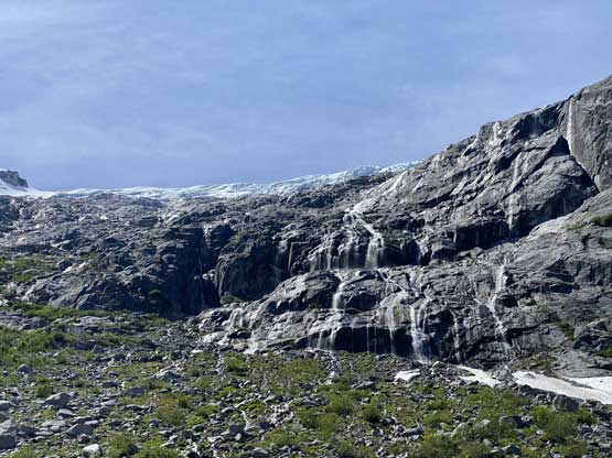
Lots and lots of waterfalls coming down from Mt. Perkins’ north glaciers

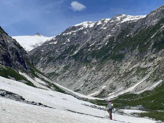
The Whiting Creek valley became a bit rocky and broken the higher we got

Me with my 105L backpack.. Photo by Alex R.
Vlad taking a long break here…
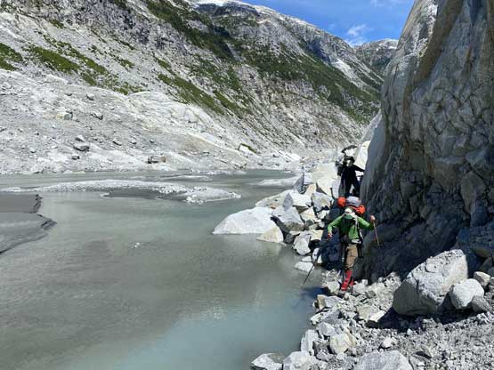
We were thankful to find this tiny ledge to bypass the lake.

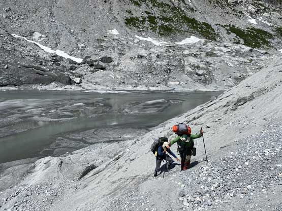
Me heading towards the toe of Whiting Glacier. Photo by Alex R.
The toe isn’t accessible so we had to climb this to get out

Me onto the glacier now trying to pick a line avoiding the crevasses
Alex and Vlad negotiating the start of the glacier
Vlad on the dry glacier with again, waterfalls behind

Fast forward. A long ways up Whiting Glacier now looking at Perkins/Whiting col
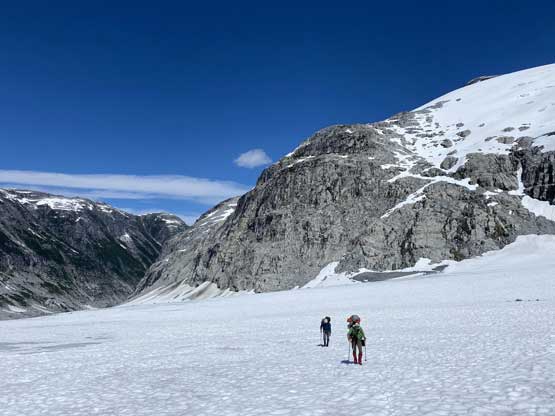
Alex and Vlad plodding across the now-snow-covered Whiting Glacier

Me heading for the base of the key ramp. Photo by Alex R.
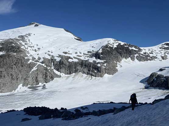
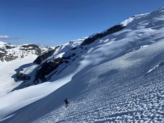
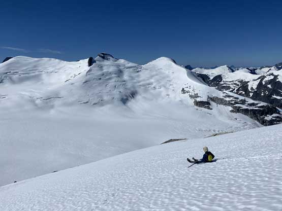
The ramp turned out to be not as scary as it looked from afar but for one short stretch we did have to traverse underneath some seracs. The ramp brought us to the eastern edge of Military Glacier. This glacier is considerably more fractured than the lower Whiting Glacier but the snow condition was pretty good and the coverage was really good. We made some easy work avoiding the saggings and cracks onto a flat bench. We traversed this flat bench all the way to the end then ascended a steep depression zone to the low point between Mt. Whiting and Howitzer Peak. We still had a couple hours of daylight time left but that’s not enough to ascend Mt. Boardman, so we just set up camp and relaxed a little bit. It was very tempting to try out Howitzer Peak but the summit block looked like climbing from any side so we didn’t bother. None of us wanted to do extra 300 m elevation gain only to be turned around.

Me leading the ramp traverse. Photo by Alex R.
Whiting Glacier and Mt. Perkins behind
Looking down at the toe of Whiting Glacier where we came up from
Vlad and Alex plodding up. This ramp was pretty easy
Exiting the ramp onto Military Glacier now. Mt. Perkins behind

Alex leading this flat bench on Military Glacier

We then ascended a steep depression zone.
Vlad ascending onto the broad pass between Mt. Whiting and Howitzer Peak
A zoomed-in view of Howitzer Peak from our camp.
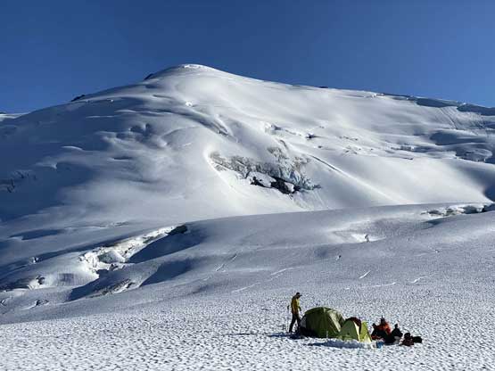
Our camp was already set up. A sub-summit of Mt. Whiting behind
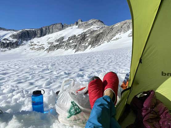
Me in the tent doing some Instagram thing…

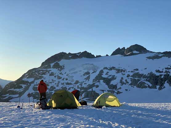
Another photo of our camp, with Sergeant Mountain behind
Our camp with Mt. Boardman behind
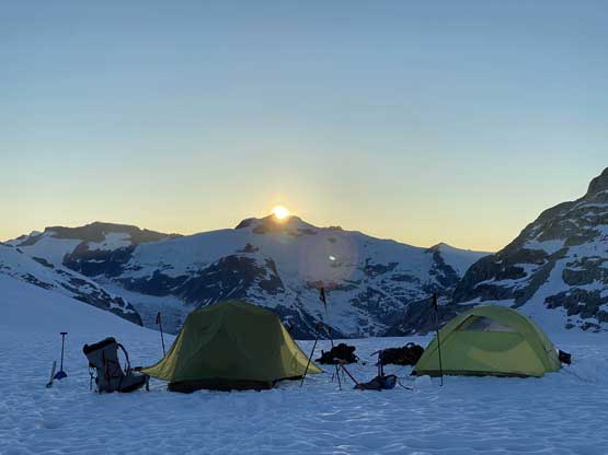
Sunset behind Mt. Doolittle/Mt. Clendinning behind our camp
Mt. Perkins from our camp

Mt. Vanstone. Too bad we skipped Vanstone and Perkins…

Another photo of Howitzer Peak
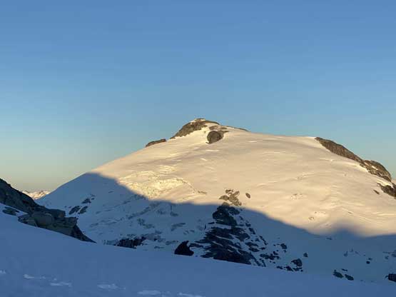
The next morning saw some bluebird skies as forecasted and we started the ascent of Mt. Boardman shortly after sunrise. The first stretch was plodding across the very flat Military Glacier with at least 100 m elevation loss to the base of Mt. Boardman’s south face. From there we picked up some zig-zagging route utilizing snow for as much as we could. The ascent onto Assault Glacier on the upper south slopes was trickier than expected with some route-finding but didn’t impose much of a problem to us. It wasn’t very clear how we were going to attack the summit block but the satellite images showed the north and west side had snow reaching the highest elevation, so we aimed for the southwest corner of the block and hoped for a route on the backside.

Alpenglow on Mt. Doolittle from our camp
Alpenglow on the sub-summit of Mt. Whiting
Partway up the south slopes of Mt. Boardman now, looking back at Sergeant Mountain
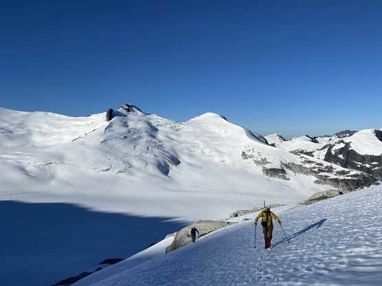
Alex and Vlad plodding up with Sergeant/Corporal behind
Vlad with Sergeant Mountain behind
Bottiger Peak and Windiger Peak

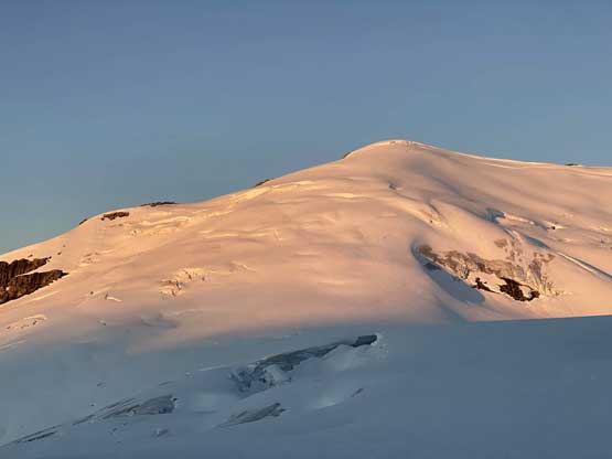
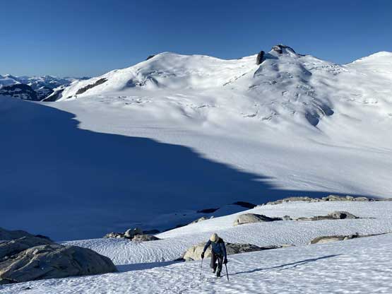
Alex and Vlad now ascending onto Assault Glacier

Plodding up Assault Glacier with Military Glacier behind

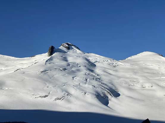
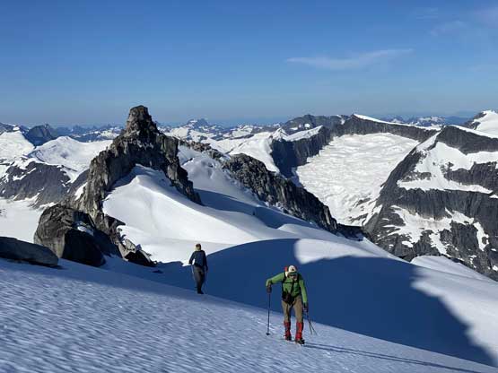
Ascending onto the windscoop under the summit pyramids
We kept traversing as we saw no route up the south side
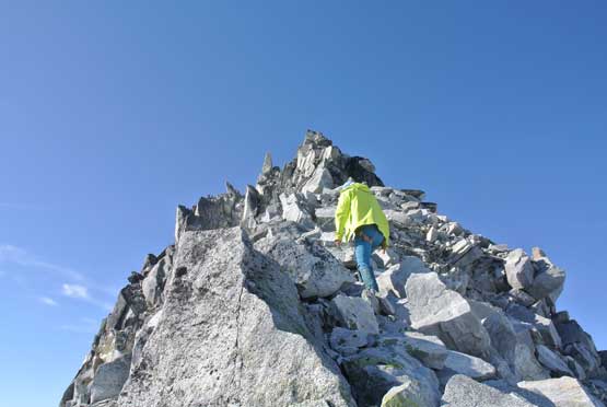
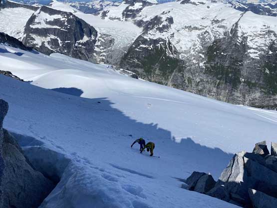
There definitely had no scramble route on the south face of the summit block so we did have to traverse onto the northwest side. Gaining the corner required a bit of tricky snow-to-rock transition and a class 3 tunnel and once over to the other side we could see the uppermost Battery Glacier reaching far onto the north ridge. We took out the ice axe and easily ascended onto the north ridge and the scramble to the summit involved a few 3rd class moves on loose blocks. The views were sick as expected and we stayed there for almost an hour soaking in the views.

Good thing these rugged pinnacles aren’t the summit..

Alex scrambling through the tunnel
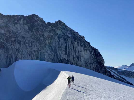
Alex and Vlad now ascending onto the upper Battery Glacier
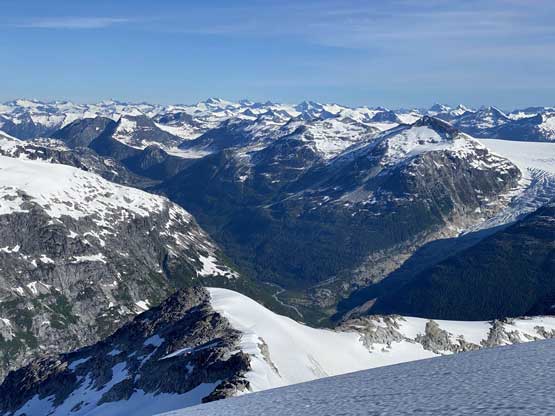
The upper Clendinning Creek valley

Alex plodding up with Mt. Doolittle and Mt. Clendinning behind
Me scrambling the north ridge of Mt. Boardman. Photo by Alex R.

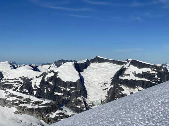
Looking sideways onto the very fractured Boardman Glacier
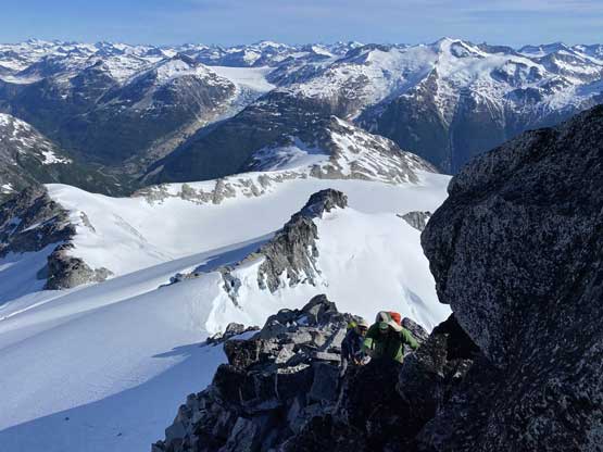
Alex and Vlad scrambling up with Frontline Mtn. and Elaho Mtn. behind
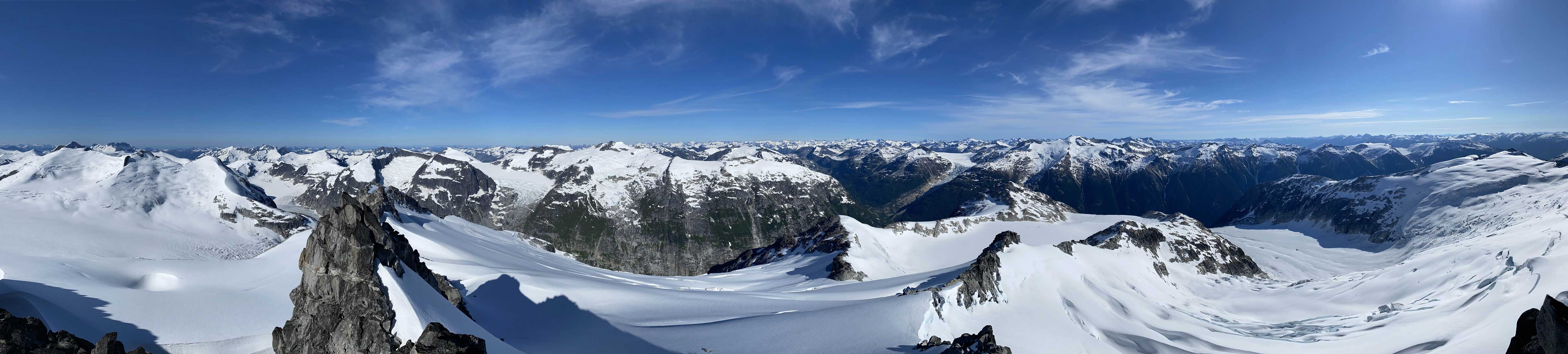
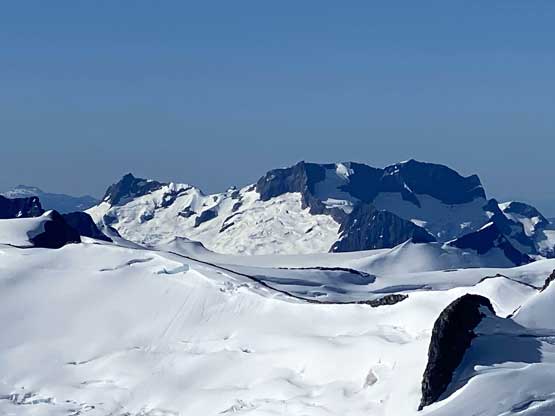
Partial Summit Panorama from Mt. Boardman. Click to view large size.

Partial Summit Panorama from Mt. Boardman. Click to view large size.

Alex and Vlad on the summit of Mt. Boardman

Looking down Boardman Glacier that drains into Clendinning Creek

Howitzer Peak in the foreground. It looks tough from all sides

This is looking past Mt. Whiting towards Mt. Tinniswood and Mt. Albert
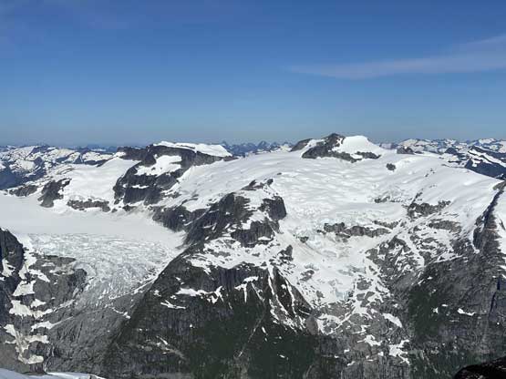
Another photo of Mt. Doolittle massif with Rund Glacier on left

Havoc Glacier in foreground; Mt. Tisiphone dominates the back

A closer look at Elaho Mountain
A closer look at Manatee Peak and Dugong Peak
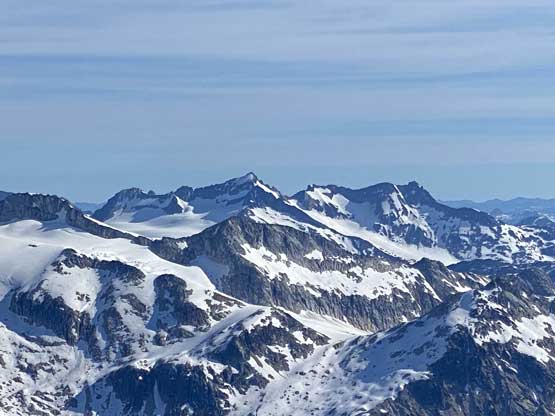
Mt. Alexsander and Hunaechin Peak in foreground; Mt. Alfred behind

Monk Peak in foreground with Beartooth, Baldy and Slide behind

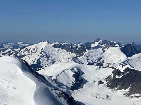
Even the very top of Mt. Waddington showed up for us!

Good Hope Mountain a remote giant pokes from far away
A closer look at Mt. Albert

We found the second ascent register after John Clarke’s FA…

Me on the summit of Mt. Boardman
On the descent we resisted the temptation to short-cut the route. We briefly talked about tagging Frontline Mountain but such would made this a long day just to get back to camp, so we opted for not. We were very happy that our exploratory roundabout route worked out just as expected without having to do any detouring. The plunge and boot-skiing down Assault Glacier onto Military Glacier was super fun, but the plod back across Military Glacier was less fun. Once back to camp we took little time to rest, broke camp right away and carried on towards Sergeant Mountain.
Down-climbing steep snow to get onto the upper Battery Glacier

A very aesthetic snow arete

Looking back at the NW face of Mt. Boardman
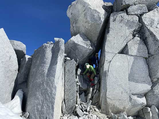
Scrambling back through the tunnel

Back onto the uppermost Assault Glacier now

Vlad plodding ahead
Vlad taking a glissade. Smart idea!

Me and Vlad plodding down. Photo by Alex R.
